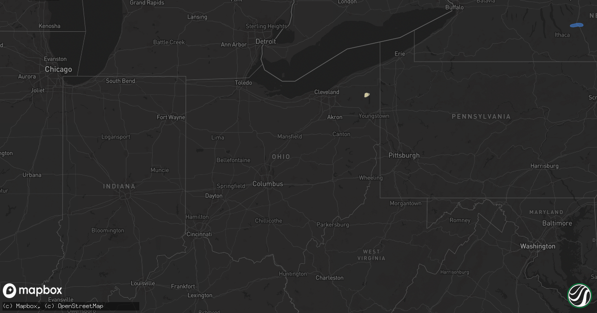
Hail Map in Ohio on July 24, 2024
Get this storm
July 24 map
$229
one time, instant access
Download today. No call, no setup
Keep the $229
Bought the map and want the full workflow? Apply the entire $229 to a subscription within 7 days. None of it is wasted.
Every map, not just this one
This buys you this map. Subscription and you get every map we run, in the markets you choose from a few cities to whole states to nationwide. Plus real-time alerts the moment a storm fires.
Contact data
Name, contact info, occupancy, even credit band for addresses in the footprint. You go from where it hit to who to call.
Become the source they trust
Unlimited branding weather history reports on demand. You already have the documented answer ready for the property owner, and you are the one who showed up with it.
Property data and RoofTrace estimates
Pull up any address you have got, its value and the exact code rules for that jurisdiction, straight from One Click Code. Then RoofTrace estimates the squares, pitch, and roof value, priced the way you price.
Storm reports in Ohio
Ohio
| Date | Description |
|---|---|
| 07/24/20243:09 PM CDT | 1 tree down on house. Time estimated from radar. |
| 07/24/20242:47 PM CDT | Tree down. |
| 07/24/20242:45 PM CDT | Tree down. |
| 07/24/20242:29 PM CDT | Multiple trees down on route 87 between n. Park street and route 46. Time estimated via radar. |
| 07/24/20241:58 PM CDT | Tree down near the intersection of pioneer trail and peck road. Time estimated via radar. |
| 07/24/20241:57 PM CDT | Tree reported down near route 82 and frost road. Time estimated via radar. |
| 07/24/20241:51 PM CDT | Large tree limb reported down near the intersection of riverside drive and duncan drive. Time estimated via radar. |
| 07/24/20241:49 PM CDT | Large tree snapped at base at denver dr and youngstown-pittsburgh rd. |
All States Impacted by Hail Map on July 24, 2024
Cities Impacted by Hail Map on July 24, 2024
- Gouverneur, NY
- De Kalb Junction, NY
- Richville, NY
- Canton, NY
- Potsdam, NY
- Norwood, NY
- Massena, NY
- Norfolk, NY
- Saint George, SC
- Groton, NY
- Cortland, NY
- Homer, NY
- McGraw, NY
- Cincinnatus, NY
- North Bloomfield, OH
- Orwell, OH
- Bristolville, OH
- Redfield, NY
- Lacona, NY
- Lowville, NY
- Constableville, NY
- Richland, NY
- Cubero, NM
- Abingdon, IL
- Maquon, IL
- Saint Augustine, IL
- London Mills, IL
- Avon, IL
- Floris, IA
- Washington, GA
- Browning, IL
- Plymouth, NC
- Milton, IA
- Douds, IA
- Bloomfield, IA
- Fairview, IL
- Java, VA
- Gretna, VA
- Linden, IA
- Cantril, IA
- Sells, AZ
- Memphis, MO
- Otley, IA
- Pella, IA
- Nathalie, VA
- Vernon Hill, VA
- Chase City, VA
- Arbela, MO
- Redfield, IA
- Brooksville, FL
- Dade City, FL
- Albia, IA
- Hamilton, IA
- Floral City, FL
- Inverness, FL
- Halifax, VA
- Ashland, IL
- Alexander, IL
- Lovilia, IA
- Wisdom, MT
- Blakesburg, IA
- Drakesville, IA
- West Des Moines, IA
- Cumming, IA
- Waukee, IA
- Norwalk, IA
- Prairie City, OR
- Bates, OR
- Unity, OR
- John Day, OR
- Hereford, OR
- Sumpter, OR
- Baker City, OR
- Lloyd, MT
- Hays, MT
- Zortman, MT
- Dodson, MT
- Haines, OR
- Union, OR
- Boise, ID
- Garden City, ID
- Red Oak, VA
- Wylliesburg, VA
- Clover, VA
- Scottsburg, VA
- Crystal Hill, VA
- Mount Lemmon, AZ
- Tucson, AZ
- Indianola, IA
- Prole, IA
- Ellisville, IL
- Martensdale, IA
- Dallas City, IL
- Carthage, IL
- Elkhart, IL
- Mount Pulaski, IL
- Williamsville, IL
- Safford, AZ
- Twentynine Palms, CA
- Buffalo, IL
- Lucile, ID
- Imnaha, OR
- White Bird, ID
- Cottonwood, ID
- La Harpe, IL
- Manilla, IA
- Defiance, IA
- Newcastle, UT
- Blandinsville, IL
- Knoxville, IA
- Dunnellon, FL
- Gorin, MO
- Coolidge, AZ
- Denio, NV
- Winnemucca, NV
- Golconda, NV
- Gibbonsville, ID
- Conner, MT
- North Fork, ID
- Jackson, MT
- Superior, MT
- Alberton, MT
- Elk City, ID
- Lolo, MT
- Orofino, ID
- Victor, MT
- Darby, MT
- Pinesdale, MT
- Stevensville, MT
- Hamilton, MT
- Florence, MT
- Corvallis, MT
- Frenchtown, MT
- Huson, MT
- Missoula, MT
- Arlee, MT
- Bonner, MT
- Milltown, MT
- Clinton, MT
- Wyaconda, MO
- Dixon, MT
- Saint Ignatius, MT
- Charlo, MT
- Ravalli, MT
- Polson, MT
- Ronan, MT
- Seeley Lake, MT
- Ovando, MT
- Maricopa, AZ
- Bigfork, MT
- Condon, MT
- Kalispell, MT
- Lincoln, MT
- Phoenix, AZ
- Casa Grande, AZ
- Rutledge, MO
- Laveen, AZ
- Stanfield, AZ
- Augusta, MT
- Tolleson, AZ
- Wallowa, OR
- North Powder, OR
- Mesa, AZ
- Cortland, OH
- Buckeye, AZ
- West Point, IA
- Glendale, AZ
- Avondale, AZ
- Goodyear, AZ


