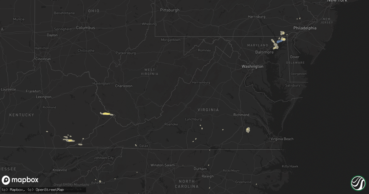
Hail Map in Virginia on August 2, 2024
Get this storm
August 2 map
$229
one time, instant access
Download today. No call, no setup
Keep the $229
Bought the map and want the full workflow? Apply the entire $229 to a subscription within 7 days. None of it is wasted.
Every map, not just this one
This buys you this map. Subscription and you get every map we run, in the markets you choose from a few cities to whole states to nationwide. Plus real-time alerts the moment a storm fires.
Contact data
Name, contact info, occupancy, even credit band for addresses in the footprint. You go from where it hit to who to call.
Become the source they trust
Unlimited branding weather history reports on demand. You already have the documented answer ready for the property owner, and you are the one who showed up with it.
Property data and RoofTrace estimates
Pull up any address you have got, its value and the exact code rules for that jurisdiction, straight from One Click Code. Then RoofTrace estimates the squares, pitch, and roof value, priced the way you price.
Storm reports in Virginia
Virginia
| Date | Description |
|---|---|
| 08/02/20246:55 PM CDT | Many trees down across sussex county. |
| 08/02/20246:19 PM CDT | Tree knocked down on bunker lane. Time estimated from radar. |
| 08/02/20246:15 PM CDT | Multiple trees down across brunswick county. |
| 08/02/20246:11 PM CDT | Tree down along northbound i-85 at mile marker 43. |
| 08/02/20245:56 PM CDT | Tree knocked down on chalkley road. Time estimated from radar. |
| 08/02/20245:30 PM CDT | Reports of multiple trees blocking roadways across nottoway county. |
| 08/02/20245:20 PM CDT | Multiple trees down across lunenburg county. |
| 08/02/20244:56 PM CDT | Thunderstorm winds blew down a tree on a house... Taking power lines down with it on mountain hill road. |
| 08/02/20244:35 PM CDT | Thunderstorm winds blew down a tree on 600-blk ringgold depot road. |
| 08/02/20244:14 PM CDT | Large tree down near the intersection of farmville rd and worsham rd. |
| 08/02/20244:13 PM CDT | Thunderstorm winds blew down a tree in scottsburg. |
| 08/02/20244:10 PM CDT | Thunderstorm winds blew down a tree on 4700 ringgold church road. |
| 08/02/20244:10 PM CDT | Multiple reports of trees down across the county. |
| 08/02/20244:07 PM CDT | Thunderstorm winds blew down two trees in the town of halifax. |
| 08/02/20243:57 PM CDT | Trees down in pamplin. Time estimated via radar. |
| 08/02/20243:55 PM CDT | Thunderstorm winds blew down a tree snapping a power pole on 2734 appalachian drive. |
| 08/02/20243:46 PM CDT | Thunderstorm winds blew down a tree on 258 willow oak road. |
| 08/02/20243:46 PM CDT | Thunderstorm winds blew down a tree at the intersection of red house road and robinson road. |
| 08/02/20243:45 PM CDT | Thunderstorm winds blew down a tree on 2398 red house road. |
| 08/02/20243:45 PM CDT | Thunderstorm winds blew down a tree at the intersection of red house road and cub creek. |
| 08/02/20243:45 PM CDT | Thunderstorm winds blew down a tree on 1286 narrow passage road. |
| 08/02/20243:44 PM CDT | Thunderstorm winds blew down a power line on 3878 promise land road. |
| 08/02/20243:43 PM CDT | Thunderstorm winds blew down a tree at the intersection of red house road and fox ridge lane. |
| 08/02/20243:41 PM CDT | Thunderstorm winds blew down a tree in south boston. |
| 08/02/20243:30 PM CDT | Thunderstorm winds blew a tree down onto power lines on 860 mt. Tabor road. |
| 08/02/20243:20 PM CDT | Several trees down in jonesville. Time estimated from radar. |
| 08/02/20243:17 PM CDT | Tree down on fairview road near bob neal lane. |
| 08/02/20243:07 PM CDT | Two large trees down across rainbow lane. |
| 08/02/20243:07 PM CDT | Tree down on white oak circle. |
| 08/02/20243:05 PM CDT | Large pine tree down on springlake place. |
| 08/02/20243:01 PM CDT | Thunderstorm winds blew down a tree at the intersection of east denver avenue and deaton street. |
| 08/02/20242:58 PM CDT | Thunderstorm winds blew down a tree on thompson drive. |
| 08/02/20242:55 PM CDT | A few trees down in rose hill. Time estimated from radar. |
| 08/02/20241:27 PM CDT | Tree down. |
| 08/02/20241:22 PM CDT | Tree down on west side of town. |
| 08/02/202412:35 PM CDT | Several trees down throughout the county. |
| 08/02/202411:30 AM CDT | Social media photo of a large tree down and statement of power outages in the text. Time is estimated from radar. |
| 08/02/202410:50 AM CDT | A couple of trees down. |
| 08/01/20248:29 PM CDT | *** 1 inj *** strong outflow winds resulted in an awning breaking free from a camper and striking a woman in the head. |
| 08/01/20247:12 PM CDT | Tree knocked down along rochambeau dr. Time estimated from radar. |
| 08/01/20247:11 PM CDT | Measured 53 kt gust along the northern shore of the james river. |
| 08/01/20247:09 PM CDT | Tree down across i64 near camp peary. |
| 08/01/20247:09 PM CDT | Tree knocked down along colonial pkwy. Time estimated from radar. Time estimated from radar. |
| 08/01/20247:09 PM CDT | Tree knocked down along jockeys neck trl. Time estimated from radar. |
All States Impacted by Hail Map on August 2, 2024
Cities Impacted by Hail Map on August 2, 2024
- Gravel Switch, KY
- Burgaw, NC
- Somerset, KY
- Courtenay, ND
- Palmer, KS
- Corbin, KY
- Thomasville, GA
- Brownsboro, AL
- Gurley, AL
- Holt, FL
- Baker, FL
- Owens Cross Roads, AL
- Leland, NC
- Green Mountain, NC
- Wilmington, NC
- Somerville, AL
- Eva, AL
- New Zion, SC
- Hollytree, AL
- Trenton, AL
- Woodville, AL
- Paint Rock, AL
- Scottsboro, AL
- Castle Hayne, NC
- Defuniak Springs, FL
- Laurel Hill, FL
- Flat Rock, AL
- Grant, AL
- New Hope, AL
- Union Grove, AL
- Arab, AL
- Blountsville, AL
- Holly Pond, AL
- Higdon, AL
- Guntersville, AL
- Delco, NC
- Ash, NC
- Savannah, GA
- Maple Hill, NC
- Albertville, AL
- Hilliard, FL
- Horton, AL
- Bennettsville, SC
- Marion, NC
- Nebo, NC
- McColl, SC
- Asheville, NC
- Alexander, NC
- Callahan, FL
- Lyons, GA
- Hardeeville, SC
- Conway, SC
- Cleveland, AL
- Wallace, NC
- Chadbourn, NC
- Whiteville, NC
- Oneonta, AL
- Kingsland, GA
- Kalamazoo, MI
- Clio, SC
- Smoaks, SC
- Blenheim, SC
- Lodge, SC
- Early Branch, SC
- Clinton, NC
- Ehrhardt, SC
- Little Rock, SC
- Dillon, SC
- Artemus, KY
- Flat Lick, KY
- Barbourville, KY
- Lake City, FL
- White Springs, FL
- Lumber Bridge, NC
- Parkton, NC
- Rose Hill, NC
- South Windsor, CT
- Mattawan, MI
- Schoolcraft, MI
- Walker, KY
- Scalf, KY
- Red Springs, NC
- Ruffin, SC
- Attalla, AL
- Gallant, AL
- Steele, AL
- Williams, SC
- Varnville, SC
- Lawton, MI
- Kettle Island, KY
- Stoney Fork, KY
- Pineville, KY
- Arjay, KY
- Rainbow City, AL
- Ashville, AL
- Colquitt, GA
- Islandton, SC
- Rowland, NC
- Maxton, NC
- Pembroke, NC
- Lumberton, NC
- Independence, VA
- Elk Creek, VA
- Russell, MA
- Walterboro, SC
- Ludowici, GA
- Frakes, KY
- Round O, SC
- Cottageville, SC
- Saint Pauls, NC
- Timmonsville, SC
- Shannon, NC
- Gadsden, AL
- Manchester, KY
- Hulen, KY
- Ohatchee, AL
- Peru, IN
- Amboy, IN
- Autryville, NC
- Townsend, GA
- Coldiron, KY
- Beverly, KY
- Helton, KY
- Taylorsville, NC
- Readyville, TN
- Wappingers Falls, NY
- Wellington, AL
- Forest Hill, MD
- Street, MD
- Hampton, SC
- Florence, SC
- Converse, IN
- Jesup, GA
- Waycross, GA
- Woodbury, TN
- Wallins Creek, KY
- Edwardsburg, MI
- Elkhart, IN
- Jonesville, VA
- Darien, GA
- Pleasant Valley, NY
- Poughkeepsie, NY
- Bladenboro, NC
- Homerville, GA
- Amory, MS
- Blackshear, GA
- Greenwood Springs, MS
- Marion, IN
- Oxford, PA
- Cochranville, PA
- Evarts, KY
- Windfall, IN
- Cranks, KY
- Bel Air, MD
- Pennington Gap, VA
- Labelle, FL
- Kingstree, SC
- Lake City, SC
- Cades, SC
- Cheyenne, WY
- Guin, AL
- Collegeville, PA
- Lincoln University, PA
- Salt Point, NY
- Hyde Park, NY
- Washington, NC
- West Grove, PA
- Churchville, MD
- Benson, NC
- Kirkwood, PA
- Norristown, PA
- Lansdale, PA
- Walsenburg, CO
- Glennville, GA
- Pinetown, NC
- Winfield, AL
- Belfry, KY
- Canada, KY
- Concord, VA
- Appomattox, VA
- Vernon Hill, VA
- Nathalie, VA
- Aberdeen, MD
- Sidney, KY
- Kimper, KY
- Pikeville, KY
- Huddy, KY
- Stone, KY
- McAndrews, KY
- Hardy, KY
- Pinsonfork, KY
- West Simsbury, CT
- Avon, CT
- Simsbury, CT
- Weatogue, CT
- Granby, CT
- North Granby, CT
- West Granby, CT
- Alamogordo, NM
- Tularosa, NM
- Phenix, VA
- Brookneal, VA
- Red House, VA
- Aberdeen Proving Ground, MD
- Perryman, MD
- Belcamp, MD
- Abingdon, MD
- Christiana, PA
- La Luz, NM
- Beaverton, AL
- Sulligent, AL
- Landenberg, PA
- Port Deposit, MD
- Colora, MD
- North East, MD
- Elkton, MD
- Quinton, AL
- Rising Sun, MD
- McCarr, KY
- Ransom, KY
- Phelps, KY
- Freeburn, KY
- Matewan, WV
- Majestic, KY
- Grover, CO
- Chugwater, WY
- Marsland, NE
- Claxton, GA
- Reidsville, GA
- Hamilton, AL
- Steens, MS
- Richmond, IN
- Eaton, OH
- Harrison, NE
- Vernon, AL
- Fayette, AL
- Dora, AL
- Millport, AL
- Graysville, AL
- Coffeeville, MS
- Oakland, MS
- West Point, MS
- Gunpowder, MD
- Edgewood, MD
- Havre De Grace, MD
- Perryville, MD
- Creedmoor, NC
- Franklinton, NC
- Collins, GA
- Columbus, MS
- Surrency, GA
- Luray, SC
- Ethelsville, AL
- Baxley, GA
- Coats, NC
- Stopover, KY
- Hawk Springs, WY
- Torrington, WY
- Kennedy, AL
- Maben, MS
- Reform, AL
- Mantee, MS
- Branson, CO
- Deer Trail, CO
- Jay Em, WY
- Tillatoba, MS
- Caledonia, MS
- Bessemer, AL
- Pheba, MS
- Lumber City, GA
- Aberdeen, MS
- Hazlehurst, GA
- Lagrange, WY
- Elon, NC
- Gibsonville, NC
- Burlington, NC
- Mulga, AL
- Daggett, CA
- Cedarbluff, MS
- Crewe, VA
- Eastpoint, FL
- Raton, NM
- Berry, AL
- Northport, AL
- Tuscaloosa, AL
- Bullock, NC
- Wildwood, FL
- Coleman, FL
- Meriden, WY
- Merriman, NE
- Bushnell, NE
- Barstow, CA
- Echola, AL
- Elrod, AL
- Gordo, AL
- Carrollton, AL
- Mathiston, MS
- Brookwood, AL
- Adger, AL
- Cottondale, AL
- Vance, AL
- Harrisburg, NE
- Gordon, NE
- East Hartford, CT
- Florence, CO
- Woodstock, AL
- West Blocton, AL
- Floyd, NM
- Waverly, VA
- Disputanta, VA
- Penrose, CO
- Wetmore, CO
- Elida, NM
- Morrill, NE
- Mitchell, NE
- Starkville, MS
- Spring Grove, VA
- Bayard, NE
- Pueblo, CO
- Gering, NE
- Stony Creek, VA
- Medford, NJ
- Marlton, NJ
- Buhl, AL
- Coker, AL
- Eutaw, AL
- Ralph, AL
- Wrightstown, NJ
- Trenton, NJ
- Columbus, NJ
- Bordentown, NJ
- Joint Base Mdl, NJ
- Jobstown, NJ
- Robbinsville, NJ
- Allentown, NJ
- Chesterfield, NJ
- Baltimore, MD
- Rosedale, MD
- Valentine, NE
- Knoxville, AL
- Mount Holly, NJ
- Briggsdale, CO
- Fort Morgan, CO
- New Raymer, CO
- Snyder, CO
- Log Lane Village, CO
- Brush, CO
- Akron, CO
- Bridgeport, NE
- Essex, MD
- Aliceville, AL
- New Egypt, NJ
- Cookstown, NJ
- Cream Ridge, NJ
- Woodsfield, OH
- Lewisville, OH
- Graysville, OH
- Lower Salem, OH
- Fosters, AL
- Cody, NE
- Sumterville, FL
- Whitman, NE
- Broadwater, NE
- Huntsville, AL
- Boligee, AL
- Laceys Spring, AL
- Glenwood, GA
- Mount Lemmon, AZ
- Otis, CO
- Angora, NE
- Tucson, AZ
- Alamo, GA
- San Manuel, AZ
- Keeling, VA
- Woodrow, CO
- Varney, KY
- Salisbury, NC
- China Grove, NC
- Landis, NC
- Agate, CO
- Caldwell, OH
- Leeds, AL
- Tariffville, CT
- East Granby, CT
- Pemberton, NJ
- Chatsworth, NJ
- Vincentown, NJ
- Brooksville, MS
- Crawford, MS
- Manchester, MD
- Middle River, MD
- Nottingham, MD
- Mosquero, NM
- Joppa, MD
- Glyndon, MD
- Reisterstown, MD
- Browns Mills, NJ
- Marana, AZ
- Westminster, MD
- Conchas Dam, NM
- Lisco, NE
- Tucumcari, NM
- Hyannis, NE
- Ashby, NE
- Venango, NE
- Rhine, GA
- The Villages, FL
- Garner, NC
- Clayton, NC
- Angier, NC
- Wake Forest, NC
- Whitsett, NC
- Troy, AL
- Eufaula, AL
- Lumpkin, GA
- Omaha, GA
- Dallas, TX
- Irving, TX
- Altoona, AL
- Goodridge, MN
- Gonvick, MN


