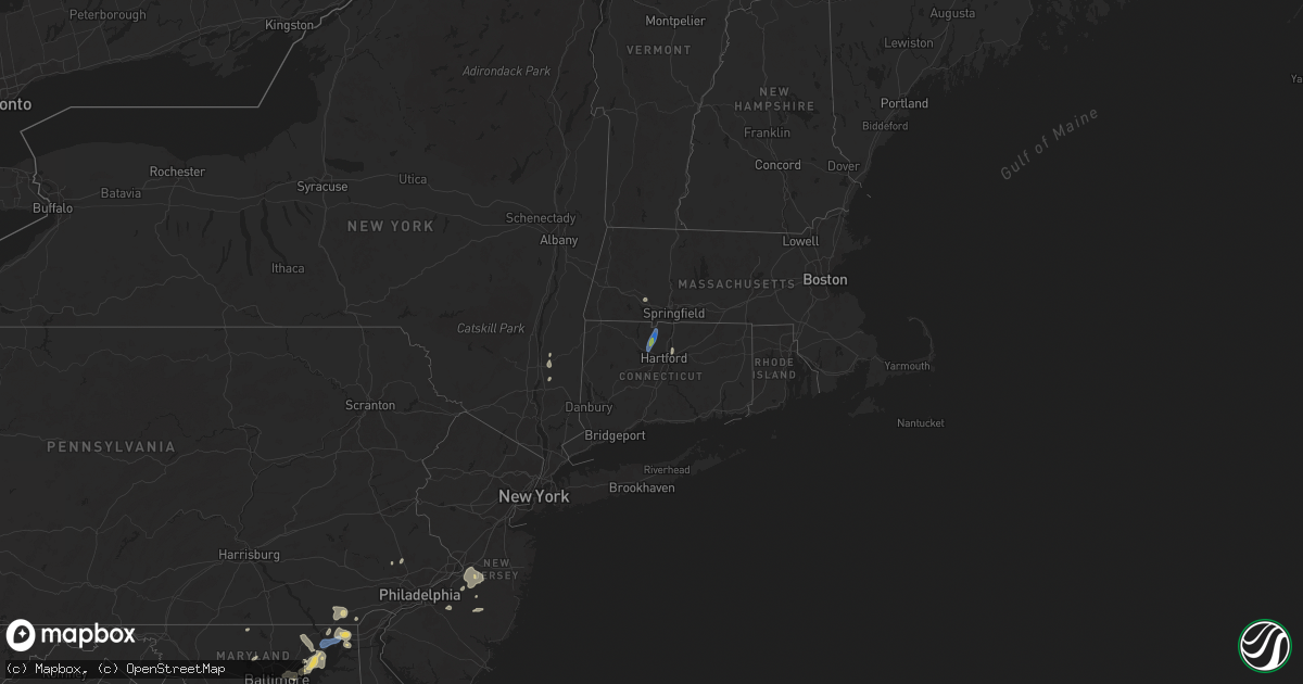
Hail Map on August 2, 2024
Get this storm
August 2 map
$229
one time, instant access
Download today. No call, no setup
Keep the $229
Bought the map and want the full workflow? Apply the entire $229 to a subscription within 7 days. None of it is wasted.
Every map, not just this one
This buys you this map. Subscription and you get every map we run, in the markets you choose from a few cities to whole states to nationwide. Plus real-time alerts the moment a storm fires.
Contact data
Name, contact info, occupancy, even credit band for addresses in the footprint. You go from where it hit to who to call.
Become the source they trust
Unlimited branding weather history reports on demand. You already have the documented answer ready for the property owner, and you are the one who showed up with it.
Property data and RoofTrace estimates
Pull up any address you have got, its value and the exact code rules for that jurisdiction, straight from One Click Code. Then RoofTrace estimates the squares, pitch, and roof value, priced the way you price.
States Impacted by Hail Map on August 2, 2024
Storm reports
Mississippi
| Date | Description |
|---|---|
| 08/02/20246:43 PM CDT | Corrects previous tstm wnd dmg report from 4 w plum grove. Roof awning blown off a mobile home. |
| 08/02/20246:37 PM CDT | Tree down across gilmer wilburn rd. |
Georgia
| Date | Description |
|---|---|
| 08/02/20245:25 PM CDT | Public report and photos of several trees down on a local property in hazelhurst. Time estimated via radar. |
| 08/02/20245:25 PM CDT | At least a half dozen trees and several wires down around northeastern jeff davis county per 911 dispatch. Time estimated via radar. |
Kentucky
| Date | Description |
|---|---|
| 08/02/20244:21 PM CDT | Report of tree down across railroad track adjacent to ky hwy 194 near south johnson bottom road outside the community of freeburn. Exact location estimated. |
| 08/02/20242:10 PM CDT | Large tree limb down. |
| 08/02/20242:06 PM CDT | Tree down. |
Rhode Island
| Date | Description |
|---|---|
| 08/02/20242:30 PM CDT | Multiple trees down on macarthur and eisenhower drive in smithfield ri. |
Tennessee
| Date | Description |
|---|---|
| 08/02/20249:45 AM CDT | Tspotter report and photo showed tree tops blown down in flat creek area. |
New Mexico
| Date | Description |
|---|---|
| 08/02/20246:20 PM CDT | Awos station k4mr 12 se tolar. |
West Virginia
| Date | Description |
|---|---|
| 08/02/20244:05 PM CDT | Tree down near the rawl post office. Time estimated from radar. |
| 08/02/20244:05 PM CDT | Tree down on route 49 between matewan and delorme. Time estimated from radar. |
South Carolina
| Date | Description |
|---|---|
| 08/02/20243:22 PM CDT | Tree down on road and on building/residence... Blocking one lane near the cayce road/mount nebo road intersection. |
| 08/02/20242:48 PM CDT | Tree down in the 2200 block of bells highway. |
| 08/02/20242:41 PM CDT | Tree down and blocking one lane near the gabriel dr/confederate highway intersection. |
| 08/02/20242:34 PM CDT | Tree down and blocking both lanes in the 100 block of bailey st. |
| 08/02/20242:31 PM CDT | Tree down blocking one lane near the bells highway/dry branch rd intersection. |
| 08/02/20242:30 PM CDT | Tree down blocking both lanes in the 3500 block of pleasant grove rd. |
Arizona
| Date | Description |
|---|---|
| 08/01/20248:59 PM CDT | Delayed report. Personal weather station. |
| 08/01/20248:52 PM CDT | Delayed report. Report of tree damage due to thunderstorm winds near intersection of twin peaks rd and oasis rd. |
| 08/01/20248:49 PM CDT | Medium size tree branches snapped. Saguaro arms snapped off. |
| 08/01/20248:40 PM CDT | Caller reported wide |
| 08/01/20248:40 PM CDT | Caller reported widespread tree damage with trees toppled over by their roots in the neighborhood just north of w speedway and n greaswood rd. |
| 08/01/20248:02 PM CDT | Delayed report. Numerous reports of thunderstorm related tree damage and damage to mobile homes. Reports near the intersection of i-10 and kolb rd. |
| 08/01/20247:59 PM CDT | Private weather station. |
Nevada
| Date | Description |
|---|---|
| 08/01/20248:11 PM CDT | Mesonet station wasnv 3.2 s washoe city |
| 08/01/20248:00 PM CDT | Report from east fork fire chief. Multiple tents and tree branches blown down at the carson valley swim center. Event time estimated. |
North Carolina
| Date | Description |
|---|---|
| 08/02/20245:48 PM CDT | Trees down county wide... Including bushy fork. |
| 08/02/20245:40 PM CDT | Power lines down between concord and roxboro. |
| 08/02/20245:25 PM CDT | Hundreds of power outages due to trees down on equipment. |
| 08/02/20245:05 PM CDT | Several trees down. |
| 08/02/20245:00 PM CDT | Thunderstorm winds blew down a large tree on 1531 old statterfield road. |
| 08/02/20244:58 PM CDT | Multiple trees down along raleigh rd. |
| 08/02/20244:55 PM CDT | Thunderstorm winds blew down a tree on 803 bertha wilson road. |
| 08/02/20244:52 PM CDT | Thunderstorm winds blew down a tree on the 300 block of walters mill road. |
| 08/02/20244:50 PM CDT | Thunderstorm winds blew down a large oak tree that blocked both lanes of 2455 park springs road. |
| 08/02/20244:23 PM CDT | Large tree down on the roadway. Radar estimated time. |
| 08/02/20244:09 PM CDT | Trees down blocking roadway. Radar estimated time. |
| 08/02/20244:02 PM CDT | Trees and powerlines down in eastern lincolnton. Time estimated from clt tdwr velocity. |
| 08/02/20244:00 PM CDT | Multiple trees down with power outages in the area. Radar estimated time. |
| 08/02/20243:53 PM CDT | Power outages caused by fallen trees reported near knightdale. |
| 08/02/20243:37 PM CDT | Large tree down blocking roadway with powerlines down. |
| 08/02/20243:26 PM CDT | Tree reported down on walnut street. |
| 08/02/20243:26 PM CDT | Multiple trees reported down on powerlines. |
| 08/02/20242:22 PM CDT | Tree limbs down... Trampoline thrown 300 yards |
| 08/02/20242:15 PM CDT | Large tree limbs blown down |
| 08/02/20242:15 PM CDT | Large tree limbs blown down. Corrected location |
| 08/02/20241:55 PM CDT | Tree reported down on intersection of us hwy 301 and i-95. |
| 08/02/20241:30 PM CDT | 260 block of deep ford road blocked by downed tree. |
| 08/02/20241:25 PM CDT | One large tree down across 194 south. |
| 08/02/20241:10 PM CDT | Tree down on benfields landing rd at holiday shores ave. |
| 08/02/202412:53 PM CDT | Tree and power lines down on wildlife rd at nc 126. |
| 08/02/202412:51 PM CDT | Tree down on power lines/utility equipment. |
| 08/02/202412:45 PM CDT | Large oak tree downed. |
| 08/02/202412:27 PM CDT | Tree down on power lines/utility equipment. |
| 08/02/20248:15 AM CDT | Peak gust measured at the n dyson street weatherflow sensor. |
| 08/01/20248:35 PM CDT | Tree blown onto house on beatty ford road. |
| 08/01/20248:35 PM CDT | A local report indicates 0 MPH wind near 5 SSW Faith |
| 08/01/20248:29 PM CDT | Several trees blown down on daugherty road. Time estimated from radar. |
| 08/01/20248:27 PM CDT | Multiple trees down blocking china grove road. Fire department on scene. |
| 08/01/20248:02 PM CDT | Tree into house on pine st and on west c st. |
Utah
| Date | Description |
|---|---|
| 08/01/20247:10 PM CDT | Mesonet station uthft i-15 mp 54 hamiltons fort. |
Connecticut
| Date | Description |
|---|---|
| 08/02/20241:45 PM CDT | Multiple trees and wires down in east granby. |
| 08/02/20241:35 PM CDT | Tree downed onto wires on north rd. Relayed by amateur radio. |
| 08/02/20241:35 PM CDT | Tree down on wires on main st. Relayed by amateur radio. |
| 08/02/20241:30 PM CDT | At least 4 trees down on power lines on floydville rd in granby ct. Another tree down on danielle rd in granby. |
| 08/02/20241:30 PM CDT | Damage reported at simsbury airport per ct demhs employee. A small plane was flipped up on its wings as well as damage to an airplane hangar. Time estimated by radar. |
| 08/02/20241:28 PM CDT | Tree downed onto a house near barry lane. Relayed by amateur radio. |
| 08/02/20241:28 PM CDT | Several trees downed on seminary rd in simsbury. |
| 08/02/20241:28 PM CDT | Tree on house near carver circle. Relayed by amateur radio. |
| 08/02/20241:25 PM CDT | Relayed by amateur radio. |
California
| Date | Description |
|---|---|
| 08/01/20247:27 PM CDT | Mesonet station xmlc1 mill canyon. |
Alabama
| Date | Description |
|---|---|
| 08/02/20246:19 PM CDT | Trees down in the vance area. |
| 08/02/20246:09 PM CDT | Multiple trees down in the brookwood area. |
| 08/02/20246:09 PM CDT | Tree down along i-20 west affecting lanes of travel. |
| 08/02/20246:03 PM CDT | Trees down on sr 216 in the peterson area. |
| 08/02/20245:53 PM CDT | Trees and some utility lines/transformers down. |
| 08/02/20245:48 PM CDT | Trees down on yellow creek road. |
| 08/02/20245:32 PM CDT | Trees down in various parts of hoover. |
| 08/02/20244:19 PM CDT | Multiple trees down on county road 47 at bethabara road. |
| 08/02/20243:06 PM CDT | Trees down... Some involving blocked roadways... In the talladega area. One residence with a tree on it on christian street. |
| 08/02/20242:44 PM CDT | Multiple trees and power lines down in the oxford area. |
| 08/02/20242:33 PM CDT | Trees down in various spots in northern talladega county... Some involving blocked roadways. |
| 08/02/20242:23 PM CDT | Trees down in the jacksonville area. |
| 08/02/20242:22 PM CDT | Trees and large limbs down in the weaver area. |
| 08/02/20242:20 PM CDT | Trees down in the alexandria area. |
| 08/02/20242:16 PM CDT | Trees down in the ohatchee area. |
| 08/02/20242:01 PM CDT | Multiple areas of trees down in the southside area. At least one motorist reported trapped between trees on hood road. Time estimated from radar. |
| 08/02/20241:54 PM CDT | Several trees down on lister ferry road. |
| 08/02/20241:49 PM CDT | A couple trees blown down on oak grove road and durham drive. Time estimated from radar. |
| 08/02/202412:41 PM CDT | A tree was knocked down... Another uprooted... And a metal roof was blown off of a large barn. This took place at 11113 alabama highway 227. Time estimated by radar. |
| 08/02/202412:23 PM CDT | A social media post/photos indicated a large tree down on power lines in scant city. Time estimated by radar. |
| 08/02/202412:18 PM CDT | Two large trees downed county rd 67 near langston. |
| 08/02/202412:18 PM CDT | Tree downed on hwy 69 at marshall north hospital. |
| 08/02/202412:10 PM CDT | In honeycomb campground... A tree on a camper and camper blown over. |
| 08/02/202412:05 PM CDT | Hwy 231 and mountain view road... Report of a tree downed. Est time from radar. |
| 08/02/202412:05 PM CDT | Corrects previous tstm wnd dmg report from 5 ssw grant. Poles and lines in the lake. Also some homes damaged; near hwy 431 and snug harbor rd. Time est from radar. |
| 08/02/202412:05 PM CDT | Poles and lines in the lake. Time est from radar. |
| 08/02/202412:04 PM CDT | Corrects previous tstm wnd dmg report from 5 se new hope. Up to 14 trees were snapped or uprooted on forty road near grant. Time estimated by radar. |
| 08/02/202411:55 AM CDT | Hwy 35 in the l |
| 08/02/202411:55 AM CDT | Hwy 35 in the larkinsville/limerock area... Several trees downed. |
| 08/02/202411:53 AM CDT | Up to 14 trees were snapped or uprooted on forty road near grant. Time estimated by radar. |
| 08/02/202411:45 AM CDT | Tree reported on power line near mm17 of hwy 67. Time est from radar. |
| 08/02/202411:45 AM CDT | County road 114 at county road 121... Tree downed blocking the road. Time est by radar. |
| 08/02/202411:43 AM CDT | A social media post indicated wind damage at paint rock valley. This included a snapped power pole... Trees uprooted... Metal roofing peeled up and heavy damage to a me |
| 08/02/202411:35 AM CDT | Tree down hwy 65 just across rr crossing near hwy 72. |
| 08/01/20247:30 PM CDT | Reports of tree limbs and power lines down in moundville. |
New Jersey
| Date | Description |
|---|---|
| 08/02/20245:50 PM CDT | Report of wires down along sooy place road in woodland township... Nj. Time estimated from radar. |
| 08/02/20245:41 PM CDT | Report of trees and wires down around millstone township in monmouth county. Time estimated from radar. |
| 08/02/20245:34 PM CDT | Wires down on route 206 and old indian mills road in tabernacle... Nj. Time estimated from radar. |
| 08/02/20245:32 PM CDT | Trees and wires down around upper freehold... Nj. |
| 08/02/20245:24 PM CDT | Wires down along georgia trail in medford... Nj. Time estimated from radar. |
| 08/02/20245:23 PM CDT | Report of several trees and wires down around medford with a few trees in houses. Probable microburst. Time estimated from radar. |
| 08/02/20245:23 PM CDT | Pictures sent in of widespread tree damage around cherry and cedar streets in medford township. Probable microburst. Time estimated from radar. |
| 08/02/20245:22 PM CDT | Report of trees and wires down around allentown. Time estimated from radar. |
| 08/02/20245:05 PM CDT | Downed trees in evesham township on elmwood road. Time estimated from radar. |
| 08/02/20245:04 PM CDT | Downed wires on farnsworth avenue in bordentown. Time estimated from radar. |
| 08/02/20245:03 PM CDT | Wires down along fountain avenue in burlington township. Time estimated from radar. |
| 08/02/20245:02 PM CDT | Several wires down in the vicinity of the route 70 and route 73 interchange. Time estimated from radar. |
| 08/02/20244:54 PM CDT | Tree blown down into wires. Time estimated from radar. |
| 08/02/20244:50 PM CDT | Njweathernet. |
| 08/02/20244:45 PM CDT | Report of wires down in pennsauken. Time estimated from radar. |
| 08/01/20248:25 PM CDT | Delayed report: several photos sent in from a trained spotter of trees down throughout carneys point. Time estimated from radar. |
Nebraska
| Date | Description |
|---|---|
| 08/02/20246:41 PM CDT | Trained spotter reported 60mph winds with dime sized hail in morrill. |
| 08/02/20246:41 PM CDT | T |
| 08/02/20246:35 PM CDT | Trained spotter reports 65mph wind gusts and pea sized hail. |
| 08/02/20246:00 PM CDT | A local report indicates 1.00 inch wind near 9 SSE Merriman |
Indiana
| Date | Description |
|---|---|
| 08/02/20245:15 PM CDT | Significant damage to a barn. |
| 08/02/20243:09 PM CDT | Reports of damage to several homes near the intersection of ct rd 111 and ct rd 20. |
Delaware
| Date | Description |
|---|---|
| 08/02/20243:40 PM CDT | Report of trees and wires down around hockessin... De. Time estimated from radar. |
| 08/02/20243:36 PM CDT | Trees and wires down around talleyville... De... Most likely from the outflow. Time estimated from radar. |
Maryland
| Date | Description |
|---|---|
| 08/02/20246:43 PM CDT | A tree down on the outer loop of i-695 near charles st in towson. Time estimated from radar. |
| 08/02/20245:33 PM CDT | Reports of trees down in southern cecil county from earleville to cecilton. |
| 08/02/20244:49 PM CDT | A wind gust to 50 knots |
| 08/02/20244:34 PM CDT | Wind gusts of up to 59 knots |
| 08/02/20244:18 PM CDT | Numerous trees reported down in the area of elkton. |
| 08/02/20244:13 PM CDT | Two different locations with trees down on newark avenue just north of elkton. |
| 08/02/20244:03 PM CDT | Md-chart sensor on i-95 at tydings bridge. |
| 08/02/20243:59 PM CDT | Numerous trees reported down in the area of the north east. |
| 08/02/20243:59 PM CDT | A couple trees and power lines down on blue ball road near zeitler road. |
| 08/02/20243:59 PM CDT | Tree down on level road. |
| 08/02/20243:50 PM CDT | Two reports of trees down just northwest of aberdeen. One on churchville road and one on paradise road. |
| 08/02/20243:50 PM CDT | Tree and power lines down on bainbridge road near perrylawn drive. |
| 08/02/20243:41 PM CDT | Numerous trees reported down in the area of port deposit. |
| 08/02/20243:10 PM CDT | A couple trees down on priestford road. Road closed. |
| 08/02/20243:10 PM CDT | Multiple trees reported down on the 1400 block of gunston road. |
| 08/02/20243:02 PM CDT | Tree down on main street in darlington. |
| 08/02/20242:58 PM CDT | A couple trees down on dublin road near hughes road. |
Colorado
| Date | Description |
|---|---|
| 08/02/20245:38 PM CDT | A local report indicates 61 MPH wind near 8 SSW Grover |
| 08/01/20247:51 PM CDT | Awos station kako akron. |
| 08/01/20247:05 PM CDT | A local report indicates 60 MPH wind near Brush |
Florida
| Date | Description |
|---|---|
| 08/02/20242:15 PM CDT | Report from hendry county emergency manager of minor damage to a metal roof in montura... As well as minor damage to a nearby metal fence. |
| 08/02/202411:03 AM CDT | The jefferson county 911 dispatch center reported a tree down near the intersection of gamble rd and main street just south of i-10. Timing estimated by radar. |
| 08/02/20244:15 AM CDT | Asos station kpns pensacola recorded a 52 knot |
New York
| Date | Description |
|---|---|
| 08/02/20246:00 PM CDT | New york city emergency management reports a few trees down along the mta q line in sheepshead bay. |
| 08/02/20243:40 PM CDT | Report of trees down in pine plains. Time estimated by radar. |
| 08/02/20243:21 PM CDT | Report of trees down. Time estimated by radar. |
| 08/02/20243:21 PM CDT | Report of trees down. Time estimated by radar. |
| 08/02/20243:11 PM CDT | Report of trees down. Time estimated by radar. |
| 08/02/20243:00 PM CDT | Trees down in pleasant valley. Time estimated from radar. |
| 08/02/20241:42 PM CDT | Pictures of tree that fell on chicken coop passed along via slack. |
Massachusetts
| Date | Description |
|---|---|
| 08/02/20243:30 PM CDT | Tree down blocking sidewalk near the intersection of f and silver streets. Relayed by amateur radio. |
| 08/02/20243:11 PM CDT | Two trees down and 1 uprooted on josiah way. Time estimated from radar. |
| 08/02/20242:11 PM CDT | Tree down on route 20 in huntington. Relayed by amateur radio. |
| 08/02/20242:11 PM CDT | Tree down near intersection of route 20 and route 112 in huntington. Relayed by amateur radio. |
Maine
| Date | Description |
|---|---|
| 08/02/20242:15 PM CDT | Small tree fell on wires on route 11 one mile north of oxbow road. Tree and cable lines caught on fire. Fire department and utility on scene. Time estimated based on ra |
Texas
| Date | Description |
|---|---|
| 08/02/20244:23 AM CDT | 1-inch tree limbs broken. Mping report |
| 08/02/20243:55 AM CDT | Mping report of broken tree limbs in euless. |
Pennsylvania
| Date | Description |
|---|---|
| 08/02/20243:25 PM CDT | Several reports of trees and wires down in west grove and jennersville. Photo shared on social media. Time estimated from radar. |
| 08/02/20243:18 PM CDT | Poles damaged and wires down at sunnyside road and paschall mill road in penn township. Time estimated from radar. |
| 08/02/20243:08 PM CDT | Some trees down in the oxford area. Time estimated from radar. |
| 08/02/20242:22 PM CDT | Report of tree limbs on wires in wyebrooke... Pa. Time estimated from radar. |
| 08/02/20241:48 PM CDT | Wires down along route 143 in greenwich township... Pa. Time estimated from radar. |
| 08/02/20241:39 PM CDT | Trees and wires down along route 143 and hawk mountain road with wires sparking. Time estimated from radar. |
| 08/02/20241:38 PM CDT | Wires down along snyder road and leesport avenue in ontelaunee township... Pa. Time estimated from radar. |
| 08/02/20241:31 PM CDT | Trees and wires down on irish creek road. Time estimated from radar. |
Virginia
| Date | Description |
|---|---|
| 08/02/20246:55 PM CDT | Many trees down across sussex county. |
| 08/02/20246:19 PM CDT | Tree knocked down on bunker lane. Time estimated from radar. |
| 08/02/20246:15 PM CDT | Multiple trees down across brunswick county. |
| 08/02/20246:11 PM CDT | Tree down along northbound i-85 at mile marker 43. |
| 08/02/20245:56 PM CDT | Tree knocked down on chalkley road. Time estimated from radar. |
| 08/02/20245:30 PM CDT | Reports of multiple trees blocking roadways across nottoway county. |
| 08/02/20245:20 PM CDT | Multiple trees down across lunenburg county. |
| 08/02/20244:56 PM CDT | Thunderstorm winds blew down a tree on a house... Taking power lines down with it on mountain hill road. |
| 08/02/20244:35 PM CDT | Thunderstorm winds blew down a tree on 600-blk ringgold depot road. |
| 08/02/20244:14 PM CDT | Large tree down near the intersection of farmville rd and worsham rd. |
| 08/02/20244:13 PM CDT | Thunderstorm winds blew down a tree in scottsburg. |
| 08/02/20244:10 PM CDT | Thunderstorm winds blew down a tree on 4700 ringgold church road. |
| 08/02/20244:10 PM CDT | Multiple reports of trees down across the county. |
| 08/02/20244:07 PM CDT | Thunderstorm winds blew down two trees in the town of halifax. |
| 08/02/20243:57 PM CDT | Trees down in pamplin. Time estimated via radar. |
| 08/02/20243:55 PM CDT | Thunderstorm winds blew down a tree snapping a power pole on 2734 appalachian drive. |
| 08/02/20243:46 PM CDT | Thunderstorm winds blew down a tree at the intersection of red house road and robinson road. |
| 08/02/20243:46 PM CDT | Thunderstorm winds blew down a tree on 258 willow oak road. |
| 08/02/20243:45 PM CDT | Thunderstorm winds blew down a tree on 1286 narrow passage road. |
| 08/02/20243:45 PM CDT | Thunderstorm winds blew down a tree on 2398 red house road. |
| 08/02/20243:45 PM CDT | Thunderstorm winds blew down a tree at the intersection of red house road and cub creek. |
| 08/02/20243:44 PM CDT | Thunderstorm winds blew down a power line on 3878 promise land road. |
| 08/02/20243:43 PM CDT | Thunderstorm winds blew down a tree at the intersection of red house road and fox ridge lane. |
| 08/02/20243:41 PM CDT | Thunderstorm winds blew down a tree in south boston. |
| 08/02/20243:30 PM CDT | Thunderstorm winds blew a tree down onto power lines on 860 mt. Tabor road. |
| 08/02/20243:20 PM CDT | Several trees down in jonesville. Time estimated from radar. |
| 08/02/20243:17 PM CDT | Tree down on fairview road near bob neal lane. |
| 08/02/20243:07 PM CDT | Tree down on white oak circle. |
| 08/02/20243:07 PM CDT | Two large trees down across rainbow lane. |
| 08/02/20243:05 PM CDT | Large pine tree down on springlake place. |
| 08/02/20243:01 PM CDT | Thunderstorm winds blew down a tree at the intersection of east denver avenue and deaton street. |
| 08/02/20242:58 PM CDT | Thunderstorm winds blew down a tree on thompson drive. |
| 08/02/20242:55 PM CDT | A few trees down in rose hill. Time estimated from radar. |
| 08/02/20241:27 PM CDT | Tree down. |
| 08/02/20241:22 PM CDT | Tree down on west side of town. |
| 08/02/202412:35 PM CDT | Several trees down throughout the county. |
| 08/02/202411:30 AM CDT | Social media photo of a large tree down and statement of power outages in the text. Time is estimated from radar. |
| 08/02/202410:50 AM CDT | A couple of trees down. |
| 08/01/20248:29 PM CDT | *** 1 inj *** strong outflow winds resulted in an awning breaking free from a camper and striking a woman in the head. |
| 08/01/20247:12 PM CDT | Tree knocked down along rochambeau dr. Time estimated from radar. |
| 08/01/20247:11 PM CDT | Measured 53 kt gust along the northern shore of the james river. |
| 08/01/20247:09 PM CDT | Tree down across i64 near camp peary. |
| 08/01/20247:09 PM CDT | Tree knocked down along colonial pkwy. Time estimated from radar. Time estimated from radar. |
| 08/01/20247:09 PM CDT | Tree knocked down along jockeys neck trl. Time estimated from radar. |
Cities Impacted by Hail Map on August 2, 2024
- Gravel Switch, KY
- Burgaw, NC
- Somerset, KY
- Courtenay, ND
- Palmer, KS
- Corbin, KY
- Thomasville, GA
- Brownsboro, AL
- Gurley, AL
- Holt, FL
- Baker, FL
- Owens Cross Roads, AL
- Leland, NC
- Green Mountain, NC
- Wilmington, NC
- Somerville, AL
- Eva, AL
- New Zion, SC
- Hollytree, AL
- Trenton, AL
- Woodville, AL
- Paint Rock, AL
- Scottsboro, AL
- Castle Hayne, NC
- Defuniak Springs, FL
- Laurel Hill, FL
- Flat Rock, AL
- Grant, AL
- New Hope, AL
- Union Grove, AL
- Arab, AL
- Blountsville, AL
- Holly Pond, AL
- Higdon, AL
- Guntersville, AL
- Delco, NC
- Ash, NC
- Savannah, GA
- Maple Hill, NC
- Albertville, AL
- Hilliard, FL
- Horton, AL
- Bennettsville, SC
- Marion, NC
- Nebo, NC
- McColl, SC
- Asheville, NC
- Alexander, NC
- Callahan, FL
- Lyons, GA
- Hardeeville, SC
- Conway, SC
- Cleveland, AL
- Wallace, NC
- Chadbourn, NC
- Whiteville, NC
- Oneonta, AL
- Kingsland, GA
- Kalamazoo, MI
- Clio, SC
- Smoaks, SC
- Blenheim, SC
- Lodge, SC
- Early Branch, SC
- Clinton, NC
- Ehrhardt, SC
- Little Rock, SC
- Dillon, SC
- Artemus, KY
- Flat Lick, KY
- Barbourville, KY
- Lake City, FL
- White Springs, FL
- Lumber Bridge, NC
- Parkton, NC
- Rose Hill, NC
- South Windsor, CT
- Mattawan, MI
- Schoolcraft, MI
- Walker, KY
- Scalf, KY
- Red Springs, NC
- Ruffin, SC
- Attalla, AL
- Gallant, AL
- Steele, AL
- Williams, SC
- Varnville, SC
- Lawton, MI
- Kettle Island, KY
- Stoney Fork, KY
- Pineville, KY
- Arjay, KY
- Rainbow City, AL
- Ashville, AL
- Colquitt, GA
- Islandton, SC
- Rowland, NC
- Maxton, NC
- Pembroke, NC
- Lumberton, NC
- Independence, VA
- Elk Creek, VA
- Russell, MA
- Walterboro, SC
- Ludowici, GA
- Frakes, KY
- Round O, SC
- Cottageville, SC
- Saint Pauls, NC
- Timmonsville, SC
- Shannon, NC
- Gadsden, AL
- Manchester, KY
- Hulen, KY
- Ohatchee, AL
- Peru, IN
- Amboy, IN
- Autryville, NC
- Townsend, GA
- Coldiron, KY
- Beverly, KY
- Helton, KY
- Taylorsville, NC
- Readyville, TN
- Wappingers Falls, NY
- Wellington, AL
- Forest Hill, MD
- Street, MD
- Hampton, SC
- Florence, SC
- Converse, IN
- Jesup, GA
- Waycross, GA
- Woodbury, TN
- Wallins Creek, KY
- Edwardsburg, MI
- Elkhart, IN
- Jonesville, VA
- Darien, GA
- Pleasant Valley, NY
- Poughkeepsie, NY
- Bladenboro, NC
- Homerville, GA
- Amory, MS
- Blackshear, GA
- Greenwood Springs, MS
- Marion, IN
- Oxford, PA
- Cochranville, PA
- Evarts, KY
- Windfall, IN
- Cranks, KY
- Bel Air, MD
- Pennington Gap, VA
- Labelle, FL
- Kingstree, SC
- Lake City, SC
- Cades, SC
- Cheyenne, WY
- Guin, AL
- Collegeville, PA
- Lincoln University, PA
- Salt Point, NY
- Hyde Park, NY
- Washington, NC
- West Grove, PA
- Churchville, MD
- Benson, NC
- Kirkwood, PA
- Norristown, PA
- Lansdale, PA
- Walsenburg, CO
- Glennville, GA
- Pinetown, NC
- Winfield, AL
- Belfry, KY
- Canada, KY
- Concord, VA
- Appomattox, VA
- Vernon Hill, VA
- Nathalie, VA
- Aberdeen, MD
- Sidney, KY
- Kimper, KY
- Pikeville, KY
- Huddy, KY
- Stone, KY
- McAndrews, KY
- Hardy, KY
- Pinsonfork, KY
- West Simsbury, CT
- Avon, CT
- Simsbury, CT
- Weatogue, CT
- Granby, CT
- North Granby, CT
- West Granby, CT
- Alamogordo, NM
- Tularosa, NM
- Phenix, VA
- Brookneal, VA
- Red House, VA
- Aberdeen Proving Ground, MD
- Perryman, MD
- Belcamp, MD
- Abingdon, MD
- Christiana, PA
- La Luz, NM
- Beaverton, AL
- Sulligent, AL
- Landenberg, PA
- Port Deposit, MD
- Colora, MD
- North East, MD
- Elkton, MD
- Quinton, AL
- Rising Sun, MD
- McCarr, KY
- Ransom, KY
- Phelps, KY
- Freeburn, KY
- Matewan, WV
- Majestic, KY
- Grover, CO
- Chugwater, WY
- Marsland, NE
- Claxton, GA
- Reidsville, GA
- Hamilton, AL
- Steens, MS
- Richmond, IN
- Eaton, OH
- Harrison, NE
- Vernon, AL
- Fayette, AL
- Dora, AL
- Millport, AL
- Graysville, AL
- Coffeeville, MS
- Oakland, MS
- West Point, MS
- Gunpowder, MD
- Edgewood, MD
- Havre De Grace, MD
- Perryville, MD
- Creedmoor, NC
- Franklinton, NC
- Collins, GA
- Columbus, MS
- Surrency, GA
- Luray, SC
- Ethelsville, AL
- Baxley, GA
- Coats, NC
- Stopover, KY
- Hawk Springs, WY
- Torrington, WY
- Kennedy, AL
- Maben, MS
- Reform, AL
- Mantee, MS
- Branson, CO
- Deer Trail, CO
- Jay Em, WY
- Tillatoba, MS
- Caledonia, MS
- Bessemer, AL
- Pheba, MS
- Lumber City, GA
- Aberdeen, MS
- Hazlehurst, GA
- Lagrange, WY
- Elon, NC
- Gibsonville, NC
- Burlington, NC
- Mulga, AL
- Daggett, CA
- Cedarbluff, MS
- Crewe, VA
- Eastpoint, FL
- Raton, NM
- Berry, AL
- Northport, AL
- Tuscaloosa, AL
- Bullock, NC
- Wildwood, FL
- Coleman, FL
- Meriden, WY
- Merriman, NE
- Bushnell, NE
- Barstow, CA
- Echola, AL
- Elrod, AL
- Gordo, AL
- Carrollton, AL
- Mathiston, MS
- Brookwood, AL
- Adger, AL
- Cottondale, AL
- Vance, AL
- Harrisburg, NE
- Gordon, NE
- East Hartford, CT
- Florence, CO
- Woodstock, AL
- West Blocton, AL
- Floyd, NM
- Waverly, VA
- Disputanta, VA
- Penrose, CO
- Wetmore, CO
- Elida, NM
- Morrill, NE
- Mitchell, NE
- Starkville, MS
- Spring Grove, VA
- Bayard, NE
- Pueblo, CO
- Gering, NE
- Stony Creek, VA
- Medford, NJ
- Marlton, NJ
- Buhl, AL
- Coker, AL
- Eutaw, AL
- Ralph, AL
- Wrightstown, NJ
- Trenton, NJ
- Columbus, NJ
- Bordentown, NJ
- Joint Base Mdl, NJ
- Jobstown, NJ
- Robbinsville, NJ
- Allentown, NJ
- Chesterfield, NJ
- Baltimore, MD
- Rosedale, MD
- Valentine, NE
- Knoxville, AL
- Mount Holly, NJ
- Briggsdale, CO
- Fort Morgan, CO
- New Raymer, CO
- Snyder, CO
- Log Lane Village, CO
- Brush, CO
- Akron, CO
- Bridgeport, NE
- Essex, MD
- Aliceville, AL
- New Egypt, NJ
- Cookstown, NJ
- Cream Ridge, NJ
- Woodsfield, OH
- Lewisville, OH
- Graysville, OH
- Lower Salem, OH
- Fosters, AL
- Cody, NE
- Sumterville, FL
- Whitman, NE
- Broadwater, NE
- Huntsville, AL
- Boligee, AL
- Laceys Spring, AL
- Glenwood, GA
- Mount Lemmon, AZ
- Otis, CO
- Angora, NE
- Tucson, AZ
- Alamo, GA
- San Manuel, AZ
- Keeling, VA
- Woodrow, CO
- Varney, KY
- Salisbury, NC
- China Grove, NC
- Landis, NC
- Agate, CO
- Caldwell, OH
- Leeds, AL
- Tariffville, CT
- East Granby, CT
- Pemberton, NJ
- Chatsworth, NJ
- Vincentown, NJ
- Brooksville, MS
- Crawford, MS
- Manchester, MD
- Middle River, MD
- Nottingham, MD
- Mosquero, NM
- Joppa, MD
- Glyndon, MD
- Reisterstown, MD
- Browns Mills, NJ
- Marana, AZ
- Westminster, MD
- Conchas Dam, NM
- Lisco, NE
- Tucumcari, NM
- Hyannis, NE
- Ashby, NE
- Venango, NE
- Rhine, GA
- The Villages, FL
- Garner, NC
- Clayton, NC
- Angier, NC
- Wake Forest, NC
- Whitsett, NC
- Troy, AL
- Eufaula, AL
- Lumpkin, GA
- Omaha, GA
- Dallas, TX
- Irving, TX
- Altoona, AL
- Goodridge, MN
- Gonvick, MN