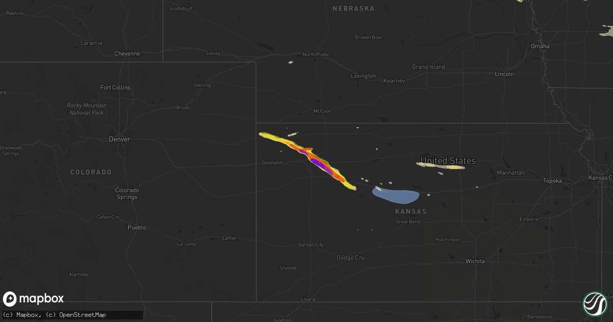
Hail Map on July 28, 2024
Get this storm
July 28 map
$229
one time, instant access
Download today. No call, no setup
Keep the $229
Bought the map and want the full workflow? Apply the entire $229 to a subscription within 7 days. None of it is wasted.
Every map, not just this one
This buys you this map. Subscription and you get every map we run, in the markets you choose from a few cities to whole states to nationwide. Plus real-time alerts the moment a storm fires.
Contact data
Name, contact info, occupancy, even credit band for addresses in the footprint. You go from where it hit to who to call.
Become the source they trust
Unlimited branding weather history reports on demand. You already have the documented answer ready for the property owner, and you are the one who showed up with it.
Property data and RoofTrace estimates
Pull up any address you have got, its value and the exact code rules for that jurisdiction, straight from One Click Code. Then RoofTrace estimates the squares, pitch, and roof value, priced the way you price.
States Impacted by Hail Map on July 28, 2024
Storm reports
Mississippi
| Date | Description |
|---|---|
| 07/28/20244:35 PM CDT | Tree down on mcelroy dr. |
North Dakota
| Date | Description |
|---|---|
| 07/28/20244:13 AM CDT | Delayed report. Trained spotter reports estimated 60 mph winds and pea size hail. 1.06 inches of rain fell in around 15 minutes. Time estimated from radar. |
| 07/28/20243:59 AM CDT | Delayed report. Trained spotter estimates 60 mph wind with pea size hail and an inch of rain in 15 minutes. |
Missouri
| Date | Description |
|---|---|
| 07/28/20244:20 AM CDT | Several tree limbs down that were 2 1/2 to 3 inches in diameter. |
Alabama
| Date | Description |
|---|---|
| 07/28/20245:05 PM CDT | A few trees blown down... Some involving power poles and lines. Time estimated from radar. |
| 07/28/202411:56 AM CDT | A tree was knocked down at 213 bryant road blocking the road completely. Time estimated by radar. |
Iowa
| Date | Description |
|---|---|
| 07/28/20246:02 PM CDT | Strong winds. Large tree branch down. Time estimated by social media time and radar. |
| 07/28/20241:35 AM CDT | Awos station kooa oskaloosa airport. 62 mph gust in the 10 min period ending at 135am cdt. |
| 07/27/202410:01 PM CDT | Power line down and an out building destroyed. Time estimated from radar. |
| 07/27/20248:50 PM CDT | From kcci tv viewer. Size estimated from hail stone in photo. |
| 07/27/20248:43 PM CDT | Hail as large as ping pong balls. Wind gusts to 40 mph as well. |
Nebraska
| Date | Description |
|---|---|
| 07/28/20243:36 AM CDT | Delayed report. Time estimated by radar. |
| 07/28/20243:20 AM CDT | Delayed report. Time estimated by radar. |
| 07/28/20243:14 AM CDT | Delayed report. Time estimated by radar. |
| 07/28/20242:28 AM CDT | A local report indicates 1.25 inch wind near Mclean |
| 07/28/20242:05 AM CDT | Hail lasted about 20 minutes. Damage to vehicles... Roof... And vegetation. |
| 07/28/20241:45 AM CDT | Several large tree limbs blown down on a farmstead. One limb fell onto a vehicle. Time estimated based on radar. |
| 07/28/20241:40 AM CDT | Damage to wind screens at a feed lot and also tree damage in the area. Time estimated from radar. |
| 07/28/20241:38 AM CDT | Damage to several large trees. One tree uprooted. Corn flattened. Time estimated based on radar. |
| 07/28/20241:20 AM CDT | Tree damage. Report from social media... Time estimated from radar. |
| 07/28/202412:45 AM CDT | Tree limbs blown down... Wind speed estimated 50-60 mph. |
| 07/28/202412:45 AM CDT | Personal weather station measured wind gust. |
Minnesota
| Date | Description |
|---|---|
| 07/28/20246:05 PM CDT | Delayed report... Time estimated from radar. Tree down blocking 10th st between keats ave and cr6. |
| 07/27/20248:00 PM CDT | The yellow medicine county sheriffs office called back around 8 pm to say that they have received reports of sewer backups... Water on roads... And some trees downed on |
Arizona
| Date | Description |
|---|---|
| 07/28/20244:45 PM CDT | Power pole down on circle i between jonnie drive and iron rose rd. |
| 07/28/20244:40 PM CDT | Relayed via social media. |
Wyoming
| Date | Description |
|---|---|
| 07/28/20246:56 PM CDT | A local report indicates 72 MPH wind near 2 ENE Osage |
| 07/28/20245:48 PM CDT | A local report indicates 70 MPH wind near 19 SSW Rozet |
| 07/28/20245:38 PM CDT | A local report indicates 62 MPH wind near 5 NNW Dwtn Gillette |
| 07/28/20245:32 PM CDT | A local report indicates 69 MPH wind near 13 NNE Wright |
| 07/28/20245:25 PM CDT | A local report indicates 1.00 inch wind near 4 WNW Beulah |
| 07/28/20245:06 PM CDT | Mesonet station wy18 halleck ridge |
| 07/27/20247:10 PM CDT | A local report indicates 62 MPH wind near 15 SSE Sundance |
South Dakota
| Date | Description |
|---|---|
| 07/28/20246:20 PM CDT | A local report indicates 68 MPH wind near 1 E Lead |
| 07/28/20246:17 PM CDT | A local report indicates 1.75 inch wind near Deadwood |
| 07/28/20246:06 PM CDT | 0.88 inch hail |
| 07/28/20245:47 PM CDT | A local report indicates 1.75 inch wind near 8 NW Terry Peak |
| 07/28/20245:05 PM CDT | A local report indicates 1.00 inch wind near Hermosa |
| 07/28/20244:35 PM CDT | A local report indicates 1.75 inch wind near 2 SE Rockerville |
| 07/28/20244:28 PM CDT | A local report indicates 1.25 inch wind near 2 SE Rockerville |
| 07/28/20245:19 AM CDT | Mesonet station 205 mclaughlin |
| 07/28/20245:11 AM CDT | Pea to quarter size hail. Time estimated from radar. |
| 07/28/20243:11 AM CDT | Siding damage to home from wind driven dime to nickel size hail. Time estimated from radar. |
| 07/28/20242:30 AM CDT | Public report of golf ball to baseball sized hail between 215 and 245 am. Multiple windshields broken... Large dents in vehicles... Corn stripped of most of its leaves. |
| 07/28/20241:13 AM CDT | A local report indicates 58 MPH wind near 1 NE Winner |
| 07/28/202412:56 AM CDT | Asos station kpir pierre muni ap. |
| 07/27/202411:30 PM CDT | A local report indicates 1.00 inch wind near 10 ENE Martin |
| 07/27/202411:25 PM CDT | A local report indicates 76 MPH wind near 5 ENE Martin |
| 07/27/202411:20 PM CDT | A local report indicates 61 MPH wind near 5 ENE Martin |
| 07/27/20248:55 PM CDT | A local report indicates 2.25 inch wind near Hermosa |
| 07/27/20248:54 PM CDT | Mping report |
| 07/27/20248:54 PM CDT | A local report indicates 1.75 inch wind near 2 NE Hermosa |
| 07/27/20248:53 PM CDT | A local report indicates 1.50 inch wind near Hermosa |
| 07/27/20248:53 PM CDT | A local report indicates 1.00 inch wind near 1 SW Hermosa |
| 07/27/20248:33 PM CDT | A local report indicates 74 MPH wind near 3 WNW Whitewood |
| 07/27/20248:15 PM CDT | A local report indicates 59 MPH wind near 4 E Dwtn Spearfish |
Kansas
| Date | Description |
|---|---|
| 07/28/20246:55 PM CDT | Hail ranged from pea to quarter in size; mostly nickel though this replaces the prior storm report from 11 s of beardsley. |
| 07/28/20246:55 PM CDT | Hail ranged from pea to quarter in size; mostly nickel though this replaces the prior storm report from 11 s of beardsley. |
| 07/28/20246:55 PM CDT | Ranged from pea to quarter size; most of it was nickel size. |
| 07/28/20246:27 PM CDT | Hail ranged from dime to quarter in size. |
| 07/28/20246:10 PM CDT | A local report indicates 1.00 inch wind near 1 NE Saint Francis |
| 07/28/20246:04 PM CDT | Quarter to half dollar size hail fell. |
| 07/28/20246:04 PM CDT | Report from mping: quarter |
| 07/28/20246:03 PM CDT | A local report indicates 1.00 inch wind near 2 NNW Saint Francis |
| 07/27/202411:22 PM CDT | A local report indicates 62 MPH wind near 4 S Russell Airport |
| 07/27/202411:22 PM CDT | A local report indicates 62 MPH wind near 3 NE Bunker Hill |
| 07/27/202411:10 PM CDT | A local report indicates 67 MPH wind near Russell Airport |
| 07/27/202410:40 PM CDT | Corrects previous non-tstm wnd dmg report from hays. Power lines down. |
| 07/27/202410:27 PM CDT | A local report indicates 61 MPH wind near 2 SW Hays |
| 07/27/20249:00 PM CDT | Dime to quarter sized hail; no electricity. |
| 07/27/20249:00 PM CDT | Upr846. |
| 07/27/20248:55 PM CDT | A local report indicates 60 MPH wind near Quinter |
| 07/27/20248:54 PM CDT | Corrects previous hail report from quinter. Quarter to golf ball size hail in quinter. |
| 07/27/20248:45 PM CDT | A local report indicates 1.00 inch wind near Park |
| 07/27/20248:32 PM CDT | Social media report with pictures of an irrigation pivot flipped over. Time estimated from radar. |
| 07/27/20248:31 PM CDT | A local report indicates 72 MPH wind near 6 N Grainfield |
| 07/27/20248:30 PM CDT | A local report indicates 68 MPH wind near 6 N Grainfield |
| 07/27/20248:23 PM CDT | Quarter to ping pong sized. |
| 07/27/20248:23 PM CDT | Estimated 70 to 75 mph. |
| 07/27/20248:20 PM CDT | Thunderstorm winds blew the closed doors of a machine shed inward... Then blew off half of the roof paneling from the shed. Some of the rafters collapsed. |
| 07/27/20248:15 PM CDT | Delayed report of a shed picked up... Thrown an unknown distance and destroyed. Pictures submitted via facebook. Time was estimated from radar. |
| 07/27/20248:15 PM CDT | Delayed report of golf ball and smaller hail ongoing from 815-830 ct. |
| 07/27/20248:06 PM CDT | Broken windows in home due to hail. |
| 07/27/20248:03 PM CDT | A local report indicates 1.75 inch wind near 1 ESE Menlo |
| 07/27/20248:03 PM CDT | Sheriff reported up to baseball sized hail. |
| 07/27/20248:01 PM CDT | Several 8 inch tree limbs downed. |
| 07/27/20248:01 PM CDT | Estimated 60 to 70 mph. |
| 07/27/20248:01 PM CDT | Numerous golf ball to tennis ball sized. |
| 07/27/20247:44 PM CDT | A local report indicates 1.50 inch wind near Gem |
| 07/27/20247:44 PM CDT | Estimating 60-70 mph. |
| 07/27/20247:44 PM CDT | A local report indicates 1.00 inch wind near 1 NE Gem |
| 07/27/20247:44 PM CDT | Several tree limbs down approx 3-4 inches in diameter. |
| 07/27/20247:30 PM CDT | Found these an hour after the storm had occurred. Estimated time of occurrence from radar. |
| 07/27/20247:30 PM CDT | Corrects previous hail report from 10 n colby. The hail had shrunk to golf ball size an hour later. Estimated time of occurrence from radar. |
| 07/27/20247:30 PM CDT | Estimated winds to be atleast 60 mph; also occurred with hail ranging from pea to between a nickel and quarter in size. |
| 07/27/20247:08 PM CDT | Occurred between 7 pm and 7:15 pm ct. |
| 07/27/20247:00 PM CDT | Estimated 50-60 mph wind gusts. |
Illinois
| Date | Description |
|---|---|
| 07/28/20245:23 PM CDT | Large branch partially blocking route 78. |
| 07/28/20245:45 AM CDT | Corrects previous tstm wnd dmg report from 1 wsw canton. Null report. Observed updated their report to say the damage had occurred on a previous day... And was not from |
| 07/28/20245:23 AM CDT | Tree damage throughout town including one large tree blown over and several large branches down... Some of which fell onto power lines. Time estimated by radar. |
| 07/28/20245:20 AM CDT | Photos shared on social media of several 3 to 6 inch diameter tree branches down. Time estimated by radar. |
Cities Impacted by Hail Map on July 28, 2024
- Fisher, MN
- Red Lake Falls, MN
- Crosslake, MN
- Hereford, AZ
- Patagonia, AZ
- Bisbee, AZ
- Smithland, IA
- Oto, IA
- Shelbina, MO
- Hill City, SD
- Elfrida, AZ
- Moorcroft, WY
- Devils Tower, WY
- Rapid City, SD
- Arivaca, AZ
- Kandiyohi, MN
- Willmar, MN
- Pittsfield, IL
- Tombstone, AZ
- Litchfield, MN
- Grove City, MN
- Anthon, IA
- Danbury, IA
- Mapleton, IA
- Sundance, WY
- Eden Valley, MN
- Atwater, MN
- Nemo, SD
- Piedmont, SD
- Bluffs, IL
- Hulett, WY
- Pierz, MN
- Willcox, AZ
- Bessemer, AL
- Watkins, MN
- Aitkin, MN
- Lake Lillian, MN
- Hermosa, SD
- Xenia, IL
- Keystone, SD
- McCalla, AL
- Whitewood, SD
- Tumacacori, AZ
- Green Valley, AZ
- Sonoita, AZ
- Sturgis, SD
- Aladdin, WY
- Beulah, WY
- Dassel, MN
- South Haven, MN
- Kimball, MN
- Boligee, AL
- Charleston, MS
- Saint Francis, KS
- Vale, SD
- Spearfish, SD
- Lead, SD
- Mount Lemmon, AZ
- Isle, MN
- Bird City, KS
- Deadwood, SD
- Newell, SD
- Pine City, MN
- Mallard, IA
- West Bend, IA
- McDonald, KS
- Granite Falls, MN
- Weston, WY
- McLeansboro, IL
- Boyd, MN
- Minneota, MN
- Taunton, MN
- Vivian, SD
- Cosmos, MN
- Springerton, IL
- Sacred Heart, MN
- Atwood, KS
- Colby, KS
- Maynard, MN
- Porter, MN
- Motley, MN
- Clarkfield, MN
- Westside, IA
- Vail, IA
- Canby, MN
- Levant, KS
- Mud Butte, SD
- Nisswa, MN
- Newcastle, WY
- Arcadia, IA
- Carroll, IA
- Halbur, IA
- Gem, KS
- Olivia, MN
- Elsie, NE
- Clara City, MN
- Box Elder, SD
- Blomkest, MN
- Rexford, KS
- Hoxie, KS
- Selden, KS
- Quitman, MS
- Danube, MN
- New Underwood, SD
- Pequot Lakes, MN
- Altoona, IA
- Mitchellville, IA
- Runnells, IA
- Prairie City, IA
- Colfax, IA
- Park, KS
- Quinter, KS
- Burke, SD
- Winner, SD
- Grainfield, KS
- Collyer, KS
- Newton, IA
- Platte, SD
- Ivanhoe, MN
- Mingo, IA
- Maxwell, IA
- Collins, IA
- Bondurant, IA
- Emmetsburg, IA
- Belle Fourche, SD
- Correctionville, IA
- Rockwell, IA
- Wakeeney, KS
- Rhodes, IA
- Baxter, IA
- Ira, IA
- Ogallah, KS
- Ellis, KS
- Melbourne, IA
- Laurel, IA
- Kellogg, IA
- Hays, KS
- Osborne, KS
- Tipton, KS
- Kyle, SD
- Wanblee, SD
- Wagner, SD
- Hunter, KS
- Beloit, KS
- Allen, SD
- Park Rapids, MN
- Lake George, MN
- Martin, SD
- Midland, SD
- Dante, SD
- Fonda, IA
- Walker, KS
- Pfeifer, KS
- Victoria, KS
- Wilson, KS
- Otis, KS
- Dorrance, KS
- Hoisington, KS
- Gorham, KS
- Russell, KS
- Bunker Hill, KS
- Delphos, KS
- Glasco, KS
- Springfield, SD
- Lake Andes, SD
- Avon, SD
- Tyndall, SD
- Tuthill, SD
- Niobrara, NE
- Norris, SD
- Fort Pierre, SD
- Bloomfield, NE
- Crofton, NE
- Moorland, IA
- Callender, IA
- Miltonvale, KS
- Somers, IA
- Milo, IA
- Ackworth, IA
- Pleasantville, IA
- Adair, IA
- Saint Marys, IA
- Indianola, IA
- Saint Charles, IA
- Prole, IA
- Parmelee, SD
- Murdo, SD
- Draper, SD
- Mission, SD
- Saint Francis, SD
- Casey, IA
- Abilene, KS
- Dexter, IA
- Stuart, IA
- Greenfield, IA
- Lacona, IA
- Ideal, SD
- Wood, SD
- Hartington, NE
- Wausa, NE
- Earlham, IA
- Winterset, IA
- Van Meter, IA
- Witten, SD
- Randolph, NE
- Menlo, IA
- Lowry, MN
- Belden, NE
- Coleridge, NE
- Monroe, IA
- Reasnor, IA
- Oskaloosa, IA
- Laurel, NE
- Magnet, NE
- Sully, IA
- Carroll, NE
- Guthrie Center, IA
- Cumming, IA
- Norwalk, IA
- Pleasant Hill, IA
- Center, NE
- Wayne, NE
- Swan, IA
- Wakefield, NE
- Presho, SD
- Colome, SD
- Concord, NE
- Emerson, NE
- Dallas, SD
- Gregory, SD
- Lower Brule, SD
- Knoxville, IA
- Thurston, NE
- Kennebec, SD
- Mclean, NE
- Creighton, NE
- Herrick, SD
- Osmond, NE
- Rosalie, NE
- Pender, NE
- Bancroft, NE
- Bonesteel, SD
- Norton, KS
- Reliance, SD
- Lyons, NE
- Decatur, NE
- Saint Charles, SD
- Butte, NE
- Fairfax, SD
- Spencer, NE
- Bristow, NE
- Lynch, NE
- Ellsworth, KS
- Elgin, ND
- Keosauqua, IA
- Bonaparte, IA
- New Leipzig, ND
- Edson, KS
- Carson, ND
- Tabor, SD
- Logan, KS
- Stockton, KS
- Selfridge, ND
- Verdigre, NE
- Kahoka, MO
- Saint Patrick, MO
- Winnetoon, NE
- McIntosh, SD
- McLaughlin, SD
- Walker, SD
- Elk Point, SD
- Westfield, IA
- Warsaw, IL
- Akron, IA
- Le Mars, IA
- Chambersburg, IL
- Griggsville, IL
- Meredosia, IL
- Winchester, IL
- Remsen, IA
- Kingsley, IA
- Quimby, IA
- Washta, IA
- Aurelia, IA
- Holstein, IA
- Alta, IA
- Galva, IA
- Schaller, IA
- Cherokee, IA
- Early, IA
- Barnard, KS
- Nemaha, IA
- Storm Lake, IA