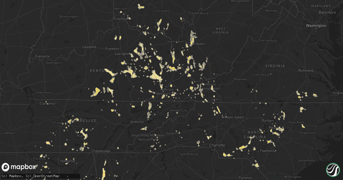
Hail Map in North Carolina on July 5, 2012
Get this storm
July 5 map
$229
one time, instant access
Download today. No call, no setup
Keep the $229
Bought the map and want the full workflow? Apply the entire $229 to a subscription within 7 days. None of it is wasted.
Every map, not just this one
This buys you this map. Subscription and you get every map we run, in the markets you choose from a few cities to whole states to nationwide. Plus real-time alerts the moment a storm fires.
Contact data
Name, contact info, occupancy, even credit band for addresses in the footprint. You go from where it hit to who to call.
Become the source they trust
Unlimited branding weather history reports on demand. You already have the documented answer ready for the property owner, and you are the one who showed up with it.
Property data and RoofTrace estimates
Pull up any address you have got, its value and the exact code rules for that jurisdiction, straight from One Click Code. Then RoofTrace estimates the squares, pitch, and roof value, priced the way you price.
Storm reports in North Carolina
North Carolina
| Date | Description |
|---|---|
| 07/05/20126:00 PM CDT | Trees down all over macon county starting north of franklin before 7 pm and reaching the georgia border at 735 pm. |
| 07/05/20126:00 PM CDT | Large limbs down on mecedonia church and medlin roads. |
| 07/05/20125:55 PM CDT | One small tree blew down and a few large limbs blown down on highway 215 toward the jackson county border. |
| 07/05/20125:50 PM CDT | Multiple trees and powerlines down on west franklin street and bragg street. |
| 07/05/20125:45 PM CDT | Large limbs down. |
| 07/05/20125:45 PM CDT | Trained spotter estimated 60 mph wind gust. Several 15 or more inch diameter oak tree branches down. |
| 07/05/20125:30 PM CDT | Trees down all over graham county with the first trees falling with the gust front crossing fontana lake around 630 pm. Gust front had crossed the county by 7 pm. |
| 07/05/20125:24 PM CDT | Tree across highway 73. Intersection of tedder rd. |
| 07/05/20125:20 PM CDT | Numerous trees down across the northern part of the county. Quarter size hail also reported at multiple locations. |
| 07/05/20125:18 PM CDT | Multiple trees down in the justice area. Time estimated by radar. |
| 07/05/20125:15 PM CDT | Four trees down on bruce thomas rd near stack rd. Quarter size hail also reported. |
| 07/05/20125:13 PM CDT | 1 tree down near intersection of bernsalem church rd and hwy 705. Time estimated. |
| 07/05/20125:10 PM CDT | Large limbs down on wolf pond road near joe collins road. |
| 07/05/20125:10 PM CDT | Numerous trees down across the county. |
| 07/05/20125:08 PM CDT | 1 tree down on rays bridge rd in whispering pines. Time estimated. |
| 07/05/20125:05 PM CDT | Three trees down. |
| 07/05/20125:00 PM CDT | Two trees down near leicester. |
| 07/05/20124:58 PM CDT | Several trees down with a few on powerlines mainly in the balsam and other areas close to the swain border. |
| 07/05/20124:55 PM CDT | Several trees down between polkton and highway 742 |
| 07/05/20124:47 PM CDT | Tree blown down near alt highway 64...just before the pitt county border. Time estimated. |
| 07/05/20124:45 PM CDT | Off duty county employee reported a few large oak tree limbs... Up to eight inches in diameter... Blown down near highway 42 and ellis road. Time estimated. |
| 07/05/20124:41 PM CDT | Numerous trees down near the 3200 block of county rd 22. Time estimated. |
| 07/05/20124:40 PM CDT | Dime to quarter sized hail on lost horse trail. |
| 07/05/20124:40 PM CDT | One tree down near weaverville. Time estimated by radar. |
| 07/05/20124:35 PM CDT | A few trees down near salemburg and several large branches down between autreyville salemburg. |
| 07/05/20124:23 PM CDT | Several trees down in the bunnlevel area |
| 07/05/20124:15 PM CDT | Large limbs down on lake james and hankins roads. |
| 07/05/20124:10 PM CDT | Report of large tree blocking roadway on montford rd near hwy 130. |
| 07/05/20124:05 PM CDT | Multiple trees and powerlines down near wolf laurel. |
| 07/05/20124:05 PM CDT | Tree on house |
| 07/05/20124:05 PM CDT | 18-22 inch diameter tree down along with downed power lines. |
| 07/05/20124:00 PM CDT | Tree down on goose pond road in ruffin |
| 07/05/20123:58 PM CDT | Large pine tree blown over and onto nws employees vehicle. No injuries. |
| 07/05/20123:54 PM CDT | Several trees and powerlines down along blacksburg highway. |
| 07/05/20123:52 PM CDT | Many trees down in the northwestern part of yancey county. |
| 07/05/20123:50 PM CDT | Tree down on route 770 |
| 07/05/20123:46 PM CDT | Large tree blown down along st. Andrews church road. Time estimated. |
| 07/05/20123:45 PM CDT | Large limbs down on north country club road. |
| 07/05/20123:44 PM CDT | Minor shingle and home siding damage and stop sign blown over on harris rd and near smith creek park. Time of event estimated by radar. |
| 07/05/20123:41 PM CDT | Winds snapped a support cable to a communications tower on brightleaf blvd causing tower to lean. 13 residents and 2 businesses evacuated. |
| 07/05/20123:35 PM CDT | Numerous trees down to the north and northwest of bakersville. |
| 07/05/20123:32 PM CDT | Large limbs in the roadway impeeding traffic and fire department called out to clear. |
| 07/05/20123:30 PM CDT | Trees down on plato-lee road |
| 07/05/20123:30 PM CDT | Trees down near stanley. |
| 07/05/20123:08 PM CDT | Tree top blown into power lines along old u.s. 1. Time estimated. |
| 07/05/20123:06 PM CDT | 2 trees down at a residence on rock cove rd. Time estimated. |
| 07/05/20123:05 PM CDT | Trees down on planters road |
| 07/05/20123:00 PM CDT | Trees blown down along highway 87 south and churchwood lane. Two large pines uprooted. Other trees across power lines causing power to be out in the area. |
| 07/05/20123:00 PM CDT | Trees down. 1 tree blew down in darby...another along elk creek darby road just southeast of darby. Lots of small limbs and debris littered the highway. |
| 07/05/20123:00 PM CDT | Several large trees down in garysburg. |
| 07/05/20122:58 PM CDT | Numerous large limbs down at the intersection of hardin road and philadelphia church road. |
| 07/05/20122:56 PM CDT | Two trees down on bald hill road |
| 07/05/20122:55 PM CDT | One tree blown down along hillsboro street. Time estimated. |
| 07/05/20122:54 PM CDT | Trees blown down. Police also reported house fire due to lightning strike. |
| 07/05/20122:50 PM CDT | Large limb down on south center church road |
| 07/05/20122:48 PM CDT | Trees down near philadelphia church road generally west of iron station. |
| 07/05/20122:45 PM CDT | 2 trees down. |
| 07/05/20122:40 PM CDT | One large tree fell onto a car in the brentmoor apartment complex off of captial blvd. |
| 07/05/20122:30 PM CDT | Tree down on bertram drive in north raleigh near capital blvd. |
| 07/05/20122:25 PM CDT | Multiple trees and powerlines down on newton. |
| 07/05/20122:25 PM CDT | Multiple trees down across the lake lure area. |
| 07/05/20122:25 PM CDT | One tree down near aberdeen |
| 07/05/20122:20 PM CDT | Trees and powerlines down on brown mountain beech road. |
| 07/05/20122:18 PM CDT | Multiple trees down in the justice area. Time estimated by radar. |
| 07/05/20122:18 PM CDT | Multiple trees down in bunn...time estimated by radar |
| 07/05/20122:15 PM CDT | Tree down on bertram drive in north raleigh near capital blvd. |
| 07/05/20122:15 PM CDT | Multiple trees down along fish hatchery road near 181. |
| 07/05/20122:05 PM CDT | Several trees down across roads. |
| 07/05/20122:04 PM CDT | Swath of trees down on southerland mill road with three trees in the road |
| 07/05/20121:50 PM CDT | Trees down on route 113 near piney creek |
| 07/05/20121:30 PM CDT | One tree down at highway 70a and meadowlands drive |
| 07/05/20121:18 PM CDT | Power lines down and transformer blown on bethel church road |
| 07/05/20121:17 PM CDT | Tree blown down along horseshoe road. Time estimated. |
| 07/05/20121:16 PM CDT | Tree blown down along brassfield church road. Time estimated. |
| 07/05/20121:15 PM CDT | One tree blown down on cannady rd. Time estimated. |
| 07/05/20121:09 PM CDT | Couple of trees down on walnut grove church road off of nc 86n |
| 07/05/201212:57 PM CDT | Numerous trees down along kiger rd. |
| 07/05/201212:55 PM CDT | Numerous trees down near nc 57 and nc 157. Multiple trees blocking the road. |
| 07/05/201212:55 PM CDT | Two trees down in the lewisville area |
| 07/05/201212:18 PM CDT | Multiple trees down across boonville |
| 07/05/201212:09 PM CDT | Church steeple and large trees down also. |
| 07/05/201212:00 PM CDT | Multiple trees down and damage to several buildings in dobson. |
| 07/05/201212:00 PM CDT | A.z. Phillips road |
| 07/05/201212:00 PM CDT | Multiple trees down along austin traphill road |
| 07/05/201211:45 AM CDT | Tree blocking southbound lane of i-77. |
| 07/04/20127:50 PM CDT | Tree reported down on butler rd near nc hwy 130 e. Time estimated by radar. |
| 07/04/20127:47 PM CDT | Tree reported down across highway on interstate 95 southbound lane near mile marker 3. Time estimated by radar. |
| 07/04/20127:34 PM CDT | Tree reported down on east raynham rd. Time estimated by radar. |
| 07/04/20127:30 PM CDT | Tree reported down on gaddys mill rd. Time estimated by radar. |
| 07/04/20127:05 PM CDT | Reported tree down at intersection of nc 41 and twisted hickory rd. |
All States Impacted by Hail Map on July 5, 2012
Cities Impacted by Hail Map on July 5, 2012
- Deerwood, MN
- Aitkin, MN
- Halifax, NC
- Sundance, WY
- Stockbridge, MI
- Smyrna, TN
- Murfreesboro, TN
- Mount Berry, GA
- Rome, GA
- Armuchee, GA
- Lindale, GA
- Gillette, WY
- Robbins, NC
- Garner, NC
- Clayton, NC
- Raleigh, NC
- Smithfield, NC
- Union Point, GA
- Raleigh, MS
- Greensboro, GA
- Salyersville, KY
- Gunlock, KY
- Royalton, KY
- Pound, VA
- Wise, VA
- Georgetown, OH
- Russellville, OH
- Salem, AL
- Windsor, KY
- Dunnville, KY
- Kings Mountain, KY
- Liberty, KY
- Waynesburg, KY
- Yosemite, KY
- Bethelridge, KY
- Mcdonough, GA
- Conyers, GA
- Whitesburg, KY
- Thornton, KY
- McKee, KY
- Berea, KY
- Iron Station, NC
- Denver, NC
- Springville, AL
- Odenville, AL
- Henderson, NC
- Mcminnville, TN
- Belle Fourche, SD
- Ostrander, OH
- Marysville, OH
- Grover, NC
- Shelby, NC
- Prestonsburg, KY
- Moncure, NC
- Sanford, NC
- Warfield, VA
- Dolphin, VA
- Monticello, GA
- Jackson, GA
- Tyner, KY
- Annville, KY
- Marston, NC
- Rockingham, NC
- Hazel Green, KY
- Mount Gilead, NC
- Ellerbe, NC
- Wartburg, TN
- Lancing, TN
- Decherd, TN
- Glenrock, WY
- Jackson, KY
- Inez, KY
- Louisa, KY
- Warfield, KY
- Fort Gay, WV
- Genoa, WV
- Pilgrim, KY
- Crum, WV
- Morrison, TN
- Manchester, TN
- Fairburn, SD
- Cobbtown, GA
- Nauvoo, AL
- Eldridge, AL
- Carthage, NC
- Eagle Springs, NC
- West End, NC
- Jackson Springs, NC
- Lawrenceburg, TN
- Phenix City, AL
- Columbus, GA
- Lillington, NC
- Jamestown, TN
- Deer Lodge, TN
- Varney, KY
- Pikeville, KY
- Independence, VA
- Mouth Of Wilson, VA
- Saulsville, WV
- Nancy, KY
- Monticello, KY
- Williamson, WV
- Belfry, KY
- Lincolnton, NC
- Corinth, KY
- Williamstown, KY
- Edmonton, KY
- Wall, SD
- Carrie, KY
- Plains, GA
- Gardners, PA
- Rogersville, TN
- Eidson, TN
- Portsmouth, OH
- Wheelersburg, OH
- Milford, OH
- Batavia, OH
- Edgefield, SC
- Model, CO
- Lusk, WY
- Pelahatchie, MS
- Gibsland, LA
- Dupree, SD
- Edgemont, SD
- McDermott, OH
- West Portsmouth, OH
- Evarts, KY
- Baxter, KY
- Harlan, KY
- Ages Brookside, KY
- Centreville, MD
- Crofton, NE
- Senoia, GA
- Sharpsburg, GA
- Eaton Rapids, MI
- Barbourville, KY
- Fort Deposit, AL
- Honoraville, AL
- Upperco, MD
- Sparks Glencoe, MD
- Manchester, MD
- Parkton, MD
- Selma, AL
- Garrison, KY
- Vanceburg, KY
- Buffalo Gap, SD
- Pelham, TN
- Monteagle, TN
- Stanville, KY
- Banner, KY
- Kimper, KY
- Ronda, NC
- Auburn, AL
- Auburn University, AL
- Wilmington, OH
- Calera, AL
- Crosby, MS
- Natchez, MS
- Four Oaks, NC
- Hephzibah, GA
- Edwards, MS
- Greer, SC
- Duncan, SC
- Kiahsville, WV
- Ranger, WV
- Branchland, WV
- Harts, WV
- Nederland, CO
- Boulder, CO
- Golden, CO
- Coeburn, VA
- Lapine, AL
- Ramer, AL
- Hope Hull, AL
- Letohatchee, AL
- Montgomery, AL
- Glendo, WY
- Saint Albans, WV
- Nitro, WV
- Hayden, CO
- Vincent, AL
- Westphalia, MI
- Weldon, NC
- Jackson, NC
- Bluffton, GA
- Edison, GA
- Fort Gaines, GA
- Moorcroft, WY
- Andersonville, GA
- Jeff, KY
- Happy, KY
- Viper, KY
- Hazard, KY
- Niceville, FL
- Winnsboro, LA
- Gilbert, LA
- Van Lear, KY
- Paintsville, KY
- Hagerhill, KY
- Auxier, KY
- East Point, KY
- El Dorado, AR
- Rowland, NC
- Maxton, NC
- Verner, WV
- Man, WV
- Fort Stockton, TX
- Girard, GA
- Sardis, GA
- Myrtle Beach, SC
- Fort Mill, SC
- Seale, AL
- Pittsview, AL
- Garrett, WY
- Jackson, SC
- West Union, OH
- Clayton, MI
- Morenci, MI
- Gravel Switch, KY
- Hustonville, KY
- Middleburg, KY
- Bradfordsville, KY
- Lebanon, KY
- Custer, SD
- Swainsboro, GA
- Twin City, GA
- Shawnee, WY
- Sevierville, TN
- Utica, MS
- Opelika, AL
- Lucasville, OH
- Piketon, OH
- Leburn, KY
- Vest, KY
- Hueysville, KY
- Wheatland, WY
- Dimondale, MI
- Charlotte, MI
- Spearfish, SD
- Abbeville, AL
- Shorterville, AL
- Milesville, SD
- Ashville, AL
- Rockford, OH
- Willshire, OH
- Wake Forest, NC
- Creedmoor, NC
- Mount Sterling, KY
- Sharpsburg, KY
- Saluda, SC
- Newberry, SC
- Silverstreet, SC
- Johnstown, CO
- Columbiana, AL
- Wapakoneta, OH
- Lakeview, OH
- Lewistown, OH
- Luverne, MN
- Steen, MN
- Roxboro, NC
- Appomattox, VA
- Frenchburg, KY
- Denniston, KY
- Wellington, KY
- Salt Lick, KY
- Roaring River, NC
- Elkin, NC
- Watertown, TN
- Milton, TN
- Rock Rapids, IA
- Midway, AL
- Eufaula, AL
- Clayton, AL
- Ellsworth, MN
- Wingate, NC
- Marshville, NC
- Tyler, AL
- Cusseta, GA
- Flat Lick, KY
- Ethridge, TN
- Mendenhall, MS
- Buffalo, SD
- Cowan, TN
- Sewanee, TN
- Winchester, TN
- Duff, TN
- La Follette, TN
- Amherstdale, WV
- Cyclone, WV
- Brenton, WV
- Clear Fork, WV
- Coal Mountain, WV
- Bim, WV
- Davin, WV
- Oneonta, AL
- Steele, AL
- Langsville, OH
- Pomeroy, OH
- Rutland, OH
- Leon, WV
- Red House, WV
- Martin, SC
- Pelham, AL
- Fordyce, NE
- Tyndall, SD
- Linton, ND
- Danville, VA
- Barnesville, GA
- Forsyth, GA
- Petersburg, TN
- Lebanon, TN
- Lascassas, TN
- Jonesville, NC
- Rutledge, TN
- Sneedville, TN
- Thorn Hill, TN
- Tazewell, TN
- Harrogate, TN
- Safford, AL
- Marion Junction, AL
- Uniontown, AL
- Red Level, AL
- Clay City, KY
- Stanton, KY
- Hayden, AL
- Blountsville, AL
- Freeport, FL
- Hartville, WY
- Bradyville, TN
- Sylva, NC
- Dublin, OH
- Plain City, OH
- Beech Island, SC
- Maben, WV
- Glen Fork, WV
- Pineville, WV
- Oceana, WV
- Ravencliff, WV
- Hamilton, AL
- Vicksburg, MS
- Millen, GA
- Jarratt, VA
- Dryden, TX
- Whitman, NE
- Merriman, NE
- Newville, AL
- Headland, AL
- Avon, SD
- Scotland, SD
- Ary, KY
- Buckhorn, KY
- Rowdy, KY
- Chavies, KY
- Dwarf, KY
- Hindman, KY
- Bonnyman, KY
- Vicco, KY
- Bulan, KY
- Sassafras, KY
- Gays Creek, KY
- Clayhole, KY
- Emmalena, KY
- Littcarr, KY
- Krypton, KY
- Lost Creek, KY
- Winchester, OH
- Highlands, NC
- Courtland, VA
- Sedley, VA
- Franklin, VA
- Hazlehurst, MS
- Owingsville, KY
- Hillsboro, KY
- Mullens, WV
- New Richmond, WV
- Sophia, WV
- Herndon, WV
- Itmann, WV
- Glen Daniel, WV
- Slab Fork, WV
- Glen White, WV
- Fairdale, WV
- Surveyor, WV
- Crab Orchard, WV
- Amigo, WV
- Beckley, WV
- Lester, WV
- San Luis, CO
- Bigelow, MN
- Worthington, MN
- Boonville, NC
- State Road, NC
- Dobson, NC
- Louisburg, NC
- Griffithsville, WV
- Alkol, WV
- Ashby, MN
- Ponce De Leon, FL
- Ricetown, KY
- Guernsey, WY
- Midville, GA
- Manville, WY
- Springport, MI
- Scott Depot, WV
- Kenna, WV
- Tornado, WV
- Winfield, WV
- Sod, WV
- Given, WV
- Buffalo, WV
- Poca, WV
- Dunbar, WV
- Charleston, WV
- Alum Creek, WV
- South Charleston, WV
- Liberty, WV
- Jamestown, KY
- Russell Springs, KY
- Beechgrove, TN
- Sandersville, GA
- Byrdstown, TN
- Albany, KY
- Booneville, KY
- Leslie, MI
- Mason, MI
- Lance Creek, WY
- Bastian, VA
- Sugar Grove, VA
- Sicily Island, LA
- Randolph, AL
- Lawley, AL
- Osyka, MS
- Jemison, AL
- Thorsby, AL
- Claxton, GA
- Metter, GA
- Collins, GA
- Tallulah, LA
- Bandy, VA
- Alzada, MT
- Elora, TN
- Flintville, TN
- Iron City, TN
- Westpoint, TN
- Cedar Bluff, VA
- La Vergne, TN
- Lynchburg, SC
- Sylvania, GA
- Ruby, SC
- Chesterfield, SC
- Peachland, NC
- Emporia, VA
- Cave Spring, GA
- Mount Vernon, KY
- Brodhead, KY
- Raymond, MS
- Greenville, GA
- Lagrange, GA
- Hogansville, GA
- Clopton, AL
- Greeneville, TN
- Lancaster, KY
- Richmond, KY
- Freeman, VA
- Dunn, NC
- Roaring Gap, NC
- Glade Valley, NC
- Chatham, LA
- Gate City, VA
- Hiltons, VA
- Kingsport, TN
- Alabaster, AL
- Hamlin, WV
- Hurricane, WV
- Huntsville, AL
- Sadieville, KY
- Clanton, AL
- Augusta, GA
- Surgoinsville, TN
- Milan, MI
- Maybee, MI
- Dubberly, LA
- Arcadia, LA
- Yolyn, WV
- Stollings, WV
- Lyburn, WV
- Cleveland, AL
- Wauseon, OH
- Delta, OH
- Hudson, MI
- Lyons, OH
- Dansville, MI
- Galax, VA
- Candor, NC
- Eagle, MI
- Carey, OH
- Alvada, OH
- Vanlue, OH
- Swannanoa, NC
- Burkesville, KY
- Breeding, KY
- Columbia, KY
- Apex, NC
- Harpersville, AL
- Altoona, AL
- Attalla, AL
- Gallant, AL
- Houston, DE
- Greenwood, DE
- Covington, GA
- Mansfield, GA
- Grass Lake, MI
- Otto, NC
- Middlesex, NC
- Knightdale, NC
- Zebulon, NC
- Wendell, NC
- Selma, NC
- Rock River, WY
- Dungannon, VA
- Hot Springs, SD
- Rocky Face, GA
- Rives Junction, MI
- Jackson, MI
- Pigeon Forge, TN
- Costilla, NM
- Arrington, TN
- Nolensville, TN
- Andalusia, AL
- Monroe, NC
- Gatlinburg, TN
- Clarksville, TN
- Laurel Hill, NC
- Hartford, AL
- Black, AL
- West Liberty, KY
- Livingston, TN
- Rickman, TN
- Rock Hill, SC
- Cary, NC
- Holly Springs, NC
- Fuquay Varina, NC
- Jones, AL
- Billingsley, AL
- Highland Home, AL
- Wagner, SD
- Delmont, SD
- Newcastle, WY
- Columbia, TN
- Kelso, TN
- Louisville, GA
- Aberdeen, NC
- Southern Pines, NC
- Cody, NE
- Eagleville, TN
- Chelsea, AL
- Lake, WV
- Hewett, WV
- Smyrna, SC
- Blacksburg, SC
- Tracy City, TN
- Glens Fork, KY
- Sabina, OH
- Flemingsburg, KY
- La Fayette, GA
- Summerville, GA
- Autryville, NC
- Walland, TN
- Townsend, TN
- Hermosa, SD
- Iaeger, WV
- Gary, IN
- Griffith, IN
- Merrillville, IN
- Walker, KY
- Toledo, OH
- Sylvania, OH
- Campton, KY
- Franklinton, NC
- Youngsville, NC
- Warthen, GA
- Lexington, GA
- Crawford, GA
- Parma, MI
- Lawrenceville, GA
- Dacula, GA
- Bonifay, FL
- Lake City, SC
- New Zion, SC
- Kingstree, SC
- Brookhaven, MS
- Nickelsville, VA
- Fort Blackmore, VA
- Benton, TN
- Ezel, KY
- Holmes Mill, KY
- Allendale, SC
- Itta Bena, MS
- Fayetteville, GA
- Hampton, GA
- Tarboro, NC
- Aiken, SC
- Loganville, GA
- Fedscreek, KY
- Greensboro, MD
- Harrington, DE
- Beattyville, KY
- Pounding Mill, VA
- Honaker, VA
- Saltville, VA
- Hulett, WY
- Grovetown, GA
- Waverly, OH
- Otway, OH
- Cullowhee, NC
- Ferguson, NC
- Phil Campbell, AL
- Russellville, AL
- Mitchell, GA
- Cochran, GA
- Magnolia, MN
- Troy, AL
- Spirit Lake, IA
- Paisley, FL
- Pulaski, TN
- Stopover, KY
- Matewan, WV
- Baisden, WV
- Wharncliffe, WV
- Hurley, VA
- Majestic, KY
- Gilbert, WV
- Pittsboro, NC
- Barnwell, SC
- Elkfork, KY
- Rougemont, NC
- Hurdle Mills, NC
- Waynesboro, GA
- Blythe, GA
- Neeses, SC
- North, SC
- Elbow Lake, MN
- Brooks, GA
- Moulton, AL
- Church Hill, MD
- Chestertown, MD
- Pecks Mill, WV
- Logan, WV
- Cedar Bluff, AL
- Double Springs, AL
- Haleyville, AL
- Winchester, KY
- Bartow, GA
- Wadley, GA
- Irvine, KY
- New Haven, IN
- Welch, WV
- Crab Orchard, KY
- Newellton, LA
- Evansville, MN
- Spearsville, LA
- Junction City, AR
- Strong, AR
- Cincinnati, OH
- Volin, SD
- Irene, SD
- Skipperville, AL
- Gaffney, SC
- Hoffman, NC
- Pensacola, FL
- Okabena, MN
- Lenoir, NC
- Woodville, MS
- Hallie, KY
- Linefork, KY
- Deep Gap, NC
- Cowpens, SC
- Ripley, WV
- Mize, KY
- Town Creek, AL
- Mount Hope, AL
- Capitol, MT
- Fort Benning, GA
- Chicago, IL
- Vermontville, MI
- Lake Odessa, MI
- Mulliken, MI
- Sunfield, MI
- Dublin, VA
- Max Meadows, VA
- Wytheville, VA
- Davisboro, GA
- Warrior, AL
- Dallas, NC
- Chatsworth, GA
- Ellijay, GA
- Perkins, GA
- McBee, SC
- Sandy Hook, KY
- Ohio City, OH
- Hartington, NE
- Findlay, OH
- Arcadia, OH
- Fostoria, OH
- Wharton, OH
- Bloomdale, OH
- Mount Blanchard, OH
- Hillsboro, TN
- Homer, LA
- East Waterford, PA
- Fort Wayne, IN
- Tylertown, MS
- Aladdin, WY
- Ivel, KY
- Deerfield, IL
- Lincolnshire, IL
- Magee, MS
- Pinola, MS
- Woodruff, SC
- Lansing, MI
- Holt, MI
- Danville, WV
- Clothier, WV
- Henlawson, WV
- Jeffrey, WV
- Chapmanville, WV
- Fort Bragg, NC
- Oak Hill, OH
- Jackson, OH
- New Bloomington, OH
- Morral, OH
- La Rue, OH
- Wooton, KY
- Cuthbert, GA
- Timmonsville, SC
- Marion, NC
- Polkton, NC
- Olympia, KY
- Florence, AL
- Wendell, MN
- Ward, CO
- Buffalo Grove, IL
- Franklin, NC
- Pleasant Lake, MI
- Dongola, IL
- Ottawa Lake, MI
- Holland, OH
- Riga, MI
- Libertyville, IL
- Lake Forest, IL
- Newton, NC
- Loveland, CO
- Winnetka, IL
- Glencoe, IL
- Athens, LA
- Georgetown, GA
- Big Spring, TX
- Garden City, TX
- Black Mountain, NC
- Carlsbad, NM
- Alberta, AL
- Rupert, GA
- Victoria, VA
- Bell Buckle, TN
- Christiana, TN
- Rose Hill, VA
- Jay Em, WY
- Buena Vista, GA
- Orrville, AL
- Lewisville, NC
- Taylors, SC
- Clio, AL
- Americus, GA
- Sunbright, TN
- Bethune, SC
- Beaver Creek, MN
- Maplesville, AL
- Owenton, KY
- Chandlersville, OH
- Williston, SC
- Kittrell, NC
- Hickory, NC
- Jolo, WV
- Panther, WV
- Rockford, AL
- Verbena, AL
- Crossville, TN
- Grundy, VA
- Potterville, MI
- Fairfield, OH
- Collinwood, TN
- Yawkey, WV
- Albany, OH
- Goodwater, AL
- Montevallo, AL
- Lilesville, NC
- Marion, VA
- Unicoi, TN
- Jonesborough, TN
- Morehead, KY
- Stephens, GA
- Thomaston, AL
- Fairmont, NC
- Plantersville, AL
- Stanton, AL
- Joppa, AL
- Beulah, WY
- Sherrills Ford, NC
- Delbarton, WV
- Wayne, WV
- Defuniak Springs, FL
- Notasulga, AL
- Tuskegee, AL
- Tuskegee Institute, AL
- Jonesville, MI
- Huddy, KY
- Hardy, KY
- Upper Sandusky, OH
- Forest, OH
- Tannersville, VA
- Kanaranzi, MN
- Ozona, TX
- Nicholasville, KY
- Rockvale, TN
- Cherokee, NC
- Deland, FL
- Manchester, OH
- Warrenton, NC
- Macclesfield, NC
- Greenville, NC
- Holly Pond, AL
- Granby, CO
- Speedwell, TN
- New Tazewell, TN
- Cumberland Gap, TN
- Rogersville, AL
- Pioneer, TN
- Gretna, VA
- Chatham, VA
- Morristown, TN
- Bean Station, TN
- Frakes, KY
- Griffin, GA
- Tuscumbia, AL
- Tazewell, VA
- Broadford, VA
- Gaston, SC
- Swansea, SC
- Moore, SC
- Old Fort, NC
- Ceres, VA
- Atkins, VA
- Troutdale, VA
- Kaycee, WY
- Glasgow, KY
- Dawsonville, GA
- Sidney, KY
- Canada, KY
- Forest Hills, KY
- Stone, KY
- Lebanon, VA
- Bledsoe, KY
- Helton, KY
- Robertsdale, AL
- Lamy, NM
- Chapel Hill, TN
- Greenville, AL
- Mauk, GA
- Grand Ledge, MI
- Warbranch, KY
- East Bend, NC
- Lumpkin, GA
- Glenview, IL
- Des Plaines, IL
- Mount Prospect, IL
- Georgetown, SC
- Richland, GA
- Douglas, WY
- Warrenville, SC
- Graniteville, SC
- Catherine, AL
- Canton, MS
- Fries, VA
- Eglin Afb, FL
- Robbins, TN
- Castlewood, VA
- Raccoon, KY
- Dana, KY
- Harold, KY
- Dwale, KY
- Betsy Layne, KY
- Allen, KY
- Savannah, GA
- Milner, GA
- Pine Mountain, GA
- Camden, AR
- Louann, AR
- Liberty, SC
- Easley, SC
- Sulligent, AL
- Beaverton, AL
- Tompkinsville, KY
- Martin, KY
- Vancleve, KY
- Princeton, WV
- Lerona, WV
- Ball Ground, GA
- Bunnlevel, NC
- Godwin, NC
- Erwin, NC
- Linden, NC
- Navarre, FL
- Norwich, OH
- Blue Rock, OH
- Zanesville, OH
- Grayson, GA
- Richwood, OH
- Raymond, OH
- Partridge, KY
- Eolia, KY
- Kermit, WV
- Alton, VA
- Milton, NC
- Hanover, WV
- Greenville, SC
- Buford, GA
- Suwanee, GA
- Brevard, NC
- Carlisle, KY
- Mount Pleasant, TN
- Anna, IL
- Chuckey, TN
- Afton, TN
- Stanford, KY
- Pembroke, GA
- Waco, KY
- Enfield, NC
- Roanoke Rapids, NC
- Hartsville, SC
- Eastman, GA
- Oneida, TN
- Kershaw, SC
- Meadowview, VA
- Evans, GA
- Portland, MI
- Yanceyville, NC
- Summer Shade, KY
- Sparta, GA
- Enning, SD
- Howes, SD
- Chiefland, FL
- South Pittsburg, TN
- Duffield, VA
- Eros, LA
- Marlette, MI
- Hardaway, AL
- Pell City, AL
- Midkiff, WV
- Bishopville, SC
- Semora, NC
- Cameron, SC
- Huntington, WV
- Willow Spring, NC
- Lexington, AL
- Estancia, NM
- Huntland, TN
- Stony Creek, VA
- Terry, MS
- White Owl, SD
- Pittsville, VA
- Lily, KY
- Arlington, OH
- Childersburg, AL
- Oxford, NC
- Stem, NC
- Vermillion, SD
- Trenton, SC
- Ridge Spring, SC
- Baileyton, AL
- Butler, GA
- Sherwood, TN
- Belvidere, TN
- Sparta, NC
- Olive Hill, KY
- Cumberland, KY
- Gurley, AL
- Omaha, GA
- Idaho Springs, CO
- Munith, MI
- Amory, MS
- Aberdeen, MS
- Wrens, GA
- Chilhowie, VA
- Port Wentworth, GA
- Keystone, SD
- Rapid City, SD
- Preston, GA
- Gulf Breeze, FL
- Scuddy, KY
- Hyden, KY
- Redfox, KY
- Busy, KY
- Blackey, KY
- Combs, KY
- Union Church, MS
- Jefferson City, TN
- Talbott, TN
- New Market, TN
- Maiden, NC
- Edison, OH
- Mount Gilead, OH
- New Vienna, OH
- Pall Mall, TN
- Adrian, MN
- Pittsford, MI
- Yale, VA
- Westminster, MD
- Hampstead, MD
- Rocky Ford, GA
- Kingston, GA
- Moriarty, NM
- Jonesville, VA
- Dryden, VA
- Pennington Gap, VA
- Big Stone Gap, VA
- Blackwater, VA
- Blackstone, VA
- Quitman, LA
- Jonesboro, LA
- Raeford, NC
- Woodbury, TN
- Sylacauga, AL
- Ravenna, KY
- Flatgap, KY
- Oil Springs, KY
- Utica, SD
- Yankton, SD
- Ennice, NC
- Salem, SC
- Langley, KY
- Printer, KY
- Drift, KY
- Cartersville, GA
- White, GA
- Dandridge, TN
- Jefferson, SC
- Pageland, SC
- Cawood, KY
- Longmont, CO
- Franklin, TN
- Panama City Beach, FL
- Sorrento, FL
- Apopka, FL
- Taiban, NM
- Bland, VA
- Piney Creek, NC
- Grassy Creek, NC
- Crumpler, NC
- Antonito, CO
- Wilmont, MN
- Middleport, OH
- Monroe, LA
- Guyton, GA
- Boaz, AL
- Stockbridge, GA
- Abingdon, VA
- South Webster, OH
- Tuckasegee, NC
- Hatchechubbee, AL
- Lakefield, MN
- Wilsonville, AL
- Alpine, AL
- Collinsville, AL
- Manchester, MI
- Ragland, AL
- Parkston, SD
- Saint Matthews, SC
- New Underwood, SD
- Edgemoor, SC
- Hardeeville, SC
- Pooler, GA
- Killen, AL
- Fayetteville, TN
- Stapleton, GA
- Smilax, KY
- Gibson, GA
- McColl, SC
- Clio, SC
- Little Rock, SC
- Cullman, AL
- Broadway, NC
- Summertown, TN
- Magnolia, MS
- Scenic, SD
- Caputa, SD
- Jeffersonville, KY
- Moorefield, KY
- Means, KY
- Ewing, KY
- Hope, KY
- Altamont, TN
- Autaugaville, AL
- New Hill, NC
- Goliad, TX
- Kenedy, TX
- Meally, KY
- West Van Lear, KY
- Wesson, MS
- Lake Villa, IL
- Round Lake, IL
- Stanley, NM
- Goldston, NC
- Columbus, OH
- Powell, OH
- Milton, FL
- Cedartown, GA
- Ewing, VA
- Arlington, GA
- North Augusta, SC
- Culloden, WV
- Patrick, SC
- Cleveland, VA
- Faunsdale, AL
- Newbern, AL
- Swanton, OH
- Saint Paul, VA
- McComb, OH
- Deshler, OH
- Hoytville, OH
- Custar, OH
- North Baltimore, OH
- Yadkinville, NC
- Sand Creek, MI
- Jasper, MI
- Fayette, OH
- Union Springs, AL
- Skippers, VA
- South Shore, KY
- Greenup, KY
- Woodville, AL
- Saline, MI
- Sandgap, KY
- Roxana, KY
- Cornettsville, KY
- Fort Sumner, NM
- Rock Island, TN
- Kyle, WV
- Elkhorn, WV
- Northfork, WV
- Kings Mountain, NC
- Cherryville, NC
- North Spring, WV
- Niobrara, NE
- Worton, MD
- Wadesboro, NC
- Hilliard, OH
- Mount Hope, WV
- Maggie Valley, NC
- Tripp, SD
- Rushmore, MN
- Carbondale, CO
- Wheeling, IL
- Northbrook, IL
- Vernon Hills, IL
- Lawrenceville, VA
- Brandon, MN
- Richlands, VA
- Jewell Ridge, VA
- Weogufka, AL
- East Bernstadt, KY
- Detroit, AL
- Van Buren, OH
- Travelers Rest, SC
- Bristol, VA
- Mendota, VA
- Lake Lure, NC
- Franklinton, LA
- Alexandria, TN
- Fort Walton Beach, FL
- Hurlburt Field, FL
- Mary Esther, FL
- Horton, MI
- Hanover, MI
- Concord, MI
- Reva, SD


