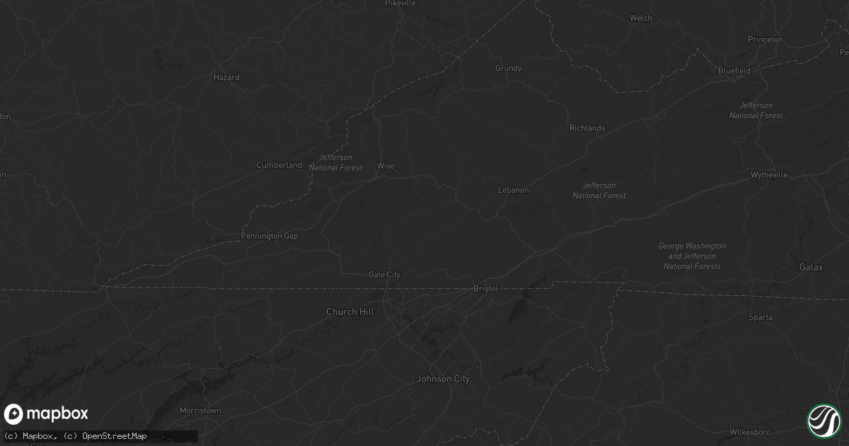
Hail Map in Auburn, AL on July 5, 2012
Get this storm
July 5 map
$229
one time, instant access
Download today. No call, no setup
Keep the $229
Bought the map and want the full workflow? Apply the entire $229 to a subscription within 7 days. None of it is wasted.
Every map, not just this one
This buys you this map. Subscription and you get every map we run, in the markets you choose from a few cities to whole states to nationwide. Plus real-time alerts the moment a storm fires.
Contact data
Name, contact info, occupancy, even credit band for addresses in the footprint. You go from where it hit to who to call.
Become the source they trust
Unlimited branding weather history reports on demand. You already have the documented answer ready for the property owner, and you are the one who showed up with it.
Property data and RoofTrace estimates
Pull up any address you have got, its value and the exact code rules for that jurisdiction, straight from One Click Code. Then RoofTrace estimates the squares, pitch, and roof value, priced the way you price.
Storm reports in Auburn, AL
Auburn, AL
| Date | Description |
|---|---|
| 07/05/20126:06 PM CDT | Berry road on southeast side of town. |
| 07/05/20126:03 PM CDT | Trees and power lines blown down across the city of auburn. |
| 07/05/20125:52 PM CDT | Trees and power lines were blown down near exit 57 on interstate 85. |
| 07/05/20125:47 PM CDT | A local report indicates 59 MPH wind near AUBURN |
All States Impacted by Hail Map on July 5, 2012
All Cities Impacted by Hail Map on July 5, 2012
- Deerwood, MN
- Aitkin, MN
- Halifax, NC
- Sundance, WY
- Stockbridge, MI
- Smyrna, TN
- Murfreesboro, TN
- Mount Berry, GA
- Rome, GA
- Armuchee, GA
- Lindale, GA
- Gillette, WY
- Robbins, NC
- Garner, NC
- Clayton, NC
- Raleigh, NC
- Smithfield, NC
- Union Point, GA
- Raleigh, MS
- Greensboro, GA
- Salyersville, KY
- Gunlock, KY
- Royalton, KY
- Pound, VA
- Wise, VA
- Georgetown, OH
- Russellville, OH
- Salem, AL
- Windsor, KY
- Dunnville, KY
- Kings Mountain, KY
- Liberty, KY
- Waynesburg, KY
- Yosemite, KY
- Bethelridge, KY
- Mcdonough, GA
- Conyers, GA
- Whitesburg, KY
- Thornton, KY
- McKee, KY
- Berea, KY
- Iron Station, NC
- Denver, NC
- Springville, AL
- Odenville, AL
- Henderson, NC
- Mcminnville, TN
- Belle Fourche, SD
- Ostrander, OH
- Marysville, OH
- Grover, NC
- Shelby, NC
- Prestonsburg, KY
- Moncure, NC
- Sanford, NC
- Warfield, VA
- Dolphin, VA
- Monticello, GA
- Jackson, GA
- Tyner, KY
- Annville, KY
- Marston, NC
- Rockingham, NC
- Hazel Green, KY
- Mount Gilead, NC
- Ellerbe, NC
- Wartburg, TN
- Lancing, TN
- Decherd, TN
- Glenrock, WY
- Jackson, KY
- Inez, KY
- Louisa, KY
- Warfield, KY
- Fort Gay, WV
- Genoa, WV
- Pilgrim, KY
- Crum, WV
- Morrison, TN
- Manchester, TN
- Fairburn, SD
- Cobbtown, GA
- Nauvoo, AL
- Eldridge, AL
- Carthage, NC
- Eagle Springs, NC
- West End, NC
- Jackson Springs, NC
- Lawrenceburg, TN
- Phenix City, AL
- Columbus, GA
- Lillington, NC
- Jamestown, TN
- Deer Lodge, TN
- Varney, KY
- Pikeville, KY
- Independence, VA
- Mouth Of Wilson, VA
- Saulsville, WV
- Nancy, KY
- Monticello, KY
- Williamson, WV
- Belfry, KY
- Lincolnton, NC
- Corinth, KY
- Williamstown, KY
- Edmonton, KY
- Wall, SD
- Carrie, KY
- Plains, GA
- Gardners, PA
- Rogersville, TN
- Eidson, TN
- Portsmouth, OH
- Wheelersburg, OH
- Milford, OH
- Batavia, OH
- Edgefield, SC
- Model, CO
- Lusk, WY
- Pelahatchie, MS
- Gibsland, LA
- Dupree, SD
- Edgemont, SD
- McDermott, OH
- West Portsmouth, OH
- Evarts, KY
- Baxter, KY
- Harlan, KY
- Ages Brookside, KY
- Centreville, MD
- Crofton, NE
- Senoia, GA
- Sharpsburg, GA
- Eaton Rapids, MI
- Barbourville, KY
- Fort Deposit, AL
- Honoraville, AL
- Upperco, MD
- Sparks Glencoe, MD
- Manchester, MD
- Parkton, MD
- Selma, AL
- Garrison, KY
- Vanceburg, KY
- Buffalo Gap, SD
- Pelham, TN
- Monteagle, TN
- Stanville, KY
- Banner, KY
- Kimper, KY
- Ronda, NC
- Auburn, AL
- Auburn University, AL
- Wilmington, OH
- Calera, AL
- Crosby, MS
- Natchez, MS
- Four Oaks, NC
- Hephzibah, GA
- Edwards, MS
- Greer, SC
- Duncan, SC
- Kiahsville, WV
- Ranger, WV
- Branchland, WV
- Harts, WV
- Nederland, CO
- Boulder, CO
- Golden, CO
- Coeburn, VA
- Lapine, AL
- Ramer, AL
- Hope Hull, AL
- Letohatchee, AL
- Montgomery, AL
- Glendo, WY
- Saint Albans, WV
- Nitro, WV
- Hayden, CO
- Vincent, AL
- Westphalia, MI
- Weldon, NC
- Jackson, NC
- Bluffton, GA
- Edison, GA
- Fort Gaines, GA
- Moorcroft, WY
- Andersonville, GA
- Jeff, KY
- Happy, KY
- Viper, KY
- Hazard, KY
- Niceville, FL
- Winnsboro, LA
- Gilbert, LA
- Van Lear, KY
- Paintsville, KY
- Hagerhill, KY
- Auxier, KY
- East Point, KY
- El Dorado, AR
- Rowland, NC
- Maxton, NC
- Verner, WV
- Man, WV
- Fort Stockton, TX
- Girard, GA
- Sardis, GA
- Myrtle Beach, SC
- Fort Mill, SC
- Seale, AL
- Pittsview, AL
- Garrett, WY
- Jackson, SC
- West Union, OH
- Clayton, MI
- Morenci, MI
- Gravel Switch, KY
- Hustonville, KY
- Middleburg, KY
- Bradfordsville, KY
- Lebanon, KY
- Custer, SD
- Swainsboro, GA
- Twin City, GA
- Shawnee, WY
- Sevierville, TN
- Utica, MS
- Opelika, AL
- Lucasville, OH
- Piketon, OH
- Leburn, KY
- Vest, KY
- Hueysville, KY
- Wheatland, WY
- Dimondale, MI
- Charlotte, MI
- Spearfish, SD
- Abbeville, AL
- Shorterville, AL
- Milesville, SD
- Ashville, AL
- Rockford, OH
- Willshire, OH
- Wake Forest, NC
- Creedmoor, NC
- Mount Sterling, KY
- Sharpsburg, KY
- Saluda, SC
- Newberry, SC
- Silverstreet, SC
- Johnstown, CO
- Columbiana, AL
- Wapakoneta, OH
- Lakeview, OH
- Lewistown, OH
- Luverne, MN
- Steen, MN
- Roxboro, NC
- Appomattox, VA
- Frenchburg, KY
- Denniston, KY
- Wellington, KY
- Salt Lick, KY
- Roaring River, NC
- Elkin, NC
- Watertown, TN
- Milton, TN
- Rock Rapids, IA
- Midway, AL
- Eufaula, AL
- Clayton, AL
- Ellsworth, MN
- Wingate, NC
- Marshville, NC
- Tyler, AL
- Cusseta, GA
- Flat Lick, KY
- Ethridge, TN
- Mendenhall, MS
- Buffalo, SD
- Cowan, TN
- Sewanee, TN
- Winchester, TN
- Duff, TN
- La Follette, TN
- Amherstdale, WV
- Cyclone, WV
- Brenton, WV
- Clear Fork, WV
- Coal Mountain, WV
- Bim, WV
- Davin, WV
- Oneonta, AL
- Steele, AL
- Langsville, OH
- Pomeroy, OH
- Rutland, OH
- Leon, WV
- Red House, WV
- Martin, SC
- Pelham, AL
- Fordyce, NE
- Tyndall, SD
- Linton, ND
- Danville, VA
- Barnesville, GA
- Forsyth, GA
- Petersburg, TN
- Lebanon, TN
- Lascassas, TN
- Jonesville, NC
- Rutledge, TN
- Sneedville, TN
- Thorn Hill, TN
- Tazewell, TN
- Harrogate, TN
- Safford, AL
- Marion Junction, AL
- Uniontown, AL
- Red Level, AL
- Clay City, KY
- Stanton, KY
- Hayden, AL
- Blountsville, AL
- Freeport, FL
- Hartville, WY
- Bradyville, TN
- Sylva, NC
- Dublin, OH
- Plain City, OH
- Beech Island, SC
- Maben, WV
- Glen Fork, WV
- Pineville, WV
- Oceana, WV
- Ravencliff, WV
- Hamilton, AL
- Vicksburg, MS
- Millen, GA
- Jarratt, VA
- Dryden, TX
- Whitman, NE
- Merriman, NE
- Newville, AL
- Headland, AL
- Avon, SD
- Scotland, SD
- Ary, KY
- Buckhorn, KY
- Rowdy, KY
- Chavies, KY
- Dwarf, KY
- Hindman, KY
- Bonnyman, KY
- Vicco, KY
- Bulan, KY
- Sassafras, KY
- Gays Creek, KY
- Clayhole, KY
- Emmalena, KY
- Littcarr, KY
- Krypton, KY
- Lost Creek, KY
- Winchester, OH
- Highlands, NC
- Courtland, VA
- Sedley, VA
- Franklin, VA
- Hazlehurst, MS
- Owingsville, KY
- Hillsboro, KY
- Mullens, WV
- New Richmond, WV
- Sophia, WV
- Herndon, WV
- Itmann, WV
- Glen Daniel, WV
- Slab Fork, WV
- Glen White, WV
- Fairdale, WV
- Surveyor, WV
- Crab Orchard, WV
- Amigo, WV
- Beckley, WV
- Lester, WV
- San Luis, CO
- Bigelow, MN
- Worthington, MN
- Boonville, NC
- State Road, NC
- Dobson, NC
- Louisburg, NC
- Griffithsville, WV
- Alkol, WV
- Ashby, MN
- Ponce De Leon, FL
- Ricetown, KY
- Guernsey, WY
- Midville, GA
- Manville, WY
- Springport, MI
- Scott Depot, WV
- Kenna, WV
- Tornado, WV
- Winfield, WV
- Sod, WV
- Given, WV
- Buffalo, WV
- Poca, WV
- Dunbar, WV
- Charleston, WV
- Alum Creek, WV
- South Charleston, WV
- Liberty, WV
- Jamestown, KY
- Russell Springs, KY
- Beechgrove, TN
- Sandersville, GA
- Byrdstown, TN
- Albany, KY
- Booneville, KY
- Leslie, MI
- Mason, MI
- Lance Creek, WY
- Bastian, VA
- Sugar Grove, VA
- Sicily Island, LA
- Randolph, AL
- Lawley, AL
- Osyka, MS
- Jemison, AL
- Thorsby, AL
- Claxton, GA
- Metter, GA
- Collins, GA
- Tallulah, LA
- Bandy, VA
- Alzada, MT
- Elora, TN
- Flintville, TN
- Iron City, TN
- Westpoint, TN
- Cedar Bluff, VA
- La Vergne, TN
- Lynchburg, SC
- Sylvania, GA
- Ruby, SC
- Chesterfield, SC
- Peachland, NC
- Emporia, VA
- Cave Spring, GA
- Mount Vernon, KY
- Brodhead, KY
- Raymond, MS
- Greenville, GA
- Lagrange, GA
- Hogansville, GA
- Clopton, AL
- Greeneville, TN
- Lancaster, KY
- Richmond, KY
- Freeman, VA
- Dunn, NC
- Roaring Gap, NC
- Glade Valley, NC
- Chatham, LA
- Gate City, VA
- Hiltons, VA
- Kingsport, TN
- Alabaster, AL
- Hamlin, WV
- Hurricane, WV
- Huntsville, AL
- Sadieville, KY
- Clanton, AL
- Augusta, GA
- Surgoinsville, TN
- Milan, MI
- Maybee, MI
- Dubberly, LA
- Arcadia, LA
- Yolyn, WV
- Stollings, WV
- Lyburn, WV
- Cleveland, AL
- Wauseon, OH
- Delta, OH
- Hudson, MI
- Lyons, OH
- Dansville, MI
- Galax, VA
- Candor, NC
- Eagle, MI
- Carey, OH
- Alvada, OH
- Vanlue, OH
- Swannanoa, NC
- Burkesville, KY
- Breeding, KY
- Columbia, KY
- Apex, NC
- Harpersville, AL
- Altoona, AL
- Attalla, AL
- Gallant, AL
- Houston, DE
- Greenwood, DE
- Covington, GA
- Mansfield, GA
- Grass Lake, MI
- Otto, NC
- Middlesex, NC
- Knightdale, NC
- Zebulon, NC
- Wendell, NC
- Selma, NC
- Rock River, WY
- Dungannon, VA
- Hot Springs, SD
- Rocky Face, GA
- Rives Junction, MI
- Jackson, MI
- Pigeon Forge, TN
- Costilla, NM
- Arrington, TN
- Nolensville, TN
- Andalusia, AL
- Monroe, NC
- Gatlinburg, TN
- Clarksville, TN
- Laurel Hill, NC
- Hartford, AL
- Black, AL
- West Liberty, KY
- Livingston, TN
- Rickman, TN
- Rock Hill, SC
- Cary, NC
- Holly Springs, NC
- Fuquay Varina, NC
- Jones, AL
- Billingsley, AL
- Highland Home, AL
- Wagner, SD
- Delmont, SD
- Newcastle, WY
- Columbia, TN
- Kelso, TN
- Louisville, GA
- Aberdeen, NC
- Southern Pines, NC
- Cody, NE
- Eagleville, TN
- Chelsea, AL
- Lake, WV
- Hewett, WV
- Smyrna, SC
- Blacksburg, SC
- Tracy City, TN
- Glens Fork, KY
- Sabina, OH
- Flemingsburg, KY
- La Fayette, GA
- Summerville, GA
- Autryville, NC
- Walland, TN
- Townsend, TN
- Hermosa, SD
- Iaeger, WV
- Gary, IN
- Griffith, IN
- Merrillville, IN
- Walker, KY
- Toledo, OH
- Sylvania, OH
- Campton, KY
- Franklinton, NC
- Youngsville, NC
- Warthen, GA
- Lexington, GA
- Crawford, GA
- Parma, MI
- Lawrenceville, GA
- Dacula, GA
- Bonifay, FL
- Lake City, SC
- New Zion, SC
- Kingstree, SC
- Brookhaven, MS
- Nickelsville, VA
- Fort Blackmore, VA
- Benton, TN
- Ezel, KY
- Holmes Mill, KY
- Allendale, SC
- Itta Bena, MS
- Fayetteville, GA
- Hampton, GA
- Tarboro, NC
- Aiken, SC
- Loganville, GA
- Fedscreek, KY
- Greensboro, MD
- Harrington, DE
- Beattyville, KY
- Pounding Mill, VA
- Honaker, VA
- Saltville, VA
- Hulett, WY
- Grovetown, GA
- Waverly, OH
- Otway, OH
- Cullowhee, NC
- Ferguson, NC
- Phil Campbell, AL
- Russellville, AL
- Mitchell, GA
- Cochran, GA
- Magnolia, MN
- Troy, AL
- Spirit Lake, IA
- Paisley, FL
- Pulaski, TN
- Stopover, KY
- Matewan, WV
- Baisden, WV
- Wharncliffe, WV
- Hurley, VA
- Majestic, KY
- Gilbert, WV
- Pittsboro, NC
- Barnwell, SC
- Elkfork, KY
- Rougemont, NC
- Hurdle Mills, NC
- Waynesboro, GA
- Blythe, GA
- Neeses, SC
- North, SC
- Elbow Lake, MN
- Brooks, GA
- Moulton, AL
- Church Hill, MD
- Chestertown, MD
- Pecks Mill, WV
- Logan, WV
- Cedar Bluff, AL
- Double Springs, AL
- Haleyville, AL
- Winchester, KY
- Bartow, GA
- Wadley, GA
- Irvine, KY
- New Haven, IN
- Welch, WV
- Crab Orchard, KY
- Newellton, LA
- Evansville, MN
- Spearsville, LA
- Junction City, AR
- Strong, AR
- Cincinnati, OH
- Volin, SD
- Irene, SD
- Skipperville, AL
- Gaffney, SC
- Hoffman, NC
- Pensacola, FL
- Okabena, MN
- Lenoir, NC
- Woodville, MS
- Hallie, KY
- Linefork, KY
- Deep Gap, NC
- Cowpens, SC
- Ripley, WV
- Mize, KY
- Town Creek, AL
- Mount Hope, AL
- Capitol, MT
- Fort Benning, GA
- Chicago, IL
- Vermontville, MI
- Lake Odessa, MI
- Mulliken, MI
- Sunfield, MI
- Dublin, VA
- Max Meadows, VA
- Wytheville, VA
- Davisboro, GA
- Warrior, AL
- Dallas, NC
- Chatsworth, GA
- Ellijay, GA
- Perkins, GA
- McBee, SC
- Sandy Hook, KY
- Ohio City, OH
- Hartington, NE
- Findlay, OH
- Arcadia, OH
- Fostoria, OH
- Wharton, OH
- Bloomdale, OH
- Mount Blanchard, OH
- Hillsboro, TN
- Homer, LA
- East Waterford, PA
- Fort Wayne, IN
- Tylertown, MS
- Aladdin, WY
- Ivel, KY
- Deerfield, IL
- Lincolnshire, IL
- Magee, MS
- Pinola, MS
- Woodruff, SC
- Lansing, MI
- Holt, MI
- Danville, WV
- Clothier, WV
- Henlawson, WV
- Jeffrey, WV
- Chapmanville, WV
- Fort Bragg, NC
- Oak Hill, OH
- Jackson, OH
- New Bloomington, OH
- Morral, OH
- La Rue, OH
- Wooton, KY
- Cuthbert, GA
- Timmonsville, SC
- Marion, NC
- Polkton, NC
- Olympia, KY
- Florence, AL
- Wendell, MN
- Ward, CO
- Buffalo Grove, IL
- Franklin, NC
- Pleasant Lake, MI
- Dongola, IL
- Ottawa Lake, MI
- Holland, OH
- Riga, MI
- Libertyville, IL
- Lake Forest, IL
- Newton, NC
- Loveland, CO
- Winnetka, IL
- Glencoe, IL
- Athens, LA
- Georgetown, GA
- Big Spring, TX
- Garden City, TX
- Black Mountain, NC
- Carlsbad, NM
- Alberta, AL
- Rupert, GA
- Victoria, VA
- Bell Buckle, TN
- Christiana, TN
- Rose Hill, VA
- Jay Em, WY
- Buena Vista, GA
- Orrville, AL
- Lewisville, NC
- Taylors, SC
- Clio, AL
- Americus, GA
- Sunbright, TN
- Bethune, SC
- Beaver Creek, MN
- Maplesville, AL
- Owenton, KY
- Chandlersville, OH
- Williston, SC
- Kittrell, NC
- Hickory, NC
- Jolo, WV
- Panther, WV
- Rockford, AL
- Verbena, AL
- Crossville, TN
- Grundy, VA
- Potterville, MI
- Fairfield, OH
- Collinwood, TN
- Yawkey, WV
- Albany, OH
- Goodwater, AL
- Montevallo, AL
- Lilesville, NC
- Marion, VA
- Unicoi, TN
- Jonesborough, TN
- Morehead, KY
- Stephens, GA
- Thomaston, AL
- Fairmont, NC
- Plantersville, AL
- Stanton, AL
- Joppa, AL
- Beulah, WY
- Sherrills Ford, NC
- Delbarton, WV
- Wayne, WV
- Defuniak Springs, FL
- Notasulga, AL
- Tuskegee, AL
- Tuskegee Institute, AL
- Jonesville, MI
- Huddy, KY
- Hardy, KY
- Upper Sandusky, OH
- Forest, OH
- Tannersville, VA
- Kanaranzi, MN
- Ozona, TX
- Nicholasville, KY
- Rockvale, TN
- Cherokee, NC
- Deland, FL
- Manchester, OH
- Warrenton, NC
- Macclesfield, NC
- Greenville, NC
- Holly Pond, AL
- Granby, CO
- Speedwell, TN
- New Tazewell, TN
- Cumberland Gap, TN
- Rogersville, AL
- Pioneer, TN
- Gretna, VA
- Chatham, VA
- Morristown, TN
- Bean Station, TN
- Frakes, KY
- Griffin, GA
- Tuscumbia, AL
- Tazewell, VA
- Broadford, VA
- Gaston, SC
- Swansea, SC
- Moore, SC
- Old Fort, NC
- Ceres, VA
- Atkins, VA
- Troutdale, VA
- Kaycee, WY
- Glasgow, KY
- Dawsonville, GA
- Sidney, KY
- Canada, KY
- Forest Hills, KY
- Stone, KY
- Lebanon, VA
- Bledsoe, KY
- Helton, KY
- Robertsdale, AL
- Lamy, NM
- Chapel Hill, TN
- Greenville, AL
- Mauk, GA
- Grand Ledge, MI
- Warbranch, KY
- East Bend, NC
- Lumpkin, GA
- Glenview, IL
- Des Plaines, IL
- Mount Prospect, IL
- Georgetown, SC
- Richland, GA
- Douglas, WY
- Warrenville, SC
- Graniteville, SC
- Catherine, AL
- Canton, MS
- Fries, VA
- Eglin Afb, FL
- Robbins, TN
- Castlewood, VA
- Raccoon, KY
- Dana, KY
- Harold, KY
- Dwale, KY
- Betsy Layne, KY
- Allen, KY
- Savannah, GA
- Milner, GA
- Pine Mountain, GA
- Camden, AR
- Louann, AR
- Liberty, SC
- Easley, SC
- Sulligent, AL
- Beaverton, AL
- Tompkinsville, KY
- Martin, KY
- Vancleve, KY
- Princeton, WV
- Lerona, WV
- Ball Ground, GA
- Bunnlevel, NC
- Godwin, NC
- Erwin, NC
- Linden, NC
- Navarre, FL
- Norwich, OH
- Blue Rock, OH
- Zanesville, OH
- Grayson, GA
- Richwood, OH
- Raymond, OH
- Partridge, KY
- Eolia, KY
- Kermit, WV
- Alton, VA
- Milton, NC
- Hanover, WV
- Greenville, SC
- Buford, GA
- Suwanee, GA
- Brevard, NC
- Carlisle, KY
- Mount Pleasant, TN
- Anna, IL
- Chuckey, TN
- Afton, TN
- Stanford, KY
- Pembroke, GA
- Waco, KY
- Enfield, NC
- Roanoke Rapids, NC
- Hartsville, SC
- Eastman, GA
- Oneida, TN
- Kershaw, SC
- Meadowview, VA
- Evans, GA
- Portland, MI
- Yanceyville, NC
- Summer Shade, KY
- Sparta, GA
- Enning, SD
- Howes, SD
- Chiefland, FL
- South Pittsburg, TN
- Duffield, VA
- Eros, LA
- Marlette, MI
- Hardaway, AL
- Pell City, AL
- Midkiff, WV
- Bishopville, SC
- Semora, NC
- Cameron, SC
- Huntington, WV
- Willow Spring, NC
- Lexington, AL
- Estancia, NM
- Huntland, TN
- Stony Creek, VA
- Terry, MS
- White Owl, SD
- Pittsville, VA
- Lily, KY
- Arlington, OH
- Childersburg, AL
- Oxford, NC
- Stem, NC
- Vermillion, SD
- Trenton, SC
- Ridge Spring, SC
- Baileyton, AL
- Butler, GA
- Sherwood, TN
- Belvidere, TN
- Sparta, NC
- Olive Hill, KY
- Cumberland, KY
- Gurley, AL
- Omaha, GA
- Idaho Springs, CO
- Munith, MI
- Amory, MS
- Aberdeen, MS
- Wrens, GA
- Chilhowie, VA
- Port Wentworth, GA
- Keystone, SD
- Rapid City, SD
- Preston, GA
- Gulf Breeze, FL
- Scuddy, KY
- Hyden, KY
- Redfox, KY
- Busy, KY
- Blackey, KY
- Combs, KY
- Union Church, MS
- Jefferson City, TN
- Talbott, TN
- New Market, TN
- Maiden, NC
- Edison, OH
- Mount Gilead, OH
- New Vienna, OH
- Pall Mall, TN
- Adrian, MN
- Pittsford, MI
- Yale, VA
- Westminster, MD
- Hampstead, MD
- Rocky Ford, GA
- Kingston, GA
- Moriarty, NM
- Jonesville, VA
- Dryden, VA
- Pennington Gap, VA
- Big Stone Gap, VA
- Blackwater, VA
- Blackstone, VA
- Quitman, LA
- Jonesboro, LA
- Raeford, NC
- Woodbury, TN
- Sylacauga, AL
- Ravenna, KY
- Flatgap, KY
- Oil Springs, KY
- Utica, SD
- Yankton, SD
- Ennice, NC
- Salem, SC
- Langley, KY
- Printer, KY
- Drift, KY
- Cartersville, GA
- White, GA
- Dandridge, TN
- Jefferson, SC
- Pageland, SC
- Cawood, KY
- Longmont, CO
- Franklin, TN
- Panama City Beach, FL
- Sorrento, FL
- Apopka, FL
- Taiban, NM
- Bland, VA
- Piney Creek, NC
- Grassy Creek, NC
- Crumpler, NC
- Antonito, CO
- Wilmont, MN
- Middleport, OH
- Monroe, LA
- Guyton, GA
- Boaz, AL
- Stockbridge, GA
- Abingdon, VA
- South Webster, OH
- Tuckasegee, NC
- Hatchechubbee, AL
- Lakefield, MN
- Wilsonville, AL
- Alpine, AL
- Collinsville, AL
- Manchester, MI
- Ragland, AL
- Parkston, SD
- Saint Matthews, SC
- New Underwood, SD
- Edgemoor, SC
- Hardeeville, SC
- Pooler, GA
- Killen, AL
- Fayetteville, TN
- Stapleton, GA
- Smilax, KY
- Gibson, GA
- McColl, SC
- Clio, SC
- Little Rock, SC
- Cullman, AL
- Broadway, NC
- Summertown, TN
- Magnolia, MS
- Scenic, SD
- Caputa, SD
- Jeffersonville, KY
- Moorefield, KY
- Means, KY
- Ewing, KY
- Hope, KY
- Altamont, TN
- Autaugaville, AL
- New Hill, NC
- Goliad, TX
- Kenedy, TX
- Meally, KY
- West Van Lear, KY
- Wesson, MS
- Lake Villa, IL
- Round Lake, IL
- Stanley, NM
- Goldston, NC
- Columbus, OH
- Powell, OH
- Milton, FL
- Cedartown, GA
- Ewing, VA
- Arlington, GA
- North Augusta, SC
- Culloden, WV
- Patrick, SC
- Cleveland, VA
- Faunsdale, AL
- Newbern, AL
- Swanton, OH
- Saint Paul, VA
- McComb, OH
- Deshler, OH
- Hoytville, OH
- Custar, OH
- North Baltimore, OH
- Yadkinville, NC
- Sand Creek, MI
- Jasper, MI
- Fayette, OH
- Union Springs, AL
- Skippers, VA
- South Shore, KY
- Greenup, KY
- Woodville, AL
- Saline, MI
- Sandgap, KY
- Roxana, KY
- Cornettsville, KY
- Fort Sumner, NM
- Rock Island, TN
- Kyle, WV
- Elkhorn, WV
- Northfork, WV
- Kings Mountain, NC
- Cherryville, NC
- North Spring, WV
- Niobrara, NE
- Worton, MD
- Wadesboro, NC
- Hilliard, OH
- Mount Hope, WV
- Maggie Valley, NC
- Tripp, SD
- Rushmore, MN
- Carbondale, CO
- Wheeling, IL
- Northbrook, IL
- Vernon Hills, IL
- Lawrenceville, VA
- Brandon, MN
- Richlands, VA
- Jewell Ridge, VA
- Weogufka, AL
- East Bernstadt, KY
- Detroit, AL
- Van Buren, OH
- Travelers Rest, SC
- Bristol, VA
- Mendota, VA
- Lake Lure, NC
- Franklinton, LA
- Alexandria, TN
- Fort Walton Beach, FL
- Hurlburt Field, FL
- Mary Esther, FL
- Horton, MI
- Hanover, MI
- Concord, MI
- Reva, SD


