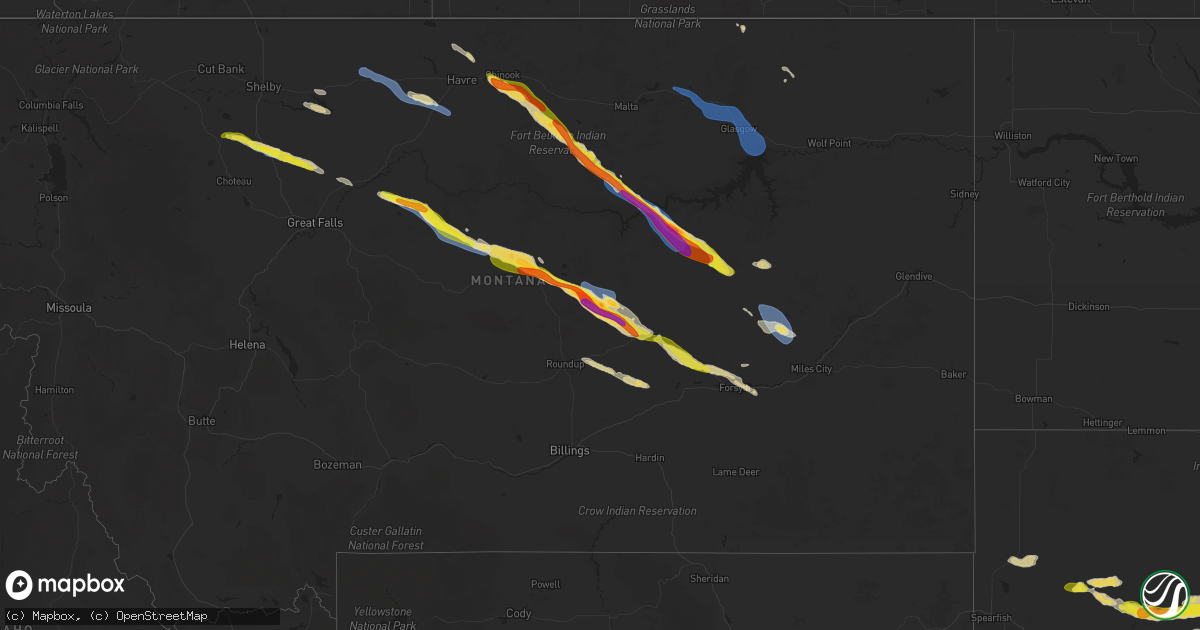
Hail Map on July 17, 2025
Get this storm
July 17 map
$229
one time, instant access
Download today. No call, no setup
Keep the $229
Bought the map and want the full workflow? Apply the entire $229 to a subscription within 7 days. None of it is wasted.
Every map, not just this one
This buys you this map. Subscription and you get every map we run, in the markets you choose from a few cities to whole states to nationwide. Plus real-time alerts the moment a storm fires.
Contact data
Name, contact info, occupancy, even credit band for addresses in the footprint. You go from where it hit to who to call.
Become the source they trust
Unlimited branding weather history reports on demand. You already have the documented answer ready for the property owner, and you are the one who showed up with it.
Property data and RoofTrace estimates
Pull up any address you have got, its value and the exact code rules for that jurisdiction, straight from One Click Code. Then RoofTrace estimates the squares, pitch, and roof value, priced the way you price.
States Impacted by Hail Map on July 17, 2025
Storm reports
Vermont
| Date | Description |
|---|---|
| 07/17/20255:24 PM CDT | Tree down on bridge street in royalton village |
| 07/17/20253:43 PM CDT | Tree... Wire. |
| 07/17/20253:43 PM CDT | Tree... Wire... And minor structural damage to a home |
North Carolina
| Date | Description |
|---|---|
| 07/17/20254:40 PM CDT | Power outages caused by fallen trees damaging equipment near cheryl avenue and north roxboro st. |
| 07/17/20254:35 PM CDT | Power outage caused by a tree damaging equipment along hartman road near carrington lane. |
| 07/17/20254:16 PM CDT | Tree down near hickory tree road and north payne road. |
| 07/17/20253:45 PM CDT | Rescue |
| 07/17/20253:45 PM CDT | Rescue squad reports a tree blown down on old wilkesboro rd. |
| 07/17/20253:28 PM CDT | Tree debris on shoulder of 6700 block of goldston carbonton road. |
| 07/17/20253:25 PM CDT | Rescue squad reports a tree blown down at midway rd and caroldon ln. |
| 07/17/20253:20 PM CDT | Rescue squad reported a tree blown down at liberty hill rd and pisgah church rd. |
| 07/17/20253:20 PM CDT | Rescue squad reports a tree down on hams grove rd. |
| 07/17/20253:18 PM CDT | One tree down on 1000 block of pleasant hill church rd. |
| 07/17/20253:12 PM CDT | Downed tree on riverside road. |
| 07/17/20253:10 PM CDT | Rescue squad reports a tree blown down on sprinkle rd. |
| 07/17/20252:30 PM CDT | Tree is down near the exit at the intersection of us-158 and us-29 near reidsville... Nc. |
| 07/17/20252:20 PM CDT | Tree down in front of douglass elementary school on price street in eden... Nc. |
| 07/17/20252:15 PM CDT | Tree down near the intersection of belthrop road and taylor road near stoneville... Nc. |
| 07/17/20252:05 PM CDT | Tree down near stony ridge road near pinnacle... Nc. |
| 07/17/20251:45 PM CDT | Tree down across the railroad track near the intersection of old rockford road and rockford road in rockford... Nc. |
Ohio
| Date | Description |
|---|---|
| 07/17/20254:31 PM CDT | Tree down into powerlines. Time estimated based on radar. |
| 07/17/20254:23 PM CDT | Tree down in the roadway at the intersection of robinson road and thompson road. Time estimated from radar. |
| 07/17/20254:04 PM CDT | Lines down. Several trees/lines down around albany. Time estimated based on radar. |
| 07/17/20253:59 PM CDT | Lines down. Time estimated based on radar. |
| 07/17/20253:55 PM CDT | Large tree down blocking both lanes of county road 193 at olive branch road. Time estimated from radar. |
| 07/17/20253:33 PM CDT | Tree down. Localized event and estimated based on radar. |
South Dakota
| Date | Description |
|---|---|
| 07/17/20255:20 AM CDT | Most of the hail was smaller... Larger pieces up to 1 inch in diameter. |
| 07/17/20254:50 AM CDT | Most of the hail was quarter size... Some pieces were about 1.5 inch in diameter. |
| 07/17/20254:50 AM CDT | Most of the hail was quarter size... Some pieces were about 1.5 inch in diameter. |
Nevada
| Date | Description |
|---|---|
| 07/16/20258:38 PM CDT | Mesonet station srznv 4.6 ne schurz |
West Virginia
| Date | Description |
|---|---|
| 07/17/20255:40 PM CDT | Large tree branch down on pleasant creek road. Time estimated from radar. |
| 07/17/20255:35 PM CDT | Tree down on hubert hill road blocking one lane. Time estimated from radar. |
| 07/17/20254:58 PM CDT | Power lines down. |
| 07/17/20254:42 PM CDT | Transformer blew with three power poles down. |
| 07/17/20254:41 PM CDT | Tree down across road. |
| 07/17/20254:38 PM CDT | Tree and line down on laurel creek road and winding road in waverly... Blocking the roadway. Time estimated from radar. Also high water reported in the area. |
| 07/17/20254:36 PM CDT | Corrects previous tstm wnd dmg report from 3 nw mineral wells. Power lines down. |
| 07/17/20254:30 PM CDT | Tree and three power lines down on a gravel road off downey road. Power pole twisted. Time estimated from radar. |
| 07/17/20254:27 PM CDT | Several reports of multiple trees down. |
| 07/17/20254:22 PM CDT | Tree down hanging on line. |
| 07/17/20251:35 PM CDT | Tree down. |
Montana
| Date | Description |
|---|---|
| 07/17/20255:28 PM CDT | A |
| 07/17/20255:28 PM CDT | Ambient weather station. |
| 07/17/20255:13 PM CDT | Peak wind gust of 52 |
| 07/17/20255:13 PM CDT | Peak wind gust of 52 mph resulted in a tree branch of 6 to 12 inches in diameter breaking off. Hail was the size of nickels. |
| 07/17/20254:30 PM CDT | A local report indicates 58 MPH wind near 2 E Inverness |
| 07/16/202511:00 PM CDT | Mesonet station mthil 1.6 nw rock springs |
| 07/16/202510:00 PM CDT | Mosby s |
| 07/16/20259:50 PM CDT | A local report indicates 1.75 inch wind near 13 ESE Winnett |
| 07/16/20259:50 PM CDT | A local report indicates 60 MPH wind near 13 ESE Winnett |
| 07/16/20259:30 PM CDT | Mdt dot site in mt 200 at mp 136. |
| 07/16/20259:30 PM CDT | A local report indicates 60 MPH wind near 8 SE Winnett |
| 07/16/20259:20 PM CDT | A local report indicates 2.00 inch wind near 6 WSW Petrolia Lake |
| 07/16/20259:10 PM CDT | Destroyed raingage. |
| 07/16/20259:05 PM CDT | Hen egg sized hail damaged windshields of 6 vehicles and completely broke out 2 house windows. |
| 07/16/20257:50 PM CDT | Mul |
| 07/16/20257:50 PM CDT | Multiple 6-inch diameter tree limbs broken off. 0.75 inch of rain in 15 minutes. |
| 07/16/20257:35 PM CDT | Estimated hail size from mt dot web cam image at mp 121 on us 191. |
| 07/16/20257:02 PM CDT | Ambient weather station stone windmil measured a 63 mph gust. |
Tennessee
| Date | Description |
|---|---|
| 07/17/20256:55 PM CDT | Reported powerlines down near the intersection of e shelby dr and getwell rd. Exact time estimated on radar. |
| 07/16/20257:02 PM CDT | Reported tree down on car near e shelby dr and tchulahoma rd. Time estimated on radar. |
New Hampshire
| Date | Description |
|---|---|
| 07/17/20256:34 PM CDT | Reported by amateur radio. Social media photos of downed trees and a tree on wires in alexandria. Time estimated by radar. |
| 07/17/20252:05 PM CDT | Reported by weather spotter. Tree down on n. Sandwich rd partially blocking southbound lane just south of bearcamp river. Tree aprox 16 inch diameter. |
| 07/17/20252:05 PM CDT | Tree down on nh 113a... Road closed at time of observation. Time estimated by radar. |
| 07/16/20257:44 PM CDT | Reported |
| 07/16/20257:44 PM CDT | Report |
| 07/16/20257:44 PM CDT | Reported by weather spotter. Observed trees down on west side of derry. Wires down on road east of hwy 28. Time estimated by radar. |
| 07/16/20257:02 PM CDT | Multiple trees down on pine hill rd and sunrise lane; two trees on wires knocked out power in neighborhood. Time estimated by radar. |
Maine
| Date | Description |
|---|---|
| 07/17/20255:35 PM CDT | Tree down on powerlines. |
| 07/17/20253:50 PM CDT | Tree down on sly brook rd. Time estimated by radar. |
| 07/17/20252:58 PM CDT | Large tree down on me-133. Time estimated by radar. |
| 07/17/20252:53 PM CDT | Canton fire reporting a tree took powerlines down across school street in canton. Time estimated by radar. |
Virginia
| Date | Description |
|---|---|
| 07/17/20253:30 PM CDT | Social media report of a tree and power lines down on blue ridge avenue near bedford... Va. |
| 07/17/20253:25 PM CDT | Thunderstorm winds blew down multiple trees along the 1400 block of high acre road. |
| 07/17/20253:16 PM CDT | Tree down. |
| 07/17/20253:12 PM CDT | Tree down. |
| 07/17/20253:08 PM CDT | Tree down. |
| 07/17/20252:05 PM CDT | Tree is down blocking both lanes of axton road near ridgeway... Va. |
| 07/17/20251:25 PM CDT | Tree is down across the road near the intersection of axton road and irisburg road near axton... Va. |
| 07/17/202512:27 PM CDT | Thunderstorm winds blew down one tree along the 100 block of general longstreet court. |
| 07/16/20259:50 PM CDT | Several trees down. |
| 07/16/20257:05 PM CDT | Several down trees. |
Kentucky
| Date | Description |
|---|---|
| 07/17/20254:14 PM CDT | Multiple trees down along clay lane... Madison county. |
| 07/17/20252:59 PM CDT | Tree down - reported by 911 call center... Near ky 1793 and north rose island rd. |
| 07/17/20252:54 PM CDT | Tree down along n cedar point rd - info from 911 call center. |
| 07/17/20252:40 PM CDT | Tree down near the intersection of morehead road and james road. |
| 07/17/20252:31 PM CDT | Power lines down at 460 s. Green street. Time estimated from radar. |
Idaho
| Date | Description |
|---|---|
| 07/17/202512:35 AM CDT | Awos station k1u7 bear lake county airport. |
| 07/16/20258:30 PM CDT | Mesonet station 3004 d4 juniper interchange i-84. |
| 07/16/20258:30 PM CDT | Mesonet station itdd9 d5 holbrook id-38. |
Utah
| Date | Description |
|---|---|
| 07/17/20255:50 PM CDT | Mesonet station utlak sr-68 at mp 15 mosida. |
Cities Impacted by Hail Map on July 17, 2025
- Joplin, MT
- Inverness, MT
- Rudyard, MT
- Hingham, MT
- Pendroy, MT
- Conrad, MT
- Valier, MT
- Gildford, MT
- Box Elder, MT
- Choteau, MT
- Brady, MT
- Chinook, MT
- Patten, ME
- Dutton, MT
- Carter, MT
- Hays, MT
- Fort Benton, MT
- Geraldine, MT
- Dodson, MT
- Malta, MT
- Gladstone, NM
- Coffee Creek, MT
- Denton, MT
- Roy, NM
- Zortman, MT
- Lewistown, MT
- Hilger, MT
- Brusett, MT
- Jordan, MT
- Roy, MT
- Grass Range, MT
- Winnett, MT
- Schurz, NV
- Yerington, NV
- Sand Springs, MT
- Cohagen, MT
- Musselshell, MT
- Ingomar, MT
- Saco, MT
- Hinsdale, MT
- Glasgow, MT
- Vandalia, MT
- Forsyth, MT
- Fort Peck, MT
- Nashua, MT
- Angela, MT
- Kinsey, MT
- White Owl, SD
- Howes, SD
- Union Center, SD
- Milesville, SD
- Cherry Creek, SD
- Midland, SD
- Hayes, SD
- Fort Pierre, SD
- Macedonia, IL
- Cedar City, UT
- Tell City, IN
- Paducah, KY
- Palmyra, IN
- Clemmons, NC
- Winston Salem, NC
- Festus, MO
- Marissa, IL
- Sparta, IL
- O'Fallon, IL
- Caseyville, IL
- Collinsville, IL
- Trementina, NM
- Coolville, OH
- Little Hocking, OH
- Pinckneyville, IL
- Canon City, CO
- Howard, CO
- Red Bud, IL
- New Athens, IL
- Lenzburg, IL
- Bennett, NC
- Springer, NM
- De Soto, MO
- Chester, MT
- Galata, MT
- Lothair, MT
- Alexandria, LA
- Custer, MT
- Hanover, IN
- Roundup, MT
- Glenview, KY
- Louisville, KY
- Leavenworth, IN
- Jeffersonville, IN
- Mount Vernon, IN
- Ewing, IL
- Fort Myers, FL
- Lehigh Acres, FL
- Benton, IL
- Sesser, IL
- Oceana, WV
- Worden, MT
- Abingdon, VA
- Lebanon, VA
- Mayodan, NC
- Sandy Ridge, NC
- Stoneville, NC
- Tennyson, IN
- Troy, IL
- Moneta, VA
- Cannelton, IN
- Troy, IN
- Shelby, MT
- Colorado Springs, CO
- Leopold, IN
- English, IN
- Watrous, NM
- Lake Placid, FL
- Cape Coral, FL
- Kremlin, MT
- Havre, MT
- Smithfield, KY
- La Grange, KY
- Pueblo, CO
- Ina, IL
- Spring Hill, FL
- Ocate, NM
- Corbin, KY
- Barboursville, WV
- Ona, WV
- La Veta, CO
- Bloomsdale, MO
- Eskdale, WV
- Belle Rive, IL
- Bonnie, IL
- Louisa, KY
- Wagon Mound, NM
- Penrose, CO
- Ledger, MT
- Hendersonville, TN
- Mount Juliet, TN
- Elizabethtown, IL
- Golconda, IL
- Burna, KY
- Smithland, KY
- Prairie Du Rocher, IL
- Saint Jacob, IL
- Edwardsville, IL
- Inez, KY
- Alum Creek, WV
- Pecos, NM
- Mebane, NC
- Graham, NC
- Floweree, MT
- Hedley, TX
- Whittington, IL
- Huntington, WV
- Finchville, KY
- Simpsonville, KY
- Fisherville, KY
- Garita, NM
- Las Vegas, NM
- Hartford, KY
- Pendleton, KY
- Roswell, NM
- Fort Sumner, NM
- Puryear, TN
- Hillsborough, NC
- Chapel Hill, NC
- Durham, NC
- Tampa, FL
- Lutz, FL
- Moore Haven, FL
- Labelle, FL
- Brooksville, KY
- Foster, KY
- Inglis, FL
- Whitley City, KY
- Pine Knot, KY
- Stearns, KY
- Proctorville, OH
- Lakeview, TX
- Highwood, MT
- Alva, FL
- Solano, NM
- Baldwin, IL
- Charleston, WV
- Tucumcari, NM
- Parrottsville, TN
- Murray, KY
- Dexter, NM
- Canyon, TX
- Mosquero, NM
- Hazel, KY
- Boonville, IN
- Strunk, KY
- Richland, MT
- Larslan, MT
- Venus, FL
- Dover, TN
- Peerless, MT
- Rosebud, MT
- San Jon, NM
- Stratford, TX
- Dalhart, TX
- Clarksville, IN
- Lexington, IN
- Newell, SD
- Belle Fourche, SD
- Enning, SD
- Mud Butte, SD
- New Harmony, IN
- Wall, SD
- Hawesville, KY
- Henderson, KY
- Boaz, KY
- Brooksville, FL
- Memphis, TN