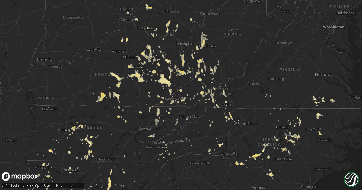
Hail Map in Alabama on July 5, 2012
Get this storm
July 5 map
$229
one time, instant access
Download today. No call, no setup
Keep the $229
Bought the map and want the full workflow? Apply the entire $229 to a subscription within 7 days. None of it is wasted.
Every map, not just this one
This buys you this map. Subscription and you get every map we run, in the markets you choose from a few cities to whole states to nationwide. Plus real-time alerts the moment a storm fires.
Contact data
Name, contact info, occupancy, even credit band for addresses in the footprint. You go from where it hit to who to call.
Become the source they trust
Unlimited branding weather history reports on demand. You already have the documented answer ready for the property owner, and you are the one who showed up with it.
Property data and RoofTrace estimates
Pull up any address you have got, its value and the exact code rules for that jurisdiction, straight from One Click Code. Then RoofTrace estimates the squares, pitch, and roof value, priced the way you price.
Storm reports in Alabama
Alabama
| Date | Description |
|---|---|
| 07/05/20126:58 PM CDT | Powerline down at the intersection of pistol range rd and highway 81 south of notasulga. |
| 07/05/20126:54 PM CDT | 1 1/2 inch hail along village drive in the waterford area with winds 40 mph gusting to 50. |
| 07/05/20126:53 PM CDT | Trees down in the wattsville community. |
| 07/05/20126:49 PM CDT | 1 inch hail along village drive in the waterford area. |
| 07/05/20126:48 PM CDT | Several tree limbs were blown down near horse pens 40. |
| 07/05/20126:38 PM CDT | A local report indicates 1.00 inch wind near ASHVILLE |
| 07/05/20126:11 PM CDT | Quarter size hail in st. Clair springs. |
| 07/05/20126:11 PM CDT | Trees and power lines down near junction of hwys 23 and 31. |
| 07/05/20126:10 PM CDT | Trees down near low gap church |
| 07/05/20126:06 PM CDT | Berry road on southeast side of town. |
| 07/05/20126:03 PM CDT | Trees and power lines blown down across the city of auburn. |
| 07/05/20126:00 PM CDT | Law enforcement reports just under golf ball size hail along highway 75. |
| 07/05/20126:00 PM CDT | Thunderstorm winds blew down numerous trees between 600 pm and 615 pm...in a broken swath that started in the royal community...and continued southward through murphree |
| 07/05/20125:52 PM CDT | Trees and power lines were blown down near exit 57 on interstate 85. |
| 07/05/20125:47 PM CDT | Tree down on highway 25 at pittman road. Winds estimated at 40 to 50 mph. |
| 07/05/20125:47 PM CDT | A local report indicates 59 MPH wind near AUBURN |
| 07/05/20125:30 PM CDT | Thunderstorm winds blew several trees down between 530 pm and 550 pm...from blountsville southwestward through rosa and into oneonta. |
| 07/05/20125:30 PM CDT | Trees blown down in blountsville blocking the roadway. |
| 07/05/20125:30 PM CDT | Trees blown down in rosa blocking roadway. |
| 07/05/20125:29 PM CDT | Quarter size hail reported |
| 07/05/20125:29 PM CDT | Wind gusts estimated at 60 mph |
| 07/05/20125:27 PM CDT | Quarter size hail was reported |
| 07/05/20125:22 PM CDT | A few trees were blown down in far southern lee county. |
| 07/05/20125:15 PM CDT | Large tree branches reported down near the corner of golf road and memorial parkway |
| 07/05/20124:44 PM CDT | Penny to quarter size hail was observed. |
| 07/05/20124:34 PM CDT | Quarter size hail was reported at the intersection of martin road and memorial parkway |
| 07/05/20123:30 PM CDT | Big oak subdivision. Trees snapped or uprooted. |
| 07/05/20123:00 PM CDT | Trees were blown down and a marina collapsed. |
| 07/05/201212:50 AM CDT | One large tree was downed as well as numerous large limbs along hwy 95 just before the bridge between ponderosa drive and county road 47 or near the white oak creek rec |
| 07/05/201212:45 AM CDT | Trees down south of eufaula along us431. |
| 07/05/201212:25 AM CDT | Trees down in town of kennedy |
| 07/05/201212:05 AM CDT | Roof damage to the lamar county emergency management agency office. Extent of damage unknown at this time. |
| 07/04/201211:41 PM CDT | Numerous trees being reported down due to the wind in the sulligent area. |
| 07/04/201211:17 PM CDT | Several small trees down along hwy 129 between hwy 278 and downtown brilliant. Roadway was covered in tree debris...including numerous small tree limbs. Time estimated |
| 07/04/201211:07 PM CDT | Oak tree fell across a county road. Wind gusts estimated to be 60 mph. |
| 07/04/201210:55 PM CDT | Estimated wind gust of 60 mph was observed by a trained spotter in the burger king parking lot just sse of the downtown haleyville area. |
| 07/04/201210:55 PM CDT | House damaged from tree falling on it in delmar area along county road 28. |
| 07/04/201210:45 PM CDT | Hwy 20 near mcfarland park in florence. Trees snapped or uprooted. |
| 07/04/201210:45 PM CDT | Awning torn off and stucco pulled loose at mount carmel church on highway 278. |
| 07/04/201210:40 PM CDT | Trees and power lines down on county roads 55 and 32. |
| 07/04/201210:35 PM CDT | Dozens of trees down in ashridge area our about 8 miles north of double springs |
| 07/04/201210:35 PM CDT | Trees and power lines down as well as poles broken along alabama highway 195 near county road 6. |
| 07/04/201210:20 PM CDT | Trees down in city limits of pell city |
| 07/04/201210:10 PM CDT | Tree down on house in town of new london |
| 07/04/20129:55 PM CDT | One tree blocking a lane on i-59 at mile marker 152. Time estimated from radar. |
| 07/04/20129:47 PM CDT | Trees were blown down in the highland lake area. |
| 07/04/20129:45 PM CDT | Along cr59 just southwest of moulton...trees and power poles both snapped by winds. In addition...siding blown off houses...underpinning of trailers removed...and a swi |
| 07/04/20129:40 PM CDT | Multiple reports of widespread damage along court st in downtown moulton. Block walls blown down and windows shattered. Debris strewn down the road. |
| 07/04/20129:30 PM CDT | Powerlines down on the east side of ohatchee. |
| 07/04/20129:28 PM CDT | Trees were blown down. |
| 07/04/20129:28 PM CDT | Trees down in snead. |
| 07/04/20129:25 PM CDT | Widespread trees blown down south of arab near intersection of hulaco road and hwy 69. |
| 07/04/20129:23 PM CDT | Trees down in the big oak community. |
| 07/04/20129:05 PM CDT | Numerous trees blown down on the peninsula in the city of guntersville. |
| 07/04/20129:00 PM CDT | Several 8ft tall pine trees blown down hear hwy 160 in crossville. |
| 07/04/20129:00 PM CDT | Trees down along coats bend rd. |
| 07/04/20128:50 PM CDT | Tree fell on powerlines on mail road in new hope. |
| 07/04/20128:50 PM CDT | Trees down across county road 136. |
| 07/04/20128:49 PM CDT | Small trees blown down in the city of guntersville. Power is also out in guntersville and boaz. |
| 07/04/20128:47 PM CDT | Tree blown down onto a house on cedar point road. |
| 07/04/20128:37 PM CDT | Security light blown down with power lines on county road 31. |
| 07/04/20128:32 PM CDT | Numerous tree limbs were blown down across cherokee county. Winds estimated at 50 mph or greater. |
| 07/04/20128:32 PM CDT | Large tree down blocking the road in the statesville area. |
| 07/04/20128:31 PM CDT | Trees down across county road 136. |
| 07/04/20128:30 PM CDT | Tin blown off 2 barns near county road 113 and county road 34. |
| 07/04/20128:30 PM CDT | Tree down blocking county road 40. |
| 07/04/20128:27 PM CDT | Tree down on road. |
| 07/04/20128:25 PM CDT | 2 large trees down in driveway in city limits. |
| 07/04/20128:15 PM CDT | 50 knot gust recorded at scottsboro airport. |
| 07/04/20128:15 PM CDT | Tree down across county road 114 in gaylesville. Tree ran over by fireman just after it fell. |
| 07/04/20128:14 PM CDT | Tree down across county road 114 near alabama highway 35. |
| 07/04/20128:14 PM CDT | Power lines down on kelly drive in pelham. |
| 07/04/20128:03 PM CDT | Tree down on power line on county road 450 just north of intersection of county road 22 and county road 16. |
| 07/04/20127:35 PM CDT | Public reports tree down and blocking fairmont road in childersburg. |
| 07/04/20127:30 PM CDT | Several trees and a wooden sign for a dog kennel business were blown down on klein road...west of childersburg. |
| 07/04/20127:25 PM CDT | Golf ball size hail at the walmart in clanton. |
| 07/04/20127:22 PM CDT | Trees and powerlines down in the randolph and lawley communities. |
| 07/04/20127:18 PM CDT | Several trees down near the concord church. The sysco building sustained roof damage and very large bay doors were blown down. |
| 07/04/20127:10 PM CDT | Several trees down near the concord church. The sysco building sustained roof damage and very large bay doors were blown down. |
| 07/04/20127:09 PM CDT | Tree down on county road 47. |
| 07/04/20127:09 PM CDT | Several trees down near the concord baptist church 2 miles west of highway 31 on cr 22. One tree is down on roof of portable building. |
| 07/04/20127:00 PM CDT | Quarter size hail in vincent. |
All States Impacted by Hail Map on July 5, 2012
Cities Impacted by Hail Map on July 5, 2012
- Deerwood, MN
- Aitkin, MN
- Halifax, NC
- Sundance, WY
- Stockbridge, MI
- Smyrna, TN
- Murfreesboro, TN
- Mount Berry, GA
- Rome, GA
- Armuchee, GA
- Lindale, GA
- Gillette, WY
- Robbins, NC
- Garner, NC
- Clayton, NC
- Raleigh, NC
- Smithfield, NC
- Union Point, GA
- Raleigh, MS
- Greensboro, GA
- Salyersville, KY
- Gunlock, KY
- Royalton, KY
- Pound, VA
- Wise, VA
- Georgetown, OH
- Russellville, OH
- Salem, AL
- Windsor, KY
- Dunnville, KY
- Kings Mountain, KY
- Liberty, KY
- Waynesburg, KY
- Yosemite, KY
- Bethelridge, KY
- Mcdonough, GA
- Conyers, GA
- Whitesburg, KY
- Thornton, KY
- McKee, KY
- Berea, KY
- Iron Station, NC
- Denver, NC
- Springville, AL
- Odenville, AL
- Henderson, NC
- Mcminnville, TN
- Belle Fourche, SD
- Ostrander, OH
- Marysville, OH
- Grover, NC
- Shelby, NC
- Prestonsburg, KY
- Moncure, NC
- Sanford, NC
- Warfield, VA
- Dolphin, VA
- Monticello, GA
- Jackson, GA
- Tyner, KY
- Annville, KY
- Marston, NC
- Rockingham, NC
- Hazel Green, KY
- Mount Gilead, NC
- Ellerbe, NC
- Wartburg, TN
- Lancing, TN
- Decherd, TN
- Glenrock, WY
- Jackson, KY
- Inez, KY
- Louisa, KY
- Warfield, KY
- Fort Gay, WV
- Genoa, WV
- Pilgrim, KY
- Crum, WV
- Morrison, TN
- Manchester, TN
- Fairburn, SD
- Cobbtown, GA
- Nauvoo, AL
- Eldridge, AL
- Carthage, NC
- Eagle Springs, NC
- West End, NC
- Jackson Springs, NC
- Lawrenceburg, TN
- Phenix City, AL
- Columbus, GA
- Lillington, NC
- Jamestown, TN
- Deer Lodge, TN
- Varney, KY
- Pikeville, KY
- Independence, VA
- Mouth Of Wilson, VA
- Saulsville, WV
- Nancy, KY
- Monticello, KY
- Williamson, WV
- Belfry, KY
- Lincolnton, NC
- Corinth, KY
- Williamstown, KY
- Edmonton, KY
- Wall, SD
- Carrie, KY
- Plains, GA
- Gardners, PA
- Rogersville, TN
- Eidson, TN
- Portsmouth, OH
- Wheelersburg, OH
- Milford, OH
- Batavia, OH
- Edgefield, SC
- Model, CO
- Lusk, WY
- Pelahatchie, MS
- Gibsland, LA
- Dupree, SD
- Edgemont, SD
- McDermott, OH
- West Portsmouth, OH
- Evarts, KY
- Baxter, KY
- Harlan, KY
- Ages Brookside, KY
- Centreville, MD
- Crofton, NE
- Senoia, GA
- Sharpsburg, GA
- Eaton Rapids, MI
- Barbourville, KY
- Fort Deposit, AL
- Honoraville, AL
- Upperco, MD
- Sparks Glencoe, MD
- Manchester, MD
- Parkton, MD
- Selma, AL
- Garrison, KY
- Vanceburg, KY
- Buffalo Gap, SD
- Pelham, TN
- Monteagle, TN
- Stanville, KY
- Banner, KY
- Kimper, KY
- Ronda, NC
- Auburn, AL
- Auburn University, AL
- Wilmington, OH
- Calera, AL
- Crosby, MS
- Natchez, MS
- Four Oaks, NC
- Hephzibah, GA
- Edwards, MS
- Greer, SC
- Duncan, SC
- Kiahsville, WV
- Ranger, WV
- Branchland, WV
- Harts, WV
- Nederland, CO
- Boulder, CO
- Golden, CO
- Coeburn, VA
- Lapine, AL
- Ramer, AL
- Hope Hull, AL
- Letohatchee, AL
- Montgomery, AL
- Glendo, WY
- Saint Albans, WV
- Nitro, WV
- Hayden, CO
- Vincent, AL
- Westphalia, MI
- Weldon, NC
- Jackson, NC
- Bluffton, GA
- Edison, GA
- Fort Gaines, GA
- Moorcroft, WY
- Andersonville, GA
- Jeff, KY
- Happy, KY
- Viper, KY
- Hazard, KY
- Niceville, FL
- Winnsboro, LA
- Gilbert, LA
- Van Lear, KY
- Paintsville, KY
- Hagerhill, KY
- Auxier, KY
- East Point, KY
- El Dorado, AR
- Rowland, NC
- Maxton, NC
- Verner, WV
- Man, WV
- Fort Stockton, TX
- Girard, GA
- Sardis, GA
- Myrtle Beach, SC
- Fort Mill, SC
- Seale, AL
- Pittsview, AL
- Garrett, WY
- Jackson, SC
- West Union, OH
- Clayton, MI
- Morenci, MI
- Gravel Switch, KY
- Hustonville, KY
- Middleburg, KY
- Bradfordsville, KY
- Lebanon, KY
- Custer, SD
- Swainsboro, GA
- Twin City, GA
- Shawnee, WY
- Sevierville, TN
- Utica, MS
- Opelika, AL
- Lucasville, OH
- Piketon, OH
- Leburn, KY
- Vest, KY
- Hueysville, KY
- Wheatland, WY
- Dimondale, MI
- Charlotte, MI
- Spearfish, SD
- Abbeville, AL
- Shorterville, AL
- Milesville, SD
- Ashville, AL
- Rockford, OH
- Willshire, OH
- Wake Forest, NC
- Creedmoor, NC
- Mount Sterling, KY
- Sharpsburg, KY
- Saluda, SC
- Newberry, SC
- Silverstreet, SC
- Johnstown, CO
- Columbiana, AL
- Wapakoneta, OH
- Lakeview, OH
- Lewistown, OH
- Luverne, MN
- Steen, MN
- Roxboro, NC
- Appomattox, VA
- Frenchburg, KY
- Denniston, KY
- Wellington, KY
- Salt Lick, KY
- Roaring River, NC
- Elkin, NC
- Watertown, TN
- Milton, TN
- Rock Rapids, IA
- Midway, AL
- Eufaula, AL
- Clayton, AL
- Ellsworth, MN
- Wingate, NC
- Marshville, NC
- Tyler, AL
- Cusseta, GA
- Flat Lick, KY
- Ethridge, TN
- Mendenhall, MS
- Buffalo, SD
- Cowan, TN
- Sewanee, TN
- Winchester, TN
- Duff, TN
- La Follette, TN
- Amherstdale, WV
- Cyclone, WV
- Brenton, WV
- Clear Fork, WV
- Coal Mountain, WV
- Bim, WV
- Davin, WV
- Oneonta, AL
- Steele, AL
- Langsville, OH
- Pomeroy, OH
- Rutland, OH
- Leon, WV
- Red House, WV
- Martin, SC
- Pelham, AL
- Fordyce, NE
- Tyndall, SD
- Linton, ND
- Danville, VA
- Barnesville, GA
- Forsyth, GA
- Petersburg, TN
- Lebanon, TN
- Lascassas, TN
- Jonesville, NC
- Rutledge, TN
- Sneedville, TN
- Thorn Hill, TN
- Tazewell, TN
- Harrogate, TN
- Safford, AL
- Marion Junction, AL
- Uniontown, AL
- Red Level, AL
- Clay City, KY
- Stanton, KY
- Hayden, AL
- Blountsville, AL
- Freeport, FL
- Hartville, WY
- Bradyville, TN
- Sylva, NC
- Dublin, OH
- Plain City, OH
- Beech Island, SC
- Maben, WV
- Glen Fork, WV
- Pineville, WV
- Oceana, WV
- Ravencliff, WV
- Hamilton, AL
- Vicksburg, MS
- Millen, GA
- Jarratt, VA
- Dryden, TX
- Whitman, NE
- Merriman, NE
- Newville, AL
- Headland, AL
- Avon, SD
- Scotland, SD
- Ary, KY
- Buckhorn, KY
- Rowdy, KY
- Chavies, KY
- Dwarf, KY
- Hindman, KY
- Bonnyman, KY
- Vicco, KY
- Bulan, KY
- Sassafras, KY
- Gays Creek, KY
- Clayhole, KY
- Emmalena, KY
- Littcarr, KY
- Krypton, KY
- Lost Creek, KY
- Winchester, OH
- Highlands, NC
- Courtland, VA
- Sedley, VA
- Franklin, VA
- Hazlehurst, MS
- Owingsville, KY
- Hillsboro, KY
- Mullens, WV
- New Richmond, WV
- Sophia, WV
- Herndon, WV
- Itmann, WV
- Glen Daniel, WV
- Slab Fork, WV
- Glen White, WV
- Fairdale, WV
- Surveyor, WV
- Crab Orchard, WV
- Amigo, WV
- Beckley, WV
- Lester, WV
- San Luis, CO
- Bigelow, MN
- Worthington, MN
- Boonville, NC
- State Road, NC
- Dobson, NC
- Louisburg, NC
- Griffithsville, WV
- Alkol, WV
- Ashby, MN
- Ponce De Leon, FL
- Ricetown, KY
- Guernsey, WY
- Midville, GA
- Manville, WY
- Springport, MI
- Scott Depot, WV
- Kenna, WV
- Tornado, WV
- Winfield, WV
- Sod, WV
- Given, WV
- Buffalo, WV
- Poca, WV
- Dunbar, WV
- Charleston, WV
- Alum Creek, WV
- South Charleston, WV
- Liberty, WV
- Jamestown, KY
- Russell Springs, KY
- Beechgrove, TN
- Sandersville, GA
- Byrdstown, TN
- Albany, KY
- Booneville, KY
- Leslie, MI
- Mason, MI
- Lance Creek, WY
- Bastian, VA
- Sugar Grove, VA
- Sicily Island, LA
- Randolph, AL
- Lawley, AL
- Osyka, MS
- Jemison, AL
- Thorsby, AL
- Claxton, GA
- Metter, GA
- Collins, GA
- Tallulah, LA
- Bandy, VA
- Alzada, MT
- Elora, TN
- Flintville, TN
- Iron City, TN
- Westpoint, TN
- Cedar Bluff, VA
- La Vergne, TN
- Lynchburg, SC
- Sylvania, GA
- Ruby, SC
- Chesterfield, SC
- Peachland, NC
- Emporia, VA
- Cave Spring, GA
- Mount Vernon, KY
- Brodhead, KY
- Raymond, MS
- Greenville, GA
- Lagrange, GA
- Hogansville, GA
- Clopton, AL
- Greeneville, TN
- Lancaster, KY
- Richmond, KY
- Freeman, VA
- Dunn, NC
- Roaring Gap, NC
- Glade Valley, NC
- Chatham, LA
- Gate City, VA
- Hiltons, VA
- Kingsport, TN
- Alabaster, AL
- Hamlin, WV
- Hurricane, WV
- Huntsville, AL
- Sadieville, KY
- Clanton, AL
- Augusta, GA
- Surgoinsville, TN
- Milan, MI
- Maybee, MI
- Dubberly, LA
- Arcadia, LA
- Yolyn, WV
- Stollings, WV
- Lyburn, WV
- Cleveland, AL
- Wauseon, OH
- Delta, OH
- Hudson, MI
- Lyons, OH
- Dansville, MI
- Galax, VA
- Candor, NC
- Eagle, MI
- Carey, OH
- Alvada, OH
- Vanlue, OH
- Swannanoa, NC
- Burkesville, KY
- Breeding, KY
- Columbia, KY
- Apex, NC
- Harpersville, AL
- Altoona, AL
- Attalla, AL
- Gallant, AL
- Houston, DE
- Greenwood, DE
- Covington, GA
- Mansfield, GA
- Grass Lake, MI
- Otto, NC
- Middlesex, NC
- Knightdale, NC
- Zebulon, NC
- Wendell, NC
- Selma, NC
- Rock River, WY
- Dungannon, VA
- Hot Springs, SD
- Rocky Face, GA
- Rives Junction, MI
- Jackson, MI
- Pigeon Forge, TN
- Costilla, NM
- Arrington, TN
- Nolensville, TN
- Andalusia, AL
- Monroe, NC
- Gatlinburg, TN
- Clarksville, TN
- Laurel Hill, NC
- Hartford, AL
- Black, AL
- West Liberty, KY
- Livingston, TN
- Rickman, TN
- Rock Hill, SC
- Cary, NC
- Holly Springs, NC
- Fuquay Varina, NC
- Jones, AL
- Billingsley, AL
- Highland Home, AL
- Wagner, SD
- Delmont, SD
- Newcastle, WY
- Columbia, TN
- Kelso, TN
- Louisville, GA
- Aberdeen, NC
- Southern Pines, NC
- Cody, NE
- Eagleville, TN
- Chelsea, AL
- Lake, WV
- Hewett, WV
- Smyrna, SC
- Blacksburg, SC
- Tracy City, TN
- Glens Fork, KY
- Sabina, OH
- Flemingsburg, KY
- La Fayette, GA
- Summerville, GA
- Autryville, NC
- Walland, TN
- Townsend, TN
- Hermosa, SD
- Iaeger, WV
- Gary, IN
- Griffith, IN
- Merrillville, IN
- Walker, KY
- Toledo, OH
- Sylvania, OH
- Campton, KY
- Franklinton, NC
- Youngsville, NC
- Warthen, GA
- Lexington, GA
- Crawford, GA
- Parma, MI
- Lawrenceville, GA
- Dacula, GA
- Bonifay, FL
- Lake City, SC
- New Zion, SC
- Kingstree, SC
- Brookhaven, MS
- Nickelsville, VA
- Fort Blackmore, VA
- Benton, TN
- Ezel, KY
- Holmes Mill, KY
- Allendale, SC
- Itta Bena, MS
- Fayetteville, GA
- Hampton, GA
- Tarboro, NC
- Aiken, SC
- Loganville, GA
- Fedscreek, KY
- Greensboro, MD
- Harrington, DE
- Beattyville, KY
- Pounding Mill, VA
- Honaker, VA
- Saltville, VA
- Hulett, WY
- Grovetown, GA
- Waverly, OH
- Otway, OH
- Cullowhee, NC
- Ferguson, NC
- Phil Campbell, AL
- Russellville, AL
- Mitchell, GA
- Cochran, GA
- Magnolia, MN
- Troy, AL
- Spirit Lake, IA
- Paisley, FL
- Pulaski, TN
- Stopover, KY
- Matewan, WV
- Baisden, WV
- Wharncliffe, WV
- Hurley, VA
- Majestic, KY
- Gilbert, WV
- Pittsboro, NC
- Barnwell, SC
- Elkfork, KY
- Rougemont, NC
- Hurdle Mills, NC
- Waynesboro, GA
- Blythe, GA
- Neeses, SC
- North, SC
- Elbow Lake, MN
- Brooks, GA
- Moulton, AL
- Church Hill, MD
- Chestertown, MD
- Pecks Mill, WV
- Logan, WV
- Cedar Bluff, AL
- Double Springs, AL
- Haleyville, AL
- Winchester, KY
- Bartow, GA
- Wadley, GA
- Irvine, KY
- New Haven, IN
- Welch, WV
- Crab Orchard, KY
- Newellton, LA
- Evansville, MN
- Spearsville, LA
- Junction City, AR
- Strong, AR
- Cincinnati, OH
- Volin, SD
- Irene, SD
- Skipperville, AL
- Gaffney, SC
- Hoffman, NC
- Pensacola, FL
- Okabena, MN
- Lenoir, NC
- Woodville, MS
- Hallie, KY
- Linefork, KY
- Deep Gap, NC
- Cowpens, SC
- Ripley, WV
- Mize, KY
- Town Creek, AL
- Mount Hope, AL
- Capitol, MT
- Fort Benning, GA
- Chicago, IL
- Vermontville, MI
- Lake Odessa, MI
- Mulliken, MI
- Sunfield, MI
- Dublin, VA
- Max Meadows, VA
- Wytheville, VA
- Davisboro, GA
- Warrior, AL
- Dallas, NC
- Chatsworth, GA
- Ellijay, GA
- Perkins, GA
- McBee, SC
- Sandy Hook, KY
- Ohio City, OH
- Hartington, NE
- Findlay, OH
- Arcadia, OH
- Fostoria, OH
- Wharton, OH
- Bloomdale, OH
- Mount Blanchard, OH
- Hillsboro, TN
- Homer, LA
- East Waterford, PA
- Fort Wayne, IN
- Tylertown, MS
- Aladdin, WY
- Ivel, KY
- Deerfield, IL
- Lincolnshire, IL
- Magee, MS
- Pinola, MS
- Woodruff, SC
- Lansing, MI
- Holt, MI
- Danville, WV
- Clothier, WV
- Henlawson, WV
- Jeffrey, WV
- Chapmanville, WV
- Fort Bragg, NC
- Oak Hill, OH
- Jackson, OH
- New Bloomington, OH
- Morral, OH
- La Rue, OH
- Wooton, KY
- Cuthbert, GA
- Timmonsville, SC
- Marion, NC
- Polkton, NC
- Olympia, KY
- Florence, AL
- Wendell, MN
- Ward, CO
- Buffalo Grove, IL
- Franklin, NC
- Pleasant Lake, MI
- Dongola, IL
- Ottawa Lake, MI
- Holland, OH
- Riga, MI
- Libertyville, IL
- Lake Forest, IL
- Newton, NC
- Loveland, CO
- Winnetka, IL
- Glencoe, IL
- Athens, LA
- Georgetown, GA
- Big Spring, TX
- Garden City, TX
- Black Mountain, NC
- Carlsbad, NM
- Alberta, AL
- Rupert, GA
- Victoria, VA
- Bell Buckle, TN
- Christiana, TN
- Rose Hill, VA
- Jay Em, WY
- Buena Vista, GA
- Orrville, AL
- Lewisville, NC
- Taylors, SC
- Clio, AL
- Americus, GA
- Sunbright, TN
- Bethune, SC
- Beaver Creek, MN
- Maplesville, AL
- Owenton, KY
- Chandlersville, OH
- Williston, SC
- Kittrell, NC
- Hickory, NC
- Jolo, WV
- Panther, WV
- Rockford, AL
- Verbena, AL
- Crossville, TN
- Grundy, VA
- Potterville, MI
- Fairfield, OH
- Collinwood, TN
- Yawkey, WV
- Albany, OH
- Goodwater, AL
- Montevallo, AL
- Lilesville, NC
- Marion, VA
- Unicoi, TN
- Jonesborough, TN
- Morehead, KY
- Stephens, GA
- Thomaston, AL
- Fairmont, NC
- Plantersville, AL
- Stanton, AL
- Joppa, AL
- Beulah, WY
- Sherrills Ford, NC
- Delbarton, WV
- Wayne, WV
- Defuniak Springs, FL
- Notasulga, AL
- Tuskegee, AL
- Tuskegee Institute, AL
- Jonesville, MI
- Huddy, KY
- Hardy, KY
- Upper Sandusky, OH
- Forest, OH
- Tannersville, VA
- Kanaranzi, MN
- Ozona, TX
- Nicholasville, KY
- Rockvale, TN
- Cherokee, NC
- Deland, FL
- Manchester, OH
- Warrenton, NC
- Macclesfield, NC
- Greenville, NC
- Holly Pond, AL
- Granby, CO
- Speedwell, TN
- New Tazewell, TN
- Cumberland Gap, TN
- Rogersville, AL
- Pioneer, TN
- Gretna, VA
- Chatham, VA
- Morristown, TN
- Bean Station, TN
- Frakes, KY
- Griffin, GA
- Tuscumbia, AL
- Tazewell, VA
- Broadford, VA
- Gaston, SC
- Swansea, SC
- Moore, SC
- Old Fort, NC
- Ceres, VA
- Atkins, VA
- Troutdale, VA
- Kaycee, WY
- Glasgow, KY
- Dawsonville, GA
- Sidney, KY
- Canada, KY
- Forest Hills, KY
- Stone, KY
- Lebanon, VA
- Bledsoe, KY
- Helton, KY
- Robertsdale, AL
- Lamy, NM
- Chapel Hill, TN
- Greenville, AL
- Mauk, GA
- Grand Ledge, MI
- Warbranch, KY
- East Bend, NC
- Lumpkin, GA
- Glenview, IL
- Des Plaines, IL
- Mount Prospect, IL
- Georgetown, SC
- Richland, GA
- Douglas, WY
- Warrenville, SC
- Graniteville, SC
- Catherine, AL
- Canton, MS
- Fries, VA
- Eglin Afb, FL
- Robbins, TN
- Castlewood, VA
- Raccoon, KY
- Dana, KY
- Harold, KY
- Dwale, KY
- Betsy Layne, KY
- Allen, KY
- Savannah, GA
- Milner, GA
- Pine Mountain, GA
- Camden, AR
- Louann, AR
- Liberty, SC
- Easley, SC
- Sulligent, AL
- Beaverton, AL
- Tompkinsville, KY
- Martin, KY
- Vancleve, KY
- Princeton, WV
- Lerona, WV
- Ball Ground, GA
- Bunnlevel, NC
- Godwin, NC
- Erwin, NC
- Linden, NC
- Navarre, FL
- Norwich, OH
- Blue Rock, OH
- Zanesville, OH
- Grayson, GA
- Richwood, OH
- Raymond, OH
- Partridge, KY
- Eolia, KY
- Kermit, WV
- Alton, VA
- Milton, NC
- Hanover, WV
- Greenville, SC
- Buford, GA
- Suwanee, GA
- Brevard, NC
- Carlisle, KY
- Mount Pleasant, TN
- Anna, IL
- Chuckey, TN
- Afton, TN
- Stanford, KY
- Pembroke, GA
- Waco, KY
- Enfield, NC
- Roanoke Rapids, NC
- Hartsville, SC
- Eastman, GA
- Oneida, TN
- Kershaw, SC
- Meadowview, VA
- Evans, GA
- Portland, MI
- Yanceyville, NC
- Summer Shade, KY
- Sparta, GA
- Enning, SD
- Howes, SD
- Chiefland, FL
- South Pittsburg, TN
- Duffield, VA
- Eros, LA
- Marlette, MI
- Hardaway, AL
- Pell City, AL
- Midkiff, WV
- Bishopville, SC
- Semora, NC
- Cameron, SC
- Huntington, WV
- Willow Spring, NC
- Lexington, AL
- Estancia, NM
- Huntland, TN
- Stony Creek, VA
- Terry, MS
- White Owl, SD
- Pittsville, VA
- Lily, KY
- Arlington, OH
- Childersburg, AL
- Oxford, NC
- Stem, NC
- Vermillion, SD
- Trenton, SC
- Ridge Spring, SC
- Baileyton, AL
- Butler, GA
- Sherwood, TN
- Belvidere, TN
- Sparta, NC
- Olive Hill, KY
- Cumberland, KY
- Gurley, AL
- Omaha, GA
- Idaho Springs, CO
- Munith, MI
- Amory, MS
- Aberdeen, MS
- Wrens, GA
- Chilhowie, VA
- Port Wentworth, GA
- Keystone, SD
- Rapid City, SD
- Preston, GA
- Gulf Breeze, FL
- Scuddy, KY
- Hyden, KY
- Redfox, KY
- Busy, KY
- Blackey, KY
- Combs, KY
- Union Church, MS
- Jefferson City, TN
- Talbott, TN
- New Market, TN
- Maiden, NC
- Edison, OH
- Mount Gilead, OH
- New Vienna, OH
- Pall Mall, TN
- Adrian, MN
- Pittsford, MI
- Yale, VA
- Westminster, MD
- Hampstead, MD
- Rocky Ford, GA
- Kingston, GA
- Moriarty, NM
- Jonesville, VA
- Dryden, VA
- Pennington Gap, VA
- Big Stone Gap, VA
- Blackwater, VA
- Blackstone, VA
- Quitman, LA
- Jonesboro, LA
- Raeford, NC
- Woodbury, TN
- Sylacauga, AL
- Ravenna, KY
- Flatgap, KY
- Oil Springs, KY
- Utica, SD
- Yankton, SD
- Ennice, NC
- Salem, SC
- Langley, KY
- Printer, KY
- Drift, KY
- Cartersville, GA
- White, GA
- Dandridge, TN
- Jefferson, SC
- Pageland, SC
- Cawood, KY
- Longmont, CO
- Franklin, TN
- Panama City Beach, FL
- Sorrento, FL
- Apopka, FL
- Taiban, NM
- Bland, VA
- Piney Creek, NC
- Grassy Creek, NC
- Crumpler, NC
- Antonito, CO
- Wilmont, MN
- Middleport, OH
- Monroe, LA
- Guyton, GA
- Boaz, AL
- Stockbridge, GA
- Abingdon, VA
- South Webster, OH
- Tuckasegee, NC
- Hatchechubbee, AL
- Lakefield, MN
- Wilsonville, AL
- Alpine, AL
- Collinsville, AL
- Manchester, MI
- Ragland, AL
- Parkston, SD
- Saint Matthews, SC
- New Underwood, SD
- Edgemoor, SC
- Hardeeville, SC
- Pooler, GA
- Killen, AL
- Fayetteville, TN
- Stapleton, GA
- Smilax, KY
- Gibson, GA
- McColl, SC
- Clio, SC
- Little Rock, SC
- Cullman, AL
- Broadway, NC
- Summertown, TN
- Magnolia, MS
- Scenic, SD
- Caputa, SD
- Jeffersonville, KY
- Moorefield, KY
- Means, KY
- Ewing, KY
- Hope, KY
- Altamont, TN
- Autaugaville, AL
- New Hill, NC
- Goliad, TX
- Kenedy, TX
- Meally, KY
- West Van Lear, KY
- Wesson, MS
- Lake Villa, IL
- Round Lake, IL
- Stanley, NM
- Goldston, NC
- Columbus, OH
- Powell, OH
- Milton, FL
- Cedartown, GA
- Ewing, VA
- Arlington, GA
- North Augusta, SC
- Culloden, WV
- Patrick, SC
- Cleveland, VA
- Faunsdale, AL
- Newbern, AL
- Swanton, OH
- Saint Paul, VA
- McComb, OH
- Deshler, OH
- Hoytville, OH
- Custar, OH
- North Baltimore, OH
- Yadkinville, NC
- Sand Creek, MI
- Jasper, MI
- Fayette, OH
- Union Springs, AL
- Skippers, VA
- South Shore, KY
- Greenup, KY
- Woodville, AL
- Saline, MI
- Sandgap, KY
- Roxana, KY
- Cornettsville, KY
- Fort Sumner, NM
- Rock Island, TN
- Kyle, WV
- Elkhorn, WV
- Northfork, WV
- Kings Mountain, NC
- Cherryville, NC
- North Spring, WV
- Niobrara, NE
- Worton, MD
- Wadesboro, NC
- Hilliard, OH
- Mount Hope, WV
- Maggie Valley, NC
- Tripp, SD
- Rushmore, MN
- Carbondale, CO
- Wheeling, IL
- Northbrook, IL
- Vernon Hills, IL
- Lawrenceville, VA
- Brandon, MN
- Richlands, VA
- Jewell Ridge, VA
- Weogufka, AL
- East Bernstadt, KY
- Detroit, AL
- Van Buren, OH
- Travelers Rest, SC
- Bristol, VA
- Mendota, VA
- Lake Lure, NC
- Franklinton, LA
- Alexandria, TN
- Fort Walton Beach, FL
- Hurlburt Field, FL
- Mary Esther, FL
- Horton, MI
- Hanover, MI
- Concord, MI
- Reva, SD


