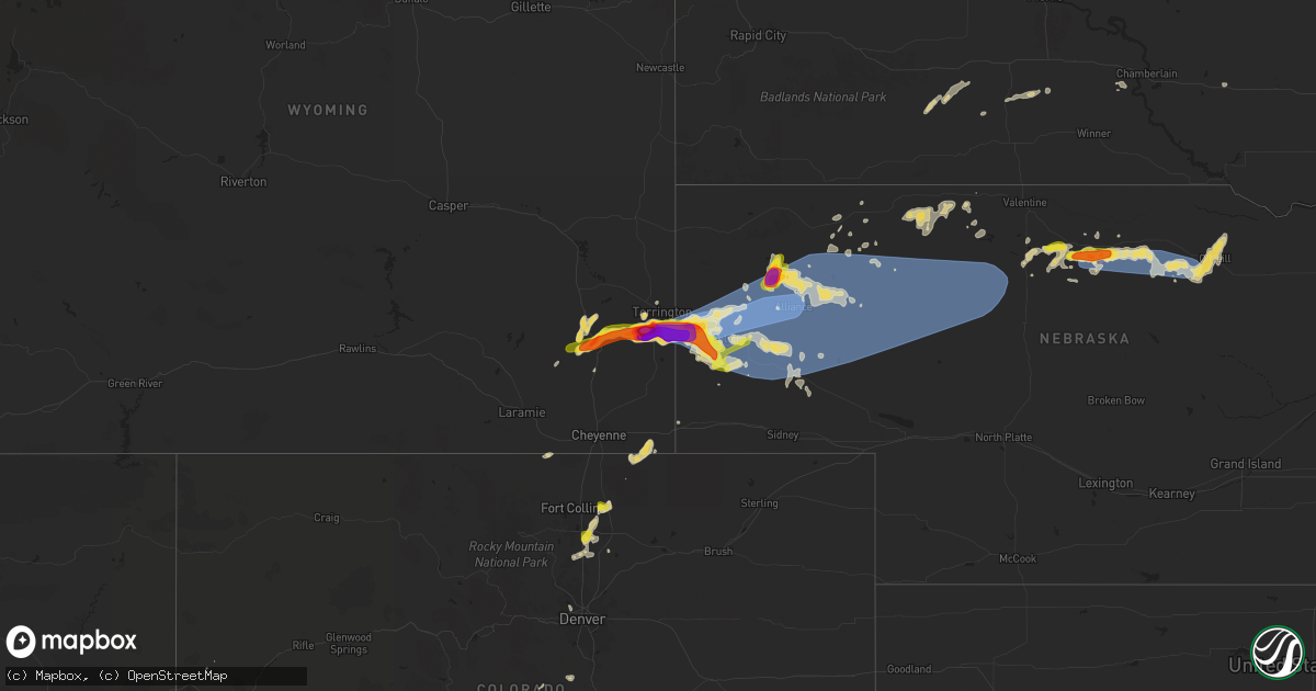
Hail Map on June 20, 2024
Get this storm
June 20 map
$229
one time, instant access
Download today. No call, no setup
Keep the $229
Bought the map and want the full workflow? Apply the entire $229 to a subscription within 7 days. None of it is wasted.
Every map, not just this one
This buys you this map. Subscription and you get every map we run, in the markets you choose from a few cities to whole states to nationwide. Plus real-time alerts the moment a storm fires.
Contact data
Name, contact info, occupancy, even credit band for addresses in the footprint. You go from where it hit to who to call.
Become the source they trust
Unlimited branding weather history reports on demand. You already have the documented answer ready for the property owner, and you are the one who showed up with it.
Property data and RoofTrace estimates
Pull up any address you have got, its value and the exact code rules for that jurisdiction, straight from One Click Code. Then RoofTrace estimates the squares, pitch, and roof value, priced the way you price.
States Impacted by Hail Map on June 20, 2024
Storm reports
Massachusetts
| Date | Description |
|---|---|
| 06/20/20246:50 PM CDT | Tree down along new fitchburg road in the area of pearl hill state park. Relayed by amateur radio. |
| 06/20/20246:50 PM CDT | Tree and wires down at intersection of haynes road and trophy avenue. Relayed by amateur radio. |
| 06/20/20246:50 PM CDT | Tree down near the 20 block of turner road in the town of townsend. Relayed by amateur radio. |
| 06/20/20246:48 PM CDT | Tree down at blackberry lane and observatory road. Relayed by amateur radio. |
| 06/20/20246:38 PM CDT | Law enforcement reports tree and wires down on devin road. Relayed by amateur radio. |
| 06/20/20246:10 PM CDT | Law enforcement report tree down on elmwood road... Blocking the street. Relayed by amateur radio. |
| 06/20/20242:55 PM CDT | Fire department reports three trees down just south of the 700 block of greenfield rd in deerfield. Relayed by amateur radio. |
| 06/20/20242:55 PM CDT | Fire department reports tree and wires down on the 10 block of miles street. Relayed by amateur radio. |
| 06/20/20242:25 PM CDT | Amateur radio reports a tree down on pomeroy meadow rd. |
| 06/20/20242:20 PM CDT | Quarter sized hail reported... Relayed by amateur radio. |
| 06/20/20242:20 PM CDT | Amateur radio report of trees down at north rd at route 202. |
| 06/19/20248:08 PM CDT | Tree and wires down on sheffield road. Relayed by amateur radio. |
| 06/19/20247:28 PM CDT | Fire department reported two moderate sized trees that were multi-trunk and snapped near the base. One tree fell onto home... But did not cause structural damage. |
| 06/19/20247:10 PM CDT | Tree down on wright street. Relayed by amateur radio. |
| 06/19/20247:09 PM CDT | Tree down and blocking road at andover st and emerald avenue. Relayed by amateur radio. |
| 06/19/20247:06 PM CDT | Tree down on car in area of kingston street. Relayed by amateur radio. |
| 06/19/20247:06 PM CDT | Tree landed on roof at 50 block of central street in fitchburg. Relayed by amateur radio. |
| 06/19/20247:00 PM CDT | Tree and wires down at andover street at trull lane and chelmsford st at manufacturers st. Relayed by amateur radio. |
New Hampshire
| Date | Description |
|---|---|
| 06/20/20246:45 PM CDT | Trees and large branches down on the north end of nashua. Time estimated via radar. |
| 06/20/20246:45 PM CDT | Chaser noted a tree down blocking parish hill rd in nashua. |
| 06/20/20246:40 PM CDT | Chaser noted numerous trees down driving through hollis. Time estimated via radar. |
| 06/20/20246:35 PM CDT | Delayed report and time estimated from radar. Numerous trees down across hudson. Power outages reported. |
| 06/20/20246:30 PM CDT | Chaser noted a tree down impeding traffic on rt. 101-a in milford. Time estimated via radar. |
| 06/20/20246:30 PM CDT | Chaser noted a large tree down blocking rt. 122 in amherst. |
| 06/20/20246:25 PM CDT | Chaser noted numerous trees down driving through wilton. |
| 06/20/20246:25 PM CDT | Delayed report. Time estimated by radar. Tree fell on roof of house on meetinghouse rd. In merrimack. |
| 06/20/20246:20 PM CDT | Chaser reports 1-inch hail fell in lyndeborough area. Also measured a 50 mph gust. |
| 06/20/20244:20 PM CDT | Tree down blocking northbound lane of main rd in chatham. |
| 06/20/20244:10 PM CDT | Multiple trees down blocking roads in madbury. |
| 06/20/20242:35 PM CDT | Trees and wires reported down in belmont... Nh. |
| 06/20/20241:35 PM CDT | Hail between 1.2-1.3in fell in canaan for 8 mins. Covered some grassy areas and broke windows at a bbq restaurant. Time estimated via radar. |
| 06/20/20241:30 PM CDT | Trained storm spotter observed 1-inch hail on east side of lebanon on stoney brook rd. |
| 06/20/20241:28 PM CDT | Trees and wires reported down in enfield... Nh. |
| 06/20/20241:28 PM CDT | Trees and wires down in canaan... Nh. |
| 06/20/20241:20 PM CDT | Half dollar sized hail fell for about ten minutes. Time estimated via radar. |
New York
| Date | Description |
|---|---|
| 06/20/20246:22 PM CDT | Tree and wires down along route 295. Time estimated from radar. |
| 06/20/20246:02 PM CDT | Tree and wires down on mccagg rd. Time estimated from radar. |
| 06/20/20246:00 PM CDT | Multiple trees and wires down along rybka rd. Time estimated from radar. |
| 06/20/20246:00 PM CDT | Multiple trees down on rabbit lane. Time estimated from radar. |
| 06/20/20245:56 PM CDT | Trees and wires down along route 9. Time estimated from radar. |
| 06/20/20245:52 PM CDT | Tree and wires down along route 13. Time estimated from radar. |
| 06/20/20245:44 PM CDT | Tree and wires down along route 28a. Time estimated from radar. |
| 06/20/20245:37 PM CDT | Tree and wires down on kinderkill lane. |
| 06/20/20245:08 PM CDT | Trees down on river rd. Time estimated from radar. |
| 06/20/20244:42 PM CDT | Tree down on 7th street. Time estimated from radar. |
| 06/20/20244:37 PM CDT | Several trees and tree limbs down in downtown albany. Time estimated from radar. |
| 06/20/20244:36 PM CDT | Large tree limbs down on south main ave between myrtle ave and park ave. |
| 06/20/20244:36 PM CDT | Large tree down on bertha st. Time estimated from radar. |
| 06/20/20244:00 PM CDT | Estimated dozen trees down off miner road in porters corners. Time estimated by radar. |
| 06/20/20243:22 PM CDT | Multiple photos of large limbs of trees snapped and downed on parked cars along state street. |
| 06/20/20243:04 PM CDT | Tree and wires down along route 40. Time estimated from radar. |
| 06/20/20242:50 PM CDT | Trees and wires down along route 149 near fort ann. Time estimated from radar. |
| 06/20/20242:30 PM CDT | Trees down |
| 06/20/20242:03 PM CDT | Trees and wires down along county route 7. Time estimated from radar. |
| 06/20/20241:29 PM CDT | Small plane overturned... Minor damage to hangar |
| 06/20/20241:29 PM CDT | A local report indicates 61 MPH wind near Plattsburgh Intl Arpt |
| 06/20/20241:28 PM CDT | Tree down on power lines along alder brook rd. |
| 06/20/20241:27 PM CDT | Tree down on schroon river rd. |
| 06/20/202412:17 PM CDT | Tree down blocking road near the intersection of sinclair and turnpike rd. |
| 06/20/202411:50 AM CDT | Quarter sized hail reports in moriah and port henry |
New Mexico
| Date | Description |
|---|---|
| 06/20/20244:08 PM CDT | Asos station kgup gallup airport. |
Vermont
| Date | Description |
|---|---|
| 06/20/20242:45 PM CDT | Tree down on rt 100... Several tree limbs down |
| 06/20/20242:37 PM CDT | Trees and powerlines down |
| 06/20/20242:36 PM CDT | Large pine tree snapped in half... Furniture and plants blown across yard |
| 06/20/20242:30 PM CDT | Report of a tree down on fort bridgman road next to the u.s. Post station. |
| 06/20/20242:30 PM CDT | Report of a tree and wires down at the intersection of fort bridgman and newton roads. |
| 06/20/20242:12 PM CDT | Trees down along with some powerlines |
| 06/20/20242:10 PM CDT | Trees and wires down on north ave |
| 06/20/20242:02 PM CDT | Tree down on wires near tyler hill rd and hubbard rd. |
| 06/20/202412:45 PM CDT | A local report indicates 1.25 inch wind near 1 SE East Middlebury |
| 06/20/202412:35 PM CDT | Tree down on seminary street extension |
Maine
| Date | Description |
|---|---|
| 06/20/20244:50 PM CDT | Delayed report... Time estimated from radar. Tree and wires down in warren with a tree on a home. |
| 06/20/20244:30 PM CDT | Delayed report... Time estimated by radar. Trees down on wires in union... Me. |
| 06/20/20244:24 PM CDT | Trees down across u.s. Route 1 near the gouldsboro town line blocking the southbound lane. |
| 06/20/20244:20 PM CDT | Trees and wires down in town. |
| 06/20/20244:19 PM CDT | Trees down on wires. |
| 06/20/20244:12 PM CDT | Trees and wires down. |
| 06/20/20244:05 PM CDT | Trees and wires down across west franklin road. |
| 06/20/20244:05 PM CDT | Tre |
| 06/20/20244:00 PM CDT | Tree down across eastbrook road. |
| 06/20/20243:55 PM CDT | Tree down on wires. |
| 06/20/20243:35 PM CDT | Delayed report. Trees down on ten road. |
| 06/20/20243:25 PM CDT | Photo on social media showing a large tree down blocking ocean ave near the intersection with washington ave in portland. |
| 06/20/20243:24 PM CDT | Tree down across wires. |
| 06/20/20243:24 PM CDT | Delayed report. Tree down on powerlines. |
| 06/20/20243:24 PM CDT | Tree and wires down onto a house. |
| 06/20/20243:24 PM CDT | Delayed report. Photo via social media showing a large portion of the tree top snapped. |
| 06/20/20243:20 PM CDT | Delayed report. Trees and wires down on margin st. |
| 06/20/20243:20 PM CDT | Delayed report... Time estimated from radar. Tree reported down in unity. |
| 06/20/20243:16 PM CDT | Delayed report. Tree down partially blocking swan road. |
| 06/20/20243:16 PM CDT | Delayed report. Tree down on wires and laying on a house on union st. |
| 06/20/20243:16 PM CDT | Tree down on building. |
| 06/20/20243:12 PM CDT | Delayed report. Tree down on the wires partially blocking avenue road. |
| 06/20/20243:11 PM CDT | Wires down catching ground on fire. |
| 06/20/20243:11 PM CDT | Wires |
| 06/20/20243:05 PM CDT | Tree down leaning on a house in gorham. No reported injuries. Time estimated via radar. |
| 06/20/20243:00 PM CDT | Powerlines down blocking the road on conant st in westbrook. |
| 06/20/20242:58 PM CDT | Delayed report. Tree down partially blocking old bangor road. |
| 06/20/20242:56 PM CDT | Tree down on wires. |
| 06/20/20242:56 PM CDT | Tree down on wires. |
| 06/20/20242:54 PM CDT | Delayed report. Tree down blocking the road. |
| 06/20/20242:52 PM CDT | Delayed report. Trees and wires down on reeves road. |
| 06/20/20242:51 PM CDT | Delayed report. Tree down on main st was struck by lightning and caught fire. |
| 06/20/20242:50 PM CDT | Tree and wires down. |
| 06/20/20242:50 PM CDT | Multiple reports of trees and wires down in detroit. |
| 06/20/20242:50 PM CDT | Delayed report. Tree down on powerlines near the bradford fire station. |
| 06/20/20242:50 PM CDT | Powerlines down in the area of rt. 11 and madawaska ave blocking one lane of traffic. Time estimated via radar. |
| 06/20/20242:48 PM CDT | Delayed report. Tree down on route 15 in charleston. |
| 06/20/20242:45 PM CDT | Tree blocking oliver hill rd. |
| 06/20/20242:40 PM CDT | Tree and power lines down blocking beckwith rd in cornville. |
| 06/20/20242:30 PM CDT | Trees and wires reported down in embden... Near moulton... Rd. |
| 06/20/20242:25 PM CDT | Multiple trees and powerlines down on north rd in limington. A large metal flagpole was also snapped. Time estimated via radar. |
| 06/20/20242:15 PM CDT | Multiple large trees and powerlines down across portions of south windham. |
| 06/20/20242:10 PM CDT | Tree and power lines down blocking gray rd in windham. |
| 06/20/20242:10 PM CDT | Tree and power lines down blocking maynard road in windham. Time estimated via radar. |
Arizona
| Date | Description |
|---|---|
| 06/20/20246:20 PM CDT | Corrects previous non-tstm wnd gst report from 2 nne san carlos. Mesonet station qsca3 san carlos no. 1. |
| 06/20/20245:57 PM CDT | Mesonet station ttba3 tonto basin. |
| 06/19/202410:40 PM CDT | Report for pioneer airfield. |
Nebraska
| Date | Description |
|---|---|
| 06/20/20246:32 PM CDT | A local report indicates 65 MPH wind near 2 W Ellsworth |
| 06/20/20246:29 PM CDT | Public facebook message of uprooted trees on skyline drive in scottsbluf... Ne. |
| 06/20/20246:14 PM CDT | Awos station kaia 4 ese alliance. |
| 06/20/20246:14 PM CDT | Awos |
| 06/20/20246:13 PM CDT | From news director for western scotts bluff county: a lot of damage out on the western side of the county... Large trees completely uprooted a number of pivots turned o |
| 06/20/20245:52 PM CDT | Alliance asos measured a 70kt gust. |
| 06/20/20245:47 PM CDT | Tornado confirmed on the ground by fire chief and was reported as rain wrapped. |
| 06/20/20245:30 PM CDT | Public report of uprooted trees on west overland in scottsbluff. Images are included... It was a large tree. |
| 06/20/20245:30 PM CDT | Delayed torn |
| 06/20/20245:30 PM CDT | Delayed tornado report from 5:30 pm ct. Estimated location. |
| 06/20/20245:26 PM CDT | Public post on facebook of golfball sized hail reported in hemingford. |
| 06/20/20245:24 PM CDT | Slack photo of a garage door bent and damaged at 901 broadway street in scottsbluff. Door is rated to 100mph. |
| 06/20/20245:10 PM CDT | A local report indicates 1.50 inch wind near 7 S Ainsworth |
| 06/20/20245:09 PM CDT | Flipped rail cars... Trees and power poles down. |
| 06/20/20245:05 PM CDT | A local report indicates 70 MPH wind near 2 ESE Melbeta |
| 06/20/20245:03 PM CDT | Heavy tree damage and debris thrown around. |
| 06/20/20245:00 PM CDT | Scottsbluff davis station reported an 84mph gust. Time estimated from radar. |
| 06/20/20244:58 PM CDT | A local report indicates 1.00 inch wind near Gering |
| 06/20/20244:58 PM CDT | Barn and roof of house damaged |
| 06/20/20244:55 PM CDT | A local report indicates 1.25 inch wind near Gering |
| 06/20/20244:51 PM CDT | A local report indicates 71 MPH wind near Scottsbluff |
| 06/20/20244:45 PM CDT | Facebook post with hail next to highlighter. Hail size estimated based on office highlighter. |
| 06/20/20244:40 PM CDT | Broken power poles and broken 3 inch tree limbs |
| 06/20/20244:39 PM CDT | A local report indicates 80 MPH wind near 5 NE Morrill |
| 06/20/20244:39 PM CDT | Powerlines snapped |
| 06/20/20244:35 PM CDT | Kneb station manager reports one of the stations broadcast towers was blown down and collapsed. 300 foot tower. Estimating 750 plus trees down in scottsbluff and gering |
| 06/20/20244:35 PM CDT | Damage reported includes a leaning power pole... Trees down... Which were snapped at the base |
| 06/20/20244:35 PM CDT | Damage reported includes a leaning power pole... Trees down... Which were snap |
| 06/20/20244:34 PM CDT | Measured from davis home weather station. |
| 06/20/20244:34 PM CDT | Trees down on south mitchell road |
| 06/20/20244:34 PM CDT | Wind estimated between 90-100 mph |
| 06/20/20244:29 PM CDT | Nws storm survey found ef-1 tornado damage along an approximately 2 mile long path between morrill and mitchell. Several homes sustained roof damage with partial roof r |
| 06/20/20244:26 PM CDT | A local report indicates 1.75 inch wind near Mitchell |
| 06/20/20244:25 PM CDT | A local report indicates 85 MPH wind near 5 NE Morrill |
| 06/20/20244:24 PM CDT | A local report indicates 1.00 inch wind near 5.5 SW Johnstown |
| 06/20/20244:23 PM CDT | Ping pong sized hail also reported |
| 06/20/20244:22 PM CDT | Powerlines down |
| 06/19/20247:48 PM CDT | A local report indicates 60 MPH wind near 12 NW Amelia |
| 06/19/20247:22 PM CDT | A local report indicates 70 MPH wind near 24 N Whitman |
| 06/19/20247:10 PM CDT | Winds gusting 60 to 70 mph with small limbs down. |
| 06/19/20247:08 PM CDT | A local report indicates 62 MPH wind near 16 S Newport |
| 06/19/20247:00 PM CDT | Wind gust estimated at 60 mph at this location with dime to penny size hail. |
Michigan
| Date | Description |
|---|---|
| 06/20/20246:00 PM CDT | Large tree uprooted and several large branches snapped. Time estimated via radar. |
| 06/20/20245:11 PM CDT | Social media photo of a snapped large healthy tree |
| 06/20/20245:05 PM CDT | 911 dispatch reported powerlines down around carleton. Additionally... Received a photo via social media of a tree with several large limbs down. Estimated 6 to 8 inche |
| 06/20/20244:13 PM CDT | Tree damage relayed by amateur radio operators. |
| 06/20/20244:05 PM CDT | A local report indicates 1.25 inch wind near Mason |
| 06/20/20244:03 PM CDT | Wind gusts estimated around 50 mph. |
| 06/20/20243:59 PM CDT | A local report indicates 1.75 inch wind near 2 E Holt |
| 06/20/20243:56 PM CDT | Tree damage in south lansing relayed from em. |
| 06/20/20243:54 PM CDT | Report from mping: quarter |
| 06/20/20243:43 PM CDT | Photos of multiple trees and large limbs down west and south of holt junior high school. Some trees blocking roads. Snapped tree branch pierced ceiling of a bedroom. Po |
| 06/20/20243:43 PM CDT | A local report indicates 1.00 inch wind near Holt |
| 06/20/20243:32 PM CDT | A local report indicates 1.25 inch wind near 3 ENE Dimondale |
| 06/20/20243:28 PM CDT | Section of wood truss and metal roofing panels blown off old lumber mill building. Power outages in and north of stanwood. |
| 06/20/20243:25 PM CDT | Large pine tree down. |
| 06/20/20242:41 PM CDT | Six to ten inch branch blocking left lane. |
| 06/20/20242:29 PM CDT | A local report indicates 1.50 inch wind near 3 S Cedar Springs |
| 06/20/20242:29 PM CDT | A local report indicates 62 MPH wind near 1 SSE Rockford |
| 06/20/20241:52 PM CDT | Photo of trees down at snell and mt. Vernon roads |
| 06/20/20241:46 PM CDT | Report from mping: golf ball |
| 06/20/20241:45 PM CDT | Large trees uprooted in the knollwood hills subdivision. Large tree limbs and power lines were also observed down as well. One large tree limb clipped the corner of a h |
| 06/20/20241:44 PM CDT | A local report indicates 1.50 inch wind near 2 NE Clarksville |
| 06/20/202412:40 PM CDT | Added information from previous lsr. Thunderstorm wind damage report from 3 se cascade. Several large trees blocking roads from 36th st/thornapple river dr to cascade r |
| 06/20/202412:40 PM CDT | Time estimated by radar and surface observations in the area. |
| 06/20/202412:25 PM CDT | Large pine tree down. |
Ohio
| Date | Description |
|---|---|
| 06/20/20246:30 PM CDT | A local report indicates 60 MPH wind near 2 NW Brailey |
| 06/20/20246:30 PM CDT | Report from police chief in delta of large tree limbs down and power outages. Time estimated via radar. |
| 06/20/20245:23 PM CDT | Asos station ktdz toledo. |
| 06/20/20245:23 PM CDT | 5 power poles snapped along cummings road at latcha road. |
| 06/19/20247:01 PM CDT | Several tree limbs down on roadway on state road 99 and egypt road. Time estimated via radar. |
Colorado
| Date | Description |
|---|---|
| 06/20/20245:53 PM CDT | Asos station kgjt grand junction rgnl ap. |
| 06/20/20245:36 PM CDT | Multiple power lines down 22628 county road 39... About 1.5 miles south of la salle. |
| 06/20/20245:12 PM CDT | A local report indicates 1.00 inch wind near 1 N Grand Junction |
| 06/20/20244:41 PM CDT | Brief landspout. |
| 06/20/20242:51 PM CDT | Varied from 1/2 inch to over quarter size. Lasted 20 minutes. |
Montana
| Date | Description |
|---|---|
| 06/20/20243:50 PM CDT | Quarter-sized hail fell for approximately 20 minutes. Damage to crops observed. Estimated 0.25 inches of rain in 15 minutes. |
| 06/20/20243:50 PM CDT | A local report indicates 1.75 inch wind near Hobson |
| 06/20/20243:00 PM CDT | Spotter reported quarter size hail. |
| 06/19/20247:20 PM CDT | Measured from the mosby nw mt |
| 06/19/20247:20 PM CDT | Measured from the mosby nw mt mesonet site. |
Wyoming
| Date | Description |
|---|---|
| 06/20/20244:06 PM CDT | A local report indicates 4.50 inch wind near Yoder |
| 06/20/20244:00 PM CDT | Reported by media from trained spotter |
| 06/20/20244:00 PM CDT | Delayed report... Storm chaser reports 4 inch hail with image on twitter. Says that there was likely 4.5+ inch hail... But could not get out to grab it. Winds likwly 60 |
| 06/20/20243:56 PM CDT | Measured by car roof anemometer reported through slack |
| 06/20/20243:53 PM CDT | A local report indicates 4.50 inch wind near 6 NW Hawk Springs |
| 06/20/20243:52 PM CDT | A local report indicates 2.50 inch wind near 9 NW Hawk Springs |
| 06/20/20243:45 PM CDT | [landspout] tornado start time 0245 / end time 0250 |
| 06/20/20243:42 PM CDT | A local report indicates 1.50 inch wind near 8 WSW Yoder |
| 06/20/20243:29 PM CDT | Golfballs with quarter sized hail photo in slack channel |
| 06/20/20243:18 PM CDT | A local report indicates 1.20 inch wind near 15 SE Wheatland |
| 06/20/20243:13 PM CDT | A local report indicates 63 MPH wind near 1 SSE Bordeaux |
| 06/20/20243:11 PM CDT | Photo in slack channel hail is accumulating in fields |
| 06/20/20243:06 PM CDT | A local report indicates 58 MPH wind near 1 SSE Bordeaux |
Utah
| Date | Description |
|---|---|
| 06/20/20243:00 PM CDT | Roof blown off neighbors house. Dime sized hail. |
Cities Impacted by Hail Map on June 20, 2024
- Mineville, NY
- Port Henry, NY
- Moriah, NY
- Bath, NY
- Moriah Center, NY
- Vergennes, VT
- Bridport, VT
- Middlebury, VT
- Oxford, MI
- Leonard, MI
- Cameron, NY
- Salisbury, VT
- Brandon, VT
- Wanblee, SD
- Grand Rapids, MI
- Westport, NY
- Long Valley, SD
- Durango, CO
- Lowell, MI
- Ada, MI
- Chestertown, NY
- Canaan, NH
- Pagosa Springs, CO
- Bayfield, CO
- Genesee, PA
- Warrensburg, NY
- Lebanon, NH
- Alto, MI
- Ripton, VT
- Clarksville, MI
- South Hero, VT
- Plattsburgh, NY
- Enfield, NH
- Saranac, MI
- Bolton Landing, NY
- Peru, NY
- Diamond Point, NY
- Romeo, MI
- Washington, MI
- Lake Odessa, MI
- Ray, MI
- Armada, MI
- Rochester, MI
- Queensbury, NY
- Lake George, NY
- Gorham, ME
- Standish, ME
- Whitehall, NY
- Fort Ann, NY
- West Baldwin, ME
- Westfield, MA
- Deerfield, MA
- South Deerfield, MA
- Cincinnatus, NY
- Pitcher, NY
- Keeseville, NY
- Oakland, MI
- Hadley, NY
- Stony Creek, NY
- Bernardston, MA
- Windham, ME
- Ganado, AZ
- Willsboro, NY
- Hanover, NH
- Princeton, IA
- Rifle, CO
- New Baltimore, MI
- Macomb, MI
- Limington, ME
- Charlotte, VT
- Essex, NY
- East Thetford, VT
- Hudson Falls, NY
- Brattleboro, VT
- Rockford, MI
- Cedar Springs, MI
- Sparta, MI
- Lake Luzerne, NY
- Etna, NH
- Livermore, CO
- Marathon, NY
- Belmont, MI
- Comstock Park, MI
- Steep Falls, ME
- Chugwater, WY
- Stanford, MT
- Wheatland, WY
- McGraw, NY
- Howard City, MI
- Buxton, ME
- Shinglehouse, PA
- Hiram, ME
- Newaygo, MI
- Greenville, MI
- Thedford, NE
- Hobson, MT
- Coudersport, PA
- Towaoc, CO
- Moccasin, MT
- Roulette, PA
- Belding, MI
- Morley, MI
- Lansing, MI
- Dimondale, MI
- Charlotte, MI
- Shiprock, NM
- Yoder, WY
- Veteran, WY
- Holt, MI
- Valentine, NE
- Blanding, UT
- Whitney Point, NY
- Wood Lake, NE
- Mason, MI
- Torrington, WY
- Buena Vista, CO
- Johnstown, NE
- Romulus, MI
- Sebago, ME
- East Baldwin, ME
- Hemingford, NE
- Rumney, NH
- Jefferson, ME
- Whitefield, ME
- Newport, NH
- Thetford Center, VT
- Schaghticoke, NY
- Moore, MT
- Lewistown, MT
- Lyman, NE
- Morrill, NE
- Mitchell, NE
- Lingle, WY
- Longmont, CO
- Valley Falls, NY
- Greenwich, NY
- Cambridge, NY
- Dansville, MI
- Arvada, CO
- Gering, NE
- Scottsbluff, NE
- Harrison, NE
- Alliance, NE
- Gallup, NM
- Loveland, CO
- Johnstown, CO
- Berthoud, CO
- Milliken, CO
- Windsor, CO
- Mead, CO
- Buskirk, NY
- Shaftsbury, VT
- Bennington, VT
- Oak Harbor, OH
- Minatare, NE
- Harrisburg, NE
- Bayard, NE
- Melbeta, NE
- Mcgrew, NE
- Glade Park, CO
- Grand Junction, CO
- Ainsworth, NE
- Greenville, NY
- Westerlo, NY
- Stockbridge, MI
- Platteville, CO
- Greeley, CO
- Selkirk, NY
- Feura Bush, NY
- Kearny, AZ
- Johnsonville, NY
- Eaton, CO
- Ault, CO
- Superior, AZ
- Woodland, MI
- Pierce, CO
- Gateway, CO
- Coeymans Hollow, NY
- Alcove, NY
- Wheat Ridge, CO
- Carpenter, WY
- Glenmont, NY
- Gregory, MI
- Albany, NY
- Rensselaer, NY
- Delmar, NY
- Long Pine, NE
- Marsland, NE
- Fort Mcdowell, AZ
- West Sand Lake, NY
- East Greenbush, NY
- Perrysburg, OH
- Stony Ridge, OH
- Ravena, NY
- Troy, NY
- South Bethlehem, NY
- Wynantskill, NY
- Castleton On Hudson, NY
- Winkelman, AZ
- Farmington, NM
- Bloomfield, NM
- Rushville, NE
- Angora, NE
- Bridgeport, NE
- Merriman, NE
- Pine Bluffs, WY
- Stuyvesant, NY
- Grover, CO
- Colorado Springs, CO
- Forest Grove, MT
- Gordon, NE
- La Salle, CO
- Averill Park, NY
- Walbridge, OH
- Northwood, OH
- Millbury, OH
- Genoa, OH
- Cody, NE
- Chinook, MT
- Kinderhook, NY
- Stuyvesant Falls, NY
- Sedalia, CO
- Lake George, CO
- Vernon, VT
- Peridot, AZ
- Bassett, NE
- Schodack Landing, NY
- Tonto Basin, AZ
- Hudson, NY
- Coxsackie, NY
- Valatie, NY
- Niverville, NY
- Athens, NY
- Ellsworth, NE
- Hay Springs, NE
- Ghent, NY
- Canisteo, NY
- Grass Range, MT
- Roundup, MT
- Payson, AZ
- Delta, OH
- De Ruyter, NY
- Curtice, OH
- Williston, OH
- Martin, OH
- Clay Center, OH
- Oregon, OH
- Swanton, OH
- Chatham, NY
- Lyndon, IL
- Lakeside, NE
- Broadwater, NE
- Oshkosh, NE
- Lisco, NE
- Bingham, NE
- Morrison, IL
- Young, AZ
- Plymouth, OH
- Willard, OH
- Newport, NE
- Gregory, SD
- Reliance, SD
- Sedona, AZ
- Sunderland, MA
- Leverett, MA
- Montague, MA
- Hays, MT
- Philmont, NY
- Amherst, MA
- Hadley, MA
- Chadwick, IL
- Pine, AZ
- Happy Jack, AZ
- White River, SD
- Kilgore, NE
- Nenzel, NE
- Wood, SD
- West Springfield, MA
- Brusett, MT
- Stuart, NE
- Whitman, NE
- Ashby, NE
- Hyannis, NE
- Mullen, NE
- Atkinson, NE
- Dodson, MT
- Whiting, VT
- Shoreham, VT
- Plankinton, SD
- Amelia, NE
- White Lake, SD
- Sand Springs, MT
- Malta, MT
- Winslow, AZ
- Miller, SD
- Ree Heights, SD
- Emmet, NE
- Forsyth, MT
- Oneill, NE
- Hingham, MT
- Chambers, NE
- Fairfield, MT
- Hinsdale, MT
- Worthing, SD
- Lennox, SD