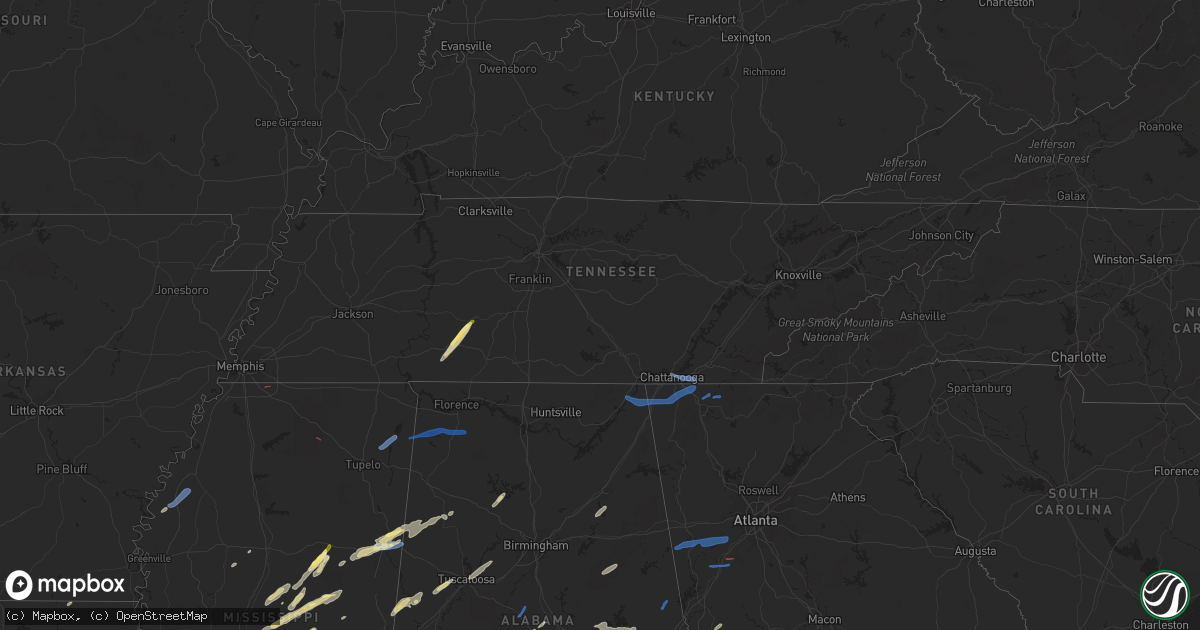
Hail Map in Tennessee on January 3, 2023
Get this storm
January 3 map
$229
one time, instant access
Download today. No call, no setup
Keep the $229
Bought the map and want the full workflow? Apply the entire $229 to a subscription within 7 days. None of it is wasted.
Every map, not just this one
This buys you this map. Subscription and you get every map we run, in the markets you choose from a few cities to whole states to nationwide. Plus real-time alerts the moment a storm fires.
Contact data
Name, contact info, occupancy, even credit band for addresses in the footprint. You go from where it hit to who to call.
Become the source they trust
Unlimited branding weather history reports on demand. You already have the documented answer ready for the property owner, and you are the one who showed up with it.
Property data and RoofTrace estimates
Pull up any address you have got, its value and the exact code rules for that jurisdiction, straight from One Click Code. Then RoofTrace estimates the squares, pitch, and roof value, priced the way you price.
Storm reports in Tennessee
Tennessee
| Date | Description |
|---|---|
| 01/03/20233:15 PM CST | Trees down leading to power outages. |
| 01/03/20232:40 PM CST | Large tree down with property damage to structure and fence. Reported by trained spotter. |
| 01/03/20232:25 PM CST | Numerous shingles blown off roof... And trees down. |
| 01/03/20232:20 PM CST | Several trees down. |
| 01/03/20232:10 PM CST | Several trees down across the county. |
| 01/03/20232:10 PM CST | Trees down on smith school rd. |
| 01/03/20232:06 PM CST | Numerous trees down across the county. |
| 01/03/20232:00 PM CST | Trees and powerlines down on ellistown rd. |
| 01/03/20231:55 PM CST | Several trees down. |
| 01/03/20231:50 PM CST | Several trees down across the county. |
| 01/03/20231:32 PM CST | Corrects previous non-tstm wnd gst report from 4 se chattanooga. Measured at the asos station kcha lovell field from thunderstorm winds. In addition... Public report of |
| 01/03/202312:30 PM CST | Thunderstorm wind damage reported in crossville. Damage included an uprooted tree... A torn roof off of a building... And shingle damage to a residence. |
| 01/03/202312:22 PM CST | Thunderstorm wind damage reported on tabor loop north of crossville. Damage included a tree that fell onto a house... A damaged carport and garage... Another uprooted t |
| 01/03/202312:22 PM CST | Corrects previous tstm wnd dmg report from 1 n crossville. Thunderstorm wind damage reported on tabor loop north of crossville. Damage included a tree that fell onto a |
| 01/03/202311:15 AM CST | Thunderstorm winds destroyed shed at a residence near unionville. |
| 01/03/202311:00 AM CST | Tspotter report of downed trees along the railroad tracks in fosterville. A roof was also torn off of a hay shed near the intersection of fosterville and bell buckle ro |
| 01/03/202310:59 AM CST | Corrects previous tstm wnd dmg report from 5 nnw bell buckle. Tspotter report of downed trees along the railroad tracks south of fosterville near bell buckle road at fo |
| 01/03/202310:59 AM CST | Tspotter report of downed trees along the railroad tracks south of fosterville near bell buckle road at fosterville road. A roof was also torn off of a nearby hay shed. |
| 01/03/202310:45 AM CST | Thunderstorm winds destroyed shed at a residence near unionville. |
| 01/03/202310:45 AM CST | Corrects previous tstm wnd dmg report from unionville. Thunderstorm winds destroyed shed at a residence near unionville. |
| 01/03/20236:09 AM CST | At 1208 PM CST, a severe thunderstorm was located near Monterey, or 14 miles northeast of Sparta, moving northeast at 50 mph. HAZARD...60 mph wind gusts. SOURCE...Radar indicated. IMPACT...Expect damage to roofs, siding, and trees. Locations impacted include... Crossville, Fairfield Glade, Monterey, Crab Orchard, Pleasant Hill, Grimsley, Lake Tansi, Cumberland Mountain State Park, Slate Springs, Clarkrange and Virgin Falls State Natural Area.This includes Interstate 40 between mile markers 292 and 340. |
| 01/03/20235:39 AM CST | At 1139 PM CST, a severe thunderstorm was located near Waynesboro, moving northeast at 50 mph. HAZARD...60 mph wind gusts and quarter size hail. SOURCE...Radar indicated. IMPACT...Hail damage to vehicles is expected. Expect wind damage to roofs, siding, and trees. Locations impacted include... Hohenwald, Waynesboro, Gordonsburg and Kimmins. |
| 01/03/20235:32 AM CST | At 1132 AM CST, a severe thunderstorm was located near Smithville, moving northeast at 40 mph. HAZARD...60 mph wind gusts. SOURCE...Radar indicated. IMPACT...Expect damage to roofs, siding, and trees. Locations impacted include... Cookeville, McMinnville, Sparta, Smithville, Woodbury, Spencer, Algood, Monterey, Baxter, Pleasant Hill, Doyle, Dowelltown, Liberty, Centertown, Hamptons Crossroads, Bakers Crossroads, Virgin Falls State Natural Area, Burgess Falls State Park, Rock Island State Park and Center Hill Lake.This includes Interstate 40 between mile markers 267 and 300. |
| 01/03/202312:42 AM CST | At 641 AM CST, a severe thunderstorm was located over Portland, moving northeast at 55 mph. HAZARD...60 mph wind gusts. SOURCE...Radar indicated. IMPACT...Expect damage to roofs, siding, and trees. Locations impacted include... Scottsville. |
| 01/03/202312:40 AM CST | At 640 AM CST, a severe thunderstorm was located near Cloverport, or 8 miles northwest of Bolivar, moving east at 35 mph. HAZARD...60 mph wind gusts. SOURCE...Radar indicated. IMPACT...Expect damage to roofs, siding, and trees. Locations impacted include... Henderson, Bolivar, Chickasaw State Forest, Chickasaw State Park, Whiteville, Silerton, Masseyville, Cloverport, Toone, Medon, Pinson, Pine Top, Parkburg, Vildo, Hatchie, Uptonville, Hickory Corners, Deanburg, Teague and Montezuma. |
| 01/03/202312:28 AM CST | At 628 AM CST, a severe thunderstorm was located over Red Banks, or near Holly Springs, moving east at 35 mph. HAZARD...60 mph wind gusts. SOURCE...Radar indicated. IMPACT...Expect damage to roofs, siding, and trees. Locations impacted include... Holly Springs, Ripley, Lamar, Snow Lake Shores, Canaan, Mt Pleasant, Gravestown, Michigan City, Red Banks, Slayden, Marianna, Walnut, Ashland, Falkner, Murry, Brody, Spring Hill, Higdon, Gilton and New Canaan. |
| 01/02/202311:51 PM CST | Quarter size hail reported on buffalo road south of hohenwald. |
| 01/02/202311:50 PM CST | A local report indicates 1.00 inch wind near 2.2 SE HOHENWALD |
| 01/02/202311:42 PM CST | At 542 AM CST, a severe thunderstorm was located over Hernando, moving east at 45 mph. HAZARD...60 mph wind gusts. SOURCE...Radar indicated. IMPACT...Expect damage to roofs, siding, and trees. Locations impacted include... Hernando, Senatobia, Holly Springs, Wall Doxey State Park, Lamar, Coldwater, Byhalia, Como, Crenshaw, Sledge, Snow Lake Shores, Mt Pleasant, Strayhorn, Lewisburg, Arkabutla, Michigan City, Red Banks, Laws Hill, Barr and Canaan. |
| 01/02/202310:12 PM CST | At 412 AM CST, severe thunderstorms were located along a line extending from near Cobb to 9 miles northwest of Big Rock, moving east at 40 mph. HAZARD...60 mph wind gusts. SOURCE...Radar indicated. IMPACT...Expect damage to roofs, siding, and trees. Severe thunderstorms will be near... Crofton around 430 AM CST.Other locations in the path of these severe thunderstorms includeHopkinsville, Oak Grove and Fort Campbell.This includes the following highways... Interstate 24 in Kentucky between Mile Markers 59 and 91. Pennyrile Parkway between Mile Markers 1 and 25. |
| 01/02/20239:44 PM CST | At 343 AM CST, a severe thunderstorm was located near Springville, or near Paris, moving northeast at 55 mph. HAZARD...60 mph wind gusts. SOURCE...Radar indicated. IMPACT...Expect damage to roofs, siding, and trees. Locations impacted include... Paris, Paris Landing State Park, Vale, Springville, Routon, Big Sandy, Henry, Mansfield, Haigler Ridge, Manleyville, Old Springville, India, Sunnyside, Van Dyke, Mixie, Spring Creek, Crews Store, Ephesus and Big Sandy Unit Tennessee National Wildlife Refuge. |
| 01/02/20239:06 PM CST | At 305 PM EST, severe thunderstorms were located along a line extending from 8 miles west of Rutledge to 6 miles southeast of Plainview to near Rockford, moving east at 55 mph. HAZARD...60 mph wind gusts. SOURCE...Radar indicated. IMPACT...Expect damage to roofs, siding, and trees. Locations impacted include... Knoxville, Morristown, Sevierville, Alcoa, Jefferson City, Newport, Rogersville, Dandridge, Rutledge and Pigeon Forge.This includes the following highways... Interstate 40 in Tennessee between mile markers 394 and 432. Interstate 81 in Tennessee between mile markers 1 and 24. |
| 01/02/20238:41 PM CST | At 241 PM EST, severe thunderstorms were located along a line extending from 9 miles southeast of La Follette to near Clinton to near Farragut, moving east at 40 mph. HAZARD...60 mph wind gusts. SOURCE...Radar indicated. IMPACT...Expect damage to roofs, siding, and trees. Locations impacted include... Knoxville, Oak Ridge, Clinton, Alcoa, Maynardville, Farragut, Louisville, Plainview, Rockford and Strawberry Plains.This includes the following highways... Interstate 40 in Tennessee near mile marker 363, and between milemarkers 369 and 401. Interstate 75 in Tennessee between mile markers 108 and 125. |
| 01/02/20238:39 PM CST | At 238 PM EST, severe thunderstorms were located along a line extending from 6 miles south of Fairview to 8 miles north of Charleston to 6 miles northwest of Cleveland, moving east at 40 mph. HAZARD...60 mph wind gusts. SOURCE...Radar indicated. IMPACT...Expect damage to roofs, siding, and trees. Locations impacted include... Cleveland, Athens, Dayton, Sweetwater, Madisonville, Decatur, Soddy-Daisy, Etowah, Charleston and Englewood.This includes Interstate 75 in Tennessee between mile markers 28 and66. |
| 01/02/20238:17 PM CST | At 216 PM EST/116 PM CST/, a severe thunderstorm was located near Lookout Mountain, or 9 miles west of Chattanooga, moving east at 45 mph. HAZARD...60 mph wind gusts. SOURCE...Radar indicated. IMPACT...Expect damage to roofs, siding, and trees. Locations impacted include... Chattanooga, Cleveland, Soddy-Daisy, Signal Mountain, Walden, Lakesite, Ridgeside, South Cleveland, Fairmount and Harrison.This includes Interstate 75 in Tennessee between mile markers 1 and28. |
All States Impacted by Hail Map on January 3, 2023
Cities Impacted by Hail Map on January 3, 2023
- Jasper, AL
- Scooba, MS
- Emelle, AL
- Aliceville, AL
- Eutaw, AL
- Ralph, AL
- Knoxville, AL
- Buhl, AL
- Ethel, MS
- Kosciusko, MS
- Carthage, MS
- Bastrop, LA
- Fayette, AL
- Millbrook, AL
- Coosada, AL
- Billingsley, AL
- Plantersville, AL
- Heidelberg, MS
- Shubuta, MS
- Deatsville, AL
- Decatur, MS
- Conehatta, MS
- Hermanville, MS
- Notasulga, AL
- Tallassee, AL
- Tuskegee, AL
- Port Allen, LA
- Brusly, LA
- Soso, MS
- Stringer, MS
- Laurel, MS
- McIntosh, AL
- Tibbie, AL
- State Line, MS
- Richton, MS
- Theriot, LA
- Gibson, LA
- Moreauville, LA
- Monterey, LA
- Marksville, LA
- Perkinston, MS
- Brooklyn, MS
- Beaumont, MS
- Wiggins, MS
- Thomasville, AL
- Pine Hill, AL
- Arlington, AL
- Walnut Grove, MS
- Philadelphia, MS
- Lena, MS
- Waynesboro, MS
- Vidalia, LA
- Woodville, MS
- Natchez, MS
- Farmer City, IL
- Waynesboro, TN
- Lawrenceburg, TN
- Collinwood, TN
- Hohenwald, TN
- Citronelle, AL
- Convent, LA
- Saint James, LA
- Gloster, MS
- Liberty, MS
- Raceland, LA
- Houma, LA
- Bourg, LA
- Dry Creek, LA
- Sugartown, LA
- Little River, AL
- Poplarville, MS
- Carriere, MS
- Bunkie, LA
- Sturgis, MS
- Ackerman, MS
- Mathiston, MS
- Weir, MS
- Cottonport, LA
- Plaucheville, LA
- Evergreen, LA
- Auburn, AL
- Opelika, AL
- Wapella, IL
- Clinton, IL
- Bellflower, IL
- Mansfield, IL
- Saint Stephens, AL
- Millry, AL
- Baton Rouge, LA
- Shiloh, GA
- Hamilton, GA
- Acme, LA
- Hessmer, LA
- Mansura, LA
- Pike Road, AL
- Montgomery, AL
- Vossburg, MS
- Autaugaville, AL
- Prattville, AL
- Caledonia, MS
- Columbus, MS
- Steens, MS
- Slidell, LA
- Oakdale, LA
- Coffeeville, AL
- Boyce, LA
- Elmer, LA
- Sieper, LA
- Otis, LA
- Fayette, MS
- Grant, LA
- Deridder, LA
- Elizabeth, LA
- Pitkin, LA
- Lacombe, LA
- Lafayette, LA
- Collins, MS
- Prairieville, LA
- Denham Springs, LA
- Saint Gabriel, LA
- Addis, LA
- Plaquemine, LA
- Sunshine, LA
- Greenwell Springs, LA
- Weldon, IL
- Maroa, IL
- Dewitt, IL
- Lane, IL
- Gadsden, AL
- Ohatchee, AL
- Ashville, AL
- Bay Springs, MS
- Pennington, AL
- La Place, LA
- Ponchatoula, LA
- Sunflower, AL
- Wagarville, AL
- Jeanerette, LA
- Saint Landry, LA
- Ville Platte, LA
- Simmesport, LA
- Tuscaloosa, AL
- Brookwood, AL
- Cottondale, AL
- Noxapater, MS
- Louisville, MS
- Canton, MS
- Camden, MS
- Uniontown, AL
- Lucedale, MS
- Vinegar Bend, AL
- Leakesville, MS
- Maplesville, AL
- Taylorsville, MS
- Ellisville, MS
- Latham, IL
- Warrensburg, IL
- Cataula, GA
- Wetumpka, AL
- Butler, AL
- Safford, AL
- Morton, MS
- Smiths Station, AL
- Salem, AL
- Fortson, GA
- Gallion, AL
- Sardis, AL
- Jones, AL
- Selma, AL
- Orrville, AL
- Columbia, MS
- Sumrall, MS
- Bassfield, MS
- Mittie, LA
- Morgan City, LA
- Franklin, LA
- Marion Junction, AL
- Marion, AL
- Roxie, MS
- Meadville, MS
- Crosby, MS
- McHenry, MS
- Moselle, MS
- Cruger, MS
- Sidon, MS
- Melvin, AL
- Stapleton, AL
- Coila, MS
- Summit, MS
- Ruth, MS
- Deer Park, AL
- Jackson, AL
- Monticello, MS
- Jayess, MS
- Alexander City, AL
- Eclectic, AL
- Shorter, AL
- Camp Hill, AL
- Dadeville, AL
- Equality, AL
- Reeves, LA
- Rosedale, MS
- McCool, MS
- Tyler, AL
- Hayneville, AL
- Mobile, AL
- Theodore, AL
- Grand Bay, AL
- Moss Point, MS
- Jonesville, LA
- Deville, LA
- Effie, LA
- Center Point, LA
- Pineville, LA
- Pachuta, MS
- Forest, MS
- Bay Saint Louis, MS
- Paulding, MS
- Sallis, MS
- Flora, MS
- Jackson, MS
- Madison, MS
- Clinton, MS
- Bolton, MS
- Brookhaven, MS
- Sontag, MS
- Hazlehurst, MS
- Wesson, MS
- Bogue Chitto, MS
- Starkville, MS
- Ashland, AL
- Talladega, AL
- Lineville, AL
- Millport, AL
- Vernon, AL
- Sulligent, AL
- Artesia, MS
- Kennedy, AL
- West Point, MS
- Lowndesboro, AL
- Bay Minette, AL
- Robertsdale, AL
- Loxley, AL
- Long Beach, MS
- Albany, LA
- Holden, LA
- Hope Hull, AL
- Mount Olive, MS
- Lockport, LA
- Grove Hill, AL
- Chatom, AL
- Magnolia, MS
- Bogalusa, LA
- Bush, LA
- Ragley, LA
- Carson, MS
- Prentiss, MS
- Vancleave, MS
- Saucier, MS
- Greensburg, LA
- Osyka, MS
- Loreauville, LA
- Saint Martinville, LA
- New Iberia, LA
- Tickfaw, LA
- Independence, LA
- McLain, MS
- Grosse Tete, LA
- Loranger, LA
- Husser, LA
- Abbeville, LA
- Erath, LA
- Clanton, AL
- Jachin, AL
- Ward, AL
- York, AL
- Catherine, AL
- Wilmer, AL
- Leroy, AL
- McCall Creek, MS
- Smithdale, MS
- Youngsville, LA
- Broussard, LA
- Lorman, MS
- Union Church, MS
- Cheneyville, LA
- Pattison, MS
- Faunsdale, AL
- Pass Christian, MS
- Gulfport, MS
- New Augusta, MS
- Seminary, MS
- Stockton, AL
- Oak Vale, MS
- Lumberton, MS
- Daphne, AL
- Irvington, AL
- Olive Branch, MS
- Myrtle, MS
- Titus, AL
- Louisville, AL
- Banks, AL
- Mount Auburn, IL
- Blue Mound, IL
- Niantic, IL
- Decatur, IL
- Sharpsburg, GA
- Newnan, GA
- Gibson City, IL
- Foosland, IL
- Lithonia, GA
- Whitesburg, GA
- Bowdon, GA
- Winston, GA
- Carrollton, GA
- Palmetto, GA
- Douglasville, GA
- Fairburn, GA
- Moreland, GA
- Chattanooga, TN
- Ooltewah, TN
- Apison, TN
- Chickamauga, GA
- Ringgold, GA
- Rising Fawn, GA
- Rock Spring, GA
- Higdon, AL
- Flat Rock, AL
- Trenton, GA
- Tunnel Hill, GA
- Stevenson, AL
- Red Bay, AL
- Belmont, MS
- Golden, MS
- Russellville, AL
- Dalton, GA
- Chatsworth, GA
- Elgin, IL
- Great Lakes, IL
- Lake Bluff, IL
- North Chicago, IL
- Linden, AL
- Demopolis, AL
- Greensboro, AL
- Lawley, AL
- Centreville, AL
- Randolph, AL
- Lafayette, AL
- Five Points, AL
- Mound Bayou, MS
- Clarksdale, MS
- Shelby, MS
- Baldwyn, MS
- Fulton, MS
- New Site, MS
- Mantachie, MS
- Marietta, MS
- Ethelsville, AL
- Quitman, MS
- Maben, MS


