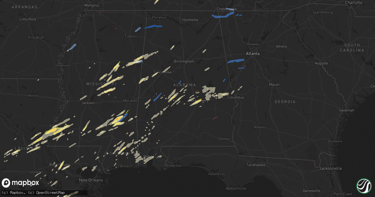
Hail Map in Alabama on January 3, 2023
Get this storm
January 3 map
$229
one time, instant access
Download today. No call, no setup
Keep the $229
Bought the map and want the full workflow? Apply the entire $229 to a subscription within 7 days. None of it is wasted.
Every map, not just this one
This buys you this map. Subscription and you get every map we run, in the markets you choose from a few cities to whole states to nationwide. Plus real-time alerts the moment a storm fires.
Contact data
Name, contact info, occupancy, even credit band for addresses in the footprint. You go from where it hit to who to call.
Become the source they trust
Unlimited branding weather history reports on demand. You already have the documented answer ready for the property owner, and you are the one who showed up with it.
Property data and RoofTrace estimates
Pull up any address you have got, its value and the exact code rules for that jurisdiction, straight from One Click Code. Then RoofTrace estimates the squares, pitch, and roof value, priced the way you price.
Storm reports in Alabama
Alabama
| Date | Description |
|---|---|
| 01/03/20233:44 PM CST | Tree down on power lines in rock mills. |
| 01/03/20233:31 PM CST | Corrects time for tstm wnd dmg report from 3 e red level. Several homes with damage along cr 235... Cr 236... Cr 237 in the clackville community. Possible tornado. |
| 01/03/20233:19 PM CST | Several homes with damage along cr 235... Cr 236... Cr 237 in the clackville community. Possible tornado. |
| 01/03/20233:19 PM CST | Adds to previous tstm wnd dmg report from 3 nnw ofelia. Power lines down and trees snapped/uprooted along cr 113 near clay/randolph county line. Possible tornado. |
| 01/03/20233:19 PM CST | Power lines down along cr 113 near clay/randolph county line. Possible tornado. |
| 01/03/20232:49 PM CST | Trees down along idaho rd near little heflin school. Possible tornado. |
| 01/03/20232:43 PM CST | A local report indicates 1.00 inch wind near 1 S GUNTER AFB |
| 01/03/20232:42 PM CST | Dime to quarter size hail reported in waka parking lot. |
| 01/03/20232:35 PM CST | Trees down in the 3400 block of clay county road 7. Possible tornado. |
| 01/03/20232:30 PM CST | Trees down along floral creek road. |
| 01/03/20232:28 PM CST | Damage to awning at clarke prep school on old highway 43 and downed trees nearby. |
| 01/03/20232:24 PM CST | Trees down across highway 84... Two miles west of the highway 84/highway 43 intersection. |
| 01/03/20232:10 PM CST | Tree across roadway at intersection of grier road and loboe road per seman fd. Possible tornado. |
| 01/03/20232:05 PM CST | Trees down at cemetery on fort williams drive. |
| 01/03/20232:00 PM CST | Tree down on odens mill road. |
| 01/03/20232:00 PM CST | Trees down and structural damage along lightwood road at jordan lake in the slapout community. Possible tornado. |
| 01/03/20231:56 PM CST | Multiple trees down and reports of home damaged. |
| 01/03/20231:56 PM CST | Damage to home and trees down on jordan lake rd. Possible tornado. |
| 01/03/20231:55 PM CST | Tree on a house in the 400 block of lightwood road. Multiple power lines down. Possible tornado. |
| 01/03/20231:46 PM CST | Multiple trees and powerlines down in the shoal creek area. Possible tornado. |
| 01/03/20231:45 PM CST | Multiple trees down on coosa co rd. 5 between marble valley and hidden valley. Trees also down in hidden valley. |
| 01/03/20231:40 PM CST | Tree and structural damage at lay lake near lay dam. Possible tornado. |
| 01/03/20231:30 PM CST | Social media report of several boat houses and trees damaged along smith lake at sheltered cove road and lone oak road. |
| 01/03/20231:15 PM CST | Trees down between joffre and old kingston. Trailer park damaged in old kingston. Possible tornado. |
| 01/03/202312:42 PM CST | A few pieces of tin blown off chicken house. |
| 01/03/202312:34 PM CST | Report of a few trees down on i-65 roughly 5 miles n of cullman. |
| 01/03/202312:30 PM CST | Tree down on power lines at the intersection of wilhite rd and coyote hollow pvt dr. |
| 01/03/202312:16 PM CST | Tree down |
| 01/03/202312:10 PM CST | Tin torn from roofs... Trees and power lines down. Possible tornado. |
| 01/03/202312:08 PM CST | Broken windows... Siding... And shutters as well as downed trees |
| 01/03/202312:08 PM CST | Numerous branches and a few trees down |
| 01/03/202312:04 PM CST | Barn down due to wind damage |
| 01/03/202311:50 AM CST | Tree down on powerlines. |
| 01/03/202311:40 AM CST | Trees and powerlines down. |
| 01/03/202311:30 AM CST | Cedars in the roadway. Possible tornado. |
| 01/03/202311:25 AM CST | Tree damage reported by gallion vfd. Possible tornado. |
| 01/03/202311:22 AM CST | Several reports of tree damage along cr 1 nw of al 43. |
| 01/03/202311:20 AM CST | Property damage: trailer destroyed and front door ripped from the house. Possible tornado. |
| 01/03/202311:11 AM CST | Power pole knocked down and multiple trees and limbs down. |
| 01/03/202311:04 AM CST | Multiple trees down. |
| 01/03/202310:50 AM CST | Wind damage to chicken houses and trees down... Causing roof damage. |
| 01/03/202310:45 AM CST | Trees and powerlines down on hwy 247. |
| 01/03/202310:45 AM CST | Trees down in southern |
| 01/03/202310:45 AM CST | Trees down in southern colbert co. Near jones rd and hwy 247. |
| 01/03/20235:59 AM CST | At 1159 PM CST, a severe thunderstorm was located 6 miles southwest of Lisman, or 10 miles west of Butler, moving northeast at 40 mph. HAZARD...60 mph wind gusts. SOURCE...Radar indicated. IMPACT...Expect damage to roofs, siding, and trees. Locations impacted include... Butler, Lisman and Pennington. |
| 01/03/20235:56 AM CST | At 1156 PM CST, severe thunderstorms were located along a line extending from 7 miles east of Waynesboro to Buckatunna to 12 miles southwest of State Line to 5 miles north of McLain, moving northeast at 50 mph. HAZARD...60 mph wind gusts. SOURCE...Radar indicated. IMPACT...Expect damage to roofs, siding, and trees. Locations impacted include... Chatom, Saint Stephens, Tibbie, Millry, State Line, Buckatunna, Silas, Fruitdale and Coffeeville. |
| 01/03/20235:50 AM CST | At 1150 PM CST, a severe thunderstorm was located near Potter Station, or 8 miles west of Selma, moving northeast at 45 mph. HAZARD...60 mph wind gusts and quarter size hail. SOURCE...Radar indicated. IMPACT...Hail damage to vehicles is expected. Expect wind damage to roofs, siding, and trees. Locations impacted include... Selma, Valley Grande, Marion Junction, Burnsville, Paul M Grist State Park, Potter Station, Valley Creek Junction, Plantersville, Suttle, Barrett Creek and Summerfield. |
| 01/03/20235:45 AM CST | Tree down at al 141 just north of county road 368. |
| 01/03/20235:27 AM CST | Tree down near county road 114. Also... Power outages reported in new brockton. |
| 01/03/20234:59 AM CST | Measured at asos station k79j at the andalusia opp airport. |
| 01/03/20234:58 AM CST | At 1057 AM CST, a severe thunderstorm was located 7 miles west of Littleville, or 8 miles southwest of Tuscumbia, moving east at 40 mph. HAZARD...60 mph wind gusts and quarter size hail. SOURCE...Radar indicated. IMPACT...Hail damage to vehicles is expected. Expect wind damage to roofs, siding, and trees. Locations impacted include... Muscle Shoals, Russellville, Sheffield, Tuscumbia, Town Creek, Littleville, Leighton, Posey Loop, Northwest Alabama Regional Airport and New Bethel. |
| 01/03/20234:57 AM CST | At 1057 PM CST, a severe thunderstorm was located over Macon, or 16 miles west of Pickensville, moving northeast at 70 mph. HAZARD...60 mph wind gusts and penny size hail. SOURCE...Radar indicated. IMPACT...Expect damage to roofs, siding, and trees. Locations impacted include... Columbus, Macon, Brooksville, Crawford, Prairie Point, Deerbrook and Bigbee Valley. |
| 01/03/20234:19 AM CST | At 1019 PM CST, a severe thunderstorm was located near Tibbee, or 8 miles south of West Point, moving northeast at 40 mph. HAZARD...60 mph wind gusts and quarter size hail. SOURCE...Radar indicated. IMPACT...Hail damage to vehicles is expected. Expect wind damage to roofs, siding, and trees. This severe thunderstorm will be near... Bent Oak around 1025 PM CST. Waverly around 1035 PM CST. Columbus AFB around 1040 PM CST. Kolola Springs around 1045 PM CST. Caledonia around 1055 PM CST.Other locations impacted by this severe thunderstorm include Artesia. |
| 01/03/20234:01 AM CST | Quarter sized hail reported at exit 50 along i-85. |
| 01/03/20233:42 AM CST | Tree down... Blocking portions of hwy 431 south in wedowee. |
| 01/03/20233:31 AM CST | Tree down along county road 43 near corinth. |
| 01/03/20233:29 AM CST | Tree down on highland ave in wadley. |
| 01/03/20233:26 AM CST | Tree down at the intersection of cr 12 and cr 24. |
| 01/03/20233:13 AM CST | Power lines down and trees on roadway on taylor road. Possible tornado. |
| 01/03/20233:13 AM CST | 3 vehicles damaged on halcyon blvd. Possible tornado. |
| 01/03/20233:13 AM CST | Damage to field at buddy watson park. Possible tornado. |
| 01/03/20233:13 AM CST | Tree on house on heritage oak court. Possible tornado. |
| 01/03/20233:13 AM CST | Trees down along bell road near eastwood glen. Possible tornado. |
| 01/03/20233:13 AM CST | Roof off home. Possible tornado. |
| 01/03/20233:13 AM CST | Damage to a transformer and debris near barnett road and prairie lane. Possible tornado. |
| 01/03/20233:11 AM CST | Trees down in green acres subdivision. |
| 01/03/20233:09 AM CST | Trees down blocking highway 49 at horseshoe bend national military park. |
| 01/03/20233:09 AM CST | Structural damage on ephesus rd near whaley ferry rd. |
| 01/03/20233:05 AM CST | Damage to a porch on rock springs rd near boone valley rd. |
| 01/03/20233:03 AM CST | Corrects time for previous tstm wnd dmg report from 2 s auburn univ montgomery. Tree on house on heritage oak court. Possible tornado. |
| 01/03/20233:03 AM CST | Corrects time for previous tstm wnd dmg report from 1 sse auburn univ montgomery. 3 vehicles damaged on halcyon blvd. Possible tornado. |
| 01/03/20233:03 AM CST | Corrects time for previous tstm wnd dmg report from 1 s auburn univ montgomery. Corrects previous tstm wnd dmg report from 1 s auburn univ montgomery. Roof off home nea |
| 01/03/20233:02 AM CST | Roof peeled off at the concrete plant on dadeville rd at us-280. Several power poles broken by a fallen treen. Tds observed on kmxx radar. |
| 01/03/20233:01 AM CST | Corrects time for previous tstm wnd dmg report from 2 sw auburn univ montgomery. Trees down along bell road near eastwood glen. Possible tornado. |
| 01/03/20233:01 AM CST | An awning was blown from a home on river ridge rd on lake martin. |
| 01/03/20232:56 AM CST | Corrects time for previous tstm wnd dmg report from 2 ese montgomery country club. Trees down in green acres subdivision. |
| 01/03/20232:51 AM CST | Power line down on central avenue in eclectic. |
| 01/03/20232:37 AM CST | Trees down on ceasarville rd... Fern rd... And crenshaw rd. |
| 01/03/20232:14 AM CST | At 813 PM CST, a severe thunderstorm was located 6 miles northwest of Waynesboro, moving east at 35 mph. HAZARD...60 mph wind gusts and quarter size hail. SOURCE...Radar indicated. IMPACT...Hail damage to vehicles is expected. Expect wind damage to roofs, siding, and trees. Locations impacted include... Silas, Gilbertown and Toxey. |
| 01/03/20231:35 AM CST | Emergency management reports trees down near the deer park community. Time estimated by radar. |
| 01/03/20231:29 AM CST | At 729 PM CST, a severe thunderstorm was located over Panola, or 14 miles southwest of Aliceville, moving northeast at 35 mph. HAZARD...Ping pong ball size hail and 60 mph wind gusts. SOURCE...Radar indicated. IMPACT...People and animals outdoors will be injured. Expect hail damage to roofs, siding, windows, and vehicles. Expect wind damage to roofs, siding, and trees. Locations impacted include... Aliceville, Gordo, Union, McMullen, Garden, New West Greene, Mantua, Panola, Jena, West Greene, Benevola, Johnston Lake, Geiger, Gainesville Lake Campground, Snoddy, Warsaw, Dillburg, George Downer Airport, Kirk and Pleasant Ridge. |
| 01/03/202312:56 AM CST | At 656 PM EST, a severe thunderstorm was located over Omaha, or 14 miles northwest of Lumpkin, moving northeast at 30 mph. HAZARD...60 mph wind gusts. SOURCE...Radar indicated. IMPACT...Expect damage to roofs, siding, and trees. Locations impacted include... Omaha, Jamestown/south Fort Benning, Louvale and Florence Marina State Park. |
| 01/03/202312:39 AM CST | Clarke county emergency management reports snapped trees and part of a roof peeled off a mobile home on center point road. |
| 01/03/202312:06 AM CST | Tree down on us hwy 11/old springville road. |
| 01/02/202311:31 PM CST | At 531 PM EST/431 PM CST/, a severe thunderstorm was located near Dothan, moving northeast at 40 mph. HAZARD...60 mph wind gusts and penny size hail. SOURCE...Radar indicated. IMPACT...Expect damage to roofs, siding, and trees. Locations impacted include... Abbeville, Fort Gaines, Headland, Dothan, Blakely, Kinsey, Cowarts, Edison, Arlington, Webb, Columbia, Newville, Bellville, Haleburg, Bluffton, Shorterville, Parksville, Hayes, Watson Crossroads and Pecan. |
| 01/02/202311:05 PM CST | At 504 PM CST, a severe thunderstorm was located over Spring Hill, or 13 miles east of Midway, moving northeast at 40 mph. HAZARD...60 mph wind gusts. SOURCE...Radar indicated. IMPACT...Expect damage to roofs, siding, and trees. Locations impacted include... Twin Springs. |
| 01/02/202311:02 PM CST | At 502 PM EST, a severe thunderstorm was located near Jamestown/south Fort Benning, or 7 miles southwest of Cusseta, moving northeast at 40 mph. HAZARD...60 mph wind gusts and penny size hail. SOURCE...Radar indicated. IMPACT...Expect damage to roofs, siding, and trees. Locations impacted include... Cusseta, Brantley, Christopher, Jamestown/south Fort Benning, Renfroe, Manta and Zellobee. |
| 01/02/202310:54 PM CST | At 453 PM CST, a severe thunderstorm was located near Pike Road, or 13 miles southeast of Montgomery, moving northeast at 55 mph. HAZARD...60 mph wind gusts and nickel size hail. SOURCE...Radar indicated. IMPACT...Expect damage to roofs, siding, and trees. Locations impacted include... Tuskegee, Shorter, Franklin, Liverpool, Lake Tuskegee, Hardaway, Tuskegee National Forest, Davisville, Society Hill, Waugh, Cross Keys, Cecil and Moton Field Municipal Airport. |
| 01/02/202310:28 PM CST | At 425 PM EST, severe thunderstorms were located along a line extending from near Liberty Hill to R.L. Harris Dam, moving east at 35 mph. HAZARD...60 mph wind gusts. SOURCE...Radar indicated. IMPACT...Expect damage to roofs, siding, and trees. Locations impacted include... Carrollton, Buchanan, Franklin, Villa Rica, Bremen, Temple, Tallapoosa, Bowdon, Mount Zion, Waco, Ephesus, Centralhatchee, Roopville, Corinth, Seaton Lake, Clem, Abilene, Draketown, John Tanner State Park and Glenn. |
| 01/02/202310:21 PM CST | At 420 PM EST, a severe thunderstorm was located over Jamestown/south Fort Benning, or near Cusseta, moving northeast at 30 mph. HAZARD...60 mph wind gusts and penny size hail. SOURCE...Radar indicated. IMPACT...Expect damage to roofs, siding, and trees. Locations impacted include... Cusseta, North Fort Benning, Jamestown/south Fort Benning, Christopher and Eelbeck/West Fort Benning. |
| 01/02/20239:54 PM CST | At 354 PM CST, a severe thunderstorm was located near Midway, moving northeast at 40 mph. HAZARD...60 mph wind gusts and penny size hail. SOURCE...Radar indicated. IMPACT...Expect damage to roofs, siding, and trees. Locations impacted include... Hurtsboro, Guerryton, Russell County Sports Complex, Seale, Rutherford, Three Notch and Hatchechubbe. |
| 01/02/20239:27 PM CST | At 327 PM CST, a severe thunderstorm was located over Society Hill, or 12 miles north of Hurtsboro, moving northeast at 45 mph. HAZARD...60 mph wind gusts and penny size hail. SOURCE...Radar indicated. IMPACT...Expect damage to roofs, siding, and trees. Locations impacted include... Phenix City, Smiths, Smiths Station, Ladonia, Uchee, Bleecker, Griffen Mill, Monterey Heights, Ladonia Sports Complex, Marvyn, Phenix Drag Strip and Parkmanville. |
| 01/02/20239:19 PM CST | At 319 PM CST, severe thunderstorms were located along a line extending from Piedmont to near Lake Wedowee, moving east at 35 mph. HAZARD...60 mph wind gusts. SOURCE...Radar indicated. IMPACT...Expect damage to roofs, siding, and trees. Locations impacted include... Heflin, Wedowee, Lake Wedowee, Ranburne, Fruithurst, Edwardsville, Woodland, Morrison Cross Roads, Corinth, Muscadine, Abernathy, Fosters Cross Roads, Mars Hills, Graham, Newell, R.L. Harris Dam, Coleman Lake And Campground, Tennant, Trickem and Lake Cleburne. |
| 01/02/20239:14 PM CST | At 313 PM CST, a severe thunderstorm was located near Camden, moving northeast at 40 mph. HAZARD...60 mph wind gusts and penny size hail. SOURCE...Radar indicated. IMPACT...Expect damage to roofs, siding, and trees. Locations impacted include... Camden, Vredenburgh and Yellow Bluff. |
| 01/02/20239:03 PM CST | At 303 PM CST, a severe thunderstorm was located 6 miles northeast of Beatrice, or 18 miles southeast of Camden, moving northeast at 45 mph. HAZARD...60 mph wind gusts and quarter size hail. SOURCE...Radar indicated. IMPACT...Hail damage to vehicles is expected. Expect wind damage to roofs, siding, and trees. Locations impacted include... Pine Apple. |
| 01/02/20238:53 PM CST | At 252 PM EST, severe thunderstorms were located along a line extending from near Ringgold to near Beaumont to near Linwood to near Mentone, moving southeast at 35 mph. HAZARD...60 mph wind gusts. SOURCE...Radar indicated. IMPACT...Expect damage to roofs, siding, and trees. Locations impacted include... Dalton, Lafayette, Chatsworth, Trion, Varnell, Eton, Tunnel Hill, Cohutta, Resaca, La Fayette, Center Post, Crandall, Sumac, Subligna, Gregory, Linwood, Beaverdale, Villanow, Naomi and Suttles Mill. |
| 01/02/20238:38 PM CST | At 238 PM CST, a severe thunderstorm was located near Dannelly Field, or 10 miles northeast of Hayneville, moving northeast at 45 mph. HAZARD...60 mph wind gusts and quarter size hail. SOURCE...Radar indicated. IMPACT...Hail damage to vehicles is expected. Expect wind damage to roofs, siding, and trees. Locations impacted include... Montgomery, Wetumpka, Tallassee, Eclectic, Montgomery Zoo, Boylston, Hyundai Motors Of Alabama, Auburn University In Montgomery, Bob Woodruff Lake, Woodcrest, Emerald Mountain, Maxwell Air Force Base, Lagoon Park, Hunter, Alabama State University, Hope Hull, Eastdale Mall, Montgomery Riverwalk Stadium, Blue Ridge and Gunter Air Force Base. |
| 01/02/20238:31 PM CST | At 231 PM CST, severe thunderstorms were located along a line extending from near Winterboro to Parkdale, moving northeast at 45 mph. HAZARD...60 mph wind gusts. SOURCE...Radar indicated. IMPACT...Expect damage to roofs, siding, and trees. Locations impacted include... Lineville, Ashland, Barfield, Cragford, Roselle, Millerville and Mellow Valley. |
| 01/02/20238:28 PM CST | At 227 PM CST, a severe thunderstorm was located over Grove Hill, moving east at 55 mph. HAZARD...60 mph wind gusts and penny size hail. SOURCE...Radar indicated. IMPACT...Expect damage to roofs, siding, and trees. Locations impacted include... Camden, Grove Hill, Vredenburgh and Fulton. |
| 01/02/20238:23 PM CST | At 223 PM EST, severe thunderstorms were located along a line extending from near Red Bank to near Ider, moving southeast at 40 mph. HAZARD...60 mph wind gusts. SOURCE...Radar indicated. IMPACT...Expect damage to roofs, siding, and trees. Locations impacted include... Ringgold, Trenton, Fort Oglethorpe, Rossville, Chickamauga, Varnell, Lookout Mountain, Cohutta, Chattanooga Valley, La Fayette, Blue Spring, Fairview, Chattanooga Valley, Hooker, Cloudland Canyon State Park, Cooper Heights, Rock Spring, Rising Fawn, Noble and Lakeview. |
| 01/02/20238:02 PM CST | At 201 PM CST, a severe thunderstorm was located over Oak Grove, or over Sylacauga, moving east at 30 mph. HAZARD...60 mph wind gusts. SOURCE...Radar indicated. IMPACT...Expect damage to roofs, siding, and trees. Locations impacted include... Sylacauga, Oak Grove, Sycamore, Sylacauga Municipal Airport, Gantts Quarry and Mignon. |
| 01/02/20237:06 PM CST | At 105 PM CST, a severe thunderstorm was located near Stevenson, or 7 miles south of Bridgeport, moving southeast at 30 mph. HAZARD...60 mph wind gusts. SOURCE...Radar indicated. IMPACT...Expect damage to roofs, siding, and trees. Locations impacted include... Bridgeport, Stevenson, Ider, Fabius, Higdon and Sulpher Springs. |
All States Impacted by Hail Map on January 3, 2023
Cities Impacted by Hail Map on January 3, 2023
- Jasper, AL
- Scooba, MS
- Emelle, AL
- Aliceville, AL
- Eutaw, AL
- Ralph, AL
- Knoxville, AL
- Buhl, AL
- Ethel, MS
- Kosciusko, MS
- Carthage, MS
- Bastrop, LA
- Fayette, AL
- Millbrook, AL
- Coosada, AL
- Billingsley, AL
- Plantersville, AL
- Heidelberg, MS
- Shubuta, MS
- Deatsville, AL
- Decatur, MS
- Conehatta, MS
- Hermanville, MS
- Notasulga, AL
- Tallassee, AL
- Tuskegee, AL
- Port Allen, LA
- Brusly, LA
- Soso, MS
- Stringer, MS
- Laurel, MS
- McIntosh, AL
- Tibbie, AL
- State Line, MS
- Richton, MS
- Theriot, LA
- Gibson, LA
- Moreauville, LA
- Monterey, LA
- Marksville, LA
- Perkinston, MS
- Brooklyn, MS
- Beaumont, MS
- Wiggins, MS
- Thomasville, AL
- Pine Hill, AL
- Arlington, AL
- Walnut Grove, MS
- Philadelphia, MS
- Lena, MS
- Waynesboro, MS
- Vidalia, LA
- Woodville, MS
- Natchez, MS
- Farmer City, IL
- Waynesboro, TN
- Lawrenceburg, TN
- Collinwood, TN
- Hohenwald, TN
- Citronelle, AL
- Convent, LA
- Saint James, LA
- Gloster, MS
- Liberty, MS
- Raceland, LA
- Houma, LA
- Bourg, LA
- Dry Creek, LA
- Sugartown, LA
- Little River, AL
- Poplarville, MS
- Carriere, MS
- Bunkie, LA
- Sturgis, MS
- Ackerman, MS
- Mathiston, MS
- Weir, MS
- Cottonport, LA
- Plaucheville, LA
- Evergreen, LA
- Auburn, AL
- Opelika, AL
- Wapella, IL
- Clinton, IL
- Bellflower, IL
- Mansfield, IL
- Saint Stephens, AL
- Millry, AL
- Baton Rouge, LA
- Shiloh, GA
- Hamilton, GA
- Acme, LA
- Hessmer, LA
- Mansura, LA
- Pike Road, AL
- Montgomery, AL
- Vossburg, MS
- Autaugaville, AL
- Prattville, AL
- Caledonia, MS
- Columbus, MS
- Steens, MS
- Slidell, LA
- Oakdale, LA
- Coffeeville, AL
- Boyce, LA
- Elmer, LA
- Sieper, LA
- Otis, LA
- Fayette, MS
- Grant, LA
- Deridder, LA
- Elizabeth, LA
- Pitkin, LA
- Lacombe, LA
- Lafayette, LA
- Collins, MS
- Prairieville, LA
- Denham Springs, LA
- Saint Gabriel, LA
- Addis, LA
- Plaquemine, LA
- Sunshine, LA
- Greenwell Springs, LA
- Weldon, IL
- Maroa, IL
- Dewitt, IL
- Lane, IL
- Gadsden, AL
- Ohatchee, AL
- Ashville, AL
- Bay Springs, MS
- Pennington, AL
- La Place, LA
- Ponchatoula, LA
- Sunflower, AL
- Wagarville, AL
- Jeanerette, LA
- Saint Landry, LA
- Ville Platte, LA
- Simmesport, LA
- Tuscaloosa, AL
- Brookwood, AL
- Cottondale, AL
- Noxapater, MS
- Louisville, MS
- Canton, MS
- Camden, MS
- Uniontown, AL
- Lucedale, MS
- Vinegar Bend, AL
- Leakesville, MS
- Maplesville, AL
- Taylorsville, MS
- Ellisville, MS
- Latham, IL
- Warrensburg, IL
- Cataula, GA
- Wetumpka, AL
- Butler, AL
- Safford, AL
- Morton, MS
- Smiths Station, AL
- Salem, AL
- Fortson, GA
- Gallion, AL
- Sardis, AL
- Jones, AL
- Selma, AL
- Orrville, AL
- Columbia, MS
- Sumrall, MS
- Bassfield, MS
- Mittie, LA
- Morgan City, LA
- Franklin, LA
- Marion Junction, AL
- Marion, AL
- Roxie, MS
- Meadville, MS
- Crosby, MS
- McHenry, MS
- Moselle, MS
- Cruger, MS
- Sidon, MS
- Melvin, AL
- Stapleton, AL
- Coila, MS
- Summit, MS
- Ruth, MS
- Deer Park, AL
- Jackson, AL
- Monticello, MS
- Jayess, MS
- Alexander City, AL
- Eclectic, AL
- Shorter, AL
- Camp Hill, AL
- Dadeville, AL
- Equality, AL
- Reeves, LA
- Rosedale, MS
- McCool, MS
- Tyler, AL
- Hayneville, AL
- Mobile, AL
- Theodore, AL
- Grand Bay, AL
- Moss Point, MS
- Jonesville, LA
- Deville, LA
- Effie, LA
- Center Point, LA
- Pineville, LA
- Pachuta, MS
- Forest, MS
- Bay Saint Louis, MS
- Paulding, MS
- Sallis, MS
- Flora, MS
- Jackson, MS
- Madison, MS
- Clinton, MS
- Bolton, MS
- Brookhaven, MS
- Sontag, MS
- Hazlehurst, MS
- Wesson, MS
- Bogue Chitto, MS
- Starkville, MS
- Ashland, AL
- Talladega, AL
- Lineville, AL
- Millport, AL
- Vernon, AL
- Sulligent, AL
- Artesia, MS
- Kennedy, AL
- West Point, MS
- Lowndesboro, AL
- Bay Minette, AL
- Robertsdale, AL
- Loxley, AL
- Long Beach, MS
- Albany, LA
- Holden, LA
- Hope Hull, AL
- Mount Olive, MS
- Lockport, LA
- Grove Hill, AL
- Chatom, AL
- Magnolia, MS
- Bogalusa, LA
- Bush, LA
- Ragley, LA
- Carson, MS
- Prentiss, MS
- Vancleave, MS
- Saucier, MS
- Greensburg, LA
- Osyka, MS
- Loreauville, LA
- Saint Martinville, LA
- New Iberia, LA
- Tickfaw, LA
- Independence, LA
- McLain, MS
- Grosse Tete, LA
- Loranger, LA
- Husser, LA
- Abbeville, LA
- Erath, LA
- Clanton, AL
- Jachin, AL
- Ward, AL
- York, AL
- Catherine, AL
- Wilmer, AL
- Leroy, AL
- McCall Creek, MS
- Smithdale, MS
- Youngsville, LA
- Broussard, LA
- Lorman, MS
- Union Church, MS
- Cheneyville, LA
- Pattison, MS
- Faunsdale, AL
- Pass Christian, MS
- Gulfport, MS
- New Augusta, MS
- Seminary, MS
- Stockton, AL
- Oak Vale, MS
- Lumberton, MS
- Daphne, AL
- Irvington, AL
- Olive Branch, MS
- Myrtle, MS
- Titus, AL
- Louisville, AL
- Banks, AL
- Mount Auburn, IL
- Blue Mound, IL
- Niantic, IL
- Decatur, IL
- Sharpsburg, GA
- Newnan, GA
- Gibson City, IL
- Foosland, IL
- Lithonia, GA
- Whitesburg, GA
- Bowdon, GA
- Winston, GA
- Carrollton, GA
- Palmetto, GA
- Douglasville, GA
- Fairburn, GA
- Moreland, GA
- Chattanooga, TN
- Ooltewah, TN
- Apison, TN
- Chickamauga, GA
- Ringgold, GA
- Rising Fawn, GA
- Rock Spring, GA
- Higdon, AL
- Flat Rock, AL
- Trenton, GA
- Tunnel Hill, GA
- Stevenson, AL
- Red Bay, AL
- Belmont, MS
- Golden, MS
- Russellville, AL
- Dalton, GA
- Chatsworth, GA
- Elgin, IL
- Great Lakes, IL
- Lake Bluff, IL
- North Chicago, IL
- Linden, AL
- Demopolis, AL
- Greensboro, AL
- Lawley, AL
- Centreville, AL
- Randolph, AL
- Lafayette, AL
- Five Points, AL
- Mound Bayou, MS
- Clarksdale, MS
- Shelby, MS
- Baldwyn, MS
- Fulton, MS
- New Site, MS
- Mantachie, MS
- Marietta, MS
- Ethelsville, AL
- Quitman, MS
- Maben, MS


