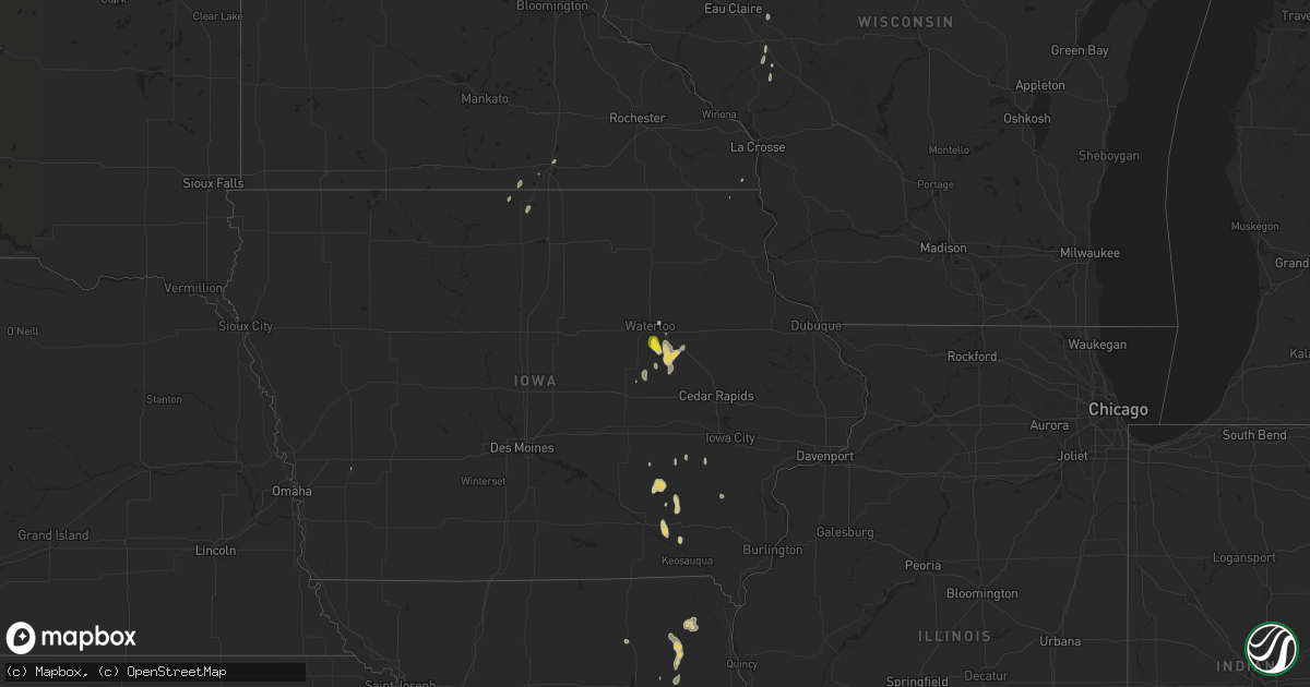
Hail Map on September 15, 2025
Get this storm
September 15 map
$229
one time, instant access
Download today. No call, no setup
Keep the $229
Bought the map and want the full workflow? Apply the entire $229 to a subscription within 7 days. None of it is wasted.
Every map, not just this one
This buys you this map. Subscription and you get every map we run, in the markets you choose from a few cities to whole states to nationwide. Plus real-time alerts the moment a storm fires.
Contact data
Name, contact info, occupancy, even credit band for addresses in the footprint. You go from where it hit to who to call.
Become the source they trust
Unlimited branding weather history reports on demand. You already have the documented answer ready for the property owner, and you are the one who showed up with it.
Property data and RoofTrace estimates
Pull up any address you have got, its value and the exact code rules for that jurisdiction, straight from One Click Code. Then RoofTrace estimates the squares, pitch, and roof value, priced the way you price.
States Impacted by Hail Map on September 15, 2025
Storm reports
Wyoming
| Date | Description |
|---|---|
| 09/15/20256:51 PM CDT | A local report indicates 71 MPH wind near 2 ENE Osage |
| 09/15/20256:09 PM CDT | A local report indicates 58 MPH wind near 7 NNE Rochelle |
| 09/15/20256:05 PM CDT | A local report indicates 60 MPH wind near 25 ESE Wright |
Mississippi
| Date | Description |
|---|---|
| 09/15/20256:37 PM CDT | Em reported trees and powerlines down in the byhalia area. Time is radar estimated. |
South Dakota
| Date | Description |
|---|---|
| 09/15/20255:26 PM CDT | A local report indicates 1.00 inch wind near 17 SW Usta |
| 09/14/20259:39 PM CDT | A local report indicates 65 MPH wind near 1 ENE Mud Butte |
| 09/14/20257:10 PM CDT | A local report indicates 59 MPH wind near 10 W Jewel Cave |
| 09/14/20257:08 PM CDT | A local report indicates 59 MPH wind near 10 W Jewel Cave |
| 09/14/20257:00 PM CDT | A local report indicates 59 MPH wind near 10 W Jewel Cave |
Missouri
| Date | Description |
|---|---|
| 09/15/20255:41 PM CDT | A local report indicates 1.00 inch wind near 4 S Gatewood |
| 09/15/20255:30 PM CDT | Quarter 1.00 in. |
| 09/15/20255:25 PM CDT | A local report indicates 1.00 inch wind near 3 ENE Republic |
| 09/15/20255:09 PM CDT | Tree down blocking the ro |
| 09/15/20255:09 PM CDT | Tree down blocking the roadway at old hwy 63 south & e bullard rd. Time estimated from radar. |
| 09/15/20255:06 PM CDT | Several large trees and large tree limbs down throughout the town of ashland per photos provided by em. Time estimated from radar. |
| 09/15/20255:06 PM CDT | Photos from em and school officials show that the uprights for the football goalpost on the southern end of the field at southern boone hs were snapped off. Time estima |
| 09/15/20255:06 PM CDT | Estimated 50-60 mph. |
| 09/15/20254:50 PM CDT | Dade county 911 reported a powerline down .25 miles west of s state highway 97 and route a. |
| 09/15/20254:40 PM CDT | Trees down just east of millersburg. Time estimated by radar. |
Arkansas
| Date | Description |
|---|---|
| 09/15/20255:50 PM CDT | Pictures of significant accumulating hail in bee branch on social media. |
| 09/15/20255:30 PM CDT | Trees blown down northwest of hot springs airport. |
| 09/15/20255:00 PM CDT | Damage to trees and a power pole shared by broadcast media on social media. |
Oklahoma
| Date | Description |
|---|---|
| 09/15/20254:20 PM CDT | Several limbs down. |
Iowa
| Date | Description |
|---|---|
| 09/15/20256:29 PM CDT | Spotter submitted picture of hail larger than a quarter north of irvine prairie. Delayed report... Time and location estimated with radar. |
North Dakota
| Date | Description |
|---|---|
| 09/14/20259:30 PM CDT | Heavy rain. |
Cities Impacted by Hail Map on September 15, 2025
- Osseo, WI
- Whitehall, WI
- Fall Creek, WI
- Cadott, WI
- Blair, WI
- Taylor, WI
- Augusta, WI
- Hixton, WI
- La Cygne, KS
- Pleasanton, KS
- Mountain Grove, MO
- Lebanon, MO
- Hartville, MO
- Dermott, AR
- Vanzant, MO
- De Witt, AR
- Salem, MO
- Raymondville, MO
- Licking, MO
- Hartshorn, MO
- Louisburg, MO
- Cross Timbers, MO
- Rolla, MO
- Dixon, MO
- Newburg, MO
- Buffalo, MO
- Canadian, TX
- Steedman, MO
- Fulton, MO
- Pinedale, WY
- Edgar Springs, MO
- Beulah, MO
- Eminence, MO
- Hammon, OK
- Hermitage, MO
- Kirksville, MO
- Vichy, MO
- Boulder, WY
- Belle, MO
- Vienna, MO
- Half Way, MO
- Summersville, MO
- Linn, MO
- Williamsburg, MO
- Hughesville, MO
- Houstonia, MO
- Lenox, MO
- Searcy, AR
- Stuttgart, AR
- Roe, AR
- Shelbyville, MO
- Washington, IA
- Crawfordsville, IA
- Des Arc, AR
- Casscoe, AR
- Marshall, MO
- Kalona, IA
- Wellman, IA
- Caledonia, MN
- Lentner, MO
- Clarence, MO
- Bland, MO
- Mexico, MO
- Tebbetts, MO
- Shelbina, MO
- Almyra, AR
- Loose Creek, MO
- Freeburg, MO
- Hunnewell, MO
- Crocketts Bluff, AR
- Saint James, MO
- Paris, MO
- Edina, MO
- Newark, MO
- Bethel, MO
- Mobeetie, TX
- Wheeler, TX
- Violet Hill, AR
- Thompson, MO
- West Fork, AR
- Bonnots Mill, MO
- Van Buren, MO
- Ellington, MO
- Oxford, AR
- Ellsinore, MO
- Santa Fe, MO
- Franklin, AR
- Bearden, AR
- Lincoln, AR
- Prairie Grove, AR
- Jefferson City, MO
- Columbia, MO
- Auxvasse, MO
- Kingdom City, MO
- Williamsville, MO
- Briscoe, TX
- Knox City, MO
- Centralia, MO
- De Valls Bluff, AR
- Parnell, IA
- North English, IA
- Patagonia, AZ
- New Bloomfield, MO
- Holts Summit, MO
- Madison, MO
- Monroe City, MO
- Batesville, AR
- Rutledge, MO
- La Belle, MO
- Doniphan, MO
- Alton, MO
- Fremont, MO
- Higden, AR
- Prim, AR
- Holly Springs, MS
- Wyaconda, MO
- Clark, MO
- Grandin, MO
- Shamrock, TX
- Senatobia, MS
- South Greenfield, MO
- Frenchmans Bayou, AR
- Bassett, AR
- Joiner, AR
- Sulphur Rock, AR
- Edgemont, AR
- Drasco, AR
- Miller, MO
- Ashland, MO
- Hartsburg, MO
- Manila, AR
- Turrell, AR
- Stotts City, MO
- Wentworth, MO
- Sarcoxie, MO
- Gilmore, AR
- Somerville, TN
- Casper, WY
- Chamois, MO
- Reeds Spring, MO
- Republic, MO
- Sheridan, AR
- Mud Butte, SD
- Moscow, TN
- Thompson, IA
- Birmingham, IA
- Fairfield Bay, AR
- Quitman, AR
- Faith, SD
- Lockwood, MO
- Scarville, IA
- Eureka Springs, AR
- Berryville, AR
- Bee Branch, AR
- Clinton, AR
- Prattsville, AR
- Ridgedale, MO
- Kiester, MN
- Emmons, MN
- Centertown, MO
- Gatewood, MO
- Shirley, AR
- Brookline, MO
- Wells, MN
- Batavia, IA
- Libertyville, IA
- Clarendon, TX
- Mclean, TX
- Bonnerdale, AR
- Royal, AR
- Huntington, AR
- Pierce City, MO
- Meadow, SD
- Jerico Springs, MO
- El Dorado Springs, MO
- Vinton, IA
- Garrison, IA
- Damascus, AR
- La Porte City, IA
- Mount Auburn, IA
- Eldon, IA
- Packwood, IA
- Jamestown, MO
- Sheldon, MO
- Richland, IA
- Ollie, IA
- Center Ridge, AR
- Oak Grove, AR
- Sigourney, IA
- Delta, IA
- Atkins, AR
- Greenbrier, AR
- Roswell, NM
- Choctaw, AR
- Couch, MO
- Red Banks, MS
- Brownsville, TN
- Byhalia, MS
- Hedrick, IA
- Hayesville, IA
- Waterloo, IA
- Morrilton, AR
- Wooster, AR
- Springfield, AR
- Gillette, WY
- Jesup, IA
- Albert Lea, MN
- South English, IA
- What Cheer, IA
- California, MO
- Brandon, IA
- Plumerville, AR
- Conway, AR
- Dewar, IA
- Keswick, IA
- Buffalo, SD
- Ripley, TN
- Perry, AR
- Houston, AR
- Sundance, WY
- Dysart, IA
- Clutier, IA
- Beulah, WY
- Bison, SD
- Mason, TN
- Sturgis, SD
- Scranton, ND
- Sardis, MS
- Batesville, MS
- Piedmont, SD
- Oakland, TN
- Traer, IA
- Reeder, ND
- Lake Mills, IA
- Forest City, IA
- Oxford, MS
- Water Valley, MS
- Box Elder, SD
- Avoca, IA
- Hettinger, ND
- Bruce, MS
- Coffeeville, MS
- Mott, ND
- Newell, SD
- Paola, KS
- Wellsville, KS
- Prairie City, SD
- Edgerton, KS
- Gardner, KS
- Eudora, KS
- Keldron, SD
- Morristown, SD
- Watauga, SD
- McIntosh, SD
- Selfridge, ND
- Linton, ND
- Winner, SD
- Alliance, NE
- Mission, SD
- Colome, SD
- Burke, SD
- Gregory, SD
- Dallas, SD