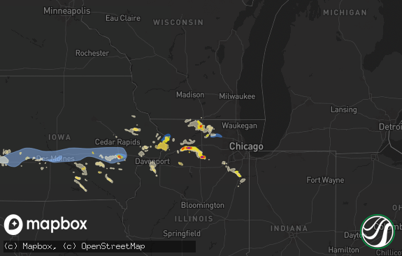
Hail Map in New Hampshire on May 16, 2022
The weather event in New Hampshire on May 16, 2022 includes Hail, Wind, and Tornado maps. 21 states and 512 cities were impacted and suffered possible damage. The total estimated number of properties impacted is 129.

Hail
Wind
Tornado
129
Estimated number of impacted properties by a 1.00" hail or larger0
Estimated number of impacted properties by a 1.75" hail or larger0
Estimated number of impacted properties by a 2.50" hail or largerStorm reports in New Hampshire
New Hampshire
| Date | Description |
|---|---|
| 05/16/20226:36 PM CDT | Large tree down partially blocking scenic view rd in holderness... Nh. Time estimated by radar. |
| 05/16/20226:33 PM CDT | Delayed report. Trees and wires down in loudon. Time estimated based on radar. |
| 05/16/20226:16 PM CDT | Hail fell for 5 minutes. Damage to branches and a metal shed. Time estimated by radar. |
| 05/16/20226:14 PM CDT | Several trees down in new boston... Nh. Time estimated by radar. |
| 05/16/20226:00 PM CDT | Tree down across main street about a half mile east of downtown henniker. Time estimated by radar. |
| 05/16/20226:00 PM CDT | Trees down on hwy 47 in francestown. Time estimated by radar. |
| 05/16/20225:56 PM CDT | Tree down on wires. |
| 05/16/20225:52 PM CDT | Trees and wires down. Old mountain rd. Time estimated via radar. |
| 05/16/20225:45 PM CDT | Tree down on elm ave in antrim... Nh. Time estimated by radar. |
| 05/16/20225:45 PM CDT | Trees and wires down. Elm ave. Time estimated via radar. |
| 05/16/20225:45 PM CDT | Trees down in north claremont. |
| 05/16/20225:39 PM CDT | Several trees down around town in claremont. |
| 05/16/20225:33 PM CDT | Trees and wires down. Hardy hill rd. Time estimated via radar. |
| 05/16/20225:29 PM CDT | Trees and wires down. Nh-rt 10. Time estimated via radar. |
| 05/16/20225:27 PM CDT | Trees and wires down. Jaffrey rd. Time estimated via radar. |
| 05/16/20225:25 PM CDT | Trees and wires down. Roxbury rd. Time estimated via radar. |
| 05/16/20225:24 PM CDT | Emergency management received multiple reports of trees down across charlestown. |
| 05/16/20225:23 PM CDT | Several large branches and small trees down in hinsdale. Time estimated by radar. |
| 05/16/20225:22 PM CDT | Trees and wires down. Sandy pond rd. Time estimated via radar. |
| 05/16/20225:22 PM CDT | Trees and wires down. Colonial village drive. Time estimated via radar. |
| 05/16/20225:22 PM CDT | Likely tornado via dashcam video. Survey will confirm. |
| 05/16/20225:22 PM CDT | Nws storm survey concluded a ef-1 tornado... With max wind speed of 90 mph... Touched down between charlestown and claremont... Nh monday afternoon. Damage included aro |
| 05/16/20225:20 PM CDT | Pictures on social media of multiple trees down on rt 12 in north charlestown... Nh. Time estimated by radar. |
| 05/16/20225:20 PM CDT | Trees and wires down. Sawyers crossing rd. Time estimated via radar. |
| 05/16/20225:20 PM CDT | Trees and wires down. Time estimated via radar. |
| 05/16/20225:15 PM CDT | Large branches down on california and winchester st in w swanzey with pea size hail. Time estimated by radar. |
| 05/16/20225:13 PM CDT | Trees and wires down. Comerford rd. Time estimated via radar. |
| 05/16/20225:13 PM CDT | Trees and wires down along old keene rd. Time estimated via radar. |
| 05/16/20225:04 PM CDT | Trees down on wires/transformer off streeter hill rd. |
| 05/16/20223:00 PM CDT | A few trees and numerous branches down east of orford on town shed rd. |
| 05/16/20222:58 PM CDT | Trees and wires down on river rd in lyme. Time estimated by radar. |
| 05/16/20222:58 PM CDT | Trees and wires down on nh rt 10. Time estimated by radar. |
| 05/16/20222:49 PM CDT | Hail fell for 3 to 4 minutes. Gusty winds blew down branches as well. |
| 05/16/20222:49 PM CDT | Hail reported to have broken a house window. |
| 05/16/20221:36 AM CDT | At 636 PM EDT, a severe thunderstorm was located over Claremont, moving northeast at 30 mph. HAZARD...60 mph wind gusts and penny size hail. SOURCE...Radar indicated. IMPACT...Expect damage to roofs, siding, and trees. Locations impacted include... Claremont, Lebanon, New London, Grafton, Hanover, Charlestown, Enfield, Canaan, Danbury, Newport, Grantham, Andover, Cornish, Croydon, Dorchester, Plainfield, Wilmot, Orange, Sunapee and Springfield.This includes Interstate 89 between mile markers 30 and 60. |
| 05/16/202212:43 AM CDT | At 543 PM EDT, severe thunderstorms were located along a line extending from 22 miles west of Westmoreland to 14 miles west of Hinsdale to 41 miles southwest of Winchester, moving east at 35 mph. HAZARD...60 mph wind gusts and nickel size hail. SOURCE...Radar indicated. IMPACT...Expect damage to roofs, siding, and trees. Locations impacted include... Keene, Claremont, Jaffrey, Henniker, Peterborough, Hopkinton, New Boston, Charlestown, Winchester, Antrim, Mont Vernon, Greenfield, Lyndeborough, Bradford, Dublin, Francestown, Bennington, Richmond, Harrisville and Nelson.This includes Interstate 89 between mile markers 18 and 30. |
| 05/16/202212:10 AM CDT | At 510 PM EDT, severe thunderstorms were located along a line extending from near Whitehall to North Adams, moving northeast at 45 mph. HAZARD...60 mph wind gusts. SOURCE...Radar indicated. IMPACT...Expect damage to roofs, siding, and trees. Locations impacted include... Bennington, North Adams, Brattleboro, Bellows Falls, Whitehall, Arlington, Londonderry, Townshend, Salem, Manchester, Stratton, Monroe, Shaftsbury, Putney, Granville, Hartford, Vernon, Dorset, Wilmington and Stamford. |
| 05/15/202210:48 PM CDT | At 348 PM EDT, a severe thunderstorm was located near Pompanoosuc, moving north at 30 mph. HAZARD...60 mph wind gusts and quarter size hail. SOURCE...Radar indicated. IMPACT...Minor hail damage to vehicles is possible. Expect wind damage to trees and powerlines. Locations impacted include... West Fairlee, Bradford, Topsham Four Corners, Wells River Village, Ryegate, Newbury, Topsham, Newbury Village, Groton Village, Groton, Fairlee, Corinth, Thetford, Wells River, West Fairlee Center, Newbury Center, South Ryegate, Boltonville, Ely and South Newbury. |
All States Impacted by Hail Map on May 16, 2022
Cities Impacted by Hail Map on May 16, 2022
- Littleton, MA
- Westford, MA
- Goltry, OK
- Millsboro, DE
- Lewes, DE
- Harbeson, DE
- Seneca, NE
- Orlando, OK
- Preston, ID
- Franklin, ID
- Amorita, OK
- Cherokee, OK
- Anthony, KS
- Waldron, KS
- Burlington, OK
- New Church, VA
- Pocomoke City, MD
- Horntown, VA
- Little Falls, NY
- Dolgeville, NY
- Middleville, NY
- Herkimer, NY
- Mohawk, NY
- Siler City, NC
- Bear Creek, NC
- Dagsboro, DE
- Lorenzo, TX
- Idalou, TX
- Lubbock, TX
- Fairview, OK
- Virginia Beach, VA
- Ratliff City, OK
- Graham, OK
- Fairfax, OK
- Ralston, OK
- Pawnee, OK
- Trappe, MD
- Nichols, SC
- Amarillo, TX
- Campobello, SC
- Ocean City, MD
- Berlin, MD
- Vermontville, NY
- Laurel, DE
- Tahoka, TX
- Wilson, TX
- Red Creek, NY
- Wolcott, NY
- Sterling, NY
- Townsend, MT
- Onancock, VA
- Bloxom, VA
- Parksley, VA
- Newsoms, VA
- Franklin, VA
- Courtland, VA
- Alva, OK
- Hurley, NY
- Germantown, NY
- West Hurley, NY
- Catskill, NY
- Woodstock, NY
- West Camp, NY
- Kingston, NY
- Saugerties, NY
- Tivoli, NY
- Red Hook, NY
- Barrytown, NY
- Saint Regis Falls, NY
- Binghamton, NY
- Vestal, NY
- Port Crane, NY
- Brackney, PA
- Friendsville, PA
- Bernville, PA
- Myerstown, PA
- Richland, PA
- Womelsdorf, PA
- Marion Station, MD
- Crisfield, MD
- Hannacroix, NY
- West Coxsackie, NY
- Ravena, NY
- Bozeman, MT
- Locust Grove, OK
- Bishopville, MD
- Salisbury, MD
- Pittsville, MD
- Parsonsburg, MD
- Whaleyville, MD
- Showell, MD
- Snow Hill, MD
- Willards, MD
- Hammond, NY
- Marshall, OK
- Temple, OK
- Grantham, NH
- Bearsville, NY
- Morton, TX
- Churubusco, NY
- Ellenburg Center, NY
- Ellenburg Depot, NY
- Sperry, OK
- Skiatook, OK
- Smyer, TX
- Wolfforth, TX
- Anton, TX
- Ropesville, TX
- Levelland, TX
- Shallowater, TX
- Chesnee, SC
- Fairlee, VT
- Orford, NH
- Lyme, NH
- Slaton, TX
- Post, TX
- Heuvelton, NY
- Petersburg, TX
- Floydada, TX
- Coxsackie, NY
- Climax, NY
- Earlton, NY
- Hancock, NY
- Starlight, PA
- Long Eddy, NY
- Fishs Eddy, NY
- East Branch, NY
- Lakewood, PA
- Pleasant Mount, PA
- Lake Como, PA
- Equinunk, PA
- Clayton, NM
- Chelmsford, MA
- Goldsboro, NC
- Pawhuska, OK
- Columbia, NC
- Manns Harbor, NC
- Philipsburg, PA
- Morrisdale, PA
- Osceola Mills, PA
- Houtzdale, PA
- Kylertown, PA
- Bigler, PA
- West Decatur, PA
- Wallaceton, PA
- Woodland, PA
- Allport, PA
- Ames, OK
- Grenville, NM
- Helena, OK
- Carmen, OK
- Manchester, OK
- Salina, OK
- Bradford, VT
- Roswell, NM
- Milnesand, NM
- Causey, NM
- Rogers, NM
- Pep, NM
- Elida, NM
- Hazelton, KS
- Wake Forest, NC
- Creedmoor, NC
- Andrews Air Force Base, MD
- Upper Marlboro, MD
- Bethel, DE
- Chesapeake Beach, MD
- Fort Belvoir, VA
- Fairfax Station, VA
- Bryans Road, MD
- Tracys Landing, MD
- Secretary, MD
- Delmar, DE
- Georgetown, DE
- Clifton, VA
- Friendship, MD
- Vienna, MD
- North Beach, MD
- Woodbridge, VA
- Huntingtown, MD
- Owings, MD
- Mardela Springs, MD
- Oxon Hill, MD
- Lorton, VA
- Clinton, MD
- Rhodesdale, MD
- Burke, VA
- Dunkirk, MD
- Aquasco, MD
- Springfield, VA
- East New Market, MD
- Millville, DE
- Alexandria, VA
- Seaford, DE
- Frankford, DE
- Brandywine, MD
- Linkwood, MD
- Cambridge, MD
- Waldorf, MD
- Sunderland, MD
- Manassas, VA
- Prince Frederick, MD
- Sharptown, MD
- Cheltenham, MD
- Ocean View, DE
- Hurlock, MD
- Fort Washington, MD
- Accokeek, MD
- Temple Hills, MD
- Boykins, VA
- Kinston, NC
- Deep Run, NC
- Bath, NC
- Washington, NC
- Wilmot, NH
- Andover, NH
- Warner, NH
- Johnson City, NY
- Endicott, NY
- Crosbyton, TX
- Greenville, NC
- Grimesland, NC
- Mosquero, NM
- Moriarty, NM
- Elizaville, NY
- Tupper Lake, NY
- Walton, NY
- Franklin, NY
- Sidney Center, NY
- Durham, NC
- Raleigh, NC
- Geuda Springs, KS
- Comanche, OK
- Santa Fe, NM
- Whitney Point, NY
- Masterson, TX
- Panhandle, TX
- Valentine, NE
- Westfield, PA
- Jasper, NY
- Addison, NY
- Knoxville, PA
- Woodhull, NY
- Troupsburg, NY
- Cameron Mills, NY
- Timber Lake, SD
- Hebron, MD
- Fairmont, OK
- Douglas, OK
- Chatham, NY
- Hillsdale, NY
- Craryville, NY
- Hudson, NY
- Spencertown, NY
- Ghent, NY
- New Bern, NC
- Vanceboro, NC
- Cove City, NC
- Dover, NC
- Chocowinity, NC
- Grifton, NC
- Ernul, NC
- Wells, NY
- Indian Lake, NY
- Conchas Dam, NM
- Crowell, TX
- Hanover, NH
- Etna, NH
- Topsham, VT
- Newbury, VT
- East Corinth, VT
- Enfield, NH
- Childress, TX
- Matador, TX
- Aurora, NC
- Edward, NC
- Wallops Island, VA
- Temperanceville, VA
- Ulster Park, NY
- Quantico, MD
- Raton, NM
- Thedford, NE
- Sedan, KS
- Delmar, MD
- Tilghman, MD
- Woolford, MD
- Bristow, VA
- Washington, DC
- Oxford, MD
- Bethany Beach, DE
- Lyon Mountain, NY
- Owls Head, NY
- Chateaugay, NY
- Kunkletown, PA
- Brodheadsville, PA
- Stroudsburg, PA
- East Stroudsburg, PA
- Bartonsville, PA
- Kresgeville, PA
- Effort, PA
- Tannersville, PA
- Gilbert, PA
- Saylorsburg, PA
- Scotrun, PA
- Henryville, PA
- Duke, OK
- Frederick, OK
- Ringwood, OK
- Cleo Springs, OK
- Stokes, NC
- Robersonville, NC
- Nanticoke, MD
- Princess Anne, MD
- Columbus, NC
- Tryon, NC
- Inman, SC
- Rutherfordton, NC
- Tell, TX
- Vaughn, NM
- Natchez, MS
- Walters, OK
- Dalhart, TX
- Jackson, LA
- Saint Francisville, LA
- Brownfield, TX
- Meadow, TX
- Moreauville, LA
- Lettsworth, LA
- Crosby, MS
- Gloster, MS
- Centreville, MS
- Roxie, MS
- Pinetown, NC
- Ralls, TX
- Loris, SC
- Chadbourn, NC
- Whiteville, NC
- Green Sea, SC
- Nakina, NC
- Clarendon, NC
- Tabor City, NC
- Paducah, TX
- Justiceburg, TX
- Snyder, TX
- Meadville, MS
- San Jon, NM
- Las Vegas, NM
- Stratford, TX
- Bard, NM
- Santa Rosa, NM
- Tylertown, MS
- Marland, OK
- Red Rock, OK
- Randlett, OK
- Ribera, NM
- Albertson, NC
- Mount Olive, NC
- Hartley, TX
- Gallatin Gateway, MT
- Waynoka, OK
- Aline, OK
- Sand Springs, OK
- Enid, OK
- Waukomis, OK
- Duncan, OK
- Lima, MT
- Worden, MT
- Austerlitz, NY
- Ransom Canyon, TX
- Plattsburgh, NY
- Chazy, NY
- West Chazy, NY
- Champlain, NY
- Mooers, NY
- Altona, NY
- Canaan, NY
- Nicholville, NY
- Pantego, NC
- Belhaven, NC
- Plymouth, NC
- Scranton, NC
- Montour Falls, NY
- Odessa, NY
- Watkins Glen, NY
- Campbell, NY
- Beaver Dams, NY
- Painted Post, NY
- Moravia, NY
- Auburn, NY
- Owego, NY
- Syracuse, NY
- Pennellville, NY
- Baldwinsville, NY
- Central Square, NY
- Williamstown, NY
- Clay, NY
- West Monroe, NY
- Constantia, NY
- Warners, NY
- Brewerton, NY
- Liverpool, NY
- Redfield, NY
- Camden, NY
- Jamaica, VT
- Petersburg, NY
- East Schodack, NY
- Averill Park, NY
- West Sand Lake, NY
- Cropseyville, NY
- Berlin, NY
- Stamford, VT
- West Dover, VT
- Wilmington, VT
- Nassau, NY
- East Dover, VT
- Pownal, VT
- Shaftsbury, VT
- Castleton On Hudson, NY
- Sand Lake, NY
- East Greenbush, NY
- Wardsboro, VT
- North Pownal, VT
- West Townshend, VT
- Hoosick Falls, NY
- North Bennington, VT
- Bennington, VT
- Williamstown, MA
- Townshend, VT
- Greenwich, NY
- Schuylerville, NY
- Salem, NY
- Argyle, NY
- Cossayuna, NY
- Granville, NY
- North Granville, NY
- Comstock, NY
- Whitehall, NY
- Fort Ann, NY
- Hastings, PA
- Lanse, PA
- Karthaus, PA
- Patton, PA
- Moshannon, PA
- Madera, PA
- Marsteller, PA
- Munson, PA
- Winburne, PA
- Cherry Tree, PA
- Nicktown, PA
- Drifting, PA
- Westover, PA
- Hawk Run, PA
- Flinton, PA
- Spangler, PA
- Grassflat, PA
- Saint Boniface, PA
- Glen Hope, PA
- Brisbin, PA
- Frenchville, PA
- New Millport, PA
- Irvona, PA
- Saint Benedict, PA
- Carrolltown, PA
- Coalport, PA
- Northern Cambria, PA
- La Jose, PA
- Starrucca, PA
- Roscoe, NY
- Deposit, NY
- Susquehanna, PA
- South Gibson, PA
- New Milford, PA
- Herrick Center, PA
- Hamden, NY
- Thompson, PA
- Delhi, NY
- Kingsley, PA
- Andes, NY
- Union Dale, PA
- Preston Park, PA
- Downsville, NY
- Delancey, NY
- Suffolk, VA
- Smithfield, VA
- Windsor, VA
- White Plains, MD
- Occoquan, VA
- La Plata, MD
- Indian Head, MD
- Royal Oak, MD
- Madison, MD
- Tipton, OK
- Altus, OK
- Elmer, OK
- Chillicothe, TX
- Gould, OK
- Spur, TX
- Altus Afb, OK
- Afton, TX
- Vernon, TX
- Davidson, OK
- Cee Vee, TX
- Hollis, OK
- Odell, TX
- Eldorado, OK
- Dickens, TX
- Quanah, TX
- Roaring Springs, TX
- Mcadoo, TX
- Headrick, OK
- Olustee, OK
- Pottstown, PA


