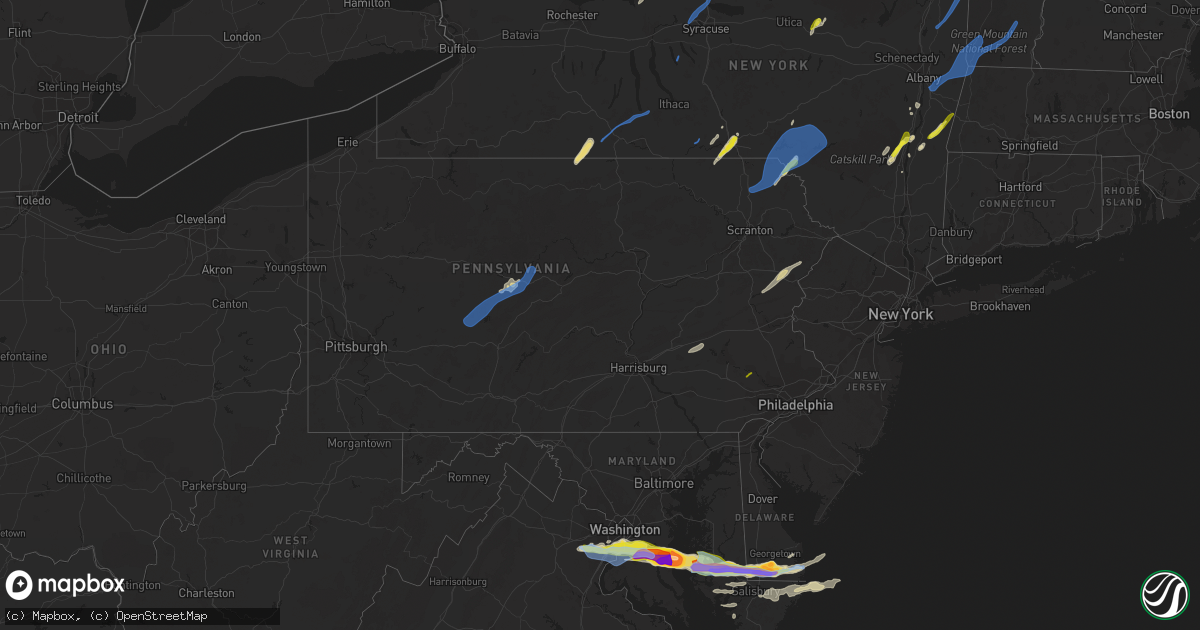
Hail Map in Pennsylvania on May 16, 2022
Get this storm
May 16 map
$229
one time, instant access
Download today. No call, no setup
Keep the $229
Bought the map and want the full workflow? Apply the entire $229 to a subscription within 7 days. None of it is wasted.
Every map, not just this one
This buys you this map. Subscription and you get every map we run, in the markets you choose from a few cities to whole states to nationwide. Plus real-time alerts the moment a storm fires.
Contact data
Name, contact info, occupancy, even credit band for addresses in the footprint. You go from where it hit to who to call.
Become the source they trust
Unlimited branding weather history reports on demand. You already have the documented answer ready for the property owner, and you are the one who showed up with it.
Property data and RoofTrace estimates
Pull up any address you have got, its value and the exact code rules for that jurisdiction, straight from One Click Code. Then RoofTrace estimates the squares, pitch, and roof value, priced the way you price.
Storm reports in Pennsylvania
Pennsylvania
| Date | Description |
|---|---|
| 05/16/20226:55 PM CDT | Numerous trees and power lines down throughout the county. |
| 05/16/20224:35 PM CDT | Hail up to quarter size. |
| 05/16/20221:40 PM CDT | Some trees down blocking post hill road between hillside dr and rt. 715. Time estimated from radar. |
| 05/16/20221:18 PM CDT | Dispatch feed reports tree down blocking road. Main street... Thompson. |
| 05/16/20221:08 PM CDT | Dispatch reports power pole and lines down on truck with 2 people entrapped. Radar-estimated time. |
| 05/16/20221:07 PM CDT | Dispatch reports tree down blocking all of turnpike street... About 2 1/2 miles south of susquehanna. Radar-estimated time. |
| 05/16/20221:04 PM CDT | Dispatch feed reports tree down on wires with arcing and sparking... On frankie lane... Scott township. |
| 05/16/202212:55 PM CDT | Some large tree limbs down in the hamburg area. Time estimated from radar. |
| 05/16/202212:50 PM CDT | Large maple tree snapped in half. |
| 05/16/202212:40 PM CDT | Tree and wires down. |
| 05/16/202211:15 AM CDT | Tree down on a house at center st and lycoming st. |
| 05/16/20229:35 AM CDT | Penndot rwis. |
| 05/16/20229:25 AM CDT | Tree down on a house with wires down on six mile run road. |
| 05/16/20229:20 AM CDT | Multiple trees down in philipsburg. |
| 05/16/20229:17 AM CDT | Trees and wires down on shoemaker lane. |
| 05/16/20229:06 AM CDT | Trees down on main st in madera. |
| 05/16/20228:56 AM CDT | Tree and wires down on glen hope blvd. |
| 05/16/20228:43 AM CDT | Trees and wires down in chest and elder twps. |
| 05/16/20228:35 AM CDT | Tree down on 1000 block rockville rd. |
| 05/16/20227:19 AM CDT | At 1218 PM EDT, a severe thunderstorm was located over Clarks Green, or over Waverly, moving northeast at 25 mph. HAZARD...60 mph wind gusts and quarter size hail. SOURCE...Radar indicated. IMPACT...Hail damage to vehicles is expected. Expect wind damage to roofs, siding, and trees. Locations impacted include... Scranton, Carbondale, Archbald, Blakely, Dickson City, Clarks Summit, Jackson, Clifford, Forest City and Clarks Green. |
| 05/16/20226:01 AM CDT | At 1100 AM EDT, a severe thunderstorm was located near Troupsburg, or 21 miles northwest of Wellsboro, moving northeast at 30 mph. HAZARD...60 mph wind gusts and quarter size hail. SOURCE...Radar indicated. IMPACT...Hail damage to vehicles is expected. Expect wind damage to roofs, siding, and trees. Locations impacted include... Bath, Campbell, Addison, Woodhull, Jasper, Thurston, Troupsburg, Cameron, Savona and Hammondsport. |
| 05/16/20225:55 AM CDT | At 1054 AM EDT, a severe thunderstorm was located over Keating, moving northeast at 40 mph. HAZARD...60 mph wind gusts and penny size hail. SOURCE...Radar indicated. IMPACT...Expect damage to roofs, siding, and trees. Locations impacted include... Keating, Renovo, South Renovo, Monument, Westport, Glen Union, Tamarack, Kettle Creek State Park, Hyner and Orviston. |
| 05/16/20225:19 AM CDT | At 1018 AM EDT, a severe thunderstorm was located over Chester Hill, moving northeast at 40 mph. HAZARD...60 mph wind gusts and penny size hail. SOURCE...Radar indicated. IMPACT...Expect damage to roofs, siding, and trees. Locations impacted include... Philipsburg, Woodland, Osceola Mills, Chester Hill, Karthaus, Snow Shoe, North Philipsburg, Clarence, South Philipsburg, Sandy Ridge, Moshannon and Pine Glen.For those driving on Interstate 80, this includes areas between theClearfield and Milesburg exits, specifically from mile markers 120 to153. |
| 05/16/20224:55 AM CDT | At 955 AM EDT, a severe thunderstorm was located near Prince Gallitzin State Park, moving northeast at 45 mph. HAZARD...60 mph wind gusts and penny size hail. SOURCE...Radar indicated. IMPACT...Expect damage to roofs, siding, and trees. Locations impacted include... Clearfield, Philipsburg, Woodland, Curwensville, Hyde, Osceola Mills, Plymptonville, Chester Hill, Houtzdale, Jeffries, Lecontes Mills and Morrisdale.For those driving on Interstate 80, this includes areas between thePenfield and Snow Shoe exits, specifically from mile markers 113 to138. |
| 05/16/20224:16 AM CDT | At 916 AM EDT, severe thunderstorms were located along a line extending from Belsano to Vinco to Southmont, moving northeast at 40 mph. HAZARD...60 mph wind gusts and penny size hail. SOURCE...Radar indicated. IMPACT...Expect damage to roofs, siding, and trees. Locations impacted include... Johnstown, Westmont, Ebensburg, Nanty-Glo, Northern Cambria, Patton, Cresson, Gallitzin, Vinco, Loretto, Hastings and East Conemaugh. |
| 05/16/20224:06 AM CDT | At 906 AM EDT, a severe thunderstorm was located 7 miles southeast of Black Lick, or 8 miles northwest of Westmont, moving east at 55 mph. HAZARD...60 mph wind gusts and quarter size hail. SOURCE...Radar indicated. IMPACT...Minor hail damage to vehicles is possible. Expect wind damage to trees and power lines, resulting in some power outages. Locations impacted include... New Florence, Seward, Bolivar, Vintondale, and Armagh. |
| 05/16/202212:17 AM CDT | At 517 PM EDT, a severe thunderstorm was located near New Morgan, or 8 miles south of Reading, moving east at 50 mph. HAZARD...60 mph wind gusts and quarter size hail. SOURCE...Radar indicated. IMPACT...Minor damage to vehicles is possible. Wind damage to roofs, siding, trees, and power lines is possible. Locations impacted include... Reading, Pottstown, Phoenixville, Lansdale, East Norriton, Wyomissing, Souderton, Birdsboro, Collegeville, Royersford, Sinking Spring, Trappe, Hatfield, East Greenville, Honey Brook, Schwenksville, Elverson, Bally, Bechtelsville and Green Lane.This includes the following highways... Pennsylvania Turnpike between mile markers 296 and 305. Northeast Extension between mile markers 25 and 38. Interstate 176 in Pennsylvania between mile markers 1 and 11. |
| 05/15/202210:31 PM CDT | At 330 PM EDT, a severe thunderstorm was located over Oakland, or 9 miles north of Port Jervis, moving northeast at 65 mph. HAZARD...60 mph wind gusts and penny size hail. SOURCE...Radar indicated. IMPACT...Expect damage to trees and power lines. This severe thunderstorm will be near... Howells around 335 PM EDT. |
| 05/15/20229:42 PM CDT | At 242 PM EDT, a severe thunderstorm was located over Henryville, or near Mount Pocono, moving northeast at 40 mph. HAZARD...60 mph wind gusts and quarter size hail. SOURCE...Radar indicated. IMPACT...Hail damage to vehicles is expected. Expect wind damage to roofs, siding, and trees. Locations impacted include... Fallsburg, Bushkill, Monticello, Lackawaxen, Blooming Grove, Honesdale, Paupack, South Fallsburg, Shohola and Matamoras. |
| 05/15/20229:28 PM CDT | At 228 PM EDT, a severe thunderstorm was located near Myerstown, moving northeast at 35 mph. HAZARD...60 mph wind gusts and quarter size hail. SOURCE...Radar indicated. IMPACT...Minor damage to vehicles is possible. Wind damage to roofs, siding, trees, and power lines is possible. Locations impacted include... Kutztown, Hamburg, Fleetwood, Laureldale, Womelsdorf, Topton, Robesonia, Leesport, Shoemakersville, Bernville, Lyons, Strausstown, Lenhartsville, Fairview Hgts and Centerport.This includes Interstate 78 in Pennsylvania between mile markers 10and 44. |
| 05/15/20228:47 PM CDT | At 147 PM EDT, severe thunderstorms were located along a line extending from Hop Bottom to near Factoryville to near Edwardsville, moving northeast at 40 mph. HAZARD...60 mph wind gusts and penny size hail. SOURCE...Radar indicated. IMPACT...Expect damage to roofs, siding, and trees. Locations impacted include... Scranton, Wilkes-Barre, Falls, Dunmore, Kingston, Plains, Carbondale, Old Forge, Pittston and Archbald. |
| 05/15/20228:42 PM CDT | At 141 PM EDT, a severe thunderstorm was located near Bernville, or 8 miles northeast of Myerstown, moving northeast at 25 mph. HAZARD...60 mph wind gusts and quarter size hail. SOURCE...Radar indicated. IMPACT...Minor damage to vehicles is possible. Wind damage to roofs, siding, trees, and power lines is possible. Locations impacted include... Kutztown, Hamburg, Womelsdorf, Topton, Leesport, Shoemakersville, Bernville, Strausstown, Lenhartsville, Fairview Hgts and Centerport.This includes Interstate 78 in Pennsylvania between mile markers 16and 44. |
| 05/15/20228:24 PM CDT | At 124 PM EDT, a severe thunderstorm was located near Brackney, or near Binghamton, moving northeast at 30 mph. HAZARD...60 mph wind gusts and quarter size hail. SOURCE...Radar indicated. IMPACT...Hail damage to vehicles is expected. Expect wind damage to roofs, siding, and trees. Locations impacted include... Binghamton, Vestal, Johnson City, Endicott, Kirkwood, Conklin, Coventry, Port Dickinson, Greene and Windsor. |
All States Impacted by Hail Map on May 16, 2022
Cities Impacted by Hail Map on May 16, 2022
- Littleton, MA
- Westford, MA
- Goltry, OK
- Millsboro, DE
- Lewes, DE
- Harbeson, DE
- Seneca, NE
- Orlando, OK
- Preston, ID
- Franklin, ID
- Amorita, OK
- Cherokee, OK
- Anthony, KS
- Waldron, KS
- Burlington, OK
- New Church, VA
- Pocomoke City, MD
- Horntown, VA
- Little Falls, NY
- Dolgeville, NY
- Middleville, NY
- Herkimer, NY
- Mohawk, NY
- Siler City, NC
- Bear Creek, NC
- Dagsboro, DE
- Lorenzo, TX
- Idalou, TX
- Lubbock, TX
- Fairview, OK
- Virginia Beach, VA
- Ratliff City, OK
- Graham, OK
- Fairfax, OK
- Ralston, OK
- Pawnee, OK
- Trappe, MD
- Nichols, SC
- Amarillo, TX
- Campobello, SC
- Ocean City, MD
- Berlin, MD
- Vermontville, NY
- Laurel, DE
- Tahoka, TX
- Wilson, TX
- Red Creek, NY
- Wolcott, NY
- Sterling, NY
- Townsend, MT
- Onancock, VA
- Bloxom, VA
- Parksley, VA
- Newsoms, VA
- Franklin, VA
- Courtland, VA
- Alva, OK
- Hurley, NY
- Germantown, NY
- West Hurley, NY
- Catskill, NY
- Woodstock, NY
- West Camp, NY
- Kingston, NY
- Saugerties, NY
- Tivoli, NY
- Red Hook, NY
- Barrytown, NY
- Saint Regis Falls, NY
- Binghamton, NY
- Vestal, NY
- Port Crane, NY
- Brackney, PA
- Friendsville, PA
- Bernville, PA
- Myerstown, PA
- Richland, PA
- Womelsdorf, PA
- Marion Station, MD
- Crisfield, MD
- Hannacroix, NY
- West Coxsackie, NY
- Ravena, NY
- Bozeman, MT
- Locust Grove, OK
- Bishopville, MD
- Salisbury, MD
- Pittsville, MD
- Parsonsburg, MD
- Whaleyville, MD
- Showell, MD
- Snow Hill, MD
- Willards, MD
- Hammond, NY
- Marshall, OK
- Temple, OK
- Grantham, NH
- Bearsville, NY
- Morton, TX
- Churubusco, NY
- Ellenburg Center, NY
- Ellenburg Depot, NY
- Sperry, OK
- Skiatook, OK
- Smyer, TX
- Wolfforth, TX
- Anton, TX
- Ropesville, TX
- Levelland, TX
- Shallowater, TX
- Chesnee, SC
- Fairlee, VT
- Orford, NH
- Lyme, NH
- Slaton, TX
- Post, TX
- Heuvelton, NY
- Petersburg, TX
- Floydada, TX
- Coxsackie, NY
- Climax, NY
- Earlton, NY
- Hancock, NY
- Starlight, PA
- Long Eddy, NY
- Fishs Eddy, NY
- East Branch, NY
- Lakewood, PA
- Pleasant Mount, PA
- Lake Como, PA
- Equinunk, PA
- Clayton, NM
- Chelmsford, MA
- Goldsboro, NC
- Pawhuska, OK
- Columbia, NC
- Manns Harbor, NC
- Philipsburg, PA
- Morrisdale, PA
- Osceola Mills, PA
- Houtzdale, PA
- Kylertown, PA
- Bigler, PA
- West Decatur, PA
- Wallaceton, PA
- Woodland, PA
- Allport, PA
- Ames, OK
- Grenville, NM
- Helena, OK
- Carmen, OK
- Manchester, OK
- Salina, OK
- Bradford, VT
- Roswell, NM
- Milnesand, NM
- Causey, NM
- Rogers, NM
- Pep, NM
- Elida, NM
- Hazelton, KS
- Wake Forest, NC
- Creedmoor, NC
- Andrews Air Force Base, MD
- Upper Marlboro, MD
- Bethel, DE
- Chesapeake Beach, MD
- Fort Belvoir, VA
- Fairfax Station, VA
- Bryans Road, MD
- Tracys Landing, MD
- Secretary, MD
- Delmar, DE
- Georgetown, DE
- Clifton, VA
- Friendship, MD
- Vienna, MD
- North Beach, MD
- Woodbridge, VA
- Huntingtown, MD
- Owings, MD
- Mardela Springs, MD
- Oxon Hill, MD
- Lorton, VA
- Clinton, MD
- Rhodesdale, MD
- Burke, VA
- Dunkirk, MD
- Aquasco, MD
- Springfield, VA
- East New Market, MD
- Millville, DE
- Alexandria, VA
- Seaford, DE
- Frankford, DE
- Brandywine, MD
- Linkwood, MD
- Cambridge, MD
- Waldorf, MD
- Sunderland, MD
- Manassas, VA
- Prince Frederick, MD
- Sharptown, MD
- Cheltenham, MD
- Ocean View, DE
- Hurlock, MD
- Fort Washington, MD
- Accokeek, MD
- Temple Hills, MD
- Boykins, VA
- Kinston, NC
- Deep Run, NC
- Bath, NC
- Washington, NC
- Wilmot, NH
- Andover, NH
- Warner, NH
- Johnson City, NY
- Endicott, NY
- Crosbyton, TX
- Greenville, NC
- Grimesland, NC
- Mosquero, NM
- Moriarty, NM
- Elizaville, NY
- Tupper Lake, NY
- Walton, NY
- Franklin, NY
- Sidney Center, NY
- Durham, NC
- Raleigh, NC
- Geuda Springs, KS
- Comanche, OK
- Santa Fe, NM
- Whitney Point, NY
- Masterson, TX
- Panhandle, TX
- Valentine, NE
- Westfield, PA
- Jasper, NY
- Addison, NY
- Knoxville, PA
- Woodhull, NY
- Troupsburg, NY
- Cameron Mills, NY
- Timber Lake, SD
- Hebron, MD
- Fairmont, OK
- Douglas, OK
- Chatham, NY
- Hillsdale, NY
- Craryville, NY
- Hudson, NY
- Spencertown, NY
- Ghent, NY
- New Bern, NC
- Vanceboro, NC
- Cove City, NC
- Dover, NC
- Chocowinity, NC
- Grifton, NC
- Ernul, NC
- Wells, NY
- Indian Lake, NY
- Conchas Dam, NM
- Crowell, TX
- Hanover, NH
- Etna, NH
- Topsham, VT
- Newbury, VT
- East Corinth, VT
- Enfield, NH
- Childress, TX
- Matador, TX
- Aurora, NC
- Edward, NC
- Wallops Island, VA
- Temperanceville, VA
- Ulster Park, NY
- Quantico, MD
- Raton, NM
- Thedford, NE
- Sedan, KS
- Delmar, MD
- Tilghman, MD
- Woolford, MD
- Bristow, VA
- Washington, DC
- Oxford, MD
- Bethany Beach, DE
- Lyon Mountain, NY
- Owls Head, NY
- Chateaugay, NY
- Kunkletown, PA
- Brodheadsville, PA
- Stroudsburg, PA
- East Stroudsburg, PA
- Bartonsville, PA
- Kresgeville, PA
- Effort, PA
- Tannersville, PA
- Gilbert, PA
- Saylorsburg, PA
- Scotrun, PA
- Henryville, PA
- Duke, OK
- Frederick, OK
- Ringwood, OK
- Cleo Springs, OK
- Stokes, NC
- Robersonville, NC
- Nanticoke, MD
- Princess Anne, MD
- Columbus, NC
- Tryon, NC
- Inman, SC
- Rutherfordton, NC
- Tell, TX
- Vaughn, NM
- Natchez, MS
- Walters, OK
- Dalhart, TX
- Jackson, LA
- Saint Francisville, LA
- Brownfield, TX
- Meadow, TX
- Moreauville, LA
- Lettsworth, LA
- Crosby, MS
- Gloster, MS
- Centreville, MS
- Roxie, MS
- Pinetown, NC
- Ralls, TX
- Loris, SC
- Chadbourn, NC
- Whiteville, NC
- Green Sea, SC
- Nakina, NC
- Clarendon, NC
- Tabor City, NC
- Paducah, TX
- Justiceburg, TX
- Snyder, TX
- Meadville, MS
- San Jon, NM
- Las Vegas, NM
- Stratford, TX
- Bard, NM
- Santa Rosa, NM
- Tylertown, MS
- Marland, OK
- Red Rock, OK
- Randlett, OK
- Ribera, NM
- Albertson, NC
- Mount Olive, NC
- Hartley, TX
- Gallatin Gateway, MT
- Waynoka, OK
- Aline, OK
- Sand Springs, OK
- Enid, OK
- Waukomis, OK
- Duncan, OK
- Lima, MT
- Worden, MT
- Austerlitz, NY
- Ransom Canyon, TX
- Plattsburgh, NY
- Chazy, NY
- West Chazy, NY
- Champlain, NY
- Mooers, NY
- Altona, NY
- Canaan, NY
- Nicholville, NY
- Pantego, NC
- Belhaven, NC
- Plymouth, NC
- Scranton, NC
- Montour Falls, NY
- Odessa, NY
- Watkins Glen, NY
- Campbell, NY
- Beaver Dams, NY
- Painted Post, NY
- Moravia, NY
- Auburn, NY
- Owego, NY
- Syracuse, NY
- Pennellville, NY
- Baldwinsville, NY
- Central Square, NY
- Williamstown, NY
- Clay, NY
- West Monroe, NY
- Constantia, NY
- Warners, NY
- Brewerton, NY
- Liverpool, NY
- Redfield, NY
- Camden, NY
- Jamaica, VT
- Petersburg, NY
- East Schodack, NY
- Averill Park, NY
- West Sand Lake, NY
- Cropseyville, NY
- Berlin, NY
- Stamford, VT
- West Dover, VT
- Wilmington, VT
- Nassau, NY
- East Dover, VT
- Pownal, VT
- Shaftsbury, VT
- Castleton On Hudson, NY
- Sand Lake, NY
- East Greenbush, NY
- Wardsboro, VT
- North Pownal, VT
- West Townshend, VT
- Hoosick Falls, NY
- North Bennington, VT
- Bennington, VT
- Williamstown, MA
- Townshend, VT
- Greenwich, NY
- Schuylerville, NY
- Salem, NY
- Argyle, NY
- Cossayuna, NY
- Granville, NY
- North Granville, NY
- Comstock, NY
- Whitehall, NY
- Fort Ann, NY
- Hastings, PA
- Lanse, PA
- Karthaus, PA
- Patton, PA
- Moshannon, PA
- Madera, PA
- Marsteller, PA
- Munson, PA
- Winburne, PA
- Cherry Tree, PA
- Nicktown, PA
- Drifting, PA
- Westover, PA
- Hawk Run, PA
- Flinton, PA
- Spangler, PA
- Grassflat, PA
- Saint Boniface, PA
- Glen Hope, PA
- Brisbin, PA
- Frenchville, PA
- New Millport, PA
- Irvona, PA
- Saint Benedict, PA
- Carrolltown, PA
- Coalport, PA
- Northern Cambria, PA
- La Jose, PA
- Starrucca, PA
- Roscoe, NY
- Deposit, NY
- Susquehanna, PA
- South Gibson, PA
- New Milford, PA
- Herrick Center, PA
- Hamden, NY
- Thompson, PA
- Delhi, NY
- Kingsley, PA
- Andes, NY
- Union Dale, PA
- Preston Park, PA
- Downsville, NY
- Delancey, NY
- Suffolk, VA
- Smithfield, VA
- Windsor, VA
- White Plains, MD
- Occoquan, VA
- La Plata, MD
- Indian Head, MD
- Royal Oak, MD
- Madison, MD
- Tipton, OK
- Altus, OK
- Elmer, OK
- Chillicothe, TX
- Gould, OK
- Spur, TX
- Altus Afb, OK
- Afton, TX
- Vernon, TX
- Davidson, OK
- Cee Vee, TX
- Hollis, OK
- Odell, TX
- Eldorado, OK
- Dickens, TX
- Quanah, TX
- Roaring Springs, TX
- Mcadoo, TX
- Headrick, OK
- Olustee, OK
- Pottstown, PA


