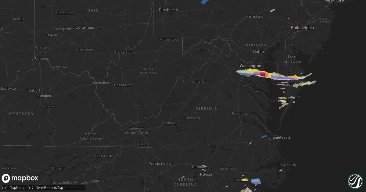
Hail Map in Virginia on May 16, 2022
Get this storm
May 16 map
$229
one time, instant access
Download today. No call, no setup
Keep the $229
Bought the map and want the full workflow? Apply the entire $229 to a subscription within 7 days. None of it is wasted.
Every map, not just this one
This buys you this map. Subscription and you get every map we run, in the markets you choose from a few cities to whole states to nationwide. Plus real-time alerts the moment a storm fires.
Contact data
Name, contact info, occupancy, even credit band for addresses in the footprint. You go from where it hit to who to call.
Become the source they trust
Unlimited branding weather history reports on demand. You already have the documented answer ready for the property owner, and you are the one who showed up with it.
Property data and RoofTrace estimates
Pull up any address you have got, its value and the exact code rules for that jurisdiction, straight from One Click Code. Then RoofTrace estimates the squares, pitch, and roof value, priced the way you price.
Storm reports in Virginia
Virginia
| Date | Description |
|---|---|
| 05/16/20223:48 PM CDT | A local report indicates 1.00 inch wind near 1 WNW THE WOODROW WILSO |
| 05/16/20223:36 PM CDT | Tree down on house on the 8000 block of richmond ave |
| 05/16/20223:35 PM CDT | Multiple trees down on the sb george washington parkway near morningside lane. |
| 05/16/20223:35 PM CDT | Powerline down near the intersection of paul spring parkway and yorktown drive |
| 05/16/20223:35 PM CDT | A local report indicates 1.00 inch wind near 2 SSE ROSE HILL |
| 05/16/20223:35 PM CDT | Report of 8-10 large trees uprooted near intersection of springwoods dr and old bridge rd. |
| 05/16/20223:33 PM CDT | Powerline down on the 4000 block of robertson blvd |
| 05/16/20223:32 PM CDT | Tree down on house on the 3000 block of battersea lane |
| 05/16/20223:31 PM CDT | A local report indicates 1.00 inch wind near FRANCONIA |
| 05/16/20223:30 PM CDT | Tree and power line downed at cypress pond lane. |
| 05/16/20223:23 PM CDT | A tree blew down on sullenberger court near va-600 silverbrook road. |
| 05/16/20223:22 PM CDT | Numerous trees down on houses in the lake ridge area |
| 05/16/20223:17 PM CDT | Tree down on house on the 12000 block of mulberry court |
| 05/16/20223:17 PM CDT | Large tree reported down in the lake ridge area. Time determined by radar. |
| 05/16/20223:17 PM CDT | Tree down on house on the 2000 block of pembroke court |
| 05/16/20223:10 PM CDT | Tree down on house on the 7000 block of slagle lane |
| 05/16/20222:43 PM CDT | Report of trees and powerlines down on the corner of rogues rd and dumfries rd |
| 05/16/20222:43 PM CDT | Report of tree down on corner of harts mill rd and springs rd |
| 05/16/20222:43 PM CDT | Report of tree down on the 10...000 block of lees mill rd |
| 05/16/20221:50 PM CDT | Corrects previous tstm wnd dmg report from 5 wsw ridgeway. Multiple trees down off horsepasture price road. Time estimated by radar. |
| 05/16/20221:48 PM CDT | Multiple trees down off horsepasture price road. Time estimated by radar. |
| 05/16/20221:36 PM CDT | Trees down including one on a shed. |
| 05/16/20221:20 PM CDT | Powerlines knocked down resulting in multiple power outages in the area. Time estimated from radar. |
| 05/16/20221:13 PM CDT | Large tree down on house near the intersection of east indian river rd. And wilson rd.. |
| 05/16/20221:07 PM CDT | Mesonet station xodu lafayette river. |
| 05/16/20221:00 PM CDT | Wires down in multiple locations near mercury blvd in hampton. Time estimated from radar. |
| 05/16/202212:58 PM CDT | Mesonet station xpoq poquoson. |
| 05/16/202212:45 PM CDT | Mesonet station va103 james river bridge@isle of wight county. |
| 05/16/202212:35 PM CDT | Trees down between longview and wills corner. |
| 05/16/202212:02 PM CDT | Trees down near intersection of bethel rd and sedley rd. |
| 05/16/20227:56 AM CDT | At 1256 PM EDT, a severe thunderstorm was located over Newsoms, or near Courtland, moving northeast at 30 mph. HAZARD...60 mph wind gusts and quarter size hail. SOURCE...Radar indicated. IMPACT...Minor damage to vehicles is possible. Expect wind damage to trees and powerlines. This severe thunderstorm will be near... Courtland around 105 PM EDT. Franklin and Hunterdale around 110 PM EDT. Sedley around 115 PM EDT. Carrsville around 125 PM EDT. Zuni around 135 PM EDT. Windsor around 140 PM EDT.Other locations impacted by this severe thunderstorm includeCollosse, Lees Mill, Handsom, Walters, Boaz, Burdette and Story. |
| 05/16/20222:35 AM CDT | At 735 PM EDT, a severe thunderstorm was located over Lawsonia, or 15 miles west of Pocomoke City, moving east at 40 mph. HAZARD...60 mph wind gusts and quarter size hail. SOURCE...Radar indicated. IMPACT...Minor damage to vehicles is possible. Expect wind damage to trees and powerlines. This severe thunderstorm will be near... Marion Station around 745 PM EDT. Pocomoke City and West Pocomoke around 800 PM EDT.Other locations impacted by this severe thunderstorm includeHorntown, Boxiron, Byrdtown, Goodwill, Hopewell, Greenbackville,Rehobeth, Kingston, Saxis and Shelltown. |
| 05/15/202211:23 PM CDT | At 423 PM EDT, a severe thunderstorm was located over Chesterfield Court House, or near Chester, moving east at 35 mph. HAZARD...60 mph wind gusts and quarter size hail. SOURCE...Radar indicated. IMPACT...Minor damage to vehicles is possible. Expect wind damage to trees and powerlines. This severe thunderstorm will be near... Chester and Bellwood around 430 PM EDT. Colonial Heights, Virginia State University and Ettrick around 435 PM EDT. Petersburg and Fort Lee around 440 PM EDT. Hopewell around 445 PM EDT.Other locations impacted by this severe thunderstorm includePocahontas State Park, Beach, Meadowville, Birchett Estate, DrewrysBluff, Petersburg National Battlefield, Centralia, Chesterfield andNew Bohemia. |
| 05/15/202210:49 PM CDT | At 349 PM EDT, a severe thunderstorm was located near Warrenton, moving east at 35 mph. HAZARD...60 mph wind gusts and quarter size hail. SOURCE...Radar indicated. IMPACT...Damaging winds will cause some trees and large branches to fall. This could injure those outdoors, as well as damage homes and vehicles. Roadways may become blocked by downed trees. Localized power outages are possible. Unsecured light objects may become projectiles. Locations impacted include... Centreville, Dale City, Fairfax, Warrenton, Lake Ridge, Linton Hall, Oakton, Chantilly, Montclair, Bull Run, Haymarket, Manassas, Sudley, Manassas Park, Fairfax Station, Gainesville, New Baltimore, Independent Hill, Nokesville and Opal. |
| 05/15/20229:54 PM CDT | At 253 PM EDT, a severe thunderstorm was located near Princess Anne, or near Kempsville, moving east at 35 mph. HAZARD...60 mph wind gusts and quarter size hail. SOURCE...Radar indicated. IMPACT...Minor damage to vehicles is possible. Expect wind damage to trees and powerlines. This severe thunderstorm will remain over mainly rural areas of the northern City of Virginia Beach, including the following locations... Bayside, Oceana, Rudee Heights, Princess Anne Plaza, North Virginia Beach, Dam Neck, Oceana NAS, Gallups Corner, Macons Corner and London Bridge. |
| 05/15/20229:15 PM CDT | At 214 PM EDT, a severe thunderstorm was located near Deep Creek, moving northeast at 30 mph. HAZARD...60 mph wind gusts and quarter size hail. SOURCE...Radar indicated. IMPACT...Minor damage to vehicles is possible. Expect wind damage to trees and powerlines. This severe thunderstorm will be near... Deep Creek and Chesapeake around 220 PM EDT. Great Bridge around 230 PM EDT. Fentress around 235 PM EDT. Princess Anne around 250 PM EDT. Virginia Beach around 300 PM EDT.Other locations impacted by this severe thunderstorm include RudeeHeights, Portlock, Mount Pleasant, Sigma, Sandbridge Beach, HerbertsCorner, Oceana NAS, Macons Corner, Pungo and Greenbrier. |
| 05/15/20229:02 PM CDT | At 202 PM EDT, a severe thunderstorm was located over Cradock, or over Downtown Portsmouth, moving east at 40 mph. HAZARD...60 mph wind gusts and quarter size hail. SOURCE...Radar indicated. IMPACT...Minor damage to vehicles is possible. Expect wind damage to trees and powerlines. This severe thunderstorm will be near... Downtown Portsmouth and Old Dominion University around 205 PM EDT. Norfolk State University, Downtown Norfolk and Ghent around 210 PM EDT. Virginia Wesleyan University, Kempsville, Regent University, Norfolk International and Norview around 215 PM EDT. Norfolk around 220 PM EDT. Virginia Beach around 235 PM EDT.Other locations impacted by this severe thunderstorm include SouthNorfolk, Rudee Heights, Portlock, Princess Anne Plaza, Oceana NAS,Macons Corner, Greenbrier, Bayside, Oceana and Wards Corner. |
| 05/15/20228:32 PM CDT | At 132 PM EDT, a severe thunderstorm was located near Isle Of Wight, or 7 miles northeast of Windsor, moving northeast at 40 mph. HAZARD...60 mph wind gusts and quarter size hail. SOURCE...Radar indicated. IMPACT...Minor damage to vehicles is possible. Expect wind damage to trees and powerlines. This severe thunderstorm will be near... Smithfield around 135 PM EDT. Driver around 140 PM EDT. Crittenden and Rescue around 145 PM EDT. Churchland around 150 PM EDT. Northampton and Beaconsdale around 155 PM EDT. Old Dominion University, Portsmouth and Norfolk NAS around 200 PM EDT. Hampton University, Ocean View, Langley AFB, Fort Monroe and Buckroe Beach around 205 PM EDT. Norfolk and Grand View around 210 PM EDT.Other locations impacted by this severe thunderstorm include FoxHill, Carrollton, Phoebus, Langley View, Longview, Benns Church,Huntersville, Wills Corner, Bethel Church and Hilton Village. |
All States Impacted by Hail Map on May 16, 2022
Cities Impacted by Hail Map on May 16, 2022
- Littleton, MA
- Westford, MA
- Goltry, OK
- Millsboro, DE
- Lewes, DE
- Harbeson, DE
- Seneca, NE
- Orlando, OK
- Preston, ID
- Franklin, ID
- Amorita, OK
- Cherokee, OK
- Anthony, KS
- Waldron, KS
- Burlington, OK
- New Church, VA
- Pocomoke City, MD
- Horntown, VA
- Little Falls, NY
- Dolgeville, NY
- Middleville, NY
- Herkimer, NY
- Mohawk, NY
- Siler City, NC
- Bear Creek, NC
- Dagsboro, DE
- Lorenzo, TX
- Idalou, TX
- Lubbock, TX
- Fairview, OK
- Virginia Beach, VA
- Ratliff City, OK
- Graham, OK
- Fairfax, OK
- Ralston, OK
- Pawnee, OK
- Trappe, MD
- Nichols, SC
- Amarillo, TX
- Campobello, SC
- Ocean City, MD
- Berlin, MD
- Vermontville, NY
- Laurel, DE
- Tahoka, TX
- Wilson, TX
- Red Creek, NY
- Wolcott, NY
- Sterling, NY
- Townsend, MT
- Onancock, VA
- Bloxom, VA
- Parksley, VA
- Newsoms, VA
- Franklin, VA
- Courtland, VA
- Alva, OK
- Hurley, NY
- Germantown, NY
- West Hurley, NY
- Catskill, NY
- Woodstock, NY
- West Camp, NY
- Kingston, NY
- Saugerties, NY
- Tivoli, NY
- Red Hook, NY
- Barrytown, NY
- Saint Regis Falls, NY
- Binghamton, NY
- Vestal, NY
- Port Crane, NY
- Brackney, PA
- Friendsville, PA
- Bernville, PA
- Myerstown, PA
- Richland, PA
- Womelsdorf, PA
- Marion Station, MD
- Crisfield, MD
- Hannacroix, NY
- West Coxsackie, NY
- Ravena, NY
- Bozeman, MT
- Locust Grove, OK
- Bishopville, MD
- Salisbury, MD
- Pittsville, MD
- Parsonsburg, MD
- Whaleyville, MD
- Showell, MD
- Snow Hill, MD
- Willards, MD
- Hammond, NY
- Marshall, OK
- Temple, OK
- Grantham, NH
- Bearsville, NY
- Morton, TX
- Churubusco, NY
- Ellenburg Center, NY
- Ellenburg Depot, NY
- Sperry, OK
- Skiatook, OK
- Smyer, TX
- Wolfforth, TX
- Anton, TX
- Ropesville, TX
- Levelland, TX
- Shallowater, TX
- Chesnee, SC
- Fairlee, VT
- Orford, NH
- Lyme, NH
- Slaton, TX
- Post, TX
- Heuvelton, NY
- Petersburg, TX
- Floydada, TX
- Coxsackie, NY
- Climax, NY
- Earlton, NY
- Hancock, NY
- Starlight, PA
- Long Eddy, NY
- Fishs Eddy, NY
- East Branch, NY
- Lakewood, PA
- Pleasant Mount, PA
- Lake Como, PA
- Equinunk, PA
- Clayton, NM
- Chelmsford, MA
- Goldsboro, NC
- Pawhuska, OK
- Columbia, NC
- Manns Harbor, NC
- Philipsburg, PA
- Morrisdale, PA
- Osceola Mills, PA
- Houtzdale, PA
- Kylertown, PA
- Bigler, PA
- West Decatur, PA
- Wallaceton, PA
- Woodland, PA
- Allport, PA
- Ames, OK
- Grenville, NM
- Helena, OK
- Carmen, OK
- Manchester, OK
- Salina, OK
- Bradford, VT
- Roswell, NM
- Milnesand, NM
- Causey, NM
- Rogers, NM
- Pep, NM
- Elida, NM
- Hazelton, KS
- Wake Forest, NC
- Creedmoor, NC
- Andrews Air Force Base, MD
- Upper Marlboro, MD
- Bethel, DE
- Chesapeake Beach, MD
- Fort Belvoir, VA
- Fairfax Station, VA
- Bryans Road, MD
- Tracys Landing, MD
- Secretary, MD
- Delmar, DE
- Georgetown, DE
- Clifton, VA
- Friendship, MD
- Vienna, MD
- North Beach, MD
- Woodbridge, VA
- Huntingtown, MD
- Owings, MD
- Mardela Springs, MD
- Oxon Hill, MD
- Lorton, VA
- Clinton, MD
- Rhodesdale, MD
- Burke, VA
- Dunkirk, MD
- Aquasco, MD
- Springfield, VA
- East New Market, MD
- Millville, DE
- Alexandria, VA
- Seaford, DE
- Frankford, DE
- Brandywine, MD
- Linkwood, MD
- Cambridge, MD
- Waldorf, MD
- Sunderland, MD
- Manassas, VA
- Prince Frederick, MD
- Sharptown, MD
- Cheltenham, MD
- Ocean View, DE
- Hurlock, MD
- Fort Washington, MD
- Accokeek, MD
- Temple Hills, MD
- Boykins, VA
- Kinston, NC
- Deep Run, NC
- Bath, NC
- Washington, NC
- Wilmot, NH
- Andover, NH
- Warner, NH
- Johnson City, NY
- Endicott, NY
- Crosbyton, TX
- Greenville, NC
- Grimesland, NC
- Mosquero, NM
- Moriarty, NM
- Elizaville, NY
- Tupper Lake, NY
- Walton, NY
- Franklin, NY
- Sidney Center, NY
- Durham, NC
- Raleigh, NC
- Geuda Springs, KS
- Comanche, OK
- Santa Fe, NM
- Whitney Point, NY
- Masterson, TX
- Panhandle, TX
- Valentine, NE
- Westfield, PA
- Jasper, NY
- Addison, NY
- Knoxville, PA
- Woodhull, NY
- Troupsburg, NY
- Cameron Mills, NY
- Timber Lake, SD
- Hebron, MD
- Fairmont, OK
- Douglas, OK
- Chatham, NY
- Hillsdale, NY
- Craryville, NY
- Hudson, NY
- Spencertown, NY
- Ghent, NY
- New Bern, NC
- Vanceboro, NC
- Cove City, NC
- Dover, NC
- Chocowinity, NC
- Grifton, NC
- Ernul, NC
- Wells, NY
- Indian Lake, NY
- Conchas Dam, NM
- Crowell, TX
- Hanover, NH
- Etna, NH
- Topsham, VT
- Newbury, VT
- East Corinth, VT
- Enfield, NH
- Childress, TX
- Matador, TX
- Aurora, NC
- Edward, NC
- Wallops Island, VA
- Temperanceville, VA
- Ulster Park, NY
- Quantico, MD
- Raton, NM
- Thedford, NE
- Sedan, KS
- Delmar, MD
- Tilghman, MD
- Woolford, MD
- Bristow, VA
- Washington, DC
- Oxford, MD
- Bethany Beach, DE
- Lyon Mountain, NY
- Owls Head, NY
- Chateaugay, NY
- Kunkletown, PA
- Brodheadsville, PA
- Stroudsburg, PA
- East Stroudsburg, PA
- Bartonsville, PA
- Kresgeville, PA
- Effort, PA
- Tannersville, PA
- Gilbert, PA
- Saylorsburg, PA
- Scotrun, PA
- Henryville, PA
- Duke, OK
- Frederick, OK
- Ringwood, OK
- Cleo Springs, OK
- Stokes, NC
- Robersonville, NC
- Nanticoke, MD
- Princess Anne, MD
- Columbus, NC
- Tryon, NC
- Inman, SC
- Rutherfordton, NC
- Tell, TX
- Vaughn, NM
- Natchez, MS
- Walters, OK
- Dalhart, TX
- Jackson, LA
- Saint Francisville, LA
- Brownfield, TX
- Meadow, TX
- Moreauville, LA
- Lettsworth, LA
- Crosby, MS
- Gloster, MS
- Centreville, MS
- Roxie, MS
- Pinetown, NC
- Ralls, TX
- Loris, SC
- Chadbourn, NC
- Whiteville, NC
- Green Sea, SC
- Nakina, NC
- Clarendon, NC
- Tabor City, NC
- Paducah, TX
- Justiceburg, TX
- Snyder, TX
- Meadville, MS
- San Jon, NM
- Las Vegas, NM
- Stratford, TX
- Bard, NM
- Santa Rosa, NM
- Tylertown, MS
- Marland, OK
- Red Rock, OK
- Randlett, OK
- Ribera, NM
- Albertson, NC
- Mount Olive, NC
- Hartley, TX
- Gallatin Gateway, MT
- Waynoka, OK
- Aline, OK
- Sand Springs, OK
- Enid, OK
- Waukomis, OK
- Duncan, OK
- Lima, MT
- Worden, MT
- Austerlitz, NY
- Ransom Canyon, TX
- Plattsburgh, NY
- Chazy, NY
- West Chazy, NY
- Champlain, NY
- Mooers, NY
- Altona, NY
- Canaan, NY
- Nicholville, NY
- Pantego, NC
- Belhaven, NC
- Plymouth, NC
- Scranton, NC
- Montour Falls, NY
- Odessa, NY
- Watkins Glen, NY
- Campbell, NY
- Beaver Dams, NY
- Painted Post, NY
- Moravia, NY
- Auburn, NY
- Owego, NY
- Syracuse, NY
- Pennellville, NY
- Baldwinsville, NY
- Central Square, NY
- Williamstown, NY
- Clay, NY
- West Monroe, NY
- Constantia, NY
- Warners, NY
- Brewerton, NY
- Liverpool, NY
- Redfield, NY
- Camden, NY
- Jamaica, VT
- Petersburg, NY
- East Schodack, NY
- Averill Park, NY
- West Sand Lake, NY
- Cropseyville, NY
- Berlin, NY
- Stamford, VT
- West Dover, VT
- Wilmington, VT
- Nassau, NY
- East Dover, VT
- Pownal, VT
- Shaftsbury, VT
- Castleton On Hudson, NY
- Sand Lake, NY
- East Greenbush, NY
- Wardsboro, VT
- North Pownal, VT
- West Townshend, VT
- Hoosick Falls, NY
- North Bennington, VT
- Bennington, VT
- Williamstown, MA
- Townshend, VT
- Greenwich, NY
- Schuylerville, NY
- Salem, NY
- Argyle, NY
- Cossayuna, NY
- Granville, NY
- North Granville, NY
- Comstock, NY
- Whitehall, NY
- Fort Ann, NY
- Hastings, PA
- Lanse, PA
- Karthaus, PA
- Patton, PA
- Moshannon, PA
- Madera, PA
- Marsteller, PA
- Munson, PA
- Winburne, PA
- Cherry Tree, PA
- Nicktown, PA
- Drifting, PA
- Westover, PA
- Hawk Run, PA
- Flinton, PA
- Spangler, PA
- Grassflat, PA
- Saint Boniface, PA
- Glen Hope, PA
- Brisbin, PA
- Frenchville, PA
- New Millport, PA
- Irvona, PA
- Saint Benedict, PA
- Carrolltown, PA
- Coalport, PA
- Northern Cambria, PA
- La Jose, PA
- Starrucca, PA
- Roscoe, NY
- Deposit, NY
- Susquehanna, PA
- South Gibson, PA
- New Milford, PA
- Herrick Center, PA
- Hamden, NY
- Thompson, PA
- Delhi, NY
- Kingsley, PA
- Andes, NY
- Union Dale, PA
- Preston Park, PA
- Downsville, NY
- Delancey, NY
- Suffolk, VA
- Smithfield, VA
- Windsor, VA
- White Plains, MD
- Occoquan, VA
- La Plata, MD
- Indian Head, MD
- Royal Oak, MD
- Madison, MD
- Tipton, OK
- Altus, OK
- Elmer, OK
- Chillicothe, TX
- Gould, OK
- Spur, TX
- Altus Afb, OK
- Afton, TX
- Vernon, TX
- Davidson, OK
- Cee Vee, TX
- Hollis, OK
- Odell, TX
- Eldorado, OK
- Dickens, TX
- Quanah, TX
- Roaring Springs, TX
- Mcadoo, TX
- Headrick, OK
- Olustee, OK
- Pottstown, PA


