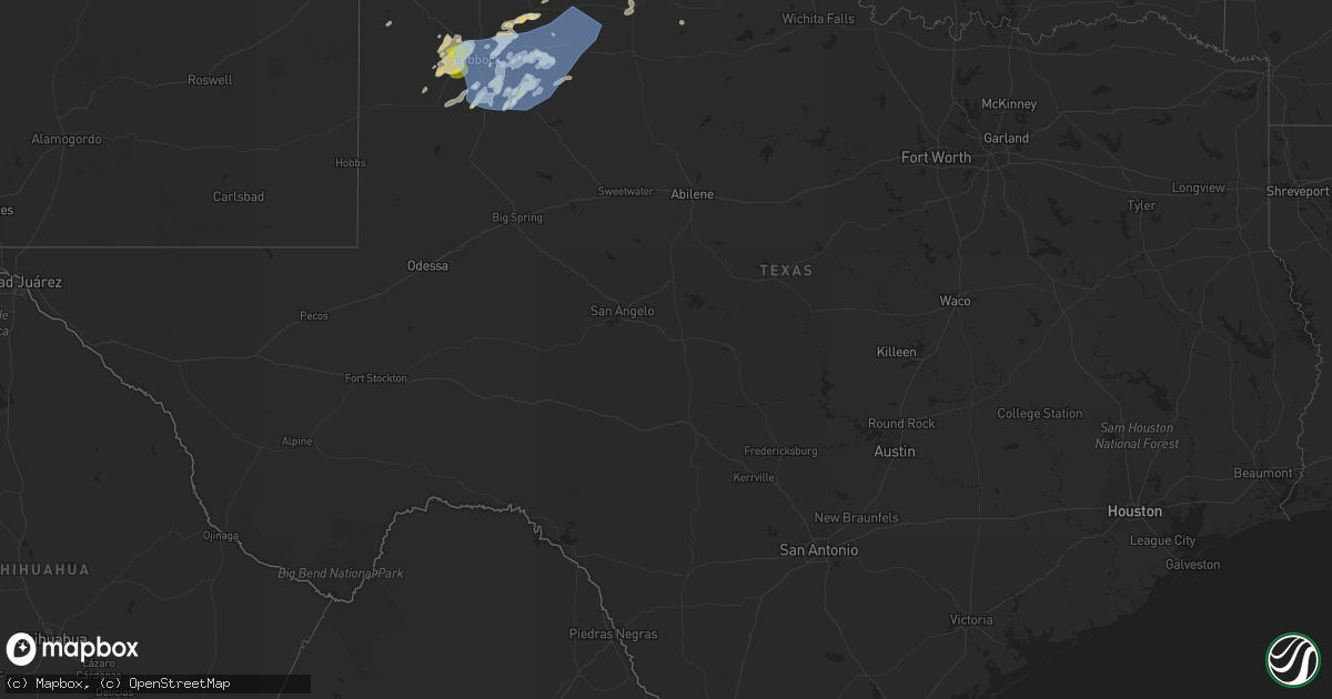
Hail Map in Texas on May 16, 2022
Get this storm
May 16 map
$229
one time, instant access
Download today. No call, no setup
Keep the $229
Bought the map and want the full workflow? Apply the entire $229 to a subscription within 7 days. None of it is wasted.
Every map, not just this one
This buys you this map. Subscription and you get every map we run, in the markets you choose from a few cities to whole states to nationwide. Plus real-time alerts the moment a storm fires.
Contact data
Name, contact info, occupancy, even credit band for addresses in the footprint. You go from where it hit to who to call.
Become the source they trust
Unlimited branding weather history reports on demand. You already have the documented answer ready for the property owner, and you are the one who showed up with it.
Property data and RoofTrace estimates
Pull up any address you have got, its value and the exact code rules for that jurisdiction, straight from One Click Code. Then RoofTrace estimates the squares, pitch, and roof value, priced the way you price.
Storm reports in Texas
Texas
| Date | Description |
|---|---|
| 05/16/20226:41 PM CDT | A local report indicates 61 MPH wind near 2 NNE SEMINOLE |
| 05/16/20227:56 AM CDT | At 1256 AM CDT, a severe thunderstorm was located over Aubrey, or 11 miles northeast of Denton, moving southeast at 20 mph. HAZARD...Quarter size hail. SOURCE...Radar indicated. IMPACT...Damage to vehicles is possible. Locations impacted include... Plano, McKinney, Frisco, Denton, Allen, Little Elm, Prosper, Fairview, Celina, Pilot Point, Aubrey, Krugerville, Cross Roads, Ray Roberts Park Isle Du Bois, Melissa, Weston and Lincoln Park. |
| 05/16/20227:29 AM CDT | At 1229 AM CDT, a severe thunderstorm was located over Frisco, moving southeast at 55 mph. HAZARD...Quarter size hail. SOURCE...Radar indicated. IMPACT...Damage to vehicles is possible. Locations impacted include... McKinney, Frisco, Allen, Wylie, Prosper, Fairview, Celina, Lucas, Lowry Crossing, Lavon, Nevada and Josephine. |
| 05/16/20227:01 AM CDT | At 1201 AM CDT, a severe thunderstorm was located near Hebron, or near The Colony, moving southeast at 30 mph. HAZARD...Ping pong ball size hail. SOURCE...Trained weather spotters. IMPACT...People and animals outdoors will be injured. Expect damage to roofs, siding, windows, and vehicles. Locations impacted include... Dallas, Plano, Garland, Mesquite, McKinney, Frisco, Richardson, Allen, Rowlett, Wylie, Rockwall, Balch Springs, Sachse, Seagoville, Forney, Addison, Murphy, Royse City, Heath and Fate.This includes the following highways... Interstate 20 between mile markers 479 and 489. Interstate 30 between mile markers 53 and 78. |
| 05/16/20225:45 AM CDT | At 1044 PM CDT, severe thunderstorms were located along a line extending from 3 miles southwest of Borger to 11 miles south of Fritch to 9 miles north of Washburn, moving east at 35 mph. HAZARD...60 mph wind gusts. SOURCE...Radar indicated. IMPACT...Minor damage to roofs, siding, and trees is possible. Locations impacted include... Amarillo, Pampa, Borger, Panhandle, Fritch, White Deer, Groom, Skellytown, Sanford, Kingsmill, Lake Meredith and Pantex. |
| 05/16/20224:50 AM CDT | At 949 PM CDT, a severe thunderstorm was located 9 miles southeast of Matador, moving northeast at 45 mph. HAZARD...70 mph wind gusts and penny size hail. SOURCE...Radar indicated. IMPACT...Expect considerable tree damage. Damage is likely to mobile homes, roofs, and outbuildings. Locations impacted include... Paducah, Matador, Grow, Cee Vee, Dumont, Northfield, Finney, Delwin, Chalk, Swearingen and Hackberry. |
| 05/16/20224:10 AM CDT | At 909 PM CDT, severe thunderstorms were located along a line extending from 7 miles south of Lockney to 3 miles southwest of Crosbyton to 7 miles west of Justiceburg, moving east at 40 mph. HAZARD...70 mph wind gusts and penny size hail. SOURCE...Radar indicated. IMPACT...Expect considerable tree damage. Damage is likely to mobile homes, roofs, and outbuildings. Locations impacted include... Post, Floydada, Crosbyton, Spur, Matador, Jayton, Dickens, Lake Alan Henry, White River Lake, Ralls, Lockney, Kalgary, Girard, Cone, South Plains, Dougherty, Justiceburg, Afton, Clairemont and Flomot. |
| 05/16/20223:28 AM CDT | At 827 PM CDT, a severe thunderstorm was located 4 miles southwest of Dalhart, moving northeast at 35 mph. HAZARD...60 mph wind gusts and quarter size hail. SOURCE...Radar indicated. IMPACT...Minor damage to roofs, siding, and trees is possible. Hail damage to vehicles is expected. Locations impacted include... Dalhart, Stratford, Ware and Conlen. |
| 05/16/20223:17 AM CDT | At 816 PM CDT, severe thunderstorms were located along a line extending from near Spade to near Slide to 9 miles south of Grassland, moving northeast at 45 mph. HAZARD...70 mph wind gusts and quarter size hail. SOURCE...Radar indicated. IMPACT...Hail damage to vehicles is expected. Expect considerable tree damage. Wind damage is also likely to mobile homes, roofs, and outbuildings. Locations impacted include... Lubbock, Plainview, Slaton, Post, Floydada, Abernathy, Tahoka, Hale Center, Crosbyton, Lake Alan Henry, White River Lake, Wolfforth, Shallowater, Idalou, Ralls, Lockney, Petersburg, Lorenzo, Ransom Canyon and Cotton Center. |
| 05/16/20222:40 AM CDT | At 739 PM CDT, a severe thunderstorm was located near Romero, or 15 miles northeast of Nara Visa, moving northeast at 30 mph. HAZARD...60 mph wind gusts and quarter size hail. SOURCE...Radar indicated. IMPACT...Minor damage to roofs, siding, and trees is possible. Hail damage to vehicles is expected. Locations impacted include... Dalhart and Romero. |
| 05/16/20222:23 AM CDT | At 723 PM CDT, a severe thunderstorm was located over Bula, or 15 miles northeast of Morton, moving northeast at 35 mph. HAZARD...60 mph wind gusts and penny size hail. SOURCE...Radar indicated. IMPACT...Expect damage to roofs, siding, and trees. Locations impacted include... Littlefield, Olton, Earth, Sudan, Amherst, Needmore, Fieldton, Spade, Muleshoe Wildlife Refuge, Bula, Pep and Springlake. |
| 05/16/20222:02 AM CDT | At 702 PM CDT, a severe thunderstorm was located over Tokio, or 13 miles east of Plains, moving northeast at 25 mph. HAZARD...60 mph wind gusts and penny size hail. SOURCE...Radar indicated. IMPACT...Expect damage to roofs, siding, and trees. Locations impacted include... Levelland, Brownfield, Sundown, Locketville, Tokio, Meadow, Smyer, Ropesville, Wellman and Opdyke West. |
| 05/16/20221:55 AM CDT | At 653 PM CDT, a cluster of severe thunderstorms were located on a line extending 10 miles southeast of Gaines County Airport, or 13 miles south o Seminole, moving north-northeast at 25 mph. A gust of 61 mph was reported at Seminole airport at 645 PM CDT. HAZARD...60 mph wind gusts. SOURCE...Radar indicated. IMPACT...Expect damage to roofs, siding, and trees. Locations impacted include... Seminole, Seagraves, Seagraves Airport, Gaines County Airport, Loop, McKenzie Lake and Gaines County Park. |
| 05/16/20221:27 AM CDT | At 627 PM CDT, a severe thunderstorm was located 4 miles northwest of Bledsoe, or 18 miles west of Morton, moving east at 25 mph. HAZARD...60 mph wind gusts and quarter size hail. SOURCE...Radar indicated. IMPACT...Hail damage to vehicles is expected. Expect wind damage to roofs, siding, and trees. Locations impacted include... Morton, Bledsoe, Muleshoe Wildlife Refuge, Bula, Enochs, Lehman, Maple and Whiteface. |
| 05/15/202210:44 PM CDT | A local report indicates 58 MPH wind near COMANCHE SPRINGS |
| 05/15/202210:42 PM CDT | A local report indicates 59 MPH wind near 6 ENE AMARILLO |
| 05/15/202210:32 PM CDT | West texas mesonet |
| 05/15/202210:20 PM CDT | West texas mesonet |
| 05/15/202210:12 PM CDT | West texas mesonet |
| 05/15/20229:40 PM CDT | West texas mesonet |
| 05/15/20229:37 PM CDT | West texas mesonet |
| 05/15/20229:27 PM CDT | At 226 AM CDT, a severe thunderstorm was located over Lake Kiowa, or 9 miles southeast of Gainesville, moving southeast at 25 mph. HAZARD...Quarter size hail. SOURCE...Radar indicated. IMPACT...Damage to vehicles is possible. Locations impacted include... Celina, Pilot Point, Collinsville, Gunter, Lake Kiowa and Tioga. |
| 05/15/20229:20 PM CDT | West texas mesonet. 59 mph gust also at 9:19 pm. |
| 05/15/20229:16 PM CDT | West texas mesonet. Gust also to 59 mph 9:15 mph. |
| 05/15/20229:05 PM CDT | West texas mesonet |
| 05/15/20229:02 PM CDT | A local report indicates 62 MPH wind near 3 SW DALHART |
| 05/15/20228:59 PM CDT | At 159 AM CDT, a severe thunderstorm was located near Aubrey, or 13 miles north of Frisco, moving southeast at 20 mph. HAZARD...Quarter size hail. SOURCE...Radar indicated. IMPACT...Damage to vehicles is possible. Locations impacted include... Plano, McKinney, Frisco, Allen, Little Elm, Prosper, Celina, Pilot Point, Aubrey, Krugerville, Melissa and Weston. |
| 05/15/20228:46 PM CDT | At 146 AM CDT, a severe thunderstorm was located over Allen, moving southeast at 20 mph. HAZARD...Quarter size hail. SOURCE...Radar indicated. IMPACT...Damage to vehicles is possible. Locations impacted include... Plano, Garland, McKinney, Richardson, Allen, Rowlett, Wylie, Rockwall, Sachse, Murphy, Royse City, Fairview, Heath, Princeton, Fate, Lucas, Parker, Farmersville, Lowry Crossing and Mobile City.This includes Interstate 30 between mile markers 62 and 78. |
| 05/15/20228:33 PM CDT | West texas mesonet. 53 mph sustained winds also recorded. |
| 05/15/20228:33 PM CDT | Emergency manager reports downed power lines in the 5700 block of 3rd st. |
| 05/15/20228:31 PM CDT | Visibility as low as 1 sm due to heavy rain and blowing dust. |
| 05/15/20228:30 PM CDT | West texas mesonet. |
| 05/15/20228:29 PM CDT | Asos station kdht dalhart |
| 05/15/20228:18 PM CDT | A local report indicates 1.00 inch wind near 5 S WOLFFORTH |
| 05/15/20228:13 PM CDT | At 113 AM CDT, a severe thunderstorm was located near Elkhart, or 13 miles southeast of Palestine, moving southeast at 20 mph. HAZARD...60 mph wind gusts and quarter size hail. SOURCE...Radar indicated. IMPACT...Hail damage to vehicles is expected. Expect wind damage to roofs, siding, and trees. Locations impacted include... Elkhart. |
| 05/15/20228:11 PM CDT | West texas mesonet. 58 mph sustained wind also recorded. |
| 05/15/20228:10 PM CDT | West texas mesonet. 54 mph sustained wind also recorded. |
| 05/15/20227:42 PM CDT | West texas mesonet |
All States Impacted by Hail Map on May 16, 2022
Cities Impacted by Hail Map on May 16, 2022
- Littleton, MA
- Westford, MA
- Goltry, OK
- Millsboro, DE
- Lewes, DE
- Harbeson, DE
- Seneca, NE
- Orlando, OK
- Preston, ID
- Franklin, ID
- Amorita, OK
- Cherokee, OK
- Anthony, KS
- Waldron, KS
- Burlington, OK
- New Church, VA
- Pocomoke City, MD
- Horntown, VA
- Little Falls, NY
- Dolgeville, NY
- Middleville, NY
- Herkimer, NY
- Mohawk, NY
- Siler City, NC
- Bear Creek, NC
- Dagsboro, DE
- Lorenzo, TX
- Idalou, TX
- Lubbock, TX
- Fairview, OK
- Virginia Beach, VA
- Ratliff City, OK
- Graham, OK
- Fairfax, OK
- Ralston, OK
- Pawnee, OK
- Trappe, MD
- Nichols, SC
- Amarillo, TX
- Campobello, SC
- Ocean City, MD
- Berlin, MD
- Vermontville, NY
- Laurel, DE
- Tahoka, TX
- Wilson, TX
- Red Creek, NY
- Wolcott, NY
- Sterling, NY
- Townsend, MT
- Onancock, VA
- Bloxom, VA
- Parksley, VA
- Newsoms, VA
- Franklin, VA
- Courtland, VA
- Alva, OK
- Hurley, NY
- Germantown, NY
- West Hurley, NY
- Catskill, NY
- Woodstock, NY
- West Camp, NY
- Kingston, NY
- Saugerties, NY
- Tivoli, NY
- Red Hook, NY
- Barrytown, NY
- Saint Regis Falls, NY
- Binghamton, NY
- Vestal, NY
- Port Crane, NY
- Brackney, PA
- Friendsville, PA
- Bernville, PA
- Myerstown, PA
- Richland, PA
- Womelsdorf, PA
- Marion Station, MD
- Crisfield, MD
- Hannacroix, NY
- West Coxsackie, NY
- Ravena, NY
- Bozeman, MT
- Locust Grove, OK
- Bishopville, MD
- Salisbury, MD
- Pittsville, MD
- Parsonsburg, MD
- Whaleyville, MD
- Showell, MD
- Snow Hill, MD
- Willards, MD
- Hammond, NY
- Marshall, OK
- Temple, OK
- Grantham, NH
- Bearsville, NY
- Morton, TX
- Churubusco, NY
- Ellenburg Center, NY
- Ellenburg Depot, NY
- Sperry, OK
- Skiatook, OK
- Smyer, TX
- Wolfforth, TX
- Anton, TX
- Ropesville, TX
- Levelland, TX
- Shallowater, TX
- Chesnee, SC
- Fairlee, VT
- Orford, NH
- Lyme, NH
- Slaton, TX
- Post, TX
- Heuvelton, NY
- Petersburg, TX
- Floydada, TX
- Coxsackie, NY
- Climax, NY
- Earlton, NY
- Hancock, NY
- Starlight, PA
- Long Eddy, NY
- Fishs Eddy, NY
- East Branch, NY
- Lakewood, PA
- Pleasant Mount, PA
- Lake Como, PA
- Equinunk, PA
- Clayton, NM
- Chelmsford, MA
- Goldsboro, NC
- Pawhuska, OK
- Columbia, NC
- Manns Harbor, NC
- Philipsburg, PA
- Morrisdale, PA
- Osceola Mills, PA
- Houtzdale, PA
- Kylertown, PA
- Bigler, PA
- West Decatur, PA
- Wallaceton, PA
- Woodland, PA
- Allport, PA
- Ames, OK
- Grenville, NM
- Helena, OK
- Carmen, OK
- Manchester, OK
- Salina, OK
- Bradford, VT
- Roswell, NM
- Milnesand, NM
- Causey, NM
- Rogers, NM
- Pep, NM
- Elida, NM
- Hazelton, KS
- Wake Forest, NC
- Creedmoor, NC
- Andrews Air Force Base, MD
- Upper Marlboro, MD
- Bethel, DE
- Chesapeake Beach, MD
- Fort Belvoir, VA
- Fairfax Station, VA
- Bryans Road, MD
- Tracys Landing, MD
- Secretary, MD
- Delmar, DE
- Georgetown, DE
- Clifton, VA
- Friendship, MD
- Vienna, MD
- North Beach, MD
- Woodbridge, VA
- Huntingtown, MD
- Owings, MD
- Mardela Springs, MD
- Oxon Hill, MD
- Lorton, VA
- Clinton, MD
- Rhodesdale, MD
- Burke, VA
- Dunkirk, MD
- Aquasco, MD
- Springfield, VA
- East New Market, MD
- Millville, DE
- Alexandria, VA
- Seaford, DE
- Frankford, DE
- Brandywine, MD
- Linkwood, MD
- Cambridge, MD
- Waldorf, MD
- Sunderland, MD
- Manassas, VA
- Prince Frederick, MD
- Sharptown, MD
- Cheltenham, MD
- Ocean View, DE
- Hurlock, MD
- Fort Washington, MD
- Accokeek, MD
- Temple Hills, MD
- Boykins, VA
- Kinston, NC
- Deep Run, NC
- Bath, NC
- Washington, NC
- Wilmot, NH
- Andover, NH
- Warner, NH
- Johnson City, NY
- Endicott, NY
- Crosbyton, TX
- Greenville, NC
- Grimesland, NC
- Mosquero, NM
- Moriarty, NM
- Elizaville, NY
- Tupper Lake, NY
- Walton, NY
- Franklin, NY
- Sidney Center, NY
- Durham, NC
- Raleigh, NC
- Geuda Springs, KS
- Comanche, OK
- Santa Fe, NM
- Whitney Point, NY
- Masterson, TX
- Panhandle, TX
- Valentine, NE
- Westfield, PA
- Jasper, NY
- Addison, NY
- Knoxville, PA
- Woodhull, NY
- Troupsburg, NY
- Cameron Mills, NY
- Timber Lake, SD
- Hebron, MD
- Fairmont, OK
- Douglas, OK
- Chatham, NY
- Hillsdale, NY
- Craryville, NY
- Hudson, NY
- Spencertown, NY
- Ghent, NY
- New Bern, NC
- Vanceboro, NC
- Cove City, NC
- Dover, NC
- Chocowinity, NC
- Grifton, NC
- Ernul, NC
- Wells, NY
- Indian Lake, NY
- Conchas Dam, NM
- Crowell, TX
- Hanover, NH
- Etna, NH
- Topsham, VT
- Newbury, VT
- East Corinth, VT
- Enfield, NH
- Childress, TX
- Matador, TX
- Aurora, NC
- Edward, NC
- Wallops Island, VA
- Temperanceville, VA
- Ulster Park, NY
- Quantico, MD
- Raton, NM
- Thedford, NE
- Sedan, KS
- Delmar, MD
- Tilghman, MD
- Woolford, MD
- Bristow, VA
- Washington, DC
- Oxford, MD
- Bethany Beach, DE
- Lyon Mountain, NY
- Owls Head, NY
- Chateaugay, NY
- Kunkletown, PA
- Brodheadsville, PA
- Stroudsburg, PA
- East Stroudsburg, PA
- Bartonsville, PA
- Kresgeville, PA
- Effort, PA
- Tannersville, PA
- Gilbert, PA
- Saylorsburg, PA
- Scotrun, PA
- Henryville, PA
- Duke, OK
- Frederick, OK
- Ringwood, OK
- Cleo Springs, OK
- Stokes, NC
- Robersonville, NC
- Nanticoke, MD
- Princess Anne, MD
- Columbus, NC
- Tryon, NC
- Inman, SC
- Rutherfordton, NC
- Tell, TX
- Vaughn, NM
- Natchez, MS
- Walters, OK
- Dalhart, TX
- Jackson, LA
- Saint Francisville, LA
- Brownfield, TX
- Meadow, TX
- Moreauville, LA
- Lettsworth, LA
- Crosby, MS
- Gloster, MS
- Centreville, MS
- Roxie, MS
- Pinetown, NC
- Ralls, TX
- Loris, SC
- Chadbourn, NC
- Whiteville, NC
- Green Sea, SC
- Nakina, NC
- Clarendon, NC
- Tabor City, NC
- Paducah, TX
- Justiceburg, TX
- Snyder, TX
- Meadville, MS
- San Jon, NM
- Las Vegas, NM
- Stratford, TX
- Bard, NM
- Santa Rosa, NM
- Tylertown, MS
- Marland, OK
- Red Rock, OK
- Randlett, OK
- Ribera, NM
- Albertson, NC
- Mount Olive, NC
- Hartley, TX
- Gallatin Gateway, MT
- Waynoka, OK
- Aline, OK
- Sand Springs, OK
- Enid, OK
- Waukomis, OK
- Duncan, OK
- Lima, MT
- Worden, MT
- Austerlitz, NY
- Ransom Canyon, TX
- Plattsburgh, NY
- Chazy, NY
- West Chazy, NY
- Champlain, NY
- Mooers, NY
- Altona, NY
- Canaan, NY
- Nicholville, NY
- Pantego, NC
- Belhaven, NC
- Plymouth, NC
- Scranton, NC
- Montour Falls, NY
- Odessa, NY
- Watkins Glen, NY
- Campbell, NY
- Beaver Dams, NY
- Painted Post, NY
- Moravia, NY
- Auburn, NY
- Owego, NY
- Syracuse, NY
- Pennellville, NY
- Baldwinsville, NY
- Central Square, NY
- Williamstown, NY
- Clay, NY
- West Monroe, NY
- Constantia, NY
- Warners, NY
- Brewerton, NY
- Liverpool, NY
- Redfield, NY
- Camden, NY
- Jamaica, VT
- Petersburg, NY
- East Schodack, NY
- Averill Park, NY
- West Sand Lake, NY
- Cropseyville, NY
- Berlin, NY
- Stamford, VT
- West Dover, VT
- Wilmington, VT
- Nassau, NY
- East Dover, VT
- Pownal, VT
- Shaftsbury, VT
- Castleton On Hudson, NY
- Sand Lake, NY
- East Greenbush, NY
- Wardsboro, VT
- North Pownal, VT
- West Townshend, VT
- Hoosick Falls, NY
- North Bennington, VT
- Bennington, VT
- Williamstown, MA
- Townshend, VT
- Greenwich, NY
- Schuylerville, NY
- Salem, NY
- Argyle, NY
- Cossayuna, NY
- Granville, NY
- North Granville, NY
- Comstock, NY
- Whitehall, NY
- Fort Ann, NY
- Hastings, PA
- Lanse, PA
- Karthaus, PA
- Patton, PA
- Moshannon, PA
- Madera, PA
- Marsteller, PA
- Munson, PA
- Winburne, PA
- Cherry Tree, PA
- Nicktown, PA
- Drifting, PA
- Westover, PA
- Hawk Run, PA
- Flinton, PA
- Spangler, PA
- Grassflat, PA
- Saint Boniface, PA
- Glen Hope, PA
- Brisbin, PA
- Frenchville, PA
- New Millport, PA
- Irvona, PA
- Saint Benedict, PA
- Carrolltown, PA
- Coalport, PA
- Northern Cambria, PA
- La Jose, PA
- Starrucca, PA
- Roscoe, NY
- Deposit, NY
- Susquehanna, PA
- South Gibson, PA
- New Milford, PA
- Herrick Center, PA
- Hamden, NY
- Thompson, PA
- Delhi, NY
- Kingsley, PA
- Andes, NY
- Union Dale, PA
- Preston Park, PA
- Downsville, NY
- Delancey, NY
- Suffolk, VA
- Smithfield, VA
- Windsor, VA
- White Plains, MD
- Occoquan, VA
- La Plata, MD
- Indian Head, MD
- Royal Oak, MD
- Madison, MD
- Tipton, OK
- Altus, OK
- Elmer, OK
- Chillicothe, TX
- Gould, OK
- Spur, TX
- Altus Afb, OK
- Afton, TX
- Vernon, TX
- Davidson, OK
- Cee Vee, TX
- Hollis, OK
- Odell, TX
- Eldorado, OK
- Dickens, TX
- Quanah, TX
- Roaring Springs, TX
- Mcadoo, TX
- Headrick, OK
- Olustee, OK
- Pottstown, PA


