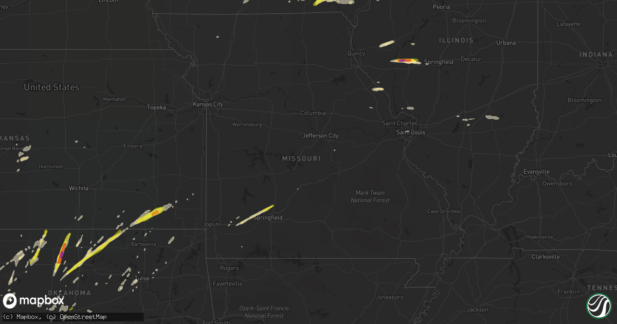
Hail Map in Missouri on May 10, 2017
Get this storm
May 10 map
$229
one time, instant access
Download today. No call, no setup
Keep the $229
Bought the map and want the full workflow? Apply the entire $229 to a subscription within 7 days. None of it is wasted.
Every map, not just this one
This buys you this map. Subscription and you get every map we run, in the markets you choose from a few cities to whole states to nationwide. Plus real-time alerts the moment a storm fires.
Contact data
Name, contact info, occupancy, even credit band for addresses in the footprint. You go from where it hit to who to call.
Become the source they trust
Unlimited branding weather history reports on demand. You already have the documented answer ready for the property owner, and you are the one who showed up with it.
Property data and RoofTrace estimates
Pull up any address you have got, its value and the exact code rules for that jurisdiction, straight from One Click Code. Then RoofTrace estimates the squares, pitch, and roof value, priced the way you price.
Storm reports in Missouri
Missouri
| Date | Description |
|---|---|
| 05/10/20172:22 PM CDT | 60-65 mph wind gust reported. |
| 05/10/20172:18 PM CDT | Delayed report...large tree blown over |
| 05/10/201712:41 AM CDT | Report relayed by ham radio. |
| 05/10/201712:40 AM CDT | A tree around 20ft tall was uprooted and numerous shingles were blown off house. |
| 05/10/201712:35 AM CDT | A nws storm survey found that a brief ef-0 tornado touched down near the intersection of gateway drive and jute road north of neosho. Several trees were uprooted. Sever |
| 05/10/201712:34 AM CDT | Public report relayed via law enforcement of a 58 mph wind gust. |
| 05/10/201712:30 AM CDT | Mping. |
All States Impacted by Hail Map on May 10, 2017
Cities Impacted by Hail Map on May 10, 2017
- Abilene, TX
- Cheyenne Wells, CO
- Kinsley, KS
- Raymond, KS
- Chase, KS
- Ellinwood, KS
- Frederick, OK
- Hollister, OK
- Winona, KS
- Wallace, KS
- Texhoma, OK
- Walsh, CO
- Keyes, OK
- Goodwell, OK
- Erick, OK
- Grinnell, KS
- Meredosia, IL
- Ashland, IL
- Arenzville, IL
- Chapin, IL
- Concord, IL
- Jacksonville, IL
- Tribune, KS
- Sharon Springs, KS
- Childress, TX
- Quanah, TX
- Vancourt, TX
- Eola, TX
- Paint Rock, TX
- Colby, KS
- Rye, CO
- Carmen, OK
- Dacoma, OK
- Bloomfield, IA
- Douds, IA
- Walsenburg, CO
- Cee Vee, TX
- Paducah, TX
- Albia, IA
- Melrose, IA
- Brady, TX
- Grainfield, KS
- Monument, KS
- Oakley, KS
- Gove, KS
- Hoxie, KS
- Claremore, OK
- Chelsea, OK
- Stratford, TX
- Lawton, OK
- Walters, OK
- Pueblo, CO
- Moran, TX
- Headrick, OK
- Silex, MO
- Clarendon, TX
- Hedley, TX
- Quail, TX
- Memphis, TX
- Silverton, TX
- Quitaque, TX
- Tulia, TX
- Lakeview, TX
- Kress, TX
- Wellington, TX
- Weldon, IA
- Humeston, IA
- Woodburn, IA
- Mount Vernon, MO
- Mount Sterling, IL
- Brackettville, TX
- Laughlin Afb, TX
- Del Rio, TX
- Arlington, CO
- La Junta, CO
- Sugar City, CO
- Amarillo, TX
- Cheyenne, OK
- Tuscola, TX
- Wingate, TX
- Blackwell, TX
- Ovalo, TX
- Merkel, TX
- Chariton, IA
- Lucas, IA
- Derby, IA
- Minneola, KS
- Eldorado, OK
- Robert Lee, TX
- Sperry, OK
- Tulsa, OK
- Altus, OK
- Olustee, OK
- Meade, KS
- Carnegie, OK
- Blackwell, OK
- Tonkawa, OK
- Jetmore, KS
- Big Lake, TX
- Erie, KS
- Wann, OK
- Helena, OK
- Jet, OK
- Goltry, OK
- Sand Springs, OK
- Sapulpa, OK
- Graford, TX
- Hawley, TX
- Orient, IA
- Chillicothe, TX
- Havana, KS
- Independence, KS
- Cherryvale, KS
- Elk City, KS
- Galesburg, IL
- Christoval, TX
- Eldorado, TX
- Happy, TX
- Mountain View, OK
- Pauls Valley, OK
- Mobeetie, TX
- Wheeler, TX
- Scottsburg, VA
- Nelson, VA
- Buffalo Junction, VA
- Springfield, MO
- Willard, MO
- Pleasant Hope, MO
- Fair Grove, MO
- Bois D Arc, MO
- Ash Grove, MO
- Branson, CO
- Trinidad, CO
- Model, CO
- Baird, TX
- Clyde, TX
- Breckenridge, TX
- Albany, TX
- Hennessey, OK
- Shidler, OK
- Gardner, CO
- Custer City, OK
- Vinita, OK
- Bluejacket, OK
- Sterling City, TX
- Canton, KS
- Elmore City, OK
- Leoti, KS
- Beulah, CO
- Stuart, IA
- Roosevelt, OK
- Creston, IA
- Plains, KS
- Winters, TX
- Tye, TX
- Buffalo Gap, TX
- Bronte, TX
- Anson, TX
- Chase City, VA
- Boydton, VA
- Skipwith, VA
- Geronimo, OK
- Uvalde, TX
- Hunter, OK
- Sigourney, IA
- Aline, OK
- Saint Charles, IA
- Hudson, KS
- Hillsboro, KS
- Camden, IL
- Timewell, IL
- Rushville, IL
- Birmingham, IA
- Sedan, KS
- Cedar Vale, KS
- Blanchard, OK
- Girard, KS
- Tecumseh, OK
- Wanette, OK
- Macomb, OK
- Lexington, OK
- Wellington, KS
- Saint Louis, MO
- Mediapolis, IA
- Knoxville, IA
- Nashville, NC
- Hollister, NC
- Battleboro, NC
- Warrenton, NC
- Castalia, NC
- Louisburg, NC
- Whitakers, NC
- Peru, KS
- Waukomis, OK
- Keysville, VA
- Ponca City, OK
- Marland, OK
- Red Rock, OK
- Edson, KS
- Melvin, TX
- Paoli, OK
- Foster, OK
- Maysville, OK
- Lindsay, OK
- Marlow, OK
- Lucien, OK
- Perry, OK
- Covington, OK
- Pond Creek, OK
- Kremlin, OK
- Lamont, OK
- Enid, OK
- Medford, OK
- Oologah, OK
- Comstock, TX
- Burbank, OK
- Lacona, IA
- Bartlesville, OK
- Chickasha, OK
- Ozona, TX
- Anadarko, OK
- Clarksville, MO
- Nebo, IL
- Wakita, OK
- Brewster, KS
- Levant, KS
- Goodland, KS
- Kellyville, OK
- Dumas, TX
- Dalhart, TX
- Parsons, KS
- San Angelo, TX
- Copan, OK
- Dewey, OK
- Brookneal, VA
- Osceola, IA
- Lawn, TX
- Cisco, TX
- Seiling, OK
- Tipton, OK
- Antonito, CO
- Putnam, OK
- Douglas, OK
- Marshall, OK
- Calumet, OK
- Okarche, OK
- Madison Heights, VA
- Rustburg, VA
- Clarksville, VA
- Phenix, VA
- Clover, VA
- Lynchburg, VA
- Concord, VA
- Gladys, VA
- Nathalie, VA
- Holly, CO
- Lamar, CO
- Cherokee, OK
- New London, IA
- Groom, TX
- Matador, TX
- Manchester, OK
- Ringwood, OK
- Nash, OK
- Cleo Springs, OK
- Rockwood, TX
- Lohn, TX
- Scott City, KS
- Gouldbusk, TX
- Ramona, OK
- Chester, OK
- Fort Stockton, TX
- Altus Afb, OK
- Duke, OK
- Farlington, KS
- Trinchera, CO
- Arapahoe, CO
- Drakesville, IA
- Taloga, OK
- Thomas, OK
- Shannon City, IA
- Afton, IA
- Ranger, TX
- Menard, TX
- Newcastle, TX
- Barnhart, TX
- Fairfax, OK
- Pawhuska, OK
- Billings, OK
- Gracemont, OK
- Fort Cobb, OK
- Sarcoxie, MO
- Stotts City, MO
- Monmouth, IL
- Lebanon, MO
- Barnsdall, OK
- Skiatook, OK
- Vici, OK
- Camargo, OK
- Leedey, OK
- Temple, OK
- Garden Grove, IA
- South Hill, VA
- Halltown, MO
- Bracey, VA
- La Crosse, VA
- Piedmont, OK
- Cashion, OK
- Masterson, TX
- Alva, OK
- Sylvia, KS
- Bristow, OK
- Mannford, OK
- Chattanooga, OK
- Vernon, TX
- Odell, TX
- Loveland, OK
- Davidson, OK
- Stafford, KS
- St John, KS
- Liberal, KS
- Guymon, OK
- Novice, TX
- Goldsboro, TX
- Cameron, IL
- Canyon, TX
- Rochelle, TX
- Spout Spring, VA
- Appomattox, VA
- Hollis, OK
- Briscoe, TX
- Arnett, OK
- Thayer, KS
- Dennis, KS
- Galesburg, KS
- Snyder, OK
- Van Wert, IA
- Murray, IA
- Thayer, IA
- Alexis, IL
- Gerlaw, IL
- Dow, IL
- Jerseyville, IL
- Brighton, IL
- Danville, IA
- Floris, IA
- Mount Pleasant, IA
- Hillsboro, IA
- Salem, IA
- Libertyville, IA
- Stockport, IA
- Selma, IA
- Eldon, IA
- Batavia, IA
- Keosauqua, IA
- Lockridge, IA
- Fairfield, IA
- Sunray, TX
- Freeburg, MO
- Mill Creek, OK
- Madill, OK
- Mannsville, OK
- Ardmore, OK
- Rush Springs, OK
- Ninnekah, OK
- Lakin, KS
- Canadian, TX
- Syracuse, KS
- Floydada, TX
- Verden, OK
- Ballinger, TX
- Weskan, KS
- Oakwood, OK
- Apache, OK
- Catoosa, OK
- Binger, OK
- Boise City, OK
- Olney, TX
- Tell, TX
- Oklahoma City, OK
- Edmond, OK
- Yukon, OK
- Alexander, IL
- Stonewall, OK
- Crescent, OK
- Hobart, OK
- Fay, OK
- El Reno, OK
- Centrahoma, OK
- Saint Paul, IA
- West Point, IA
- Chandlerville, IL
- Centerville, IA
- Pierce City, MO
- Everton, MO
- Eden, TX
- Jacksboro, TX
- Strawn, TX
- Oxford, KS
- South Haven, KS
- Doole, TX
- Pleasant Hill, IL
- Perrin, TX
- Milton, IA
- Donnellson, IA
- Bonaparte, IA
- Farmington, IA
- Randolph, VA
- Charlotte Court House, VA
- Kingfisher, OK
- Fort McKavett, TX
- Bethany, OK
- Burlington, IA
- Gould, OK
- Caddo, TX
- Bradley, OK
- Saxe, VA
- Wylliesburg, VA
- Manson, NC
- Drakes Branch, VA
- Great Bend, KS
- Blair, OK
- Mountain Park, OK
- Mangum, OK
- Melcher Dallas, IA
- Stratford, OK
- Eastland, TX
- Deer Creek, OK
- Fairmont, OK
- Bison, OK
- Osage, OK
- Prue, OK
- Cullen, VA
- Shamrock, TX
- Unionville, IA
- Elgin, OK
- Prescott, IA
- Kirkwood, IL
- Biggsville, IL
- Harrah, OK
- Meeker, OK
- Wellston, OK
- Luther, OK
- Cassville, MO
- Mertzon, TX
- Isabella, OK
- Fairview, OK
- Cement, OK
- Bluffs, IL
- Chambersburg, IL
- Duncan, OK
- Faxon, OK
- Granite, OK
- Lone Wolf, OK
- Vandalia, IL
- Garber, OK
- Hanston, KS
- Mutual, OK
- Mooreland, OK
- Albany, MO
- Alma, IL
- Patoka, IL
- Virgilina, VA
- Healy, KS
- Leon, IA
- Granada, CO
- Pamplin, VA
- Union City, OK
- Shobonier, IL
- Fowler, KS
- Red House, VA
- Bullock, NC
- Oxford, NC
- Red Oak, VA
- Saint Peter, IL
- Cyril, OK
- Elmer, OK
- Cordell, OK
- Minco, OK
- Graham, TX
- Cleveland, OK
- Grenola, KS
- Miller, MO
- La Russell, MO
- Lueders, TX
- Indiahoma, OK
- Cache, OK
- Waynoka, OK
- Cushing, OK
- Louisville, IL
- Mason, IL
- Edgewood, IL
- Farina, IL
- Ingraham, IL
- Tishomingo, OK
- Grafton, IL
- Sonora, TX
- Stillwater, OK
- Ripley, OK
- Collinsville, TX
- Tioga, TX
- Valley View, TX
- Carlsbad, TX
- Coffeyville, KS
- Gruver, TX
- Santo, TX
- Gordon, TX
- Bowling Green, MO
- Maramec, OK
- Yale, OK
- Marietta, OK
- Larned, KS
- Kismet, KS
- Moravia, IA
- Mulhall, OK
- Orlando, OK
- New Berlin, IL
- Kaw City, OK
- Troy, MO
- Rowena, TX
- Gladstone, IL
- Stronghurst, IL
- Campo, CO
- Rocky Mount, NC
- Yarmouth, IA
- Mount Union, IA
- Neodesha, KS
- Kim, CO
- Hasty, CO
- Wiley, CO


