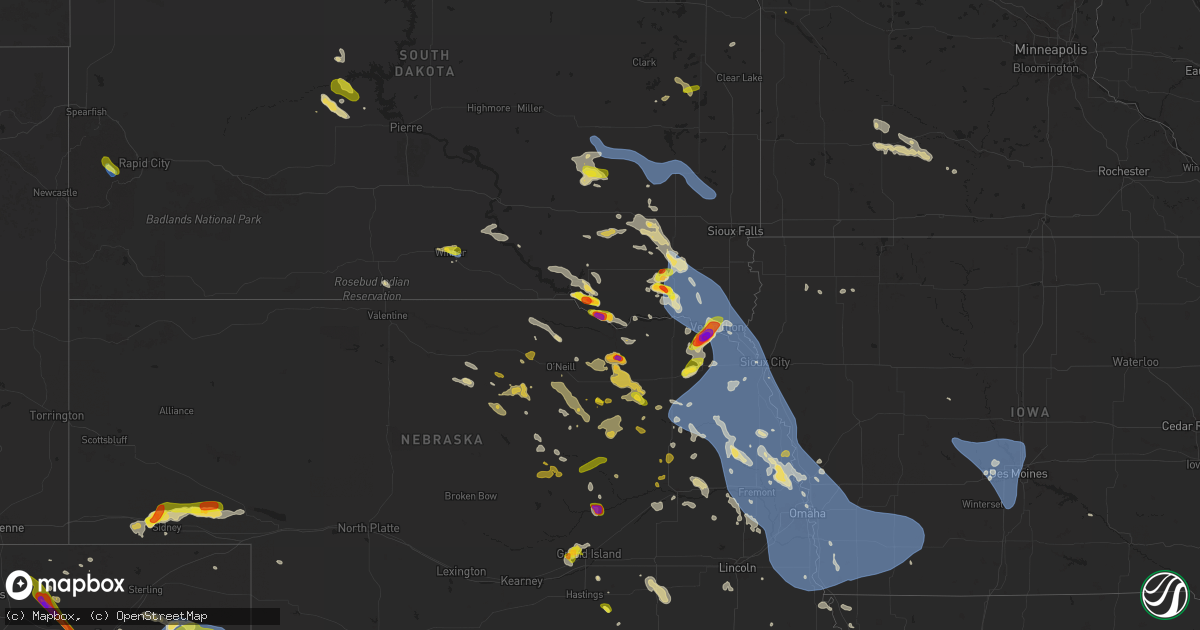
Hail Map on July 7, 2025
Get this storm
July 7 map
$229
one time, instant access
Download today. No call, no setup
Keep the $229
Bought the map and want the full workflow? Apply the entire $229 to a subscription within 7 days. None of it is wasted.
Every map, not just this one
This buys you this map. Subscription and you get every map we run, in the markets you choose from a few cities to whole states to nationwide. Plus real-time alerts the moment a storm fires.
Contact data
Name, contact info, occupancy, even credit band for addresses in the footprint. You go from where it hit to who to call.
Become the source they trust
Unlimited branding weather history reports on demand. You already have the documented answer ready for the property owner, and you are the one who showed up with it.
Property data and RoofTrace estimates
Pull up any address you have got, its value and the exact code rules for that jurisdiction, straight from One Click Code. Then RoofTrace estimates the squares, pitch, and roof value, priced the way you price.
States Impacted by Hail Map on July 7, 2025
Storm reports
South Carolina
| Date | Description |
|---|---|
| 07/07/20253:48 PM CDT | Tree down on pine grove road near the intersection with benton farm road. This was due to thunderstorm outflow. Time estimated by radar. |
Colorado
| Date | Description |
|---|---|
| 07/07/20256:35 PM CDT | Corrects previous tstm wnd gst report from 2 nnw wray. K2v5. |
| 07/07/20256:35 PM CDT | Corrects previous tstm wnd gst report from 2 nnw wray. K2v5. ( |
| 07/07/20256:27 PM CDT | Kcowray25. |
| 07/07/20256:26 PM CDT | Spotter network report of 60 mph wind gust via a handheld anemometer. |
| 07/07/20256:25 PM CDT | K2v5. |
| 07/07/20256:25 PM CDT | Report of some powerlines down south of wray; unknown on exact location and how many as of now. |
| 07/07/20255:53 PM CDT | Weatherlink site rdm cattle. |
| 07/07/20255:51 PM CDT | Good variety of hail sizes with quarter estimated to be the highest. |
| 07/07/20255:51 PM CDT | Good variety of hail sizes with quarter estimated to be the highest. |
| 07/07/20255:47 PM CDT | Kcoyuma34 weatherunderground site. |
| 07/07/20255:45 PM CDT | Quarter size hail ongoing in yuma. |
| 07/07/20255:40 PM CDT | Yuma county dispatch relayed a report of a tornado looking to the wnw of this location. Was not sure it was in yuma or washington county. |
| 07/07/20255:40 PM CDT | Yuma county dispatch relayed a report of a tornado looking to the wnw of this location. Was n |
| 07/07/20255:40 PM CDT | Yuma county dispatch relayed a report of a tornado looking to the wnw of this locat |
| 07/07/20255:30 PM CDT | 8 or 9 power poles down between cr45 and cr 47. Highway 59 sb is also closed in that area as well for restoration of the powerlines. |
| 07/07/20255:25 PM CDT | A local report indicates 1.50 inch wind near Otis |
| 07/07/20255:16 PM CDT | Reported via social media. Time and location estimated. |
| 07/07/20255:15 PM CDT | Retired nws employee measured 3.9cm diameter hail in otis approximately 20 minutes after it fell. |
| 07/07/20255:11 PM CDT | Video evidence of a few tennis ball or baseball sized hailstones which significantly damaged the rear windshield of a vehicle. Most stones were quarter to golf ball siz |
| 07/07/20255:09 PM CDT | A local report indicates 63 MPH wind near Akron |
| 07/07/20254:09 PM CDT | [landspout] photos of a brief landspout from 309 to 313 pm mdt. There was some visible evidence of a funnel at the cloud base despite the absence of a well defined upd |
| 07/07/20251:49 PM CDT | A local report indicates 66 MPH wind near 2 SSE Centennial |
| 07/06/202510:57 PM CDT | One small tree blown down and stripped of most of its leaves. Spotter reported some hail but did not have an estimate of size. |
Ohio
| Date | Description |
|---|---|
| 07/07/20256:55 PM CDT | Tree down along buckeye ridge road. Time estimated via radar. |
| 07/07/20256:50 PM CDT | Tree down along buttermilk hill road 3 miles nnw of mcconnelsville. Time estimated via radar. |
| 07/07/20256:37 PM CDT | Tree down across kasler creek road. Time estimated from radar. Reprt time was 740 pm. |
| 07/07/20254:59 PM CDT | Trees and power lines down at crouse chapel road and 159. Time estimated from radar. |
| 07/07/20254:59 PM CDT | Large tree down on blackwater road. Time estimated from radar. |
| 07/07/20254:32 PM CDT | Corrects previous tstm wnd dmg report from lisbon. Report of multiple wires down in the area. Time estimated based on radar. |
| 07/07/20254:26 PM CDT | Report of multiple wires down in the area. Time estimated based on radar. |
| 07/07/20253:04 PM CDT | Tree down. Time estimated via radar. |
| 07/07/20253:01 PM CDT | Tree down. Time estimated via radar. |
| 07/07/20252:57 PM CDT | An nws cleveland storm survey determined that an ef-0 tornado occurred from chatham township to lafayette township in medina county oh. The tornado began near the inter |
| 07/07/20252:56 PM CDT | Delayed report; time estimated by radar; spotter reported roof damage near the intersection of smith and cartsen. |
| 07/07/20252:46 PM CDT | Several 3 inch tree limbs down. Time estimated via radar. |
| 07/06/20257:02 PM CDT | Three large trees down along route 266. Time estimated via radar. Also water over road... But likely due to a blocked culvert. |
| 07/06/20257:02 PM CDT | Three large trees down along route 266. Time estimated via radar. Also water over road... But likel |
South Dakota
| Date | Description |
|---|---|
| 07/07/20256:46 PM CDT | Large tree limbs down in yankton. Time estimated from radar. |
| 07/07/20256:45 PM CDT | Awos station kykn yankton municipal airport. |
| 07/07/20256:00 PM CDT | Mesonet station 163 sd rwis freeman. |
| 07/07/20255:50 PM CDT | Heavy rain and hail up to the sized of golf balls. |
| 07/07/20255:45 PM CDT | Corrects previous hail report from menno. Hutchinson county em reported golf ball hail in menno. |
| 07/07/20255:45 PM CDT | Rachell sandow called to report golf ball hail in menno. |
| 07/07/20255:25 PM CDT | Photo of lime-sized hail via social media. |
| 07/07/20254:54 PM CDT | Heavy rainfall and various sizes of hail up to golfball for about 8 minutes. |
| 07/07/20254:37 PM CDT | A local report indicates 1.00 inch wind near 1 WNW Hayti |
| 07/07/20254:14 PM CDT | Not very much hail... But some stones as big as a quarter. Heavy rain also occurred. |
| 07/07/20254:01 PM CDT | A local report indicates 64 MPH wind near 1 NE Winner |
| 07/07/20253:51 PM CDT | A local report indicates 1.00 inch wind near 1 NNW Winner |
| 07/07/20253:50 PM CDT | A local report indicates 1.00 inch wind near 2 NNW Winner |
| 07/06/20258:05 PM CDT | Es |
| 07/06/20258:05 PM CDT | Estimated 50-60 mph wind gusts from police officer. Sporatic power outages due to tree damage aro |
| 07/06/20258:05 PM CDT | Estimated 50-60 mph wind gusts from police officer. Sporatic power outages due to tree damage around town. |
| 07/06/20257:56 PM CDT | A few very strong thunderstorm winds broke two large branches out of healthy tree... And then very heavy rain started. |
| 07/06/20257:09 PM CDT | Mesonet station 197 sd rwis gayville. |
| 07/06/20257:08 PM CDT | Em estimating a wind gust around 60 mph at the intersection of 455th ave and 306th st. |
| 07/06/20257:08 PM CDT | Em estimat |
Arkansas
| Date | Description |
|---|---|
| 07/07/20254:02 PM CDT | Large trees across the road. |
Kansas
| Date | Description |
|---|---|
| 07/07/20253:14 AM CDT | Sporadic reports of downed tree limbs and wires. Time estimated from radar. |
| 07/07/20252:56 AM CDT | Several reports of downed tree limbs and wires in the muncie area from outflow winds. Time estimated from radar. |
Minnesota
| Date | Description |
|---|---|
| 07/07/20255:20 PM CDT | Multiple tree limbs up to 6 inch in size down. |
| 07/07/20255:14 PM CDT | Pictures of multiple 1-3 inch tree limbs... And one 4-5 inch limb down near greenway portal. |
| 07/07/20254:50 PM CDT | A local report indicates 1.00 inch wind near 8 N East Grand Forks |
| 07/06/20259:33 PM CDT | A local report indicates a tornado near 3 ENE Lockhart |
| 07/06/20259:00 PM CDT | A local report indicates a tornado near 2 N Lockhart |
| 07/06/20257:36 PM CDT | 6 trees on a wind break were blown over at a farm on 220th ave. |
| 07/06/20257:35 PM CDT | Tree fell on a power line... Taking out power in godahl. |
| 07/06/20257:18 PM CDT | Photos sent in of large tree branches snapped at a home west of leavenworth. |
| 07/06/20257:16 PM CDT | A local report indicates 1.00 inch wind near 4 E Key West |
Iowa
| Date | Description |
|---|---|
| 07/07/202512:35 AM CDT | 4 inch diameter tree limb snapped. Delayed report relayed through social media. Time estimated by radar. |
| 07/07/202512:25 AM CDT | Two personal weather stations reported 72 and 74 mph gusts at 125 and 1230 am... Respectively. Small microburst |
| 07/07/202512:25 AM CDT | Two personal weather stations reported 72 and 74 mph gusts at 125 and 1230 am... Respectively. Small microburst signature on radar. |
| 07/07/202512:23 AM CDT | Top of mature tree snapped. Delayed report relayed through social media. Time estimated by radar. |
| 07/07/202512:16 AM CDT | Several trees snapped and uprooted. Delayed report relayed through social media. Time estimated by radar. |
| 07/07/202512:10 AM CDT | Pws. |
| 07/06/202511:43 PM CDT | Fallen tree near douglas and 50th and branches down in neighborhoods in the vicinity. Delayed report relayed through social media. Time estimated by radar. |
| 07/06/202511:32 PM CDT | Personal weather station. |
| 07/06/202511:24 PM CDT | Pws. |
| 07/06/202510:15 PM CDT | A local report indicates 60 MPH wind near 5 SW Mcclelland |
| 07/06/202510:12 PM CDT | Large branches down. |
| 07/06/20258:28 PM CDT | Asos station ksux sioux gateway airport. |
New York
| Date | Description |
|---|---|
| 07/07/20256:39 PM CDT | Several trees and wires down in romulus. |
| 07/07/20255:00 PM CDT | Media relayed report of strong winds and several snapped power poles on muckey rd. |
| 07/07/20254:59 PM CDT | Trees and wires down on jones road. |
| 07/07/20254:45 PM CDT | Trees down over shamrock road. |
| 07/07/20254:44 PM CDT | Trees and wires down on east franklin street. |
| 07/07/20254:35 PM CDT | Trees and wires down on watkins road. |
| 07/07/20254:35 PM CDT | Trees and wi |
| 07/07/20254:31 PM CDT | Large tree over hickory grove road via social media photo. |
| 07/07/20254:31 PM CDT | Tree fallen on property on sing sing road. |
| 07/07/20254:26 PM CDT | Large willow tree blocking one lane of traffic on prospect street. |
| 07/07/20254:25 PM CDT | Tree down at the corner of lilac drive and aster drive. |
| 07/07/20254:07 PM CDT | Large tree fallen on property via social media photo. |
| 07/07/20254:02 PM CDT | Trees and wires down over old groton road. |
| 07/07/20253:30 PM CDT | Wires down on route 92. |
| 07/07/20253:22 PM CDT | Tree and wires down near clark reservation state park. |
| 07/07/20253:15 PM CDT | Wires down on kennedy road. |
| 07/07/20252:54 PM CDT | Tree in roadway. |
| 07/07/20252:48 PM CDT | Trees and power lines down on shibley road. Time estimated from radar. |
| 07/07/20252:41 PM CDT | Wires down neare route 31 and button road. |
| 07/07/20252:22 PM CDT | A few trees down along glenburn rd. One tree took down wires and a pole with a small transformer. The pole and wires landed on a car... Smashing the windshield and caus |
| 07/07/20252:22 PM CDT | Small tree down on morgan road. |
| 07/07/20252:22 PM CDT | Wires down on morgan and buckley roads. |
| 07/07/20252:02 PM CDT | Power line down across north beaver and water streets. |
Oklahoma
| Date | Description |
|---|---|
| 07/07/20255:10 PM CDT | A local report indicates 61 MPH wind near 4 NW Talala |
Mississippi
| Date | Description |
|---|---|
| 07/07/20256:30 PM CDT | Skirting was blown off a mobile home. Trees and power lines were also blown down. |
| 07/07/20254:50 PM CDT | A tree was blown down on zetus road. |
Pennsylvania
| Date | Description |
|---|---|
| 07/07/20255:59 PM CDT | Tree down on wires in the 300 block of little plum run road. |
| 07/07/20255:56 PM CDT | Multiple trees down in the vicinity of hunter hollow road and shirk hollow road. |
| 07/07/20255:22 PM CDT | 911 call center reported wires down. Time estimated from radar. |
| 07/07/20255:19 PM CDT | Tree down at the intersection of coudersport pike and pa-44. |
| 07/07/20255:09 PM CDT | Large tree down on hyner run road near the hyner lodge foundation. |
| 07/07/20254:50 PM CDT | Tree down along lisbon road. |
| 07/07/20254:35 PM CDT | 911 call center reported tree down at melvin drive and north mercer street. Time estimated from radar. |
| 07/07/20253:58 PM CDT | Report of a tree down on a phone line along east river road. Time estimated based on radar. |
| 07/07/20253:16 PM CDT | Report of a tree down blocking one side of dutch lane. Time estimated based on radar. |
| 07/07/20253:16 PM CDT | Report of a tree down blocking one side of dutc |
| 07/07/20253:13 PM CDT | Report of tree onto house along 3rd street and through the roof. Time estimated based on radar. |
| 07/07/20253:12 PM CDT | Report of tree down along walnut road that ripped powerlines off house. Time estimated based on radar. |
| 07/07/20253:11 PM CDT | Report of a tree falling behind building in alleyway near ormond avenue. Time estimated based on radar. |
Virginia
| Date | Description |
|---|---|
| 07/07/20252:12 PM CDT | Tree down on rockfish valley highway at avon road. |
Nebraska
| Date | Description |
|---|---|
| 07/07/20256:30 PM CDT | Report of mix of quarters and dime sized hail. |
| 07/07/20256:27 PM CDT | A local report indicates 1.50 inch wind near 12 SW Oshkosh |
| 07/07/20256:19 PM CDT | Quarter to ping pong ball size hail was reported. |
| 07/07/20255:55 PM CDT | Trained spotter reports quarter size hail. |
| 07/07/20255:46 PM CDT | Hail nearing tennis ball-size from chaser live stream. Time estimated from radar on highway 14 west of winnetoon. |
| 07/07/20255:21 PM CDT | Fire chief reports golf ball size hail. |
| 07/07/20253:01 PM CDT | Report on social media of quarter sized hail in fairfield. |
| 07/06/202510:17 PM CDT | Personal weather station. |
| 07/06/202510:16 PM CDT | Personal weather station. |
| 07/06/202510:14 PM CDT | A local report indicates 59 MPH wind near 3 ESE Papillion |
| 07/06/202510:10 PM CDT | 4 inch tree branch snapped. |
| 07/06/202510:09 PM CDT | A local report indicates 67 MPH wind near 4 NNW Omaha |
| 07/06/202510:03 PM CDT | Personal weather station. |
| 07/06/202510:00 PM CDT | A local report indicates 58 MPH wind near 6 S Fort Calhoun |
| 07/06/20259:58 PM CDT | A local report indicates 61 MPH wind near Blair |
| 07/06/20259:52 PM CDT | Personal weather station. |
| 07/06/20259:50 PM CDT | A local report indicates 61 MPH wind near 1 WNW Valley |
| 07/06/20259:18 PM CDT | A local report indicates 60 MPH wind near 2 ESE Tekamah |
| 07/06/20259:16 PM CDT | Corrects previous tstm wnd gst report from 2 ese tekamah. |
| 07/06/20258:40 PM CDT | Mostly penny to nickel sized hail... But a few quarter sized stones. |
| 07/06/20258:23 PM CDT | Some of the hail was quarter to half dollar size. |
| 07/06/20257:51 PM CDT | Mix of nickel to quarter size hail at 7:51 pm. |
| 07/06/20257:15 PM CDT | 3 to 3.5 inch diameter hail. |
| 07/06/20257:00 PM CDT | A local report indicates 1.75 inch wind near 3 ESE Wynot |
Missouri
| Date | Description |
|---|---|
| 07/07/20254:25 PM CDT | Very windy as the storm moved through. At least some small twigs downed in the parking lot. Time estimated from radar. |
| 07/07/20253:40 PM CDT | Billboards blown away and an rv tipped over at the i-70 rv center. Multiple rvs damaged. Time estimated from radar. |
| 07/07/20253:20 PM CDT | A local report indicates 68 MPH wind near Auxvasse |
| 07/07/20253:54 AM CDT | Downed tree and wires near sunset hill road. Time estimated from radar. |
| 07/07/20253:16 AM CDT | Downed tree and wires just north of birmingham. Time confirme |
| 07/07/20253:16 AM CDT | Downed tree and wires just north of birmingham. Time confi |
| 07/07/20253:16 AM CDT | Downed tree and wires just north of birmingham. Time confirmed from radar. |
| 07/07/20253:11 AM CDT | Downed tree limb and wires near valleyview lane. Time confirmed from radar. |
| 07/07/20253:10 AM CDT | Social media report and mping report of downed tree limbs in the utica area. Time estimated from radar. |
| 07/07/20252:52 AM CDT | Mping report of tree limbs down. Utility company also reports power outages in the area around this time. Radar indicates from thunderstorm outflow. |
| 07/07/20252:47 AM CDT | Downed tree limb and wires from thunderstorm outflow. Time confirmed from radar. |
| 07/07/20252:47 AM CDT | Downed tree limbs and wires near 76th street from thunderstorm outflow. Time confirmed from radar. |
| 07/07/20252:47 AM CDT | Downed tree and wires near pennsylvania avenue from thunderstorm outflow. Time confirmed from radar. |
| 07/07/20252:35 AM CDT | Downed wires near prairie view road. Time estimated from radar. |
| 07/07/20252:20 AM CDT | Downed tree and wires from thunderstorm outflow near west concord drive. Time confirmed from radar. |
| 07/07/20252:19 AM CDT | Downed tree limbs and wires near hillyard road. Time estimated from radar. |
| 07/07/20252:19 AM CDT | Downed tree and wires near burnside avenue. Time confirmed from radar. |
| 07/07/20251:45 AM CDT | Several reports of downed wires in the st. Joseph area. Time estimated from radar. |
| 07/07/20251:44 AM CDT | Downed tree limbs and wires near route jj. Time estimated from radar. |
| 07/07/20251:33 AM CDT | A local report indicates 59 MPH wind near Saint Joseph Airport |
| 07/07/202512:23 AM CDT | Multiple reports of downed wires and three broken power poles. Time based on dispatch report. Location approximated from radar... With additional reports in holt county |
North Dakota
| Date | Description |
|---|---|
| 07/07/20256:22 PM CDT | Mostly dime to penny... Some quarters mixed in. |
| 07/07/20256:15 PM CDT | A local report indicates 1.00 inch wind near Manvel |
| 07/07/20255:20 PM CDT | A local report indicates 3.50 inch wind near 6 W Lankin |
| 07/07/20255:15 PM CDT | Video of windshield being damaged sent in by storm chaser. Location estimated by radar. |
| 07/07/20255:10 PM CDT | A local report indicates 2.50 inch wind near 7 SW Adams |
| 07/07/20255:08 PM CDT | A local report indicates 1.25 inch wind near 3 NW Pillsbury |
| 07/07/20255:08 PM CDT | Spotter reported tornado on ground 5 ne of lawton. |
| 07/07/20255:08 PM CDT | Photo via social media. |
| 07/07/20254:55 PM CDT | A local report indicates 1.00 inch wind near 4 WSW Hope |
| 07/07/20254:47 PM CDT | Report by faa weather observier... Relayed by broadcast media. |
| 07/07/20254:27 PM CDT | A local report indicates a tornado near 2 NNE Edmore |
| 07/07/20254:20 PM CDT | A local report indicates 1.75 inch wind near 3 W Manvel |
| 07/07/20253:53 PM CDT | Corrects previous tornado report from 1 sw calio. Report relayed via media. |
| 07/07/20253:51 PM CDT | Corrects previous tornado report from 1 sw calio. Report relayed via media. |
| 07/07/20253:43 PM CDT | Multiple reports and images of a tornado south of calio. |
| 07/07/20253:27 PM CDT | Quarter sized hail reported by trained weather spotters. |
| 07/06/20257:57 PM CDT | A local report indicates a tornado near 6 E Reynolds |
| 07/06/20257:56 PM CDT | Bin damage... Broken trees... Hayloft door missing... And trampoline in the trees. |
| 07/06/20257:31 PM CDT | Report from mping: quarter |
| 07/06/20257:22 PM CDT | Corrects previous hail report from 4 nnw thompson. Mostly dime to penny... Some quarters mixed in. |
Cities Impacted by Hail Map on July 7, 2025
- Hayes, SD
- Abernathy, TX
- McLaughlin, SD
- Lafayette, LA
- Scott, LA
- Duson, LA
- Bullhead, SD
- Wakpala, SD
- New Effington, SD
- Sisseton, SD
- Rosholt, SD
- Beardsley, MN
- Andover, OH
- Linesville, PA
- Dumont, MN
- Barry, MN
- Graceville, MN
- Forrest City, AR
- Wynne, AR
- Perryville, MO
- Only, TN
- Sedgewickville, MO
- Friedheim, MO
- Searcy, AR
- Buffalo Valley, TN
- Baxter, TN
- Oak Ridge, MO
- Gainesboro, TN
- Bloomington Springs, TN
- Port Byron, NY
- Conroe, TX
- McRae, AR
- Weedsport, NY
- Jordan, NY
- Hilham, TN
- Cookeville, TN
- Malvern, AR
- Santa Fe, TN
- Columbia, TN
- Vevay, IN
- Madison, IN
- Spearsville, LA
- El Dorado, AR
- Junction City, AR
- Akron, OH
- Allons, TN
- Livingston, TN
- Eldorado, TX
- Cuyahoga Falls, OH
- Alpena, SD
- Huron, SD
- Woonsocket, SD
- Saint Paul, NE
- Palmer, NE
- Clay Center, NE
- Wessington Springs, SD
- Ochopee, FL
- Brookfield, OH
- Fowler, OH
- Vienna, OH
- Munroe Falls, OH
- Tallmadge, OH
- Wolbach, NE
- Artesian, SD
- Cavour, SD
- Gilby, ND
- Forest River, ND
- Gregory, SD
- Auxvasse, MO
- Bradford, AR
- Burghill, OH
- Carthage, SD
- Silver Creek, NE
- Bennett, CO
- Fairfield, NE
- Minto, ND
- Strandburg, SD
- Moore Haven, FL
- Decaturville, TN
- Kingdom City, MO
- Fulton, MO
- Williamsburg, MO
- Fedora, SD
- Howard, SD
- Glenvil, NE
- Burke, SD
- McClure, IL
- Thebes, IL
- Manvel, ND
- Correll, MN
- Hermitage, AR
- Jersey, AR
- Osceola, NE
- Winner, SD
- Munich, ND
- Hannaford, ND
- Little Rock, AR
- Fairfax, SD
- Star City, AR
- Pine Bluff, AR
- Monroe, NE
- Platte Center, NE
- Briggsdale, CO
- Columbus, NE
- Letcher, SD
- Bauxite, AR
- Plankinton, SD
- Odessa, MN
- Fort Pierre, SD
- Canova, SD
- Florence, CO
- Wetmore, CO
- Beulah, CO
- Pueblo, CO
- Hill City, SD
- Cooperstown, ND
- Lake Andes, SD
- Wagner, SD
- Beaver Dams, NY
- Corning, NY
- Homer, NY
- Mcville, ND
- Port Allen, LA
- Platte, SD
- Hazel, SD
- Rapid City, SD
- Grand Forks, ND
- East Grand Forks, MN
- Winfred, SD
- Ramona, SD
- Madison, SD
- Edmore, ND
- Fairdale, ND
- Adams, ND
- Lawton, ND
- Willow Lake, SD
- Hayti, SD
- Appleton, MN
- Eminence, KY
- Smithfield, KY
- Shelbyville, KY
- Midland, SD
- Vienna, SD
- Emlenton, PA
- Mabelvale, AR
- Plain Dealing, LA
- Jamestown, ND
- Hensley, AR
- Little York, NY
- Big Flats, NY
- Horseheads, NY
- Bryant, SD
- Spencer, SD
- Mitchell, SD
- Lake Norden, SD
- Cortland, NY
- Preble, NY
- Anton, CO
- Alexandria, SD
- Boyers, PA
- Harrisville, PA
- Groton, NY
- Cimarron, NM
- Ypsilanti, ND
- Montpelier, ND
- Ocate, NM
- Emery, SD
- Humphrey, NE
- Lamy, NM
- Akron, CO
- Clarksburg, OH
- Frankfort, OH
- Tully, NY
- Alsen, ND
- Potter, NE
- Alexander, AR
- Mertzon, TX
- Cincinnatus, NY
- Truxton, NY
- Luverne, ND
- Hope, ND
- Pillsbury, ND
- Madison, NE
- Newfield, NY
- Spencer, NY
- Creston, NE
- Sidney, NE
- Oak Ridge, LA
- Brooktondale, NY
- Ithaca, NY
- Willseyville, NY
- Sterling, CO
- Doniphan, NE
- Trumbull, NE
- Mesquite, NM
- Anthony, NM
- Berino, NM
- Giltner, NE
- Lock Haven, PA
- Page, ND
- Colton, SD
- Chester, SD
- Petersburg, NE
- Iroquois, SD
- Parker, PA
- Gurley, NE
- Guadalupita, NM
- West Pittsburg, PA
- Wampum, PA
- New Castle, PA
- Otis, CO
- Dante, SD
- England, AR
- Freeville, NY
- Lindsay, NE
- Bridgewater, SD
- Niobrara, NE
- Springfield, SD
- Loxahatchee, FL
- Brookhaven, MS
- Elmira, NY
- Candor, NY
- Fordville, ND
- Cadiz, KY
- Dorchester, SC
- Avon, SD
- Orchard, CO
- Dryden, NY
- Ellwood City, PA
- Portersville, PA
- Harmony, PA
- Lynch, NE
- Lesterville, SD
- Utica, SD
- Menno, SD
- Wesson, MS
- Scotland, SD
- Lankin, ND
- Lodgepole, NE
- Verdigre, NE
- Grand Island, NE
- Edinburg, ND
- Wood River, NE
- Marion, ND
- Battle Creek, NE
- Norfolk, NE
- Geddes, SD
- Winnetoon, NE
- Clarkson, NE
- Freeman, SD
- Meadow Grove, NE
- McGraw, NY
- Yuma, CO
- Parkston, SD
- Olivet, SD
- Marion, SD
- Cairo, NE
- Monticello, AR
- Delmont, SD
- Ullin, IL
- Hodges, AL
- Humphrey, AR
- Eckley, CO
- New Raymer, CO
- Viborg, SD
- Hurley, SD
- Dalton, NE
- Irene, SD
- Volin, SD
- Yankton, SD
- Mission Hill, SD
- Centerville, SD
- Wakonda, SD
- Oshkosh, NE
- Lisbon, ND
- Eden, SD
- Nome, ND
- Oriska, ND
- Monroe, SD
- Langford, SD
- Stirum, ND
- Cogswell, ND
- Britton, SD
- Gwinner, ND
- Parker, SD
- Bradley, SD
- Lake Preston, SD
- Oldham, SD
- Aneta, ND
- Michigan, ND
- Montrose, SD
- Henry, SD
- Wallace, SD
- Forman, ND
- Fingal, ND
- Valley City, ND
- Erwin, SD
- Webster, SD
- Canistota, SD
- Roslyn, SD
- Center, NE
- Creighton, NE
- Brunswick, NE
- Chappell, NE
- Orchard, NE
- Pierce, NE
- Van Etten, NY
- Tyndall, SD
- Freedom, PA
- Tabor, SD
- Laurel, NE
- Belden, NE
- Wray, CO
- Haigler, NE
- Vernon, CO
- Idalia, CO
- Saint Francis, KS
- Mekinock, ND
- Humnoke, AR
- Randolph, NE
- Coleridge, NE
- Dickey, ND
- Seminole, TX
- Millfield, OH
- Glouster, OH
- Nelsonville, OH
- Buchtel, OH
- Athens, OH
- Page, NE
- Williamsport, OH
- Chillicothe, OH
- Logan, OH
- New Straitsville, OH
- Kanorado, KS
- Hartington, NE
- Springer, NM
- Tilden, NE
- Plainview, NE
- Royal, NE
- Newman Grove, NE
- Circleville, OH
- Erin, NY
- Ethan, SD
- Marathon, NY
- Neligh, NE
- Carroll, NE
- Talala, OK
- Salem, SD
- Indian Mound, TN
- Newcastle, NE
- Wynot, NE
- Saint Helena, NE
- Wabasso, MN
- Albion, NE
- Clements, MN
- Julesburg, CO
- Amherst, CO
- Fordyce, NE
- Redwood Falls, MN
- Vermillion, SD
- McVeytown, PA
- Atkinson, NE
- Bloomfield, NE
- Verona, ND
- Burbank, SD
- Terry, MS
- Raymond, MS
- Maskell, NE
- Brush, CO
- Moriarty, NM
- Osmond, NE
- Crofton, NE
- Dixon, NE
- Wakefield, NE
- Emerson, NE
- Inman, NE
- Springfield, MN
- Clearwater, NE
- Elgin, NE
- Sanborn, MN
- Lamberton, MN
- Stuttgart, AR
- Trementina, NM
- Hubbard, NE
- Andrews, TX
- Woodlawn, TN
- Oneill, NE
- Comfrey, MN
- Sleepy Eye, MN
- Rebersburg, PA
- Newbern, TN
- Loganton, PA
- Amesville, OH
- Thompson, ND
- Beresford, SD
- Alcester, SD
- Elk Point, SD
- Gayville, SD
- Ribera, NM
- Hanska, MN
- Saint James, MN
- Oakdale, NE
- Hospers, IA
- Sheldon, IA
- Granville, IA
- Ponca, NE
- Jefferson, SD
- Westfield, IA
- Hinton, IA
- North Sioux City, SD
- Sioux City, IA
- Alda, NE
- Pisek, ND
- Branson, CO
- Armour, SD
- Bainbridge, OH
- Vaughn, NM
- Park City, KY
- Jackson, NE
- South Sioux City, NE
- Dakota City, NE
- Sergeant Bluff, IA
- Mission, SD
- Encino, NM
- Mount Vernon, SD
- Ovid, CO
- New Concord, KY
- Ewing, NE
- Owego, NY
- La Junta, CO
- Stickney, SD
- Corsica, SD
- Spalding, NE
- Greeley, NE
- Primrose, NE
- Bird City, KS
- Venango, NE
- Lewellen, NE
- Primghar, IA
- Holyoke, CO
- Ada, MN
- Madelia, MN
- Dimock, SD
- Mill Creek, PA
- Mount Union, PA
- Las Animas, CO
- Tekamah, NE
- Salix, IA
- Decatur, NE
- Sloan, IA
- Macy, NE
- Wayne, NE
- Allen, NE
- Concord, NE
- Hoskins, NE
- Stanton, NE
- Waterbury, NE
- Winside, NE
- Homer, NE
- Pilger, NE
- Winnebago, NE
- Oakland, NE
- West Point, NE
- Bancroft, NE
- Thurston, NE
- Wisner, NE
- Lyons, NE
- Rosalie, NE
- Craig, NE
- Beemer, NE
- Walthill, NE
- Pender, NE
- Howells, NE
- Whiting, IA
- Onawa, IA
- Blencoe, IA
- Little Sioux, IA
- Dodge, NE
- Herman, NE
- North Bend, NE
- Ames, NE
- Uehling, NE
- Hooper, NE
- Scribner, NE
- Winslow, NE
- Nickerson, NE
- Fremont, NE
- Snyder, NE
- Hartley, IA
- Ord, NE
- North Loup, NE
- Chambers, NE
- Mill Hall, PA
- Big Sandy, TN
- Stewart, TN
- Sutherland, IA
- Morgan, MN
- McDonald, KS
- Arlington, NE
- Walnut Grove, MS
- Blair, NE
- Scotia, NE
- Kennard, NE
- Waverly, TN
- Cedar Rapids, NE
- Bassett, NE
- Leigh, NE
- Kim, CO
- Carthage, MS
- Missouri Valley, IA
- Schuyler, NE
- Leslie, AR
- Marshall, AR
- Omaha, NE
- Fort Calhoun, NE
- Malmo, NE
- Colon, NE
- Morse Bluff, NE
- Wahoo, NE
- Cedar Bluffs, NE
- Mead, NE
- Valley, NE
- Yutan, NE
- Ithaca, NE
- Ashland, NE
- Waterloo, NE
- Bennington, NE
- Persia, IA
- Honey Creek, IA
- Gretna, NE
- Modale, IA
- Underwood, IA
- Washington, NE
- Crescent, IA
- Elkhorn, NE
- Minden, IA
- Pisgah, IA
- Logan, IA
- Magnolia, IA
- Mondamin, IA
- Boys Town, NE
- Neola, IA
- Greenwood, NE
- Carter Lake, IA
- La Vista, NE
- Papillion, NE
- Council Bluffs, IA
- Glenwood, IA
- Bellevue, NE
- McClelland, IA
- Carson, IA
- Hancock, IA
- Oakland, IA
- Springfield, NE
- Offutt Afb, NE
- Silver City, IA
- Treynor, IA
- Crookston, MN
- Prague, NE
- New Marshfield, OH
- Capitan, NM
- Stuart, NE
- Comstock, TX
- Amelia, NE
- Red Lake Falls, MN
- Emmet, NE
- Corona, NM
- Union Furnace, OH
- Euclid, MN
- Glencoe, NM
- Ruidoso Downs, NM
- Woodburn, KY
- Bowling Green, KY
- Sims, AR
- Mifflinburg, PA
- Lewisburg, PA
- Story, AR
- Hereford, AZ
- Klamath River, CA
- David City, NE
- Bartlett, NE
- Grant, NE
- Almena, KS
- Wiggins, CO
- Weldona, CO
- Long Pine, NE
- Brainard, NE
- Bellwood, NE
- Tabor, IA
- Sidney, IA
- Chauncey, OH
- Jacksonville, OH
- Randolph, IA
- Kersey, CO
- Galeton, CO
- Ault, CO
- Dallas Center, IA
- Waukee, IA
- Lancaster, MN
- Bouton, IA
- Perry, IA
- Minburn, IA
- Peru, NE
- Saint Edward, NE
- Fort Morgan, CO
- Grimes, IA
- Watson, MO
- Rock Port, MO
- Grover, CO
- Urbandale, IA
- Seward, NE
- South Bend, NE
- Pacific Junction, IA
- Plattsmouth, NE
- Cedar Creek, NE
- Macedonia, IA
- Alvo, NE
- Louisville, NE
- Elmwood, NE
- Murdock, NE
- Mineola, IA
- Weeping Water, NE
- Unadilla, NE
- Nehawka, NE
- Avoca, NE
- Syracuse, NE
- Murray, NE
- Malvern, IA
- Manley, NE
- Percival, IA
- Nebraska City, NE
- Otoe, NE
- Henderson, IA
- Union, NE
- Thurman, IA
- Hastings, IA
- Dunbar, NE
- Farragut, IA
- Emerson, IA
- Imogene, IA
- Riverton, IA
- Hamburg, IA
- Essex, IA
- Shenandoah, IA
- Red Oak, IA
- Stanton, IA
- Clarinda, IA
- Villisca, IA
- Corning, IA
- Elliott, IA
- Griswold, IA
- Nodaway, IA
- Grant, IA
- Carbon, IA
- Prescott, IA
- Massena, IA
- Cumberland, IA
- Bridgewater, IA
- Lewis, IA
- Linwood, NE
- Long Island, KS
- Bruno, NE
- Lenora, KS
- Newport, NE
- Ericson, NE
- Genoa, NE
- Van Meter, IA
- Adel, IA
- Burwell, NE
- Craig, MO
- Patriot, OH
- Weston, NE
- Farnhamville, IA
- Lohrville, IA
- Clive, IA
- Churdan, IA
- Paton, IA
- Palmyra, NE
- Bennet, NE
- Fullerton, NE
- Belgrade, NE
- Stamford, NE
- Pencil Bluff, AR
- Warren, AR
- Auburn, NE
- Garland, NE
- Milford, NE
- Griffithville, AR
- Jamaica, IA
- Dawson, IA
- Bagley, IA
- West Des Moines, IA
- Norwalk, IA
- Prole, IA
- Linden, IA
- Yale, IA
- Booneville, IA
- Saint Charles, IA
- Cumming, IA
- Bevington, IA
- Woodward, IA
- Martensdale, IA
- Saint Marys, IA
- Indianola, IA
- Des Moines, IA
- Granger, IA
- Johnston, IA
- Windsor Heights, IA
- Polk City, IA
- Ankeny, IA
- Madrid, IA
- Huxley, IA
- Elkhart, IA
- Alleman, IA
- Cambridge, IA
- Slater, IA
- Fairfax, MO
- Pleasant Dale, NE
- Tecumseh, NE
- Lewiston, NE
- Steinauer, NE
- Martell, NE
- Hallam, NE
- Crete, NE
- Fairmont, NE
- Geneva, NE
- Brownville, NE
- Elk Creek, NE
- McCool Junction, NE
- Jacksonburg, WV
- Smithfield, WV
- Clovis, NM
- Troy, KS
- Henderson, NE
- Wathena, KS
- Milligan, NE
- Roswell, NM
- Friona, TX
- Texico, NM
- Oak, NE
- Exeter, NE
- Bovina, TX
- Farwell, TX
- Davenport, NE
- Tarkio, MO
- Grafton, NE
- Carleton, NE
- Hebron, NE
- Portales, NM
- Saint Joseph, MO
- De Kalb, MO
- Strang, NE
- Shickley, NE
- Hale Center, TX
- Deshler, NE
- Bedford, IA
- Gravity, IA
- Logan, KS
- Lubbock, TX
- Plainview, TX
- Barnard, MO
- Nelson, NE
- Albia, IA
- Oskaloosa, IA
- Courtland, KS
- Littlefork, MN
- Northboro, IA
- Coin, IA
- Blanchard, IA
- Montgomery City, MO
- New Florence, MO
- Oregon, MO
- Amazonia, MO
- Savannah, MO
- Cosby, MO
- Easton, MO
- Faucett, MO
- Agency, MO
- Elwood, KS
- Gower, MO
- Stewartsville, MO
- Plattsburg, MO
- Dearborn, MO
- Lathrop, MO
- Turney, MO
- Trimble, MO
- Holt, MO
- Smithville, MO
- Camden Point, MO
- Edgerton, MO
- Kansas City, MO
- Weston, MO
- Platte City, MO
- Liberty, MO
- Kearney, MO
- Excelsior Springs, MO
- Lawson, MO