Hail Map in Delaware on March 28, 2021
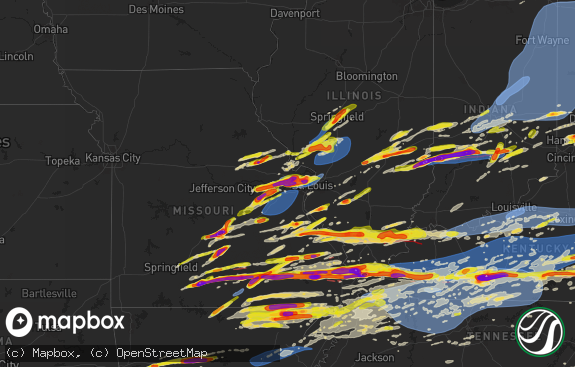
The weather event in Delaware on March 28, 2021 includes Hail and Wind maps. 8 states and 367 cities were impacted and suffered possible damage. The total estimated number of properties impacted is 0.

Hail
Wind
0
Estimated number of impacted properties by a 1.00" hail or larger0
Estimated number of impacted properties by a 1.75" hail or larger0
Estimated number of impacted properties by a 2.50" hail or largerStorm reports in Delaware
Delaware
| Date | Description |
|---|---|
| 03/28/20216:26 PM CDT | Downed utility pole and wires near new wharf road. Time estimated from radar. |
| 03/28/20216:20 PM CDT | Dedot gauge near state route 1 and trap shooters road. Time estimated from radar. |
| 03/28/20215:50 PM CDT | Dedot gauge at i-95 and marsh road. |
| 03/28/20215:47 PM CDT | Several reports of downed tree limbs and power lines in the bellefonte area. Time estimated from radar. |
| 03/28/20215:47 PM CDT | Dedot gauge at u.s. Highway 1 at the appoquinimink river. |
| 03/28/20215:44 PM CDT | Kilg asos. |
| 03/28/20215:42 PM CDT | A couple of light poles blown over in a parking lot. |
| 03/28/20215:39 PM CDT | Several reports of downed tree limbs and power lines in the albertson park area. Time estimated from radar. |
| 03/28/20215:35 PM CDT | De dot gauge. |
| 03/28/20215:34 PM CDT | Several reports of downed tree limbs and power lines in the windy hills area. Time estimated from radar. |
| 03/28/20215:34 PM CDT | Downed tree on north star road. Time estimated from radar. |
| 03/28/20211:47 AM CDT | At 646 PM EDT, severe thunderstorms were located along a line extending from Norristown to Arden to Pennsville, moving east at 55 mph. This line of storms has a history of producing wind damage. HAZARD...60 mph wind gusts. SOURCE...Public. IMPACT...Damage to roofs, siding, trees, and power lines is possible. Locations impacted include... Philadelphia, Camden, Wilmington, Vineland, Gloucester City, Cherry Hill, Bensalem, Evesham, Mount Laurel, Norristown, Chester, Willingboro, Deptford, Voorhees, Medford, West Deptford, Glassboro, Lindenwold, West Norriton and Hammonton.This includes the following highways... New Jersey Turnpike between exits 1 and 7A. Pennsylvania Turnpike between mile markers 327 and 359. Northeast Extension between mile markers 21 and 23. Interstate 95 in Pennsylvania between mile markers 0 and 40. Interstate 95 in Delaware between mile markers 17 and 23. Interstate 76 in Pennsylvania between mile markers 327 and 351. Interstate 76 in New Jersey between mile markers 0 and 3. Interstate 195 in New Jersey between mile markers 9 and 10. Interstate 295 in New Jersey between mile markers 0 and 60. Interstate 676 in Pennsylvania between mile markers 0 and 1. Interstate 676 in New Jersey between mile markers 0 and 4. Interstate 476 in Pennsylvania between mile markers 0 and 19. Atlantic City Expressway between mile markers 30 and 44. |
| 03/28/202112:43 AM CDT | At 543 PM EDT, severe thunderstorms were located along a line extending from near Stewartstown to near Cockeysville, moving east at 35 mph. HAZARD...60 mph wind gusts. SOURCE...Radar indicated. IMPACT...Damaging winds will cause some trees and large branches to fall. This could injure those outdoors, as well as damage homes and vehicles. Roadways may become blocked by downed trees. Localized power outages are possible. Unsecured light objects may become projectiles. Locations impacted include... Elkton, Aberdeen, Havre De Grace, Calvert, Bel Air South, Bel Air North, North East, Jarrettsville, Rising Sun, Charlestown, Cecilton, Blake, Bohemias Mills, West Nottingham, Bay View, Lombard, Richardsmere, Woodlawn, Cherry Hill and Conowingo. |
All States Impacted by Hail Map on March 28, 2021
Cities Impacted by Hail Map on March 28, 2021
- Creswell, NC
- Roper, NC
- Nashville, NC
- Rocky Mount, NC
- Spring Hope, NC
- Freeport, TX
- Blakely, GA
- Brazoria, TX
- Odum, GA
- Oak City, NC
- Scotland Neck, NC
- Hobgood, NC
- Jesup, GA
- Plymouth, NC
- Columbia, NC
- Andrews, SC
- Funkstown, MD
- Rocky Ridge, MD
- Hagerstown, MD
- Emmitsburg, MD
- Thurmont, MD
- Sabillasville, MD
- Westminster, MD
- Williamsport, MD
- Smithsburg, MD
- Taneytown, MD
- Keymar, MD
- Drexel Hill, PA
- Narvon, PA
- Bradley Beach, NJ
- Gibbsboro, NJ
- Gladwyne, PA
- Devon, PA
- Lansdale, PA
- Essington, PA
- Glassboro, NJ
- Windsor, NJ
- Leola, PA
- Sharon Hill, PA
- Jenkintown, PA
- Media, PA
- Allentown, NJ
- Collingswood, NJ
- Point Pleasant Beach, NJ
- Glenside, PA
- Folsom, PA
- New Holland, PA
- Ronks, PA
- Brookhaven, PA
- Audubon, NJ
- Norwood, PA
- Pedricktown, NJ
- Fort Monmouth, NJ
- Palmyra, NJ
- Englishtown, NJ
- Jackson, NJ
- Elkins Park, PA
- Clifton Heights, PA
- Magnolia, NJ
- Norristown, PA
- Marlboro, NJ
- Mickleton, NJ
- Garnet Valley, PA
- Swedesboro, NJ
- Stratford, NJ
- Abington, PA
- Montchanin, DE
- Pine Beach, NJ
- Cherry Hill, NJ
- Levittown, PA
- Ocean Grove, NJ
- Deal, NJ
- Haddon Heights, NJ
- Cheyney, PA
- Mantua, NJ
- Sea Girt, NJ
- Phoenixville, PA
- Downingtown, PA
- Bordentown, NJ
- Barnegat, NJ
- Horsham, PA
- Island Heights, NJ
- Mont Clare, PA
- Chesterfield, NJ
- Spring City, PA
- Wyncote, PA
- Cranbury, NJ
- Lumberton, NJ
- Thorndale, PA
- Cookstown, NJ
- Bryn Athyn, PA
- Oaklyn, NJ
- Hatboro, PA
- Pennsauken, NJ
- Haverford, PA
- Yorklyn, DE
- Mount Holly, NJ
- Narberth, PA
- Gibbstown, NJ
- Beachwood, NJ
- Ocean Gate, NJ
- Collegeville, PA
- Gordonville, PA
- Chester, PA
- Bayville, NJ
- Grenloch, NJ
- Pemberton, NJ
- Brick, NJ
- Lakehurst, NJ
- Beverly, NJ
- Allenwood, NJ
- King Of Prussia, PA
- Roebling, NJ
- Richboro, PA
- Clarksboro, NJ
- Belmar, NJ
- Riverside, NJ
- Terre Hill, PA
- National Park, NJ
- Cochranville, PA
- Chatsworth, NJ
- Eatontown, NJ
- Flourtown, PA
- Croydon, PA
- Spring House, PA
- West Berlin, NJ
- Gap, PA
- Merchantville, NJ
- Burlington, NJ
- Fairless Hills, PA
- Long Branch, NJ
- Chester Heights, PA
- Robbinsville, NJ
- North East, MD
- New Egypt, NJ
- Malvern, PA
- Gloucester City, NJ
- Riverton, NJ
- Ardmore, PA
- New Castle, DE
- Kennett Square, PA
- Brielle, NJ
- Willow Grove, PA
- Intercourse, PA
- Joint Base Mdl, NJ
- Wallingford, PA
- Port Deposit, MD
- Claymont, DE
- Cheltenham, PA
- Huntingdon Valley, PA
- Woodbury Heights, NJ
- Mount Royal, NJ
- Mount Laurel, NJ
- Rockland, DE
- Rancocas, NJ
- Morton, PA
- Berwyn, PA
- Barrington, NJ
- Hainesport, NJ
- North Wales, PA
- Marcus Hook, PA
- Voorhees, NJ
- Berlin, NJ
- Forked River, NJ
- Mullica Hill, NJ
- Lawnside, NJ
- Merion Station, PA
- Feasterville Trevose, PA
- Royersford, PA
- Immaculata, PA
- Bear, DE
- Conshohocken, PA
- Pitman, NJ
- Elverson, PA
- Rising Sun, MD
- Chester Springs, PA
- Villanova, PA
- Freehold, NJ
- Clementon, NJ
- Pennsville, NJ
- Warminster, PA
- Exton, PA
- Wilmington, DE
- Paradise, PA
- Blackwood, NJ
- Broomall, PA
- Thorofare, NJ
- West Grove, PA
- Williamstown, NJ
- Morgantown, PA
- Atco, NJ
- Moorestown, NJ
- West Chester, PA
- Langhorne, PA
- Atglen, PA
- Dresher, PA
- Kinzers, PA
- Allenhurst, NJ
- Marlton, NJ
- Woodstown, NJ
- Browns Mills, NJ
- Mount Ephraim, NJ
- Columbus, NJ
- Seaside Heights, NJ
- Bala Cynwyd, PA
- Waretown, NJ
- Somerdale, NJ
- Lavallette, NJ
- Millstone Township, NJ
- Jobstown, NJ
- Blue Bell, PA
- Newtown, PA
- Ridley Park, PA
- Southampton, PA
- Chadds Ford, PA
- Camden, NJ
- Newtown Square, PA
- Plymouth Meeting, PA
- Upper Darby, PA
- Lafayette Hill, PA
- Manchester Township, NJ
- Penns Grove, NJ
- Holmes, PA
- Wenonah, NJ
- Seaside Park, NJ
- Lawrence Township, NJ
- Princeton Junction, NJ
- East Earl, PA
- Spring Lake, NJ
- Lansdowne, PA
- Pottstown, PA
- Mantoloking, NJ
- Havertown, PA
- Elk Mills, MD
- Hammonton, NJ
- Woodbury, NJ
- Prospect Park, PA
- Lanoka Harbor, NJ
- Monroeville, NJ
- Darby, PA
- Neptune, NJ
- Philadelphia, PA
- Glenolden, PA
- Bridgeport, PA
- Landenberg, PA
- Springfield, PA
- Hightstown, NJ
- Wayne, PA
- West Long Branch, NJ
- Glendora, NJ
- Honey Brook, PA
- Swarthmore, PA
- Woodlyn, PA
- Haddonfield, NJ
- Asbury Park, NJ
- Runnemede, NJ
- Avon By The Sea, NJ
- Vincentown, NJ
- Howell, NJ
- Farmingdale, NJ
- Oakhurst, NJ
- Manasquan, NJ
- Newark, DE
- Bryn Mawr, PA
- Monroe Township, NJ
- Florence, NJ
- Parkesburg, PA
- Sicklerville, NJ
- Paoli, PA
- Bellmawr, NJ
- Toms River, NJ
- Crum Lynne, PA
- Glenmoore, PA
- Wrightstown, NJ
- Maple Shade, NJ
- Oceanport, NJ
- Coatesville, PA
- Paulsboro, NJ
- Morrisville, PA
- Oreland, PA
- Bristol, PA
- Folcroft, PA
- Fort Washington, PA
- Colts Neck, NJ
- Roosevelt, NJ
- Bensalem, PA
- Sewell, NJ
- Christiana, PA
- Willingboro, NJ
- Trenton, NJ
- Aston, PA
- Glen Mills, PA
- Waterford Works, NJ
- Thornton, PA
- Lakewood, NJ
- Westville, NJ
- Ambler, PA
- Bridgeport, NJ
- Wynnewood, PA
- Oaks, PA
- Cream Ridge, NJ
- Elkton, MD
- Medford, NJ
- Hockessin, DE
- Cross Hill, SC
- Newberry, SC
- Kinards, SC
- Silverstreet, SC
- Chappells, SC
- Mountville, SC
- Gable, SC
- Kingstree, SC
- Swansea, SC
- Dalzell, SC
- Pinewood, SC
- Shaw Afb, SC
- West Columbia, SC
- Gaston, SC
- Columbia, SC
- Rembert, SC
- Saint Matthews, SC
- Eastover, SC
- Mayesville, SC
- New Zion, SC
- Sumter, SC
- Gadsden, SC
- Alcolu, SC
- Cayce, SC
- Hopkins, SC
- Manning, SC
- Wedgefield, SC
- Macclesfield, NC
- Robersonville, NC
- Williamston, NC
- Lewiston Woodville, NC
- Merry Hill, NC
- Colerain, NC
- Edenton, NC
- Tarboro, NC
- Windsor, NC
- Hamilton, NC
- Griffin, GA
- Jenkinsburg, GA
- Locust Grove, GA
- Jackson, GA
- Monticello, GA
- Flovilla, GA
- Byron, GA
- Knoxville, GA
- Lizella, GA
- Dry Branch, GA
- Macon, GA
- Louisville, GA
- Waynesboro, GA
- Midville, GA
- Perkins, GA
- Davisboro, GA
- Kite, GA
- Harrison, GA
- Millen, GA
- Tennille, GA
- Wadley, GA
- Swainsboro, GA
- Sardis, GA
- Bartow, GA
- Wrightsville, GA
- Sylvania, GA


