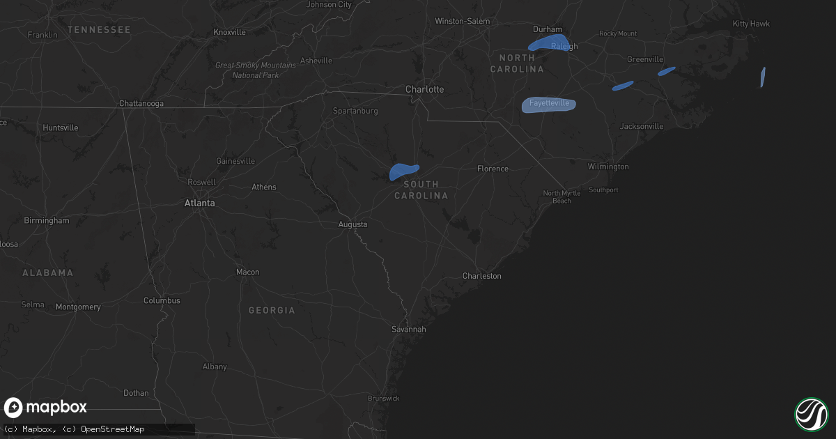
Hail Map in South Carolina on February 16, 2025
Get this storm
February 16 map
$229
one time, instant access
Download today. No call, no setup
Keep the $229
Bought the map and want the full workflow? Apply the entire $229 to a subscription within 7 days. None of it is wasted.
Every map, not just this one
This buys you this map. Subscription and you get every map we run, in the markets you choose from a few cities to whole states to nationwide. Plus real-time alerts the moment a storm fires.
Contact data
Name, contact info, occupancy, even credit band for addresses in the footprint. You go from where it hit to who to call.
Become the source they trust
Unlimited branding weather history reports on demand. You already have the documented answer ready for the property owner, and you are the one who showed up with it.
Property data and RoofTrace estimates
Pull up any address you have got, its value and the exact code rules for that jurisdiction, straight from One Click Code. Then RoofTrace estimates the squares, pitch, and roof value, priced the way you price.
Storm reports in South Carolina
South Carolina
| Date | Description |
|---|---|
| 02/16/20259:25 AM CST | Scdps reports tree down on hudson mill road. |
| 02/16/20258:18 AM CST | Tree down on i-20 near winburn road... West of florence... Sc. |
| 02/16/20258:05 AM CST | Sumter dispatch reported trees down on us 15 at brewington rd. Time estimated by radar. |
| 02/16/20257:54 AM CST | Multiple trees down in darlington county along potato house road. Report arrived at 9:01 am... Damage time estimated via radar. |
| 02/16/20257:45 AM CST | Sumter dispatch reported trees down on peach orchard rd at oakcrest rd. Time estimated by radar. |
| 02/16/20257:39 AM CST | Sc department of public safety reported a tree blocking the roadway on sc 121 north of johnston. Time estimated by radar. |
| 02/16/20257:37 AM CST | Sumter dispatch reported trees down on black river rd northeast of dalzell. Time estimated by radar. |
| 02/16/20257:35 AM CST | Lee county dispatch reported dot in route to downed trees in bishopville. Time estimated by radar. |
| 02/16/20257:34 AM CST | Tree reported down near ebenezer road and old wire road west in marlboro county... Sc. |
| 02/16/20257:33 AM CST | Chesterfield dispatch reported trees and powerlines down on hwy 52 near the cheraw state park entrance. Time estimated by radar. |
| 02/16/20257:30 AM CST | Chesterfield dispatch reported trees and powerlines down on hwy 1 at society hill rd. Time estimated by radar. |
| 02/16/20257:27 AM CST | Chesterfield dispatch reported trees and powerlines down on hwy 102 near turnage rd. Time estimated by radar. |
| 02/16/20257:19 AM CST | Chesterfield dispatch reported trees and powerlines down on hartsville-ruby rd at huggins rd. Time estimated by radar. |
| 02/16/20256:57 AM CST | Spotter provided a video of downed flag pole due to thunderstorm winds. |
| 02/16/20256:50 AM CST | Sc department of public safety reported a tree down on wilson blvd. |
| 02/16/20256:43 AM CST | Sc highway patrol reported trees down along i-77 south of blythewood rd. |
| 02/16/20256:37 AM CST | Sc department of public safety reported trees down on i26. |
| 02/16/20256:36 AM CST | Aiken county sheriff dispatch reported a tree down on i20 at mile marker 22. |
| 02/16/20256:30 AM CST | Sc department of public safety reported a tree down on dutch fork road. |
| 02/16/20256:30 AM CST | Coast guard island rcwinds site measured 58 mph gust. |
| 02/16/20256:27 AM CST | Corrects previous tstm wnd dmg report from 1 nne aiken municipal apt. Aiken county sheriff dispatch reported a tree down on i20 at mile marker 22. |
| 02/16/20256:24 AM CST | Sc highway patrol reported tree down on i-77 south of heritage rd. |
| 02/16/20256:18 AM CST | Social media post with pictures showing a snapped tree on a property on dockside circle. Time estimated by radar. |
| 02/16/20256:14 AM CST | Sc department of public safety reported a tree blocking the roadway on sc 121 north of johnston. Time estimated by radar. |
| 02/16/20256:10 AM CST | Power outage due to fallen trees or limbs near langrum branch rd. Time estimated. |
| 02/16/20256:05 AM CST | Newberry county dispatch reported trees down at mount pleasant rd and mt bethel garmany rd. |
| 02/16/20256:04 AM CST | Sc department of public safety reported trees down on i-26 near hwy 219. Time estimated by radar. |
| 02/16/20256:01 AM CST | Newberry county dispatch reported trees down along george loop. |
| 02/16/20256:00 AM CST | Sc department of public safety reported trees down on i-26. Time estimated by radar. |
All States Impacted by Hail Map on February 16, 2025
Cities Impacted by Hail Map on February 16, 2025
- Utica, MS
- Crystal Springs, MS
- Terry, MS
- Raymond, MS
- Byram, MS
- Little Mountain, SC
- Chapin, SC
- Lexington, SC
- Gilbert, SC
- Irmo, SC
- Jenkinsville, SC
- Columbia, SC
- Winnsboro, SC
- Blythewood, SC
- Raeford, NC
- Fort Bragg, NC
- Shannon, NC
- Red Springs, NC
- Fayetteville, NC
- Hope Mills, NC
- Lumber Bridge, NC
- Parkton, NC
- Chapel Hill, NC
- Pittsboro, NC
- Apex, NC
- Cary, NC
- Durham, NC
- Morrisville, NC
- Raleigh, NC
- Garner, NC
- Salemburg, NC
- Stedman, NC
- Wade, NC
- Autryville, NC
- Roseboro, NC
- Lumberton, NC
- Fairmont, NC
- Orrum, NC
- Bladenboro, NC
- Elizabethtown, NC
- White Oak, NC
- Tar Heel, NC
- Clarkton, NC
- Wallace, NC
- Harrells, NC
- Garland, NC
- Ivanhoe, NC
- Willard, NC
- Teachey, NC
- Goldsboro, NC
- La Grange, NC
- Dudley, NC
- Snow Hill, NC
- Hookerton, NC
- Seven Springs, NC
- Kinston, NC
- Vanceboro, NC
- Chocowinity, NC
- Grimesland, NC
- Blounts Creek, NC
- Washington, NC
- Salvo, NC
- Waves, NC
- Buxton, NC
- Avon, NC
- Hatteras, NC
- Ocracoke, NC
- Frisco, NC


