Hail Map in Delaware on October 31, 2019
Get this storm
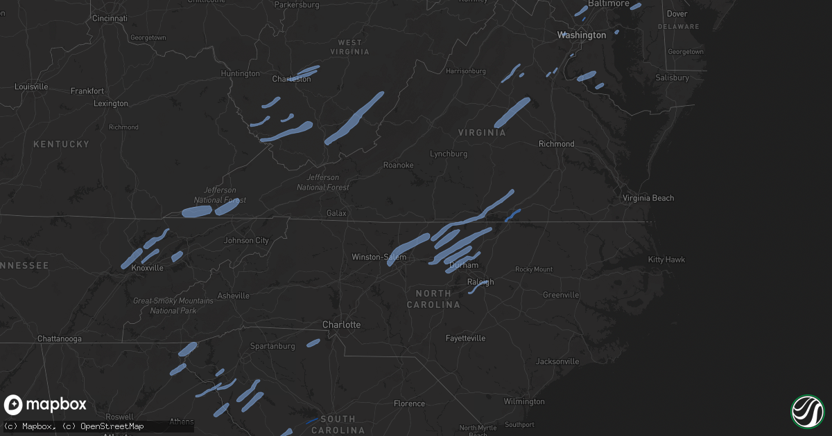
October 31 map
$229
one time, instant access
Download today. No call, no setup
Keep the $229
Bought the map and want the full workflow? Apply the entire $229 to a subscription within 7 days. None of it is wasted.
Every map, not just this one
This buys you this map. Subscription and you get every map we run, in the markets you choose from a few cities to whole states to nationwide. Plus real-time alerts the moment a storm fires.
Contact data
Name, contact info, occupancy, even credit band for addresses in the footprint. You go from where it hit to who to call.
Become the source they trust
Unlimited branding weather history reports on demand. You already have the documented answer ready for the property owner, and you are the one who showed up with it.
Property data and RoofTrace estimates
Pull up any address you have got, its value and the exact code rules for that jurisdiction, straight from One Click Code. Then RoofTrace estimates the squares, pitch, and roof value, priced the way you price.
Storm reports in Delaware
Delaware
| Date | Description |
|---|---|
| 10/31/20196:54 AM CDT | At 1154 PM EDT, severe thunderstorms were located along a line extending from near Richboro to near Alloway, moving northeast at 70 mph. HAZARD...60 mph wind gusts. SOURCE...Radar indicated. IMPACT...Damage to roofs, siding, trees, and power lines is possible. Locations impacted include... Philadelphia, Trenton, Camden, Vineland, New Brunswick, Perth Amboy, Bridgeton, Gloucester City, Somerset, Edison, Cherry Hill, Old Bridge, Bensalem, East Brunswick, Evesham, South Brunswick, Sayreville, Mount Laurel, North Brunswick and Manalapan.This includes the following highways... Atlantic City Expressway between mile markers 29 and 44. Garden State Parkway between mile markers 121 and 133. Interstate 195 in New Jersey between mile markers 0 and 16. Interstate 287 in New Jersey between mile markers 0 and 10. Interstate 295 in New Jersey between mile markers 17 and 76. Interstate 95 in Pennsylvania between mile markers 34 and 40. New Jersey Turnpike between exits 2 and 13. |
| 10/31/201912:20 AM CDT | Several trees snapped near a residence. Time estimated from radar. |
| 10/31/201912:02 AM CDT | A local report indicates 59 MPH wind near 3 SSW LITTLE CREEK |
| 10/30/201911:49 PM CDT | Downed tree on smyrna leipsic road between big oak road and hurd road. Time estimated from radar. |
| 10/30/201911:35 PM CDT | Dedot gauge. |
| 10/30/201911:28 PM CDT | Trees down... Homes damaged. Time estimated from radar. |
| 10/30/201911:27 PM CDT | Downed tree on new bridge road between route 141 and rising sun lane. Time estimated from radar. |
| 10/30/201911:27 PM CDT | Downed tree near the intersection of montchanin road and buck road. Time estimated from radar. |
| 10/30/201911:27 PM CDT | Downed tree on thompsons bridge road between guyencourt road and woodlawn road. Time estimated from radar. |
| 10/30/201911:20 PM CDT | Several trees snapped near a residence. Time estimated from radar. |
| 10/30/201911:19 PM CDT | Downed power lines on way road between old kennett road and creek road. Time estimated from radar. |
| 10/30/201911:19 PM CDT | Downed tree and wires near the intersection of old county road and farmington avenue. Time estimated from radar. |
| 10/30/201911:02 PM CDT | A local report indicates 59 MPH wind near 3 SSW LITTLE CREEK |
| 10/30/201910:49 PM CDT | Downed tree on smyrna leipsic road between big oak road and hurd road. Time estimated from radar. |
| 10/30/201910:35 PM CDT | Dedot gauge. |
| 10/30/201910:28 PM CDT | Trees down... Homes damaged. Time estimated from radar. |
| 10/30/201910:27 PM CDT | Downed tree near the intersection of montchanin road and buck road. Time estimated from radar. |
| 10/30/201910:27 PM CDT | Downed tree on thompsons bridge road between guyencourt road and woodlawn road. Time estimated from radar. |
| 10/30/201910:27 PM CDT | Downed tree on new bridge road between route 141 and rising sun lane. Time estimated from radar. |
| 10/30/201910:19 PM CDT | Downed power lines on way road between old kennett road and creek road. Time estimated from radar. |
| 10/30/201910:19 PM CDT | Downed tree and wires near the intersection of old county road and farmington avenue. Time estimated from radar. |
All States Impacted by Hail Map on October 31, 2019
Cities Impacted by Hail Map on October 31, 2019
- La Crosse, VA
- Boydton, VA
- Bracey, VA
- Brodnax, VA
- Culpeper, VA
- Madison, VA
- Aroda, VA
- Brightwood, VA
- Reva, VA
- Pratts, VA
- Rochelle, VA
- Oakpark, VA
- Mitchells, VA
- Louisa, VA
- Scottsville, VA
- Mineral, VA
- Troy, VA
- Bremo Bluff, VA
- Fork Union, VA
- Kents Store, VA
- Palmyra, VA
- Fredericksburg, VA
- Stafford, VA
- Lorton, VA
- Annapolis, MD
- Lenore, WV
- Williamson, WV
- Logan, WV
- Pecks Mill, WV
- Delbarton, WV
- Chapmanville, WV
- Holden, WV
- Foster, WV
- Julian, WV
- Danville, WV
- Harts, WV
- Big Creek, WV
- Bim, WV
- Wharton, WV
- Twilight, WV
- Gilbert, WV
- Ravencliff, WV
- Glen Rogers, WV
- Fairdale, WV
- Glen Daniel, WV
- Matewan, WV
- Coal Mountain, WV
- Simon, WV
- Surveyor, WV
- Maben, WV
- Baisden, WV
- Saxon, WV
- Wharncliffe, WV
- Beckley, WV
- Lester, WV
- Bolt, WV
- Glen Fork, WV
- Jesse, WV
- Oceana, WV
- Verner, WV
- Matheny, WV
- Arnett, WV
- Cyclone, WV
- Clear Fork, WV
- Slab Fork, WV
- Procious, WV
- Elkview, WV
- Bomont, WV
- Charleston, WV
- Clendenin, WV
- South Charleston, WV
- Crawley, WV
- Pence Springs, WV
- Renick, WV
- Sandstone, WV
- Green Sulphur Springs, WV
- Hinton, WV
- Jumping Branch, WV
- Nimitz, WV
- Williamsburg, WV
- Buckeye, WV
- Grassy Meadows, WV
- Asbury, WV
- Maxwelton, WV
- Hillsboro, WV
- Lewisburg, WV
- Flat Top, WV
- Talcott, WV
- Smoot, WV
- Alderson, WV
- Waterloo, SC
- Abbeville, SC
- Hodges, SC
- Greenwood, SC
- Clayton, GA
- Tiger, GA
- North Augusta, SC
- Grovetown, GA
- Clarks Hill, SC
- Ridge Spring, SC
- Johnston, SC
- Evans, GA
- Augusta, GA
- Trenton, SC
- Monetta, SC
- Harlem, GA
- Graniteville, SC
- Aiken, SC
- Beech Island, SC
- Gibson, GA
- Warrenville, SC
- Avera, GA
- Wrens, GA
- Matthews, GA
- Hephzibah, GA
- Stapleton, GA
- Gloverville, SC
- Blythe, GA
- Keysville, GA
- Bartow, GA
- Wadley, GA
- Waynesboro, GA
- Davisboro, GA
- New Ellenton, SC
- Jackson, SC
- Louisville, GA
- Sharon, SC
- Smyrna, SC
- Clover, SC
- York, SC
- Gilbert, SC
- Lexington, SC
- Reidsville, NC
- Ruffin, NC
- Kernersville, NC
- Colfax, NC
- High Point, NC
- Stokesdale, NC
- Yanceyville, NC
- Greensboro, NC
- Browns Summit, NC
- Summerfield, NC
- Pelham, NC
- Oak Ridge, NC
- Alton, VA
- Virgilina, VA
- Skipwith, VA
- Semora, NC
- Elon, NC
- South Hill, VA
- Milton, NC
- Baskerville, VA
- Kenbridge, VA
- Clarksville, VA
- Nelson, VA
- Roxboro, NC
- Blanch, NC
- Chase City, VA
- Buffalo Junction, VA
- Leasburg, NC
- Prospect Hill, NC
- Mebane, NC
- Hurdle Mills, NC
- Burlington, NC
- Hillsborough, NC
- Cedar Grove, NC
- Henderson, NC
- Graham, NC
- Oxford, NC
- Timberlake, NC
- Haw River, NC
- Rougemont, NC
- Efland, NC
- Bahama, NC
- Stem, NC
- Durham, NC
- Creedmoor, NC
- Butner, NC
- Carrboro, NC
- Chapel Hill, NC
- Raleigh, NC
- Knightdale, NC
- Apex, NC
- Holly Springs, NC
- Fuquay Varina, NC
- Clarkesville, GA
- Demorest, GA
- Mount Airy, GA
- Toccoa, GA
- Long Creek, SC
- Westminster, SC
- Anderson, SC
- Pendleton, SC
- Bowersville, GA
- Canon, GA
- Royston, GA
- Starr, SC
- Hartwell, GA
- Laurens, SC
- Donalds, SC
- Due West, SC
- Iva, SC
- Ware Shoals, SC
- Belton, SC
- Elberton, GA
- Hockessin, DE
- Gladwyne, PA
- Kennett Square, PA
- Wilmington, DE
- Bridgeport, PA
- Newtown Square, PA
- Chalfont, PA
- Paoli, PA
- Blue Bell, PA
- Philadelphia, PA
- Oreland, PA
- Villanova, PA
- Willow Grove, PA
- Berwyn, PA
- Horsham, PA
- Dresher, PA
- Montgomeryville, PA
- Spring House, PA
- Landenberg, PA
- Conshohocken, PA
- Media, PA
- Lafayette Hill, PA
- Newtown, PA
- Hatboro, PA
- Richboro, PA
- Malvern, PA
- Thornton, PA
- Flourtown, PA
- Huntingdon Valley, PA
- King Of Prussia, PA
- Devon, PA
- Avondale, PA
- Toughkenamon, PA
- Southampton, PA
- Doylestown, PA
- West Chester, PA
- Gwynedd, PA
- Cheyney, PA
- Bryn Mawr, PA
- Glen Mills, PA
- Warminster, PA
- Norristown, PA
- Ambler, PA
- North Wales, PA
- Jamison, PA
- Chadds Ford, PA
- Glenside, PA
- Furlong, PA
- Plymouth Meeting, PA
- Wayne, PA
- Warrington, PA
- Abington, PA
- Fort Washington, PA
- Silver Spring, MD
- Oakton, VA
- Vienna, VA
- Worton, MD
- Chestertown, MD
- Faulkner, MD
- Mechanicsville, MD
- Newburg, MD
- King George, VA
- Charlotte Hall, MD
- Dahlgren, VA
- Coltons Point, MD
- Leonardtown, MD
- Bushwood, MD
- Abell, MD
- Avenue, MD
- Brinklow, MD
- Ellicott City, MD
- Brookeville, MD
- Olney, MD
- Highland, MD
- Clarksville, MD
- Rockville, MD
- Dayton, MD
- Sandy Spring, MD
- Derwood, MD
- Norris, TN
- Heiskell, TN
- Oak Ridge, TN
- Clinton, TN
- Andersonville, TN
- Powell, TN
- Corryton, TN
- Luttrell, TN
- Blaine, TN
- Knoxville, TN
- Maynardville, TN
- Sharps Chapel, TN
- Tazewell, TN
- New Tazewell, TN
- Dryden, VA
- Duffield, VA
- Blackwater, VA
- Jonesville, VA
- Rose Hill, VA
- Pennington Gap, VA
- Gate City, VA
- Coeburn, VA
- Nickelsville, VA
- Fort Blackmore, VA
- Dungannon, VA
- Talbott, TN
- Jefferson City, TN
- New Market, TN
- Dandridge, TN
- Morristown, TN


