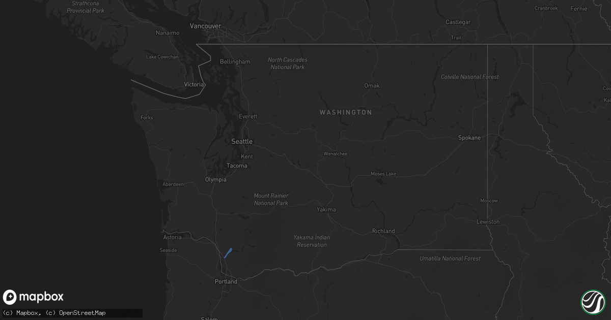
Hail Map in Washington on October 24, 2021
Get this storm
October 24 map
$229
one time, instant access
Download today. No call, no setup
Keep the $229
Bought the map and want the full workflow? Apply the entire $229 to a subscription within 7 days. None of it is wasted.
Every map, not just this one
This buys you this map. Subscription and you get every map we run, in the markets you choose from a few cities to whole states to nationwide. Plus real-time alerts the moment a storm fires.
Contact data
Name, contact info, occupancy, even credit band for addresses in the footprint. You go from where it hit to who to call.
Become the source they trust
Unlimited branding weather history reports on demand. You already have the documented answer ready for the property owner, and you are the one who showed up with it.
Property data and RoofTrace estimates
Pull up any address you have got, its value and the exact code rules for that jurisdiction, straight from One Click Code. Then RoofTrace estimates the squares, pitch, and roof value, priced the way you price.
Storm reports in Washington
Washington
| Date | Description |
|---|---|
| 10/24/20216:00 PM CDT | Tree down in mountain view cemetery. 700 customers lost power in walla walla. Report from walla walla union bulletin. |
| 10/24/20213:45 PM CDT | Amtrak reports a tree down on the tracks just south of kelso-longview... Blocking the coast starlight train southbound from kelso. |
| 10/24/20213:30 PM CDT | Downed tree blocked one lane of interstate 5 sb near woodland. Tree was removed by 5pm. |
| 10/23/202110:00 PM CDT | A local report indicates 63 MPH wind near 2 NE CAPE DISAPPOINTMEN |
All States Impacted by Hail Map on October 24, 2021
Cities Impacted by Hail Map on October 24, 2021
- Breckenridge, MO
- Griggsville, IL
- Farmington, MO
- Doe Run, MO
- Bismarck, MO
- Middle Brook, MO
- Ironton, MO
- Belleview, MO
- Hamilton, MO
- Eminence, MO
- Hartshorn, MO
- Summersville, MO
- Atkins, AR
- Meredosia, IL
- Mammoth Spring, AR
- Thayer, MO
- Jacksonville, IL
- Virginia, IL
- Ashland, IL
- Arenzville, IL
- Hartsburg, MO
- Centertown, MO
- Jefferson City, MO
- Chillicothe, MO
- Lock Springs, MO
- Mooresville, MO
- Gallatin, MO
- Salem, MO
- Bunker, MO
- Potosi, MO
- Mineral Point, MO
- Belgrade, MO
- Cabool, MO
- Willow Springs, MO
- Sedalia, MO
- Bath, IL
- Havana, IL
- Browning, IL
- Astoria, IL
- Kirksville, MO
- Brashear, MO
- Pittsfield, IL
- New Salem, IL
- Winchester, IL
- Pleasant Plains, IL
- Tallula, IL
- Bluffs, IL
- Chambersburg, IL
- Petersburg, IL
- Alexander, IL
- Concord, IL
- Chapin, IL
- Patton, MO
- Fredericktown, MO
- Cedarville, AR
- Alma, AR
- Rudy, AR
- Uniontown, AR
- Van Buren, AR
- Muldrow, OK
- Natural Dam, AR
- Fieldon, IL
- Jerseyville, IL
- Farrar, MO
- Perryville, MO
- Friedheim, MO
- Sedgewickville, MO
- Uniontown, MO
- Frohna, MO
- Dearborn, MO
- Edgerton, MO
- Gower, MO
- Plattsburg, MO
- Mountain View, MO
- Arcadia, MO
- Grandview, IN
- Lamar, IN
- Evanston, IN
- Tahlequah, OK
- Park Hill, OK
- Aviston, IL
- Trenton, IL
- Breese, IL
- Curryville, MO
- Jacob, IL
- Oak Ridge, MO
- Lesterville, MO
- Saint Mary, MO
- Redford, MO
- Gorham, IL
- Ava, IL
- Ellington, MO
- Marquand, MO
- Annapolis, MO
- Vulcan, MO
- Des Arc, MO
- Stilwell, OK
- Cookson, OK
- Bunch, OK
- Muskogee, OK
- Fort Gibson, OK
- Kane, IL
- Carrollton, IL
- Prairie Du Rocher, IL
- Red Bud, IL
- Henderson, KY
- Sidell, IL
- Beardstown, IL
- Louisiana, MO
- New Canton, IL
- Frankford, MO
- Chandlerville, IL
- Rockport, IL
- Versailles, IL
- Barry, IL
- Bowling Green, MO
- Pleasant Hill, IL
- Hollister, MO
- Omaha, AR
- Ridgedale, MO
- Excello, MO
- Huntsville, MO
- Midland, AR
- Huntington, AR
- Cameron, OK
- Hackett, AR
- Centerville, KS
- Gainesville, MO
- Lead Hill, AR
- Protem, MO
- Cedarcreek, MO
- Kirbyville, MO
- Peel, AR
- Mountain Home, AR
- Clarkridge, AR
- Udall, MO
- Gepp, AR
- Oakland, AR
- Bakersfield, MO
- Caulfield, MO
- West Plains, MO
- Gamaliel, AR
- Viola, AR
- Pontiac, MO
- Moody, MO
- Newburgh, IN
- Spottsville, KY
- Baldwin, IL
- Marissa, IL
- Glenallen, MO
- Sainte Genevieve, MO
- Bloomsdale, MO
- Sallisaw, OK
- Ipava, IL
- Lewistown, IL
- Park Hills, MO
- Irondale, MO
- Bonne Terre, MO
- Doniphan, MO
- Gatewood, MO
- Franklin, IL
- Reed, KY
- Centerville, MO
- Black, MO
- Grandin, MO
- Hamburg, IA
- Koshkonong, MO
- Salem, AR
- Couch, MO
- Sturkie, AR
- Millersville, MO
- Marble Hill, MO
- New Athens, IL
- Sparta, IL
- Blue Eye, MO
- Athens, IL
- Murphysboro, IL
- Linwood, NE
- Prague, NE
- Kidder, MO
- Chula, MO
- Cameron, MO
- Jamesport, MO
- Hartford, AR
- Macon, MO
- Easton, IL
- Kilbourne, IL
- Strafford, MO
- Oakdale, IL
- Stoutland, MO
- Otterville, MO
- Smithton, MO
- Wheeling, MO
- Linneus, MO
- Kingston, MO
- Turney, MO
- Lathrop, MO
- Pattonsburg, MO
- Gilman City, MO
- Jameson, MO
- Coffey, MO
- Spickard, MO
- Bethany, MO
- Trenton, MO
- Green Castle, MO
- New Boston, MO
- Meadville, MO
- Browning, MO
- Purdin, MO
- Winigan, MO
- Brookfield, MO
- Novinger, MO
- Milan, MO
- Prairie Home, MO
- Jamestown, MO
- Bunceton, MO
- Boonville, MO
- Wooldridge, MO
- Rocheport, MO
- Columbia, MO
- Richland, MO
- Troy, KS
- Woodland, WA
- La Center, WA
- Vandalia, IL
- Highland, IL
- Lebanon, IL
- Beckemeyer, IL
- Dupo, IL
- Germantown, IL
- East Carondelet, IL
- Alma, IL
- Millstadt, IL
- Greenville, IL
- Patoka, IL
- East Saint Louis, IL
- Columbia, IL
- Kinmundy, IL
- Keyesport, IL
- O'Fallon, IL
- Carlyle, IL
- Vernon, IL
- Belleville, IL
- Saint Jacob, IL
- Fairview Heights, IL
- Summerfield, IL
- Pocahontas, IL
- Leadwood, MO
- Festus, MO
- Evansville, IL
- French Village, MO
- Bixby, MO
- Chester, IL
- Pilot Knob, MO
- Percy, IL
- Steeleville, IL
- Rockwood, IL
- Winona, MO
- Piedmont, MO
- Sherman, IL
- Greenview, IL
- Mount Pulaski, IL
- Williamsville, IL
- Elkhart, IL
- Lincoln, IL
- Springfield, IL
- Beason, IL
- Middletown, IL
- Cantrall, IL
- Chestnut, IL
- New Holland, IL
- Zalma, MO
- Chaffee, MO
- Wappapello, MO
- McGee, MO
- Gipsy, MO
- Greenville, MO
- Lowndes, MO
- Cape Girardeau, MO
- Advance, MO
- Whitewater, MO
- Richview, IL


