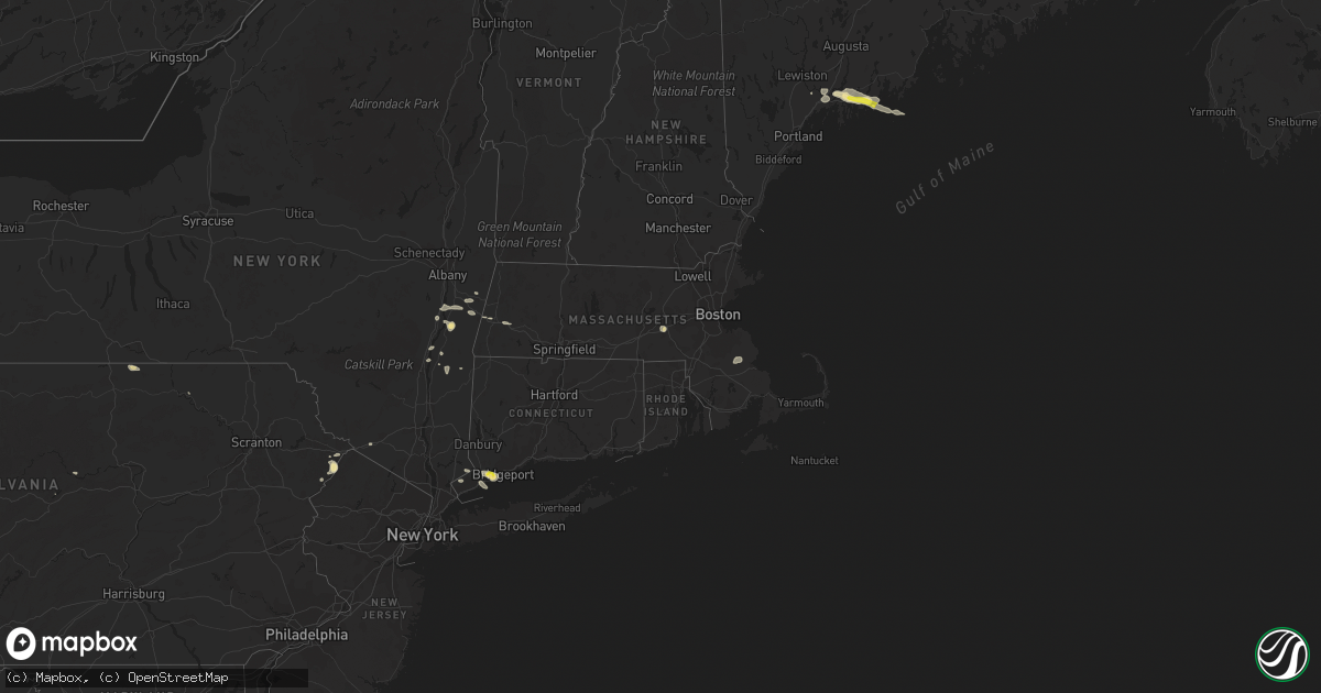
Hail Map in Connecticut on September 6, 2018
Get this storm
September 6 map
$229
one time, instant access
Download today. No call, no setup
Keep the $229
Bought the map and want the full workflow? Apply the entire $229 to a subscription within 7 days. None of it is wasted.
Every map, not just this one
This buys you this map. Subscription and you get every map we run, in the markets you choose from a few cities to whole states to nationwide. Plus real-time alerts the moment a storm fires.
Contact data
Name, contact info, occupancy, even credit band for addresses in the footprint. You go from where it hit to who to call.
Become the source they trust
Unlimited branding weather history reports on demand. You already have the documented answer ready for the property owner, and you are the one who showed up with it.
Property data and RoofTrace estimates
Pull up any address you have got, its value and the exact code rules for that jurisdiction, straight from One Click Code. Then RoofTrace estimates the squares, pitch, and roof value, priced the way you price.
Storm reports in Connecticut
Connecticut
| Date | Description |
|---|---|
| 09/06/20184:13 PM CDT | Mulitple trees reported down and snapped...time estimated by radar |
| 09/06/20183:55 PM CDT | Numerous trees reported down on briscoe road |
| 09/06/20183:30 PM CDT | Trees and wires down closing 4 roads including marion ave at sunnyside drive |
| 09/06/20183:20 PM CDT | Tree and wires down on skungamaug road |
| 09/06/20182:34 PM CDT | Tree down on wires. |
| 09/06/20182:25 PM CDT | Tree down on wires. |
| 09/06/20182:14 PM CDT | Tree down on wires. |
| 09/06/201812:22 AM CDT | At 522 PM EDT, a severe thunderstorm was located over Fairfield, or near Bridgeport, moving east at 25 mph. HAZARD...70 mph wind gusts and ping pong ball size hail. SOURCE...Radar indicated. IMPACT...People and animals outdoors will be injured. Expect hail damage to roofs, siding, windows, and vehicles. Expect considerable tree damage. Wind damage is also likely to mobile homes, roofs, and outbuildings. This severe thunderstorm will be near... Bridgeport around 525 PM EDT. |
| 09/05/201810:43 PM CDT | At 343 PM EDT, a severe thunderstorm was located near Litchfield, or 7 miles southwest of Torrington, moving east at 25 mph. HAZARD...60 mph wind gusts and penny size hail. SOURCE...Radar indicated. IMPACT...Expect damage to roofs, siding, and trees. This severe thunderstorm will be near... Litchfield around 355 PM EDT. Thomaston and Northwest Harwinton around 400 PM EDT.Other locations impacted by this severe thunderstorm includeGrappaville, South Kent, Haight Vineyard, Pequabuck, Reynolds Bridge,Kent Furnace, Hancock, Skiff Mountain, Lower Merryall and Warren. |
| 09/05/20189:59 PM CDT | At 259 PM EDT, severe thunderstorms were located along a line extending from near Chester to Otis and Sandisfield in the Berkshires, moving east at 25 mph. HAZARD...60 mph wind gusts and penny size hail. SOURCE...Radar indicated. IMPACT...Expect damage to trees and power lines. Locations impacted include... Springfield, Chicopee, Westfield, Holyoke, Agawam, West Springfield, Simsbury, Ludlow, South Hadley, Easthampton, Suffield, Granby, Canton, Southwick, Southampton, East Granby, Huntington, Hartland, Russell and Westhampton. |
All States Impacted by Hail Map on September 6, 2018
Cities Impacted by Hail Map on September 6, 2018
- Yazoo City, MS
- Silver City, MS
- Hebron, ND
- Glen Ullin, ND
- Richardton, ND
- Churchs Ferry, ND
- Devils Lake, ND
- Beulah, ND
- Zap, ND
- Auburn, KY
- Russellville, KY
- Topsham, ME
- Ezel, KY
- West Liberty, KY
- Mize, KY
- Carbondale, IL
- Murphysboro, IL
- Makanda, IL
- Nashville, TN
- Ashland City, TN
- Linden, TN
- Howard, PA
- Morganfield, KY
- Clay, KY
- Oberlin, LA
- Hudson, NY
- Ghent, NY
- Chillicothe, OH
- Frenchburg, KY
- Stanton, KY
- Means, KY
- Burns, TN
- Dickson, TN
- McKee, KY
- Marion, IL
- Wolford, ND
- Bowling Green, KY
- Pioneer, TN
- La Follette, TN
- Deridder, LA
- Dingmans Ferry, PA
- Ferdinand, IN
- Clay City, KY
- Germantown, OH
- Taylor, ND
- West Stockbridge, MA
- Stockbridge, MA
- Hanson, KY
- Manitou, KY
- Stottville, NY
- Athens, NY
- Oakland, KY
- Scottsville, KY
- Smiths Grove, KY
- Cando, ND
- Martin, TN
- South Fulton, TN
- Englewood, TN
- Leeds, ND
- York, ND
- Towner, ND
- Willow City, ND
- Franklin, TN
- Eaton, OH
- West Alexandria, OH
- Tellico Plains, TN
- Westport, CT
- Southport, CT
- Norwalk, CT
- Wilton, CT
- Weston, CT
- Fairfield, CT
- Cannelton, IN
- Tell City, IN
- Rugby, ND
- Waverly, OH
- Walpole, ME
- South Bristol, ME
- Wiscasset, ME
- Trevett, ME
- Woolwich, ME
- Boothbay, ME
- Liberty, KY
- Nolensville, TN
- Brentwood, TN
- Antioch, TN
- Corydon, KY
- Dixon, KY
- Sebree, KY
- Cutler, IL
- Percy, IL
- Ava, IL
- Becket, MA
- Lee, MA
- Franklin, KY
- Cedar Grove, TN
- Slaughters, KY
- Rolette, ND
- Knox, ND
- Charlotte, TN
- Gillett, PA
- Millerton, PA
- Pegram, TN
- Pemaquid, ME
- Bristol, ME
- Edgecomb, ME
- Bath, ME
- Danville, WV
- Julian, WV
- Ridgeview, WV
- Foster, WV
- Stamford, CT
- Greenwich, CT
- Rockfield, KY
- Layton, NJ
- Durham, ME
- Altenburg, MO
- Jackson, MO
- Jeffersonville, KY
- Mylo, ND
- Bisbee, ND
- Starkweather, ND
- Red Hook, NY
- Stanfordville, NY
- Clinton Corners, NY
- Melber, KY
- Milford, PA
- Franklin, OH
- Middletown, OH
- Miamisburg, OH
- Farmersville, OH
- Perry Hall, MD
- Parkville, MD
- Nottingham, MD
- Singer, LA
- New Leipzig, ND
- Darlington, PA
- Henderson, KY
- Nellis, WV
- Madison, WV
- Costa, WV
- White Bluff, TN
- Saugerties, NY
- Barrytown, NY
- Joelton, TN
- Albany, KY
- Negley, OH
- East Palestine, OH
- Rogers, OH
- East Nassau, NY
- Williamsburg, KY
- Crary, ND
- Etowah, TN
- Webster, ND
- Brunswick, ME
- Wysox, PA
- Steeleville, IL
- Campbell Hill, IL
- Mittie, LA
- Dry Creek, LA
- Kinder, LA
- Lakota, ND
- Westborough, MA
- Hopkinton, MA
- Flemingsburg, KY
- New Palestine, IN
- Greenfield, IN
- Fountaintown, IN
- Duff, TN
- Street, MD
- Coxsackie, NY
- Wolf Lake, IL
- Alto Pass, IL
- Pomona, IL
- Jonesboro, IL
- Cape Girardeau, MO
- New Harbor, ME
- Chamberlain, ME
- Elizaville, NY
- Tivoli, NY
- Germantown, NY
- Middletown, NY
- Slate Hill, NY
- Old Appleton, MO
- De Soto, IL
- Frohna, MO
- Grand Tower, IL
- Oak Ridge, MO
- Cobden, IL
- Uniontown, MO
- Vergennes, IL
- Gorham, IL
- Pleasant View, TN
- Chester, IL
- Rockwood, IL
- Perryville, MO
- Pound Ridge, NY
- New Canaan, CT
- Wickliffe, KY
- Barlow, KY
- Pembroke, MA
- Hanson, MA
- Halifax, MA
- Auburn, ME
- Lisbon, ME
- New Gloucester, ME
- Lock Haven, PA
- Kevil, KY
- Brookport, IL
- Paducah, KY
- West Paducah, KY
- Valley Grove, WV
- Bethany, WV
- Irvine, KY
- Beattyville, KY
- Lewisburg, KY
- Morgantown, KY
- East Chatham, NY
- Old Chatham, NY
- Brainard, NY
- Manchester, KY
- Boonville, IN
- Malden On Hudson, NY
- Salt Lick, KY
- Olympia, KY
- Glasgow, KY
- Austerlitz, NY
- Chatham, NY
- Waynesville, OH
- Lebanon, OH
- Tamiment, PA
- Bushkill, PA
- Hazel Green, KY
- Halls, TN
- Pine Plains, NY
- Gandeeville, WV
- Round Pond, ME
- Bowdoinham, ME
- Columbia, NJ
- Montague, NJ
- Minnewaukan, ND
- Beaver Falls, PA
- New Brighton, PA
- Brownsville, KY
- Wildersville, TN
- Lexington, TN
- Alvaton, KY
- Merryville, LA
- Longville, LA
- Richland, IN
- West Coxsackie, NY
- Valatie, NY
- Kinderhook, NY
- Stuyvesant, NY
- Schodack Landing, NY


