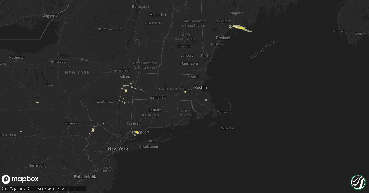
Hail Map in Massachusetts on September 6, 2018
Get this storm
September 6 map
$229
one time, instant access
Download today. No call, no setup
Keep the $229
Bought the map and want the full workflow? Apply the entire $229 to a subscription within 7 days. None of it is wasted.
Every map, not just this one
This buys you this map. Subscription and you get every map we run, in the markets you choose from a few cities to whole states to nationwide. Plus real-time alerts the moment a storm fires.
Contact data
Name, contact info, occupancy, even credit band for addresses in the footprint. You go from where it hit to who to call.
Become the source they trust
Unlimited branding weather history reports on demand. You already have the documented answer ready for the property owner, and you are the one who showed up with it.
Property data and RoofTrace estimates
Pull up any address you have got, its value and the exact code rules for that jurisdiction, straight from One Click Code. Then RoofTrace estimates the squares, pitch, and roof value, priced the way you price.
Storm reports in Massachusetts
Massachusetts
| Date | Description |
|---|---|
| 09/06/20184:10 PM CDT | Large tree branch down on a car on elm street |
| 09/06/20184:00 PM CDT | Tree down on wires on north street |
| 09/06/20184:00 PM CDT | Multiple wires down scattered on norfolk street |
| 09/06/20183:59 PM CDT | Tree down on school street |
| 09/06/20183:44 PM CDT | Tree branch down on wires on water row at plympton sreet |
| 09/06/20183:41 PM CDT | Large tree down on lovering street |
| 09/06/20183:40 PM CDT | Wires and tree down on fuller place |
| 09/06/20183:34 PM CDT | Tree down on hiler street in the rolling meadow area |
| 09/06/20183:33 PM CDT | Tree down blocking road on high street |
| 09/06/20183:25 PM CDT | Tree down on rocky pond road |
| 09/06/20183:25 PM CDT | Trees down on princeton road... Chamberlin road... And campground road |
| 09/06/20183:25 PM CDT | Tree down on north washington street |
| 09/06/20182:55 PM CDT | Tree down on princeton road |
| 09/06/20182:37 PM CDT | Large tree down on browning pond road at the oakham line |
| 09/06/20182:35 PM CDT | Tree and wires down between williams and laurel road |
| 09/06/20182:35 PM CDT | Trees and wires down on alpine road |
| 09/06/20182:25 PM CDT | 3 trees down blocking north lane |
| 09/06/20182:20 PM CDT | Tree and wires down on a trcuk on hardwick road at mechanic street. |
| 09/06/20181:53 PM CDT | Road blocked by downed tree and wires down. |
| 09/06/20181:43 PM CDT | Tree and wires down on a house. |
| 09/06/20181:17 PM CDT | Tree down on wires. |
| 09/06/20181:17 PM CDT | Tree down on wires. |
| 09/06/20181:17 PM CDT | Large tree down with wires blocking road. |
| 09/05/201811:51 PM CDT | At 451 PM EDT, a severe thunderstorm was located over the coastal waters 8 miles northwest of Provincetown, moving east at 30 mph. HAZARD...60 mph wind gusts and quarter size hail. SOURCE...Radar indicated. IMPACT...Hail damage to vehicles is possible. Expect damage to trees and power lines. Locations impacted include... Provincetown, Wellfleet and Truro. |
| 09/05/201811:23 PM CDT | At 422 PM EDT, a severe thunderstorm was located over Hopkinton, or near Milford, moving east at 45 mph. HAZARD...60 mph wind gusts and quarter size hail. SOURCE...Radar indicated. IMPACT...Hail damage to vehicles is possible. Expect damage to trees and power lines. Locations impacted include... Boston, Cambridge, Quincy, Lynn, Newton, Somerville, Framingham, Waltham, Malden, Brookline, Medford, Weymouth, Revere, Arlington, Everett, Salem, Marlborough, Braintree, Chelsea and Natick. |
| 09/05/20189:58 PM CDT | At 257 PM EDT, a severe thunderstorm was located over Pine Plains, or 13 miles east of Rhinebeck, moving east at 25 mph. HAZARD...70 mph wind gusts and penny size hail. SOURCE...Radar indicated. IMPACT...Expect considerable tree damage. Damage is likely to mobile homes, roofs, and outbuildings. This severe thunderstorm will be near... Amenia and Millerton around 310 PM EDT. Sharon around 320 PM EDT. Falls Village around 330 PM EDT. Canaan around 335 PM EDT. Norfolk around 350 PM EDT. Torrington around 355 PM EDT. Winsted around 400 PM EDT.Other locations impacted by this severe thunderstorm includeCornwall, West Torrington, Ancramdale, South Canaan, Lithgow,Wrightville, Salisbury, Smithfield, South Amenia and Taconic. |
| 09/05/20189:36 PM CDT | At 236 PM EDT, a severe thunderstorm was located near Great Barrington, moving east at 25 mph. HAZARD...60 mph wind gusts and penny size hail. SOURCE...Radar indicated. IMPACT...Expect damage to roofs, siding, and trees. This severe thunderstorm will be near... Great Barrington and Housatonic around 240 PM EDT. Sheffield around 245 PM EDT. Ashley Falls around 250 PM EDT. Otis and Sandisfield around 315 PM EDT.Other locations impacted by this severe thunderstorm includeHartsville, Konkapot, Gomorrah, New Boston, Alford, Newsboy Statue,Montville, North Hillsdale, Alander and Southfield. |
| 09/05/20189:18 PM CDT | At 218 PM EDT, a severe thunderstorm was located over Clermont, or 7 miles east of Saugerties, moving east at 25 mph. HAZARD...60 mph wind gusts and penny size hail. SOURCE...Radar indicated. IMPACT...Expect damage to roofs, siding, and trees. This severe thunderstorm will be near... Pine Plains and Ancram around 240 PM EDT. Copake around 250 PM EDT. Millerton around 300 PM EDT.Other locations impacted by this severe thunderstorm include PachinMills, Ancramdale, Kerleys Corners, Burden Dock, Burden, Churchtown,Linden Acres, Linlithgo Mills, Nevis and Fraleighs. |
| 09/05/20189:06 PM CDT | At 206 PM EDT, a severe thunderstorm was located near Austerlitz, or 9 miles east of Chatham, moving east at 30 mph. HAZARD...60 mph wind gusts and penny size hail. SOURCE...Radar indicated. IMPACT...Expect damage to roofs, siding, and trees. This severe thunderstorm will be near... Lenox around 220 PM EDT. Lee around 225 PM EDT. Pittsfield around 230 PM EDT. Becket around 245 PM EDT.Other locations impacted by this severe thunderstorm includeBarkerville, Glendale, Williamsville, Lenox Dale, The Center AtLenox, Stearnsville, Carey Corner, West Pittsfield, West StockbridgeCenter and Leisure Lee. |
All States Impacted by Hail Map on September 6, 2018
Cities Impacted by Hail Map on September 6, 2018
- Yazoo City, MS
- Silver City, MS
- Hebron, ND
- Glen Ullin, ND
- Richardton, ND
- Churchs Ferry, ND
- Devils Lake, ND
- Beulah, ND
- Zap, ND
- Auburn, KY
- Russellville, KY
- Topsham, ME
- Ezel, KY
- West Liberty, KY
- Mize, KY
- Carbondale, IL
- Murphysboro, IL
- Makanda, IL
- Nashville, TN
- Ashland City, TN
- Linden, TN
- Howard, PA
- Morganfield, KY
- Clay, KY
- Oberlin, LA
- Hudson, NY
- Ghent, NY
- Chillicothe, OH
- Frenchburg, KY
- Stanton, KY
- Means, KY
- Burns, TN
- Dickson, TN
- McKee, KY
- Marion, IL
- Wolford, ND
- Bowling Green, KY
- Pioneer, TN
- La Follette, TN
- Deridder, LA
- Dingmans Ferry, PA
- Ferdinand, IN
- Clay City, KY
- Germantown, OH
- Taylor, ND
- West Stockbridge, MA
- Stockbridge, MA
- Hanson, KY
- Manitou, KY
- Stottville, NY
- Athens, NY
- Oakland, KY
- Scottsville, KY
- Smiths Grove, KY
- Cando, ND
- Martin, TN
- South Fulton, TN
- Englewood, TN
- Leeds, ND
- York, ND
- Towner, ND
- Willow City, ND
- Franklin, TN
- Eaton, OH
- West Alexandria, OH
- Tellico Plains, TN
- Westport, CT
- Southport, CT
- Norwalk, CT
- Wilton, CT
- Weston, CT
- Fairfield, CT
- Cannelton, IN
- Tell City, IN
- Rugby, ND
- Waverly, OH
- Walpole, ME
- South Bristol, ME
- Wiscasset, ME
- Trevett, ME
- Woolwich, ME
- Boothbay, ME
- Liberty, KY
- Nolensville, TN
- Brentwood, TN
- Antioch, TN
- Corydon, KY
- Dixon, KY
- Sebree, KY
- Cutler, IL
- Percy, IL
- Ava, IL
- Becket, MA
- Lee, MA
- Franklin, KY
- Cedar Grove, TN
- Slaughters, KY
- Rolette, ND
- Knox, ND
- Charlotte, TN
- Gillett, PA
- Millerton, PA
- Pegram, TN
- Pemaquid, ME
- Bristol, ME
- Edgecomb, ME
- Bath, ME
- Danville, WV
- Julian, WV
- Ridgeview, WV
- Foster, WV
- Stamford, CT
- Greenwich, CT
- Rockfield, KY
- Layton, NJ
- Durham, ME
- Altenburg, MO
- Jackson, MO
- Jeffersonville, KY
- Mylo, ND
- Bisbee, ND
- Starkweather, ND
- Red Hook, NY
- Stanfordville, NY
- Clinton Corners, NY
- Melber, KY
- Milford, PA
- Franklin, OH
- Middletown, OH
- Miamisburg, OH
- Farmersville, OH
- Perry Hall, MD
- Parkville, MD
- Nottingham, MD
- Singer, LA
- New Leipzig, ND
- Darlington, PA
- Henderson, KY
- Nellis, WV
- Madison, WV
- Costa, WV
- White Bluff, TN
- Saugerties, NY
- Barrytown, NY
- Joelton, TN
- Albany, KY
- Negley, OH
- East Palestine, OH
- Rogers, OH
- East Nassau, NY
- Williamsburg, KY
- Crary, ND
- Etowah, TN
- Webster, ND
- Brunswick, ME
- Wysox, PA
- Steeleville, IL
- Campbell Hill, IL
- Mittie, LA
- Dry Creek, LA
- Kinder, LA
- Lakota, ND
- Westborough, MA
- Hopkinton, MA
- Flemingsburg, KY
- New Palestine, IN
- Greenfield, IN
- Fountaintown, IN
- Duff, TN
- Street, MD
- Coxsackie, NY
- Wolf Lake, IL
- Alto Pass, IL
- Pomona, IL
- Jonesboro, IL
- Cape Girardeau, MO
- New Harbor, ME
- Chamberlain, ME
- Elizaville, NY
- Tivoli, NY
- Germantown, NY
- Middletown, NY
- Slate Hill, NY
- Old Appleton, MO
- De Soto, IL
- Frohna, MO
- Grand Tower, IL
- Oak Ridge, MO
- Cobden, IL
- Uniontown, MO
- Vergennes, IL
- Gorham, IL
- Pleasant View, TN
- Chester, IL
- Rockwood, IL
- Perryville, MO
- Pound Ridge, NY
- New Canaan, CT
- Wickliffe, KY
- Barlow, KY
- Pembroke, MA
- Hanson, MA
- Halifax, MA
- Auburn, ME
- Lisbon, ME
- New Gloucester, ME
- Lock Haven, PA
- Kevil, KY
- Brookport, IL
- Paducah, KY
- West Paducah, KY
- Valley Grove, WV
- Bethany, WV
- Irvine, KY
- Beattyville, KY
- Lewisburg, KY
- Morgantown, KY
- East Chatham, NY
- Old Chatham, NY
- Brainard, NY
- Manchester, KY
- Boonville, IN
- Malden On Hudson, NY
- Salt Lick, KY
- Olympia, KY
- Glasgow, KY
- Austerlitz, NY
- Chatham, NY
- Waynesville, OH
- Lebanon, OH
- Tamiment, PA
- Bushkill, PA
- Hazel Green, KY
- Halls, TN
- Pine Plains, NY
- Gandeeville, WV
- Round Pond, ME
- Bowdoinham, ME
- Columbia, NJ
- Montague, NJ
- Minnewaukan, ND
- Beaver Falls, PA
- New Brighton, PA
- Brownsville, KY
- Wildersville, TN
- Lexington, TN
- Alvaton, KY
- Merryville, LA
- Longville, LA
- Richland, IN
- West Coxsackie, NY
- Valatie, NY
- Kinderhook, NY
- Stuyvesant, NY
- Schodack Landing, NY


