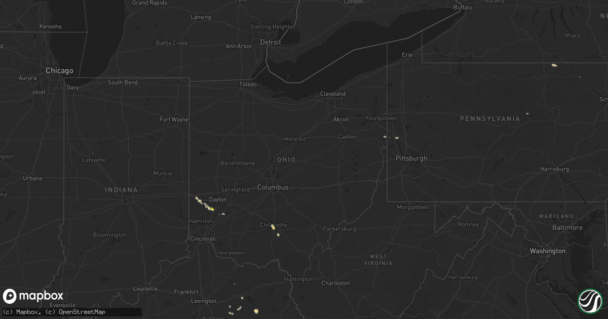
Hail Map in Ohio on September 6, 2018
Get this storm
September 6 map
$229
one time, instant access
Download today. No call, no setup
Keep the $229
Bought the map and want the full workflow? Apply the entire $229 to a subscription within 7 days. None of it is wasted.
Every map, not just this one
This buys you this map. Subscription and you get every map we run, in the markets you choose from a few cities to whole states to nationwide. Plus real-time alerts the moment a storm fires.
Contact data
Name, contact info, occupancy, even credit band for addresses in the footprint. You go from where it hit to who to call.
Become the source they trust
Unlimited branding weather history reports on demand. You already have the documented answer ready for the property owner, and you are the one who showed up with it.
Property data and RoofTrace estimates
Pull up any address you have got, its value and the exact code rules for that jurisdiction, straight from One Click Code. Then RoofTrace estimates the squares, pitch, and roof value, priced the way you price.
Storm reports in Ohio
Ohio
| Date | Description |
|---|---|
| 09/06/20182:59 PM CDT | Multiple trees down. Time estimated from radar data. |
| 09/06/20181:42 PM CDT | Wind damage to large tree branches |
| 09/06/20181:38 PM CDT | Trees down along route 658 |
| 09/06/20181:29 PM CDT | Quarter sized hail near n dixie hwy and pennyroyal rd. |
| 09/06/20181:25 PM CDT | Tree down. Time estimated from radar data. |
| 09/06/20181:08 PM CDT | Tree down. Time estimated from radar data. |
| 09/06/201812:51 PM CDT | Tree down. Time estimated from radar data. |
| 09/06/201811:55 AM CDT | Several large tree limbs down on route 16. |
| 09/06/201811:54 AM CDT | Five inch diameter branches downed at partridge rd and partridge ct. Time estimated via radar. |
| 09/06/20187:42 AM CDT | At 1242 PM EDT, a severe thunderstorm was located over Hebron, moving east at 25 mph. HAZARD...60 mph wind gusts. SOURCE...Radar indicated. IMPACT...Expect damage to trees and power lines. Locations impacted include... Newark, Heath, Granville, Buckeye Lake, Hebron, Hanover, Harbor Hills, Granville South, Marne, Fairfield Beach, Thornport, Kirkersville, Gratiot, Toboso, Brownsville, Interstate 70 at State Route 37 and Interstate 70 at State Route 13.This includes I-70 in Ohio between mile markers 123 and 142, and nearmile marker 144. |
| 09/05/201810:59 PM CDT | At 358 PM EDT, a severe thunderstorm was located near Chillicothe, moving east at 20 mph. HAZARD...60 mph wind gusts and quarter size hail. SOURCE...Radar indicated. IMPACT...Minor hail damage to vehicles is possible. Expect wind damage to trees and power lines. Locations impacted include... Chillicothe, Londonderry, Massieville, Mooresville, Scioto Trail State Park and Richmond Dale. |
| 09/05/20189:24 PM CDT | At 223 PM EDT, a severe thunderstorm was located 7 miles south of Coshocton, moving east at 25 mph. HAZARD...Wind gusts to 60 mph and quarter-size hail. SOURCE...Radar. IMPACT...Minor hail damage to vehicles is possible. Expect wind damage to trees and power lines, resulting in some power outages. Locations impacted include... Coshocton... Cambridge... Newcomerstown... West Lafayette... Conesville... Old Washington... Plainfield... Otsego... Boden... Birmingham... Salt Fork State Park... Kimbolton...This includes Interstate 77 in Ohio between mile markers 48 and 66. |
| 09/05/20189:24 PM CDT | At 224 PM EDT, a severe thunderstorm was located over Springboro, moving east at 20 mph. HAZARD...60 mph wind gusts and quarter size hail. SOURCE...Radar indicated. IMPACT...Minor hail damage to vehicles is possible. Expect wind damage to trees and power lines. Locations impacted include... Kettering, Middletown, Miamisburg, Springboro, Franklin, Moraine, Carlisle, West Carrollton, Centerville, Lytle, Pekin, State Route 48 at State Route 73 and Woodbourne-Hyde Park.This includes I-75 in Ohio between mile markers 35 and 46. |
| 09/05/20189:06 PM CDT | At 206 PM EDT, a severe thunderstorm was located over Carlisle, moving east at 15 mph. HAZARD...60 mph wind gusts and nickel size hail. SOURCE...Radar indicated. IMPACT...Expect damage to trees and power lines. Locations impacted include... Kettering, Middletown, Miamisburg, Springboro, Franklin, Moraine, Carlisle, West Carrollton, Germantown and Poast Town Heights.This includes I-75 in Ohio between mile markers 36 and 48. |
| 09/05/20188:20 PM CDT | At 120 PM EDT, a severe thunderstorm was located over West Alexandria, moving east at 15 mph. HAZARD...60 mph wind gusts and quarter size hail. SOURCE...Radar indicated. IMPACT...Minor hail damage to vehicles is possible. Expect wind damage to trees and power lines. Locations impacted include... Trotwood, Eaton, West Alexandria, Gratis, Germantown, New Lebanon, Farmersville, Wheatville and Pyrmont. |
All States Impacted by Hail Map on September 6, 2018
Cities Impacted by Hail Map on September 6, 2018
- Yazoo City, MS
- Silver City, MS
- Hebron, ND
- Glen Ullin, ND
- Richardton, ND
- Churchs Ferry, ND
- Devils Lake, ND
- Beulah, ND
- Zap, ND
- Auburn, KY
- Russellville, KY
- Topsham, ME
- Ezel, KY
- West Liberty, KY
- Mize, KY
- Carbondale, IL
- Murphysboro, IL
- Makanda, IL
- Nashville, TN
- Ashland City, TN
- Linden, TN
- Howard, PA
- Morganfield, KY
- Clay, KY
- Oberlin, LA
- Hudson, NY
- Ghent, NY
- Chillicothe, OH
- Frenchburg, KY
- Stanton, KY
- Means, KY
- Burns, TN
- Dickson, TN
- McKee, KY
- Marion, IL
- Wolford, ND
- Bowling Green, KY
- Pioneer, TN
- La Follette, TN
- Deridder, LA
- Dingmans Ferry, PA
- Ferdinand, IN
- Clay City, KY
- Germantown, OH
- Taylor, ND
- West Stockbridge, MA
- Stockbridge, MA
- Hanson, KY
- Manitou, KY
- Stottville, NY
- Athens, NY
- Oakland, KY
- Scottsville, KY
- Smiths Grove, KY
- Cando, ND
- Martin, TN
- South Fulton, TN
- Englewood, TN
- Leeds, ND
- York, ND
- Towner, ND
- Willow City, ND
- Franklin, TN
- Eaton, OH
- West Alexandria, OH
- Tellico Plains, TN
- Westport, CT
- Southport, CT
- Norwalk, CT
- Wilton, CT
- Weston, CT
- Fairfield, CT
- Cannelton, IN
- Tell City, IN
- Rugby, ND
- Waverly, OH
- Walpole, ME
- South Bristol, ME
- Wiscasset, ME
- Trevett, ME
- Woolwich, ME
- Boothbay, ME
- Liberty, KY
- Nolensville, TN
- Brentwood, TN
- Antioch, TN
- Corydon, KY
- Dixon, KY
- Sebree, KY
- Cutler, IL
- Percy, IL
- Ava, IL
- Becket, MA
- Lee, MA
- Franklin, KY
- Cedar Grove, TN
- Slaughters, KY
- Rolette, ND
- Knox, ND
- Charlotte, TN
- Gillett, PA
- Millerton, PA
- Pegram, TN
- Pemaquid, ME
- Bristol, ME
- Edgecomb, ME
- Bath, ME
- Danville, WV
- Julian, WV
- Ridgeview, WV
- Foster, WV
- Stamford, CT
- Greenwich, CT
- Rockfield, KY
- Layton, NJ
- Durham, ME
- Altenburg, MO
- Jackson, MO
- Jeffersonville, KY
- Mylo, ND
- Bisbee, ND
- Starkweather, ND
- Red Hook, NY
- Stanfordville, NY
- Clinton Corners, NY
- Melber, KY
- Milford, PA
- Franklin, OH
- Middletown, OH
- Miamisburg, OH
- Farmersville, OH
- Perry Hall, MD
- Parkville, MD
- Nottingham, MD
- Singer, LA
- New Leipzig, ND
- Darlington, PA
- Henderson, KY
- Nellis, WV
- Madison, WV
- Costa, WV
- White Bluff, TN
- Saugerties, NY
- Barrytown, NY
- Joelton, TN
- Albany, KY
- Negley, OH
- East Palestine, OH
- Rogers, OH
- East Nassau, NY
- Williamsburg, KY
- Crary, ND
- Etowah, TN
- Webster, ND
- Brunswick, ME
- Wysox, PA
- Steeleville, IL
- Campbell Hill, IL
- Mittie, LA
- Dry Creek, LA
- Kinder, LA
- Lakota, ND
- Westborough, MA
- Hopkinton, MA
- Flemingsburg, KY
- New Palestine, IN
- Greenfield, IN
- Fountaintown, IN
- Duff, TN
- Street, MD
- Coxsackie, NY
- Wolf Lake, IL
- Alto Pass, IL
- Pomona, IL
- Jonesboro, IL
- Cape Girardeau, MO
- New Harbor, ME
- Chamberlain, ME
- Elizaville, NY
- Tivoli, NY
- Germantown, NY
- Middletown, NY
- Slate Hill, NY
- Old Appleton, MO
- De Soto, IL
- Frohna, MO
- Grand Tower, IL
- Oak Ridge, MO
- Cobden, IL
- Uniontown, MO
- Vergennes, IL
- Gorham, IL
- Pleasant View, TN
- Chester, IL
- Rockwood, IL
- Perryville, MO
- Pound Ridge, NY
- New Canaan, CT
- Wickliffe, KY
- Barlow, KY
- Pembroke, MA
- Hanson, MA
- Halifax, MA
- Auburn, ME
- Lisbon, ME
- New Gloucester, ME
- Lock Haven, PA
- Kevil, KY
- Brookport, IL
- Paducah, KY
- West Paducah, KY
- Valley Grove, WV
- Bethany, WV
- Irvine, KY
- Beattyville, KY
- Lewisburg, KY
- Morgantown, KY
- East Chatham, NY
- Old Chatham, NY
- Brainard, NY
- Manchester, KY
- Boonville, IN
- Malden On Hudson, NY
- Salt Lick, KY
- Olympia, KY
- Glasgow, KY
- Austerlitz, NY
- Chatham, NY
- Waynesville, OH
- Lebanon, OH
- Tamiment, PA
- Bushkill, PA
- Hazel Green, KY
- Halls, TN
- Pine Plains, NY
- Gandeeville, WV
- Round Pond, ME
- Bowdoinham, ME
- Columbia, NJ
- Montague, NJ
- Minnewaukan, ND
- Beaver Falls, PA
- New Brighton, PA
- Brownsville, KY
- Wildersville, TN
- Lexington, TN
- Alvaton, KY
- Merryville, LA
- Longville, LA
- Richland, IN
- West Coxsackie, NY
- Valatie, NY
- Kinderhook, NY
- Stuyvesant, NY
- Schodack Landing, NY


