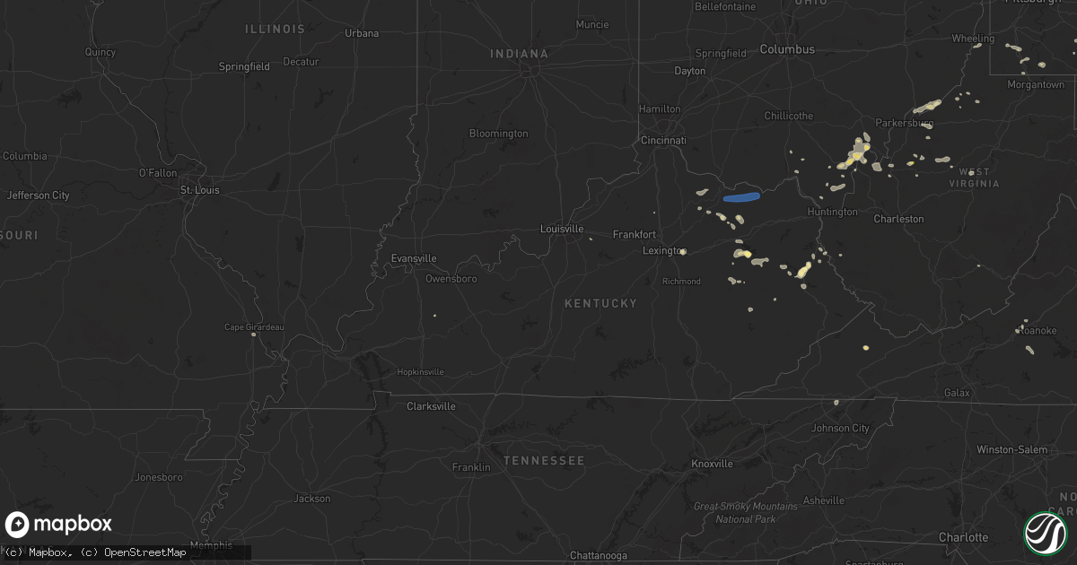
Hail Map in Kentucky on August 31, 2024
Get this storm
August 31 map
$229
one time, instant access
Download today. No call, no setup
Keep the $229
Bought the map and want the full workflow? Apply the entire $229 to a subscription within 7 days. None of it is wasted.
Every map, not just this one
This buys you this map. Subscription and you get every map we run, in the markets you choose from a few cities to whole states to nationwide. Plus real-time alerts the moment a storm fires.
Contact data
Name, contact info, occupancy, even credit band for addresses in the footprint. You go from where it hit to who to call.
Become the source they trust
Unlimited branding weather history reports on demand. You already have the documented answer ready for the property owner, and you are the one who showed up with it.
Property data and RoofTrace estimates
Pull up any address you have got, its value and the exact code rules for that jurisdiction, straight from One Click Code. Then RoofTrace estimates the squares, pitch, and roof value, priced the way you price.
Storm reports in Kentucky
Kentucky
| Date | Description |
|---|---|
| 08/31/20245:45 PM CDT | Mesonet station fw1232 monticello. |
| 08/31/20243:51 PM CDT | Trees down on highway 7 and 460. Time estimated from radar. |
| 08/31/20243:06 PM CDT | Trees and power poles down on barrett pike. |
| 08/31/20243:06 PM CDT | Corrects previous tstm wnd dmg report from 4 ese germantown. Trees and power poles down on barrett pike. Time estimated from radar. |
| 08/31/20243:02 PM CDT | Trees and power poles down. Time estimated from radar. |
| 08/31/20242:35 PM CDT | Large tree down at 1515 hillsboro road. Time estimated from radar. Report came in at 3:49 pm to county dispatch. |
| 08/31/20242:06 PM CDT | Multiple reports of tree damage and limbs down across portions of clark county... Including within the city of winchester along meadowbrook drive. |
| 08/31/202412:57 PM CDT | A tree was down on ky 1750 near address 571 ky route 1750 east point. The event time is radar estimated. |
| 08/31/202412:55 PM CDT | A tree was blown down along church street in the city paintsville. The event time is radar estimated. |
| 08/31/202412:54 PM CDT | A tree was blown down on ky 581 on ky 581 near the s curve area or about a tenth of a mile north of ky 40. The event time is radar estimated. |
| 08/31/202412:48 PM CDT | A tree was blown down onto a powerline that fell into the road near address 1250 ky 993 tutor key. The event time is radar estimated. |
| 08/31/202412:12 PM CDT | Trees down on highway 364. |
| 08/31/202411:52 AM CDT | A tree was blown down onto a powerline along us 460 near the intersection of new cummer road also known as orville henry road just west of the community of grassy creek |
| 08/31/202411:51 AM CDT | Corrects time of previous tstm wnd dmg report from 1 nne west liberty. Trees down on highway 7 and 460. Time estimated from radar. |
| 08/31/202411:49 AM CDT | One tree down at 2059 highway 2071... Wellington... Ky. Time estimated from radar. Tree felled from convective outflow gust travelling south of warned storm. |
| 08/31/202411:44 AM CDT | Tree down on highway 722. Time estimated from radar. |
| 08/31/20248:52 AM CDT | Time estimated from radar. |
All States Impacted by Hail Map on August 31, 2024
Cities Impacted by Hail Map on August 31, 2024
- Maysville, KY
- Tollesboro, KY
- Flemingsburg, KY
- Vanceburg, KY
- Ironton, OH
- Kitts Hill, OH
- Frenchburg, KY
- Salt Lick, KY
- Scottown, OH
- Willow Wood, OH
- Crown City, OH
- Pedro, OH
- Wellington, KY
- West Liberty, KY
- Bidwell, OH
- Gallipolis, OH
- Patriot, OH
- Ezel, KY
- Louisa, KY
- Cheshire, OH
- Fort Gay, WV
- River, KY
- Lowmansville, KY
- Gallipolis Ferry, WV
- Waverly, WV
- Saint Marys, WV
- Point Pleasant, WV
- Glen Dale, WV
- Wheeling, WV
- Moundsville, WV
- Ulysses, KY
- Tutor Key, KY
- Paintsville, KY
- Petroleum, WV
- West Columbia, WV
- Mason, WV
- Pomeroy, OH
- Cottageville, WV
- Mount Alto, WV
- Salyersville, KY
- Letart, WV
- Hartford, WV
- Racine, OH
- Middleport, OH
- Tomahawk, KY
- Sistersville, WV
- Friendly, WV
- Middlebourne, WV
- Windber, PA
- Oil Springs, KY
- Wittensville, KY
- Inez, KY
- Dunlow, WV
- Porters Falls, WV
- Reader, WV
- New Martinsville, WV
- Stambaugh, KY
- Ripley, WV
- Le Roy, WV
- Reedy, WV
- Jacksonburg, WV
- Sandyville, WV
- Staffordsville, KY
- Hagerhill, KY
- Sitka, KY
- Spencer, WV
- Graysville, PA
- Prosperity, PA
- Waynesburg, PA
- Sycamore, PA
- Mount Morris, PA
- Mount Olivet, KY
- Carlisle, KY
- Jackson, KY
- Carmichaels, PA
- Campton, KY
- Prestonsburg, KY
- East Point, KY
- Palestine, WV
- Creston, WV
- Thelma, KY
- West Van Lear, KY
- Scott City, MO
- Mount Zion, WV
- Grantsville, WV
- Arnoldsburg, WV
- Masontown, PA
- Smithfield, PA
- Martin, PA
- Greensboro, PA
- Beattyville, KY
- Rogers, KY
- Shade, OH
- Walker, WV
- Normalville, PA
- Acme, PA
- Johnstown, PA
- Mineral Point, PA
- Elizabeth, WV
- Slade, KY
- Normantown, WV
- Winchester, KY
- Lexington, KY
- Ewing, KY
- Schellsburg, PA
- Rockwood, PA
- Mill Run, PA
- Exchange, WV
- Stoystown, PA
- Cairnbrook, PA
- Central City, PA
- Cairo, WV
- Cedarville, WV
- Crawley, WV
- Smoot, WV
- Friedens, PA
- Berlin, PA
- Manns Choice, PA
- Petersburg, WV
- Hillsboro, KY
- Waiteville, WV
- Newport, OH
- Reno, OH
- Marietta, OH
- Wallingford, KY
- Brooksville, KY
- Germantown, KY
- Frostburg, MD
- Rutland, OH
- Meyersdale, PA
- Fairhope, PA
- Williamstown, WV
- Bedford, PA
- Everett, PA
- Clearville, PA
- Wellersburg, PA
- Hyndman, PA
- Honaker, VA
- Rowe, VA
- Mount Savage, MD
- Cumberland, MD
- Ridgeley, WV
- Keyser, WV
- Langsville, OH
- Lyerly, GA
- Beaver, OH
- Lucasville, OH
- New Matamoras, OH
- Burlington, WV
- Flintstone, MD
- Fort Ashby, WV
- Morehead, KY
- Romney, WV
- Summerville, GA
- Rome, GA
- Sacramento, KY
- Cabins, WV
- Minford, OH
- Artemas, PA
- Little Orleans, MD
- Oldtown, MD
- Portsmouth, OH
- Springfield, WV
- Great Cacapon, WV
- Augusta, WV
- Shanks, WV
- Points, WV
- Slanesville, WV
- Pine Ridge, KY
- Salem, VA
- Capon Bridge, WV
- Olympia, KY
- Oak Hill, OH
- Thurman, OH
- Paw Paw, WV
- Bloomery, WV
- Blaine, KY
- Sylacauga, AL
- Rockford, AL
- Goodwater, AL
- Leon, WV
- Swoope, VA
- Bristol, VA
- Blountville, TN
- Kingsport, TN
- Staunton, VA
- Middlebrook, VA
- Easley, SC
- Greenville, SC
- Taylors, SC
- Greer, SC
- Fairfield, VA
- Fishersville, VA
- Waynesboro, VA
- Simpsonville, KY
- Fisherville, KY
- Mauldin, SC
- Afton, VA
- Stuarts Draft, VA
- Lyndhurst, VA
- Callaway, VA
- Boones Mill, VA
- Rocky Mount, VA
- Sadieville, KY
- Roma, TX
- Finchville, KY
- Mayslick, KY


