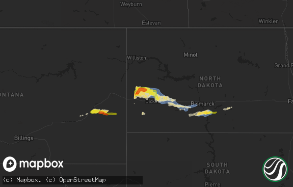
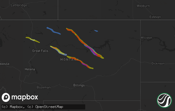
Hail Map in Ohio on August 30, 2019
The weather event in Ohio on August 30, 2019 includes Hail, Wind, and Tornado maps. 16 states and 203 cities were impacted and suffered possible damage. The total estimated number of properties impacted is 0.

Hail
Wind
Tornado
0
Estimated number of impacted properties by a 1.00" hail or larger0
Estimated number of impacted properties by a 1.75" hail or larger0
Estimated number of impacted properties by a 2.50" hail or largerStorm reports in Ohio
Ohio
| Date | Description |
|---|---|
| 08/30/20196:17 PM CDT | Trees down. |
| 08/30/20196:07 PM CDT | Trees down. |
| 08/30/20196:07 PM CDT | Trees down. |
| 08/30/20196:03 PM CDT | Trees down. |
| 08/30/20194:17 PM CDT | Tree branch down. Photo posted on social media. Time estimated from radar. |
| 08/30/20194:16 PM CDT | Numerous trees and large branches downed along trego creek road... Lunbeck road... And malone road. |
| 08/30/20194:15 PM CDT | Numerous trees reported down in huntington township. Time estimated from radar. |
| 08/30/20194:14 PM CDT | Large tree fell into power lines on bauer road and oh-276 and large tree fell down at 1571 us-50. Time estimated from radar. |
| 08/30/20194:14 PM CDT | Tree down on benton road. Time estimated from radar. |
| 08/30/20193:55 PM CDT | One tree branch... Approximately 6 inches in diameter... Downed along eastern avenue. Time estimated from radar. |
| 08/30/20192:56 PM CDT | Roof and insulation damage to apartment complex on harrison avenue between walnut and state. Time estimated from radar. |
| 08/30/201912:06 AM CDT | At 506 PM EDT, a severe thunderstorm was located near Batavia, moving east at 20 mph. HAZARD...60 mph wind gusts and penny size hail. SOURCE...Radar indicated. IMPACT...Expect damage to trees and power lines. Locations impacted include... Milford, Amelia, Mount Orab, Williamsburg, Batavia, Withamsville, Camp Dennison, Owensville, Newtonsville, Fayetteville, Mulberry, Chasetown, Clermont County Airport, Perintown, Mount Carmel, East Fork State Park, Day Heights, Willowville, Summerside and Mount Repose. |
All States Impacted by Hail Map on August 30, 2019
Cities Impacted by Hail Map on August 30, 2019
- Woodville, TX
- Patagonia, AZ
- Grover, CO
- Kiowa, CO
- Calhan, CO
- Ramah, CO
- Elbert, CO
- Montezuma, KS
- Cimarron, KS
- Sublette, KS
- Copeland, KS
- Satanta, KS
- Plains, KS
- Scott, AR
- North Little Rock, AR
- Warren, TX
- Akron, CO
- Alvord, TX
- Chico, TX
- Wetmore, CO
- Bassett, NE
- Marshall, TX
- Fort Morgan, CO
- Weldona, CO
- La Veta, CO
- Sullivan, MO
- Whitesboro, TX
- Gardner, CO
- Jacksboro, TX
- Agate, CO
- Nacogdoches, TX
- Garrison, TX
- Rosebud, MO
- Leslie, MO
- Gerald, MO
- Vail, AZ
- Anton, CO
- Douglas, WY
- Kanorado, KS
- Goodland, KS
- Milford, OH
- Cincinnati, OH
- Batavia, OH
- Center, TX
- Cheyenne, WY
- Elk City, OK
- Roswell, NM
- Rockwall, TX
- Dodge City, KS
- Yoder, WY
- Chugwater, WY
- Wheatland, WY
- Tonto Basin, AZ
- Glenrock, WY
- Longview, TX
- Jetmore, KS
- Leasburg, MO
- Saint Clair, MO
- Bourbon, MO
- Grubville, MO
- Lonedell, MO
- Gray Summit, MO
- Beaufort, MO
- Robertsville, MO
- Catawissa, MO
- Union, MO
- Eureka, MO
- Villa Ridge, MO
- House Springs, MO
- Dittmer, MO
- Labadie, MO
- Pacific, MO
- Cedar Hill, MO
- Cuba, MO
- Spurger, TX
- Deridder, LA
- Buckhorn, NM
- Newkirk, NM
- Ingalls, KS
- Throckmorton, TX
- Shreveport, LA
- Veteran, WY
- Torrington, WY
- Pine Bluffs, WY
- New Raymer, CO
- Trinidad, CO
- Weston, CO
- Cheyenne, OK
- Sayre, OK
- Decatur, TX
- Kirbyville, TX
- Laverne, OK
- Rye, CO
- Walsenburg, CO
- Erick, OK
- Texline, TX
- Tomball, TX
- Spring, TX
- Kismet, KS
- Taloga, OK
- Hillsboro, MO
- La Junta, CO
- Trinchera, CO
- Kimball, NE
- Ewing, NE
- Elgin, NE
- Newton, TX
- Colorado Springs, CO
- Mooreland, OK
- Hillister, TX
- Briggsdale, CO
- Hereford, CO
- Livingston, TX
- Carpenter, WY
- Royse City, TX
- Bon Wier, TX
- Farmersville, TX
- Gate, OK
- Fort Garland, CO
- Colby, KS
- Fredericksburg, TX
- Kerrville, TX
- Bridgeport, TX
- Burkeville, TX
- Wiggins, CO
- Orchard, CO
- Fort Thomas, KY
- Newport, KY
- Covington, KY
- Bellevue, KY
- Post, TX
- Call, TX
- Wellston, OK
- Snyder, TX
- Nevada, TX
- Woodward, OK
- Fort Supply, OK
- Willcox, AZ
- Jasper, TX
- Clifton, AZ
- Meade, KS
- Cleves, OH
- Hallsville, TX
- Johnstown, NE
- Colmesneil, TX
- Sadler, TX
- Leedey, OK
- Alamogordo, NM
- Beeler, KS
- Selden, KS
- Buffalo, OK
- Glendo, WY
- Elgin, AZ
- Sonoita, AZ
- Tularosa, NM
- Dalhart, TX
- Felt, OK
- Benton, AR
- Alexander, AR
- Westcliffe, CO
- Cope, CO
- Burlington, CO
- Wiergate, TX
- Owensville, MO
- Las Animas, CO
- Lamar, CO
- Ness City, KS
- Gainesville, TX
- Muenster, TX
- Rosanky, TX
- Owensville, OH
- Chambers, NE
- Saint Francis, KS
- Fowler, KS
- Sardinia, OH
- Lavon, TX
- San Augustine, TX
- East Saint Louis, IL
- Steelville, MO
- Ainsworth, NE
- Hoxie, KS
- Vernon, CO
- Barnhart, MO
- Sharon, OK
- Quinlan, TX
- Broaddus, TX
- Bronson, TX
- Harrison, OH
- Miamitown, OH
- Lexington, OK
- Hammon, OK
- Kersey, CO
- Simla, CO
- Seiling, OK
- Chillicothe, OH
- Waverly, OH
- Rio Grande, OH
- Thurman, OH
- Gallipolis Ferry, WV
- Gallipolis, OH
- Bidwell, OH
- Henderson, WV
- West Harrison, IN


