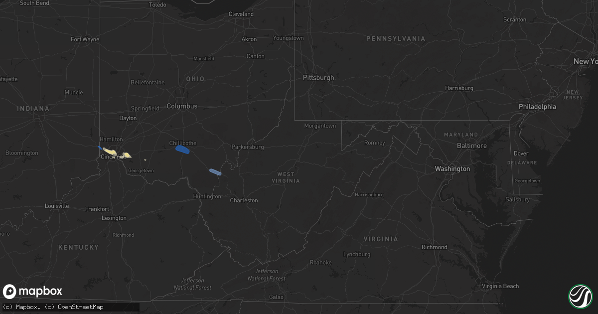
Hail Map in West Virginia on August 30, 2019
Get this storm
August 30 map
$229
one time, instant access
Download today. No call, no setup
Keep the $229
Bought the map and want the full workflow? Apply the entire $229 to a subscription within 7 days. None of it is wasted.
Every map, not just this one
This buys you this map. Subscription and you get every map we run, in the markets you choose from a few cities to whole states to nationwide. Plus real-time alerts the moment a storm fires.
Contact data
Name, contact info, occupancy, even credit band for addresses in the footprint. You go from where it hit to who to call.
Become the source they trust
Unlimited branding weather history reports on demand. You already have the documented answer ready for the property owner, and you are the one who showed up with it.
Property data and RoofTrace estimates
Pull up any address you have got, its value and the exact code rules for that jurisdiction, straight from One Click Code. Then RoofTrace estimates the squares, pitch, and roof value, priced the way you price.
Storm reports in West Virginia
West Virginia
| Date | Description |
|---|---|
| 08/30/20196:10 PM CDT | Tree down. |
| 08/30/20196:10 PM CDT | 0.25 inch limbs down. Estimated winds 50 mph |
| 08/30/20192:11 AM CDT | At 711 PM EDT, a severe thunderstorm was located near Gallipolis, moving southeast at 30 mph. HAZARD...70 mph wind gusts. SOURCE...Radar indicated. IMPACT...Expect considerable tree damage. Damage is likely to mobile homes, roofs, and outbuildings. Locations impacted include... Point Pleasant, Gallipolis, Buffalo, Henderson, Leon, Grimms Landing, Gallopolis Ferry, Southside and Ashton. |
| 08/30/20191:48 AM CDT | At 648 PM EDT, a severe thunderstorm was located near Rio Grande, moving southeast at 50 mph. HAZARD...60 mph wind gusts. SOURCE...Radar indicated. IMPACT...Expect damage to roofs, siding, and trees. Locations impacted include... Point Pleasant, Gallipolis, Rio Grande, Henderson, Leon, Adamsville, Grimms Landing, Gallopolis Ferry, Gage, Southside, Centerpoint and Ashton. |
All States Impacted by Hail Map on August 30, 2019
Cities Impacted by Hail Map on August 30, 2019
- Woodville, TX
- Patagonia, AZ
- Grover, CO
- Kiowa, CO
- Calhan, CO
- Ramah, CO
- Elbert, CO
- Montezuma, KS
- Cimarron, KS
- Sublette, KS
- Copeland, KS
- Satanta, KS
- Plains, KS
- Scott, AR
- North Little Rock, AR
- Warren, TX
- Akron, CO
- Alvord, TX
- Chico, TX
- Wetmore, CO
- Bassett, NE
- Marshall, TX
- Fort Morgan, CO
- Weldona, CO
- La Veta, CO
- Sullivan, MO
- Whitesboro, TX
- Gardner, CO
- Jacksboro, TX
- Agate, CO
- Nacogdoches, TX
- Garrison, TX
- Rosebud, MO
- Leslie, MO
- Gerald, MO
- Vail, AZ
- Anton, CO
- Douglas, WY
- Kanorado, KS
- Goodland, KS
- Milford, OH
- Cincinnati, OH
- Batavia, OH
- Center, TX
- Cheyenne, WY
- Elk City, OK
- Roswell, NM
- Rockwall, TX
- Dodge City, KS
- Yoder, WY
- Chugwater, WY
- Wheatland, WY
- Tonto Basin, AZ
- Glenrock, WY
- Longview, TX
- Jetmore, KS
- Leasburg, MO
- Saint Clair, MO
- Bourbon, MO
- Grubville, MO
- Lonedell, MO
- Gray Summit, MO
- Beaufort, MO
- Robertsville, MO
- Catawissa, MO
- Union, MO
- Eureka, MO
- Villa Ridge, MO
- House Springs, MO
- Dittmer, MO
- Labadie, MO
- Pacific, MO
- Cedar Hill, MO
- Cuba, MO
- Spurger, TX
- Deridder, LA
- Buckhorn, NM
- Newkirk, NM
- Ingalls, KS
- Throckmorton, TX
- Shreveport, LA
- Veteran, WY
- Torrington, WY
- Pine Bluffs, WY
- New Raymer, CO
- Trinidad, CO
- Weston, CO
- Cheyenne, OK
- Sayre, OK
- Decatur, TX
- Kirbyville, TX
- Laverne, OK
- Rye, CO
- Walsenburg, CO
- Erick, OK
- Texline, TX
- Tomball, TX
- Spring, TX
- Kismet, KS
- Taloga, OK
- Hillsboro, MO
- La Junta, CO
- Trinchera, CO
- Kimball, NE
- Ewing, NE
- Elgin, NE
- Newton, TX
- Colorado Springs, CO
- Mooreland, OK
- Hillister, TX
- Briggsdale, CO
- Hereford, CO
- Livingston, TX
- Carpenter, WY
- Royse City, TX
- Bon Wier, TX
- Farmersville, TX
- Gate, OK
- Fort Garland, CO
- Colby, KS
- Fredericksburg, TX
- Kerrville, TX
- Bridgeport, TX
- Burkeville, TX
- Wiggins, CO
- Orchard, CO
- Fort Thomas, KY
- Newport, KY
- Covington, KY
- Bellevue, KY
- Post, TX
- Call, TX
- Wellston, OK
- Snyder, TX
- Nevada, TX
- Woodward, OK
- Fort Supply, OK
- Willcox, AZ
- Jasper, TX
- Clifton, AZ
- Meade, KS
- Cleves, OH
- Hallsville, TX
- Johnstown, NE
- Colmesneil, TX
- Sadler, TX
- Leedey, OK
- Alamogordo, NM
- Beeler, KS
- Selden, KS
- Buffalo, OK
- Glendo, WY
- Elgin, AZ
- Sonoita, AZ
- Tularosa, NM
- Dalhart, TX
- Felt, OK
- Benton, AR
- Alexander, AR
- Westcliffe, CO
- Cope, CO
- Burlington, CO
- Wiergate, TX
- Owensville, MO
- Las Animas, CO
- Lamar, CO
- Ness City, KS
- Gainesville, TX
- Muenster, TX
- Rosanky, TX
- Owensville, OH
- Chambers, NE
- Saint Francis, KS
- Fowler, KS
- Sardinia, OH
- Lavon, TX
- San Augustine, TX
- East Saint Louis, IL
- Steelville, MO
- Ainsworth, NE
- Hoxie, KS
- Vernon, CO
- Barnhart, MO
- Sharon, OK
- Quinlan, TX
- Broaddus, TX
- Bronson, TX
- Harrison, OH
- Miamitown, OH
- Lexington, OK
- Hammon, OK
- Kersey, CO
- Simla, CO
- Seiling, OK
- Chillicothe, OH
- Waverly, OH
- Rio Grande, OH
- Thurman, OH
- Gallipolis Ferry, WV
- Gallipolis, OH
- Bidwell, OH
- Henderson, WV
- West Harrison, IN


