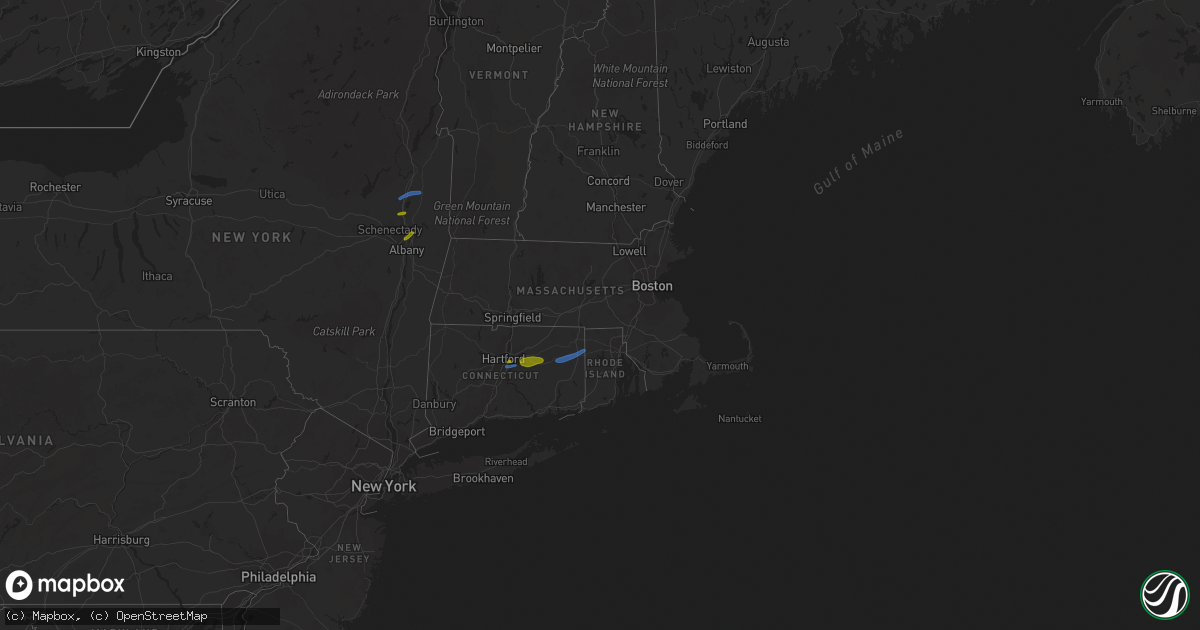
Hail Map in Connecticut on August 21, 2019
Get this storm
August 21 map
$229
one time, instant access
Download today. No call, no setup
Keep the $229
Bought the map and want the full workflow? Apply the entire $229 to a subscription within 7 days. None of it is wasted.
Every map, not just this one
This buys you this map. Subscription and you get every map we run, in the markets you choose from a few cities to whole states to nationwide. Plus real-time alerts the moment a storm fires.
Contact data
Name, contact info, occupancy, even credit band for addresses in the footprint. You go from where it hit to who to call.
Become the source they trust
Unlimited branding weather history reports on demand. You already have the documented answer ready for the property owner, and you are the one who showed up with it.
Property data and RoofTrace estimates
Pull up any address you have got, its value and the exact code rules for that jurisdiction, straight from One Click Code. Then RoofTrace estimates the squares, pitch, and roof value, priced the way you price.
Storm reports in Connecticut
Connecticut
| Date | Description |
|---|---|
| 08/21/20195:52 PM CDT | Tree limbs down on linden street and harold street. |
| 08/21/20195:45 PM CDT | Large branches down on birchwood and milwood roads in east hartford ct. One large branch down at corner of birchwood road and silver lane. |
| 08/21/20195:05 PM CDT | Power lines down on summit street. |
| 08/21/20195:05 PM CDT | Tree down on bissell street. Wires down on spruce at bissell street. |
| 08/21/20195:05 PM CDT | Large branches down on wires on florence street in manchester ct. |
| 08/21/20194:42 PM CDT | Tree down on wires on daniels farm road at hillsboro road. |
| 08/21/20194:41 PM CDT | Tree down on wires on teller road. |
| 08/21/20194:41 PM CDT | Trees and wires down on whitney avenue. |
| 08/21/20192:30 PM CDT | Trees down along portions of north bear hill road. |
| 08/21/20192:20 PM CDT | Tree down on route 44 in eastford ct |
| 08/21/20192:20 PM CDT | Trees and wires down on main street. |
| 08/21/20191:43 AM CDT | At 643 PM EDT, severe thunderstorms were located along a line extending from near Copake to near Red Hook, moving east at 25 mph. HAZARD...60 mph wind gusts and penny size hail. SOURCE...Radar indicated. IMPACT...Expect damage to roofs, siding, and trees. Locations impacted include... Torrington, Rhinebeck, Amenia, Sharon, Pine Plains, Red Hook, Norfolk, Canaan, Millerton, Stanfordville, Falls Village, Cornwall Bridge, Bethel, Salisbury, Goshen, Milan, Colebrook, Cornwall, Smithfield and West Torrington. |
| 08/21/20191:42 AM CDT | At 641 PM EDT, a severe thunderstorm was located over Glastonbury, moving east at 35 mph. HAZARD...60 mph wind gusts and quarter size hail. SOURCE...Radar indicated. IMPACT...Expect wind damage to trees and power lines. Minor hail damage to vehicles is possible. Locations impacted include... Hartford, Manchester, East Hartford, Glastonbury, Wethersfield, Mansfield, East Hampton, Rocky Hill, Cromwell, Coventry, Hebron, Portland, Lebanon, Marlborough, Columbia, Bolton and Andover. |
| 08/21/20191:34 AM CDT | At 634 PM EDT, severe thunderstorms were located along a line extending from near East Windsor to Falls Village, moving east at 40 mph. HAZARD...60 mph wind gusts. SOURCE...Radar indicated. IMPACT...Expect damage to trees and power lines. Locations impacted include... Springfield, New Britain, West Hartford, Chicopee, Enfield, Westfield, Holyoke, Amherst, Windsor, Northampton, Agawam, West Springfield, Farmington, Deerfield, Simsbury, Ludlow, Bloomfield, Avon, South Hadley and Easthampton. |
| 08/21/20191:05 AM CDT | At 605 PM EDT, severe thunderstorms were located along a line extending from Williamstown to Clermont, moving east at 30 mph. HAZARD...60 mph wind gusts. SOURCE...Radar indicated. IMPACT...Expect damage to roofs, siding, and trees. Locations impacted include... Pittsfield, North Adams, Great Barrington, Adams, Williamstown, Lee, Lenox, Sheffield, Cheshire, Becket, Otis, Sandisfield, Florida, Hancock, Savoy, New Ashford, Ashley Falls, Housatonic, Berkshire and Dalton. |
| 08/21/201912:47 AM CDT | At 547 PM EDT, a severe thunderstorm was located over Glastonbury, moving east at 35 mph. HAZARD...60 mph wind gusts and quarter size hail. SOURCE...Radar indicated. IMPACT...Expect wind damage to trees and power lines. Minor hail damage to vehicles is possible. Locations impacted include... Hartford, Manchester, East Hartford, Glastonbury, Wethersfield, Mansfield, Windham, Plainfield, Rocky Hill, Willimantic, Coventry, Hebron, Brooklyn, Lebanon, Marlborough, Columbia, Canterbury, Bolton, Ashford and Pomfret. |
| 08/21/201912:12 AM CDT | At 512 PM EDT, a severe thunderstorm was located over New Canaan, moving east at 25 mph. HAZARD...60 mph wind gusts and penny size hail. SOURCE...Radar indicated. IMPACT...Expect damage to trees and power lines. This severe thunderstorm will be near... Wilton around 520 PM EDT. Westport and Weston around 530 PM EDT. Bridgeport and Fairfield around 545 PM EDT. Trumbull around 555 PM EDT. Shelton and Stratford around 605 PM EDT. |
| 08/20/201911:15 PM CDT | At 415 PM EDT, a severe thunderstorm was located near Port Ewen, or near Kingston, moving east at 35 mph. HAZARD...60 mph wind gusts and quarter size hail. SOURCE...Radar indicated. IMPACT...Hail damage to vehicles is expected. Expect wind damage to roofs, siding, and trees. Locations impacted include... Kingston, New Paltz, Rhinebeck, Hyde Park, Hurley, Amenia, Pine Plains, Red Hook, Ancram, Millerton, Stanfordville, Tillson, Port Ewen, Staatsburg, Lake Katrine, Esopus, Rosendale, Marbletown, Bethel and Milan. |
| 08/20/20199:26 PM CDT | At 225 PM EDT, a severe thunderstorm was located over East Hartford, moving northeast at 30 mph. This storm downed trees on wires as it moved through Farmington. HAZARD...60 mph wind gusts. SOURCE...Radar indicated. IMPACT...Expect damage to trees and power lines. This severe thunderstorm will be near... Manchester, Glastonbury and East Windsor around 235 PM EDT. South Windsor and Bolton around 240 PM EDT. Vernon around 245 PM EDT. Andover around 250 PM EDT. Ellington and Coventry around 255 PM EDT. Mansfield and Tolland around 300 PM EDT. Willington and Chaplin around 315 PM EDT. Ashford, Eastford and Union around 320 PM EDT. |
| 08/20/20198:25 PM CDT | At 125 PM EDT, a severe thunderstorm was located over Terryville, or near Bristol, moving northeast at 35 mph. HAZARD...60 mph wind gusts and penny size hail. SOURCE...Radar indicated. IMPACT...Expect damage to trees and power lines. This severe thunderstorm will be near... Plainville around 130 PM EDT. Southington and Farmington around 135 PM EDT. Canton around 140 PM EDT. Avon around 145 PM EDT. Hartford, West Hartford, East Hartford, Simsbury and Bloomfield around 155 PM EDT. Windsor, Windsor Locks and East Granby around 205 PM EDT. Manchester and East Windsor around 210 PM EDT. South Windsor around 215 PM EDT.Other locations impacted by this severe thunderstorm includeAllentown, Pequabuck and Terryville Station. |
| 08/20/20198:23 PM CDT | At 123 PM EDT, a severe thunderstorm was located over Terryville, or near Bristol, moving east at 45 mph. HAZARD...60 mph wind gusts and penny size hail. SOURCE...Radar indicated. IMPACT...Expect damage to roofs, siding, and trees. Locations impacted include... Torrington, Thomaston, New Hartford, Litchfield, Northwest Harwinton, Oakville, Terryville, New Hartford Center, Woodbury Center, New Preston, Watertown, Plymouth, Woodbury, Harwinton, Bethlehem, Washington, Goshen, Morris, Roxbury and Warren. |
All States Impacted by Hail Map on August 21, 2019
Cities Impacted by Hail Map on August 21, 2019
- Albion, IL
- Augusta, KS
- Andover, KS
- Casper, WY
- Sedan, KS
- Longton, KS
- Morrison, CO
- Denver, CO
- Williamsburg, KS
- Yoder, WY
- Hawk Springs, WY
- Littleton, CO
- Chesterfield, MO
- Ballwin, MO
- Tennyson, IN
- Gentryville, IN
- Richland, IN
- Chrisney, IN
- Rockport, IN
- Portageville, MO
- Trafford, AL
- Warrior, AL
- Matheson, CO
- Belleview, MO
- Belgrade, MO
- Benedict, KS
- Elk City, KS
- Independence, KS
- Neodesha, KS
- Fredonia, KS
- Texhoma, OK
- Kenton, OK
- Boise City, OK
- Mount Hope, KS
- Chugwater, WY
- Cambridge, KS
- Loogootee, IN
- Jasper, IN
- Dubois, IN
- Peace Valley, MO
- Goddard, KS
- Colwich, KS
- Garden Plain, KS
- Andale, KS
- Wichita, KS
- Cheney, KS
- Haven, KS
- Viola, KS
- Moundville, MO
- Nevada, MO
- Goodwell, OK
- Princeton, IN
- Patoka, IN
- Burrton, KS
- Black Eagle, MT
- Cascade, MT
- Great Falls, MT
- Milo, MO
- Walker, MO
- Worland, WY
- Bluford, IL
- Dale, IN
- Whitewater, KS
- Aurora, CO
- Agate, CO
- Halstead, KS
- Garnett, KS
- Greeley, KS
- Richmond, KS
- Princeton, KS
- Conway Springs, KS
- Floral, AR
- Newton, KS
- Noble, IL
- Harwood, MO
- El Dorado Springs, MO
- Inman, KS
- Rocky Ford, CO
- Wayne City, IL
- Keenes, IL
- Mount Vernon, IL
- Fairfield, IL
- Sims, IL
- Rock, KS
- Doswell, VA
- Liberal, KS
- Hugoton, KS
- Thermopolis, WY
- Kirby, WY
- Salem, MO
- Niotaze, KS
- Peru, KS
- Clearwater, KS
- Maize, KS
- Lebanon, MO
- Eldridge, MO
- Kaycee, WY
- La Cygne, KS
- Arkansas City, KS
- Garden City, KS
- Holcomb, KS
- Sedgwick, KS
- Valley Center, KS
- Marthasville, MO
- Windyville, MO
- Rolla, MO
- Power, MT
- Dexter, MO
- Fenton, MO
- Douglass, KS
- Golden, CO
- Stockton, MO
- Argenta, IL
- Derby, KS
- Waverly, KS
- Hutchinson, KS
- Dexter, KS
- Holland, IN
- Moline, KS
- Floweree, MT
- Deepwater, MO
- Osceola, MO
- Lowry City, MO
- Guymon, OK
- Richland, MO
- Turpin, OK
- Simla, CO
- Ramah, CO
- Calhan, CO
- Westphalia, KS
- Bentley, KS
- Milton, KS
- Norwich, KS
- Haysville, KS
- Poseyville, IN
- Liberal, MO
- Stoutland, MO
- Caledonia, MO
- Rector, AR
- Welda, KS
- Colony, KS
- Mount Vernon, IN
- Evansville, IN
- Pleasanton, KS
- Amoret, MO
- Udall, KS
- Pomona, KS
- Quenemo, KS
- Bigelow, AR
- Otwell, IN
- Potosi, MO
- Mineral Point, MO
- Owensboro, KY
- Grenola, KS
- Paragould, AR
- Harrisburg, NE
- Lyman, NE
- Buhler, KS
- Moundridge, KS
- Cannelburg, IN
- Butler, MO
- Ellery, IL
- Shoals, IN
- French Lick, IN
- Bunker, MO
- Bloomfield, MO
- Dix, NE
- Urbana, MO
- Jerico Springs, MO
- Lockwood, MO
- Boss, MO
- Buffalo, WY
- Yuma, CO
- Le Roy, KS
- Garrett, WY
- West Salem, IL
- Hazleton, IN
- Vincennes, IN
- Owensville, IN
- Allendale, IL
- New Harmony, IN
- Wadesville, IN
- Grayville, IL
- Mount Carmel, IL
- Decker, IN
- Griffin, IN
- Petersburg, IN
- Meriden, WY
- Malden, MO
- Newburg, MO
- Edgar Springs, MO
- Rose Hill, KS
- Walsenburg, CO
- Lawrenceville, IL
- Bridgeport, IL
- Bushnell, NE
- East Earl, PA
- Iuka, IL
- Francisco, IN
- Parma, MO
- Williamsville, MO
- Ironton, MO
- Middle Brook, MO
- Lesterville, MO
- Saint James, MO
- Forgan, OK
- Atlanta, KS
- Lilbourn, MO
- Ferdinand, IN
- Newburgh, IN
- Englewood, CO
- Appleton City, MO
- Black, MO
- Owensville, MO
- Dahlgren, IL
- Barnhill, IL
- Johnsonville, IL
- Winslow, IN
- Kit Carson, CO
- Dixon, MO
- Wheat Ridge, CO
- Conrad, MT
- Bono, AR
- Fontana, KS
- Claremont, IL
- Olney, IL
- Bronaugh, MO
- Sheldon, MO
- Boonville, IN
- Holyoke, CO
- Reading, KS
- Knobel, AR
- Dieterich, IL
- Lincoln City, IN
- Stendal, IN
- Oakland City, IN
- Santa Claus, IN
- Huntingburg, IN
- Birdseye, IN
- Saint Anthony, IN
- Lovington, IL
- Houston, AR
- Golden Gate, IL
- Fairfield, MT
- Sumner, IL
- Deer Trail, CO
- Poplar Bluff, MO
- Benton, KS
- Ingraham, IL
- Clay City, IL
- Rush, CO
- Lamar, MO
- Fort Leonard Wood, MO
- Centerville, MO
- Eureka, MO
- Pacific, MO
- Cisne, IL
- Cedar Vale, KS
- Burden, KS
- Winfield, KS
- Piggott, AR
- Wheatland, WY
- Parker, KS
- Flemington, MO
- Sedalia, CO
- Saint Louis, MO
- Fremont, MO
- Lysite, WY
- Shoshoni, WY
- Medicine Bow, WY
- Round Lake, NY
- Ballston Lake, NY
- Ballston Spa, NY
- Mechanicville, NY
- Troy, NY
- Latham, NY
- Albany, NY
- Waterford, NY
- Cohoes, NY
- Watervliet, NY
- Tyngsboro, MA
- Pelham, NH
- Hudson, NH
- Nashua, NH
- Andover, CT
- Columbia, CT
- Glastonbury, CT
- Bolton, CT
- Coventry, CT
- Manchester, CT
- Mansfield Center, CT
- Storrs Mansfield, CT
- Hebron, CT
- East Hartford, CT
- Union Mills, NC
- Marion, NC
- Bostic, NC
- Stony Point, NC
- Catawba, NC
- Conover, NC
- Claremont, NC
- Taylorsville, NC
- Hickory, NC
- Statesville, NC
- Oaktown, IN
- Saint Francisville, IL
- Bruceville, IN
- Bicknell, IN
- Oktaha, OK
- Checotah, OK
- Catoosa, OK
- Tulsa, OK
- Colorado Springs, CO
- Cotopaxi, CO
- Granite Falls, NC
- College Park, MD
- Bowie, MD
- Hyattsville, MD
- Lanham, MD
- Silver Spring, MD
- Harwood, MD
- Upper Marlboro, MD
- Bladensburg, MD
- Glenn Dale, MD
- Takoma Park, MD
- Greenbelt, MD
- Riverdale, MD
- Saratoga Springs, NY
- Schuylerville, NY
- Wethersfield, CT
- Canterbury, CT
- Brooklyn, CT
- Danielson, CT
- Dayville, CT
- Chaplin, CT
- North Windham, CT
- Foster, RI
- Hampton, CT
- Narvon, PA
- Mohnton, PA
- Morgantown, PA
- Douglassville, PA
- Elverson, PA
- Birdsboro, PA


