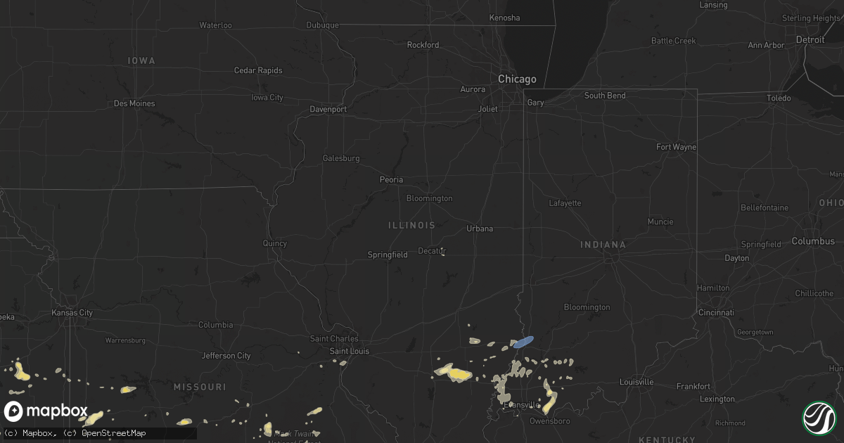
Hail Map in Illinois on August 21, 2019
Get this storm
August 21 map
$229
one time, instant access
Download today. No call, no setup
Keep the $229
Bought the map and want the full workflow? Apply the entire $229 to a subscription within 7 days. None of it is wasted.
Every map, not just this one
This buys you this map. Subscription and you get every map we run, in the markets you choose from a few cities to whole states to nationwide. Plus real-time alerts the moment a storm fires.
Contact data
Name, contact info, occupancy, even credit band for addresses in the footprint. You go from where it hit to who to call.
Become the source they trust
Unlimited branding weather history reports on demand. You already have the documented answer ready for the property owner, and you are the one who showed up with it.
Property data and RoofTrace estimates
Pull up any address you have got, its value and the exact code rules for that jurisdiction, straight from One Click Code. Then RoofTrace estimates the squares, pitch, and roof value, priced the way you price.
Storm reports in Illinois
Illinois
| Date | Description |
|---|---|
| 08/21/20196:29 AM CDT | At 1129 PM CDT, a severe thunderstorm was located 7 miles southwest of Mount Carmel, moving northeast at 20 mph. HAZARD...60 mph wind gusts and quarter size hail. SOURCE...Radar indicated. IMPACT...Hail damage to vehicles is expected. Expect wind damage to roofs, siding, and trees. Locations impacted include... Princeton, Mount Carmel, Owensville, Patoka, Bellmont and Keensburg. |
| 08/21/20194:44 AM CDT | At 943 PM CDT, a severe thunderstorm was located near Fairfield, moving northeast at 30 mph. HAZARD...60 mph wind gusts and quarter size hail. SOURCE...Radar indicated. IMPACT...Hail damage to vehicles is expected. Expect wind damage to roofs, siding, and trees. Locations impacted include... Fairfield, Wayne City, Cisne, Jeffersonville, Sims, Mount Erie, Keenes and Johnsonville.This includes Interstate 64 in Illinois between Mile Markers 92 and115. |
| 08/21/20194:14 AM CDT | At 913 PM CDT, a severe thunderstorm was located near Bluford, or 13 miles northeast of Mount Vernon, moving east at 30 mph. HAZARD...60 mph wind gusts and quarter size hail. SOURCE...Radar indicated. IMPACT...Hail damage to vehicles is expected. Expect wind damage to roofs, siding, and trees. Locations impacted include... Mount Vernon, Fairfield, Wayne City, Bluford, Cisne, Dix, Jeffersonville, Sims, Keenes and Johnsonville.This includes Interstate 64 in Illinois between Mile Markers 106 and110. |
| 08/20/20199:50 PM CDT | Tree down on w. Curry st. In fairfield. |
| 08/20/20199:45 PM CDT | Trees reported down along divide road and hwy 37 in northeast jefferson county. Time estimated. |
All States Impacted by Hail Map on August 21, 2019
Cities Impacted by Hail Map on August 21, 2019
- Albion, IL
- Augusta, KS
- Andover, KS
- Casper, WY
- Sedan, KS
- Longton, KS
- Morrison, CO
- Denver, CO
- Williamsburg, KS
- Yoder, WY
- Hawk Springs, WY
- Littleton, CO
- Chesterfield, MO
- Ballwin, MO
- Tennyson, IN
- Gentryville, IN
- Richland, IN
- Chrisney, IN
- Rockport, IN
- Portageville, MO
- Trafford, AL
- Warrior, AL
- Matheson, CO
- Belleview, MO
- Belgrade, MO
- Benedict, KS
- Elk City, KS
- Independence, KS
- Neodesha, KS
- Fredonia, KS
- Texhoma, OK
- Kenton, OK
- Boise City, OK
- Mount Hope, KS
- Chugwater, WY
- Cambridge, KS
- Loogootee, IN
- Jasper, IN
- Dubois, IN
- Peace Valley, MO
- Goddard, KS
- Colwich, KS
- Garden Plain, KS
- Andale, KS
- Wichita, KS
- Cheney, KS
- Haven, KS
- Viola, KS
- Moundville, MO
- Nevada, MO
- Goodwell, OK
- Princeton, IN
- Patoka, IN
- Burrton, KS
- Black Eagle, MT
- Cascade, MT
- Great Falls, MT
- Milo, MO
- Walker, MO
- Worland, WY
- Bluford, IL
- Dale, IN
- Whitewater, KS
- Aurora, CO
- Agate, CO
- Halstead, KS
- Garnett, KS
- Greeley, KS
- Richmond, KS
- Princeton, KS
- Conway Springs, KS
- Floral, AR
- Newton, KS
- Noble, IL
- Harwood, MO
- El Dorado Springs, MO
- Inman, KS
- Rocky Ford, CO
- Wayne City, IL
- Keenes, IL
- Mount Vernon, IL
- Fairfield, IL
- Sims, IL
- Rock, KS
- Doswell, VA
- Liberal, KS
- Hugoton, KS
- Thermopolis, WY
- Kirby, WY
- Salem, MO
- Niotaze, KS
- Peru, KS
- Clearwater, KS
- Maize, KS
- Lebanon, MO
- Eldridge, MO
- Kaycee, WY
- La Cygne, KS
- Arkansas City, KS
- Garden City, KS
- Holcomb, KS
- Sedgwick, KS
- Valley Center, KS
- Marthasville, MO
- Windyville, MO
- Rolla, MO
- Power, MT
- Dexter, MO
- Fenton, MO
- Douglass, KS
- Golden, CO
- Stockton, MO
- Argenta, IL
- Derby, KS
- Waverly, KS
- Hutchinson, KS
- Dexter, KS
- Holland, IN
- Moline, KS
- Floweree, MT
- Deepwater, MO
- Osceola, MO
- Lowry City, MO
- Guymon, OK
- Richland, MO
- Turpin, OK
- Simla, CO
- Ramah, CO
- Calhan, CO
- Westphalia, KS
- Bentley, KS
- Milton, KS
- Norwich, KS
- Haysville, KS
- Poseyville, IN
- Liberal, MO
- Stoutland, MO
- Caledonia, MO
- Rector, AR
- Welda, KS
- Colony, KS
- Mount Vernon, IN
- Evansville, IN
- Pleasanton, KS
- Amoret, MO
- Udall, KS
- Pomona, KS
- Quenemo, KS
- Bigelow, AR
- Otwell, IN
- Potosi, MO
- Mineral Point, MO
- Owensboro, KY
- Grenola, KS
- Paragould, AR
- Harrisburg, NE
- Lyman, NE
- Buhler, KS
- Moundridge, KS
- Cannelburg, IN
- Butler, MO
- Ellery, IL
- Shoals, IN
- French Lick, IN
- Bunker, MO
- Bloomfield, MO
- Dix, NE
- Urbana, MO
- Jerico Springs, MO
- Lockwood, MO
- Boss, MO
- Buffalo, WY
- Yuma, CO
- Le Roy, KS
- Garrett, WY
- West Salem, IL
- Hazleton, IN
- Vincennes, IN
- Owensville, IN
- Allendale, IL
- New Harmony, IN
- Wadesville, IN
- Grayville, IL
- Mount Carmel, IL
- Decker, IN
- Griffin, IN
- Petersburg, IN
- Meriden, WY
- Malden, MO
- Newburg, MO
- Edgar Springs, MO
- Rose Hill, KS
- Walsenburg, CO
- Lawrenceville, IL
- Bridgeport, IL
- Bushnell, NE
- East Earl, PA
- Iuka, IL
- Francisco, IN
- Parma, MO
- Williamsville, MO
- Ironton, MO
- Middle Brook, MO
- Lesterville, MO
- Saint James, MO
- Forgan, OK
- Atlanta, KS
- Lilbourn, MO
- Ferdinand, IN
- Newburgh, IN
- Englewood, CO
- Appleton City, MO
- Black, MO
- Owensville, MO
- Dahlgren, IL
- Barnhill, IL
- Johnsonville, IL
- Winslow, IN
- Kit Carson, CO
- Dixon, MO
- Wheat Ridge, CO
- Conrad, MT
- Bono, AR
- Fontana, KS
- Claremont, IL
- Olney, IL
- Bronaugh, MO
- Sheldon, MO
- Boonville, IN
- Holyoke, CO
- Reading, KS
- Knobel, AR
- Dieterich, IL
- Lincoln City, IN
- Stendal, IN
- Oakland City, IN
- Santa Claus, IN
- Huntingburg, IN
- Birdseye, IN
- Saint Anthony, IN
- Lovington, IL
- Houston, AR
- Golden Gate, IL
- Fairfield, MT
- Sumner, IL
- Deer Trail, CO
- Poplar Bluff, MO
- Benton, KS
- Ingraham, IL
- Clay City, IL
- Rush, CO
- Lamar, MO
- Fort Leonard Wood, MO
- Centerville, MO
- Eureka, MO
- Pacific, MO
- Cisne, IL
- Cedar Vale, KS
- Burden, KS
- Winfield, KS
- Piggott, AR
- Wheatland, WY
- Parker, KS
- Flemington, MO
- Sedalia, CO
- Saint Louis, MO
- Fremont, MO
- Lysite, WY
- Shoshoni, WY
- Medicine Bow, WY
- Round Lake, NY
- Ballston Lake, NY
- Ballston Spa, NY
- Mechanicville, NY
- Troy, NY
- Latham, NY
- Albany, NY
- Waterford, NY
- Cohoes, NY
- Watervliet, NY
- Tyngsboro, MA
- Pelham, NH
- Hudson, NH
- Nashua, NH
- Andover, CT
- Columbia, CT
- Glastonbury, CT
- Bolton, CT
- Coventry, CT
- Manchester, CT
- Mansfield Center, CT
- Storrs Mansfield, CT
- Hebron, CT
- East Hartford, CT
- Union Mills, NC
- Marion, NC
- Bostic, NC
- Stony Point, NC
- Catawba, NC
- Conover, NC
- Claremont, NC
- Taylorsville, NC
- Hickory, NC
- Statesville, NC
- Oaktown, IN
- Saint Francisville, IL
- Bruceville, IN
- Bicknell, IN
- Oktaha, OK
- Checotah, OK
- Catoosa, OK
- Tulsa, OK
- Colorado Springs, CO
- Cotopaxi, CO
- Granite Falls, NC
- College Park, MD
- Bowie, MD
- Hyattsville, MD
- Lanham, MD
- Silver Spring, MD
- Harwood, MD
- Upper Marlboro, MD
- Bladensburg, MD
- Glenn Dale, MD
- Takoma Park, MD
- Greenbelt, MD
- Riverdale, MD
- Saratoga Springs, NY
- Schuylerville, NY
- Wethersfield, CT
- Canterbury, CT
- Brooklyn, CT
- Danielson, CT
- Dayville, CT
- Chaplin, CT
- North Windham, CT
- Foster, RI
- Hampton, CT
- Narvon, PA
- Mohnton, PA
- Morgantown, PA
- Douglassville, PA
- Elverson, PA
- Birdsboro, PA


