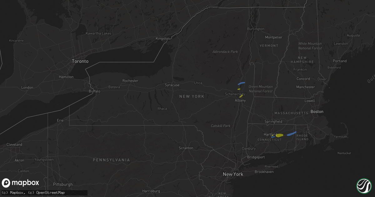
Hail Map in New York on August 21, 2019
Get this storm
August 21 map
$229
one time, instant access
Download today. No call, no setup
Keep the $229
Bought the map and want the full workflow? Apply the entire $229 to a subscription within 7 days. None of it is wasted.
Every map, not just this one
This buys you this map. Subscription and you get every map we run, in the markets you choose from a few cities to whole states to nationwide. Plus real-time alerts the moment a storm fires.
Contact data
Name, contact info, occupancy, even credit band for addresses in the footprint. You go from where it hit to who to call.
Become the source they trust
Unlimited branding weather history reports on demand. You already have the documented answer ready for the property owner, and you are the one who showed up with it.
Property data and RoofTrace estimates
Pull up any address you have got, its value and the exact code rules for that jurisdiction, straight from One Click Code. Then RoofTrace estimates the squares, pitch, and roof value, priced the way you price.
Storm reports in New York
New York
| Date | Description |
|---|---|
| 08/21/20194:50 PM CDT | Tree down. |
| 08/21/20194:45 PM CDT | Wires down in kinderhook. |
| 08/21/20194:45 PM CDT | Large tree down on power lines on bedford avenue. |
| 08/21/20194:40 PM CDT | Tree down on route 9j near gibbons road. |
| 08/21/20194:18 PM CDT | Trees and wires down on rte 66 between rte 355 and snyders corners rd. |
| 08/21/20193:55 PM CDT | Trees and wires down in cohoes. |
| 08/21/20193:55 PM CDT | A couple of trees down in clinton township. |
| 08/21/20193:49 PM CDT | A local report indicates 1.00 inch wind near 1 ESE COHOES |
| 08/21/20193:45 PM CDT | A local report indicates 1.00 inch wind near 1 SSW LATHAM |
| 08/21/20193:20 PM CDT | Tree down. |
| 08/21/20193:10 PM CDT | Tree down in the town of easton. |
| 08/21/20193:07 PM CDT | Tree down on wires at route 32 and creek locks road |
| 08/21/20192:49 PM CDT | A local report indicates 1.00 inch wind near ROUND LAKE |
| 08/21/20192:49 PM CDT | Tree limbs down in yard in accord |
| 08/21/20192:49 PM CDT | Tree down on route 9 |
| 08/21/20192:45 PM CDT | Trees and wires down in northumberland. |
| 08/21/20192:35 PM CDT | Ef1 tornado confirmed in saratoga springs. Estimated maximum wind speed 105 mph. |
| 08/21/20192:30 PM CDT | Large tree down. Damaged three parked cars on union ave. |
| 08/21/20192:25 PM CDT | Several reports of limbs down on wires in wilton. |
| 08/21/20192:25 PM CDT | Limbs down on wires in greenfield. |
| 08/21/20192:25 PM CDT | Trees and wires down on west high street in ballston spa. |
| 08/21/20192:25 PM CDT | Wires down in ballston spa. |
| 08/21/20192:25 PM CDT | Trees and wires down on mourningkill drive in ballson spa. |
| 08/21/20191:26 PM CDT | Multiple trees down and damage to a barn. |
| 08/21/20191:24 PM CDT | Ef1 tornado confirmed. Estimated maximum wind speed 85 to 90 mph. |
| 08/21/20191:10 PM CDT | Tree down on route 30 between mayfield and northville. |
| 08/21/201912:44 PM CDT | Route 111 closed in the town of caroga due to a downed tree |
| 08/21/20191:58 AM CDT | At 657 AM EDT, a severe thunderstorm was located over Sandy Island Beach State Park, moving northeast at 45 mph. HAZARD...60 mph wind gusts. SOURCE...Radar indicated. IMPACT...Expect damage to roofs, siding, and trees. Locations impacted include... Watertown, Sandy Island Beach State Park, Fort Drum, Stony Point, Carthage, Lowville, Pulaski, West Carthage, Clayton and Adams. This includes Interstate 81 between exits 35 and 52. |
| 08/21/20191:28 AM CDT | At 627 AM EDT, a severe thunderstorm was located near Oswego, moving northeast at 40 mph. HAZARD...60 mph wind gusts and penny size hail. SOURCE...Radar indicated. IMPACT...Expect damage to roofs, siding, and trees. Locations impacted include... Oswego, Fulton, Sandy Island Beach State Park, Pulaski, Central Square, Selkirk Shores State Park, Mexico Point State Park, Nine Mile Point, Battle Island State Park and Hastings. This includes Interstate 81 between exits 32 and 37. |
| 08/21/201912:41 AM CDT | At 540 PM EDT, a severe thunderstorm was located over Beacon, moving east at 30 mph. HAZARD...60 mph wind gusts and quarter size hail. SOURCE...Radar indicated. IMPACT...Hail damage to vehicles is expected. Expect wind damage to roofs, siding, and trees. Locations impacted include... Beacon, Pawling, Wappingers Falls, Fishkill, Hopewell Junction, Myers Corner, Wingdale, Red Oaks Mill, East Fishkill, Beekman, Stormville, Baker Corner, Knapps Corner, South Dover, New Hamburg, Glenham, Clove Valley, Poughquag, Pecksville and Pleasant Ridge. |
| 08/21/201912:25 AM CDT | At 525 AM EDT, a severe thunderstorm was located over Round Lake, or near Mechanicville, moving east at 25 mph. HAZARD...60 mph wind gusts and half dollar size hail. SOURCE...Radar indicated. IMPACT...Hail damage to vehicles is expected. Expect wind damage to roofs, siding, and trees. Locations impacted include... Clifton Park, Saratoga Springs, Mechanicville, Milton, Ballston Spa, Cambridge, Greenwich, Round Lake, Country Knolls, North Ballston Spa, Burnt Hills, Halfmoon, Malta, Lee, Pittstown, Easton, Stillwater, Schaghticoke, Valley Falls and Deans Corners. |
| 08/20/201911:48 PM CDT | At 448 AM EDT, a severe thunderstorm was located near Delanson, or 7 miles south of Amsterdam, moving east at 40 mph. HAZARD...60 mph wind gusts and penny size hail. SOURCE...Radar indicated. IMPACT...Expect damage to roofs, siding, and trees. Locations impacted include... Schenectady, Clifton Park, Rotterdam, Saratoga Springs, Amsterdam, Scotia, Mechanicville, Glenville, Niskayuna, Milton, Duanesburg, Ballston Spa, Round Lake, Delanson, Rotterdam Junction, East Glenville, Burnt Hills, Country Knolls, North Ballston Spa and Alplaus. |
| 08/20/201910:34 PM CDT | At 334 PM EDT, a severe thunderstorm was located near Kerhonkson, or 8 miles north of Ellenville, moving east at 25 mph. HAZARD...60 mph wind gusts and quarter size hail. SOURCE...Radar indicated. IMPACT...Hail damage to vehicles is expected. Expect wind damage to roofs, siding, and trees. Locations impacted include... Kingston, New Paltz, Ellenville, Hurley, Kerhonkson, Lake Katrine, Tillson, Napanoch, Olivebridge, Port Ewen, High Falls, Wawarsing, Esopus, Rosendale, Marbletown, Cherrytown, Rolling Meadows, Maple Hill, Palentown and Atwood. |
| 08/20/201910:28 PM CDT | At 328 PM EDT, severe thunderstorms were located along a line extending from near West Glens Falls to East Glenville, moving east at 25 mph. HAZARD...60 mph wind gusts and penny size hail. SOURCE...Radar indicated. IMPACT...Expect damage to roofs, siding, and trees. Locations impacted include... Clifton Park, Saratoga Springs, Glens Falls, Hudson Falls, Mechanicville, Hoosick Falls, Salem, Milton, Ballston Spa, Fort Edward, Cambridge, Greenwich, Round Lake, Burnt Hills, Country Knolls, North Ballston Spa, East Glenville, Gates, Wilton and Malta. |
| 08/20/201910:00 PM CDT | At 259 PM EDT, a severe thunderstorm was located over Galway, or 9 miles northeast of Amsterdam, moving east at 25 mph. HAZARD...60 mph wind gusts and penny size hail. SOURCE...Radar indicated. IMPACT...Expect damage to roofs, siding, and trees. Locations impacted include... Saratoga Springs, Milton, Ballston Spa, Hagaman, Round Lake, Galway, North Ballston Spa, Rock City Falls, Gates, Malta, Greenfield, Stillwater, Parkis Mills, Deans Corners, Shaw Corners, Barkersville, West Milton, Wayville, Wiley Corners and Halls Corner. |
| 08/20/20199:45 PM CDT | At 245 PM EDT, a severe thunderstorm was located over Edinburg, or 16 miles northwest of Saratoga Springs, moving east at 25 mph. HAZARD...60 mph wind gusts and penny size hail. SOURCE...Radar indicated. IMPACT...Expect damage to roofs, siding, and trees. Locations impacted include... Corinth, Edinburg, Day Center, Kings, Mount Pleasant, Wilton, Gurn Spring, Tenantville, Grangerville, Kings Station, Glenwild, Greenfield Center, Conklingville, North Greenfield, Porter Corners, West Day, Batchellerville, Fox Hill, Randall Corner and Lake Desolation. |
| 08/20/20199:03 PM CDT | At 202 PM EDT, a severe thunderstorm was located over Ephratah, or near Johnstown, moving east at 30 mph. HAZARD...60 mph wind gusts and penny size hail. SOURCE...Radar indicated. IMPACT...Expect damage to roofs, siding, and trees. Locations impacted include... Amsterdam, Gloversville, Johnstown, Fonda, Ephratah, Broadalbin, Hagaman, Mayfield, Fort Johnson, Tribes Hill, Perth, Berkshire, Fultonville, Nelliston, Meco, West Perth, Munsonville, Church Corners, Broadalbin Junction and Fical Corners. |
| 08/20/20198:44 PM CDT | At 143 PM EDT, a severe thunderstorm was located over Caroga Lake, or 9 miles northwest of Gloversville, moving east at 20 mph. HAZARD...60 mph wind gusts and penny size hail. SOURCE...Radar indicated. IMPACT...Expect damage to roofs, siding, and trees. Locations impacted include... Gloversville, Broadalbin, Northville, Mayfield, Caroga Lake, Cranberry Creek, Caroga Lake Public Campground, Northampton Beach Public Campground, Berkshire, Bleecker, Arietta, Benson, Meco, Munsonville, Sweets Crossing, Pinnacle, Rockwood, Broadalbin Junction, Fical Corners and Tomantown. |
All States Impacted by Hail Map on August 21, 2019
Cities Impacted by Hail Map on August 21, 2019
- Albion, IL
- Augusta, KS
- Andover, KS
- Casper, WY
- Sedan, KS
- Longton, KS
- Morrison, CO
- Denver, CO
- Williamsburg, KS
- Yoder, WY
- Hawk Springs, WY
- Littleton, CO
- Chesterfield, MO
- Ballwin, MO
- Tennyson, IN
- Gentryville, IN
- Richland, IN
- Chrisney, IN
- Rockport, IN
- Portageville, MO
- Trafford, AL
- Warrior, AL
- Matheson, CO
- Belleview, MO
- Belgrade, MO
- Benedict, KS
- Elk City, KS
- Independence, KS
- Neodesha, KS
- Fredonia, KS
- Texhoma, OK
- Kenton, OK
- Boise City, OK
- Mount Hope, KS
- Chugwater, WY
- Cambridge, KS
- Loogootee, IN
- Jasper, IN
- Dubois, IN
- Peace Valley, MO
- Goddard, KS
- Colwich, KS
- Garden Plain, KS
- Andale, KS
- Wichita, KS
- Cheney, KS
- Haven, KS
- Viola, KS
- Moundville, MO
- Nevada, MO
- Goodwell, OK
- Princeton, IN
- Patoka, IN
- Burrton, KS
- Black Eagle, MT
- Cascade, MT
- Great Falls, MT
- Milo, MO
- Walker, MO
- Worland, WY
- Bluford, IL
- Dale, IN
- Whitewater, KS
- Aurora, CO
- Agate, CO
- Halstead, KS
- Garnett, KS
- Greeley, KS
- Richmond, KS
- Princeton, KS
- Conway Springs, KS
- Floral, AR
- Newton, KS
- Noble, IL
- Harwood, MO
- El Dorado Springs, MO
- Inman, KS
- Rocky Ford, CO
- Wayne City, IL
- Keenes, IL
- Mount Vernon, IL
- Fairfield, IL
- Sims, IL
- Rock, KS
- Doswell, VA
- Liberal, KS
- Hugoton, KS
- Thermopolis, WY
- Kirby, WY
- Salem, MO
- Niotaze, KS
- Peru, KS
- Clearwater, KS
- Maize, KS
- Lebanon, MO
- Eldridge, MO
- Kaycee, WY
- La Cygne, KS
- Arkansas City, KS
- Garden City, KS
- Holcomb, KS
- Sedgwick, KS
- Valley Center, KS
- Marthasville, MO
- Windyville, MO
- Rolla, MO
- Power, MT
- Dexter, MO
- Fenton, MO
- Douglass, KS
- Golden, CO
- Stockton, MO
- Argenta, IL
- Derby, KS
- Waverly, KS
- Hutchinson, KS
- Dexter, KS
- Holland, IN
- Moline, KS
- Floweree, MT
- Deepwater, MO
- Osceola, MO
- Lowry City, MO
- Guymon, OK
- Richland, MO
- Turpin, OK
- Simla, CO
- Ramah, CO
- Calhan, CO
- Westphalia, KS
- Bentley, KS
- Milton, KS
- Norwich, KS
- Haysville, KS
- Poseyville, IN
- Liberal, MO
- Stoutland, MO
- Caledonia, MO
- Rector, AR
- Welda, KS
- Colony, KS
- Mount Vernon, IN
- Evansville, IN
- Pleasanton, KS
- Amoret, MO
- Udall, KS
- Pomona, KS
- Quenemo, KS
- Bigelow, AR
- Otwell, IN
- Potosi, MO
- Mineral Point, MO
- Owensboro, KY
- Grenola, KS
- Paragould, AR
- Harrisburg, NE
- Lyman, NE
- Buhler, KS
- Moundridge, KS
- Cannelburg, IN
- Butler, MO
- Ellery, IL
- Shoals, IN
- French Lick, IN
- Bunker, MO
- Bloomfield, MO
- Dix, NE
- Urbana, MO
- Jerico Springs, MO
- Lockwood, MO
- Boss, MO
- Buffalo, WY
- Yuma, CO
- Le Roy, KS
- Garrett, WY
- West Salem, IL
- Hazleton, IN
- Vincennes, IN
- Owensville, IN
- Allendale, IL
- New Harmony, IN
- Wadesville, IN
- Grayville, IL
- Mount Carmel, IL
- Decker, IN
- Griffin, IN
- Petersburg, IN
- Meriden, WY
- Malden, MO
- Newburg, MO
- Edgar Springs, MO
- Rose Hill, KS
- Walsenburg, CO
- Lawrenceville, IL
- Bridgeport, IL
- Bushnell, NE
- East Earl, PA
- Iuka, IL
- Francisco, IN
- Parma, MO
- Williamsville, MO
- Ironton, MO
- Middle Brook, MO
- Lesterville, MO
- Saint James, MO
- Forgan, OK
- Atlanta, KS
- Lilbourn, MO
- Ferdinand, IN
- Newburgh, IN
- Englewood, CO
- Appleton City, MO
- Black, MO
- Owensville, MO
- Dahlgren, IL
- Barnhill, IL
- Johnsonville, IL
- Winslow, IN
- Kit Carson, CO
- Dixon, MO
- Wheat Ridge, CO
- Conrad, MT
- Bono, AR
- Fontana, KS
- Claremont, IL
- Olney, IL
- Bronaugh, MO
- Sheldon, MO
- Boonville, IN
- Holyoke, CO
- Reading, KS
- Knobel, AR
- Dieterich, IL
- Lincoln City, IN
- Stendal, IN
- Oakland City, IN
- Santa Claus, IN
- Huntingburg, IN
- Birdseye, IN
- Saint Anthony, IN
- Lovington, IL
- Houston, AR
- Golden Gate, IL
- Fairfield, MT
- Sumner, IL
- Deer Trail, CO
- Poplar Bluff, MO
- Benton, KS
- Ingraham, IL
- Clay City, IL
- Rush, CO
- Lamar, MO
- Fort Leonard Wood, MO
- Centerville, MO
- Eureka, MO
- Pacific, MO
- Cisne, IL
- Cedar Vale, KS
- Burden, KS
- Winfield, KS
- Piggott, AR
- Wheatland, WY
- Parker, KS
- Flemington, MO
- Sedalia, CO
- Saint Louis, MO
- Fremont, MO
- Lysite, WY
- Shoshoni, WY
- Medicine Bow, WY
- Round Lake, NY
- Ballston Lake, NY
- Ballston Spa, NY
- Mechanicville, NY
- Troy, NY
- Latham, NY
- Albany, NY
- Waterford, NY
- Cohoes, NY
- Watervliet, NY
- Tyngsboro, MA
- Pelham, NH
- Hudson, NH
- Nashua, NH
- Andover, CT
- Columbia, CT
- Glastonbury, CT
- Bolton, CT
- Coventry, CT
- Manchester, CT
- Mansfield Center, CT
- Storrs Mansfield, CT
- Hebron, CT
- East Hartford, CT
- Union Mills, NC
- Marion, NC
- Bostic, NC
- Stony Point, NC
- Catawba, NC
- Conover, NC
- Claremont, NC
- Taylorsville, NC
- Hickory, NC
- Statesville, NC
- Oaktown, IN
- Saint Francisville, IL
- Bruceville, IN
- Bicknell, IN
- Oktaha, OK
- Checotah, OK
- Catoosa, OK
- Tulsa, OK
- Colorado Springs, CO
- Cotopaxi, CO
- Granite Falls, NC
- College Park, MD
- Bowie, MD
- Hyattsville, MD
- Lanham, MD
- Silver Spring, MD
- Harwood, MD
- Upper Marlboro, MD
- Bladensburg, MD
- Glenn Dale, MD
- Takoma Park, MD
- Greenbelt, MD
- Riverdale, MD
- Saratoga Springs, NY
- Schuylerville, NY
- Wethersfield, CT
- Canterbury, CT
- Brooklyn, CT
- Danielson, CT
- Dayville, CT
- Chaplin, CT
- North Windham, CT
- Foster, RI
- Hampton, CT
- Narvon, PA
- Mohnton, PA
- Morgantown, PA
- Douglassville, PA
- Elverson, PA
- Birdsboro, PA


