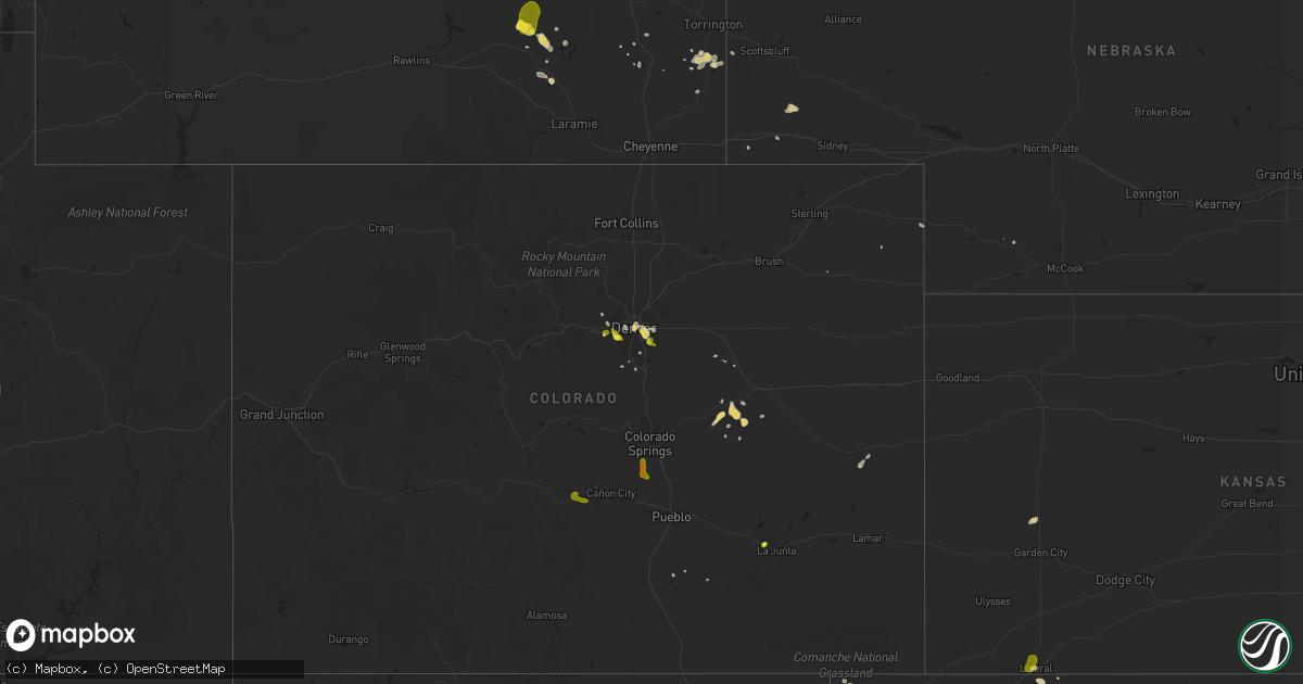
Hail Map on August 21, 2019
Get this storm
August 21 map
$229
one time, instant access
Download today. No call, no setup
Keep the $229
Bought the map and want the full workflow? Apply the entire $229 to a subscription within 7 days. None of it is wasted.
Every map, not just this one
This buys you this map. Subscription and you get every map we run, in the markets you choose from a few cities to whole states to nationwide. Plus real-time alerts the moment a storm fires.
Contact data
Name, contact info, occupancy, even credit band for addresses in the footprint. You go from where it hit to who to call.
Become the source they trust
Unlimited branding weather history reports on demand. You already have the documented answer ready for the property owner, and you are the one who showed up with it.
Property data and RoofTrace estimates
Pull up any address you have got, its value and the exact code rules for that jurisdiction, straight from One Click Code. Then RoofTrace estimates the squares, pitch, and roof value, priced the way you price.
States Impacted by Hail Map on August 21, 2019
Storm reports
Indiana
| Date | Description |
|---|---|
| 08/21/20196:49 AM CDT | At 1149 PM CDT, a severe thunderstorm was located over Poseyville, or 11 miles west of Fort Branch, moving northeast at 20 mph. HAZARD...60 mph wind gusts and penny size hail. SOURCE...Radar indicated. IMPACT...Expect damage to roofs, siding, and trees. Locations impacted include... Fort Branch, Haubstadt, Owensville, Poseyville and Cynthiana. This includes the following highways... Interstate 69 in Indiana near Mile Marker 24. Interstate 64 in Indiana between Mile Markers 8 and 17, and betweenMile Markers 20 and 21. |
| 08/21/20191:44 AM CDT | Tree down on power pole on speed road. |
| 08/21/201912:07 AM CDT | Emergency manager reports trees down near old us 50 and overhead road. |
| 08/21/201912:03 AM CDT | Emergency management reports trees down; power outages. |
| 08/20/201911:55 PM CDT | Trees down in the wadesville area. Time estimated by radar. |
| 08/20/201911:50 PM CDT | A tree down on hwy 56 in hazelton and another along j. Ford road southeast of town. Wind speed magnitude and trees size unknown... But swa was in effect for winds up to |
Georgia
| Date | Description |
|---|---|
| 08/20/201911:28 PM CDT | At 427 PM EDT, a severe thunderstorm was located near Dellwood, or near Swainsboro, and is nearly stationary. HAZARD...60 mph wind gusts and quarter size hail. SOURCE...Radar indicated. IMPACT...Hail damage to vehicles is expected. Expect wind damage to roofs, siding, and trees. Locations impacted include... Swainsboro, Kite, Norristown Junction, Dellwood and Modoc. |
Montana
| Date | Description |
|---|---|
| 08/21/20192:54 AM CDT | At 753 PM MDT, a severe thunderstorm was located near Great Falls, moving northeast at 15 mph. HAZARD...60 mph wind gusts and quarter size hail. SOURCE...Radar indicated. IMPACT...Hail damage to vehicles is expected. Expect wind damage to roofs, siding, and trees. Locations impacted include... Great Falls, Black Eagle and Malmstrom Afb. |
| 08/21/20192:17 AM CDT | At 716 PM MDT, a severe thunderstorm was located 10 miles northeast of Cascade, moving northeast at 25 mph. HAZARD...60 mph wind gusts and quarter size hail. SOURCE...Trained weather spotters. IMPACT...Hail damage to vehicles is expected. Expect wind damage to roofs, siding, and trees. Locations impacted include... Great Falls, Black Eagle, Ulm, Malmstrom Afb, Sand Coulee, Tracy and Centerville. |
| 08/20/20199:04 PM CDT | Wind gusted to 58 mph at the great falls airport from 7:53 pm to 8:04 pm mdt. |
| 08/20/20198:58 PM CDT | Large billboard near the pilot travel center - town pump truck stop was folded in half... With two of four large wooden supports snapped above ground level. Time was es |
| 08/20/20198:55 PM CDT | Asos station kgtf great falls. |
| 08/20/20198:53 PM CDT | Measured by weather station at residence on wells fargo drive. Time estimated by radar and nearby observations. |
| 08/20/20198:53 PM CDT | Time corrected to 7:53pm... Which corrects the previous tstm wnd gst report from 5 wsw great falls. |
| 08/20/20198:17 PM CDT | Awos station k1im india. |
| 08/20/20198:14 PM CDT | Quarter sized hail reported. |
Massachusetts
| Date | Description |
|---|---|
| 08/21/20195:40 PM CDT | Tree down in becket. |
| 08/21/20195:25 PM CDT | Wires down in lee. |
| 08/21/20195:20 PM CDT | Tree down in lenox. |
| 08/21/20192:20 PM CDT | Primary wires down due to tstm wind on harrison street in newburyport ma. Wires down span along 3 houses on the block. |
| 08/21/20191:33 PM CDT | Numerous large branches down on huntington avenue in methuen ma. Tree and wires down on kensington avenue and tree down on east street. |
| 08/21/20192:14 AM CDT | At 713 PM EDT, a severe thunderstorm was located over Brooklyn, or 7 miles north of Plainfield, moving east at 35 mph. HAZARD...60 mph wind gusts. SOURCE...Radar indicated. IMPACT...Expect damage to trees and power lines. Locations impacted include... Providence, Cranston, Pawtucket, East Providence, Cumberland, North Providence, Johnston, North Attleborough, Plainfield, Attleboro, Smithfield, Lincoln, Central Falls, Killingly, Burrillville, Seekonk, North Smithfield, Rehoboth, Scituate and Glocester. |
| 08/21/20192:00 AM CDT | At 659 PM EDT, severe thunderstorms were located along a line extending from Sandisfield to near Stanfordville, moving east at 40 mph. HAZARD...60 mph wind gusts and penny size hail. SOURCE...Radar indicated. IMPACT...Expect damage to roofs, siding, and trees. Locations impacted include... Torrington, Rhinebeck, New Hartford, Amenia, Sharon, Pine Plains, Norfolk, Millbrook, Canaan, Millerton, Sandisfield, Northwest Harwinton, Stanfordville, New Hartford Center, Ashley Falls, Falls Village, Staatsburg, Cornwall Bridge, Winsted and Harwinton. |
| 08/21/201912:51 AM CDT | At 550 PM EDT, severe thunderstorms were located along a line extending from near Nassau to near North-South Lake Campground, moving southeast at 30 mph. HAZARD...60 mph wind gusts and quarter size hail. SOURCE...Radar indicated. IMPACT...Hail damage to vehicles is expected. Expect wind damage to roofs, siding, and trees. Locations impacted include... Hudson, Catskill, Saugerties, Chatham, Nassau, Claverack, Livingston, Copake, New Baltimore, Stephentown, Coxsackie, Pine Plains, New Lebanon, Clermont, Valatie, Athens, Austerlitz, Ancram, Castleton-On-Hudson and Philmont. |
| 08/21/201912:05 AM CDT | At 505 PM EDT, a severe thunderstorm was located over Feura Bush, or near Delmar, moving east at 30 mph. HAZARD...60 mph wind gusts and quarter size hail. SOURCE...Radar indicated. IMPACT...Hail damage to vehicles is expected. Expect wind damage to roofs, siding, and trees. Locations impacted include... Albany, East Greenbush, Rensselaer, Chatham, Nassau, Delmar, Guilderland, New Baltimore, Westerlo, Ravena, Voorheesville, New Lebanon, Valatie, Castleton-On-Hudson, Kinderhook, Selkirk, Feura Bush, New Scotland, Coeymans and Stuyvesant. |
| 08/20/201910:55 PM CDT | At 355 PM EDT, a severe thunderstorm was located over Foster, or 8 miles northwest of Coventry, moving east at 30 mph. HAZARD...60 mph wind gusts. SOURCE...Radar indicated. IMPACT...Expect damage to trees and power lines. This severe thunderstorm will be near... Scituate around 405 PM EDT. Coventry, Smithfield and Glocester around 415 PM EDT. West Warwick around 420 PM EDT. Johnston around 425 PM EDT. Providence, Cranston and North Providence around 430 PM EDT. Central Falls around 435 PM EDT. Pawtucket, East Providence, North Attleborough and Barrington around 440 PM EDT. Seekonk and Warren around 445 PM EDT. |
| 08/20/20198:52 PM CDT | At 151 PM EDT, a severe thunderstorm was located near Nashua, moving northeast at 20 mph. HAZARD...60 mph wind gusts and quarter size hail. SOURCE...Radar indicated. IMPACT...Hail damage to vehicles is expected. Expect wind damage to roofs, siding, and trees. Locations impacted include... Nashua, Derry, Salem, Litchfield, Hudson, Pelham, Londonderry and Windham.This includes Interstate 93 between mile markers 1 and 13. |
Virginia
| Date | Description |
|---|---|
| 08/21/20196:45 PM CDT | Corrects previous tstm wnd dmg report from pamplin city. Several trees down in the pamplin area. |
| 08/21/20195:02 PM CDT | Tree down on wildwood knoll farm lane at hard rock way |
| 08/21/20194:51 PM CDT | Tree down on catharpin rd at lawyers rd |
| 08/21/20194:37 PM CDT | Tree down on lafayette drive near constitution highway |
| 08/21/20193:22 PM CDT | Tree down along tatum lane. |
| 08/21/20193:20 PM CDT | Tree down along s. Mayo road. |
| 08/21/20193:12 PM CDT | Tree down near hardees. |
| 08/21/20193:10 PM CDT | One tree down on a car near intersection of hatchers chapel road and red bank school road. No injuries. |
| 08/21/20193:07 PM CDT | Multiple trees down along hatchers chapel road. |
| 08/21/20193:05 PM CDT | Tree down on car along claudville hwy/103. No injuries. |
| 08/21/20193:02 PM CDT | A few trees down along home place road. |
| 08/21/20192:45 PM CDT | Tree down along route 601 north... Blocking the road. |
| 08/21/20192:29 PM CDT | Tree down blocking road in vicinity of maple shade road... And tory creek road. |
| 08/21/20192:25 PM CDT | Tree down on shelor road. |
| 08/21/20192:23 PM CDT | Tree down on dugspur road. |
| 08/21/20193:04 AM CDT | At 804 PM EDT, a severe thunderstorm was located over Kings Dominion, or 7 miles northeast of Ashland, moving east at 25 mph. HAZARD...60 mph wind gusts and penny size hail. SOURCE...Radar indicated. IMPACT...Expect damage to trees and powerlines. This severe thunderstorm will be near, Dawn around 810 PM EDT. Hanover around 815 PM EDT. Mangohick around 825 PM EDT. Beulahville around 835 PM EDT. Aylett and Manquin around 845 PM EDT.Other locations impacted by this severe thunderstorm include Enfield,Central Garage, Owenton, Oliver, Gum Tree, Upshaw, Doswell, EtnaMills, Epworth and Biscoe. |
| 08/21/201912:37 AM CDT | At 537 PM EDT, a severe thunderstorm was located 11 miles east of Orange, moving southeast at 20 mph. HAZARD...60 mph wind gusts and quarter size hail. SOURCE...Radar indicated. IMPACT...Damaging winds will cause some trees and large branches to fall. This could injure those outdoors, as well as damage homes and vehicles. Roadways may become blocked by downed trees. Localized power outages are possible. Unsecured light objects may become projectiles. Locations impacted include... Gold Dale, Mine Run, Logan, Rhoadesville, Brokenburg, Parker and Verdiersville. |
| 08/20/201911:52 PM CDT | At 452 PM EDT, a severe thunderstorm was located near Ayersville, moving southeast at 35 mph. HAZARD...60 mph wind gusts. SOURCE...Radar indicated. IMPACT...Expect damage to roofs, siding, and trees. Locations impacted include... Eden... Reidsville... Wentworth... Mayodan... and Madison.This includes The following Locations The Martinsville Speedway andMartinsville Airport. |
| 08/20/201910:25 PM CDT | At 324 PM EDT, severe thunderstorms were located from Mabry Mill to Laurel Fork to Fancy Gap, moving east at 25 mph. HAZARD...60 mph wind gusts and quarter size hail. SOURCE...Radar indicated. IMPACT...Hail damage to vehicles is expected. Expect wind damage to roofs, siding, and trees. Locations impacted include... Fancy Gap... Woolwine... Ararat... Laurel Fork... and Meadows Of Dan. |
| 08/20/20197:15 PM CDT | A few trees down. |
New York
| Date | Description |
|---|---|
| 08/21/20194:50 PM CDT | Tree down. |
| 08/21/20194:45 PM CDT | Wires down in kinderhook. |
| 08/21/20194:45 PM CDT | Large tree down on power lines on bedford avenue. |
| 08/21/20194:40 PM CDT | Tree down on route 9j near gibbons road. |
| 08/21/20194:18 PM CDT | Trees and wires down on rte 66 between rte 355 and snyders corners rd. |
| 08/21/20193:55 PM CDT | Trees and wires down in cohoes. |
| 08/21/20193:55 PM CDT | A couple of trees down in clinton township. |
| 08/21/20193:49 PM CDT | A local report indicates 1.00 inch wind near 1 ESE COHOES |
| 08/21/20193:45 PM CDT | A local report indicates 1.00 inch wind near 1 SSW LATHAM |
| 08/21/20193:20 PM CDT | Tree down. |
| 08/21/20193:10 PM CDT | Tree down in the town of easton. |
| 08/21/20193:07 PM CDT | Tree down on wires at route 32 and creek locks road |
| 08/21/20192:49 PM CDT | A local report indicates 1.00 inch wind near ROUND LAKE |
| 08/21/20192:49 PM CDT | Tree down on route 9 |
| 08/21/20192:49 PM CDT | Tree limbs down in yard in accord |
| 08/21/20192:45 PM CDT | Trees and wires down in northumberland. |
| 08/21/20192:35 PM CDT | Ef1 tornado confirmed in saratoga springs. Estimated maximum wind speed 105 mph. |
| 08/21/20192:30 PM CDT | Large tree down. Damaged three parked cars on union ave. |
| 08/21/20192:25 PM CDT | Wires down in ballston spa. |
| 08/21/20192:25 PM CDT | Trees and wires down on west high street in ballston spa. |
| 08/21/20192:25 PM CDT | Limbs down on wires in greenfield. |
| 08/21/20192:25 PM CDT | Several reports of limbs down on wires in wilton. |
| 08/21/20192:25 PM CDT | Trees and wires down on mourningkill drive in ballson spa. |
| 08/21/20191:26 PM CDT | Multiple trees down and damage to a barn. |
| 08/21/20191:24 PM CDT | Ef1 tornado confirmed. Estimated maximum wind speed 85 to 90 mph. |
| 08/21/20191:10 PM CDT | Tree down on route 30 between mayfield and northville. |
| 08/21/201912:44 PM CDT | Route 111 closed in the town of caroga due to a downed tree |
| 08/21/20191:58 AM CDT | At 657 AM EDT, a severe thunderstorm was located over Sandy Island Beach State Park, moving northeast at 45 mph. HAZARD...60 mph wind gusts. SOURCE...Radar indicated. IMPACT...Expect damage to roofs, siding, and trees. Locations impacted include... Watertown, Sandy Island Beach State Park, Fort Drum, Stony Point, Carthage, Lowville, Pulaski, West Carthage, Clayton and Adams. This includes Interstate 81 between exits 35 and 52. |
| 08/21/20191:28 AM CDT | At 627 AM EDT, a severe thunderstorm was located near Oswego, moving northeast at 40 mph. HAZARD...60 mph wind gusts and penny size hail. SOURCE...Radar indicated. IMPACT...Expect damage to roofs, siding, and trees. Locations impacted include... Oswego, Fulton, Sandy Island Beach State Park, Pulaski, Central Square, Selkirk Shores State Park, Mexico Point State Park, Nine Mile Point, Battle Island State Park and Hastings. This includes Interstate 81 between exits 32 and 37. |
| 08/21/201912:41 AM CDT | At 540 PM EDT, a severe thunderstorm was located over Beacon, moving east at 30 mph. HAZARD...60 mph wind gusts and quarter size hail. SOURCE...Radar indicated. IMPACT...Hail damage to vehicles is expected. Expect wind damage to roofs, siding, and trees. Locations impacted include... Beacon, Pawling, Wappingers Falls, Fishkill, Hopewell Junction, Myers Corner, Wingdale, Red Oaks Mill, East Fishkill, Beekman, Stormville, Baker Corner, Knapps Corner, South Dover, New Hamburg, Glenham, Clove Valley, Poughquag, Pecksville and Pleasant Ridge. |
| 08/21/201912:25 AM CDT | At 525 AM EDT, a severe thunderstorm was located over Round Lake, or near Mechanicville, moving east at 25 mph. HAZARD...60 mph wind gusts and half dollar size hail. SOURCE...Radar indicated. IMPACT...Hail damage to vehicles is expected. Expect wind damage to roofs, siding, and trees. Locations impacted include... Clifton Park, Saratoga Springs, Mechanicville, Milton, Ballston Spa, Cambridge, Greenwich, Round Lake, Country Knolls, North Ballston Spa, Burnt Hills, Halfmoon, Malta, Lee, Pittstown, Easton, Stillwater, Schaghticoke, Valley Falls and Deans Corners. |
| 08/20/201911:48 PM CDT | At 448 AM EDT, a severe thunderstorm was located near Delanson, or 7 miles south of Amsterdam, moving east at 40 mph. HAZARD...60 mph wind gusts and penny size hail. SOURCE...Radar indicated. IMPACT...Expect damage to roofs, siding, and trees. Locations impacted include... Schenectady, Clifton Park, Rotterdam, Saratoga Springs, Amsterdam, Scotia, Mechanicville, Glenville, Niskayuna, Milton, Duanesburg, Ballston Spa, Round Lake, Delanson, Rotterdam Junction, East Glenville, Burnt Hills, Country Knolls, North Ballston Spa and Alplaus. |
| 08/20/201910:34 PM CDT | At 334 PM EDT, a severe thunderstorm was located near Kerhonkson, or 8 miles north of Ellenville, moving east at 25 mph. HAZARD...60 mph wind gusts and quarter size hail. SOURCE...Radar indicated. IMPACT...Hail damage to vehicles is expected. Expect wind damage to roofs, siding, and trees. Locations impacted include... Kingston, New Paltz, Ellenville, Hurley, Kerhonkson, Lake Katrine, Tillson, Napanoch, Olivebridge, Port Ewen, High Falls, Wawarsing, Esopus, Rosendale, Marbletown, Cherrytown, Rolling Meadows, Maple Hill, Palentown and Atwood. |
| 08/20/201910:28 PM CDT | At 328 PM EDT, severe thunderstorms were located along a line extending from near West Glens Falls to East Glenville, moving east at 25 mph. HAZARD...60 mph wind gusts and penny size hail. SOURCE...Radar indicated. IMPACT...Expect damage to roofs, siding, and trees. Locations impacted include... Clifton Park, Saratoga Springs, Glens Falls, Hudson Falls, Mechanicville, Hoosick Falls, Salem, Milton, Ballston Spa, Fort Edward, Cambridge, Greenwich, Round Lake, Burnt Hills, Country Knolls, North Ballston Spa, East Glenville, Gates, Wilton and Malta. |
| 08/20/201910:00 PM CDT | At 259 PM EDT, a severe thunderstorm was located over Galway, or 9 miles northeast of Amsterdam, moving east at 25 mph. HAZARD...60 mph wind gusts and penny size hail. SOURCE...Radar indicated. IMPACT...Expect damage to roofs, siding, and trees. Locations impacted include... Saratoga Springs, Milton, Ballston Spa, Hagaman, Round Lake, Galway, North Ballston Spa, Rock City Falls, Gates, Malta, Greenfield, Stillwater, Parkis Mills, Deans Corners, Shaw Corners, Barkersville, West Milton, Wayville, Wiley Corners and Halls Corner. |
| 08/20/20199:45 PM CDT | At 245 PM EDT, a severe thunderstorm was located over Edinburg, or 16 miles northwest of Saratoga Springs, moving east at 25 mph. HAZARD...60 mph wind gusts and penny size hail. SOURCE...Radar indicated. IMPACT...Expect damage to roofs, siding, and trees. Locations impacted include... Corinth, Edinburg, Day Center, Kings, Mount Pleasant, Wilton, Gurn Spring, Tenantville, Grangerville, Kings Station, Glenwild, Greenfield Center, Conklingville, North Greenfield, Porter Corners, West Day, Batchellerville, Fox Hill, Randall Corner and Lake Desolation. |
| 08/20/20199:03 PM CDT | At 202 PM EDT, a severe thunderstorm was located over Ephratah, or near Johnstown, moving east at 30 mph. HAZARD...60 mph wind gusts and penny size hail. SOURCE...Radar indicated. IMPACT...Expect damage to roofs, siding, and trees. Locations impacted include... Amsterdam, Gloversville, Johnstown, Fonda, Ephratah, Broadalbin, Hagaman, Mayfield, Fort Johnson, Tribes Hill, Perth, Berkshire, Fultonville, Nelliston, Meco, West Perth, Munsonville, Church Corners, Broadalbin Junction and Fical Corners. |
| 08/20/20198:44 PM CDT | At 143 PM EDT, a severe thunderstorm was located over Caroga Lake, or 9 miles northwest of Gloversville, moving east at 20 mph. HAZARD...60 mph wind gusts and penny size hail. SOURCE...Radar indicated. IMPACT...Expect damage to roofs, siding, and trees. Locations impacted include... Gloversville, Broadalbin, Northville, Mayfield, Caroga Lake, Cranberry Creek, Caroga Lake Public Campground, Northampton Beach Public Campground, Berkshire, Bleecker, Arietta, Benson, Meco, Munsonville, Sweets Crossing, Pinnacle, Rockwood, Broadalbin Junction, Fical Corners and Tomantown. |
Maryland
| Date | Description |
|---|---|
| 08/21/20195:56 PM CDT | Large branch down on muddy creek road at shady oaks road |
| 08/21/20195:47 PM CDT | Tree down on route 2 at old birdsville road |
| 08/21/20195:14 PM CDT | Tree down on wires on newton street |
| 08/21/20195:10 PM CDT | Single engine... 4000 pound airplane flipped and leaking fuel |
| 08/21/20195:10 PM CDT | Tree down on wires along dartmouth avenue |
| 08/21/20195:10 PM CDT | A local report indicates 63 MPH wind near COLLEGE PARK AIRPORT |
| 08/21/20195:10 PM CDT | Several trees down along calvert road |
| 08/21/20195:10 PM CDT | Tree down on pony trail lane |
| 08/21/20191:45 AM CDT | At 645 PM EDT, severe thunderstorms were located along a line extending from Mayo to Upper Marlboro, moving southeast at 20 mph. HAZARD...60 mph wind gusts. SOURCE...Radar indicated. IMPACT...Damaging winds will cause some trees and large branches to fall. This could injure those outdoors, as well as damage homes and vehicles. Roadways may become blocked by downed trees. Localized power outages are possible. Unsecured light objects may become projectiles. Locations impacted include... Annapolis, Mayo, Shady Side, Chesapeake Beach, Deale, Upper Marlboro, Rhode River, South River, Andrews Air Force Base, Rosaryville, Marlton, Dunkirk, Londontowne, Edgewater, Owings, Galesville, Friendship, Highland Beach, Hillsmere Shores and Harwood. |
| 08/21/20191:13 AM CDT | At 612 PM EDT, a severe thunderstorm was located over New Carrollton, or over Greenbelt, moving southeast at 25 mph. HAZARD...60 mph wind gusts. SOURCE...College Park Airport reported a wind gust to 63 mph. IMPACT...Damaging winds will cause some trees and large branches to fall. This could injure those outdoors, as well as damage homes and vehicles. Roadways may become blocked by downed trees. Localized power outages are possible. Unsecured light objects may become projectiles. Locations impacted include... Bowie, Annapolis, College Park, Crofton, Greenbelt, Langley Park, Beltsville, Forestville, Largo, Bladensburg, Mayo, University of Maryland, Fedex Field, Odenton, Landover, Hyattsville, Parole, East Riverdale, Adelphi and Kettering. |
Pennsylvania
| Date | Description |
|---|---|
| 08/21/20193:31 PM CDT | Downed tree blocking chelsea road near cherry lane. Time estimated from radar. |
| 08/21/20193:17 PM CDT | Several large tree limbs snapped. Time estimated from radar. |
| 08/21/20193:05 PM CDT | Downed tree blocking the access road to the east vincent township pd. Time based on dispatch report. |
| 08/21/20193:04 PM CDT | Downed tree near the intersection of hoffecker road and french creek road. Time estimated from radar. |
| 08/21/20192:38 PM CDT | Downed tree on bechtel road. Time estimated from radar. |
| 08/21/20192:33 PM CDT | Downed tree and wires near the intersection of black matt road and yocum road. Time estimated from radar. |
| 08/21/20192:14 PM CDT | Tree down near lincoln road and lorane road. Time estimated from radar. |
| 08/21/20192:14 PM CDT | Tree down on wires on haycreek road. Time estimated from radar. |
| 08/21/20192:08 PM CDT | Several reports of trees... Power lines... And power poles down around plow road in robeson twp. Time estimated from radar. |
| 08/21/20192:03 PM CDT | Numerous trees down between shea drive and diehl road. Time estimated from radar. |
| 08/21/20192:00 PM CDT | Estimated hail to the size of quarters. Social media report relayed by trained spotter. Time estimated from radar. |
| 08/21/20192:00 PM CDT | Trees down. Social media report relayed by trained spotter. Time estimated from radar. |
| 08/20/201911:07 PM CDT | At 406 PM EDT, a severe thunderstorm was located over Phoenixville, or 14 miles north of West Chester, moving east at 20 mph. HAZARD...60 mph wind gusts and quarter size hail. SOURCE...Radar indicated. IMPACT...Minor damage to vehicles is possible. Wind damage to roofs, siding, trees, and power lines is possible. Locations impacted include... Norristown, Phoenixville, West Norriton, East Norriton, Conshohocken, Ambler, Collegeville, Royersford, Trappe, Schwenksville, Bryn Mawr, Valley Forge, Plymouth Meeting, King Of Prussia, Radnor Township, Horsham, Skippack, Bridgeport, Spring City and North Wales. |
| 08/20/201910:08 PM CDT | At 308 PM EDT, a severe thunderstorm was located over Birdsboro, or near Reading, moving east at 20 mph. HAZARD...60 mph wind gusts and quarter size hail. SOURCE...Radar indicated. IMPACT...Minor damage to vehicles is possible. Wind damage to roofs, siding, trees, and power lines is possible. Locations impacted include... Reading, Pottstown, Birdsboro, Collegeville, Royersford, Trappe, East Greenville, Schwenksville, Bally, Bechtelsville, Green Lane, Spring Mount, Gilbertsville, Cedarville, Stowe, Shillington, Boyertown, Pennsburg, Spring City and Mount Penn. |
Connecticut
| Date | Description |
|---|---|
| 08/21/20195:52 PM CDT | Tree limbs down on linden street and harold street. |
| 08/21/20195:45 PM CDT | Large branches down on birchwood and milwood roads in east hartford ct. One large branch down at corner of birchwood road and silver lane. |
| 08/21/20195:05 PM CDT | Tree down on bissell street. Wires down on spruce at bissell street. |
| 08/21/20195:05 PM CDT | Power lines down on summit street. |
| 08/21/20195:05 PM CDT | Large branches down on wires on florence street in manchester ct. |
| 08/21/20194:42 PM CDT | Tree down on wires on daniels farm road at hillsboro road. |
| 08/21/20194:41 PM CDT | Trees and wires down on whitney avenue. |
| 08/21/20194:41 PM CDT | Tree down on wires on teller road. |
| 08/21/20192:30 PM CDT | Trees down along portions of north bear hill road. |
| 08/21/20192:20 PM CDT | Tree down on route 44 in eastford ct |
| 08/21/20192:20 PM CDT | Trees and wires down on main street. |
| 08/21/20191:43 AM CDT | At 643 PM EDT, severe thunderstorms were located along a line extending from near Copake to near Red Hook, moving east at 25 mph. HAZARD...60 mph wind gusts and penny size hail. SOURCE...Radar indicated. IMPACT...Expect damage to roofs, siding, and trees. Locations impacted include... Torrington, Rhinebeck, Amenia, Sharon, Pine Plains, Red Hook, Norfolk, Canaan, Millerton, Stanfordville, Falls Village, Cornwall Bridge, Bethel, Salisbury, Goshen, Milan, Colebrook, Cornwall, Smithfield and West Torrington. |
| 08/21/20191:42 AM CDT | At 641 PM EDT, a severe thunderstorm was located over Glastonbury, moving east at 35 mph. HAZARD...60 mph wind gusts and quarter size hail. SOURCE...Radar indicated. IMPACT...Expect wind damage to trees and power lines. Minor hail damage to vehicles is possible. Locations impacted include... Hartford, Manchester, East Hartford, Glastonbury, Wethersfield, Mansfield, East Hampton, Rocky Hill, Cromwell, Coventry, Hebron, Portland, Lebanon, Marlborough, Columbia, Bolton and Andover. |
| 08/21/20191:34 AM CDT | At 634 PM EDT, severe thunderstorms were located along a line extending from near East Windsor to Falls Village, moving east at 40 mph. HAZARD...60 mph wind gusts. SOURCE...Radar indicated. IMPACT...Expect damage to trees and power lines. Locations impacted include... Springfield, New Britain, West Hartford, Chicopee, Enfield, Westfield, Holyoke, Amherst, Windsor, Northampton, Agawam, West Springfield, Farmington, Deerfield, Simsbury, Ludlow, Bloomfield, Avon, South Hadley and Easthampton. |
| 08/21/20191:05 AM CDT | At 605 PM EDT, severe thunderstorms were located along a line extending from Williamstown to Clermont, moving east at 30 mph. HAZARD...60 mph wind gusts. SOURCE...Radar indicated. IMPACT...Expect damage to roofs, siding, and trees. Locations impacted include... Pittsfield, North Adams, Great Barrington, Adams, Williamstown, Lee, Lenox, Sheffield, Cheshire, Becket, Otis, Sandisfield, Florida, Hancock, Savoy, New Ashford, Ashley Falls, Housatonic, Berkshire and Dalton. |
| 08/21/201912:47 AM CDT | At 547 PM EDT, a severe thunderstorm was located over Glastonbury, moving east at 35 mph. HAZARD...60 mph wind gusts and quarter size hail. SOURCE...Radar indicated. IMPACT...Expect wind damage to trees and power lines. Minor hail damage to vehicles is possible. Locations impacted include... Hartford, Manchester, East Hartford, Glastonbury, Wethersfield, Mansfield, Windham, Plainfield, Rocky Hill, Willimantic, Coventry, Hebron, Brooklyn, Lebanon, Marlborough, Columbia, Canterbury, Bolton, Ashford and Pomfret. |
| 08/21/201912:12 AM CDT | At 512 PM EDT, a severe thunderstorm was located over New Canaan, moving east at 25 mph. HAZARD...60 mph wind gusts and penny size hail. SOURCE...Radar indicated. IMPACT...Expect damage to trees and power lines. This severe thunderstorm will be near... Wilton around 520 PM EDT. Westport and Weston around 530 PM EDT. Bridgeport and Fairfield around 545 PM EDT. Trumbull around 555 PM EDT. Shelton and Stratford around 605 PM EDT. |
| 08/20/201911:15 PM CDT | At 415 PM EDT, a severe thunderstorm was located near Port Ewen, or near Kingston, moving east at 35 mph. HAZARD...60 mph wind gusts and quarter size hail. SOURCE...Radar indicated. IMPACT...Hail damage to vehicles is expected. Expect wind damage to roofs, siding, and trees. Locations impacted include... Kingston, New Paltz, Rhinebeck, Hyde Park, Hurley, Amenia, Pine Plains, Red Hook, Ancram, Millerton, Stanfordville, Tillson, Port Ewen, Staatsburg, Lake Katrine, Esopus, Rosendale, Marbletown, Bethel and Milan. |
| 08/20/20199:26 PM CDT | At 225 PM EDT, a severe thunderstorm was located over East Hartford, moving northeast at 30 mph. This storm downed trees on wires as it moved through Farmington. HAZARD...60 mph wind gusts. SOURCE...Radar indicated. IMPACT...Expect damage to trees and power lines. This severe thunderstorm will be near... Manchester, Glastonbury and East Windsor around 235 PM EDT. South Windsor and Bolton around 240 PM EDT. Vernon around 245 PM EDT. Andover around 250 PM EDT. Ellington and Coventry around 255 PM EDT. Mansfield and Tolland around 300 PM EDT. Willington and Chaplin around 315 PM EDT. Ashford, Eastford and Union around 320 PM EDT. |
| 08/20/20198:25 PM CDT | At 125 PM EDT, a severe thunderstorm was located over Terryville, or near Bristol, moving northeast at 35 mph. HAZARD...60 mph wind gusts and penny size hail. SOURCE...Radar indicated. IMPACT...Expect damage to trees and power lines. This severe thunderstorm will be near... Plainville around 130 PM EDT. Southington and Farmington around 135 PM EDT. Canton around 140 PM EDT. Avon around 145 PM EDT. Hartford, West Hartford, East Hartford, Simsbury and Bloomfield around 155 PM EDT. Windsor, Windsor Locks and East Granby around 205 PM EDT. Manchester and East Windsor around 210 PM EDT. South Windsor around 215 PM EDT.Other locations impacted by this severe thunderstorm includeAllentown, Pequabuck and Terryville Station. |
| 08/20/20198:23 PM CDT | At 123 PM EDT, a severe thunderstorm was located over Terryville, or near Bristol, moving east at 45 mph. HAZARD...60 mph wind gusts and penny size hail. SOURCE...Radar indicated. IMPACT...Expect damage to roofs, siding, and trees. Locations impacted include... Torrington, Thomaston, New Hartford, Litchfield, Northwest Harwinton, Oakville, Terryville, New Hartford Center, Woodbury Center, New Preston, Watertown, Plymouth, Woodbury, Harwinton, Bethlehem, Washington, Goshen, Morris, Roxbury and Warren. |
New Jersey
| Date | Description |
|---|---|
| 08/21/20194:32 PM CDT | Tree down in roselle park. |
| 08/21/20194:32 PM CDT | Trees reported down in winfield. |
| 08/21/20193:56 PM CDT | Downed power lines near noe avenue and shunpike road. Time estimated from radar. |
| 08/21/20193:55 PM CDT | Trees and wires down. Time estimated from radar. |
| 08/21/20193:40 PM CDT | Tree snapped on main street near far hills in bedminster twp. Time estimated from radar. |
| 08/21/20193:13 PM CDT | Several reports of trees and wires down throughout the township. Widespread power outages were reported. Time estimated from radar. |
| 08/21/20192:56 PM CDT | Downed trees and power lines near old turnpike road and settlers ridge court. Time estimated from radar. |
| 08/21/20192:55 PM CDT | Downed trees and wires in multiple locations near newtons corner road. Power outages reported. Time estimated from radar. |
| 08/21/201912:29 AM CDT | At 528 PM EDT, a severe thunderstorm was located over Union, or over Linden, moving east at 30 mph. HAZARD...60 mph wind gusts. SOURCE...Radar indicated. IMPACT...Expect damage to trees and power lines. This severe thunderstorm will be near... Newark around 535 PM EDT. Bayonne and Harrison around 540 PM EDT. Jersey City and Secaucus around 545 PM EDT. Hoboken and The Verrazano Narrows Bridge around 550 PM EDT. Coney Island and Midtown Manhattan around 555 PM EDT. Flatbush and Crown Heights around 600 PM EDT. Laguardia Airport and Jackson Heights around 605 PM EDT. Flushing and Rockaway Beach around 610 PM EDT. Jamaica and Kennedy Airport around 615 PM EDT. Valley Stream and Woodmere around 620 PM EDT. |
| 08/20/201911:36 PM CDT | At 436 PM EDT, a severe thunderstorm was located over White House Station, or 9 miles northwest of Somerville, moving east at 25 mph. HAZARD...60 mph wind gusts and nickel size hail. SOURCE...Radar indicated. IMPACT...Damage to roofs, siding, trees, and power lines is possible. Locations impacted include... Perth Amboy, Somerville, Edison, Bridgewater, Carteret, Madison, Middlesex, Bound Brook, Manville, Chatham, Peapack And Gladstone, Lebanon, Califon, Far Hills, Colonia, Martinsville, Millington, White House Station, Society Hill and Basking Ridge.This includes the following highways... Garden State Parkway between mile markers 128 and 134. Interstate 287 in New Jersey between mile markers 0 and 31. Interstate 78 in New Jersey between mile markers 18 and 42. New Jersey Turnpike between exits 11 and 13. |
Oklahoma
| Date | Description |
|---|---|
| 08/21/20194:35 PM CDT | Several 1 to 2 inch tree limbs down across checotah |
| 08/21/20194:35 PM CDT | Estimated 60 to 65 mph winds in checotah. Time is radar estimated. |
| 08/21/20193:33 PM CDT | Football equipment damage at catoosa high school via picture on social media. |
| 08/21/20193:32 PM CDT | Quarter size hail estimated by nws employee in catoosa. |
| 08/20/20199:11 PM CDT | At 211 AM CDT, a severe thunderstorm was located 6 miles northwest of Alabaster Caverns State Park, moving north at 10 mph. HAZARD...60 mph wind gusts and quarter size hail. SOURCE...Radar indicated. IMPACT...Hail damage to vehicles is expected. Expect wind damage to roofs, siding, and trees. Locations impacted include... Freedom, Alabaster Caverns State Park and Camp Houston. |
| 08/20/20197:20 PM CDT | A local report indicates 59 MPH wind near 2 E GOODWELL |
| 08/20/20197:14 PM CDT | A local report indicates 60 MPH wind near 2 W GUYMON |
Vermont
| Date | Description |
|---|---|
| 08/21/20194:05 PM CDT | Ef1 tornado confirmed. Estimated maximum wind speed 105 to 110 mph. |
| 08/20/201911:32 PM CDT | At 432 PM EDT, a severe thunderstorm was located over Latham, moving east at 20 mph. HAZARD...60 mph wind gusts and quarter size hail. SOURCE...Radar indicated. IMPACT...Hail damage to vehicles is expected. Expect wind damage to roofs, siding, and trees. Locations impacted include... Albany, Troy, Clifton Park, Cohoes, Watervliet, Rensselaer, Colonie, Latham, Menands, Stephentown, Green Island, Grafton, Waterford, Berlin, Loudonville, West Sand Lake, Averill Park, Center Brunswick, Wyantskill and Wynantskill. |
| 08/20/201911:24 PM CDT | At 423 PM EDT, severe thunderstorms were located along a line extending from 6 miles west of Dorset to near Cambridge to near Mechanicville, moving east at 25 mph. HAZARD...70 mph wind gusts and penny size hail. SOURCE...Radar indicated. IMPACT...Expect considerable tree damage. Damage is likely to mobile homes, roofs, and outbuildings. Locations impacted include... Bennington, Hoosick Falls, Arlington, Salem, Manchester, Shaftsbury, Dorset, Cambridge, Manchester Center, Hoosick, Porter, Pittstown, White Creek, North Bennington, Sunderland, Rupert, Schaghticoke, Valley Falls, Woodford and Sandgate. |
Wyoming
| Date | Description |
|---|---|
| 08/21/20194:55 PM CDT | Public report on highway 26. Driver estimated... But did not stop to measure and said the hail left dents in his truck. |
| 08/21/20191:05 AM CDT | At 605 PM MDT, a severe thunderstorm was located 7 miles east of Red Wall, which is 21 miles south of Kaycee, moving north at 20 mph. HAZARD...60 mph wind gusts and quarter size hail. SOURCE...Radar indicated. IMPACT...Hail damage to vehicles is expected. Expect wind damage to roofs, siding, and trees. This severe thunderstorm will be near... Hole In The Wall around 630 PM MDT. |
| 08/21/201912:35 AM CDT | At 534 PM MDT, a severe thunderstorm was located near Worland, and is nearly stationary. HAZARD...Quarter size hail. SOURCE...Radar indicated. IMPACT...Damage to vehicles is expected. This severe thunderstorm will remain over mainly rural areas of north central Washakie County, including the following locations... Washakie County Fairgrounds. |
| 08/21/201912:32 AM CDT | At 532 PM MDT, a severe thunderstorm was located 11 miles northwest of Wheatland Reservoir 3, or 48 miles north of Laramie, moving southeast at 15 mph. HAZARD...60 mph wind gusts and quarter size hail. SOURCE...Radar indicated. IMPACT...Hail damage to vehicles is expected. Expect wind damage to roofs, siding, and trees. Locations impacted include... Wheatland Reservoir 3. |
| 08/21/201912:31 AM CDT | At 531 PM MDT, a severe thunderstorm was located near Powder River, which is 31 miles northwest of Casper, moving northeast at 5 to 10 mph. HAZARD...Quarter size hail. SOURCE...Radar indicated. IMPACT...Damage to vehicles is expected. This severe thunderstorm will be near... Goldeneye Reservoir around 610 PM MDT.Other locations impacted by this severe thunderstorm include Natrona. |
| 08/21/201912:28 AM CDT | At 527 PM MDT, a severe thunderstorm was located 7 miles southeast of Winchester, which is 14 miles south of Worland, moving northeast at 25 mph. This warning replaces the previous warning for east central Hot Springs County and central Washakie County. HAZARD...Quarter size hail. SOURCE...Radar indicated. IMPACT...Damage to vehicles is expected. This severe thunderstorm will remain over mainly rural areas of east central Hot Springs and central Washakie Counties. |
| 08/20/201911:56 PM CDT | At 456 PM MDT, a severe thunderstorm was located over Kirby, which is 10 miles north of Thermopolis, moving northeast at 5 mph. HAZARD...Quarter size hail. SOURCE...Radar indicated. IMPACT...Damage to vehicles is expected. This severe thunderstorm will be near... Winchester around 520 PM MDT. |
| 08/20/201911:49 PM CDT | At 448 PM MDT, a severe thunderstorm was located near Battle Mountain, or 55 miles south of Casper, moving southeast at 5 mph. HAZARD...60 mph wind gusts and quarter size hail. SOURCE...Radar indicated. IMPACT...Hail damage to vehicles is expected. Expect wind damage to roofs, siding, and trees. Locations impacted include... Medicine Bow. |
| 08/20/201911:38 PM CDT | At 438 PM MDT, a severe thunderstorm was located 10 miles northwest of Cottonwood Pass, which is 24 miles east of Thermopolis, moving east at 15 mph. HAZARD...Quarter size hail. SOURCE...Radar indicated. IMPACT...Damage to vehicles is expected. This severe thunderstorm will remain over mainly rural areas of southeastern Hot Springs and south central Washakie Counties. |
| 08/20/201911:26 PM CDT | At 426 PM MDT, a severe thunderstorm was located 10 miles north of Alcova, which is 22 miles southwest of Casper, moving northwest at 10 mph. HAZARD...Half dollar size hail. SOURCE...Radar indicated. IMPACT...Damage to vehicles is expected. This severe thunderstorm will remain over mainly rural areas of south central Natrona County. |
| 08/20/201911:20 PM CDT | At 419 PM MDT, severe thunderstorms were located along a line extending from 8 miles north of Little Medicine School to 9 miles south of Campbell Creek Campground to near Battle Mountain, moving east at 10 mph. HAZARD...60 mph wind gusts and quarter size hail. SOURCE...Radar indicated. IMPACT...Hail damage to vehicles is expected. Expect wind damage to roofs, siding, and trees. Locations impacted include... Battle Mountain, Campbell Creek Campground, Little Medicine School and Boxelder. |
| 08/20/201911:05 PM CDT | At 405 PM MDT, a severe thunderstorm was located 8 miles south of Ten Sleep, moving northwest at 25 mph. HAZARD...Quarter size hail. SOURCE...Radar indicated. IMPACT...Damage to vehicles is expected. This severe thunderstorm will remain over mainly rural areas of northeastern Washakie County. |
| 08/20/201910:55 PM CDT | At 354 PM MDT, a severe thunderstorm was located over Moneta, which is 18 miles east of Shoshoni, moving northwest at 10 mph. HAZARD...Quarter size hail. SOURCE...Radar indicated. IMPACT...Damage to vehicles is expected. This severe thunderstorm will be near... Lysite around 415 PM MDT. |
| 08/20/20199:58 PM CDT | At 258 PM MDT, a severe thunderstorm was located 11 miles northeast of Cottonwood Pass, which is 30 miles south of Ten Sleep, moving north at 5 mph. HAZARD...Quarter size hail. SOURCE...Radar indicated. IMPACT...Damage to vehicles is expected. This severe thunderstorm will remain over mainly rural areas of southeastern Washakie County. |
| 08/20/20198:16 PM CDT | Mesonet station ew8925 linch. |
Arizona
| Date | Description |
|---|---|
| 08/20/20199:42 PM CDT | At 241 PM MST, a severe thunderstorm was located near western Nogales, moving southeast at 10 mph. HAZARD...60 mph wind gusts and penny size hail along with heavy rain. SOURCE...Radar indicated. IMPACT...Expect damage to roofs, siding, and trees. Locations impacted include... Nogales.This includes the following highways... Interstate 19 between mile markers 1 and 9. Route 82 between mile markers 1 and 5. |
| 08/20/20199:26 PM CDT | At 226 PM MST, a severe thunderstorm was located 8 miles northwest of Bisbee, and is nearly stationary. HAZARD...60 mph wind gusts and quarter size hail. SOURCE...Radar indicated. IMPACT...Hail damage to vehicles is expected. Expect wind damage to roofs, siding, and trees. Locations impacted include... Bisbee.This includes the following highways... Route 80 between mile markers 324 and 350. Route 90 between mile markers 332 and 336. Route 92 near mile marker 355. |
| 08/20/20199:01 PM CDT | At 200 PM MST, a severe thunderstorm was located southeast of Sonoita, or 18 miles west of Sierra Vista, and is slowly moving toward the southeast.. HAZARD...60 mph wind gusts and quarter size hail. SOURCE...Radar indicated. IMPACT...Hail damage to vehicles is expected. Expect wind damage to roofs, siding, and trees. Locations impacted include... Patagonia, Sonoita, Elgin and Canelo. This includes the following highways... Route 82 between mile markers 20 and 26. Route 83 between mile markers 14 and 27. |
Colorado
| Date | Description |
|---|---|
| 08/21/20194:06 PM CDT | Report from mping: ping pong ball |
| 08/21/20194:04 PM CDT | Report from mping: half dollar |
| 08/21/20197:32 AM CDT | At 1232 AM MDT, severe thunderstorms were located along a line extending from 7 miles east of Ellsworth to North Sterling Reservoir, moving east at 35 mph. These are very dangerous storms. HAZARD...80 mph wind gusts and quarter size hail. SOURCE...Radar indicated. IMPACT...Flying debris will be dangerous to those caught without shelter. Mobile homes will be heavily damaged. Expect considerable damage to roofs, windows, and vehicles. Extensive tree damage and power outages are likely. Locations impacted include... Alliance, Sidney, Lodgepole, Gurley, Colton, Sunol, Brownson, Lorenzo, Alliance Airport and Sidney Airport.This includes Interstate 80 in Nebraska between mile markers 48 and76. |
| 08/21/20194:06 AM CDT | At 905 PM CDT, a severe thunderstorm was located 9 miles northeast of Felt, or 10 miles west of Boise City, moving west at 10 mph. HAZARD...60 mph wind gusts. SOURCE...Radar indicated. IMPACT...Minor damage to roofs, siding, and trees is possible. Locations impacted include... Boise City, Keyes, Kenton, Wheeless, Black Mesa Park, Felt and Griggs. |
| 08/21/20192:39 AM CDT | At 739 PM MDT, a severe thunderstorm was located near Sedalia, or 23 miles south of Denver, moving east at 10 mph. HAZARD...Quarter size hail. SOURCE...Radar indicated. IMPACT...Damage to vehicles is expected. Locations impacted include... Castle Rock, southwestern Parker, Sedalia, Castle Pines and Louviers. |
| 08/21/20191:34 AM CDT | At 634 PM MDT, a severe thunderstorm was located over western Aurora, or 8 miles southeast of Denver, moving northwest at 5 mph. HAZARD...60 mph wind gusts and quarter size hail. SOURCE...Radar indicated. IMPACT...Expect damage to roofs, siding, and trees. Hail damage to vehicles is expected. Locations impacted include... Denver, Aurora, eastern Centennial, Greenwood Village, Arapahoe Park and Buckley AFB. |
| 08/21/20191:03 AM CDT | At 602 PM MDT, a severe thunderstorm was located over northeastern Denver, moving west at 5 mph. HAZARD...Quarter size hail. SOURCE...Radar indicated. IMPACT...Damage to vehicles is expected. Locations impacted include... Denver and southwestern Commerce City. |
| 08/20/201911:22 PM CDT | Hailed for 20 minutes. |
| 08/20/201911:09 PM CDT | At 408 PM MDT, a severe thunderstorm was located over Texas Creek, or 12 miles northeast of Hayden Pass Burn Scar, moving northeast at 15 mph. HAZARD...60 mph wind gusts and quarter size hail. SOURCE...Radar indicated. IMPACT...Hail damage to vehicles is expected. Expect wind damage to roofs, siding, and trees. Locations impacted include... Texas Creek, Royal Gorge and Canon City. |
| 08/20/201910:08 PM CDT | At 307 PM MDT, a severe thunderstorm was located 11 miles southwest of Fountain, or 16 miles south of Colorado Springs, moving south at 15 mph. HAZARD...Half dollar size hail. SOURCE...Public. IMPACT...Damage to vehicles is expected. Locations impacted include... Southern Colorado Springs, Fountain, Stratmoor, Penrose, Fort Carson, Pueblo West, Pinon, Security and Security-Widefield. |
| 08/20/20197:45 PM CDT | A local report indicates 1.00 inch wind near 3 SE DENVER |
| 08/20/20197:41 PM CDT | A local report indicates 1.00 inch wind near 1 N GENESEE |
| 08/20/20197:40 PM CDT | A local report indicates 1.00 inch wind near 3 W AURORA |
| 08/20/20197:27 PM CDT | A local report indicates 1.00 inch wind near 3 SW LAKEWOOD |
Missouri
| Date | Description |
|---|---|
| 08/21/20193:25 PM CDT | Quarter size hail mixed in with a lot of pea to half inch sized hail. |
| 08/21/20194:23 AM CDT | At 923 PM CDT, a severe thunderstorm was located near Walker, or near El Dorado Springs, moving northeast at 15 mph. HAZARD...60 mph wind gusts and quarter size hail. SOURCE...Radar indicated. IMPACT...Hail damage to vehicles is expected. Expect wind damage to roofs, siding, and trees. Locations impacted include... El Dorado Springs... Osceola... Walker... Schell City... Roscoe... Harwood... Tiffin... Taberville... Cedar Springs... Monegaw Springs... |
| 08/21/20192:51 AM CDT | At 750 PM CDT, a severe thunderstorm was located 8 miles northwest of Lebanon, moving northeast at 15 mph. HAZARD...60 mph wind gusts and quarter size hail. SOURCE...Radar indicated. IMPACT...Hail damage to vehicles is expected. Expect wind damage to roofs, siding, and trees. Locations impacted include... Lebanon... Bennett Spring State Park... Stoutland... Bennett Springs... Windyville... Eldridge... Decaturville... Plad... Sleeper... Montreal...This includes Interstate 44 between mile markers 132 and 141. |
| 08/21/20192:36 AM CDT | At 736 PM CDT, a severe thunderstorm was located near Salem, moving east at 5 mph. HAZARD...60 mph wind gusts and quarter size hail. SOURCE...Radar indicated. IMPACT...Hail damage to vehicles is expected. Expect wind damage to roofs, siding, and trees. Locations impacted include... Howes... Sligo... |
| 08/21/20192:10 AM CDT | At 709 AM CDT, a severe thunderstorm was located over Alma, or near Concordia, moving east at 20 mph. HAZARD...60 mph wind gusts and quarter size hail. SOURCE...Radar indicated. IMPACT...Hail damage to vehicles is expected. Expect wind damage to roofs, siding, and trees. Locations impacted include... Concordia, Sweet Springs, Waverly, Corder, Alma, Malta Bend, Blackburn, Emma, Aullville, Mount Leonard and Grand Pass.This includes Interstate 70 in Missouri between mile markers 53 and74. |
| 08/21/20191:02 AM CDT | At 601 AM CDT, a severe thunderstorm was located over Chillicothe, moving east at 25 mph. HAZARD...60 mph wind gusts and nickel size hail. SOURCE...Radar indicated. IMPACT...Expect damage to roofs, siding, and trees. Locations impacted include... Chillicothe, Brookfield, Meadville, Laclede, Linneus, Wheeling, Utica, Chula, Purdin, Mendon, Sumner, Rothville, Spring Hill, Avalon and Dawn. |
| 08/21/201912:19 AM CDT | At 519 AM CDT, a severe thunderstorm was located near Hamilton, moving east at 15 mph. HAZARD...60 mph wind gusts and quarter size hail. SOURCE...Radar indicated. IMPACT...Hail damage to vehicles is expected. Expect wind damage to roofs, siding, and trees. Locations impacted include... Chillicothe, Hamilton, Gallatin, Jamesport, Breckenridge, Kingston, Utica, Altamont, Ludlow, Mooresville, Lock Springs, Spring Hill and Dawn. |
| 08/20/201911:05 PM CDT | At 405 PM CDT, a severe thunderstorm was located over Grassy, or 10 miles west of Marble Hill, moving southeast at 10 mph. HAZARD...60 mph wind gusts and quarter size hail. SOURCE...Radar indicated. IMPACT...Hail damage to vehicles is expected. Expect wind damage to roofs, siding, and trees. Locations impacted include... Marble Hill, Cascade, Grassy, Zalma and Glenallen. |
| 08/20/20199:58 PM CDT | At 258 PM CDT, a severe thunderstorm was located over Fremont, or 9 miles southwest of Van Buren, moving southeast at 10 mph. HAZARD...60 mph wind gusts and quarter size hail. SOURCE...Radar indicated. IMPACT...Hail damage to vehicles is expected. Expect wind damage to roofs, siding, and trees. Locations impacted include... Fremont. |
| 08/20/20198:55 PM CDT | At 154 PM CDT, a severe thunderstorm was located over Dodd City, or 11 miles northwest of Yellville, moving northeast at 10 mph. HAZARD...60 mph wind gusts and quarter size hail. SOURCE...Radar indicated. IMPACT...Hail damage to vehicles is expected. Expect wind damage to roofs, siding, and trees. Locations impacted include... Bull Shoals... Lakeview in Baxter County... Arkawana... Dodd City... Price Place... Ozark Isle... Lakeway... Bull Shoals State Park... Clark Hill... Clarkridge... Monarch... Oakland... Peel... Three Brothers... Bull Shoals Lake... Norfork Lake... |
| 08/20/20198:53 PM CDT | Delayed report. Numerous 6-8 inch limbs down throughout chesterfield and clarkson valley between i-64 and wilson road. Time estimated from radar. |
| 08/20/20197:43 PM CDT | Tree limbs down. |
Ohio
| Date | Description |
|---|---|
| 08/21/20195:00 AM CDT | A roof was blown off a mobile home near amelia. |
| 08/21/20195:00 AM CDT | Tree down. Time estimated from radar. |
| 08/21/20194:51 AM CDT | Tree blown down. Time estimated from radar. |
Kentucky
| Date | Description |
|---|---|
| 08/21/20194:49 AM CDT | Tree down. Time estimated from radar. |
| 08/21/20194:48 AM CDT | Tree down. Time estimated from radar. |
| 08/21/20194:24 AM CDT | Tree down near white tower elementary school. Time estimated from radar. |
Rhode Island
| Date | Description |
|---|---|
| 08/21/20193:20 PM CDT | Tree limbs down on wires on railroad street in lincoln ri. |
| 08/21/20193:15 PM CDT | Tree on a house on rockland road. |
| 08/21/20193:15 PM CDT | Trees and wires down on rockland road at central pike. |
| 08/21/20192:55 PM CDT | Tree down on house on south killingly road. |
| 08/21/20192:55 PM CDT | Large tree limbs down blocking one lane of travel on foster center road. |
| 08/21/20191:45 AM CDT | At 644 PM EDT, a severe thunderstorm was located over Hampton, or near Windham, moving east at 40 mph. HAZARD...60 mph wind gusts. SOURCE...Radar indicated. IMPACT...Expect damage to trees and power lines. Locations impacted include... Coventry, Mansfield, Windham, Plainfield, Willimantic, Killingly, Brooklyn, Canterbury, Foster, Pomfret, Sterling, Chaplin, Hampton and Scotland. |
| 08/20/20199:57 PM CDT | At 256 PM EDT, a severe thunderstorm was located over Andover, or near Mansfield, moving northeast at 20 mph. HAZARD...60 mph wind gusts and quarter size hail. SOURCE...Radar indicated. IMPACT...Expect wind damage to trees and power lines. Minor hail damage to vehicles is possible. This severe thunderstorm will be near... Mansfield, Willimantic and Lebanon around 310 PM EDT. Windham around 320 PM EDT. Chaplin around 335 PM EDT. Hampton around 345 PM EDT. Brooklyn around 355 PM EDT. Thompson and Pomfret around 400 PM EDT. |
Kansas
| Date | Description |
|---|---|
| 08/21/20196:55 PM CDT | Estimated 60 to 70 mph winds in buhler. |
| 08/21/20196:35 PM CDT | Spotter estimated wind speeds approaching 60 mph at his location. Hail was also occurring... But size is unknown since the spotter was driving at the time. |
| 08/21/20195:45 PM CDT | Electrical line blown down. |
| 08/21/20196:02 AM CDT | At 1102 PM CDT, a severe thunderstorm was located near Elk City, or 8 miles west of Independence, moving east at 35 mph. HAZARD...60 mph wind gusts and half dollar size hail. SOURCE...Radar indicated. IMPACT...Hail damage to vehicles is expected. Expect wind damage to roofs, siding, and trees. Locations impacted include... Parsons, Coffeyville, Independence, Neodesha, Fredonia, Cherryvale, Caney, Oswego, Erie, Chetopa, Altamont, St. Paul, Thayer, Edna, Dearing, Altoona, Mound Valley, Elk City, Tyro and Galesburg. |
| 08/21/20195:01 AM CDT | At 1000 PM CDT, a severe thunderstorm was located over Andale, or near Mount Hope, moving east at 15 mph. HAZARD...60 mph wind gusts and half dollar size hail. SOURCE...Radar indicated. IMPACT...Hail damage to vehicles is expected. Expect wind damage to roofs, siding, and trees. Locations impacted include... Wichita, Park City, Valley Center, Maize, Sedgwick, Colwich, Mount Hope, Andale and Bentley.This includes Interstate 135 between Mile Markers 8 and 22. |
| 08/21/20193:55 AM CDT | At 855 PM CDT, severe thunderstorms were located along a line extending from near Towanda to 5 miles northeast of Douglass to 5 miles north of Udall to 5 miles northwest of Belle Plaine, moving southeast at 30 mph. HAZARD...70 mph wind gusts and half dollar size hail. SOURCE...Radar indicated. IMPACT...Hail damage to vehicles is expected. Expect considerable tree damage. Wind damage is also likely to mobile homes, roofs, and outbuildings. Locations impacted include... Derby, El Dorado, Winfield, Andover, Haysville, Augusta, Mulvane, Rose Hill, Clearwater, Douglass, Belle Plaine, Towanda, Oxford, Benton, Udall, Leon, Burden, Dexter, Atlanta and Latham.This includes Interstate 35 between Mile Markers 24 and 41, andbetween Mile Markers 56 and 74. |
| 08/21/20193:32 AM CDT | At 832 PM CDT, a severe thunderstorm was located near Severy, or 8 miles north of Howard, moving northeast at 10 mph. HAZARD...60 mph wind gusts and quarter size hail. SOURCE...Radar indicated. IMPACT...Hail damage to vehicles is expected. Expect wind damage to roofs, siding, and trees. Locations impacted include... Severy, Fall River, Climax, Piedmont, Fall River Lake and Fall River State Park. |
| 08/21/20193:04 AM CDT | At 803 PM CDT, a severe thunderstorm was located near Garnett, moving east-southeast at 20 mph. HAZARD...60 mph wind gusts and quarter size hail. SOURCE...Radar indicated. IMPACT...Hail damage to vehicles is expected. Expect wind damage to roofs, siding, and trees. Locations impacted include... Parker. |
| 08/21/20192:56 AM CDT | At 756 PM CDT, severe thunderstorms were located along a line extending from 5 miles southwest of Burns to near Viola, moving southeast at 25 mph. HAZARD...70 mph wind gusts and half dollar size hail. SOURCE...Public. IMPACT...Hail damage to vehicles is expected. Expect considerable tree damage. Wind damage is also likely to mobile homes, roofs, and outbuildings. Locations impacted include... Wichita, Derby, Newton, El Dorado, Andover, Haysville, Augusta, Wellington, Park City, Valley Center, Bel Aire, Mulvane, Goddard, Rose Hill, Maize, Clearwater, Douglass, Sedgwick, Belle Plaine and Towanda.This includes the following highways... Interstate 135 between Mile Markers 0 and 33. Interstate 35 between Mile Markers 5 and 95. |
| 08/21/20192:43 AM CDT | At 743 PM CDT, a severe thunderstorm was located over Linn Valley, or near La Cygne, moving southeast at 15 mph. HAZARD...60 mph wind gusts and quarter size hail. SOURCE...Radar indicated. IMPACT...Hail damage to vehicles is expected. Expect wind damage to roofs, siding, and trees. Locations impacted include... La Cygne, Linn Valley, Amsterdam, Amoret, Foster, Merwin and Worland. |
| 08/21/20192:43 AM CDT | At 742 PM CDT, a severe thunderstorm was located 4 miles west-northwest of Garnett, moving east-southeast at 15 mph. HAZARD...60 mph wind gusts and half dollar size hail. SOURCE...Radar indicated. IMPACT...Hail damage to vehicles is expected. Expect wind damage to roofs, siding, and trees. Locations impacted include... Garnett and Greeley. |
| 08/21/20192:20 AM CDT | At 720 PM CDT, a severe thunderstorm was located 6 miles northwest of Halstead, moving southeast at 20 mph. HAZARD...70 mph wind gusts and ping pong ball size hail. SOURCE...Radar indicated. IMPACT...People and animals outdoors will be injured. Expect hail damage to roofs, siding, windows, and vehicles. Expect considerable tree damage. Wind damage is also likely to mobile homes, roofs, and outbuildings. Locations impacted include... Newton, Hesston, Halstead, North Newton, Burrton, Whitewater, Walton and Newton Airport.This includes Interstate 135 between Mile Markers 25 and 42. |
| 08/21/20191:56 AM CDT | At 656 PM CDT, a severe thunderstorm was located over Haven, moving southeast at 25 mph. HAZARD...Ping pong ball size hail and 60 mph wind gusts. SOURCE...Radar indicated. IMPACT...People and animals outdoors will be injured. Expect hail damage to roofs, siding, windows, and vehicles. Expect wind damage to roofs, siding, and trees. Locations impacted include... Wichita, Park City, Valley Center, Goddard, Maize, Sedgwick, Colwich, Haven, Burrton, Mount Hope, Kechi, Andale, Bentley, West Wichita, Eisenhower National Airport, Yoder and Lake Afton.This includes Interstate 135 between Mile Markers 11 and 24. |
| 08/21/20191:37 AM CDT | At 637 PM CDT, a severe thunderstorm was located 6 miles east of Eva, or 14 miles southeast of Elkhart, moving northeast at 5 mph. HAZARD...60 mph wind gusts and quarter size hail. SOURCE...Radar indicated. IMPACT...Minor damage to roofs, siding, and trees is possible. Hail damage to vehicles is expected. Locations impacted include... Guymon, Hooker, Goodwell, Texhoma, Tyrone, Optima, Keyes, Hardesty, Hough, Adams, Griggs, Eva and Sturgis. |
| 08/21/20191:30 AM CDT | At 630 PM CDT, a severe thunderstorm was located 6 miles west of Inman, moving east at 15 mph. HAZARD...60 mph wind gusts and penny size hail. SOURCE...Radar indicated. IMPACT...Expect damage to roofs, siding, and trees. Locations impacted include... Mcpherson, Moundridge, Inman, Buhler and Mcpherson Airport. This includes Interstate 135 between Mile Markers 49 and 60. |
| 08/21/20191:29 AM CDT | At 628 PM CDT, a severe thunderstorm was located 6 miles west of Inman, moving east at 15 mph. This is a very dangerous storm. HAZARD...100 mph wind gusts. SOURCE...Radar indicated. IMPACT...You are in a life-threatening situation. Flying debris may be deadly to those caught without shelter. Mobile homes will be destroyed. Expect considerable damage to homes and businesses. Expect extensive tree damage and power outages. Locations impacted include... Mcpherson, Moundridge, Inman, Buhler and Mcpherson Airport. This includes Interstate 135 between Mile Markers 49 and 60. |
| 08/21/201912:58 AM CDT | At 557 PM CDT, a severe thunderstorm was located very near Liberal, moving northeast at 10 mph. HAZARD...60 mph wind gusts and quarter size hail. SOURCE...Law enforcement. Power line damage has been reported with this storm near Liberal. IMPACT...Hail damage to vehicles is expected. Expect wind damage to roofs, siding, and trees. Locations impacted include... Liberal and Hayne. |
| 08/21/201912:26 AM CDT | At 526 PM CDT, a severe thunderstorm was located very near Liberal, moving northeast at 25 mph. HAZARD...60 mph wind gusts and quarter size hail. SOURCE...Radar indicated. IMPACT...Hail damage to vehicles is expected. Expect wind damage to roofs, siding, and trees. Locations impacted include... Liberal and Hayne. |
| 08/20/20199:47 PM CDT | Power lines down. |
| 08/20/20199:28 PM CDT | Delayed report. Mping report of 1-inch tree limbs broken and/or shingles blown off. |
| 08/20/20199:20 PM CDT | Peak wind gust at strother field sw of winfield. Gust associated with thunderstorm outflow winds. |
| 08/20/20199:16 PM CDT | A local report indicates 77 MPH wind near DOUGLASS |
| 08/20/20198:52 PM CDT | A local report indicates 70 MPH wind near 2 W DOUGLASS |
| 08/20/20198:52 PM CDT | Tree limbs down and torrential rainfall. |
| 08/20/20198:45 PM CDT | A local report indicates 65 MPH wind near BENTON |
| 08/20/20198:37 PM CDT | Large tree down at estelle and funston in east wichita. |
| 08/20/20198:21 PM CDT | Estimated 70 mph gust at i-235 and central. Report via twitter. |
| 08/20/20198:18 PM CDT | Delayed report. Tree down at oliver and lincoln. Time estimated based on radar. |
| 08/20/20198:18 PM CDT | A local report indicates 74 MPH wind near WICHITA EISENHOWER NATI |
| 08/20/20198:12 PM CDT | A local report indicates 66 MPH wind near WICHITA EISENHOWER NATI |
| 08/20/20198:09 PM CDT | A local report indicates 65 MPH wind near 4 N WICHITA EISENHOWER |
| 08/20/20198:02 PM CDT | A local report indicates 1.25 inch wind near N LAKE AFTON |
| 08/20/20198:01 PM CDT | A local report indicates 70 MPH wind near 1 N GODDARD |
| 08/20/20197:58 PM CDT | A local report indicates 65 MPH wind near 1 N GODDARD |
| 08/20/20197:58 PM CDT | 5 inch tree limb snapped at 5th ave. And vine st. Delayed report. Time based on radar data. |
| 08/20/20197:50 PM CDT | A local report indicates 60 MPH wind near 1 N GODDARD |
| 08/20/20197:34 PM CDT | Estimated 50-60 mph gusts and dime size hail. |
| 08/20/20197:32 PM CDT | Multiple reports of trees down northeast of halstead. Report via twitter. |
| 08/20/20197:23 PM CDT | Delayed report. Multiple trees down. Tree on a car. Power poles snapped. Time estimated based on radar. |
| 08/20/20197:19 PM CDT | Delayed report. |
| 08/20/20197:01 PM CDT | Estimated 50 to 60 mph wind gusts east of buhler. Small tree branches being blown down. |
South Carolina
| Date | Description |
|---|---|
| 08/21/20197:01 AM CDT | At 1201 AM EDT, a severe thunderstorm was located over Mccormick County Airport, or 18 miles south of Greenwood, moving east at 10 mph. HAZARD...60 mph wind gusts and penny size hail. SOURCE...Radar indicated. IMPACT...Expect damage to roofs, siding, and trees. Locations impacted include... Mccormick County Airport, Pleasant Lane, Whitetown, Northside Fire Station Main and Cleora. |
North Carolina
| Date | Description |
|---|---|
| 08/21/20195:58 PM CDT | Two trees down near the mcdowell rd exit of interstate 73-74 in asheboro. |
| 08/21/20195:57 PM CDT | Large tree down on the 100 block of n cameron st in hillsborough. |
| 08/21/20195:31 PM CDT | Tree down at the 4100 block of gilliam church rd. |
| 08/21/20195:31 PM CDT | Tree down at university dr and s church st. |
| 08/21/20195:21 PM CDT | Numerous trees down in the mcleansville area. |
| 08/21/20195:12 PM CDT | Tree down at w market st and ashland dr in greensboro. |
| 08/21/20195:10 PM CDT | Approximately 10 trees down in the archdale and trinity areas. |
| 08/21/20195:08 PM CDT | Tree down at yanceyville rd and doggett rd. |
| 08/21/20195:07 PM CDT | Tree down at air harbor rd and gold dust trail. |
| 08/21/20195:04 PM CDT | Tree down at the 1100 block of joe moore rd. |
| 08/21/20195:04 PM CDT | Tree down at hasty hill rd and burton rd. |
| 08/21/20195:02 PM CDT | Tree down at the 4200 block of w lexington ave ext. |
| 08/21/20195:01 PM CDT | Tree down on the 6300 block of lake brandt rd in summerfield. |
| 08/21/20195:00 PM CDT | Tree down on jack brown road. |
| 08/21/20194:57 PM CDT | Tree down on the 100 block of liberty dr in thomasville. |
| 08/21/20194:49 PM CDT | Corrects previous tstm wnd dmg report from 3 ene monroeton. Trees down near reidsville lake. |
| 08/21/20194:48 PM CDT | Strong thunderstorm winds from a suspected microburst downed several trees and tossed outside objects and furniture within the century park avenue neighborhood near ker |
| 08/21/20194:40 PM CDT | Trees down near reidsville lake. |
| 08/21/20194:37 PM CDT | Tree down on power line along mccoy street. |
| 08/21/20194:30 PM CDT | Large tree limbs down and pea size hail. |
| 08/21/20194:27 PM CDT | Tree down along salem church road. |
| 08/21/20194:25 PM CDT | City of statesville reports multiple downed trees and power lines throughout the city. |
| 08/21/20194:25 PM CDT | Power lines and a large tree down at sullivan rd and lakeside dr. |
| 08/21/20194:15 PM CDT | Tree down. Measured wind gust at the upper piedmont research station was 36 mph. |
| 08/21/20194:15 PM CDT | Emergency manager reporting extensive tree damage along highway 70 from just east of the catawba river to the sharon community. Some homes damaged by falling trees as w |
| 08/21/20194:13 PM CDT | Multiple trees down in the rural hall area. |
| 08/21/20194:07 PM CDT | Tree down along price street. |
| 08/21/20193:55 PM CDT | Trees down along anglin mill road. |
| 08/21/20193:55 PM CDT | Tree down... 2167 perch road. |
| 08/21/20193:55 PM CDT | Trees down on river bend rd and rest home rd. |
| 08/21/20193:50 PM CDT | Tree down... Stony ridge rd. |
| 08/21/20193:45 PM CDT | Tree down... Hardy road. |
| 08/21/20193:45 PM CDT | Trees down on cape hickory road near liberty baptist church. |
| 08/21/20193:45 PM CDT | Power lines down. |
| 08/21/20193:40 PM CDT | Large tree down across malcolm blvd. |
| 08/21/20193:39 PM CDT | Numerous trees and power lines down in the area. |
| 08/21/20193:38 PM CDT | Trees and power lines down. |
| 08/21/20193:38 PM CDT | A house on ben eller lane was split in half by a large tree that fell on the house. No reported injuries. Other trees and power lines were blown down by the storm in th |
| 08/21/20193:38 PM CDT | The vashti community was the hardest hit in alexander county by this storm. A road in this area was completely shut down from numerous tree falls blocking the road. Als |
| 08/21/20193:35 PM CDT | Trees and power lines down in the rhodhiss area. |
| 08/21/20193:34 PM CDT | Trees and power lines down in the granite falls area. |
| 08/21/20193:30 PM CDT | Tree down across malcolm blvd and benfield dr at rutherford college. |
| 08/21/20193:25 PM CDT | Trees and power lines down. |
| 08/21/20192:35 PM CDT | Trees down involving power lines along us 64. Time estimated by radar. |
| 08/21/20192:10 PM CDT | About 10 minutes of hail with hail as large as quarters. The wind blew down several small limbs. |
| 08/21/20192:10 PM CDT | About 10 minutes of hail with hail as large as quarters. The wind blew down several small limbs. |
| 08/21/201912:55 PM CDT | Cummings grove golf course had 3 trees blown down. |
| 08/21/20191:29 AM CDT | At 627 PM EDT, severe thunderstorms were located along a line extending from near Jericho to near Randleman, moving east at 50 mph. These storms are producing wind damage across Guilford County. HAZARD...60 mph wind gusts. SOURCE...Radar indicated. IMPACT...Expect damage to roofs, siding, and trees. Locations impacted include... Durham, Chapel Hill, Burlington, Asheboro, Graham, Hillsborough, Randleman, Pittsboro, Siler City and Carrboro. |
| 08/21/201912:47 AM CDT | At 546 PM EDT, a severe thunderstorm was located 11 miles northwest of Kannapolis, or near Mooresville, moving east at 25 mph. HAZARD...60 mph wind gusts and penny size hail. SOURCE...Radar indicated. IMPACT...Expect damage to trees and power lines. Locations impacted include... Kannapolis, Concord, Mooresville, China Grove, Landis, Enochville, Rockwell, Mt Pleasant, Faith and Mount Ulla. |
| 08/21/201912:43 AM CDT | At 542 PM EDT, severe thunderstorms were located along a line extending from Reidsville to near Pine Hall to near Lexington, moving east at 30 mph. HAZARD...60 mph wind gusts. SOURCE...Law enforcement reported a history of sporadic downed trees with this line of storms as it crossed Forsyth County. IMPACT...Expect damage to roofs, siding, and trees. Locations impacted include... Greensboro, High Point, Burlington, Asheboro, Graham, Randleman, Thomasville, Elon, McLeansville and Archdale. |
| 08/21/201912:41 AM CDT | At 541 PM EDT, a severe thunderstorm was located near Reidsville, moving southeast at 40 mph. HAZARD...60 mph wind gusts. SOURCE...Radar indicated. IMPACT...Expect damage to roofs, siding, and trees. Locations impacted include... Reidsville... Wentworth... Yanceyville... Bethel... and Jericho. |
| 08/21/201912:02 AM CDT | At 501 PM EDT, a severe thunderstorm was located 10 miles northeast of Newton, or over Lookout Shoals Lake, moving east at 25 mph. HAZARD...60 mph wind gusts and quarter size hail. SOURCE...Radar indicated. IMPACT...Minor hail damage to vehicles is expected. Expect wind damage to trees and power lines. Locations impacted include... Statesville, St. Stephens, Troutman, Catawba, Lookout Shoals Lake, Lake Norman State Park, Scotts, Oxford, Claremont and Stony Point. |
| 08/20/201911:55 PM CDT | At 455 PM EDT, severe thunderstorms were located along a line extending from near Pilot Mountain State Park to East Bend to Shacktown, moving east at 25 mph. HAZARD...60 mph wind gusts and penny size hail. SOURCE...Radar indicated. IMPACT...Expect damage to roofs, siding, and trees. Locations impacted include... Winston-Salem, Lexington, Thomasville, Kernersville, Clemmons, Bermuda Run, Huntsville, Lewisville, Walkertown and Rural Hall. |
| 08/20/201911:39 PM CDT | At 438 PM EDT, a severe thunderstorm was located over Siloam, moving east at 30 mph. HAZARD...60 mph wind gusts and quarter size hail. SOURCE...Radar indicated. IMPACT...Hail damage to vehicles is expected. Expect wind damage to roofs, siding, and trees. Locations impacted include... Fairview... Pilot Mountain... Boonville... East Bend... and King. |
| 08/20/201911:38 PM CDT | At 438 PM EDT, a severe thunderstorm was located 5 miles west of Hickory, or near Hildebran, moving east at 15 mph. HAZARD...60 mph wind gusts and penny size hail. SOURCE...Radar indicated. IMPACT...Expect damage to trees and power lines. Locations impacted include... Hickory, Newton, St. Stephens, Conover, Longview, Icard, Hildebran, Hickory Regional Airport, Mountain View and Startown. |
| 08/20/201911:33 PM CDT | At 432 PM EDT, a severe thunderstorm was located near Lenoir, moving east at 15 mph. HAZARD...60 mph wind gusts and half dollar size hail. SOURCE...Radar indicated. IMPACT...Minor hail damage to vehicles is expected. Expect wind damage to trees and power lines. Locations impacted include... Lenoir, Gamewell, Hudson, Cajah's Mountain, Cedar Rock, Kings Creek, Collettsville, Granite Falls, Sawmills and Northlakes. |
| 08/20/201911:25 PM CDT | At 425 PM EDT, a severe thunderstorm was located near Taylorsville, moving east at 10 mph. HAZARD...60 mph wind gusts and quarter size hail. SOURCE...Radar indicated. IMPACT...Minor hail damage to vehicles is expected. Expect wind damage to trees and power lines. Locations impacted include... Taylorsville, Stony Point, Hiddenite, Little River In Alexander County, Vashti, Millersville, Ellendale, Lookout Shoals Lake, Bethlehem and Lake Hickory. |
| 08/20/201910:25 PM CDT | At 325 PM EDT, a severe thunderstorm was located 11 miles north of Rutherfordton, moving northeast at 20 mph. HAZARD...60 mph wind gusts and quarter size hail. SOURCE...Radar indicated. IMPACT...Minor hail damage to vehicles is expected. Expect wind damage to trees and power lines. Locations impacted include... Thermal City, Fero, Dysartsville, Sunshine, Union Mills, Morganton and South Mountains State Park. |
| 08/20/20199:53 PM CDT | At 253 PM EDT, a severe thunderstorm was located 9 miles west of Rutherfordton, or 5 miles east of Lake Lure, moving east at 10 mph. HAZARD...60 mph wind gusts and quarter size hail. SOURCE...Radar indicated. IMPACT...Minor hail damage to vehicles is expected. Expect wind damage to trees and power lines. Locations impacted include... Rutherfordton, Shingle Hollow, Green Hill, Thermal City, Union Mills, Spindale and Lake Lure. |
Arkansas
| Date | Description |
|---|---|
| 08/21/20194:38 PM CDT | Shingles blown off a roof. Time is radar estimated. |
| 08/21/20193:50 PM CDT | Power lines were blown down. |
| 08/21/20192:57 PM CDT | Multiple tree limbs blown down. |
| 08/21/20192:15 PM CDT | A power line was blown down. |
| 08/21/20192:12 PM CDT | Several trees were blown down. |
| 08/21/201912:33 AM CDT | At 532 PM CDT, a severe thunderstorm was located near Concord, or 10 miles southwest of Batesville, and is nearly stationary. HAZARD...60 mph wind gusts and quarter size hail. SOURCE...Radar indicated. IMPACT...Hail damage to vehicles is expected. Expect wind damage to roofs, siding, and trees. Locations impacted include... Concord... Almond... Hutchinson... Locust Grove... |
| 08/20/201911:20 PM CDT | At 420 PM CDT, a severe thunderstorm was located near Sidney, or 10 miles southwest of Ash Flat, and is nearly stationary. HAZARD...60 mph wind gusts and quarter size hail. SOURCE...Radar indicated. IMPACT...Hail damage to vehicles is expected. Expect wind damage to roofs, siding, and trees. Locations impacted include... Evening Shade... |
| 08/20/201910:53 PM CDT | At 353 PM CDT, a severe thunderstorm was located over Thola, or 10 miles east of Marshall, and is nearly stationary. HAZARD...60 mph wind gusts and quarter size hail. SOURCE...Radar indicated. IMPACT...Hail damage to vehicles is expected. Expect wind damage to roofs, siding, and trees. Locations impacted include... Thola... Alco... Landis... |
| 08/20/201910:45 PM CDT | At 344 PM CDT, a severe thunderstorm was located over Mountain Home, moving northeast at 5 mph. HAZARD...60 mph wind gusts and quarter size hail. SOURCE...Radar indicated. IMPACT...Hail damage to vehicles is expected. Expect wind damage to roofs, siding, and trees. Locations impacted include... Mountain Home... Gassville... Arkawana... Fawn Park... Colfax... Ozark Regional Airport... Cotter... Midway in Baxter County... Buford... Norfork Lake... |
| 08/20/201910:33 PM CDT | At 332 PM CDT, a severe thunderstorm was located near Thola, or 13 miles east of Marshall, moving north at 5 mph. HAZARD...60 mph wind gusts and quarter size hail. SOURCE...Radar indicated. IMPACT...Hail damage to vehicles is expected. Expect wind damage to roofs, siding, and trees. Locations impacted include... Big Flat... Landis... Onia... |
| 08/20/201910:10 PM CDT | At 310 PM CDT, a severe thunderstorm was located near Advance, or 15 miles south of Mountain Home, moving north at 5 mph. HAZARD...60 mph wind gusts and quarter size hail. SOURCE...Radar indicated. IMPACT...Hail damage to vehicles is expected. Expect wind damage to roofs, siding, and trees. Locations impacted include... Advance... Herron... Lone Rock... Push Mountian... |
| 08/20/20199:34 PM CDT | At 234 PM CDT, a severe thunderstorm was located over Rodney, or 12 miles southeast of Mountain Home, and is nearly stationary. HAZARD...60 mph wind gusts and quarter size hail. SOURCE...Radar indicated. IMPACT...Hail damage to vehicles is expected. Expect wind damage to roofs, siding, and trees. Locations impacted include... Norfork... Salesville... Rodney... Norfork Dam... Jordan... Norfork Lake... |
| 08/20/20199:02 PM CDT | At 202 PM CDT, a severe thunderstorm was located over Capps, or near Harrison, moving east at 15 mph. HAZARD...60 mph wind gusts and quarter size hail. SOURCE...Radar indicated. IMPACT...Hail damage to vehicles is expected. Expect wind damage to roofs, siding, and trees. Locations impacted include... Harrison... Western Grove... Valley Springs... Olvey... Red Bank... Capps... Bellefonte... Batavia... Bear Creek Springs... Marble Falls... Yardelle... Gaither... |
New Hampshire
| Date | Description |
|---|---|
| 08/21/20191:10 PM CDT | Tree down on bush hill road. |
| 08/21/20191:05 PM CDT | Time estimated by radar. |
| 08/21/20191:05 PM CDT | Tree down on dracut road |
| 08/21/201912:32 AM CDT | At 531 PM EDT, a severe thunderstorm was located over Hooksett, or 8 miles northwest of Manchester, moving east at 20 mph. HAZARD...60 mph wind gusts and quarter size hail. SOURCE...Radar indicated. IMPACT...Hail damage to vehicles is expected. Expect wind damage to roofs, siding, and trees. Locations impacted include... Manchester, Concord, Northwood, Hooksett, Epsom, Goffstown, Raymond, Bow, Chester, Allenstown, Deerfield, Candia, Dunbarton and Pembroke.This includes the following highways... Interstate 293 between mile markers 7 and 11. Interstate 89 between mile markers 0 and 1. Interstate 93 between mile markers 21 and 35. |
| 08/20/201910:14 PM CDT | At 313 PM EDT, a severe thunderstorm was located over Newburyport, or near Hampton, moving northeast at 30 mph. This storm had a history of producing a funnel cloud. HAZARD...60 mph wind gusts and nickel size hail. SOURCE...Radar indicated. IMPACT...Expect damage to trees and power lines. Locations impacted include... Newburyport, Amesbury, Salisbury, Georgetown, Newbury, Merrimac, Rowley and West Newbury. |
| 08/20/20199:37 PM CDT | At 236 PM EDT, a severe thunderstorm was located over Haverhill, moving northeast at 35 mph. HAZARD...60 mph wind gusts and quarter size hail. SOURCE...Radar indicated. IMPACT...Expect wind damage to trees and power lines. Minor hail damage to vehicles is possible. Locations impacted include... Lawrence, Haverhill, Methuen, North Andover, Newburyport, Amesbury, Salisbury, Georgetown, Boxford, Newbury, Groveland, Merrimac, West Newbury, South Hampton and Plaistow. |
| 08/20/20199:03 PM CDT | At 202 PM EDT, a severe thunderstorm was located over Tyngsborough, or near Lowell, moving northeast at 20 mph. HAZARD...60 mph wind gusts and quarter size hail. SOURCE...Radar indicated. IMPACT...Expect wind damage to trees and power lines. Minor hail damage to vehicles is possible. This severe thunderstorm will be near... Lowell around 215 PM EDT. Pelham around 220 PM EDT. Dracut around 230 PM EDT. |
Illinois
| Date | Description |
|---|---|
| 08/21/20196:29 AM CDT | At 1129 PM CDT, a severe thunderstorm was located 7 miles southwest of Mount Carmel, moving northeast at 20 mph. HAZARD...60 mph wind gusts and quarter size hail. SOURCE...Radar indicated. IMPACT...Hail damage to vehicles is expected. Expect wind damage to roofs, siding, and trees. Locations impacted include... Princeton, Mount Carmel, Owensville, Patoka, Bellmont and Keensburg. |
| 08/21/20194:44 AM CDT | At 943 PM CDT, a severe thunderstorm was located near Fairfield, moving northeast at 30 mph. HAZARD...60 mph wind gusts and quarter size hail. SOURCE...Radar indicated. IMPACT...Hail damage to vehicles is expected. Expect wind damage to roofs, siding, and trees. Locations impacted include... Fairfield, Wayne City, Cisne, Jeffersonville, Sims, Mount Erie, Keenes and Johnsonville.This includes Interstate 64 in Illinois between Mile Markers 92 and115. |
| 08/21/20194:14 AM CDT | At 913 PM CDT, a severe thunderstorm was located near Bluford, or 13 miles northeast of Mount Vernon, moving east at 30 mph. HAZARD...60 mph wind gusts and quarter size hail. SOURCE...Radar indicated. IMPACT...Hail damage to vehicles is expected. Expect wind damage to roofs, siding, and trees. Locations impacted include... Mount Vernon, Fairfield, Wayne City, Bluford, Cisne, Dix, Jeffersonville, Sims, Keenes and Johnsonville.This includes Interstate 64 in Illinois between Mile Markers 106 and110. |
| 08/20/20199:50 PM CDT | Tree down on w. Curry st. In fairfield. |
| 08/20/20199:45 PM CDT | Trees reported down along divide road and hwy 37 in northeast jefferson county. Time estimated. |
Nebraska
| Date | Description |
|---|---|
| 08/21/20197:39 AM CDT | At 1239 AM CDT, a severe thunderstorm was located near Boelus, or 20 miles west of Grand Island, moving east at 5 mph. HAZARD...Quarter size hail. SOURCE...Radar indicated. IMPACT...Damage to vehicles is expected. Locations impacted include... Cairo. |
| 08/21/20197:36 AM CDT | At 1236 AM CDT, a severe thunderstorm was located near Giltner, or 12 miles southeast of Grand Island, moving east at 15 mph. HAZARD...Quarter size hail. SOURCE...Radar indicated. IMPACT...Damage to vehicles is expected. Locations impacted include... Aurora and Giltner. This includes Interstate 80 between mile markers 318 and 331. |
| 08/21/20194:45 AM CDT | Mobile home flipped and rolled one time. Shingles removed from adjacent single family home and windows broken on south side. One tree uprooted on property. |
| 08/21/201912:09 AM CDT | At 509 AM CDT, severe thunderstorms were located along a line extending from near Elsmere to near Broken Bow, moving east at 45 mph. HAZARD...70 mph wind gusts and penny size hail. SOURCE...Radar indicated. IMPACT...Expect considerable tree damage. Damage is likely to mobile homes, roofs, and outbuildings. Locations impacted include... Broken Bow, Taylor, Brewster, Sargent, Merna, Anselmo, Comstock, Berwyn, Rose, Victoria Springs State Recreation Area, Weissert, Westerville, Lillian, Milburn, Hofeld Lake, Milburn Diversion Dam State Wildlife Management Area, Fox Bayou, Raven, Almeria Meadow State Wildlife Management Area and Walworth.This includes the following highways... Highway 183 between mile markers 93 and 169. Highway 2 between mile markers 259 and 291. Highway 92 between mile markers 271 and 273. |
| 08/20/201910:42 PM CDT | At 341 AM CDT, a severe thunderstorm was located near Friend, or 25 miles southeast of York, moving northeast at 30 mph. HAZARD...60 mph wind gusts. SOURCE...Mesonet weather station. IMPACT...Expect damage to roofs, siding, and trees. Locations impacted include... Crete, Milford, Friend, Dorchester, Pleasant Dale, Swan Creek Reservoir Number 2, Walnut Creek Recreation Area and Blue River State Recreation Area.This includes Interstate 80 in Nebraska between mile markers 385 and388. |
| 08/20/20199:55 PM CDT | At 254 AM CDT, a severe thunderstorm was located near Fairmont, or 13 miles south of York, moving east at 25 mph. HAZARD...Quarter size hail. SOURCE...Radar indicated. IMPACT...Damage to vehicles is expected. Locations impacted include... Geneva, Exeter, Fairmont, McCool Junction and Lushton. This includes Interstate 80 between mile markers 363 and 365. |
| 08/20/20199:25 PM CDT | At 225 AM CDT, severe thunderstorms were located along a line extending from near Table Rock to 9 miles northwest of Summerfield to 5 miles west of Blue Springs, moving south at 30 mph. HAZARD...60 mph wind gusts. SOURCE...Radar indicated. IMPACT...Expect damage to roofs, siding, and trees. Locations impacted include... Beatrice, Wymore, Pawnee City, Blue Springs, Odell, Table Rock, Summerfield, Du Bois, Barneston, Elk Creek, Burchard, Liberty, Steinauer, Lewiston, Virginia, Rockford State Recreation Area and Camp Cornhusker. |
| 08/20/20199:24 PM CDT | At 224 AM CDT, a severe thunderstorm was located near Oregon, or 8 miles north of Troy, moving east at 10 mph. HAZARD...60 mph wind gusts and half dollar size hail. SOURCE...Radar indicated. IMPACT...Hail damage to vehicles is expected. Expect wind damage to roofs, siding, and trees. Locations impacted include... Highland, Oregon, Amazonia, Forest City, White Cloud, Iowa Point and Fanning.This includes Interstate 29 between mile markers 60 and 72. |
| 08/20/20198:59 PM CDT | At 159 AM CDT, severe thunderstorms were located along a line extending from near Hazard to near Trumbull, moving east at 20 mph. HAZARD...Golf ball size hail and 60 mph wind gusts. SOURCE...Radar indicated. IMPACT...People and animals outdoors will be injured. Expect hail damage to roofs, siding, windows, and vehicles. Expect wind damage to roofs, siding, and trees. Locations impacted include... Grand Island, Ravenna, Wood River, Shelton, Doniphan, Cairo, Alda, Pleasanton, Dannebrog, Litchfield, Rockville, Hazard, Poole and Boelus.This includes Interstate 80 between mile markers 296 and 317. |
| 08/20/20198:55 PM CDT | At 154 AM CDT, severe thunderstorms were located along a line extending from near Giltner to near Stockham to near McCool Junction, moving northeast at 5 mph. HAZARD...Golf ball size hail. SOURCE...Radar indicated. IMPACT...People and animals outdoors will be injured. Expect damage to roofs, siding, windows, and vehicles. Locations impacted include... York, Aurora, Sutton, Harvard, Henderson, Fairmont, Hampton, McCool Junction, Giltner, Phillips, Bradshaw, Trumbull, Grafton, Saronville, Stockham and Lushton.This includes Interstate 80 between mile markers 318 and 358. |
| 08/20/20198:50 PM CDT | At 149 AM CDT, a severe thunderstorm was located 9 miles south of Sterling, or 17 miles east of Beatrice, moving south at 25 mph. HAZARD...60 mph wind gusts and quarter size hail. SOURCE...Radar indicated. IMPACT...Hail damage to vehicles is expected. Expect wind damage to roofs, siding, and trees. Locations impacted include... Sterling, Adams, Filley, Lewiston, Virginia and Crab Orchard. |
| 08/20/20198:32 PM CDT | At 132 AM CDT, a severe thunderstorm was located near Prosser, or 11 miles northwest of Hastings, moving northeast at 10 mph. HAZARD...Half dollar size hail. SOURCE...Radar indicated. IMPACT...Damage to vehicles is expected. Locations impacted include... Doniphan, Alda, Prosser and Hansen. This includes Interstate 80 between mile markers 298 and 313. |
| 08/20/20198:28 PM CDT | At 127 AM CDT, severe thunderstorms were located along a line extending from near Boelus to near Grand Island, moving northeast at 5 mph. HAZARD...Golf ball size hail and 60 mph wind gusts. SOURCE...Radar indicated. IMPACT...People and animals outdoors will be injured. Expect hail damage to roofs, siding, windows, and vehicles. Expect wind damage to roofs, siding, and trees. Locations impacted include... Grand Island, Ravenna, Cairo, Dannebrog, Rockville and Boelus. |
| 08/20/20198:20 PM CDT | At 120 AM CDT, severe thunderstorms were located along a line extending from near Litchfield to near Rockville, moving north at 10 mph. HAZARD...Half dollar size hail. SOURCE...Radar indicated. IMPACT...Damage to vehicles is expected. Locations impacted include... Litchfield and Hazard. |
| 08/20/20198:17 PM CDT | At 117 AM CDT, a severe thunderstorm was located over Lushton, or 13 miles southwest of York, moving east at 10 mph. HAZARD...Half dollar size hail. SOURCE...Radar indicated. IMPACT...Damage to vehicles is expected. Locations impacted include... Henderson and Lushton. This includes Interstate 80 between mile markers 349 and 351. |
| 08/20/20198:13 PM CDT | At 112 AM CDT, a severe thunderstorm was located near Stockham, or 21 miles northeast of Hastings, moving east at 10 mph. HAZARD...Ping pong ball size hail. SOURCE...Radar indicated. IMPACT...People and animals outdoors will be injured. Expect damage to roofs, siding, windows, and vehicles. Locations impacted include... Giltner and Stockham. This includes Interstate 80 between mile markers 329 and 338. |
| 08/20/20198:10 PM CDT | At 110 AM CDT, severe thunderstorms were located along a line extending from near Mason City to 7 miles north of Oconto to 13 miles north of Gothenburg, moving north at 20 mph. HAZARD...Ping pong ball size hail. SOURCE...Radar indicated. IMPACT...People and animals outdoors will be injured. Expect damage to roofs, siding, windows, and vehicles. Locations impacted include... Broken Bow, Arnold, Callaway, Sargent, Ansley, Merna, Mason City, Comstock, Berwyn, Victoria Springs State Recreation Area, Weissert, Westerville, Lillian, Lodi, Buckeye, Finchville, Round Valley, Etna, Milldale and Arcadia Diversion Dam State Wildlife Management Area.This includes the following highways... Highway 183 between mile markers 82 and 115. Highway 2 between mile markers 261 and 307. Highway 92 between mile markers 248 and 308. |
Louisiana
| Date | Description |
|---|---|
| 08/21/20192:58 PM CDT | Strong winds associated with a downburst ripped off portions of a roof of a shopping center at the corner of hooper and sullivan in central. Fire department station 31 |
Cities Impacted by Hail Map on August 21, 2019
- Albion, IL
- Augusta, KS
- Andover, KS
- Casper, WY
- Sedan, KS
- Longton, KS
- Morrison, CO
- Denver, CO
- Williamsburg, KS
- Yoder, WY
- Hawk Springs, WY
- Littleton, CO
- Chesterfield, MO
- Ballwin, MO
- Tennyson, IN
- Gentryville, IN
- Richland, IN
- Chrisney, IN
- Rockport, IN
- Portageville, MO
- Trafford, AL
- Warrior, AL
- Matheson, CO
- Belleview, MO
- Belgrade, MO
- Benedict, KS
- Elk City, KS
- Independence, KS
- Neodesha, KS
- Fredonia, KS
- Texhoma, OK
- Kenton, OK
- Boise City, OK
- Mount Hope, KS
- Chugwater, WY
- Cambridge, KS
- Loogootee, IN
- Jasper, IN
- Dubois, IN
- Peace Valley, MO
- Goddard, KS
- Colwich, KS
- Garden Plain, KS
- Andale, KS
- Wichita, KS
- Cheney, KS
- Haven, KS
- Viola, KS
- Moundville, MO
- Nevada, MO
- Goodwell, OK
- Princeton, IN
- Patoka, IN
- Burrton, KS
- Black Eagle, MT
- Cascade, MT
- Great Falls, MT
- Milo, MO
- Walker, MO
- Worland, WY
- Bluford, IL
- Dale, IN
- Whitewater, KS
- Aurora, CO
- Agate, CO
- Halstead, KS
- Garnett, KS
- Greeley, KS
- Richmond, KS
- Princeton, KS
- Conway Springs, KS
- Floral, AR
- Newton, KS
- Noble, IL
- Harwood, MO
- El Dorado Springs, MO
- Inman, KS
- Rocky Ford, CO
- Wayne City, IL
- Keenes, IL
- Mount Vernon, IL
- Fairfield, IL
- Sims, IL
- Rock, KS
- Doswell, VA
- Liberal, KS
- Hugoton, KS
- Thermopolis, WY
- Kirby, WY
- Salem, MO
- Niotaze, KS
- Peru, KS
- Clearwater, KS
- Maize, KS
- Lebanon, MO
- Eldridge, MO
- Kaycee, WY
- La Cygne, KS
- Arkansas City, KS
- Garden City, KS
- Holcomb, KS
- Sedgwick, KS
- Valley Center, KS
- Marthasville, MO
- Windyville, MO
- Rolla, MO
- Power, MT
- Dexter, MO
- Fenton, MO
- Douglass, KS
- Golden, CO
- Stockton, MO
- Argenta, IL
- Derby, KS
- Waverly, KS
- Hutchinson, KS
- Dexter, KS
- Holland, IN
- Moline, KS
- Floweree, MT
- Deepwater, MO
- Osceola, MO
- Lowry City, MO
- Guymon, OK
- Richland, MO
- Turpin, OK
- Simla, CO
- Ramah, CO
- Calhan, CO
- Westphalia, KS
- Bentley, KS
- Milton, KS
- Norwich, KS
- Haysville, KS
- Poseyville, IN
- Liberal, MO
- Stoutland, MO
- Caledonia, MO
- Rector, AR
- Welda, KS
- Colony, KS
- Mount Vernon, IN
- Evansville, IN
- Pleasanton, KS
- Amoret, MO
- Udall, KS
- Pomona, KS
- Quenemo, KS
- Bigelow, AR
- Otwell, IN
- Potosi, MO
- Mineral Point, MO
- Owensboro, KY
- Grenola, KS
- Paragould, AR
- Harrisburg, NE
- Lyman, NE
- Buhler, KS
- Moundridge, KS
- Cannelburg, IN
- Butler, MO
- Ellery, IL
- Shoals, IN
- French Lick, IN
- Bunker, MO
- Bloomfield, MO
- Dix, NE
- Urbana, MO
- Jerico Springs, MO
- Lockwood, MO
- Boss, MO
- Buffalo, WY
- Yuma, CO
- Le Roy, KS
- Garrett, WY
- West Salem, IL
- Hazleton, IN
- Vincennes, IN
- Owensville, IN
- Allendale, IL
- New Harmony, IN
- Wadesville, IN
- Grayville, IL
- Mount Carmel, IL
- Decker, IN
- Griffin, IN
- Petersburg, IN
- Meriden, WY
- Malden, MO
- Newburg, MO
- Edgar Springs, MO
- Rose Hill, KS
- Walsenburg, CO
- Lawrenceville, IL
- Bridgeport, IL
- Bushnell, NE
- East Earl, PA
- Iuka, IL
- Francisco, IN
- Parma, MO
- Williamsville, MO
- Ironton, MO
- Middle Brook, MO
- Lesterville, MO
- Saint James, MO
- Forgan, OK
- Atlanta, KS
- Lilbourn, MO
- Ferdinand, IN
- Newburgh, IN
- Englewood, CO
- Appleton City, MO
- Black, MO
- Owensville, MO
- Dahlgren, IL
- Barnhill, IL
- Johnsonville, IL
- Winslow, IN
- Kit Carson, CO
- Dixon, MO
- Wheat Ridge, CO
- Conrad, MT
- Bono, AR
- Fontana, KS
- Claremont, IL
- Olney, IL
- Bronaugh, MO
- Sheldon, MO
- Boonville, IN
- Holyoke, CO
- Reading, KS
- Knobel, AR
- Dieterich, IL
- Lincoln City, IN
- Stendal, IN
- Oakland City, IN
- Santa Claus, IN
- Huntingburg, IN
- Birdseye, IN
- Saint Anthony, IN
- Lovington, IL
- Houston, AR
- Golden Gate, IL
- Fairfield, MT
- Sumner, IL
- Deer Trail, CO
- Poplar Bluff, MO
- Benton, KS
- Ingraham, IL
- Clay City, IL
- Rush, CO
- Lamar, MO
- Fort Leonard Wood, MO
- Centerville, MO
- Eureka, MO
- Pacific, MO
- Cisne, IL
- Cedar Vale, KS
- Burden, KS
- Winfield, KS
- Piggott, AR
- Wheatland, WY
- Parker, KS
- Flemington, MO
- Sedalia, CO
- Saint Louis, MO
- Fremont, MO
- Lysite, WY
- Shoshoni, WY
- Medicine Bow, WY
- Round Lake, NY
- Ballston Lake, NY
- Ballston Spa, NY
- Mechanicville, NY
- Troy, NY
- Latham, NY
- Albany, NY
- Waterford, NY
- Cohoes, NY
- Watervliet, NY
- Tyngsboro, MA
- Pelham, NH
- Hudson, NH
- Nashua, NH
- Andover, CT
- Columbia, CT
- Glastonbury, CT
- Bolton, CT
- Coventry, CT
- Manchester, CT
- Mansfield Center, CT
- Storrs Mansfield, CT
- Hebron, CT
- East Hartford, CT
- Union Mills, NC
- Marion, NC
- Bostic, NC
- Stony Point, NC
- Catawba, NC
- Conover, NC
- Claremont, NC
- Taylorsville, NC
- Hickory, NC
- Statesville, NC
- Oaktown, IN
- Saint Francisville, IL
- Bruceville, IN
- Bicknell, IN
- Oktaha, OK
- Checotah, OK
- Catoosa, OK
- Tulsa, OK
- Colorado Springs, CO
- Cotopaxi, CO
- Granite Falls, NC
- College Park, MD
- Bowie, MD
- Hyattsville, MD
- Lanham, MD
- Silver Spring, MD
- Harwood, MD
- Upper Marlboro, MD
- Bladensburg, MD
- Glenn Dale, MD
- Takoma Park, MD
- Greenbelt, MD
- Riverdale, MD
- Saratoga Springs, NY
- Schuylerville, NY
- Wethersfield, CT
- Canterbury, CT
- Brooklyn, CT
- Danielson, CT
- Dayville, CT
- Chaplin, CT
- North Windham, CT
- Foster, RI
- Hampton, CT
- Narvon, PA
- Mohnton, PA
- Morgantown, PA
- Douglassville, PA
- Elverson, PA
- Birdsboro, PA