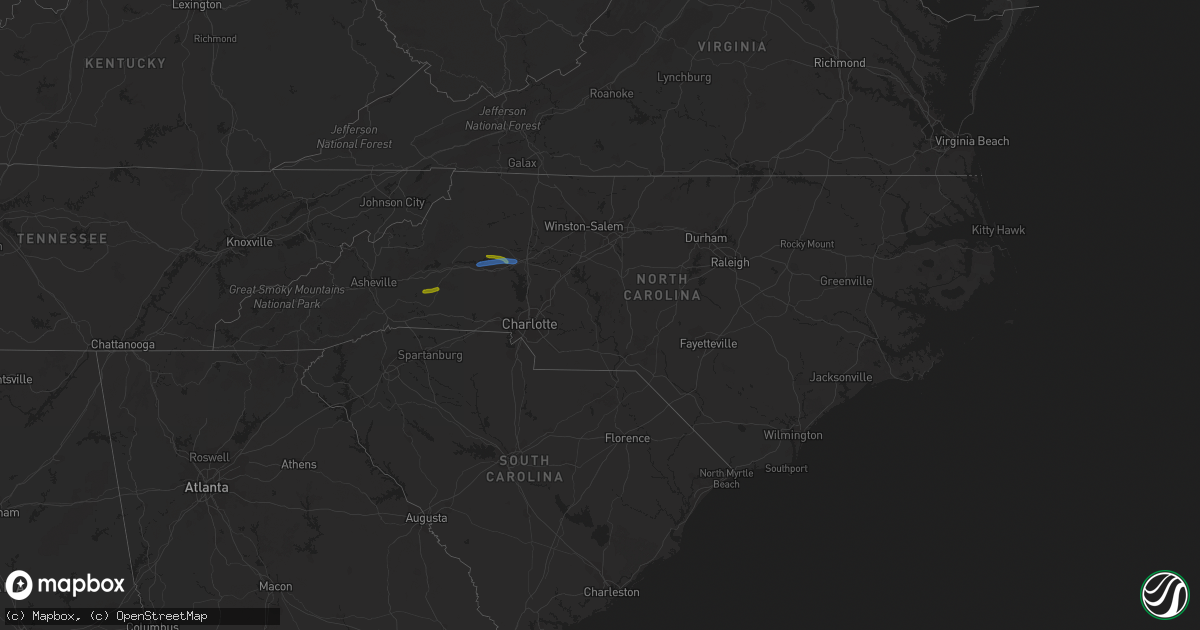
Hail Map in North Carolina on August 21, 2019
Get this storm
August 21 map
$229
one time, instant access
Download today. No call, no setup
Keep the $229
Bought the map and want the full workflow? Apply the entire $229 to a subscription within 7 days. None of it is wasted.
Every map, not just this one
This buys you this map. Subscription and you get every map we run, in the markets you choose from a few cities to whole states to nationwide. Plus real-time alerts the moment a storm fires.
Contact data
Name, contact info, occupancy, even credit band for addresses in the footprint. You go from where it hit to who to call.
Become the source they trust
Unlimited branding weather history reports on demand. You already have the documented answer ready for the property owner, and you are the one who showed up with it.
Property data and RoofTrace estimates
Pull up any address you have got, its value and the exact code rules for that jurisdiction, straight from One Click Code. Then RoofTrace estimates the squares, pitch, and roof value, priced the way you price.
Storm reports in North Carolina
North Carolina
| Date | Description |
|---|---|
| 08/21/20195:58 PM CDT | Two trees down near the mcdowell rd exit of interstate 73-74 in asheboro. |
| 08/21/20195:57 PM CDT | Large tree down on the 100 block of n cameron st in hillsborough. |
| 08/21/20195:31 PM CDT | Tree down at the 4100 block of gilliam church rd. |
| 08/21/20195:31 PM CDT | Tree down at university dr and s church st. |
| 08/21/20195:21 PM CDT | Numerous trees down in the mcleansville area. |
| 08/21/20195:12 PM CDT | Tree down at w market st and ashland dr in greensboro. |
| 08/21/20195:10 PM CDT | Approximately 10 trees down in the archdale and trinity areas. |
| 08/21/20195:08 PM CDT | Tree down at yanceyville rd and doggett rd. |
| 08/21/20195:07 PM CDT | Tree down at air harbor rd and gold dust trail. |
| 08/21/20195:04 PM CDT | Tree down at the 1100 block of joe moore rd. |
| 08/21/20195:04 PM CDT | Tree down at hasty hill rd and burton rd. |
| 08/21/20195:02 PM CDT | Tree down at the 4200 block of w lexington ave ext. |
| 08/21/20195:01 PM CDT | Tree down on the 6300 block of lake brandt rd in summerfield. |
| 08/21/20195:00 PM CDT | Tree down on jack brown road. |
| 08/21/20194:57 PM CDT | Tree down on the 100 block of liberty dr in thomasville. |
| 08/21/20194:49 PM CDT | Corrects previous tstm wnd dmg report from 3 ene monroeton. Trees down near reidsville lake. |
| 08/21/20194:48 PM CDT | Strong thunderstorm winds from a suspected microburst downed several trees and tossed outside objects and furniture within the century park avenue neighborhood near ker |
| 08/21/20194:40 PM CDT | Trees down near reidsville lake. |
| 08/21/20194:37 PM CDT | Tree down on power line along mccoy street. |
| 08/21/20194:30 PM CDT | Large tree limbs down and pea size hail. |
| 08/21/20194:27 PM CDT | Tree down along salem church road. |
| 08/21/20194:25 PM CDT | Power lines and a large tree down at sullivan rd and lakeside dr. |
| 08/21/20194:25 PM CDT | City of statesville reports multiple downed trees and power lines throughout the city. |
| 08/21/20194:15 PM CDT | Emergency manager reporting extensive tree damage along highway 70 from just east of the catawba river to the sharon community. Some homes damaged by falling trees as w |
| 08/21/20194:15 PM CDT | Tree down. Measured wind gust at the upper piedmont research station was 36 mph. |
| 08/21/20194:13 PM CDT | Multiple trees down in the rural hall area. |
| 08/21/20194:07 PM CDT | Tree down along price street. |
| 08/21/20193:55 PM CDT | Trees down on river bend rd and rest home rd. |
| 08/21/20193:55 PM CDT | Trees down along anglin mill road. |
| 08/21/20193:55 PM CDT | Tree down... 2167 perch road. |
| 08/21/20193:50 PM CDT | Tree down... Stony ridge rd. |
| 08/21/20193:45 PM CDT | Power lines down. |
| 08/21/20193:45 PM CDT | Tree down... Hardy road. |
| 08/21/20193:45 PM CDT | Trees down on cape hickory road near liberty baptist church. |
| 08/21/20193:40 PM CDT | Large tree down across malcolm blvd. |
| 08/21/20193:39 PM CDT | Numerous trees and power lines down in the area. |
| 08/21/20193:38 PM CDT | The vashti community was the hardest hit in alexander county by this storm. A road in this area was completely shut down from numerous tree falls blocking the road. Als |
| 08/21/20193:38 PM CDT | Trees and power lines down. |
| 08/21/20193:38 PM CDT | A house on ben eller lane was split in half by a large tree that fell on the house. No reported injuries. Other trees and power lines were blown down by the storm in th |
| 08/21/20193:35 PM CDT | Trees and power lines down in the rhodhiss area. |
| 08/21/20193:34 PM CDT | Trees and power lines down in the granite falls area. |
| 08/21/20193:30 PM CDT | Tree down across malcolm blvd and benfield dr at rutherford college. |
| 08/21/20193:25 PM CDT | Trees and power lines down. |
| 08/21/20192:35 PM CDT | Trees down involving power lines along us 64. Time estimated by radar. |
| 08/21/20192:10 PM CDT | About 10 minutes of hail with hail as large as quarters. The wind blew down several small limbs. |
| 08/21/20192:10 PM CDT | About 10 minutes of hail with hail as large as quarters. The wind blew down several small limbs. |
| 08/21/201912:55 PM CDT | Cummings grove golf course had 3 trees blown down. |
| 08/21/20191:29 AM CDT | At 627 PM EDT, severe thunderstorms were located along a line extending from near Jericho to near Randleman, moving east at 50 mph. These storms are producing wind damage across Guilford County. HAZARD...60 mph wind gusts. SOURCE...Radar indicated. IMPACT...Expect damage to roofs, siding, and trees. Locations impacted include... Durham, Chapel Hill, Burlington, Asheboro, Graham, Hillsborough, Randleman, Pittsboro, Siler City and Carrboro. |
| 08/21/201912:47 AM CDT | At 546 PM EDT, a severe thunderstorm was located 11 miles northwest of Kannapolis, or near Mooresville, moving east at 25 mph. HAZARD...60 mph wind gusts and penny size hail. SOURCE...Radar indicated. IMPACT...Expect damage to trees and power lines. Locations impacted include... Kannapolis, Concord, Mooresville, China Grove, Landis, Enochville, Rockwell, Mt Pleasant, Faith and Mount Ulla. |
| 08/21/201912:43 AM CDT | At 542 PM EDT, severe thunderstorms were located along a line extending from Reidsville to near Pine Hall to near Lexington, moving east at 30 mph. HAZARD...60 mph wind gusts. SOURCE...Law enforcement reported a history of sporadic downed trees with this line of storms as it crossed Forsyth County. IMPACT...Expect damage to roofs, siding, and trees. Locations impacted include... Greensboro, High Point, Burlington, Asheboro, Graham, Randleman, Thomasville, Elon, McLeansville and Archdale. |
| 08/21/201912:41 AM CDT | At 541 PM EDT, a severe thunderstorm was located near Reidsville, moving southeast at 40 mph. HAZARD...60 mph wind gusts. SOURCE...Radar indicated. IMPACT...Expect damage to roofs, siding, and trees. Locations impacted include... Reidsville... Wentworth... Yanceyville... Bethel... and Jericho. |
| 08/21/201912:02 AM CDT | At 501 PM EDT, a severe thunderstorm was located 10 miles northeast of Newton, or over Lookout Shoals Lake, moving east at 25 mph. HAZARD...60 mph wind gusts and quarter size hail. SOURCE...Radar indicated. IMPACT...Minor hail damage to vehicles is expected. Expect wind damage to trees and power lines. Locations impacted include... Statesville, St. Stephens, Troutman, Catawba, Lookout Shoals Lake, Lake Norman State Park, Scotts, Oxford, Claremont and Stony Point. |
| 08/20/201911:55 PM CDT | At 455 PM EDT, severe thunderstorms were located along a line extending from near Pilot Mountain State Park to East Bend to Shacktown, moving east at 25 mph. HAZARD...60 mph wind gusts and penny size hail. SOURCE...Radar indicated. IMPACT...Expect damage to roofs, siding, and trees. Locations impacted include... Winston-Salem, Lexington, Thomasville, Kernersville, Clemmons, Bermuda Run, Huntsville, Lewisville, Walkertown and Rural Hall. |
| 08/20/201911:39 PM CDT | At 438 PM EDT, a severe thunderstorm was located over Siloam, moving east at 30 mph. HAZARD...60 mph wind gusts and quarter size hail. SOURCE...Radar indicated. IMPACT...Hail damage to vehicles is expected. Expect wind damage to roofs, siding, and trees. Locations impacted include... Fairview... Pilot Mountain... Boonville... East Bend... and King. |
| 08/20/201911:38 PM CDT | At 438 PM EDT, a severe thunderstorm was located 5 miles west of Hickory, or near Hildebran, moving east at 15 mph. HAZARD...60 mph wind gusts and penny size hail. SOURCE...Radar indicated. IMPACT...Expect damage to trees and power lines. Locations impacted include... Hickory, Newton, St. Stephens, Conover, Longview, Icard, Hildebran, Hickory Regional Airport, Mountain View and Startown. |
| 08/20/201911:33 PM CDT | At 432 PM EDT, a severe thunderstorm was located near Lenoir, moving east at 15 mph. HAZARD...60 mph wind gusts and half dollar size hail. SOURCE...Radar indicated. IMPACT...Minor hail damage to vehicles is expected. Expect wind damage to trees and power lines. Locations impacted include... Lenoir, Gamewell, Hudson, Cajah's Mountain, Cedar Rock, Kings Creek, Collettsville, Granite Falls, Sawmills and Northlakes. |
| 08/20/201911:25 PM CDT | At 425 PM EDT, a severe thunderstorm was located near Taylorsville, moving east at 10 mph. HAZARD...60 mph wind gusts and quarter size hail. SOURCE...Radar indicated. IMPACT...Minor hail damage to vehicles is expected. Expect wind damage to trees and power lines. Locations impacted include... Taylorsville, Stony Point, Hiddenite, Little River In Alexander County, Vashti, Millersville, Ellendale, Lookout Shoals Lake, Bethlehem and Lake Hickory. |
| 08/20/201910:25 PM CDT | At 325 PM EDT, a severe thunderstorm was located 11 miles north of Rutherfordton, moving northeast at 20 mph. HAZARD...60 mph wind gusts and quarter size hail. SOURCE...Radar indicated. IMPACT...Minor hail damage to vehicles is expected. Expect wind damage to trees and power lines. Locations impacted include... Thermal City, Fero, Dysartsville, Sunshine, Union Mills, Morganton and South Mountains State Park. |
| 08/20/20199:53 PM CDT | At 253 PM EDT, a severe thunderstorm was located 9 miles west of Rutherfordton, or 5 miles east of Lake Lure, moving east at 10 mph. HAZARD...60 mph wind gusts and quarter size hail. SOURCE...Radar indicated. IMPACT...Minor hail damage to vehicles is expected. Expect wind damage to trees and power lines. Locations impacted include... Rutherfordton, Shingle Hollow, Green Hill, Thermal City, Union Mills, Spindale and Lake Lure. |
All States Impacted by Hail Map on August 21, 2019
Cities Impacted by Hail Map on August 21, 2019
- Albion, IL
- Augusta, KS
- Andover, KS
- Casper, WY
- Sedan, KS
- Longton, KS
- Morrison, CO
- Denver, CO
- Williamsburg, KS
- Yoder, WY
- Hawk Springs, WY
- Littleton, CO
- Chesterfield, MO
- Ballwin, MO
- Tennyson, IN
- Gentryville, IN
- Richland, IN
- Chrisney, IN
- Rockport, IN
- Portageville, MO
- Trafford, AL
- Warrior, AL
- Matheson, CO
- Belleview, MO
- Belgrade, MO
- Benedict, KS
- Elk City, KS
- Independence, KS
- Neodesha, KS
- Fredonia, KS
- Texhoma, OK
- Kenton, OK
- Boise City, OK
- Mount Hope, KS
- Chugwater, WY
- Cambridge, KS
- Loogootee, IN
- Jasper, IN
- Dubois, IN
- Peace Valley, MO
- Goddard, KS
- Colwich, KS
- Garden Plain, KS
- Andale, KS
- Wichita, KS
- Cheney, KS
- Haven, KS
- Viola, KS
- Moundville, MO
- Nevada, MO
- Goodwell, OK
- Princeton, IN
- Patoka, IN
- Burrton, KS
- Black Eagle, MT
- Cascade, MT
- Great Falls, MT
- Milo, MO
- Walker, MO
- Worland, WY
- Bluford, IL
- Dale, IN
- Whitewater, KS
- Aurora, CO
- Agate, CO
- Halstead, KS
- Garnett, KS
- Greeley, KS
- Richmond, KS
- Princeton, KS
- Conway Springs, KS
- Floral, AR
- Newton, KS
- Noble, IL
- Harwood, MO
- El Dorado Springs, MO
- Inman, KS
- Rocky Ford, CO
- Wayne City, IL
- Keenes, IL
- Mount Vernon, IL
- Fairfield, IL
- Sims, IL
- Rock, KS
- Doswell, VA
- Liberal, KS
- Hugoton, KS
- Thermopolis, WY
- Kirby, WY
- Salem, MO
- Niotaze, KS
- Peru, KS
- Clearwater, KS
- Maize, KS
- Lebanon, MO
- Eldridge, MO
- Kaycee, WY
- La Cygne, KS
- Arkansas City, KS
- Garden City, KS
- Holcomb, KS
- Sedgwick, KS
- Valley Center, KS
- Marthasville, MO
- Windyville, MO
- Rolla, MO
- Power, MT
- Dexter, MO
- Fenton, MO
- Douglass, KS
- Golden, CO
- Stockton, MO
- Argenta, IL
- Derby, KS
- Waverly, KS
- Hutchinson, KS
- Dexter, KS
- Holland, IN
- Moline, KS
- Floweree, MT
- Deepwater, MO
- Osceola, MO
- Lowry City, MO
- Guymon, OK
- Richland, MO
- Turpin, OK
- Simla, CO
- Ramah, CO
- Calhan, CO
- Westphalia, KS
- Bentley, KS
- Milton, KS
- Norwich, KS
- Haysville, KS
- Poseyville, IN
- Liberal, MO
- Stoutland, MO
- Caledonia, MO
- Rector, AR
- Welda, KS
- Colony, KS
- Mount Vernon, IN
- Evansville, IN
- Pleasanton, KS
- Amoret, MO
- Udall, KS
- Pomona, KS
- Quenemo, KS
- Bigelow, AR
- Otwell, IN
- Potosi, MO
- Mineral Point, MO
- Owensboro, KY
- Grenola, KS
- Paragould, AR
- Harrisburg, NE
- Lyman, NE
- Buhler, KS
- Moundridge, KS
- Cannelburg, IN
- Butler, MO
- Ellery, IL
- Shoals, IN
- French Lick, IN
- Bunker, MO
- Bloomfield, MO
- Dix, NE
- Urbana, MO
- Jerico Springs, MO
- Lockwood, MO
- Boss, MO
- Buffalo, WY
- Yuma, CO
- Le Roy, KS
- Garrett, WY
- West Salem, IL
- Hazleton, IN
- Vincennes, IN
- Owensville, IN
- Allendale, IL
- New Harmony, IN
- Wadesville, IN
- Grayville, IL
- Mount Carmel, IL
- Decker, IN
- Griffin, IN
- Petersburg, IN
- Meriden, WY
- Malden, MO
- Newburg, MO
- Edgar Springs, MO
- Rose Hill, KS
- Walsenburg, CO
- Lawrenceville, IL
- Bridgeport, IL
- Bushnell, NE
- East Earl, PA
- Iuka, IL
- Francisco, IN
- Parma, MO
- Williamsville, MO
- Ironton, MO
- Middle Brook, MO
- Lesterville, MO
- Saint James, MO
- Forgan, OK
- Atlanta, KS
- Lilbourn, MO
- Ferdinand, IN
- Newburgh, IN
- Englewood, CO
- Appleton City, MO
- Black, MO
- Owensville, MO
- Dahlgren, IL
- Barnhill, IL
- Johnsonville, IL
- Winslow, IN
- Kit Carson, CO
- Dixon, MO
- Wheat Ridge, CO
- Conrad, MT
- Bono, AR
- Fontana, KS
- Claremont, IL
- Olney, IL
- Bronaugh, MO
- Sheldon, MO
- Boonville, IN
- Holyoke, CO
- Reading, KS
- Knobel, AR
- Dieterich, IL
- Lincoln City, IN
- Stendal, IN
- Oakland City, IN
- Santa Claus, IN
- Huntingburg, IN
- Birdseye, IN
- Saint Anthony, IN
- Lovington, IL
- Houston, AR
- Golden Gate, IL
- Fairfield, MT
- Sumner, IL
- Deer Trail, CO
- Poplar Bluff, MO
- Benton, KS
- Ingraham, IL
- Clay City, IL
- Rush, CO
- Lamar, MO
- Fort Leonard Wood, MO
- Centerville, MO
- Eureka, MO
- Pacific, MO
- Cisne, IL
- Cedar Vale, KS
- Burden, KS
- Winfield, KS
- Piggott, AR
- Wheatland, WY
- Parker, KS
- Flemington, MO
- Sedalia, CO
- Saint Louis, MO
- Fremont, MO
- Lysite, WY
- Shoshoni, WY
- Medicine Bow, WY
- Round Lake, NY
- Ballston Lake, NY
- Ballston Spa, NY
- Mechanicville, NY
- Troy, NY
- Latham, NY
- Albany, NY
- Waterford, NY
- Cohoes, NY
- Watervliet, NY
- Tyngsboro, MA
- Pelham, NH
- Hudson, NH
- Nashua, NH
- Andover, CT
- Columbia, CT
- Glastonbury, CT
- Bolton, CT
- Coventry, CT
- Manchester, CT
- Mansfield Center, CT
- Storrs Mansfield, CT
- Hebron, CT
- East Hartford, CT
- Union Mills, NC
- Marion, NC
- Bostic, NC
- Stony Point, NC
- Catawba, NC
- Conover, NC
- Claremont, NC
- Taylorsville, NC
- Hickory, NC
- Statesville, NC
- Oaktown, IN
- Saint Francisville, IL
- Bruceville, IN
- Bicknell, IN
- Oktaha, OK
- Checotah, OK
- Catoosa, OK
- Tulsa, OK
- Colorado Springs, CO
- Cotopaxi, CO
- Granite Falls, NC
- College Park, MD
- Bowie, MD
- Hyattsville, MD
- Lanham, MD
- Silver Spring, MD
- Harwood, MD
- Upper Marlboro, MD
- Bladensburg, MD
- Glenn Dale, MD
- Takoma Park, MD
- Greenbelt, MD
- Riverdale, MD
- Saratoga Springs, NY
- Schuylerville, NY
- Wethersfield, CT
- Canterbury, CT
- Brooklyn, CT
- Danielson, CT
- Dayville, CT
- Chaplin, CT
- North Windham, CT
- Foster, RI
- Hampton, CT
- Narvon, PA
- Mohnton, PA
- Morgantown, PA
- Douglassville, PA
- Elverson, PA
- Birdsboro, PA


