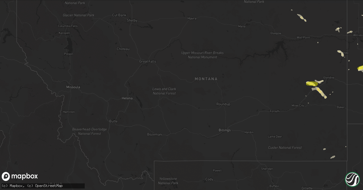
Hail Map in Montana on August 4, 2019
Get this storm
August 4 map
$229
one time, instant access
Download today. No call, no setup
Keep the $229
Bought the map and want the full workflow? Apply the entire $229 to a subscription within 7 days. None of it is wasted.
Every map, not just this one
This buys you this map. Subscription and you get every map we run, in the markets you choose from a few cities to whole states to nationwide. Plus real-time alerts the moment a storm fires.
Contact data
Name, contact info, occupancy, even credit band for addresses in the footprint. You go from where it hit to who to call.
Become the source they trust
Unlimited branding weather history reports on demand. You already have the documented answer ready for the property owner, and you are the one who showed up with it.
Property data and RoofTrace estimates
Pull up any address you have got, its value and the exact code rules for that jurisdiction, straight from One Click Code. Then RoofTrace estimates the squares, pitch, and roof value, priced the way you price.
Storm reports in Montana
Montana
| Date | Description |
|---|---|
| 08/04/20196:47 PM CDT | Car port on property was blown across the street and damaged a pickup. Winds were estimated at 75 mph. Hail damaged some crops as well... Estimated at penny-sized. Time |
| 08/04/201912:29 AM CDT | At 529 PM MDT, a severe thunderstorm was located 9 miles north of Terry, moving southeast at 30 mph. HAZARD...60 mph wind gusts and half dollar size hail. SOURCE...Radar indicated. IMPACT...Hail damage to vehicles is expected. Expect wind damage to roofs, siding, and trees. Locations impacted include... Fallon, Mildred and Marsh. |
| 08/03/201911:50 PM CDT | At 449 AM MDT, a severe thunderstorm was located near Volborg, or 25 miles north of Broadus, moving east at 25 mph. HAZARD...60 mph wind gusts and quarter size hail. SOURCE...Radar indicated. IMPACT...Hail damage to vehicles is expected. Expect wind damage to roofs, siding, and trees. Locations impacted include... Volborg. |
| 08/03/201910:42 PM CDT | At 341 AM MDT, a severe thunderstorm was located 10 miles northwest of Hardin, moving east at 25 mph. HAZARD...60 mph wind gusts and quarter size hail. SOURCE...Radar indicated. IMPACT...Hail damage to vehicles is expected. Expect wind damage to roofs, siding, and trees. Locations impacted include... Hardin. |
All States Impacted by Hail Map on August 4, 2019
Cities Impacted by Hail Map on August 4, 2019
- Ray, ND
- Epping, ND
- Alamo, ND
- Grassy Butte, ND
- Surrey, ND
- Burlington, ND
- Minot, ND
- Norwich, ND
- Berthold, ND
- Carpio, ND
- Velva, ND
- Leonard, ND
- Mcleod, ND
- Sidney, MT
- Pine Ridge, SD
- Kyle, SD
- Terry, MT
- Froid, MT
- Crookston, NE
- Houston, AL
- Double Springs, AL
- Longville, LA
- Dequincy, LA
- Philadelphia, MS
- Mandan, ND
- Chadron, NE
- Harvey, ND
- Maddock, ND
- Cook, MN
- Alzada, MT
- Waynesboro, MS
- Buckatunna, MS
- Rushville, NE
- Kilgore, NE
- Nettleton, MS
- Batesland, SD
- Fallon, MT
- Wanblee, SD
- Allen, SD
- Palermo, ND
- Stanley, ND
- Byhalia, MS
- Crossville, AL
- Dawson, AL
- Bay Springs, MS
- La Pine, OR
- Des Lacs, ND
- Martin, ND
- Max, ND
- Coleharbor, ND
- Benedict, ND
- Turtle Lake, ND
- Mercer, ND
- Ryder, ND
- Garrison, ND
- Douglas, ND
- Menahga, MN
- Ellsworth, NE
- Tetonia, ID
- Felt, ID
- Powers Lake, ND
- Anamoose, ND
- Porcupine, SD
- Vinemont, AL
- Hitterdal, MN
- De Kalb, MS
- Breckenridge, MN
- La Grande, OR
- Marion, ND
- Butte, ND
- Crofton, KY
- Hopkinsville, KY
- Eva, AL
- Joppa, AL
- Baileyton, AL
- Killdeer, ND
- Dunn Center, ND
- Fairfield, ND
- Valentine, NE
- Lowndesboro, AL
- Ross, ND
- Pocatello, ID
- Arbon, ID
- Martin, SD
- Aberdeen, MS
- Geraldine, AL
- Carthage, MS
- Richardton, ND
- Tioga, ND
- Sebeka, MN
- New York Mills, MN
- Crane Lake, MN
- Robinson, ND
- Tuttle, ND
- Pike Road, AL
- Mathews, AL
- Montgomery, AL
- Ramer, AL
- Bladenboro, NC
- Fort Ransom, ND
- Gordon, NE
- Park Rapids, MN
- Glenburn, ND
- Bantry, ND
- Deering, ND
- Berlin, MD
- Whaleyville, MD
- Willards, MD
- Pittsville, MD
- Taylorsville, NC
- Granite Falls, NC
- Merriman, NE
- Hyannis, NE
- Ashby, NE
- Voltaire, ND
- Ruso, ND
- Mcclusky, ND
- Ottertail, MN
- Richville, MN
- Whitman, NE
- Hackensack, MN
- Grady, AL
- Foxhome, MN
- Fergus Falls, MN
- Sawyer, ND
- Escalante, UT
- Keystone, NE
- Prairie City, OR
- Douglas, WY
- Lisbon, ND
- Addison, AL
- Upton, WY
- Centreville, AL
- Erhard, MN
- Dent, MN
- Underwood, MN
- Irwin, ID
- Fessenden, ND
- Wheatland, ND
- Fingal, ND
- Pontotoc, MS
- Evergreen, AL
- Repton, AL
- Monroeville, AL
- Halliday, ND
- Hawley, MN
- Lake Park, MN
- Vardaman, MS
- Houston, MS
- Houlka, MS
- Goodman, MS
- Durant, MS
- Granville, ND
- Beulah, ND
- Golden Valley, ND
- Rockfield, KY
- Morgantown, KY
- Auburn, KY
- Hay Springs, NE
- Big Falls, MN
- Orr, MN
- Hayneville, AL
- Tyler, AL
- Bowdon, ND
- Manning, ND
- Glendive, MT
- Newcastle, WY
- Osage, WY
- Williston, ND
- Cleveland, MS
- Prattville, AL
- Hermosa, SD
- Lexington, MS
- Prairie, MS
- Calhoun City, MS
- Fyffe, AL
- Arthur, NE
- Highland Home, AL
- Goshen, AL
- Okolona, MS
- Inverness, MS
- Westpoint, TN
- Elizabethtown, NC
- Akron, AL
- Moundville, AL
- Greensboro, AL
- Gore Springs, MS
- Duck Hill, MS
- Lemoyne, NE
- Detroit Lakes, MN
- Ocean City, MD
- Fenwick Island, DE
- Selbyville, DE
- Ulen, MN
- Adamsville, TN
- Fort Laramie, WY
- Nevis, MN
- Falkville, AL
- Cullman, AL
- Sulligent, AL
- Lewellen, NE
- Indianola, MS
- Isola, MS
- White Earth, ND
- Lambert, MT
- Taylor, ND
- Hebron, ND
- Luverne, AL
- Buchanan, ND
- Yuma, CO
- Cartwright, ND
- Saint Anthony, ND
- Wheatland, WY
- Peerless, MT
- Wolf Point, MT
- Sumpter, OR
- Plaza, ND
- Russellville, AL
- Leighton, AL
- Harwood, ND
- Rockford, AL
- Hazelton, ND
- Kenmare, ND
- Glen Ullin, ND
- Makoti, ND
- Roseglen, ND
- Union, MS
- Hudson, NC
- West Point, MS
- Preston, MS
- Battle Lake, MN
- Henning, MN
- Perham, MN
- Springview, NE
- Cathay, ND
- New Rockford, ND
- Grenada, MS
- Frankford, DE
- Millville, DE
- Dagsboro, DE
- Ocean View, DE
- Wadena, MN
- Gladstone, ND
- Wildrose, ND
- Winona, MS
- Holcomb, MS
- Wahpeton, ND
- Minter, AL
- Coffeeville, AL
- Akeley, MN
- Millry, AL
- Auburn, AL
- Opelika, AL
- Shelly, MN
- Callaway, MN
- Audubon, MN
- Georgetown, MN
- Cody, NE
- Dickinson, ND
- Finger, TN
- Iuka, MS
- Vernon, AL
- Millsboro, DE
- Hartville, WY
- Elizabeth, MN
- Donnybrook, ND
- Collierville, TN
- Rossville, TN
- Big Creek, MS
- Brentwood, TN
- Franklin, TN
- Lawrenceburg, TN
- Sardis, AL
- La Vergne, TN
- Antioch, TN
- Nolensville, TN
- Marsland, NE
- Alliance, NE
- Hurdsfield, ND
- Orrville, AL
- Borup, MN
- Mandaree, ND
- New Town, ND
- Bluffton, MN
- Rochert, MN
- Ismay, MT
- Pittsboro, MS
- Poplar, MT
- Hornbrook, CA
- Gordo, AL
- Reform, AL
- Beach, ND
- Hammond, MT
- Boyes, MT
- Arlington, TN
- Nortonville, KY
- Leland, MS
- Backus, MN
- Wibaux, MT
- Rugby, ND
- Hickory, NC
- Clinton, TN
- Oak Ridge, TN
- Oliver Springs, TN
- Bowling Green, KY
- Cummings, ND
- Hemingford, NE
- Jemison, AL
- Enville, TN
- Henderson, TN
- Norfolk, VA
- Carrollton, AL
- Pingree, ND
- Kensal, ND
- Richland, MT
- Finley, ND
- Peterman, AL
- Verona, ND
- Ashland, OR
- Interior, SD
- Evergreen, NC
- Chadbourn, NC
- Ainsworth, NE
- Columbus, MS
- Caledonia, MS
- Alexander, ND
- Autaugaville, AL
- Drake, ND
- Attleboro, MA
- Rehoboth, MA
- North Attleboro, MA
- Attleboro Falls, MA
- Berkley, MA
- Dighton, MA
- North Dighton, MA
- Somerset, MA
- Taunton, MA
- Swansea, MA
- Assonet, MA
- Fall River, MA
- Ogallala, NE
- Brule, NE
- Paxton, NE
- Saint Francis, SD
- Nenzel, NE
- Tuthill, SD


