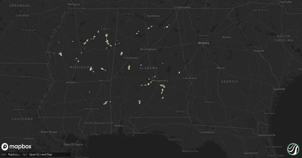
Hail Map in Alabama on August 4, 2019
Get this storm
August 4 map
$229
one time, instant access
Download today. No call, no setup
Keep the $229
Bought the map and want the full workflow? Apply the entire $229 to a subscription within 7 days. None of it is wasted.
Every map, not just this one
This buys you this map. Subscription and you get every map we run, in the markets you choose from a few cities to whole states to nationwide. Plus real-time alerts the moment a storm fires.
Contact data
Name, contact info, occupancy, even credit band for addresses in the footprint. You go from where it hit to who to call.
Become the source they trust
Unlimited branding weather history reports on demand. You already have the documented answer ready for the property owner, and you are the one who showed up with it.
Property data and RoofTrace estimates
Pull up any address you have got, its value and the exact code rules for that jurisdiction, straight from One Click Code. Then RoofTrace estimates the squares, pitch, and roof value, priced the way you price.
Storm reports in Alabama
Alabama
| Date | Description |
|---|---|
| 08/04/20193:16 PM CDT | Tree fallen onto roadway on county rd 29 near lowndesboro. Time estimated from radar. |
| 08/04/20192:34 PM CDT | Emergency manager reports large tree down and branches down near cahaba rd. Time estimated by radar. |
| 08/04/20192:04 PM CDT | Trees down near dublin along hwy 94. A tree was also reported down on hwy 331. Time estimated by radar. |
| 08/04/20191:41 PM CDT | Emergency manager reports trees and power lines down near and along north goshen rd. Time estimated by radar. |
| 08/04/20191:53 AM CDT | At 653 PM CDT, a severe thunderstorm was located 4 miles west of Buckatunna, or 8 miles south of Waynesboro, and is nearly stationary. HAZARD...60 mph wind gusts. SOURCE...Radar indicated. IMPACT...Expect damage to roofs, siding, and trees. Locations impacted include... Waynesboro, Clara, Millry, State Line, Buckatunna and Fruitdale. |
| 08/03/201910:06 PM CDT | At 306 PM CDT, a severe thunderstorm was located near Gordonville, or 7 miles northwest of Mosses, and is nearly stationary. HAZARD...60 mph wind gusts and quarter size hail. SOURCE...Radar indicated. IMPACT...Hail damage to vehicles is expected. Expect wind damage to roofs, siding, and trees. Locations impacted include... Mosses, Hayneville, White Hall, Gordonville, Lowndesboro, Benton, Beechwood, Mount Willing and Collirene. |
| 08/03/20199:19 PM CDT | At 219 PM CDT, a severe thunderstorm was located just north of Greenville, moving southeast at 10 mph. HAZARD...60 mph wind gusts. SOURCE...Radar indicated. IMPACT...Expect damage to roofs, siding, and trees. Locations impacted include... Greenville. |
| 08/03/20199:02 PM CDT | At 201 PM CDT, severe thunderstorms were located along a line extending from near Pinedale to near Dublin, moving east at 20 mph. HAZARD...60 mph wind gusts and quarter size hail. SOURCE...Radar indicated. IMPACT...Hail damage to vehicles is expected. Expect wind damage to roofs, siding, and trees. Locations impacted include... Southeastern Montgomery, Meadville, Pike Road, Pine Level, Dublin, Mount Meigs, Snowdoun, Shopton, Grady, Pinedale, Ramer, Waugh, Carters Hill, Barachias, Brassell, China Grove, Currys, Mitchell and Cecil. |
| 08/03/20198:37 PM CDT | At 137 PM CDT, a severe thunderstorm was located over Petrey, or 11 miles north of Luverne, moving east at 10 mph. HAZARD...60 mph wind gusts. SOURCE...Radar indicated. IMPACT...Expect damage to roofs, siding, and trees. Locations impacted include... Luverne, Rutledge, Petrey and Highland Home. |
All States Impacted by Hail Map on August 4, 2019
Cities Impacted by Hail Map on August 4, 2019
- Ray, ND
- Epping, ND
- Alamo, ND
- Grassy Butte, ND
- Surrey, ND
- Burlington, ND
- Minot, ND
- Norwich, ND
- Berthold, ND
- Carpio, ND
- Velva, ND
- Leonard, ND
- Mcleod, ND
- Sidney, MT
- Pine Ridge, SD
- Kyle, SD
- Terry, MT
- Froid, MT
- Crookston, NE
- Houston, AL
- Double Springs, AL
- Longville, LA
- Dequincy, LA
- Philadelphia, MS
- Mandan, ND
- Chadron, NE
- Harvey, ND
- Maddock, ND
- Cook, MN
- Alzada, MT
- Waynesboro, MS
- Buckatunna, MS
- Rushville, NE
- Kilgore, NE
- Nettleton, MS
- Batesland, SD
- Fallon, MT
- Wanblee, SD
- Allen, SD
- Palermo, ND
- Stanley, ND
- Byhalia, MS
- Crossville, AL
- Dawson, AL
- Bay Springs, MS
- La Pine, OR
- Des Lacs, ND
- Martin, ND
- Max, ND
- Coleharbor, ND
- Benedict, ND
- Turtle Lake, ND
- Mercer, ND
- Ryder, ND
- Garrison, ND
- Douglas, ND
- Menahga, MN
- Ellsworth, NE
- Tetonia, ID
- Felt, ID
- Powers Lake, ND
- Anamoose, ND
- Porcupine, SD
- Vinemont, AL
- Hitterdal, MN
- De Kalb, MS
- Breckenridge, MN
- La Grande, OR
- Marion, ND
- Butte, ND
- Crofton, KY
- Hopkinsville, KY
- Eva, AL
- Joppa, AL
- Baileyton, AL
- Killdeer, ND
- Dunn Center, ND
- Fairfield, ND
- Valentine, NE
- Lowndesboro, AL
- Ross, ND
- Pocatello, ID
- Arbon, ID
- Martin, SD
- Aberdeen, MS
- Geraldine, AL
- Carthage, MS
- Richardton, ND
- Tioga, ND
- Sebeka, MN
- New York Mills, MN
- Crane Lake, MN
- Robinson, ND
- Tuttle, ND
- Pike Road, AL
- Mathews, AL
- Montgomery, AL
- Ramer, AL
- Bladenboro, NC
- Fort Ransom, ND
- Gordon, NE
- Park Rapids, MN
- Glenburn, ND
- Bantry, ND
- Deering, ND
- Berlin, MD
- Whaleyville, MD
- Willards, MD
- Pittsville, MD
- Taylorsville, NC
- Granite Falls, NC
- Merriman, NE
- Hyannis, NE
- Ashby, NE
- Voltaire, ND
- Ruso, ND
- Mcclusky, ND
- Ottertail, MN
- Richville, MN
- Whitman, NE
- Hackensack, MN
- Grady, AL
- Foxhome, MN
- Fergus Falls, MN
- Sawyer, ND
- Escalante, UT
- Keystone, NE
- Prairie City, OR
- Douglas, WY
- Lisbon, ND
- Addison, AL
- Upton, WY
- Centreville, AL
- Erhard, MN
- Dent, MN
- Underwood, MN
- Irwin, ID
- Fessenden, ND
- Wheatland, ND
- Fingal, ND
- Pontotoc, MS
- Evergreen, AL
- Repton, AL
- Monroeville, AL
- Halliday, ND
- Hawley, MN
- Lake Park, MN
- Vardaman, MS
- Houston, MS
- Houlka, MS
- Goodman, MS
- Durant, MS
- Granville, ND
- Beulah, ND
- Golden Valley, ND
- Rockfield, KY
- Morgantown, KY
- Auburn, KY
- Hay Springs, NE
- Big Falls, MN
- Orr, MN
- Hayneville, AL
- Tyler, AL
- Bowdon, ND
- Manning, ND
- Glendive, MT
- Newcastle, WY
- Osage, WY
- Williston, ND
- Cleveland, MS
- Prattville, AL
- Hermosa, SD
- Lexington, MS
- Prairie, MS
- Calhoun City, MS
- Fyffe, AL
- Arthur, NE
- Highland Home, AL
- Goshen, AL
- Okolona, MS
- Inverness, MS
- Westpoint, TN
- Elizabethtown, NC
- Akron, AL
- Moundville, AL
- Greensboro, AL
- Gore Springs, MS
- Duck Hill, MS
- Lemoyne, NE
- Detroit Lakes, MN
- Ocean City, MD
- Fenwick Island, DE
- Selbyville, DE
- Ulen, MN
- Adamsville, TN
- Fort Laramie, WY
- Nevis, MN
- Falkville, AL
- Cullman, AL
- Sulligent, AL
- Lewellen, NE
- Indianola, MS
- Isola, MS
- White Earth, ND
- Lambert, MT
- Taylor, ND
- Hebron, ND
- Luverne, AL
- Buchanan, ND
- Yuma, CO
- Cartwright, ND
- Saint Anthony, ND
- Wheatland, WY
- Peerless, MT
- Wolf Point, MT
- Sumpter, OR
- Plaza, ND
- Russellville, AL
- Leighton, AL
- Harwood, ND
- Rockford, AL
- Hazelton, ND
- Kenmare, ND
- Glen Ullin, ND
- Makoti, ND
- Roseglen, ND
- Union, MS
- Hudson, NC
- West Point, MS
- Preston, MS
- Battle Lake, MN
- Henning, MN
- Perham, MN
- Springview, NE
- Cathay, ND
- New Rockford, ND
- Grenada, MS
- Frankford, DE
- Millville, DE
- Dagsboro, DE
- Ocean View, DE
- Wadena, MN
- Gladstone, ND
- Wildrose, ND
- Winona, MS
- Holcomb, MS
- Wahpeton, ND
- Minter, AL
- Coffeeville, AL
- Akeley, MN
- Millry, AL
- Auburn, AL
- Opelika, AL
- Shelly, MN
- Callaway, MN
- Audubon, MN
- Georgetown, MN
- Cody, NE
- Dickinson, ND
- Finger, TN
- Iuka, MS
- Vernon, AL
- Millsboro, DE
- Hartville, WY
- Elizabeth, MN
- Donnybrook, ND
- Collierville, TN
- Rossville, TN
- Big Creek, MS
- Brentwood, TN
- Franklin, TN
- Lawrenceburg, TN
- Sardis, AL
- La Vergne, TN
- Antioch, TN
- Nolensville, TN
- Marsland, NE
- Alliance, NE
- Hurdsfield, ND
- Orrville, AL
- Borup, MN
- Mandaree, ND
- New Town, ND
- Bluffton, MN
- Rochert, MN
- Ismay, MT
- Pittsboro, MS
- Poplar, MT
- Hornbrook, CA
- Gordo, AL
- Reform, AL
- Beach, ND
- Hammond, MT
- Boyes, MT
- Arlington, TN
- Nortonville, KY
- Leland, MS
- Backus, MN
- Wibaux, MT
- Rugby, ND
- Hickory, NC
- Clinton, TN
- Oak Ridge, TN
- Oliver Springs, TN
- Bowling Green, KY
- Cummings, ND
- Hemingford, NE
- Jemison, AL
- Enville, TN
- Henderson, TN
- Norfolk, VA
- Carrollton, AL
- Pingree, ND
- Kensal, ND
- Richland, MT
- Finley, ND
- Peterman, AL
- Verona, ND
- Ashland, OR
- Interior, SD
- Evergreen, NC
- Chadbourn, NC
- Ainsworth, NE
- Columbus, MS
- Caledonia, MS
- Alexander, ND
- Autaugaville, AL
- Drake, ND
- Attleboro, MA
- Rehoboth, MA
- North Attleboro, MA
- Attleboro Falls, MA
- Berkley, MA
- Dighton, MA
- North Dighton, MA
- Somerset, MA
- Taunton, MA
- Swansea, MA
- Assonet, MA
- Fall River, MA
- Ogallala, NE
- Brule, NE
- Paxton, NE
- Saint Francis, SD
- Nenzel, NE
- Tuthill, SD


