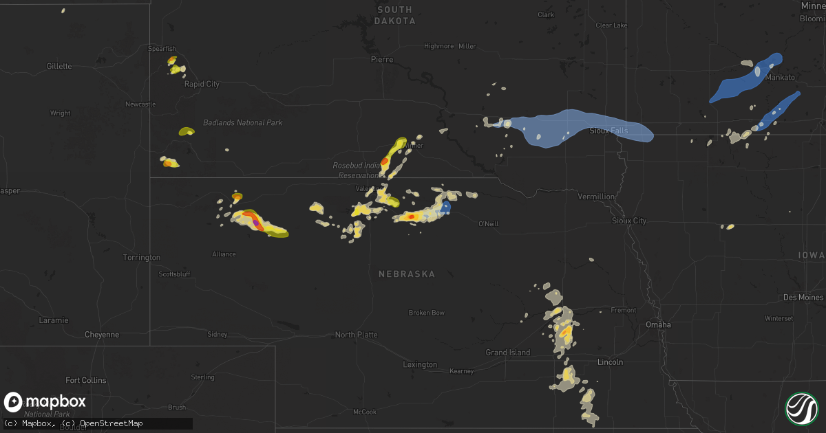
Hail Map on August 17, 2025
Get this storm
August 17 map
$229
one time, instant access
Download today. No call, no setup
Keep the $229
Bought the map and want the full workflow? Apply the entire $229 to a subscription within 7 days. None of it is wasted.
Every map, not just this one
This buys you this map. Subscription and you get every map we run, in the markets you choose from a few cities to whole states to nationwide. Plus real-time alerts the moment a storm fires.
Contact data
Name, contact info, occupancy, even credit band for addresses in the footprint. You go from where it hit to who to call.
Become the source they trust
Unlimited branding weather history reports on demand. You already have the documented answer ready for the property owner, and you are the one who showed up with it.
Property data and RoofTrace estimates
Pull up any address you have got, its value and the exact code rules for that jurisdiction, straight from One Click Code. Then RoofTrace estimates the squares, pitch, and roof value, priced the way you price.
States Impacted by Hail Map on August 17, 2025
Storm reports
Oklahoma
| Date | Description |
|---|---|
| 08/17/20256:55 PM CDT | Buffalo mesonet. |
| 08/17/20252:55 PM CDT | A power pole and two large trees blown down near sulphur hills golf course. Spotter network report. Time estimated from radar. |
Arkansas
| Date | Description |
|---|---|
| 08/17/20253:01 PM CDT | Watched tree fall live at i-57 and exit 42 via arkansas depa |
| 08/17/20253:01 PM CDT | Watched tree fall live at i-57 and exit 42 |
| 08/17/20253:00 PM CDT | A few power poles were snapped in the vicinity of garner... Utilized archived radar velocity to time event. |
| 08/17/20252:41 PM CDT | Large tree limbs down near the town of center hill. Winds estimated by spotter of at least 60 mph. |
Texas
| Date | Description |
|---|---|
| 08/17/20256:30 PM CDT | Fence line damage reported from downburst winds... Estimated around 60 mph. |
| 08/17/20256:10 PM CDT | Report of roughly 6 |
| 08/17/20256:10 PM CDT | Report of roughly 60 mph wind gusts from a d |
| 08/17/20256:10 PM CDT | Report of roughly 60 mph wind gusts from a downburst that damaged part of a fence line. |
| 08/17/20255:45 PM CDT | Damage to a fence of a residence was reported on social media. |
| 08/17/20255:39 PM CDT | Slack report of trees and fences blown down in turkey. West texas mesonet measured a 61 mph gust prior to the time of the received report. |
| 08/17/20255:23 PM CDT | Slack report and image of significant roof damage to an apartment complex... With roofs torn off the buildings. Late report. Time estimated by radar. |
| 08/17/20255:23 PM CDT | West texas mesonet. There was also a report of trees and fences blown down in turkey. |
| 08/17/20255:23 PM CDT | West texas mesonet. There was also a report of zero mile visibility from wind-driven... Torrential rainfall on the west loop. |
| 08/17/20254:57 PM CDT | West texas mesonet. |
| 08/17/20254:45 PM CDT | Report of a downed power pole blocking traffic. |
| 08/17/20254:30 PM CDT | West texas mesonet. |
Missouri
| Date | Description |
|---|---|
| 08/17/20255:52 PM CDT | A local report indicates 58 MPH wind near 1 NNW Woodson Terrace |
| 08/17/20254:55 PM CDT | Numerous limbs 12-18 inches in diameter and a few trees down in an area from grand ave to jefferson ave... North of 5th street. |
| 08/17/20254:47 PM CDT | Multiple trees down. |
| 08/17/20254:21 PM CDT | Asos station kuno west plains asos. |
| 08/16/20257:13 PM CDT | Numerous power outages. |
Nebraska
| Date | Description |
|---|---|
| 08/17/20253:13 AM CDT | Estimated 55 to 60 mph wind gusts. Time estimated from radar. |
| 08/17/20253:11 AM CDT | Nickel to quarter size hail. Time estimated from radar. |
| 08/17/20253:10 AM CDT | Call received from dispatch at 310 am and hail was ongoing at the time. |
| 08/16/20259:53 PM CDT | Golf ball sized hail in ainsworth. Time estimated from radar. |
| 08/16/20258:15 PM CDT | Quarter size hail with 40 to 50 mph winds. |
Maine
| Date | Description |
|---|---|
| 08/17/20253:04 PM CDT | Tree down on powerlines on pitcher rd. Time estimated by radar. |
| 08/17/20252:11 PM CDT | Fire department reports 1 tree down which took down some wires. Time estimated by radar. |
Maryland
| Date | Description |
|---|---|
| 08/17/20255:35 PM CDT | Multiple trees downed onto us-1 in rising sun. Additional trees were noted downed along the side of the road on the northbound side. |
| 08/17/20255:00 PM CDT | Trained spotter reports hail around quarter size... Possibly slightly larger... In conowingo along us-222. |
| 08/17/20255:00 PM CDT | Reports of multiple trees downed along us-222 north of conowingo to the pa state line. |
| 08/17/20254:42 PM CDT | Multiple trees downed onto us-1 in rising sun. Additional trees were noted downed along the side of the road on the northbound side. Corrected for time. |
| 08/17/20252:40 PM CDT | Allegany county 911 reported three downed trees in the cumberland area. |
| 08/17/20252:37 PM CDT | Tree down at 859 valley st |
| 08/17/20252:37 PM CDT | Tree down near intersection of amherst ave and ore st |
| 08/17/20252:37 PM CDT | Tree down at 901 michigan ave |
Montana
| Date | Description |
|---|---|
| 08/17/20256:55 PM CDT | A local report indicates 61 MPH wind near 8 N Forestgrove |
| 08/17/20256:30 PM CDT | Estimated wind gusts near 60 mph. Apple tree took a hit. |
| 08/17/20256:09 PM CDT | Ambient weather station. Sustained winds of 47 mph at the time of observation. |
| 08/16/202511:15 PM CDT | Tree downed into powerline. |
| 08/16/202511:05 PM CDT | Asos station kmls miles city. |
| 08/16/202511:05 PM CDT | Asos station kmls miles city. |
| 08/16/20259:45 PM CDT | Angela agrimet station. |
| 08/16/20258:00 PM CDT | Dovetail hydromet site from the montana climate office mesonet. |
| 08/16/20257:55 PM CDT | Mosby nw hydromet site from the montana climate office mesonet. |
| 08/16/20257:45 PM CDT | Winnett dot site. |
| 08/16/20257:30 PM CDT | War horse nw hydromet site from the montana climate office mesonet. |
| 08/16/20257:25 PM CDT | War horse nw hydromet site from the montana climate office mesonet. |
| 08/16/20257:25 PM CDT | 59 mph thunderstorm wind gust at roy e hydromet. |
| 08/16/20257:10 PM CDT | Crazy raws - elev 7321 feet. |
Louisiana
| Date | Description |
|---|---|
| 08/17/20256:52 PM CDT | A tree and multiple large limbs were snapped behind and adjacent to a home in the northern sections of west monroe. Report from social media. |
| 08/17/20256:35 PM CDT | Trees down across highway 2 east at stewart road. |
| 08/17/20256:33 PM CDT | A tree top was snapped and fell across jimmy johnson road just north of highway 15. |
| 08/17/20256:20 PM CDT | A skirting was blown off of a mobile home in the conway community. Large tree limbs were snapped as well. Report via social media. |
| 08/16/20257:10 PM CDT | Public call of limbs up to 2 inches broken along with power outages in the woodridge neighborhood in mandeville. Time estimated by radar. |
| 08/16/20257:10 PM CDT | Public call of limbs up to 2 inches broken along with power outages in the woodridge neighborhood in mandeville. Time estimated by radar. |
Pennsylvania
| Date | Description |
|---|---|
| 08/17/20254:40 PM CDT | Wires down throughout wrightsdale. |
| 08/17/20254:40 PM CDT | Wires down throughout wrightsdale. |
| 08/17/20254:13 PM CDT | Trees down near deaver road and lancaster pike. |
| 08/17/20253:35 PM CDT | Trees down near frogtown road and marticville road. |
| 08/17/20251:49 PM CDT | Report of tree down on powerlines over mae west road. Time estimated based on radar. |
| 08/17/20251:48 PM CDT | Report of tree down on sugar loaf road. Time estimated based on radar. |
| 08/17/20251:37 PM CDT | Report of tree on vehicle along holland hill road. Time estimated based on radar. |
| 08/17/20251:37 PM CDT | Report of tree down onto vehicle along mill run road. Time estimated based on radar. |
| 08/17/20251:37 PM CDT | Tree down on glades pike near log house rd. |
| 08/17/20251:35 PM CDT | Report of over 20 trees down within parking lot area of fallingwater. Time estimated based on radar. |
| 08/17/202512:47 PM CDT | Klbe airport. |
| 08/17/202512:45 PM CDT | Several trees down in unity township. |
| 08/17/202512:36 PM CDT | Several trees down in greensburg. |
| 08/17/202512:25 PM CDT | Report of multiple trees down and snapped in backyard along baughman lane. Time estimated based on radar. |
Tennessee
| Date | Description |
|---|---|
| 08/17/20251:55 PM CDT | Delayed report. A rotten tree fell onto a mobile home. A couple other branches fell... One causing a power pole to lean. Time of report based on radar. |
Kansas
| Date | Description |
|---|---|
| 08/16/20258:40 PM CDT | Peak gust measured by ks mesonet station. |
| 08/16/20258:40 PM CDT | A local report indicates 59 MPH wind near Rooks County Airport |
| 08/16/20258:29 PM CDT | Measured by a kansas state mesonet s |
| 08/16/20258:29 PM CDT | Measured by a kansas state mesonet site. |
| 08/16/20257:30 PM CDT | Reported on the south end of webster dam. |
South Dakota
| Date | Description |
|---|---|
| 08/17/20254:52 PM CDT | A local report indicates 1.00 inch wind near 6 SSE Brownsville |
| 08/17/20252:39 PM CDT | A local report indicates 1.00 inch wind near 1 WNW Wind Cave Visitor |
| 08/17/20257:23 AM CDT | Asos station kabr aberdeen rgnl ap. |
| 08/17/20257:14 AM CDT | Asos station kabr aberdeen rgnl ap. |
| 08/16/202510:13 PM CDT | Mesonet station grms2 gregory 16n |
| 08/16/202510:13 PM CDT | Mesonet station grms2 gregory 16n |
| 08/16/20259:30 PM CDT | A local report indicates 60 MPH wind near Winner |
Mississippi
| Date | Description |
|---|---|
| 08/17/20255:29 PM CDT | A 12-inch diameter tree was downed onto new hope road. Dime sized hail was also observed in the area. |
Cities Impacted by Hail Map on August 17, 2025
- Ipswich, SD
- Aberdeen, SD
- Columbia, SD
- Houghton, SD
- Claremont, SD
- Amherst, SD
- Andover, SD
- Langford, SD
- Mount Auburn, IL
- Conde, SD
- Webster, SD
- Roslyn, SD
- Eden, SD
- Britton, SD
- Pierpont, SD
- Mechanicsburg, IL
- Lake City, SD
- Grenville, SD
- Buffalo, IL
- Leola, SD
- Roscoe, SD
- Bath, SD
- Westport, SD
- Groton, SD
- Bristol, SD
- Waubay, SD
- Sisseton, SD
- Peever, SD
- Ellendale, ND
- Fullerton, ND
- Henley, MO
- Greensburg, PA
- Bovard, PA
- Jeannette, PA
- Latrobe, PA
- Bradenville, PA
- Youngstown, PA
- Derry, PA
- Hostetter, PA
- Ligonier, PA
- Loyalhanna, PA
- Pleasant Unity, PA
- Rector, PA
- Acme, PA
- Laughlintown, PA
- Stahlstown, PA
- Mount Pleasant, PA
- Hunker, PA
- Youngwood, PA
- Luxor, PA
- Bradford, AR
- Boswell, PA
- Somerset, PA
- Smithton, MO
- Fowler, IL
- Quincy, IL
- McRae, AR
- Holts Summit, MO
- Searcy, AR
- Rose Bud, AR
- Custer, SD
- New Bloomfield, MO
- Fulton, MO
- Hot Springs, SD
- Buffalo Gap, SD
- White Castle, LA
- Belfast, ME
- Gulfport, MS
- Mokane, MO
- Collinsville, AL
- Lubbock, TX
- Quitman, AR
- Long Beach, MS
- Carbon Hill, AL
- Linn, MO
- Hannibal, MO
- Pass Christian, MS
- Payson, IL
- Warren, AR
- Columbia, MO
- Hull, IL
- Bankston, AL
- Plainville, IL
- Center, MO
- Alton, MO
- Pequea, PA
- Winnsboro, LA
- Quarryville, PA
- Drumore, PA
- Holtwood, PA
- Sturkie, AR
- Viola, AR
- Salem, AR
- Greenwell Springs, LA
- Baton Rouge, LA
- Couch, MO
- Shallowater, TX
- New Providence, PA
- Nemo, SD
- Deadwood, SD
- Harrisburg, MO
- Lecanto, FL
- Piedmont, SD
- Abbeville, LA
- Mena, AR
- Peach Bottom, PA
- Clarendon, TX
- Slaughter, LA
- Centreville, AL
- Conowingo, MD
- Washington, MO
- Mobeetie, TX
- Sturgis, SD
- Zachary, LA
- Jackson, LA
- Miami, TX
- Bowling Green, MO
- Rolla, MO
- Rising Sun, MD
- Lynchburg, MO
- Quitaque, TX
- Vichy, MO
- Starkville, MS
- Winona, MS
- Duck Hill, MS
- Pioneer, LA
- Epps, LA
- Camden, AR
- Hampton, AR
- Darlington, MD
- Ethelsville, AL
- Stanford, MT
- Geyser, MT
- Lead, SD
- Canadian, TX
- Coffeeville, MS
- Ventress, LA
- Glynn, LA
- Jarreau, LA
- Turkey, TX
- Mangum, OK
- Olustee, OK
- Duke, OK
- Saint Francisville, LA
- Centreville, MS
- Rayville, LA
- Woodville, MS
- Colora, MD
- Moccasin, MT
- Hobson, MT
- Sayre, OK
- Matador, TX
- Port Allen, LA
- Columbus, MS
- Conestoga, PA
- Bogue, KS
- Moore, MT
- Lewistown, MT
- Lockney, TX
- Maringouin, LA
- Stockton, KS
- Grosse Tete, LA
- Clarksdale, MS
- Rosedale, LA
- Erick, OK
- Durham, OK
- Vaiden, MS
- Mangham, LA
- Flomot, TX
- Thomson, IL
- Lula, GA
- Elk City, OK
- Morrison, IL
- New Iberia, LA
- Marion, LA
- Saint Martinville, LA
- Denton, MT
- San Angelo, TX
- Hilger, MT
- Thedford, NE
- Hay Springs, NE
- Farmerville, LA
- Spearsville, LA
- Bridgeton, MO
- Saint Ann, MO
- Central City, IA
- Saint Louis, MO
- Hazelwood, MO
- Sidney, MT
- Licking, MO
- Fairmont, MN
- Armstrong, IA
- Dolliver, IA
- Ceylon, MN
- Coggon, IA
- Sullivan, MO
- Bourbon, MO
- Jal, NM
- Sulligent, AL
- Plainville, KS
- Damar, KS
- Roy, MT
- Grass Range, MT
- Rushville, NE
- Leslie, MO
- Chadron, NE
- Butler, OK
- Canute, OK
- Estherville, IA
- Duke, MO
- Cheyenne, OK
- Valentine, NE
- Walker, IA
- Hooker, OK
- Okolona, AR
- Winnett, MT
- Granada, MN
- Sumner, IA
- Westgate, IA
- Edgar Springs, MO
- Downsville, LA
- West Monroe, LA
- Beulah, MO
- Buffalo, OK
- Rosston, OK
- Laverne, OK
- Winnebago, MN
- Blue Earth, MN
- Windom, MN
- Bingham Lake, MN
- Mountain Lake, MN
- Bingham, NE
- Hammon, OK
- Hartley, TX
- Edgemont, SD
- Pearl River, LA
- Sheffield, IA
- Delavan, MN
- Leedey, OK
- Minnesota Lake, MN
- Easton, MN
- Mapleton, MN
- Waldorf, MN
- Saint James, MN
- Butterfield, MN
- Comfrey, MN
- Darfur, MN
- Hampton, IA
- Dougherty, IA
- Grayson, LA
- Agra, KS
- Kensington, KS
- Kirwin, KS
- Foss, OK
- Pemberton, MN
- Janesville, MN
- Phillipsburg, KS
- Musselshell, MT
- Ellsworth, NE
- Madelia, MN
- Sleepy Eye, MN
- Hanska, MN
- Brusett, MT
- Mosby, MT
- Elmore, MN
- Swea City, IA
- Ledyard, IA
- Abita Springs, LA
- Winner, SD
- Mission, SD
- Freedom, OK
- Wood Lake, NE
- Gordon, NE
- Johnstown, NE
- Salem, MO
- Dalhart, TX
- Rogersville, MO
- Logan, KS
- Ozark, MO
- Dunnell, MN
- Sand Springs, MT
- Nicollet, MN
- New Ulm, MN
- Mankato, MN
- Lake Crystal, MN
- Courtland, MN
- Saint Peter, MN
- Ashby, NE
- Wyoming, IA
- Sparks, NE
- Merriman, NE
- Mandeville, LA
- Covington, LA
- Preston, MO
- Clinton, OK
- Oxford Junction, IA
- Olin, IA
- Woodward, OK
- Stratford, TX
- Springview, NE
- Fort Supply, OK
- Clarence, IA
- Lowden, IA
- Fortuna, ND
- Alva, OK
- Witten, SD
- Wheatland, IA
- Ainsworth, NE
- Zahl, ND
- New Liberty, IA
- Calamus, IA
- Grand Mound, IA
- Dixon, IA
- Alamo, ND
- Taloga, OK
- Westby, MT
- Dagmar, MT
- Lost Nation, IA
- New Orleans, LA
- Metairie, LA
- Cody, NE
- Donahue, IA
- Long Grove, IA
- Long Pine, NE
- Eldridge, IA
- Medicine Lodge, KS
- Mills, NE
- Baldwin, IA
- Pine Ridge, SD
- Bassett, NE
- Grenora, ND
- Davenport, IA
- Belle Chasse, LA
- Solon, IA
- Mount Vernon, IA
- Gregory, SD
- Newport, NE
- Platte, SD
- Naper, NE
- Stuart, NE
- Atkinson, NE
- Miles City, MT
- Weston, WY
- Truman, MN
- White Lake, SD
- Stickney, SD
- Plankinton, SD
- Volborg, MT
- Kinsey, MT
- Ismay, MT
- Lake Andes, SD
- Armour, SD
- Wessington Springs, SD
- Mount Vernon, SD
- Ethan, SD
- Mitchell, SD
- Corsica, SD
- Dimock, SD
- Woonsocket, SD
- Parkston, SD
- Alexandria, SD
- Fulton, SD
- Olivet, SD
- Emery, SD
- Spencer, SD
- Morse Bluff, NE
- White Sulphur Springs, MT
- Wilsall, MT
- Big Timber, MT
- Freeman, SD
- Bridgewater, SD
- Canistota, SD
- Salem, SD
- Marion, SD
- Silver Creek, NE
- Genoa, NE
- Albion, NE
- Newman Grove, NE
- Saint Edward, NE
- Montrose, SD
- Monroe, SD
- Hartford, SD
- Humboldt, SD
- Lyons, SD
- Baltic, SD
- Crooks, SD
- Colton, SD
- Lindsay, NE
- Monroe, NE
- Humphrey, NE
- Spirit Lake, IA
- Okoboji, IA
- Arnolds Park, IA
- Platte Center, NE
- Osceola, NE
- Columbus, NE
- Duncan, NE
- Sioux Falls, SD
- Renner, SD
- Larchwood, IA
- Brandon, SD
- Valley Springs, SD
- Lester, IA
- Hills, MN
- Rock Rapids, IA
- Garretson, SD
- Steen, MN
- Beaver Creek, MN
- Luverne, MN
- Kanaranzi, MN
- Lakefield, MN
- Shelby, NE
- Stromsburg, NE
- Gresham, NE
- Harris, IA
- Geneva, NE
- Fullerton, NE
- Palmer, NE
- David City, NE
- Rising City, NE
- Bellwood, NE
- Ellsworth, MN
- Magnolia, MN
- Ulysses, NE
- Surprise, NE
- Sherburn, MN
- Waco, NE
- Ohiowa, NE
- Milligan, NE
- Alpha, MN
- Exeter, NE
- Fairmont, NE
- Utica, NE
- Beaver Crossing, NE
- York, NE
- Friend, NE
- Cordova, NE
- Reeder, ND
- New Hampton, IA
- Tobias, NE
- Pilger, NE
- Benedict, NE
- Bowman, ND
- Ringsted, IA
- McCool Junction, NE
- Western, NE
- Swanton, NE
- Plymouth, NE
- Daykin, NE
- Fairbury, NE
- Wisner, NE
- Rhame, ND
- Amidon, ND
- Capitol, MT
- New England, ND
- Wilber, NE
- Dorchester, NE
- Buffalo, SD
- Ekalaka, MT
- De Witt, NE
- Lytton, IA
- Sac City, IA
- Jansen, NE
- Crete, NE
- Ludlow, SD
- Lodgepole, SD
- Rockwell City, IA
- Jolley, IA
- Regent, ND
- Diller, NE
- Endicott, NE
- Woolstock, IA
- Steele City, NE
- Brunswick, NE
- Ireton, IA
- Milford, IA
- Lefor, ND
- Lake Park, IA
- Ocheyedan, IA
- Odell, NE
- Concordia, KS
- Staplehurst, NE
- Polk, NE