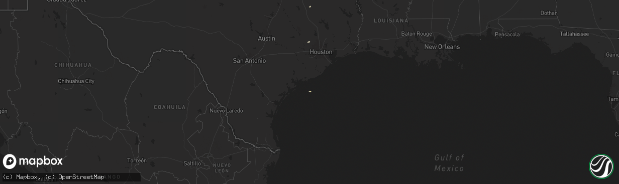
Hail Map on August 19, 2025
The weather event on August 19, 2025 includes Wind and Hail maps. 16 states and 603 cities were impacted and suffered possible damage. The total estimated number of properties impacted is 13,053.
Want more than just the map?
Turn this storm into a full workflow.
- Owner + property data so you know who to knock
- OnDemand branded weather history reports to win the "did we even have hail?" argument
- RoofTrace estimate so reps stop guessing numbers at the door
Bought this map? Upgrade within 7 days and we'll credit the $230. (10-15 min setup call)
Wind
Hail
13,053
Estimated number of impacted properties by a 1.00" hail or larger0
Estimated number of impacted properties by a 1.75" hail or larger0
Estimated number of impacted properties by a 2.50" hail or largerStates Impacted by Hail Map on August 19, 2025
Storm reports
Alabama
| Date | Description |
|---|---|
| 08/18/202511:54 PM CDT | A tree was knocked down onto cox creek parkway at the intersection with mars hill road. Time estimated by radar and mesonet observation. |
| 08/18/202511:05 PM CDT | A tree was knocked down across the road at the intersection of cr 27 and north shore drive. Time estimated by radar. |
| 08/18/20259:40 PM CDT | A tree limb was knocked down blocking one lane of rasch road between cloverdale road and taylor road. Time estimated by radar. |
Louisiana
| Date | Description |
|---|---|
| 08/18/202510:05 PM CDT | A utility pole was broken near jaggers ln and wade rd. |
| 08/18/20259:20 PM CDT | A metal/tin roof was peeled back and removed on a mobile home on liberty church road... Just east of the town of spearsville. At the same residence... A large chicken p |
| 08/18/20259:12 PM CDT | Thunderstorm winds blew off part of a tin roof on a house in spearsville. |
| 08/18/20259:10 PM CDT | A tree down on la hwy 550 near lem road in the laran community. |
Indiana
| Date | Description |
|---|---|
| 08/19/20255:55 PM CDT | A local report indicates 59 MPH wind near 3 SSW French Lick |
| 08/19/20251:47 PM CDT | Multiple trees down... One of which fell on powerlines. |
Texas
| Date | Description |
|---|---|
| 08/19/20255:15 PM CDT | A few small trees down and metal traffic signs bent near st. Marys university. |
| 08/19/20254:30 PM CDT | A multi-trunk tree was split and knocked over a street light. |
| 08/19/20254:25 PM CDT | Corrects previous tstm wnd dmg report from 1 wnw natalia. There was damage on 5th and 6th streets in natalia. Several trees were knocked down and took down power lines. |
| 08/19/20254:25 PM CDT | Power lines downed across multiple houses and trees downed. |
| 08/19/20254:20 PM CDT | Corrects previous thunderstorm wind damage report from 1 ssw sonora. The sutton county sheriffs office reported numerous roofs blown off... Power poles are down... And |
| 08/19/20254:20 PM CDT | The sutton county sheriffs office reported numerous roofs blown off... Power poles are down... And numerous large trees are down just south of sonora off of u.s. Hwy 27 |
| 08/19/20253:20 PM CDT | Video confirmed a landspout formed under a developing shower close to the east end of amistad reservoir... North of loop 79. The landspout appears to have remained over |
| 08/19/20252:55 PM CDT | Trained spotter reported damaging winds 1 mile to the north of clyde... Tx. He received some damage to his house. |
| 08/19/20252:40 PM CDT | Pictures of a multi-trunked tree split at inks lake state park. Estimating winds of 55 mph. Time estimated from radar. |
| 08/19/20252:40 PM CDT | Corrects previous tstm wnd dmg report from inks lake state park. Pictures of a multi-trunked tree split at inks lake state park. The park has an anemometer that measure |
| 08/19/202512:54 PM CDT | A 58 mph gust was measured by station anpt2. |
| 08/19/20258:18 AM CDT | Photo sent by harris county pct 4 employee showing trees down on waller spring creek rd. Time estimated from radar. |
| 08/18/202510:52 PM CDT | A local report indicates 63 MPH wind near 9 NNE Sunray |
| 08/18/20258:48 PM CDT | Multiple social media reports of several trees down along western center from i-35 to beach st. |
Kansas
| Date | Description |
|---|---|
| 08/19/20255:44 PM CDT | Kzlf_transmitter_site. |
| 08/19/20253:44 PM CDT | A local report indicates 58 MPH wind near 3 S Willowbrook |
| 08/19/20253:29 PM CDT | Spotter reports quarter sized hail near glen elder. |
| 08/19/20253:28 PM CDT | Report from mping: quarter |
| 08/19/20253:18 PM CDT | Report from mping: half dollar |
| 08/19/20253:16 PM CDT | A local report indicates 1.00 inch wind near 3 E East Wichita |
| 08/19/20253:10 PM CDT | A local report indicates 72 MPH wind near 3 ENE El Dorado |
| 08/19/20253:09 PM CDT | Report from mping: quarter |
| 08/19/20251:10 PM CDT | 4-6 inch tree limbs down. |
| 08/19/20251:07 PM CDT | Large tree limbs down across junction city |
| 08/19/20251:04 PM CDT | 10-12 inch tree limbs down on the north side of town. |
| 08/19/20251:00 PM CDT | Several outbuildings destroyed. Time estimated from radar. |
| 08/19/202512:54 PM CDT | Metal building damaged |
Oklahoma
| Date | Description |
|---|---|
| 08/19/20256:21 PM CDT | Large tre |
| 08/19/20256:21 PM CDT | Large tree downed. |
| 08/19/20256:10 PM CDT | Power lines downed. Time estimated. |
| 08/19/20255:30 PM CDT | 59 mph gust measured by the oklahoma mesonet site 3 miles southeast of stuart. |
| 08/19/20254:40 PM CDT | Rolled over rvs... Peeled roofs on houses... And roofs removed from barns. |
| 08/19/20254:33 PM CDT | Personal weather station measured 67 mph wind gust. |
| 08/19/20254:28 PM CDT | Damage to a large outbuilding |
| 08/19/20253:20 PM CDT | Power poles snapped and some leaning along stretch of 1st street/jennings road east to sw 177th street. Time estimated from radar. |
| 08/19/20252:39 PM CDT | Lawton municipal airport. |
| 08/18/20258:00 PM CDT | One pole barn roof ripped off and multiple trees and power poles down. Time estimated from radar. |
Ohio
| Date | Description |
|---|---|
| 08/19/20254:15 PM CDT | Large tree down near the intersection of edwood ave and north bend rd -- time estimated. |
| 08/19/20253:10 PM CDT | Corrects previous tstm wnd dmg report from 1 se north college hill. Large tree down near the intersection of edwood ave and north bend rd -- time estimated. |
Montana
| Date | Description |
|---|---|
| 08/19/20252:15 AM CDT | Blm cherry ridge. |
| 08/19/20252:10 AM CDT | Montana mesonet station lake thubadeau w. |
| 08/19/20251:50 AM CDT | Montana mesonet station simpson |
| 08/19/20251:50 AM CDT | A local report indicates 60 MPH wind near 25 N Kremlin |
| 08/19/20251:50 AM CDT | Montana mesonet station simpson. |
| 08/19/20251:35 AM CDT | Montana mesonet stat |
| 08/19/20251:35 AM CDT | Montana mesonet station wetzel ne. |
| 08/19/20251:35 AM CDT | Montana mesonet station kremlin nw. |
| 08/19/20251:35 AM CDT | Mesonet station gw6391 gildford 10n. |
| 08/19/20251:15 AM CDT | Mesonet station ew1937 goldstone. |
| 08/19/20251:00 AM CDT | Big sandy mt mesonet. |
| 08/19/20251:00 AM CDT | Big sandy mt |
| 08/19/20251:00 AM CDT | Montana mesonet station inverness n. |
| 08/19/202512:45 AM CDT | Mesonet station gw3478 tctiber. |
| 08/19/202512:35 AM CDT | Montana mesonet station dog gun lake e. |
| 08/19/202512:30 AM CDT | Mesonet station gw1952 riverview colony. |
| 08/19/202512:30 AM CDT | Mesonet station gw1986 lothair 9n. |
| 08/19/202512:25 AM CDT | Mesonet station gw1986 lothair 9n. |
| 08/18/202511:50 PM CDT | Ambient weather station. Sustained winds were 57 mph at the time of observation. |
| 08/18/202511:43 PM CDT | Ambient weather station. Sustained winds were 55 mph at the time of observation. |
| 08/18/202511:40 PM CDT | Ambient weather station. Sustained winds were 57 mph at the time of observation. |
| 08/18/202511:34 PM CDT | Ambient weather station. |
| 08/18/202511:30 PM CDT | Corrects previous non-tstm wnd gst report from 5 wsw great falls. Asos station kgtf great falls airport. |
| 08/18/202511:10 PM CDT | Montana mesonet station fairfield. |
| 08/18/202511:10 PM CDT | Montana mesonet station sun river se. |
| 08/18/202511:05 PM CDT | Awos station k1hm 6 nne fairfield. |
| 08/18/202510:55 PM CDT | Ambient weather station. |
| 08/18/202510:50 PM CDT | Montana mesonet station augusta n. |
| 08/18/202510:45 PM CDT | Ambient station. |
Missouri
| Date | Description |
|---|---|
| 08/19/20254:52 PM CDT | Tree down between senath and caruth. |
| 08/19/20254:37 PM CDT | Tree down on east commercial st. |
| 08/19/20253:20 PM CDT | Fences down... Playsets damaged... And shingle damage on homes at township line rd/cr-467. |
| 08/19/20252:45 PM CDT | Garage door blown in near home depot. |
| 08/19/20252:45 PM CDT | Movie theater screen damaged at the 21 drive inn northeast of van buren due to strong winds. |
| 08/19/20252:39 PM CDT | Photos show a large tree branch snapped and large patches of shingles removed from a house in this general area. Time estimated from radar. |
| 08/19/20252:31 PM CDT | 50-55 mph wind gusts also reported. |
| 08/19/20252:05 PM CDT | Two reports of estimated gusts to around 60 mph in cape girardeau. |
| 08/19/20252:00 PM CDT | Wind blew down a large portion of a tree. |
| 08/19/20252:00 PM CDT | Large amount of corn blown over due to strong winds near intersection of cr 638 and 618. |
| 08/19/20251:46 PM CDT | A few trees down between cape girardeau and jackson. Observed wind gusts estimated between 40-60 mph. |
Mississippi
| Date | Description |
|---|---|
| 08/19/20256:58 PM CDT | A couple of trees down on itasca drive. Time is radar estimated. |
| 08/18/20258:50 PM CDT | Law enforcement reported multiple trees down within the city limits. |
| 08/18/20258:32 PM CDT | Greenville asos site measured a 59 mph gust. |
| 08/18/20258:32 PM CDT | Corrects previous tstm wnd gst report from greenville. Greenville asos site measured a 59 mph gust. |
| 08/18/20258:15 PM CDT | Corrects previous tstm wnd dmg report from 1 e indianola. Roof partially blown off of inmate house |
New Mexico
| Date | Description |
|---|---|
| 08/19/20254:35 PM CDT | [landspout] video shared by broadcast media of a landspout near the bernalillo/sandoval county line. |
Kentucky
| Date | Description |
|---|---|
| 08/19/20256:18 PM CDT | Tree fell on building on the 7500 block of dunwoody court. Sdf gusted to 3 |
| 08/19/20256:18 PM CDT | Tree fell on building on the 7500 block of dunwoody court. Sdf gusted to 37 mph. |
| 08/19/20254:45 PM CDT | Corrects previous tstm wnd dmg report from 2 sse folsomdale. Tree down on a house near ky-408/ky-1241. Tree in the roadway at ky-1241/beasley loop. |
| 08/19/20254:31 PM CDT | Tree down on a house near ky-408/ky-1241. Tree in the roadway at ky-1241/beasley loop. |
| 08/19/20253:20 PM CDT | Large tree fell on/near a house. |
| 08/19/20253:15 PM CDT | Six trees fell on parker lane property. Time estimated from radar. |
| 08/18/20257:34 PM CDT | Damage to a fence and broken tree limbs at the overlook at eastwood. Time from radar. |
Arkansas
| Date | Description |
|---|---|
| 08/19/20256:35 PM CDT | Trees down. |
| 08/19/20256:30 PM CDT | Downed trees and powerlines |
| 08/19/20256:30 PM CDT | Downed trees and powerlines around gentry. Time estimated from radar. Info relayed by local broadcast media. |
| 08/19/20255:50 PM CDT | Tree and powerlines down on highway 42 in the city limits. Time is radar estimated. |
| 08/19/20255:00 PM CDT | Tree down at the intersection of 10th and hearn. |
| 08/19/20254:40 PM CDT | Destroyed outbuilding. Time estimated via radar. Video relayed via broadcast media social media account. |
| 08/19/20254:40 PM CDT | Tree down on a camper near monte ne. Time estimated from radar. Photo shared via broadcast media social media account. |
| 08/19/20254:26 PM CDT | Saline county fire/rescue communicated that a couple of very large trees fell on homes... Just across the saline county line into hot spring county. Trees fell on homes |
| 08/19/20254:19 PM CDT | A couple of trees down in the city limits. Time is radar estimated. |
| 08/19/20253:58 PM CDT | Lawrence county oem reports trees down in black rock due to winds associated with nearby storms. |
| 08/19/20253:40 PM CDT | Trees were blown down. |
| 08/19/20253:20 PM CDT | Trees blown down in this area. |
| 08/19/20252:30 PM CDT | **delayed report** the roof of a covered deck was blown off of a home in oakland. Pictures relayed via local broadcast media. |
| 08/19/20251:45 PM CDT | Several trees were blown down. |
| 08/19/20251:41 PM CDT | Multiple trees and powerlines blown down in the general area. Near this specific point... There were a couple of roofs damaged by thunderstorm winds. Near oaklawn there |
| 08/19/202512:45 PM CDT | Large tree fell on home in the athens community on highway 84. Also... Some hail was reported with this storm... But size unknown. |
| 08/18/20257:35 PM CDT | Limbs and power lines down. |
| 08/18/20257:30 PM CDT | Fence blown down. |
Illinois
| Date | Description |
|---|---|
| 08/19/20254:35 PM CDT | 4 to 6 inch diameter tree branches blown down... One limb taking a power line with it. Intersection of il-1 and county road 880n. |
| 08/19/20253:02 PM CDT | Tree fell onto bassett school rd. |
Cities Impacted by Hail Map on August 19, 2025
- Mapleton, KS
- Hockley, TX
- Waller, TX
- Oakwood, TX
- Hempstead, TX
- Prescott, KS
- Abilene, KS
- Solomon, KS
- White City, KS
- Concord, AR
- Drasco, AR
- Junction City, KS
- Herington, KS
- Minneapolis, KS
- Woodbine, KS
- Hope, KS
- Milford, KS
- Riley, KS
- Chapman, KS
- Enterprise, KS
- Wakefield, KS
- Fort Riley, KS
- Patton, MO
- Marquand, MO
- Marshall, AR
- Sedgewickville, MO
- Arcadia, MO
- Perryville, MO
- Strong City, KS
- Jackson, MO
- Longford, KS
- Burdick, KS
- Gypsum, KS
- Friedheim, MO
- Mountain View, AR
- Hot Springs Village, AR
- Lonsdale, AR
- Annapolis, MO
- Fredericktown, MO
- Oak Ridge, MO
- Bradford, AR
- Dwight, KS
- Manhattan, KS
- Alta Vista, KS
- Cottonwood Falls, KS
- Quitman, AR
- Shelbyville, IN
- Fairland, IN
- Judsonia, AR
- Lincolnville, KS
- Clinton, AR
- Altenburg, MO
- Harriet, AR
- Eagletown, OK
- Bee Branch, AR
- Normangee, TX
- Clarksville, AR
- Hartman, AR
- North Zulch, TX
- Valley Springs, AR
- Elmdale, KS
- Daisy, MO
- Greenville, MO
- Winona, MO
- Shirley, AR
- Liberty Hill, TX
- Kingsville, TX
- Burbank, OK
- Burns, KS
- Dennard, AR
- Solgohachia, AR
- Hearne, TX
- Center Ridge, AR
- Cape Girardeau, MO
- Cedar Point, KS
- McClure, IL
- Poteet, TX
- Fay, OK
- Springfield, AR
- Franklin, TX
- Fox, AR
- Oakland, AR
- Whitewater, MO
- Benton, KS
- Newton, KS
- Burfordville, MO
- Fairfax, OK
- Fifty Six, AR
- Damascus, AR
- Van Buren, MO
- Ellington, MO
- Bryan, TX
- Gainesville, MO
- Perryville, AR
- Everton, AR
- Rover, AR
- Hattieville, AR
- Dierks, AR
- Advance, MO
- Kerrville, TX
- Center Point, TX
- Alton, MO
- Smyrna, GA
- Plumerville, AR
- Pocahontas, AR
- Myrtle, MO
- Mulberry, AR
- Gatewood, MO
- Lesterville, MO
- Rocksprings, TX
- Marietta, GA
- Mount Judea, AR
- Lawton, OK
- Faxon, OK
- El Dorado, KS
- Doniphan, MO
- Zalma, MO
- Casa, AR
- Oran, MO
- Bell City, MO
- Helotes, TX
- Thomas, OK
- Towanda, KS
- Junction, IL
- Cave In Rock, IL
- Elizabethtown, IL
- Poplar Bluff, MO
- Ola, AR
- Plainview, AR
- Cabot, AR
- Mayflower, AR
- Wappapello, MO
- Williamsville, MO
- Ellsinore, MO
- Alma, AR
- Bandera, TX
- Bloomfield, MO
- Glen Elder, KS
- Beebe, AR
- Sainte Genevieve, MO
- Burnet, TX
- Couch, MO
- Delphos, KS
- Tescott, KS
- Franklin, AR
- Melbourne, AR
- Charleston, MO
- Danville, AR
- Buncombe, IL
- Sterling, KS
- Rosiclare, IL
- Herod, IL
- Warm Springs, AR
- Ravenden Springs, AR
- Morrilton, AR
- Medina, TX
- Ozark, AR
- Vilonia, AR
- Bunch, OK
- Buchanan Dam, TX
- Iola, TX
- Dardanelle, AR
- Puxico, MO
- Houston, AR
- Lockesburg, AR
- Merom, IN
- Sullivan, IN
- Bluffton, TX
- Mico, TX
- San Antonio, TX
- Welling, OK
- Beloit, KS
- Jacksonville, AR
- Ozona, TX
- Grandin, MO
- Mammoth Spring, AR
- Thayer, MO
- Goreville, IL
- Watonga, OK
- Sherwood, AR
- Lyons, KS
- Camp, AR
- Nickerson, KS
- Tow, TX
- Black Rock, AR
- Uniontown, AR
- Muldrow, OK
- Perry, AR
- North Little Rock, AR
- Wichita, KS
- Llano, TX
- Cecil, AR
- Boling, TX
- Van Vleck, TX
- Pledger, TX
- Dongola, IL
- Maumelle, AR
- Conway, AR
- Bigelow, AR
- Cape Coral, FL
- Dudley, MO
- Utopia, TX
- Sabinal, TX
- Moores Hill, IN
- Port Charlotte, FL
- Dallas, GA
- Barksdale, TX
- Ravenden, AR
- Poughkeepsie, AR
- Williford, AR
- Hardy, AR
- Ironton, MO
- Marion, KY
- Imboden, AR
- Golconda, IL
- Natural Dam, AR
- Birch Tree, MO
- Partridge, KS
- Abbyville, KS
- Bremond, TX
- Mcconnell Afb, KS
- Maynard, AR
- Cypress, IL
- North Fort Myers, FL
- Andover, KS
- Derby, KS
- Little Rock, AR
- Concan, TX
- Leon, KS
- Atlanta, KS
- Uvalde, TX
- Knippa, TX
- Whitewater, KS
- Rio Frio, TX
- Cedarville, AR
- D Hanis, TX
- Salem, KY
- Rudy, AR
- Hutchinson, KS
- Geneseo, KS
- Lorraine, KS
- Dugger, IN
- Rose Hill, KS
- Leakey, TX
- Ellsworth, KS
- Evening Shade, AR
- Belknap, IL
- Burlington, TX
- Vanderpool, TX
- Hampton, KY
- Glencoe, AR
- Doe Run, MO
- Fort Myers, FL
- Douglass, KS
- Benton, AR
- Paron, AR
- Alexander, AR
- Carlisle, IN
- Fort Myers Beach, FL
- Haysville, KS
- Cawker City, KS
- Downs, KS
- Esbon, KS
- Eureka, KS
- Equality, IL
- Fisk, MO
- Pawnee, OK
- Glencoe, OK
- Calvert, TX
- Barnard, KS
- Campbell, MO
- Bloomsdale, MO
- French Village, MO
- Ballinger, TX
- Marquez, TX
- Rosebud, TX
- Jewett, TX
- Piggott, AR
- Peck, KS
- South Hutchinson, KS
- Heavener, OK
- Clearwater, KS
- Bonne Terre, MO
- Thornton, TX
- Devine, TX
- Natalia, TX
- Lytle, TX
- Rector, AR
- Metropolis, IL
- Karnak, IL
- Walnut Ridge, AR
- Oxford, KS
- Geuda Springs, KS
- Traskwood, AR
- Brackettville, TX
- La Coste, TX
- Portis, KS
- O'Kean, AR
- Salem, AR
- Springville, IN
- Wilsonville, NE
- Bloomfield, IN
- Newberry, IN
- Paducah, KY
- Salem, MO
- Groesbeck, TX
- Geary, OK
- Waldron, AR
- Greenway, AR
- Pollard, AR
- Brookport, IL
- Hitchcock, OK
- Okeene, OK
- Kingfisher, OK
- Irondale, MO
- Potosi, MO
- Mineral Point, MO
- Witter, AR
- Wellington, KS
- Paragould, AR
- Bono, AR
- Beech Grove, AR
- Lafe, AR
- Marmaduke, AR
- Princeton, KY
- Bismarck, MO
- Belle Plaine, KS
- Severy, KS
- Mansfield, AR
- Huntington, AR
- Vincennes, IN
- Boaz, KY
- Mayfield, KY
- Hickory, KY
- Norcatur, KS
- Farmington, MO
- Park Hills, MO
- Malvern, AR
- Booneville, AR
- Mccurtain, OK
- Leadwood, MO
- Rogers, TX
- Englewood, FL
- Heltonville, IN
- Udall, KS
- Jonesboro, AR
- Belgrade, MO
- Caledonia, MO
- Cherryville, MO
- Rolla, MO
- Murfreesboro, AR
- Bedford, IN
- Huntsville, AR
- Edcouch, TX
- Buckholts, TX
- Senath, MO
- Hornersville, MO
- Arbyrd, MO
- Leachville, AR
- Manila, AR
- Lenox, MO
- Edgar Springs, MO
- Blytheville, AR
- Delight, AR
- Aline, OK
- Grantsburg, IL
- Brookland, AR
- Hartford, AR
- Symsonia, KY
- Ledbetter, KY
- Bulverde, TX
- Marshall, OK
- Douglas, OK
- Carmen, OK
- Temple, TX
- Sonora, TX
- Dell, AR
- Etowah, AR
- Elberfeld, IN
- Norman, IN
- Decker, IN
- Prescott, AR
- Blevins, AR
- Dupont, IN
- Amity, AR
- Weslaco, TX
- Donna, TX
- Saint Amant, LA
- Gonzales, LA
- Mcalester, OK
- Stuart, OK
- Jadwin, MO
- Crystal City, TX
- Belton, TX
- Elsa, TX
- Menard, TX
- Keiser, AR
- Osceola, AR
- Wilson, AR
- Agra, KS
- Kensington, KS
- De Soto, MO
- Festus, MO
- Harper, KS
- S Coffeyville, OK
- Belleview, MO
- Madison, IN
- Kendalia, TX
- Kempner, TX
- French Lick, IN
- Jbsa Lackland, TX
- Phillipsburg, KS
- Oakland City, IN
- Lake City, AR
- Medford, OK
- Steelville, MO
- Macedonia, IL
- Cherry Valley, AR
- Wynne, AR
- Lamont, OK
- Paris, TN
- La Pryor, TX
- Kiowa, KS
- Alva, OK
- Hardtner, KS
- Cabool, MO
- Elk Creek, MO
- Willow Springs, MO
- Henry, TN
- Clarksville, TN
- Seligman, MO
- Crothersville, IN
- Meadville, MS
- Seymour, IN
- Brownstown, IN
- Raymondville, MO
- Summersville, MO
- Coldwater, MS
- Hartshorn, MO
- McKenzie, TN
- Cherokee, OK
- Bertram, TX
- Woodlawn, TN
- Ochopee, FL
- Austin, IN
- Kremlin, OK
- Quemado, TX
- Enid, OK
- Lutz, FL
- Land O'Lakes, FL
- Birdseye, IN
- Copperas Cove, TX
- Cook Sta, MO
- Bison, OK
- Olive Branch, MS
- Memphis, TN
- Stendal, IN
- Waynoka, OK
- Carmi, IL
- Crossville, IL
- Clifton, AZ
- Billings, MO
- Crane, MO
- Jasper, IN
- Roxie, MS
- Gentry, AR
- Colcord, OK
- Watts, OK
- Siloam Springs, AR
- Inola, OK
- Huntingdon, TN
- Wilson, KS
- Bristow, IN
- Branchville, IN
- Tell City, IN
- Saint Croix, IN
- Hollister, MO
- Newburg, MO
- Irvington, KY
- Nardin, OK
- Jerome, MO
- Dixon, MO
- Bentonville, AR
- Hiwasse, AR
- Stamford, NE
- Decatur, AR
- Bunker, MO
- Cedar Grove, TN
- Oakwood, OK
- Orlando, OK
- Eddyville, NE
- Salado, TX
- Crocker, MO
- Vine Grove, KY
- Crescent, OK
- Guthrie, OK
- Waynesville, MO
- Fort Leonard Wood, MO
- Coffeyville, KS
- Louisville, KY
- Little River Academy, TX
- Oconto, NE
- Eunice, MO
- Hennessey, OK
- Burlington, OK
- Sumner, NE
- Saint Robert, MO
- Mulhall, OK
- Briggs, TX
- Oklahoma City, OK
- Southaven, MS
- Waukomis, OK
- Wewoka, OK
- Hartshorne, OK
- Alma, NE
- Orleans, NE
- Long Island, KS
- Holyrood, KS
- Gaylord, KS
- Overton, NE
- Muskogee, OK
- Checotah, OK
- Holdenville, OK
- Greenville, MS
- Smith Center, KS
- Chickasha, OK
- Ninnekah, OK
- Bradley, OK
- Alex, OK
- Eufaula, OK
- Athol, KS
- Marlow, OK
- Oktaha, OK
- Lindsay, OK
- Decatur, TX
- Hanna, OK
- Fort Worth, TX
- Spearsville, LA
- Frohna, MO
- Springdale, AR
- Wolf Lake, IL
- Grand Tower, IL
- Dustin, OK
- Perryton, TX
- Leland, MS
- Chester, MT
- Whitlash, MT
- Galata, MT
- Oak Grove, LA
- Pioneer, LA
- Rayville, LA
- Joplin, MT
- Mer Rouge, LA
- Baldwyn, MS
- Oak Ridge, LA
- Bowie, TX
- Bellevue, TX
- Inverness, MT
- Augusta, MT
- Fairfield, MT
- Choteau, MT
- Cascade, MT
- Simms, MT
- Fort Shaw, MT
- Ledger, MT
- Conrad, MT
- Brady, MT
- Dutton, MT
- Sun River, MT
- Rudyard, MT
- Wilburton, OK
- Smithland, KY
- Ulm, MT
- Great Falls, MT
- Vaughn, MT
- Power, MT
- Havre, MT
- Honobia, OK
- Sand Coulee, MT
- Stratford, TX
- Gruver, TX
- Sunray, TX
- Floweree, MT
- Black Eagle, MT
- Carter, MT
- Stringtown, OK
- Shelby, MT
- Fort Benton, MT
- Lothair, MT
- Hingham, MT
- Gildford, MT
- Kremlin, MT
- Leopold, IN
- Foster, OK
- Wichita Falls, TX
- Chinook, MT
- Harlem, MT
- Hogeland, MT
- Henryetta, OK
- Blanchard, OK
- Quinton, OK
- Nocona, TX
- Montague, TX