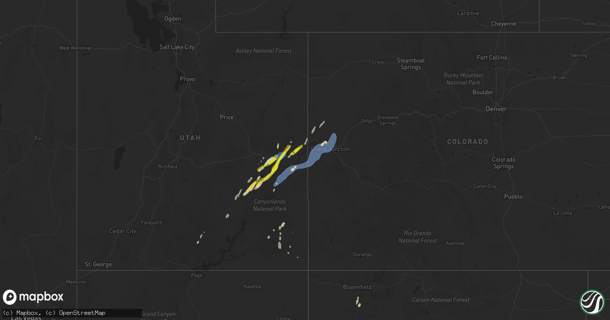
Hail Map on September 12, 2025
Get this storm
September 12 map
$229
one time, instant access
Download today. No call, no setup
Keep the $229
Bought the map and want the full workflow? Apply the entire $229 to a subscription within 7 days. None of it is wasted.
Every map, not just this one
This buys you this map. Subscription and you get every map we run, in the markets you choose from a few cities to whole states to nationwide. Plus real-time alerts the moment a storm fires.
Contact data
Name, contact info, occupancy, even credit band for addresses in the footprint. You go from where it hit to who to call.
Become the source they trust
Unlimited branding weather history reports on demand. You already have the documented answer ready for the property owner, and you are the one who showed up with it.
Property data and RoofTrace estimates
Pull up any address you have got, its value and the exact code rules for that jurisdiction, straight from One Click Code. Then RoofTrace estimates the squares, pitch, and roof value, priced the way you price.
States Impacted by Hail Map on September 12, 2025
Storm reports
Utah
| Date | Description |
|---|---|
| 09/12/202510:44 AM CDT | A local report indicates 1.25 inch wind near 17 NW Moab |
| 09/12/202510:06 AM CDT | A local report indicates 1.00 inch wind near 25 NNW Castle Valley |
Montana
| Date | Description |
|---|---|
| 09/12/20256:36 PM CDT | 1.5 inch hail estimated from photo via social media. |
| 09/12/20253:24 PM CDT | [landspout] report via media: funnel cloud was observed picking up dust for about 45 seconds and believed to have touched the ground. Location was about 6 mi south of |
| 09/11/202511:47 PM CDT | Corrects previous non-tstm wnd gst report from 1 se baker. Asos station kbhk baker. |
New Mexico
| Date | Description |
|---|---|
| 09/12/20254:56 PM CDT | A local report indicates 58 MPH wind near 2 N Petroglyph National |
| 09/12/20253:30 PM CDT | Mesonet station nm003 lordsburg playa i10 mp11 |
North Dakota
| Date | Description |
|---|---|
| 09/12/20256:25 PM CDT | Hailed for about 20 minutes... Mainly before this time of the half dollar hail. Some hail also fell off and on after this time. |
| 09/12/20256:25 PM CDT | Ground was white with hail. Also received 0.80 inch of rain. |
| 09/12/20256:15 PM CDT | Relayed to nws by broadcast media partner. |
| 09/12/20256:00 PM CDT | Also rained 2.4 inches from the storm. |
| 09/12/20254:48 PM CDT | Ground was white with hail... And some hail still remained at the time of this report. Mostly smaller than quarter... But quarter size was the largest. |
| 09/12/202512:59 PM CDT | Multiple reports of a funnel cloud followed by a tornado. Confirmed by a 911 dispatch center. Estimated location based on radar. |
| 09/12/202512:59 PM CDT | Multiple rep |
| 09/12/202510:19 AM CDT | Brief period of nickel to quarter sized hail followed by a brief period of heavy rain. Time estimated based on radar. |
| 09/11/20258:12 PM CDT | A local report indicates 1.00 inch wind near 1 NNW New Salem |
| 09/11/20257:10 PM CDT | Mainly smaller hail but a few around the size of a quarter. |
| 09/11/20257:10 PM CDT | Mainly smaller hail but a few around the size of a |
Wyoming
| Date | Description |
|---|---|
| 09/12/20255:55 PM CDT | Called report in and social media photo. |
Arizona
| Date | Description |
|---|---|
| 09/12/20256:24 PM CDT | Estimated 1.5 inch hail along highway 191. |
| 09/12/20256:00 PM CDT | Estimated hail size of 1.5 inches with hail accumulation covering the roadways of roughly 8 inches deep. |
| 09/12/20255:47 PM CDT | Report of overturned semitruck. |
| 09/12/20255:41 PM CDT | Weather station recorded wind gust of 60 mph. |
| 09/12/20255:41 PM CDT | Weather station recorded wind gust of 60 mph. |
| 09/12/20251:30 PM CDT | Photo and video of numerous 1 inch hail stones via facebook. |
| 09/12/20251:25 PM CDT | Several photos and videos showing quarter size hail in san manuel. |
| 09/12/202512:11 PM CDT | [landspout] time and location estimated with radar. No damage reported. |
| 09/12/20251:03 AM CDT | Asos station ksad gusted to 58 mph. |
| 09/11/20257:25 PM CDT | Guthrie raws measured wind gust of 63 mph. Time estimated based on radar. |
South Dakota
| Date | Description |
|---|---|
| 09/12/20256:58 PM CDT | Golf-ball hail for about 15 minutes. Flooding of the yard. |
| 09/12/20254:35 AM CDT | A local report indicates 58 MPH wind near 1 NNE Faith |
| 09/12/20254:07 AM CDT | A local report indicates 59 MPH wind near Howes |
| 09/12/202512:31 AM CDT | A local report indicates 63 MPH wind near 2 SW Bridger |
| 09/12/202512:26 AM CDT | A local report indicates 62 MPH wind near 2 SW Bridger |
| 09/12/202512:25 AM CDT | A local report indicates 67 MPH wind near 11 W Milesville |
| 09/12/202512:21 AM CDT | A local report indicates 58 MPH wind near 2 SW Bridger |
| 09/12/202512:20 AM CDT | A local report indicates 62 MPH wind near 11 W Milesville |
| 09/11/20257:05 PM CDT | Time estimated. |
Colorado
| Date | Description |
|---|---|
| 09/12/20255:34 PM CDT | Asos station kril garfield county rgnl ap. |
| 09/12/20254:12 PM CDT | Asos station kgjt grand junction rgnl ap. |
| 09/12/20254:06 PM CDT | Power lines down due to thunderstorm winds. |
| 09/12/202512:30 PM CDT | A local report indicates 61 MPH wind near 5 NW Mack |
Minnesota
| Date | Description |
|---|---|
| 09/12/202511:39 AM CDT | Trained spotter reported quarter size to slightly larger than quarter size hail at central lakes college near college drive and the mississippi river. |
| 09/12/202511:11 AM CDT | Location is approximate near the brainerd airport. Trained spotter reported very strong winds and very heavy rain and large hail that was quarter size and up to an inch |
| 09/12/202511:00 AM CDT | Gusty east winds followed by very heavy rain and hail at time of observation. Hail was mostly dime size but there were a few quarter size hailstones at times. |
| 09/12/202510:37 AM CDT | A local report indicates 1.00 inch wind near 3 E East Gull Lake |
| 09/12/202510:28 AM CDT | Heavy rain and hail falling. Hail was accumulating and looked like snow outside. Hail was marble size to quarter size. |
| 09/12/20258:42 AM CDT | Time estimated from radar. |
Cities Impacted by Hail Map on September 12, 2025
- Anamoose, ND
- Hanksville, UT
- Dent, MN
- Erhard, MN
- Escalante, UT
- Puposky, MN
- Tenstrike, MN
- Hines, MN
- Richville, MN
- Perham, MN
- Ottertail, MN
- New York Mills, MN
- Wadena, MN
- Deer Creek, MN
- Sebeka, MN
- Bluffton, MN
- Staples, MN
- Verndale, MN
- Kelliher, MN
- Thompson, UT
- Motley, MN
- Harvey, ND
- Watertown, SD
- Fessenden, ND
- Green River, UT
- Winkelman, AZ
- Pillager, MN
- Aldrich, MN
- Brainerd, MN
- Nisswa, MN
- Pequot Lakes, MN
- Northome, MN
- Grenville, SD
- Waubay, SD
- Cathay, ND
- Mizpah, MN
- Wyarno, WY
- Clearmont, WY
- San Carlos, AZ
- Peridot, AZ
- Chambers, AZ
- Ganado, AZ
- Baxter, MN
- Sheridan, WY
- Roslyn, SD
- Ironton, MN
- Merrifield, MN
- Webster, SD
- De Beque, CO
- Fort Ripley, MN
- Wirt, MN
- Donnelly, MN
- Chinle, AZ
- Garrison, MN
- Cook, MN
- Angora, MN
- Hillman, MN
- Onamia, MN
- Clinton, MN
- Ray, ND
- Beardsley, MN
- Browns Valley, MN
- Isle, MN
- Wahkon, MN
- Oracle, AZ
- San Manuel, AZ
- Banner, WY
- Buffalo, WY
- Blanding, UT
- Ramah, NM
- Bluewater, NM
- Monticello, UT
- Homestead, FL
- Crownpoint, NM
- Willcox, AZ
- Pierz, MN
- Lake Powell, UT
- Milaca, MN
- Moab, UT
- Pima, AZ
- Farmington, NM
- Geyser, MT
- Rush City, MN
- Mora, MN
- Grasston, MN
- Braham, MN
- Stanchfield, MN
- Cochise, AZ
- Harris, MN
- Glade Park, CO
- Gateway, CO
- Lordsburg, NM
- Havre, MT
- Saint Croix Falls, WI
- Cushing, WI
- North Branch, MN
- Bloomfield, NM
- Raynesford, MT
- Grantsburg, WI
- Grand Junction, CO
- Fruita, CO
- Mack, CO
- Lewistown, MT
- Whitetail, MT
- Centuria, WI
- Melville, MT
- Big Sandy, MT
- Chinook, MT
- Rhame, ND
- Redstone, MT
- Shawmut, MT
- Lloyd, MT
- Buckhorn, NM
- San Simon, AZ
- Milltown, WI
- Balsam Lake, WI
- Amery, WI
- Belt, MT
- Bowman, ND
- Whitewater, CO
- Hays, MT
- Upton, WY
- Stockett, MT
- Newcastle, WY
- Superior, AZ
- Douglas, AZ
- McNeal, AZ
- Osage, WY
- Solen, ND
- Wolf Point, MT
- Grass Range, MT
- Lusk, WY
- Carson, ND
- Custer, SD
- Zortman, MT
- Fort Benton, MT
- Watauga, SD
- Poplar, MT
- Raleigh, ND
- Malta, MT
- Carter, MT
- Scobey, MT
- Cannon Ball, ND
- Fort Yates, ND
- Morristown, SD
- Dodson, MT
- Ten Sleep, WY
- New Leipzig, ND
- Selfridge, ND
- Mandan, ND
- Flasher, ND
- McIntosh, SD
- Hill City, SD
- Safford, AZ
- Plentywood, MT
- Saint Anthony, ND
- Keldron, SD
- Antelope, MT
- Morenci, AZ
- Clifton, AZ
- Cubero, NM
- Almont, ND
- New Salem, ND
- Dagmar, MT
- Westby, MT
- Fence Lake, NM
- Reserve, MT
- Meadow, SD
- Zuni, NM
- Brady, MT
- Grants, NM
- Belle Fourche, SD
- Flaxville, MT
- Hulett, WY
- Outlook, MT
- Devils Tower, WY
- Grenora, ND
- Bedrock, CO
- Pine Ridge, SD
- Lemmon, SD
- Kyle, SD
- Fortuna, ND
- Bison, SD
- Whiteriver, AZ
- Thatcher, AZ
- Vail, AZ
- Killdeer, ND
- Sonoita, AZ
- Show Low, AZ
- Newell, SD
- Ambrose, ND
- Animas, NM
- Crosby, ND
- Benson, AZ
- Dunn Center, ND
- Reva, SD
- Buffalo, SD
- Mud Butte, SD
- Watford City, ND
- Mandaree, ND
- Wall, SD
- Keene, ND
- Prairie City, SD
- Faith, SD
- Milesville, SD
- New Town, ND
- Medora, ND
- Lambert, MT
- Hettinger, ND
- Grassy Butte, ND
- Halliday, ND
- Roseglen, ND
- Froid, MT
- White Owl, SD
- Berthold, ND
- Enning, SD
- Agar, SD
- Onida, SD
- Union Center, SD
- Howes, SD
- Stanley, ND
- Gettysburg, SD
- Cherry Creek, SD
- Lebanon, SD
- Ross, ND
- Midland, SD
- Isabel, SD
- Dupree, SD
- Parshall, ND
- Palermo, ND
- Eagle Butte, SD
- Quinn, SD
- Philip, SD