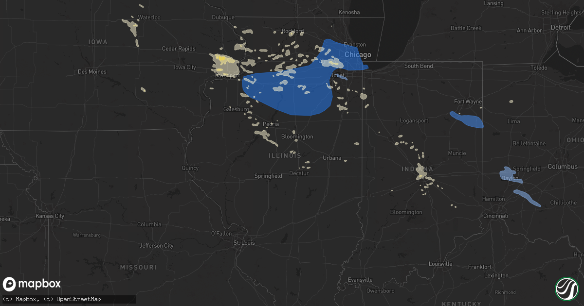
Hail Map in Illinois on July 14, 2024
Get this storm
July 14 map
$229
one time, instant access
Download today. No call, no setup
Keep the $229
Bought the map and want the full workflow? Apply the entire $229 to a subscription within 7 days. None of it is wasted.
Every map, not just this one
This buys you this map. Subscription and you get every map we run, in the markets you choose from a few cities to whole states to nationwide. Plus real-time alerts the moment a storm fires.
Contact data
Name, contact info, occupancy, even credit band for addresses in the footprint. You go from where it hit to who to call.
Become the source they trust
Unlimited branding weather history reports on demand. You already have the documented answer ready for the property owner, and you are the one who showed up with it.
Property data and RoofTrace estimates
Pull up any address you have got, its value and the exact code rules for that jurisdiction, straight from One Click Code. Then RoofTrace estimates the squares, pitch, and roof value, priced the way you price.
Storm reports in Illinois
Illinois
| Date | Description |
|---|---|
| 07/14/202411:51 AM CDT | Some shingles blown off and large branches down. |
| 07/14/20249:25 AM CDT | Trees and large tree limbs downed in and near grant park. Patches of corn also flattened east of grant park. |
| 07/14/20248:43 AM CDT | Updates previous tstm wnd dmg report from joliet. Photos relayed by em show about half of the roof blown off the illinois rock and roll museum. The roof and roofing mat |
| 07/14/20248:43 AM CDT | Report relayed that part of the roof of the forge music venue was damaged or destroyed. Time estimated based on radar. |
| 07/14/20248:43 AM CDT | Corrects previous tstm wnd dmg report from joliet. Part of the roof of the joliet junior college was blown off... Hitting the illinois rock and roll museum to its south |
| 07/14/20248:40 AM CDT | Several branches down and lost power. |
| 07/14/20248:39 AM CDT | Multiple reports of tree damage across the west side of joliet... Including snapped trees and downed limbs. Time estimated from radar. |
| 07/14/20242:08 AM CDT | Delayed report. Large tree blown down blocking route 1. |
| 07/14/20241:25 AM CDT | Large tree limb down on south linden near jersey st. Blocking all lanes. |
| 07/14/20241:25 AM CDT | A local report indicates 1.00 inch wind near Normal |
| 07/14/20241:20 AM CDT | Corrects previous tstm wnd dmg report from 1 ssw bloomington. Corrects previous tstm wnd dmg report from 1 nnw central illinois airport. Delayed report. Several large h |
| 07/14/20241:20 AM CDT | Corrects previous tstm wnd dmg report from 1 nnw central illinois airport. Delayed report. Several large hardwood tree limbs down around mcgraw park area. One large tre |
| 07/14/20241:20 AM CDT | Delayed report. Several large hardwood tree limbs down around mcgraw park area. One large tree 2 ft in diameter split... Possibly due to lightning. |
| 07/14/202412:49 AM CDT | Large tree limbs downed and large metal sheets removed from a farm outbuilding near chatsworth. Time estimated from radar. |
| 07/14/202412:29 AM CDT | Pontiac municipal airport. |
| 07/14/202412:18 AM CDT | Several instances of tree damage in the cornell area... Including snapped trees and downed large tree limbs. Time estimated from radar. |
| 07/14/202412:00 AM CDT | Tree limbs blown down onto power lines. Time estimated from radar. |
| 07/13/202411:51 PM CDT | Corrects previous tstm wnd dmg report from 3 e varna. Some shingles blown off and large branches down. Corrected time. |
| 07/13/202411:51 PM CDT | Corrects previous tstm wnd dmg repor |
| 07/13/202411:50 PM CDT | Large branches of 1 foot plus downed. |
| 07/13/202411:50 PM CDT | Power lines and trees downed throughout town. |
| 07/13/202411:45 PM CDT | Illinois valley regional airport. |
| 07/13/202411:45 PM CDT | Corrects previous tstm wnd gst report from 2 nw peru. Illinois valley regional airport. |
| 07/13/202411:43 PM CDT | Couple trees downed in wolf hollow area. Time estimated using radar. |
| 07/13/202411:42 PM CDT | Ef1... Max wind 100 mph... Path length 6.33 miles... Max width 100 yards. This tornado touched down just east of the illinois river... Near the north edge of billsbach |
| 07/13/202411:40 PM CDT | Wind damage to mobile home park on the north side of henry. Time estimated from radar. |
| 07/13/202411:40 PM CDT | Ef1... Max wind 90 mph... Path length 0.45 miles... Width 50 yards. Mostly straight line wind damage occurred... With hardwood trees snapped 1/3 the way up... But mostl |
| 07/13/202411:22 PM CDT | Sheriff reported a tree blocking midland road near the country club. Time of the event estimated using radar. |
| 07/13/202411:19 PM CDT | Measured at the kewanee airport. |
| 07/13/202411:15 PM CDT | Powerpoles and a tree down near neponset. Time of the event estimated using radar. |
| 07/13/202411:00 PM CDT | Tree limb down on powerlines. Time of the event estimated using radar. |
| 07/13/202410:54 PM CDT | Measured at bob reade field on the north side of geneseo. |
| 07/13/202410:50 PM CDT | Trees and power lines down throughout town. |
| 07/13/202410:46 PM CDT | Several small tree branches down approx. 3-4 inch in diameter reported via social media. Time estimated from radar. |
| 07/13/202410:45 PM CDT | A local report indicates 58 MPH wind near 1 WNW North Center - Ch |
| 07/13/202410:44 PM CDT | Relayed by broadcast media. |
| 07/13/202410:40 PM CDT | Numerous large branches and several trees down in a path from near 48th and state st to east of mlk dr and 46th st. |
| 07/13/202410:36 PM CDT | Delayed report and time estimated from radar. Large tree down across residential street. |
| 07/13/202410:35 PM CDT | Local media reported roof damage and debris scattered on the street from a building near 68th street and rhodes avenue. Time estimated by radar. |
| 07/13/202410:34 PM CDT | A local report indicates 59 MPH wind near Midway Airport |
| 07/13/202410:34 PM CDT | Measured gust to 60 mph. |
| 07/13/202410:19 PM CDT | Light pole leaning over granart road. |
| 07/13/202410:15 PM CDT | Tree blocking road... Stewart and scotch road. |
| 07/13/202410:15 PM CDT | 10 inch tree limb downed. |
| 07/13/202410:12 PM CDT | Peak gust recorded on personal weather station. |
| 07/13/202410:12 PM CDT | Wind gusts at least 60 mph. |
| 07/13/202410:10 PM CDT | House lost its roof and chimmeny on stargrass lane. Another house was damaged after a gazebo was blown into. Time estimated. |
| 07/13/202410:09 PM CDT | Tree reported down rt47 and hydraulic. |
| 07/13/202410:09 PM CDT | Tree and power lines down on occupied vehicle on schnider road. |
| 07/13/202410:04 PM CDT | Nws employee reported 6 to 12 inch branches down around the woodridge circle. Time estimated by radar. |
| 07/13/202410:00 PM CDT | Tree down castle street south of plesant. |
| 07/13/20249:58 PM CDT | Power poles and lines blocking lafox road. |
| 07/13/20249:57 PM CDT | Roughly 2 foot tree blocking road in 700 block of elmwood. |
| 07/13/20249:57 PM CDT | 6-8 inch branch downed in 500 block of elite st. |
| 07/13/20249:55 PM CDT | Measured wind gust to 70 mph at kdpa asos. |
| 07/13/20249:55 PM CDT | Large tree limb blown down on fremont street. |
| 07/13/20249:55 PM CDT | 14-inch tree branch downed. |
| 07/13/20249:55 PM CDT | 8 inch tree limb downed. |
| 07/13/20249:54 PM CDT | Several trees and corn crops damaged just west of dupage airport. |
| 07/13/20249:50 PM CDT | Power poles blownd down on loretta drive. Numerous trees down in roadway. |
| 07/13/20249:49 PM CDT | Large tree blocking ramm road. |
| 07/13/20249:48 PM CDT | Roof collapse and roof blown off storage building. |
| 07/13/20249:47 PM CDT | Tree and power lines down on meredith road. |
| 07/13/20249:46 PM CDT | Tree down on a house and cars on main street. |
| 07/13/20249:46 PM CDT | Estimated wind gust to 60 mph at route 38 and peck road. |
| 07/13/20249:44 PM CDT | Public posted on social media of a tree uprooted in the yard of the algonquin lakes subdivision near algonquin road and lake cook road. Time estimated by radar. |
| 07/13/20249:42 PM CDT | Tree blocking marcy road. |
| 07/13/20249:42 PM CDT | Public reported 1 foot diameter tree snapped at its base. Time estimated by radar. |
| 07/13/20249:41 PM CDT | Numerous trees blown down. |
| 07/13/20249:41 PM CDT | Large branch downed or tree uprooted. Relayed via mping. |
| 07/13/20249:40 PM CDT | Tree limbs snapped and downed on house. |
| 07/13/20249:36 PM CDT | Numerous trees blown down along peplow road... Road is impassible... Tree limbs down on lines. |
| 07/13/20249:30 PM CDT | Public reported tree limbs and a small tree down. Radar estimated by radar. |
| 07/13/20249:25 PM CDT | Roof off a house... Several trees down... Damage to a greenhouse. |
| 07/13/20249:16 PM CDT | Relayed by broadcast media. |
| 07/13/20249:13 PM CDT | Numerous trees and limbs downed between 1st street and the railroad tracks... Just north of taylor street. |
| 07/13/20249:00 PM CDT | Public reported tree down on twombly rd approx. 1/4 mile from woodlawn rd. Time estimated by radar. |
| 07/13/20248:59 PM CDT | Public reported a tree down on parkview drive in rochelle. Time estimated by radar. |
| 07/13/20248:39 PM CDT | Tree limb damage. Possible tornado 839 pm to 843 pm in this area. |
| 07/13/20248:25 PM CDT | Tree limbs blown down. |
| 07/13/20248:15 PM CDT | Tree limbs down. |
| 07/13/20248:15 PM CDT | Awos at the freeport airport measured a gust of 58 mph. |
| 07/13/20247:40 PM CDT | Trees down a few miles south of stockton. Times estimated from radar data. |
| 07/13/20247:16 PM CDT | Corrects previous tstm wnd dmg report from hanover. Tree down in hanover. Time estimated from radar data. |
All States Impacted by Hail Map on July 14, 2024
Cities Impacted by Hail Map on July 14, 2024
- Ashton, IL
- Oregon, IL
- Chana, IL
- Rochelle, IL
- Mchenry, IL
- Grant Park, IL
- Kempton, PA
- Shoemakersville, PA
- Hamburg, PA
- New Tripoli, PA
- Fleetwood, PA
- Attica, IN
- Lafayette, IN
- Delphi, IN
- Dayton, IN
- Blandon, PA
- Bringhurst, IN
- Frankfort, IN
- Mulberry, IN
- Kutztown, PA
- Markle, IN
- Rossville, IN
- Kirklin, IN
- Green Lane, PA
- Harleysville, PA
- Perkiomenville, PA
- Huntington, IN
- Michigantown, IN
- Telford, PA
- Schwenksville, PA
- Sheridan, IN
- Bernville, PA
- Arcadia, IN
- Atlanta, IN
- Cloverdale, IN
- Monroeville, IN
- Cicero, IN
- Westfield, IN
- Sellersville, PA
- Zieglerville, PA
- Indianapolis, IN
- Zionsville, IN
- Carmel, IN
- Souderton, PA
- Quakertown, PA
- Elverson, PA
- Glenmoore, PA
- Hatfield, PA
- Lansdale, PA
- Ottawa, OH
- Continental, OH
- De Kalb, MS
- Downingtown, PA
- Chester Springs, PA
- Blue Bell, PA
- Norristown, PA
- North Wales, PA
- New Palestine, IN
- Scooba, MS
- New Brunswick, NJ
- Piscataway, NJ
- Highland Park, NJ
- Somerset, NJ
- Shuqualak, MS
- Edison, NJ
- South Plainfield, NJ
- Greenwood, IN
- Fountaintown, IN
- Fairland, IN
- Davidsonville, MD
- Edgewater, MD
- Flourtown, PA
- Fort Washington, PA
- Ambler, PA
- Forest, IN
- Shelbyville, IN
- Tipton, IN
- Kempton, IN
- Coatesville, PA
- Bargersville, IN
- Franklin, IN
- Metuchen, NJ
- York, AL
- Livingston, AL
- Morgantown, IN
- Exton, PA
- Silver Springs, FL
- Narvon, PA
- Gap, PA
- Parkesburg, PA
- Honey Brook, PA
- Meridian, MS
- Greensburg, IN
- Thorndale, PA
- Harwood, MD
- Riva, MD
- Atglen, PA
- West Milton, OH
- Tipp City, OH
- Vandalia, OH
- Dayton, OH
- Englewood, OH
- Alpha, OH
- Xenia, OH
- Fairborn, OH
- Warren, IN
- Bluffton, IN
- Uniondale, IN
- Liberty Center, IN
- Decatur, IN
- Ossian, IN
- Craigville, IN
- Berne, IN
- Monroe, IN
- Geneva, IN
- Rockford, OH
- Willshire, OH
- Bryn Mawr, PA
- Gladwyne, PA
- Cochranville, PA
- Christiana, PA
- Deland, FL
- Cuba, AL
- Shady Side, MD
- Lisman, AL
- Butler, AL
- Saint Cloud, WI
- Malone, WI
- Fort McCoy, FL
- Oregonia, OH
- Waynesville, OH
- Wilmington, OH
- Harveysburg, OH
- Clarksville, OH
- New Vienna, OH
- Leesburg, OH
- Hillsboro, OH
- Deltona, FL
- New Carlisle, OH
- New Lebanon, OH
- Brookville, OH
- Clayton, OH
- Essington, PA
- Prospect Park, PA
- Norwood, PA
- Ridley Park, PA
- Pine Valley, CA
- Goose Creek, SC
- Twentynine Palms, CA
- Gibsonton, FL
- Amory, MS
- Bel Air, MD
- Toxey, AL
- Gatesville, NC
- Nettleton, MS
- Meadview, AZ
- Cofield, NC
- Harrellsville, NC
- Tyner, NC
- Hobbsville, NC
- Hanahan, SC
- Tampa, FL
- Riverview, FL
- Oviedo, FL
- Winter Park, FL
- Orlando, FL
- Prescott, AZ
- Seligman, AZ
- Mountain Center, CA
- Seffner, FL
- Dover, FL
- Peach Springs, AZ
- Ishpeming, MI
- Negaunee, MI
- Edenton, NC
- Willcox, AZ
- Anza, CA
- Put In Bay, OH
- Charleston, SC
- North Charleston, SC
- Palmer, MI
- Glenmora, LA
- Hertford, NC
- Pitkin, LA
- Patagonia, AZ
- Forest, MS
- Gwinn, MI
- Skandia, MI
- Millry, AL
- Lena, MS
- Whiteriver, AZ
- Charleston Afb, SC
- Sonoita, AZ
- Clermont, FL
- Payson, AZ
- Rock, MI
- Colerain, NC
- Frankville, AL
- Palm Desert, CA
- Sherwood, ND
- Oakdale, LA
- Elizabeth, LA
- Summerville, SC
- Mohall, ND
- Antler, ND
- Singer, LA
- Saint Stephens, AL
- Peridot, AZ
- Rio Rico, AZ
- Padroni, CO
- Tubac, AZ
- Wellsburg, IA
- Iron River, MI
- Kingman, AZ
- Grundy Center, IA
- Crystal Falls, MI
- Chatom, AL
- State Line, MS
- Big Bear City, CA
- Richton, MS
- Leakesville, MS
- Reinbeck, IA
- Hayward, WI
- Westhope, ND
- Rapid River, MI
- Fruitdale, AL
- Sterling, CO
- Pine, AZ
- Nahunta, GA
- Watersmeet, MI
- Sedona, AZ
- Benson, AZ
- Neely, MS
- Tucson, AZ
- Maxbass, ND
- Lincoln, IA
- Gladbrook, IA
- Lindon, CO
- Nogales, AZ
- Morrison, IA
- Dike, IA
- Sagola, MI
- Otis, CO
- Holland, IA
- Potter, NE
- Memphis, TN
- Little Lake, MI
- McLain, MS
- Brandon, FL
- Vail, AZ
- Woodrow, CO
- Stockton, AL
- Little River, AL
- Blue Mounds, WI
- Galena, IL
- Houlka, MS
- Houston, MS
- Mount Vernon, AL
- Foster City, MI
- Garwin, IA
- Toledo, IA
- Beaumont, MS
- New Augusta, MS
- Brooklyn, MS
- Iron Mountain, MI
- Aurora, NC
- Mount Horeb, WI
- Black Earth, WI
- Mazomanie, WI
- Goose Lake, IA
- Elizabeth, IL
- Anton, CO
- Cope, CO
- Stockton, IL
- Wheatland, IA
- Calamus, IA
- Cross Plains, WI
- Hanover, IL
- Saint Petersburg, FL
- Felch, MI
- Souris, ND
- Eagle River, WI
- Madison, WI
- Charlotte, IA
- Akron, CO
- Donahue, IA
- Long Grove, IA
- Lake Tomahawk, WI
- Newburg, ND
- Three Lakes, WI
- Perronville, MI
- Middleton, WI
- Dane, WI
- Freeport, IL
- German Valley, IL
- Darlington, WI
- Shullsburg, WI
- Grand Mound, IA
- Bainville, MT
- Rhinelander, WI
- Poplarville, MS
- Lumberton, MS
- Dixon, IA
- De Witt, IA
- Clinton, IA
- Gratiot, WI
- Rimrock, AZ
- Waunakee, WI
- Yuma, CO
- Bryant, IA
- Mount Carroll, IL
- Barneveld, WI
- Arena, WI
- Camp Verde, AZ
- Alamo, ND
- Zahl, ND
- Kramer, ND
- Joes, CO
- Ernul, NC
- New Bern, NC
- Williston, ND
- Mount Lemmon, AZ
- Groveland, FL
- Purvis, MS
- Hattiesburg, MS
- Verona, WI
- Winslow, IL
- Bantry, ND
- Upham, ND
- Willow City, ND
- Browntown, WI
- Oregon, WI
- Bottineau, ND
- Casselberry, FL
- Winter Springs, FL
- Traer, IA
- South Wayne, WI
- Arriba, CO
- Flagler, CO
- Brodhead, WI
- Cherry Valley, IL
- Rockford, IL
- Winnebago, IL
- Byron, IL
- Sauk City, WI
- Stoughton, WI
- Cedar Falls, IA
- Belvidere, IL
- Kirkland, IL
- Woodman, WI
- Harleyville, SC
- Dorchester, SC
- Parkersburg, IA
- Crawford, NE
- Whitney, NE
- Pecatonica, IL
- Stillman Valley, IL
- Cuba City, WI
- Belmont, WI
- Albany, WI
- Towner, ND
- Seibert, CO
- Milledgeville, IL
- Chadwick, IL
- Morrison, IL
- Saint George, SC
- Ridott, IL
- Thomson, IL
- Sabula, IA
- Marana, AZ
- Rugby, ND
- Stratton, CO
- Vona, CO
- Waverly, IA
- Janesville, IA
- Shell Rock, IA
- Deering, ND
- Fulton, IL
- Erie, IL
- Oracle, AZ
- Bridgeport, NE
- Prentiss, MS
- Monroe Center, IL
- Monroe, WI
- Mount Morris, IL
- Monticello, WI
- Juda, WI
- Esmond, IL
- Ray, ND
- Darien, WI
- Avalon, WI
- Trenary, MI
- Milton, WI
- Janesville, WI
- Lindenwood, IL
- Holcomb, IL
- Davis Junction, IL
- Watford City, ND
- Epping, ND
- Sterling, IL
- Tioga, ND
- Fenton, IL
- Eloy, AZ
- Newhebron, MS
- Trenton, ND
- Alexander, ND
- Keene, ND
- New Town, ND
- Stanley, ND
- Red Rock, AZ
- Picacho, AZ
- Florence, AZ
- Dixon, IL
- Lyndon, IL
- Malta, IL
- Steward, IL
- Dewey, AZ
- Humboldt, AZ
- Fremont, IA
- Granville, ND
- New Boston, IL
- Delavan, WI
- Whitewater, WI
- Lake Geneva, WI
- Illinois City, IL
- Prescott Valley, AZ
- Rose Hill, IA
- Oskaloosa, IA
- Elkhorn, WI
- Glenburn, ND
- Franklin Grove, IL
- Joy, IL
- Lee, IL
- Mayer, AZ
- Maple Park, IL
- Elburn, IL
- Hampshire, IL
- Elgin, IL
- Saint Charles, IL
- Kenmare, ND
- Waterman, IL
- Shabbona, IL
- Arizona City, AZ
- Dekalb, IL
- Carriere, MS
- Lost Nation, IA
- Delmar, IA
- White Earth, ND
- Sugar Grove, IL
- Big Rock, IL
- Karlsruhe, ND
- Palermo, ND
- Casa Grande, AZ
- Hinckley, IL
- Lowden, IA
- Preston, IA
- Picayune, MS
- Stennis Space Center, MS
- Miles, IA
- Drake, ND
- Berthold, ND
- Aurora, IL
- West Chicago, IL
- Naperville, IL
- Warrenville, IL
- Teeds Grove, IA
- Stockton, IA
- New Liberty, IA
- Black Canyon City, AZ
- West Brooklyn, IL
- Batavia, IL
- Geneva, IL
- Wayne, IL
- Paw Paw, IL
- Earlville, IL
- Bristol, IL
- Oswego, IL
- Montgomery, IL
- Yorkville, IL
- Tolley, ND
- Maricopa, AZ
- Parshall, ND
- Walcott, IA
- Davenport, IA
- McCausland, IA
- Camanche, IA
- Durant, IA
- Princeton, IA
- Eldridge, IA
- Walnut, IL
- Harmon, IL
- Deer Grove, IL
- Plaza, ND
- Plainfield, IL
- Bay Saint Louis, MS
- Sublette, IL
- Garrison, ND
- Amboy, IL
- Ohio, IL
- Woodridge, IL
- Lisle, IL
- Downers Grove, IL
- Bolingbrook, IL
- Cordova, IL
- Compton, IL
- La Moille, IL
- Mendota, IL
- Blue Grass, IA
- East Moline, IL
- Port Byron, IL
- Bettendorf, IA
- Le Claire, IA
- Pleasant Valley, IA
- Rapids City, IL
- Hampton, IL
- Albany, IL
- Romeoville, IL
- Lemont, IL
- Darien, IL
- Lockport, IL
- Prophetstown, IL
- Congress, AZ
- Morristown, AZ
- Coal Valley, IL
- Geneseo, IL
- Hillsdale, IL
- Silvis, IL
- Rock Island, IL
- Moline, IL
- Carbon Cliff, IL
- Rock Falls, IL
- Bartlett, IL
- Hoffman Estates, IL
- Newark, IL
- North Aurora, IL
- Mooseheart, IL
- Plano, IL
- Sandwich, IL
- Gilberts, IL
- Barrington, IL
- Sheridan, IL
- Somonauk, IL
- Wasco, IL
- Streamwood, IL
- Carpentersville, IL
- Dundee, IL
- South Elgin, IL
- Millbrook, IL
- Algonquin, IL
- Hanover Park, IL
- Roselle, IL
- Carol Stream, IL
- Glen Ellyn, IL
- Glendale Heights, IL
- Bloomingdale, IL
- Winfield, IL
- Wheaton, IL
- Schaumburg, IL
- Broadview, IL
- Westmont, IL
- La Grange Park, IL
- Elk Grove Village, IL
- Hinsdale, IL
- Westchester, IL
- Elmhurst, IL
- Oak Park, IL
- Berkeley, IL
- Bensenville, IL
- Villa Park, IL
- Stone Park, IL
- Lincolnwood, IL
- Addison, IL
- Maywood, IL
- Brookfield, IL
- Oak Brook, IL
- Riverside, IL
- Lombard, IL
- Melrose Park, IL
- Medinah, IL
- River Forest, IL
- Itasca, IL
- Hines, IL
- Arlington Heights, IL
- Bellwood, IL
- Hillside, IL
- Park Ridge, IL
- Franklin Park, IL
- River Grove, IL
- Rolling Meadows, IL
- Western Springs, IL
- Mount Prospect, IL
- Chicago, IL
- Willowbrook, IL
- Des Plaines, IL
- Wood Dale, IL
- La Grange, IL
- Forest Park, IL
- Elmwood Park, IL
- Clarendon Hills, IL
- Skokie, IL
- Niles, IL
- Harwood Heights, IL
- Schiller Park, IL
- Lyons, IL
- Berwyn, IL
- Palatine, IL
- Harvey, IL
- Justice, IL
- Palos Hills, IL
- South Holland, IL
- Crestwood, IL
- Palos Heights, IL
- Homewood, IL
- Oak Forest, IL
- Bridgeview, IL
- Midlothian, IL
- Blue Island, IL
- Robbins, IL
- Tinley Park, IL
- Country Club Hills, IL
- Hickory Hills, IL
- Alsip, IL
- Thornton, IL
- Riverdale, IL
- Dolton, IL
- Glenwood, IL
- Orland Park, IL
- Chicago Heights, IL
- Hometown, IL
- Lansing, IL
- Markham, IL
- Burbank, IL
- Oak Lawn, IL
- Posen, IL
- Hazel Crest, IL
- Palos Park, IL
- Worth, IL
- Evergreen Park, IL
- Chicago Ridge, IL
- Flossmoor, IL
- Cicero, IL
- Summit Argo, IL
- Willow Springs, IL
- Homer Glen, IL
- Calumet City, IL
- Hazen, ND
- Atkinson, IL
- Annawan, IL
- Arlington, IL
- Princeton, IL
- Tiskilwa, IL
- Wyanet, IL
- Shelbyville, MI
- Van Orin, IL
- Colona, IL
- Phoenix, AZ
- Malden, IL
- Middleville, MI
- Wayland, MI
- Roseglen, ND
- Ryder, ND
- Toulon, IL
- Stanton, ND
- Paradise Valley, AZ
- Scottsdale, AZ
- Bureau, IL
- Washburn, ND
- Spring Valley, IL
- Neponset, IL
- Wilmington, IL
- Morris, IL
- Coal City, IL
- Elwood, IL
- Channahon, IL
- Hammond, IN
- Whiting, IN
- Gary, IN
- East Chicago, IN
- Leland, IL
- Osco, IL
- Putnam, IL
- New Bedford, IL
- Buda, IL
- Hooppole, IL
- Kewanee, IL
- Mineral, IL
- Galva, IL
- Millington, IL
- Tampico, IL
- Cambridge, IL
- Manlius, IL
- Sheffield, IL
- Bradford, IL
- Triumph, IL
- Hennepin, IL
- Dalzell, IL
- Troy Grove, IL
- Cherry, IL
- Mark, IL
- Peru, IL
- Ladd, IL
- Granville, IL
- Dover, IL
- Ottawa, IL
- Oglesby, IL
- Utica, IL
- Depue, IL
- La Salle, IL
- Serena, IL
- Seatonville, IL
- Rio Verde, AZ
- Altona, IL
- Woodhull, IL
- Manteno, IL
- Peotone, IL
- Cave Creek, AZ
- Dorr, MI
- Grand Ridge, IL
- Esmond, ND
- Maddock, ND
- Anamoose, ND
- Harvey, ND
- Fessenden, ND
- Martin, ND
- Beulah, ND
- Underwood, ND
- Standard, IL
- McNabb, IL
- Cedar Point, IL
- Wedron, IL
- Seneca, IL
- Marseilles, IL
- Tonica, IL
- Lostant, IL
- Minooka, IL
- Joliet, IL
- Streator, IL
- New Rockford, ND
- Cathay, ND
- Lake Village, IN
- Momence, IL
- Lowell, IN
- Sheyenne, ND
- Victoria, IL
- La Fayette, IL
- Byron Center, MI
- Turtle Lake, ND
- Balfour, ND
- Carrington, ND
- Wickenburg, AZ
- Galesburg, IL
- Alexis, IL
- Gerlaw, IL
- Grandville, MI
- Schneider, IN
- Ransom, IL
- Gilson, IL
- Williamsfield, IL
- Dahinda, IL
- Wyoming, MI
- Grand Rapids, MI
- Caledonia, MI
- Alto, MI
- Chandler, AZ
- Morocco, IN
- Peoria, IL
- Kankakee, IL
- Bonfield, IL
- Chebanse, IL
- Yates City, IL
- Herscher, IL
- Clifton, IL
- Metamora, IL
- Washington, IL
- Wyoming, IL
- Bishop Hill, IL
- Shorewood, IL
- Henry, IL
- Dana, IL
- Leonore, IL
- Graymont, IL
- Minonk, IL
- Chillicothe, IL
- Cornell, IL
- Lowpoint, IL
- Pontiac, IL
- Dwight, IL
- Toluca, IL
- Verona, IL
- Gardner, IL
- Rutland, IL
- Flanagan, IL
- Blackstone, IL
- Lacon, IL
- Long Point, IL
- Roanoke, IL
- Speer, IL
- La Rose, IL
- Wenona, IL
- Magnolia, IL
- Sparland, IL
- Ancona, IL
- Kinsman, IL
- Gridley, IL
- Washburn, IL
- Varna, IL
- Chenoa, IL
- Odell, IL
- Mazon, IL
- Benson, IL
- Braidwood, IL
- Cabery, IL
- Essex, IL
- Emington, IL
- Braceville, IL
- Reddick, IL
- Campus, IL
- Buckingham, IL
- South Wilmington, IL
- Saunemin, IL
- Elmwood, IL
- Canton, IL
- Carlock, IL
- Bloomington, IL
- Farmington, IL
- Ada, MI
- Lowell, MI
- Glasford, IL
- Mapleton, IL
- Trivoli, IL
- Buckeye, AZ
- Ashkum, IL
- Mcclusky, ND
- Goodrich, ND
- Normal, IL
- Denhoff, ND
- South Pekin, IL
- Kingston Mines, IL
- Manito, IL
- Pekin, IL
- Wing, ND
- Ypsilanti, ND
- McLean, IL
- Litchville, ND
- Marion, ND
- Tuttle, ND
- Shirley, IL
- Bowdon, ND
- Waynesville, IL
- Robinson, ND
- Kathryn, ND
- Hurdsfield, ND
- Clinton, IL
- Sykeston, ND
- Woodworth, ND
- Jamestown, ND
- Dawson, ND
- Pingree, ND
- Eagle, MI
- Dewitt, MI
- Pettibone, ND
- Cisco, IL
- Argenta, IL
- Templeton, IN
- Oxford, IN
- Otterbein, IN
- Green Valley, IL
- Rossville, IL
- Courtenay, ND
- Wimbledon, ND
- Delavan, IL
- Midland, SD
- Tappen, ND
- Oreana, IL
- Saint Johns, MI
- Homer, IL
- Fairmount, IL
- Cleveland, ND
- Medina, ND
- Fithian, IL
- Cerro Gordo, IL
- Spiritwood, ND
- Sanborn, ND
- Valley City, ND
- Decatur, IL
- Forsyth, IL
- Jud, ND
- Montpelier, ND
- Emden, IL
- Milbank, SD
- Big Stone City, SD
- Nome, ND
- Bellingham, MN
- Fingal, ND
- Marietta, MN
- Fairmount, ND
- Wahpeton, ND
- Oriska, ND
- Onida, SD
- Howell, MI
- Madison, MN
- Webster, SD
- Enderlin, ND
- Odessa, MN
- Campbell, MN
- Sisseton, SD
- Tintah, MN
- Milnor, ND
- Claire City, SD
- Elbow Lake, MN
- Norcross, MN
- Lidgerwood, ND
- Veblen, SD
- Dawson, MN
- Montevideo, MN
- Waubay, SD
- Barney, ND
- Wyndmere, ND
- Sheldon, ND
- Leonard, ND
- Sayreville, NJ
- Hankinson, ND
- Ortley, SD
- Colonia, NJ
- Lisbon, ND
- Fort Ransom, ND
- Cayuga, ND
- Summit, SD
- Twin Brooks, SD
- Clarkfield, MN
- Marvin, SD
- Boyd, MN
- Granite Falls, MN
- Parlin, NJ
- Echo, MN
- Miller, SD
- Walcott, ND
- Orient, SD
- Sacred Heart, MN
- Belview, MN
- Wood Lake, MN
- Kindred, ND
- Redwood Falls, MN
- Renville, MN
- Clements, MN
- Morton, MN
- Morgan, MN
- Appleton, MN
- Sleepy Eye, MN
- Wheaton, MN
- Maynard, MN
- Donnelly, MN
- New Ulm, MN
- Herman, MN
- Dumont, MN
- Chokio, MN
- Alberta, MN
- Morris, MN
- Hanley Falls, MN
- Holloway, MN
- Hancock, MN
- Vesta, MN
- Franklin, MN
- Hanska, MN
- Danvers, MN
- Clontarf, MN
- Benson, MN
- Seaforth, MN
- Wabasso, MN
- Murdock, MN
- Kerkhoven, MN
- Ross, ND
- New Lenox, IL
- Manhattan, IL
- Frankfort, IL


