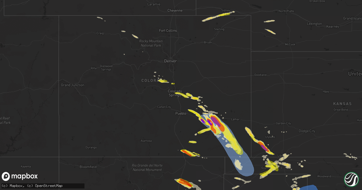
Hail Map on July 5, 2023
Get this storm
July 5 map
$229
one time, instant access
Download today. No call, no setup
Keep the $229
Bought the map and want the full workflow? Apply the entire $229 to a subscription within 7 days. None of it is wasted.
Every map, not just this one
This buys you this map. Subscription and you get every map we run, in the markets you choose from a few cities to whole states to nationwide. Plus real-time alerts the moment a storm fires.
Contact data
Name, contact info, occupancy, even credit band for addresses in the footprint. You go from where it hit to who to call.
Become the source they trust
Unlimited branding weather history reports on demand. You already have the documented answer ready for the property owner, and you are the one who showed up with it.
Property data and RoofTrace estimates
Pull up any address you have got, its value and the exact code rules for that jurisdiction, straight from One Click Code. Then RoofTrace estimates the squares, pitch, and roof value, priced the way you price.
States Impacted by Hail Map on July 5, 2023
Storm reports
Texas
| Date | Description |
|---|---|
| 07/05/20236:26 PM CDT | A local report indicates 1.00 inch wind near 6 NE Kellerville |
| 07/05/20236:20 PM CDT | A local report indicates 1.00 inch wind near 1 NNE Mclean |
| 07/05/20235:25 PM CDT | Measured by a west texas mesonet. |
| 07/05/20235:02 PM CDT | Storm chaser reported a few very large hail stones as he traveled south on highway 83. Hail appeared to be wrapping around the rear flank down downdraft of a supercell |
| 07/05/20234:10 PM CDT | A local report indicates 1.75 inch wind near 3 NE Miami |
| 07/05/20233:47 PM CDT | Measured by west texas mesonet. |
| 07/05/20233:45 PM CDT | Picture sent via social media. Location estimated by radar. |
| 07/05/20234:44 AM CDT | A local report indicates 60 MPH wind near 10 E Miami |
| 07/05/20234:29 AM CDT | A local report indicates 59 MPH wind near 2 ESE Pampa |
| 07/05/20233:15 AM CDT | A local report indicates 60 MPH wind near 3 ENE Perryton |
| 07/05/20233:12 AM CDT | A local report indicates 64 MPH wind near 6 E New Deal |
| 07/05/20232:04 AM CDT | A local report indicates 64 MPH wind near 6 E New Deal |
| 07/05/20231:47 AM CDT | A local report indicates 67 MPH wind near 3 WSW Aiken |
| 07/05/20231:35 AM CDT | A local report indicates 58 MPH wind near 1 S Plainview |
| 07/05/20231:28 AM CDT | A local report indicates 59 MPH wind near 1 S Plainview |
| 07/05/20231:08 AM CDT | A local report indicates 61 MPH wind near 6 S Olton |
| 07/05/20231:00 AM CDT | Potential wake low. Gusts in excess of 58 mph from 1:00am pm to 1:10 am with peak occurring at 1:00 am. |
| 07/05/202312:37 AM CDT | Corrects previous tstm wnd gst report from 3 se pantex. Potential wake low. Gusts in excess of 58 mph from 1237 am to 1248 am with peak occurring at 1241 am. |
| 07/05/202312:37 AM CDT | Potential wake low. Gusts in excess of 58 mph from 1237 pm to 1248 pm with peak occurring at 1241 pm. |
| 07/04/202311:56 PM CDT | Tree limb down near midwestern state university. |
| 07/04/202311:51 PM CDT | Sustained 56 mph. Severe wind gusts from 58 to 78 mph from 1150 pm through 1155 pm. Measured by the west texas mesonet. |
| 07/04/202311:50 PM CDT | Sustained 50 mph. Measured by the west texas mesonet. |
| 07/04/202311:18 PM CDT | A local report indicates 70 MPH wind near 11 WNW Bootleg |
| 07/04/20239:25 PM CDT | Hail mostly peas to marbles... But a few larger stones up to quarter size. |
| 07/04/20239:09 PM CDT | A local report indicates 67 MPH wind near 3 W Goodlett |
| 07/04/20238:59 PM CDT | A local report indicates 58 MPH wind near 3 W Goodlett |
| 07/04/20237:20 PM CDT | Snapped tree limbs and power pole down along highway 83. Chaser reported possible tornado. |
| 07/04/20237:10 PM CDT | Wind measured by west texas mesonet. Several large trees reported down near fm 1547. Large branches are blocking fm 3143. |
Tennessee
| Date | Description |
|---|---|
| 07/04/20237:11 PM CDT | Corrects previous non-tstm wnd gst report from 4 ne whitehaven. Asos station kmem memphis. |
| 07/04/20237:05 PM CDT | Power lines down on a house on joy lane near airways boulevard. Time is radar estimated. |
Oklahoma
| Date | Description |
|---|---|
| 07/05/20234:25 AM CDT | A local report indicates 59 MPH wind near 8 WSW Arnett |
| 07/05/20232:00 AM CDT | Spotter reports quarters in the ama nws chat. |
| 07/05/20231:55 AM CDT | A local report indicates 71 MPH wind near 3 SSE Boise City |
Alabama
| Date | Description |
|---|---|
| 07/05/20235:15 PM CDT | Several small and large hardwood branches broken. Maxwell afb weather observer noted a peak gust of 37 kts |
| 07/04/20237:18 PM CDT | A few trees were blown down in southside. One social media post shows a home sustained minor roof damage. |
New Mexico
| Date | Description |
|---|---|
| 07/05/20236:50 PM CDT | Along state route 39. Report via twitter. |
| 07/05/20236:50 PM CDT | A local report indicates 1.00 inch wind near 7 WSW Roy |
| 07/05/20236:13 PM CDT | A local report indicates 1.00 inch wind near Springer |
| 07/05/20236:12 PM CDT | Report from mping. |
| 07/05/20236:05 PM CDT | A local report indicates 1.75 inch wind near Springer |
| 07/04/20239:35 PM CDT | Asos station ktcc tucumcari muni airport. |
| 07/04/20239:31 PM CDT | Asos station ktcc tucumcari muni airport. |
| 07/04/20239:27 PM CDT | Mesonet station up364 tuc |
| 07/04/20239:27 PM CDT | Mesonet station up364 tucumcari 9 ne |
| 07/04/20237:15 PM CDT | Hail started at 550pm and continued through 630pm. Largest hail stones were occurring around 615pm. No significant damage noted. |
| 07/04/20237:14 PM CDT | Report from mping: golf ball |
Florida
| Date | Description |
|---|---|
| 07/05/20236:05 PM CDT | Mesonet station xtrm terminal channel. |
| 07/05/20233:16 PM CDT | A reported transformer has fallen and a small fire has been reported near burger king... Us hwy 331s. |
| 07/05/20233:15 PM CDT | A power line and trees have been reported to have fallen down across the road in the area of 940 south 2nd street cross street of bruce avenue and hill street. |
| 07/05/20233:15 PM CDT | Tree down in de funiak springs. |
| 07/05/20231:35 PM CDT | Report passed on from fdem of two planes flipped over at kissimmee gateway airport due to high wind gusts. Time estimated via radar. |
Wisconsin
| Date | Description |
|---|---|
| 07/05/20233:56 PM CDT | Large limbs down. Time estimated with radar. |
| 07/05/20232:53 PM CDT | Large tree snapped causing power outage. Time estimated with radar. |
| 07/05/20232:36 PM CDT | Delayed report. Damage to sheds... A porch which was under construction and trees near willow valley rd. |
| 07/05/20232:00 PM CDT | Whole tree about 15-20 inches in diameter down across the road. |
| 07/05/20232:00 PM CDT | Corrects previous tstm wnd dmg report from 1 ene milwaukee. Multiple reports of downed large limbs... Uprooted and snapped trees. Time estimated with radar. |
| 07/05/20232:00 PM CDT | One large tree snapped an another uprooted. Time estimated with radar. |
| 07/05/202312:50 PM CDT | Power lines knocked down east of stoughton. Via dane county 911. |
| 07/05/202312:33 PM CDT | Trees down on the east side of fitchburg. |
| 07/05/202312:30 PM CDT | Tree limbs down in fitchburg. Via dane county dispatch. |
| 07/05/202312:19 PM CDT | Power lines reported down in town of rockdale. |
| 07/05/202312:16 PM CDT | Large tree down in the area of e. Rockdale rd in the town of christiana. |
Illinois
| Date | Description |
|---|---|
| 07/05/20236:54 PM CDT | Private weather station kilparkf15 recorded a 64 mph wind gust near park forest. |
| 07/05/20235:47 PM CDT | Numerous trees and powerlines down throughout the city. |
| 07/05/20235:34 PM CDT | Private weather station kilauror58 recorded a 60mph gust near north aurora. |
| 07/05/20235:20 PM CDT | Report of straight-line winds heading southbound on i-57 with trees bending and a couple snapped. Size and health of the trees unknown. |
| 07/05/20234:25 PM CDT | Estimated 50-60 mph. |
| 07/05/20233:09 PM CDT | Downed power poles. |
| 07/05/20232:56 PM CDT | Large tree uprooted landing on a building. |
| 07/05/20232:54 PM CDT | Multiple tree branches downed in morton grove near frontage road and i-94. Relayed via wgn-tv. Time estimated by radar. |
| 07/05/20232:45 PM CDT | Numerous large trees and tree limbs down at white oaks golf course. |
| 07/05/20232:42 PM CDT | Photos from twitter report show heavy tree damage in lewistown some trees/branches on houses. |
| 07/05/20232:24 PM CDT | Large branches downed. |
| 07/05/20231:59 PM CDT | Tree limbs down near highway 20 and elizabeth scales mound road. Relayed by law enforcement. Time estimated by radar. |
| 07/04/20237:15 PM CDT | 15 inch diameter tree downed near 182nd street and violet road. Relayed via amateur radio. Time estimated by radar. |
| 07/04/20237:05 PM CDT | Large branch down blocking 101st and torrence. |
Kansas
| Date | Description |
|---|---|
| 07/04/202311:38 PM CDT | A local report indicates 1.00 inch wind near 7 SW Woods |
| 07/04/202310:20 PM CDT | Report made via social media. |
Colorado
| Date | Description |
|---|---|
| 07/05/20236:02 PM CDT | Report from mping: quarter |
| 07/05/20234:45 PM CDT | A local report indicates 1.00 inch wind near 2 ESE Monument |
| 07/05/20234:42 PM CDT | Relayed by broadcast media. |
| 07/05/20234:30 PM CDT | Report from mping: hen egg |
| 07/05/20234:22 PM CDT | Report from mping: half dollar |
| 07/05/20234:20 PM CDT | Report from mping: quarter |
| 07/05/20234:20 PM CDT | A local report indicates 1.00 inch wind near 1 N Trinidad |
| 07/05/20234:19 PM CDT | Report from mping: golf ball |
| 07/05/20231:02 AM CDT | Sustained 51 kt with gust to 71 kt. |
| 07/05/202312:56 AM CDT | Asos station kspd 8 s springfield. |
| 07/05/202312:37 AM CDT | A local report indicates 1.00 inch wind near 9 NW Springfield |
| 07/04/202311:05 PM CDT | Window on north side of house blown out with by wind and hail. |
| 07/04/202311:05 PM CDT | Updates previous tstm wnd dmg report from 1 w las animas. Multiple windows on north side of house blown out by wind and hail. |
| 07/04/202310:54 PM CDT | A local report indicates 3.00 inch wind near La Junta |
| 07/04/202310:42 PM CDT | Asos station klhx la junta airport. |
| 07/04/202310:37 PM CDT | Winds gusting over 60 mph. 0.85 inches of rain in 15 minutes. Hail and rain destroyed garden. |
| 07/04/202310:37 PM CDT | Heavy rain with minor flooding at this time. |
| 07/04/202310:30 PM CDT | Piing pong to 3 in hail reported. |
| 07/04/202310:05 PM CDT | Estimated winds to 50 mph. |
| 07/04/20237:58 PM CDT | Hail of 1.1 inch at 658 pm. |
| 07/04/20237:48 PM CDT | Report from mping: quarter |
| 07/04/20237:42 PM CDT | A local report indicates 1.00 inch wind near 2 NE Colorado Springs |
Kentucky
| Date | Description |
|---|---|
| 07/05/20235:47 PM CDT | Wind damage to several roofs in the area. |
| 07/05/20231:12 AM CDT | Large tree down on lost creek road near thomasville lane in perry county. Utility lines are down with it. Blocking entire roadway. Likely down due to thunderstorms in a |
Missouri
| Date | Description |
|---|---|
| 07/05/20234:30 PM CDT | Multiple trees down reports of power outages and a tree fell on a house. |
| 07/05/20233:35 PM CDT | Corrects time previous tstm wnd dmg report from poplar bluff. Multiple trees down... Reports of power outages and a tree fell on a house. |
Georgia
| Date | Description |
|---|---|
| 07/05/20236:58 PM CDT | Tree down at stagecoach rd and riverview dr in oglethorpe. |
Nebraska
| Date | Description |
|---|---|
| 07/04/202310:26 PM CDT | A local report indicates 1.00 inch wind near 7 SSE Sidney |
| 07/04/202310:17 PM CDT | Half dollar size hail. |
Maine
| Date | Description |
|---|---|
| 07/05/20234:21 PM CDT | Corrects previous tstm wnd dmg report from 2 s alexander. Large tree down on wires blocking the cooper road |
| 07/05/20234:21 PM CDT | Large tree down on wires blocking the cooper road. |
| 07/05/20233:50 PM CDT | A couple of trees down in marion township. Time estimated via radar. |
| 07/05/20233:22 PM CDT | Three trees blown down. |
| 07/05/20233:21 PM CDT | Several trees down with large tree down on wires blocking the cooper road |
Mississippi
| Date | Description |
|---|---|
| 07/05/20236:20 PM CDT | Report of tree downed across hwy 11 near moselle elementary. |
| 07/04/20238:30 PM CDT | Tree downed across hwy 80 from kalem. Time estimated based on radar. |
| 07/04/20237:06 PM CDT | Weakened cedar tree fell across southern oaks drive in clinton. Video from social media. |
Arkansas
| Date | Description |
|---|---|
| 07/05/20235:37 PM CDT | Trained spotter reports tree down on power lines on marr ln. |
| 07/05/20234:29 PM CDT | Newport asos measured 62 mph wind gust. |
| 07/05/20234:20 PM CDT | Corrects previous tstm wnd dmg report from piggott. Public reports video of large tree knocked down due to wind. Time is radar estimated. |
| 07/05/20234:15 PM CDT | Public reports video of large tree knocked down due to wind. Time is radar estimated. |
| 07/05/20233:35 PM CDT | Trees down in el dorado at college ave at 8th. Damaged a church sign. Also 1000 block of crestwood; tree on house. Fire department on scene. Power cut to house. |
| 07/05/20232:30 PM CDT | Several trees blown down south of mt. Ida. |
| 07/05/20231:20 PM CDT | A few trees blown down across mountain home. |
North Carolina
| Date | Description |
|---|---|
| 07/05/20233:33 PM CDT | Tree fallen on highway 50... Blocking the road. |
| 07/05/20233:15 PM CDT | Tree down blocking road. Time estimated from radar. |
| 07/05/20233:14 PM CDT | Trees down. Time estimated from radar. |
| 07/05/20233:09 PM CDT | Trees down. Time estimated from radar. |
| 07/05/20233:06 PM CDT | Tree fell and damaged roof of house west of rose hill. Time estimated from radar. |
| 07/05/20233:02 PM CDT | Weather spotter reported trees down. |
| 07/05/20231:34 PM CDT | Tree down at old stage rd and pete fish rd. |
| 07/05/20231:30 PM CDT | Several trees reported down in the area of nc hwy 42 s and fairview farm rd in asheboro. Time estimated by radar. |
Indiana
| Date | Description |
|---|---|
| 07/04/20238:43 PM CDT | Large tree down. Time estimated by radar. |
| 07/04/20238:39 PM CDT | Tree down on road. Time estimated. |
| 07/04/20238:38 PM CDT | Large tree down across road. Time estimated. |
| 07/04/20238:38 PM CDT | Numerous 3 to 5 inch tree limbs down. A couple entire trees toppled. Rot noted in the toppled trees though. Time estimated by radar. |
| 07/04/20238:37 PM CDT | Asos station ksbn south bend international ap. |
| 07/04/20238:30 PM CDT | Public report on twitter of a tree down on madison rd between redwood and pecan rd in north liberty... In. |
| 07/04/20238:30 PM CDT | Corrects time of previous tstm wnd dmg report from 4 sse crumstown. Large tree down in the road. Time estimated by radar. |
| 07/04/20238:30 PM CDT | Numerous trees and limbs down. Time estimated by radar. |
| 07/04/20238:00 PM CDT | Large tree down in the road. Time estimated by radar. |
Cities Impacted by Hail Map on July 5, 2023
- Madison, WI
- Oregon, WI
- Verona, WI
- Stoughton, WI
- Cambridge, WI
- Edgerton, WI
- Longs, SC
- Little River, SC
- Wade, NC
- Fayetteville, NC
- Columbus, WI
- Waterloo, WI
- Norfork, AR
- Chester, AR
- Sainte Genevieve, MO
- Lake Mills, WI
- Canadian, TX
- Miami, TX
- Trinidad, CO
- Newport, AR
- Amagon, AR
- Weiner, AR
- Cash, AR
- Trinchera, CO
- Briscoe, TX
- Springer, NM
- Gould, OK
- Hollis, OK
- Vinson, OK
- Palmer Lake, CO
- Monument, CO
- Colorado Springs, CO
- Sedalia, CO
- Lake George, CO
- Atkinson, IL
- Bradford, IL
- Toulon, IL
- Lowndes, MO
- Greenville, MO
- Paw Paw, IL
- Buffalo, IL
- Vossburg, MS
- Paulding, MS
- Sycamore, IL
- Wappapello, MO
- Lena, IL
- De Land, IL
- Staunton, IL
- Edinburg, IL
- Amorita, OK
- Bryant, IA
- Preston, IA
- Miles, IA
- Clinton, IA
- Glasford, IL
- Canton, IL
- Manito, IL
- Grand Bay, AL
- Burlington, IA
- Placida, FL
- Clare, IL
- Malta, IL
- Geneva, AL
- Westville, FL
- Dalton City, IL
- Mt Zion, IL
- Decatur, IL
- Macomb, IL
- Sheridan, IL
- Leland, IL
- Teutopolis, IL
- Jefferson, WI
- Emmet, AR
- Lithia, FL
- Pocahontas, AR
- Imboden, AR
- Black Rock, AR
- Black, AL
- Bonifay, FL
- French Village, MO
- Bloomsdale, MO
- Warm Springs, AR
- Couch, MO
- Midlothian, IL
- Alsip, IL
- Blue Island, IL
- Posen, IL
- Robbins, IL
- Orlando, FL
- Kissimmee, FL
- Cuba, IL
- Lewistown, IL
- Colchester, IL
- Tennessee, IL
- Plymouth, IL
- Huntington, AR
- Mansfield, AR
- Effingham, IL
- Goose Lake, IA
- Charlotte, IA
- De Witt, IA
- Jacksonville, NC
- Defuniak Springs, FL
- Meddybemps, ME
- Chicago, IL
- Bay Minette, AL
- New Athens, IL
- Red Bud, IL
- Sarasota, FL
- Dix, IL
- Davenport, FL
- Farmington, MO
- Roosevelt, OK
- Lone Wolf, OK
- Farmer City, IL
- Belgium, WI
- Higgins, TX
- Savanna, IL
- Saint Mary, MO
- Sebring, FL
- Lorida, FL
- Hudson, IL
- Lexington, IL
- Gridley, IL
- Random Lake, WI
- Fredonia, WI
- Hector, AR
- Jerusalem, AR
- Booneville, AR
- Prairie Du Rocher, IL
- Evansville, IL
- Witt, IL
- Irving, IL
- Nokomis, IL
- Maple Hill, NC
- Shreveport, LA
- Lincoln, IL
- Rose Hill, NC
- Magnolia, NC
- El Dorado, AR
- Vancleave, MS
- Tavares, FL
- Astatula, FL
- Mascoutah, IL
- Bowling Green, FL
- Pachuta, MS
- Dennysville, ME
- Pembroke, ME
- New Smyrna Beach, FL
- Osteen, FL
- Geneva, FL
- Arkadelphia, AR
- Sorento, IL
- New Douglas, IL
- Conway, SC
- Watertown, WI
- Reeseville, WI
- Mammoth Spring, AR
- Atkins, AR
- Hardtner, KS
- Roscoe, IL
- Caledonia, IL
- South Beloit, IL
- Milton, FL
- Baker, FL
- Fort Knox, KY
- Vine Grove, KY
- Wing, AL
- Saline, LA
- Goldonna, LA
- Hobart, OK
- Mount Sterling, IL
- Sheboygan Falls, WI
- Plymouth, WI
- Oswego, IL
- Montgomery, IL
- Aurora, IL
- Bristol, IL
- Zolfo Springs, FL
- Monroe, LA
- Smithville, AR
- Powhatan, AR
- Highland, IL
- Marine, IL
- Freeburg, IL
- Violet Hill, AR
- Brockwell, AR
- Franklin, AR
- Groveland, FL
- Mascotte, FL
- Baileyville, ME
- Greenbush, MI
- Oscoda, MI
- De Queen, AR
- Mechanicsburg, IL
- Mount Auburn, IL
- Whitewater, WI
- Fort Atkinson, WI
- Trenton, IL
- Lebanon, IL
- Summerfield, IL
- New Baden, IL
- Elgin, IL
- Dundee, IL
- Carpentersville, IL
- Cisco, IL
- Argenta, IL
- Clinton, IL
- Dewitt, IL
- Eglin Afb, FL
- Marshall, WI
- Holt, FL
- Crestview, FL
- Piggott, AR
- Wimauma, FL
- Riverview, FL
- Moweaqua, IL
- McCrory, AR
- Bailey, CO
- Shawnee, CO
- Hoxie, AR
- Alicia, AR
- Walnut Ridge, AR
- Maroa, IL
- Winnabow, NC
- Elizabeth, AR
- Geneva, IL
- Williford, AR
- Ipava, IL
- Smithfield, IL
- Table Grove, IL
- Vermont, IL
- Sabula, IA
- Spragueville, IA
- Teeds Grove, IA
- Hanover, IL
- Bellevue, IA
- Virginia Beach, VA
- Chesapeake, VA
- Walshville, IL
- Rochelle, IL
- Esmond, IL
- Kingston, IL
- Perryville, MO
- Alton, MO
- Arcadia, FL
- Leslie, AR
- Clinton, AR
- Alhambra, IL
- Mountain View, AR
- Marissa, IL
- Lenzburg, IL
- Baldwin, IL
- Sparta, IL
- Five Points, AL
- Strong, AR
- Mcfarland, WI
- Louin, MS
- Sedgewickville, MO
- Towanda, IL
- Taylorville, IL
- Owaneco, IL
- Linden, NC
- Port Byron, IL
- Witts Springs, AR
- Woodland Park, CO
- Amity, AR
- Mena, AR
- Viola, AR
- Rector, AR
- Brooklyn, WI
- Crete, IL
- Strawberry, AR
- Interlachen, FL
- Saint Matthews, SC
- Miami, NM
- Marshall, AR
- Big Clifty, KY
- Cerro Gordo, IL
- Monticello, IL
- Milmine, IL
- West Monroe, LA
- Mount Judea, AR
- Butler, GA
- Reynolds, GA
- Ideal, GA
- Oak Ridge, MO
- Friedheim, MO
- Daisy, MO
- Millersville, MO
- Washington, LA
- Hampshire, IL
- Burlington, OK
- Everton, AR
- Western Grove, AR
- Fults, IL
- Ruston, LA
- Simsboro, LA
- Elkhart Lake, WI
- Sheboygan, WI
- New Orleans, LA
- Mount Erie, IL
- Donnellson, IL
- Hillsboro, IL
- Panama, IL
- Hillsdale, IL
- Roseboro, NC
- Mason City, IL
- Liverpool, IL
- Ponce De Leon, FL
- Mountain Home, AR
- Gassville, AR
- Poplar Bluff, MO
- Vredenburgh, AL
- Franklin, AL
- Johnson Creek, WI
- Fredericktown, MO
- Kiowa, KS
- Mamou, LA
- Elburn, IL
- Sugar Grove, IL
- Sullivan, WI
- Helenville, WI
- Earlville, IL
- Mclean, TX
- Shamrock, TX
- Clarendon, TX
- Wellington, TX
- Quail, TX
- Wagon Mound, NM
- Roy, NM
- Solano, NM
- Conchas Dam, NM
- West Memphis, AR
- Memphis, TN
- Lake Cormorant, MS
- Walls, MS
- Horn Lake, MS
- Germantown, TN
- Cordova, TN
- Southaven, MS
- Collierville, TN
- Olive Branch, MS
- Proctor, AR
- Byhalia, MS
- Hernando, MS
- Nesbit, MS
- Marion, AR
- Erick, OK
- Calhan, CO
- Yoder, CO
- Model, CO
- Quanah, TX
- Mosquero, NM
- Boone, CO
- La Junta, CO
- Childress, TX
- Paducah, TX
- Mangum, OK
- Dodson, TX
- Tucumcari, NM
- Rush, CO
- Olney Springs, CO
- Peetz, CO
- Sidney, NE
- Grady, NM
- Mcalister, NM
- Adrian, TX
- Hereford, TX
- Richfield, KS
- Johnson, KS
- Rolla, KS
- Hugoton, KS
- Rocky Ford, CO
- Manzanola, CO
- Ordway, CO
- Las Animas, CO
- Goodwell, OK
- Gruver, TX
- Cheraw, CO
- Sugar City, CO
- Crowley, CO
- Swink, CO
- Texico, NM
- San Jon, NM
- Broadview, NM
- Bovina, TX
- Friona, TX
- Farwell, TX
- Wildorado, TX
- Amarillo, TX
- Canyon, TX
- Vega, TX
- Guymon, OK
- Hooker, OK
- Wichita Falls, TX
- Henrietta, TX
- Holliday, TX
- Iowa Park, TX
- Sheppard Afb, TX
- Scotland, TX
- Springfield, CO
- Kim, CO
- Pritchett, CO
- Dimmitt, TX
- Muleshoe, TX
- Summerfield, TX
- Earth, TX
- Happy, TX
- Dekalb, IL
- Wilmington, IL
- Pine, CO
- Two Dot, MT
- Eldorado, OK
- Oak Brook, IL
- Batavia, IL
- Riverdale, IL
- Calumet City, IL
- Palos Park, IL
- Downsville, LA
- South Holland, IL
- Chicago Heights, IL
- Lansing, IL
- Munster, IN
- Toponas, CO
- Louisville, MS
- Larkspur, CO
- Rupert, GA
- Kempton, IL
- Cabery, IL
- Cullom, IL
- Oak Forest, IL
- Orland Park, IL
- Palos Heights, IL
- Markham, IL
- Crestwood, IL
- Harvey, IL
- Brooksville, MS
- Portia, AR
- Rainbow City, AL
- Gadsden, AL
- Ohatchee, AL
- Nahunta, GA
- Country Club Hills, IL
- Mobeetie, TX
- Riverside, IL
- La Grange Park, IL
- La Grange, IL
- Hines, IL
- Broadview, IL
- Forest Park, IL
- Lyons, IL
- Brookfield, IL
- Maywood, IL
- Lambert, MS
- Marks, MS
- Barrington, IL
- Burbank, IL
- Moorhead, MS
- Indianola, MS
- Inverness, MS
- Texola, OK
- Pampa, TX
- Industry, IL
- Greenwell Springs, LA
- Baker, LA
- Baton Rouge, LA
- Dyer, IN
- Mills, NM
- Burlington, ME
- Dieterich, IL
- Hinsdale, IL
- Willowbrook, IL
- Western Springs, IL
- Cameron, SC
- Shiloh, NC
- Camden, NC
- Townsend, GA
- Mickleton, NJ
- Swedesboro, NJ
- Gibbstown, NJ
- Brunswick, GA
- Darien, GA
- Electra, TX
- Slater, CO
- Craig, CO
- Hattieville, AR
- Eau Claire, MI
- Dowagiac, MI
- Seminary, MS
- Sumrall, MS
- Hattiesburg, MS
- Rossville, TN
- Coahoma, MS
- Calico Rock, AR
- Scotland, AR
- Franktown, CO
- Castle Rock, CO
- Gladstone, NM
- Melbourne, AR
- Waycross, GA
- Homewood, IL
- Hazel Crest, IL
- Okeechobee, FL
- Shawboro, NC
- Itta Bena, MS
- Canton, MS
- Yemassee, SC
- Green Pond, SC
- Hazelton, KS
- Moselle, MS
- Walsh, CO
- Campo, CO
- Boise City, OK
- Manter, KS
- Panhandle, TX
- Claude, TX
- Nazareth, TX
- Hart, TX
- Amherst, TX
- Fieldton, TX
- Olton, TX
- Littlefield, TX
- Springlake, TX
- Plainview, TX
- Kress, TX
- Hale Center, TX
- Tulia, TX
- Wheeler, TX
- Lockney, TX
- Abernathy, TX
- Petersburg, TX
- Floydada, TX
- Hardesty, OK
- Stratford, TX
- Keyes, OK
- Dalhart, TX
- Texhoma, OK
- Durham, OK
- Crawford, OK
- Cheyenne, OK
- Reydon, OK
- Sweetwater, OK
- Elk City, OK
- Hammon, OK
- Sayre, OK
- Leedey, OK
- Arnett, OK
- Palisade, NE
- Wauneta, NE
- Enders, NE
- Hayes Center, NE
- Gate, OK
- Perryton, TX
- Hillside, IL
- Walden, CO
- Follett, TX
- Shattuck, OK
- Watson, OK
- Potterville, MI
- New Raymer, CO
- Booker, TX
- Plains, KS
- Sublette, KS
- Lodgepole, NE
- Broken Bow, OK
- Clovis, NM
- Okemah, OK
- Bethel, OK
- Holly, CO
- Turpin, OK
- Coalgate, OK
- Centrahoma, OK
- Haworth, OK
- Ada, OK
- Stonewall, OK
- Stoneham, CO
- Padroni, CO
- Atoka, OK
- Coleman, OK
- Laverne, OK
- Ulysses, KS
- Weleetka, OK
- Liberal, KS
- Kismet, KS
- Minter City, MS
- Tupelo, OK
- Allen, OK
- Bridgeport, NJ
- Arlington, CO
- Charleston, MS
- Philipp, MS
- Courtland, MS
- Batesville, MS
- Willow, OK
- Wallace, NE
- Elsie, NE
- Lyon, MS
- Tutwiler, MS
- Madrid, NE
- Pearl, MS
- Florence, MS
- Wapanucka, OK
- Macon, MS
- Denham Springs, LA
- Tyrone, OK
- Doddsville, MS
- Ruleville, MS
- Holcomb, MS
- Ogden, AR
- Ashdown, AR
- Rohwer, AR
- Paden, OK
- Depew, OK
- Hartley, TX
- Wickes, AR
- Prague, OK
- Stigler, OK
- Byers, TX
- South Boardman, MI
- Stroud, OK
- Sparks, OK
- Beaver, OK
- Howe, OK
- Gillham, AR
- Randlett, OK
- Chandler, OK
- Mccurtain, OK
- Waurika, OK
- Temple, OK
- Hastings, OK
- Walters, OK
- Vance, MS
- Eufaula, OK
- Crawfordsville, AR
- Balko, OK
- Granite, OK