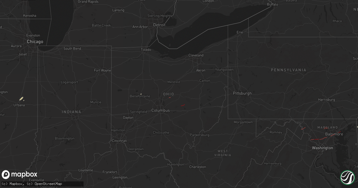
Hail Map in Ohio on June 5, 2024
Get this storm
June 5 map
$229
one time, instant access
Download today. No call, no setup
Keep the $229
Bought the map and want the full workflow? Apply the entire $229 to a subscription within 7 days. None of it is wasted.
Every map, not just this one
This buys you this map. Subscription and you get every map we run, in the markets you choose from a few cities to whole states to nationwide. Plus real-time alerts the moment a storm fires.
Contact data
Name, contact info, occupancy, even credit band for addresses in the footprint. You go from where it hit to who to call.
Become the source they trust
Unlimited branding weather history reports on demand. You already have the documented answer ready for the property owner, and you are the one who showed up with it.
Property data and RoofTrace estimates
Pull up any address you have got, its value and the exact code rules for that jurisdiction, straight from One Click Code. Then RoofTrace estimates the squares, pitch, and roof value, priced the way you price.
Storm reports in Ohio
Ohio
| Date | Description |
|---|---|
| 06/05/20242:35 PM CDT | Tree took down wires and a pole on 131st street. |
| 06/05/20241:25 PM CDT | Several powerlines downed. |
| 06/05/20241:25 PM CDT | Several powerlines downed. |
| 06/05/20241:15 PM CDT | Several powerlines downed. |
| 06/05/20241:15 PM CDT | Several powerlines downed. |
| 06/05/202412:44 AM CDT | Tree down on indian hill road. |
| 06/05/202412:30 AM CDT | Tree down on west state street. |
| 06/05/202412:12 AM CDT | A number of trees down. |
| 06/05/202412:06 AM CDT | A number of trees down across franklin township. |
| 06/04/202411:38 PM CDT | Multiple trees down. Damage to buildings. Possible injuries. |
| 06/04/202411:37 PM CDT | Storm survey team confirms a tornado in frazeysburg. Damage consistent with at least ef1 rating and could be higher pending further investigation. Survey remains on goi |
| 06/04/20249:56 PM CDT | Reports of many trees down in the area of claylick road southeast and lesley road southeast. |
| 06/04/20249:31 PM CDT | Report of large branches down. Other yard debris thrown around. |
| 06/04/20249:30 PM CDT | Large branches down along lancaster road sw. |
| 06/04/20247:59 PM CDT | Large tree down near sycamore road and ohio state route 661. |
| 06/04/20247:52 PM CDT | Damage to an outbuilding on possum st... Possible tornado. |
| 06/04/20247:44 PM CDT | Nws storm damage survey determined an ef0 tornado with estimated peak winds of 85 mph impacted the brandon area. Damage path length is about 3 miles and maximum path wi |
| 06/04/20247:02 PM CDT | Ef0 tornado confirmed via video and ema finding minor tree damage in the area. Estimated wind speed of 65 mph. |
All States Impacted by Hail Map on June 5, 2024
Cities Impacted by Hail Map on June 5, 2024
- Arlington, TX
- Grand Prairie, TX
- Mansfield, TX
- Midlothian, TX
- Cedar Hill, TX
- Whitney, TX
- Aquilla, TX
- Valley Mills, TX
- West, TX
- Waco, TX
- Clifton, TX
- Rantoul, IL
- China Spring, TX
- Thomasboro, IL
- Gifford, IL
- Woodway, TX
- Crawford, TX
- Oglesby, TX
- McGregor, TX
- Moody, TX
- Hewitt, TX
- Galveston, TX
- Champaign, IL
- Saint Joseph, IL
- New Durham, NH
- Live Oak, FL
- Bridgton, ME
- Denmark, ME
- Port Lavaca, TX
- Jasper, FL
- Victoria, TX
- Harrison, ME
- Naples, ME
- Jennings, FL
- Ventress, LA
- Wabasha, MN
- Alma, WI
- Kellogg, MN
- Altura, MN
- Cochrane, WI
- Arcadia, WI
- Gorham, ME
- Standish, ME
- Buxton, ME
- Eldorado, TX
- Sonora, TX
- Casco, ME
- Gray, ME
- Oxford, ME
- Portsmouth, NH
- Durham, NH
- Greenland, NH
- Windham, ME
- New Gloucester, ME
- Raymond, ME
- Howland, ME
- Dover, NH
- Madbury, NH
- Exeter, ME
- Corinth, ME
- Charleston, ME
- Garland, ME
- Lagrange, ME
- Minden City, MI
- Dover Foxcroft, ME
- Leesburg, VA
- Paeonian Springs, VA
- Old Town, ME
- Hope, ME
- Springfield, ME
- Orangeburg, SC
- Saint Matthews, SC
- Searsmont, ME
- Lincolnville, ME
- Milford, ME
- Greenbush, ME
- Poolesville, MD
- Boyds, MD
- Newmarket, NH
- Germantown, MD
- Eliot, ME
- Hudson, ME
- Gaithersburg, MD
- Orono, ME
- Wagener, SC
- Derwood, MD
- Tremont, MS
- Hamilton, AL
- Olney, MD
- Stratham, NH
- Hilliard, FL
- Sykesville, MD
- Finksburg, MD
- Reisterstown, MD
- Ozona, TX
- Gainesville, FL
- Sandy Spring, MD
- Ashton, MD
- Highland, MD
- Fulton, MD
- Clarksville, MD
- Columbia, MD
- Hodges, AL
- Spruce Pine, AL
- McCamey, TX
- Brookston, MN
- Centerburg, OH
- Micanopy, FL
- Reddick, FL
- Baltimore, MD
- Halethorpe, MD
- Dickerson, MD
- Cottondale, AL
- Middle River, MD
- Bellefontaine, OH
- Essex, MD
- Summerfield, FL
- Leesville, SC
- Batesburg, SC
- Calumet, MI
- Hancock, MI
- Roscommon, MI
- Mohawk, MI
- Del Rio, TX
- Upperco, MD
- Pikesville, MD
- Owings Mills, MD
- Glyndon, MD
- Stevenson, MD
- Westminster, MD
- Taneytown, MD
- Northport, AL
- Sweet Water, AL
- Bunker Hill, WV
- Inwood, WV
- Newbern, AL
- Faunsdale, AL
- Rocksprings, TX
- Shepherdstown, WV
- Middletown, DE
- Sharpsburg, MD
- Keedysville, MD
- Boonsboro, MD
- Rock, MI
- Ellabell, GA
- Bloomingdale, GA
- Nashport, OH
- Frazeysburg, OH
- Saint Francisville, LA
- Claude, TX
- Amarillo, TX
- Canyon, TX
- Wayside, TX
- Happy, TX
- Winfield, AL
- Eldridge, AL
- Carbon Hill, AL
- Nauvoo, AL
- Madison, AL
- Harvest, AL
- Huntsville, AL


