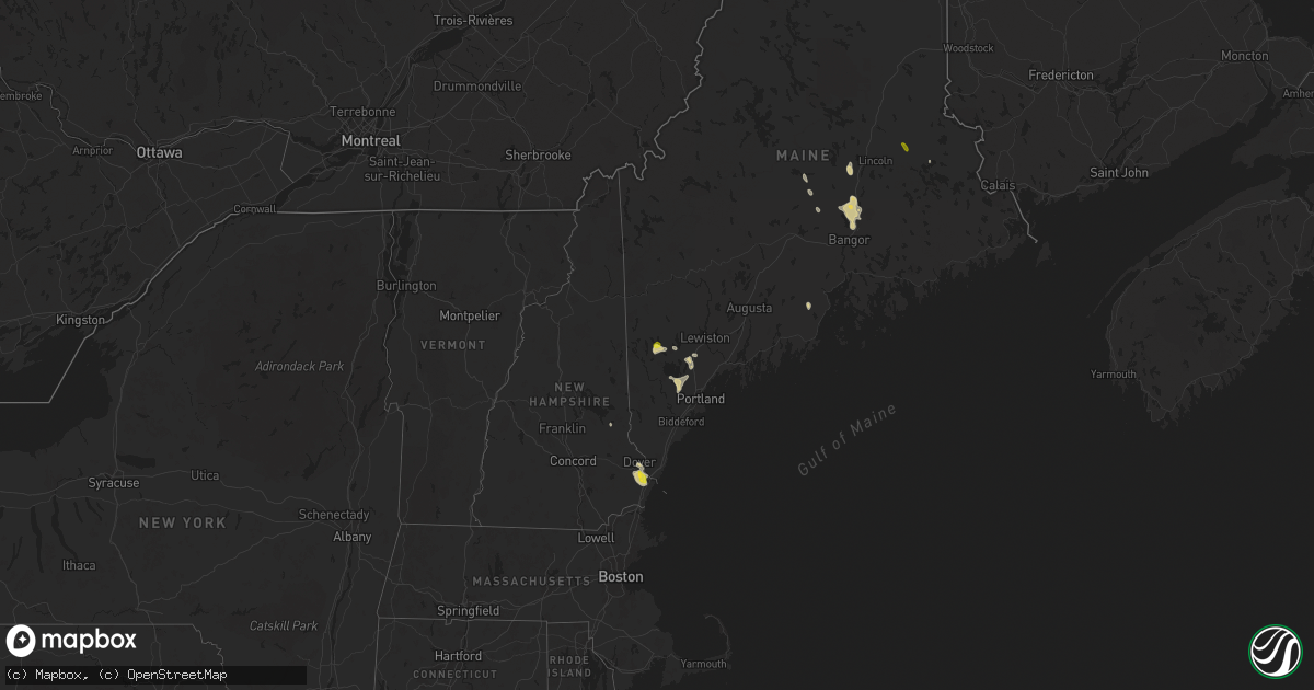
Hail Map on June 5, 2024
Get this storm
June 5 map
$229
one time, instant access
Download today. No call, no setup
Keep the $229
Bought the map and want the full workflow? Apply the entire $229 to a subscription within 7 days. None of it is wasted.
Every map, not just this one
This buys you this map. Subscription and you get every map we run, in the markets you choose from a few cities to whole states to nationwide. Plus real-time alerts the moment a storm fires.
Contact data
Name, contact info, occupancy, even credit band for addresses in the footprint. You go from where it hit to who to call.
Become the source they trust
Unlimited branding weather history reports on demand. You already have the documented answer ready for the property owner, and you are the one who showed up with it.
Property data and RoofTrace estimates
Pull up any address you have got, its value and the exact code rules for that jurisdiction, straight from One Click Code. Then RoofTrace estimates the squares, pitch, and roof value, priced the way you price.
States Impacted by Hail Map on June 5, 2024
Storm reports
Florida
| Date | Description |
|---|---|
| 06/05/20244:05 PM CDT | Delayed report of powerlines down from thunderstorm winds... Time estimated from radar. |
| 06/04/20247:58 PM CDT | Reports and video of multiple fences blown over and damage to pool cages just to the south of the lakeland airport. |
Delaware
| Date | Description |
|---|---|
| 06/04/20247:59 PM CDT | Small trees down at walker school road and fleming landing road/de 9. |
Maryland
| Date | Description |
|---|---|
| 06/05/20246:42 PM CDT | Public sent images of brief tornado on the ground just east of the carroll county regional airport. Time estimated from radar. |
| 06/05/20246:42 PM CDT | Numerous reports of homes damaged... Wires and trees down as well as collapsed structures in and around the city of gaithersburg. |
| 06/05/20246:39 PM CDT | *** 5 inj *** tree into house on dogwood drive with multiple injuries reported. |
| 06/05/20246:29 PM CDT | Tree damage was observed just west of the seneca water resource recovery facility as a result of a tornado. |
| 06/05/20246:29 PM CDT | Significant damage to the seneca water resource recovery facility as a result of a tornado. |
| 06/05/20246:23 PM CDT | Multiple trees down along the 16000 block of germantown road |
| 06/05/20246:15 PM CDT | Trained spotter located at the junction of rt. 28 and rt. 117 in maryland reported a tornado on the ground about 3 miles west of their location. |
| 06/05/20246:11 PM CDT | Local spotter confirmed tornado lofting debris into the air. |
| 06/05/20244:42 PM CDT | Trained spotter video shows a tornado over an open field between 5:42 and 5:45 pm just south of boonsboro. |
| 06/04/20249:32 PM CDT | Tree down near 800 block of rock run rd |
| 06/04/20249:24 PM CDT | Tree down near the 200 block of rowlandsville rd |
| 06/04/20249:24 PM CDT | Tree down near rock springs rd and conowingo rd |
| 06/04/20248:28 PM CDT | Tree down near hawley rd and principio rd. |
| 06/04/20248:21 PM CDT | Tree down along the curve of sumpter dr. |
| 06/04/20248:19 PM CDT | Numerous homes damaged and trees down in the middle river area. |
| 06/04/20247:57 PM CDT | Tornadic circulation evident on multiple radars. Damage reported to homes on cowhide circle i |
| 06/04/20247:57 PM CDT | Tornadic circulation evident on multiple radars. Damage reported to homes on cowhide circle in this enhanced vrot signature |
| 06/04/20247:56 PM CDT | Tree down near s monroe st and washington blvd. |
| 06/04/20247:45 PM CDT | Spotter report and video of tornado crossing i-95 near i-195 in arbutus. Numerous trees and power lines down in the area. |
| 06/04/20247:26 PM CDT | Several videos of tornado on the ground in columbia. |
| 06/04/20247:26 PM CDT | Several videos of tornado on the ground in columbia. Numerous trees and powerlines down near the intersection of tamar drive and high tor hill in columbia. |
| 06/04/20247:07 PM CDT | Drone video sent of tornado on the ground east of brookesville... Md. |
| 06/04/20247:07 PM CDT | At least two trees on houses in the gamber and eldersburg areas. |
| 06/04/20247:00 PM CDT | Cecil county em reported tornado damage in the gamber area. Approximately 8 structure were damaged. Parts of cherry tree lane and bartholow road remain closed due to do |
Alabama
| Date | Description |
|---|---|
| 06/05/20246:57 PM CDT | Numerous trees and power lines down in winfield. Some trees on homes. |
| 06/05/20246:53 PM CDT | A home was damaged along atkinson rd. |
| 06/05/20246:52 PM CDT | An ef1 tornado was confirmed by nws birmingham in far northwest fayette county. This tornado moved northeast into marion county impacting the winfield community. |
| 06/05/20246:50 PM CDT | A few trees were down in the linden area. |
| 06/05/20246:46 PM CDT | An ef1 tornado was confirmed by nws memphis in itawamba county... Ms... Which continued into marion county... Al. The tornado dissipated before crossing i-22. |
| 06/05/20246:46 PM CDT | Corrects previous tstm wnd dmg report from 2 wnw bexar. Tree down in the bexar community. Location and time estimated by radar. |
| 06/05/20246:39 PM CDT | Social media report of trees blocking county road 24 in perry county. |
| 06/05/20246:15 PM CDT | Multiple trees down in southwestern sumter county. |
| 06/05/20247:49 AM CDT | A tree was knocked down at 8745 frankfort road. Time estimated by radar. |
| 06/04/20249:39 PM CDT | Tree down at cr 33 and cr 245. |
| 06/04/20249:29 PM CDT | Tree down in the crow mountain area. |
| 06/04/20249:29 PM CDT | Corrects previous tstm wnd dmg report from 5 ene skyline. Tree down in the crow mountain area. |
| 06/04/20249:27 PM CDT | Tree down near the 1600 block on cr 162. |
| 06/04/20249:23 PM CDT | Corrects previous tstm wnd dmg report from 2 s hollywood. Tree down at ruby johnson drive at cr 33 in hollywood. |
| 06/04/20249:23 PM CDT | Tree down at ruby johnson drive at cr 33 in hollywood. |
| 06/04/20249:20 PM CDT | Trees down a |
| 06/04/20249:20 PM CDT | Trees down and power outages in scottsboro... Section... And macedonia. |
| 06/04/20249:00 PM CDT | A tree was knocked down in nixon chapel area. |
| 06/04/20248:55 PM CDT | A social media post indicated a photo of a helicopter overturned at 608 white oak road. Time estimated by nearby k8a0 awos wind gust. |
| 06/04/20248:46 PM CDT | At county line road at u.s. Highway 72. |
| 06/04/20248:20 PM CDT | Trees across the road at cr 605 at cr 91. Time estimated by radar. |
| 06/04/20248:13 PM CDT | Tree and transformer damage at curry street at highway 31 sw. Tree on a car on puckett street sw. A tree and power lines down on sparkman street nw. Time estimated by r |
| 06/04/20248:12 PM CDT | A tree and power lines were knocked down on rocky ford road in hartselle. |
| 06/04/20248:12 PM CDT | A tree was knocked down in hartselle. Location unspecified. Time estimated by radar. |
| 06/04/20248:12 PM CDT | A tree limb was blocking the road at tunsel road sw at rustic lane in hartselle. |
| 06/04/20248:12 PM CDT | A tree down on a patio and possibly a house on cherokee lane nw in hartselle. Time esimated by radar. |
| 06/04/20248:00 PM CDT | Trees were knocked down at 333 virginia avenue. |
| 06/04/20248:00 PM CDT | Trees were knocked down at the intersection of highway 20 at beverly avenue. Time estimated by radar. |
| 06/04/20247:56 PM CDT | A power pole was down at 530 south blackwell road in sheffield. Time estimated by radar. |
| 06/04/20247:56 PM CDT | Reports of downed trees south of jasper. |
| 06/04/20247:49 PM CDT | Corrects previous tstm wnd dmg report from 6 ssw tuscumbia. A tree was knocked down at 8745 frankfort road. Time estimated by radar. |
| 06/04/20247:47 PM CDT | A tree was knocked down at 2900 smallwood mountain road. Time estimated by radar. |
| 06/04/20247:39 PM CDT | A tree was knocked down on wagon mountain road at frankfort road. Time estimated by radar. |
| 06/04/20247:37 PM CDT | A tree was down on the road at lime rock road and little egypt road. Time estimated by radar. |
| 06/04/20247:32 PM CDT | Trees down on county road 2. |
| 06/04/20247:29 PM CDT | A tree was knocked down at the intersection of moody lane and 6th street. Time estimated by radar. |
| 06/04/20247:28 PM CDT | Trees down on albert turner sr memorial hwy and hwy 183. |
| 06/04/20247:27 PM CDT | Trees down on highway 187 in belgreen. |
| 06/04/20247:24 PM CDT | Trees across south sandy rd near hwy 82. |
| 06/04/20247:24 PM CDT | Several trees down in the samantha area. |
| 06/04/20247:19 PM CDT | Storm spotter measured 61 mph wind gust. |
| 06/04/20247:18 PM CDT | Tree on home on entrekin road. |
| 06/04/20247:15 PM CDT | Several trees down in the coker area. |
| 06/04/20247:14 PM CDT | Roof damage to two chicken houses on cr 16. |
| 06/04/20247:10 PM CDT | Numerous trees down in jefferson county... Including the concord... Maytown... Adamsville... Forestdale... Fultondale... Mt. Olive... And morris. |
| 06/04/20247:07 PM CDT | Several trees down in the brookwood area. |
| 06/04/20247:05 PM CDT | A few trees down on power lines in greensboro... Newbern... And moundville. |
Michigan
| Date | Description |
|---|---|
| 06/05/20245:15 PM CDT | Report of a tree down. On atlantic street west of birch street. Public report relayed by a local broadcasting partner. |
| 06/05/20245:15 PM CDT | Media reports a whole tree is down in west hancock that has fallen partially onto minnesota street. Report relayed by wluctv6. |
| 06/05/20245:15 PM CDT | Large diameter maple branch snapped in hancock. Report via social media. |
| 06/05/20244:15 PM CDT | Law enforcement dispatch reports a tree is down in bessemer. Time estimated via kmqt radar. |
| 06/05/20244:15 PM CDT | L |
| 06/05/20244:10 PM CDT | Law enforcement dispatch reported three trees snapped in north ironwood. Time estimated via kmqt radar. |
| 06/05/20244:10 PM CDT | Nws student volunteer in ironwood reported a large diameter maple tree of one foot diameter snapped in ironwood. Time is estimated via kmqt radar. |
| 06/05/20244:10 PM CDT | Law enforcement dispatch reports a tree snapped and is lying on a rooftop in the city of ironwood. Time estimated via kmqt radar. |
| 06/05/20243:47 PM CDT | 911 dispatch reports multiple trees and power lines down across the county. |
| 06/05/20243:33 PM CDT | Report of multiple trees down across carsonville. |
| 06/05/20243:27 PM CDT | Estimated 8 inch tree limb downed. |
| 06/05/20243:00 PM CDT | One foot diameter tree limb downed. |
| 06/05/20242:53 PM CDT | Estimated 10 inch tree limb snapped. |
| 06/05/20242:53 PM CDT | Estimated 5 inch tree limb snapped. |
| 06/05/20242:39 PM CDT | Multiple pictures posted on social media of gas station awning collapsed onto cars. |
| 06/05/20242:30 PM CDT | The livonia emergency manager reported extensive tree damage extending from lyndon to norman st to six mile and merriman rd. |
| 06/05/20241:58 PM CDT | *** 2 inj *** a tree landed onto two trucks located on south duck lake road... Injuring two men who were taken to the hospital. |
| 06/05/202412:19 PM CDT | Per storm survey: ef-0 tornado hit forest dunes golf club in southeast crawford county. Tornado on ground for 0.3 mile/1 minute with 90 yard path width. Estimated max w |
| 06/05/202412:19 PM CDT | Corrects previous non-tstm wnd dmg report from 7 nne roscommon. Probable tornado. Numerous downed trees at the forest dunes golf club. Pending storm survey. |
Tennessee
| Date | Description |
|---|---|
| 06/04/20249:52 PM CDT | Tree down across road. |
| 06/04/20249:50 PM CDT | Tree down across road. |
| 06/04/20249:48 PM CDT | Tree down across road. |
| 06/04/20249:48 PM CDT | Tree down across road. |
| 06/04/20249:44 PM CDT | Tree down across road. |
| 06/04/20249:38 PM CDT | Tree down across road. |
| 06/04/20249:38 PM CDT | 181 customers without power. |
| 06/04/20249:23 PM CDT | Power lines were hanging low due to strong winds at the intersection of lincoln road and smith mill road. Time estimated by radar. |
| 06/04/20249:23 PM CDT | A tree was knocked down blocking both lanes of the road at 107 wells hill road. Time estimated by radar. |
Minnesota
| Date | Description |
|---|---|
| 06/05/20246:35 PM CDT | Awos station ksyn stanton ap. |
| 06/05/20246:35 PM CDT | Awos station ksyn st |
| 06/05/20246:25 PM CDT | Large tree down on powerlines. Reported via x. |
| 06/05/20246:15 PM CDT | Mn dot observation on i-94. |
| 06/05/20245:20 PM CDT | Tree on powerline. Winds made it feel like their car was going to be blown off the road. |
| 06/05/20245:10 PM CDT | A photo of a tree fallen down over a fence in the north side of cloquet area was shared via facebook. The tree was large enough to cause damage to the fence upon fallin |
| 06/05/20245:04 PM CDT | Report from mping: trees uprooted or snapped. |
| 06/05/20244:54 PM CDT | A local report indicates 62 MPH wind near Park Rapids |
| 06/05/20244:54 PM CDT | Picture via social media. Several trees downed on the pokegama golf course. Time estimated from report and radar. |
| 06/05/20243:45 PM CDT | Broke tree branches 4 to 6 inches in diamter... Along with an old spruce. |
| 06/05/20242:57 PM CDT | Picture via social media of a large pine tree fallen across 5th avenue in virginia. Time estimated from radar. |
| 06/05/20242:20 PM CDT | Mesonet station mn069 u.s.61 - kellogg - mp 53. |
Virginia
| Date | Description |
|---|---|
| 06/05/20245:42 PM CDT | Trees down near garriland dr and frostleaf ln coincident with tornadic debris signature. |
| 06/05/20244:55 PM CDT | Power lines blown down causing a fire. |
West Virginia
| Date | Description |
|---|---|
| 06/05/20243:58 PM CDT | Tornadic signature on radar from circulation crossing potomac farms drive & comegy drive. Multiple trees down with road closed. |
| 06/05/20243:57 PM CDT | Tornadic signature on radar from circulation crossing kearneysville pike & shveda way. Multiple trees down with road closed. |
| 06/05/20243:32 PM CDT | Tree down near the intersection of charles town road and short road |
| 06/05/20243:27 PM CDT | Video sent of tornado on the ground... Likely near route 9 and short road near the berkeley/jefferson county line. |
| 06/05/20243:25 PM CDT | Tree down near the intersection of short road and opequon lane |
| 06/05/20243:04 PM CDT | Numerous trees down along emery lane in inwood. |
Texas
| Date | Description |
|---|---|
| 06/05/20244:20 PM CDT | Corrects previous hail report from 6 n sonora. To golf ball instead of ping pong. |
| 06/05/20249:30 AM CDT | A member of the public shared photos of trees damaged along north main street in dayton. |
| 06/04/20247:00 PM CDT | A cocorahs observer reported quarter size hail. Time was estimated from radar. |
New Hampshire
| Date | Description |
|---|---|
| 06/05/20244:10 PM CDT | Corrects previous tstm wnd dmg report from 2 w newfields. Tree and wires down on halls mill road in newfields. |
| 06/05/20244:10 PM CDT | Tree and wires down on halls mill road in newfields. |
| 06/05/20244:00 PM CDT | Several trees and wires down on stratham lane at dearborn road in greenland. |
| 06/05/20243:55 PM CDT | Two trees down blocking willobrook avenue in stratham. |
| 06/05/20243:55 PM CDT | Corrects previous tstm wnd dmg report from 2 wsw greenland. Two trees down blocking willobrook avenue in stratham. |
| 06/05/20243:45 PM CDT | Corrects previous hail report from 1 nne newington. Measured 1-inch hail fell for 5 mins in the newington area. |
| 06/05/20243:45 PM CDT | Measured 1-inch hail fell for 5 mins in the newington area. |
Mississippi
| Date | Description |
|---|---|
| 06/05/20246:43 PM CDT | Trees reported down along pate road in itawamba county. Radar estimated time. Possible tornado. |
| 06/05/20246:26 PM CDT | Tree and large limbs down blocking roadway. |
| 06/05/20246:04 PM CDT | A pine tree was blown down across cuba road. |
| 06/05/20245:58 PM CDT | Corrects previous tstm wnd dmg report from 2 s lauderdale. A big tree was blown down in the dalewood area... And an outdoor umbrella was lofted and broke the window on |
| 06/05/20245:58 PM CDT | An outdoor umbrella was lofted and broke the window on a home in the dalewood area. Report with picture relayed via facebook. |
| 06/05/20245:58 PM CDT | A tree fell onto a car on azalea drive. |
| 06/05/20245:55 PM CDT | A tree was downed onto powerlines near concord drive and highway 69. Other scattered trees were downed across the county. |
| 06/05/20245:53 PM CDT | Trees were blown down in the vicinity of rabbit road and will butchee road. Report relayed via facebook. |
| 06/05/20245:53 PM CDT | A tree fell onto power lines along causeyville whynot road. Report relayed via facebook. |
| 06/05/20245:50 PM CDT | A few trees were blown down on us highway 45 near marion. |
| 06/05/20245:48 PM CDT | Clarke county ema reported several trees down across the county. |
| 06/05/20245:45 PM CDT | A social media report of a tree down completely blocking highway 39 between daleville and dekalb was relayed. |
| 06/05/20245:41 PM CDT | A tree was blown down near the intersection of 14th street and 46th avenue. Report relayed via facebook. |
| 06/05/20245:40 PM CDT | A large tree was snapped at the fellowship cemetery on fellowship road. Report and picture relayed via facebook. |
| 06/05/20245:40 PM CDT | A social media report of several trees down and a blown transformer was relayed. |
| 06/05/20245:36 PM CDT | Corrects previous tstm wnd dmg report from philadelphia. Neshoba county eoc reported trees down on a home. Other trees were broken or uprooted in the area as well. |
| 06/05/20245:36 PM CDT | Neshoba county eoc reported trees down on a home. |
| 06/05/20245:33 PM CDT | A few trees were blown down at clarkco state park. Report relayed via facebook. |
| 06/05/20245:30 PM CDT | About one quarter of the roof tin was peeled back off freeman tractor along ms highway 494. |
| 06/05/20245:30 PM CDT | Clarke county ema reported trees down on a home and power lines. |
| 06/05/20245:30 PM CDT | A tree was blown down onto power lines in quitman. Report relayed via facebook. |
| 06/05/20245:26 PM CDT | A tree was blown down on stuckeys bridge road near concord umc. |
| 06/05/20245:24 PM CDT | Clarke county ema reported trees down on a home and power lines. |
| 06/05/20245:24 PM CDT | A tree fell onto and damaged a home in little rock. |
| 06/05/20245:18 PM CDT | Jasper county ema reported several trees down. |
| 06/05/20245:15 PM CDT | Winston county ema reported a tree down. |
| 06/05/20245:14 PM CDT | Jasper county ema reported several trees down. |
| 06/05/20245:13 PM CDT | Large tree branches were blown down in hickory. |
| 06/05/20245:06 PM CDT | A large tree was blown down in sandtown. Report with picture relayed via facebook. |
| 06/05/20245:05 PM CDT | A tree was blown down along county road 218... And some tin was blown off a parking canopy. |
| 06/05/20245:04 PM CDT | A tree was blown down in newton. |
| 06/05/20245:00 PM CDT | Jasper county ema reported several trees down. |
| 06/05/20245:00 PM CDT | Jasper county ema reported several trees down and a large limb down on a power line. |
| 06/05/20244:57 PM CDT | Corrects previous tstm wnd dmg report from sandersville. A tree fell across us highway 11 just south of its intersection with poplar street... And multiple other large |
| 06/05/20244:57 PM CDT | Report from mping of wind damage similar to trees uprooted or snapped or a roof blown off. |
| 06/05/20244:57 PM CDT | Corrects previous tstm wnd dmg report from sandersville. A tree fell across us highway 111 just south of its intersection with poplar street... And other branches were |
| 06/05/20244:56 PM CDT | Jones eoc reported numerous trees and power lines down... Including several trees on homes. A roof was blown off of a home. |
| 06/05/20244:40 PM CDT | Jones county eoc reported several trees down... Including trees blocking the east bound lane of highway 84. |
| 06/05/20244:25 PM CDT | Report from mping of wind damage similar to trees uprooted or snapped or a roof blown off. |
| 06/04/20247:43 PM CDT | Neshoba county eoc reported numerous trees down across southern portions of the county. |
Maine
| Date | Description |
|---|---|
| 06/05/20245:57 PM CDT | Delayed report. Social media picture showed half dollar sized hail. |
| 06/05/20245:57 PM CDT | Corrects previous tstm wnd dmg report from lee. Trees and wires down in lee reported from penobscot rcc. Time based on radar. |
| 06/05/20245:53 PM CDT | Corrects previous hail report from 4 n springfield. This was on the west tucker ridge road. |
| 06/05/20245:53 PM CDT | Corrects previous hail report from 5 se kingman. |
| 06/05/20245:40 PM CDT | A local report indicates 1.75 inch wind near 5 SE Kingman |
| 06/05/20245:32 PM CDT | Corrects previous hail report from mattawamkeag for the correct time. Delayed report. Social media picture shows quarter to ping pong ball hail covering the grass. |
| 06/05/20245:19 PM CDT | Trees and wires down in lee reported from penobscot rcc. |
| 06/05/20244:32 PM CDT | Delayed report. Social media picture shows quarter to ping pong ball hail covering the grass. |
| 06/05/20244:13 PM CDT | Delayed report. Tree down on powerlines on oak grove road. |
| 06/05/20244:13 PM CDT | Delayed report. Tree down onto a house on maple street. No injuries. Time estimated by radar. |
| 06/05/20244:12 PM CDT | Tree across hudson road. |
| 06/05/20244:09 PM CDT | Tree down on wires on forest ave. |
| 06/05/20244:08 PM CDT | Tree down on lakeside landing road. |
| 06/05/20244:07 PM CDT | Tree and wires down on a car on poplar street. |
| 06/05/20244:05 PM CDT | Delayed report. Tree down on powerlines on frenchs point road. |
| 06/05/20244:03 PM CDT | Two or three trees down on power lines on shore road south. Location reported as on the dover foxcroft/sebec line. |
| 06/05/20244:01 PM CDT | Delayed report. Multiple trees down on a house on sandy beach shore road. Time estimated by radar. |
| 06/05/20244:00 PM CDT | Delayed report. Tree down partially blocking bennoch road. |
| 06/05/20243:55 PM CDT | Delayed report. Tree down blocking ridge road. |
| 06/05/20243:52 PM CDT | Delayed report... Social media picture from charleston fire dept shows numerous trees down on ridge road. |
| 06/05/20243:46 PM CDT | Delayed report. Multiple trees down on powerlines. Power is out in the area. |
| 06/05/20241:51 PM CDT | Cumberland county dispatch reported a couple trees on wires in windham and gray. No road closures were reported. Time estimated by radar. |
| 06/05/20241:51 PM CDT | Corrects previous tstm wnd dmg report from 1 e north windham. Cumberland county dispatch reported a couple trees on wires in windham and gray. No road closures were rep |
| 06/05/20241:36 PM CDT | Dispatch reports trees and wires down on us-302. 1 foot of water was also reported on the road. Time estimated by report time. |
| 06/05/20241:16 PM CDT | Corrects previous hail report from 1 e bridgton. Spotter reported a hailstone roughly the size of a quarter. Numerous reports of pea and dime size hail was also reporte |
| 06/05/20241:16 PM CDT | Spotter reported a hailstone roughly the size of a quarter. Numerous reports of pea and dime size hail was also reported. Time estimated by radar. |
Indiana
| Date | Description |
|---|---|
| 06/05/202412:26 PM CDT | Tree and powerlines downed. Size and condition of tree unknown. |
| 06/05/202412:26 PM CDT | Tree and powerlines downed. Size and condition of tree unknown. |
| 06/05/202412:25 PM CDT | Tree downed. Size and condition unknown. |
| 06/05/202412:25 PM CDT | Tree downed. Size and condition unknown. |
Georgia
| Date | Description |
|---|---|
| 06/05/20243:53 PM CDT | Effingham county emergency management reported that a tree fell on a house on standard lane. |
| 06/05/20243:53 PM CDT | Effingham county emergency management reported a 6 inch diameter pine tree down on the 500 block of old tusculum road. |
| 06/05/20243:50 PM CDT | Effingham county emergency management reported a tree down on power lines at the 900 block of old tusculum road. |
| 06/05/20243:33 PM CDT | Effingham county emergency management reported an 8 inch diameter pine tree down at the intersection of midland road and olde manor lane. |
Ohio
| Date | Description |
|---|---|
| 06/05/20242:35 PM CDT | Tree took down wires and a pole on 131st street. |
| 06/05/20241:25 PM CDT | Several powerlines downed. |
| 06/05/20241:25 PM CDT | Several powerlines downed. |
| 06/05/20241:15 PM CDT | Several powerlines downed. |
| 06/05/20241:15 PM CDT | Several powerlines downed. |
| 06/05/202412:44 AM CDT | Tree down on indian hill road. |
| 06/05/202412:30 AM CDT | Tree down on west state street. |
| 06/05/202412:12 AM CDT | A number of trees down. |
| 06/05/202412:06 AM CDT | A number of trees down across franklin township. |
| 06/04/202411:38 PM CDT | Multiple trees down. Damage to buildings. Possible injuries. |
| 06/04/202411:37 PM CDT | Storm survey team confirms a tornado in frazeysburg. Damage consistent with at least ef1 rating and could be higher pending further investigation. Survey remains on goi |
| 06/04/20249:56 PM CDT | Reports of many trees down in the area of claylick road southeast and lesley road southeast. |
| 06/04/20249:31 PM CDT | Report of large branches down. Other yard debris thrown around. |
| 06/04/20249:30 PM CDT | Large branches down along lancaster road sw. |
| 06/04/20247:59 PM CDT | Large tree down near sycamore road and ohio state route 661. |
| 06/04/20247:52 PM CDT | Damage to an outbuilding on possum st... Possible tornado. |
| 06/04/20247:44 PM CDT | Nws storm damage survey determined an ef0 tornado with estimated peak winds of 85 mph impacted the brandon area. Damage path length is about 3 miles and maximum path wi |
| 06/04/20247:02 PM CDT | Ef0 tornado confirmed via video and ema finding minor tree damage in the area. Estimated wind speed of 65 mph. |
South Carolina
| Date | Description |
|---|---|
| 06/05/20245:10 PM CDT | Sc highway patrol reported a tree down on i20. |
| 06/05/20245:09 PM CDT | Sc highway patrol reported a tree down on i20 near mile marker 44. |
| 06/05/20244:43 PM CDT | Saluda county dispatch reported trees and powerlines down at the intersection of west creek and double bridges rd. Time estimated based on radar. |
| 06/05/20244:42 PM CDT | Saluda county dispatch reported trees & powerlines down at the intersection of west creek rd and beulah rd. Time estimated based on radar. |
| 06/05/20244:23 PM CDT | Calhoun county dispatch reported powerlines down in a f |
| 06/05/20244:23 PM CDT | Calhoun county dispatch reported powerlines down in a field along sikes rd. Time estimated based on radar. |
| 06/05/20242:50 PM CDT | Lake wateree state park tackle shop reported 2 trees down within the park. |
| 06/05/20241:30 AM CDT | Colleton county emergency management reported a tree down near the 2600 block of hendersonville highway that was blocking one lane. The tree likely came down due to thu |
Illinois
| Date | Description |
|---|---|
| 06/05/20248:29 AM CDT | Damage to power lines and grain bins. Time estimated by radar. |
| 06/05/20247:45 AM CDT | Delayed report. Large tree limb down. About 24 inches in diameter. |
Wisconsin
| Date | Description |
|---|---|
| 06/05/20246:58 PM CDT | Tree down... Took power pole down with it. |
| 06/05/20245:40 PM CDT | Multiple large tree limbs down. Time estimated by radar. |
| 06/05/20245:25 PM CDT | Trees down. Time estimated by radar. |
| 06/05/20245:23 PM CDT | Tree uprooted. |
| 06/05/20245:21 PM CDT | Pictures of many trees down throughout a campground. These all appear to be large and healthy trees that were uprooted due to strong thunderstorm winds. These pictures |
| 06/05/20245:21 PM CDT | Measured at rhinelander airport. |
| 06/05/20245:15 PM CDT | Corrects previous tstm wnd dmg report from tomahawk. Several trees down. |
| 06/05/20245:15 PM CDT | Tree down. |
| 06/05/20245:15 PM CDT | Delayed report. Public social media report with photo showing a partially dead or at least sick tree snapped at the trunk about 10 feet from the base right in the town |
| 06/05/20245:15 PM CDT | Three trees uprooted. Lots of trees down near the school. Flipped shed. |
| 06/05/20244:45 PM CDT | Pubic social media report with photo showing uprooted tree about 2 foot diameter laying on the ground in the village of superior near wi hwy 105 and hwy 35. Time estima |
| 06/05/20244:30 PM CDT | Delayed report. Time estimated from radar. |
| 06/05/20244:00 PM CDT | Trees down with minor damage to a greenhouse. Time estimated. |
| 06/05/20243:25 PM CDT | Delayed report from a trained spotter of 4 trees laying on highway gg between clam lake and mellen in central ashland county. Time given by trained spotter and verified |
| 06/05/20242:56 PM CDT | Several trees blown down onto power lines. |
| 06/05/20242:55 PM CDT | Six delayed reports of trees down on roadways especially county highway h along scenic drive and on yderstad road and related driveways between the village of delta and |
| 06/04/20249:00 PM CDT | Tree blwon down. |
| 06/04/20248:44 PM CDT | Asos station klse la crosse regional airport. |
| 06/04/20248:42 PM CDT | Tree branches snapped. |
| 06/04/20248:05 PM CDT | Several trees blown down onto power lines. |
Cities Impacted by Hail Map on June 5, 2024
- Arlington, TX
- Grand Prairie, TX
- Mansfield, TX
- Midlothian, TX
- Cedar Hill, TX
- Whitney, TX
- Aquilla, TX
- Valley Mills, TX
- West, TX
- Waco, TX
- Clifton, TX
- Rantoul, IL
- China Spring, TX
- Thomasboro, IL
- Gifford, IL
- Woodway, TX
- Crawford, TX
- Oglesby, TX
- McGregor, TX
- Moody, TX
- Hewitt, TX
- Galveston, TX
- Champaign, IL
- Saint Joseph, IL
- New Durham, NH
- Live Oak, FL
- Bridgton, ME
- Denmark, ME
- Port Lavaca, TX
- Jasper, FL
- Victoria, TX
- Harrison, ME
- Naples, ME
- Jennings, FL
- Ventress, LA
- Wabasha, MN
- Alma, WI
- Kellogg, MN
- Altura, MN
- Cochrane, WI
- Arcadia, WI
- Gorham, ME
- Standish, ME
- Buxton, ME
- Eldorado, TX
- Sonora, TX
- Casco, ME
- Gray, ME
- Oxford, ME
- Portsmouth, NH
- Durham, NH
- Greenland, NH
- Windham, ME
- New Gloucester, ME
- Raymond, ME
- Howland, ME
- Dover, NH
- Madbury, NH
- Exeter, ME
- Corinth, ME
- Charleston, ME
- Garland, ME
- Lagrange, ME
- Minden City, MI
- Dover Foxcroft, ME
- Leesburg, VA
- Paeonian Springs, VA
- Old Town, ME
- Hope, ME
- Springfield, ME
- Orangeburg, SC
- Saint Matthews, SC
- Searsmont, ME
- Lincolnville, ME
- Milford, ME
- Greenbush, ME
- Poolesville, MD
- Boyds, MD
- Newmarket, NH
- Germantown, MD
- Eliot, ME
- Hudson, ME
- Gaithersburg, MD
- Orono, ME
- Wagener, SC
- Derwood, MD
- Tremont, MS
- Hamilton, AL
- Olney, MD
- Stratham, NH
- Hilliard, FL
- Sykesville, MD
- Finksburg, MD
- Reisterstown, MD
- Ozona, TX
- Gainesville, FL
- Sandy Spring, MD
- Ashton, MD
- Highland, MD
- Fulton, MD
- Clarksville, MD
- Columbia, MD
- Hodges, AL
- Spruce Pine, AL
- McCamey, TX
- Brookston, MN
- Centerburg, OH
- Micanopy, FL
- Reddick, FL
- Baltimore, MD
- Halethorpe, MD
- Dickerson, MD
- Cottondale, AL
- Middle River, MD
- Bellefontaine, OH
- Essex, MD
- Summerfield, FL
- Leesville, SC
- Batesburg, SC
- Calumet, MI
- Hancock, MI
- Roscommon, MI
- Mohawk, MI
- Del Rio, TX
- Upperco, MD
- Pikesville, MD
- Owings Mills, MD
- Glyndon, MD
- Stevenson, MD
- Westminster, MD
- Taneytown, MD
- Northport, AL
- Sweet Water, AL
- Bunker Hill, WV
- Inwood, WV
- Newbern, AL
- Faunsdale, AL
- Rocksprings, TX
- Shepherdstown, WV
- Middletown, DE
- Sharpsburg, MD
- Keedysville, MD
- Boonsboro, MD
- Rock, MI
- Ellabell, GA
- Bloomingdale, GA
- Nashport, OH
- Frazeysburg, OH
- Saint Francisville, LA
- Claude, TX
- Amarillo, TX
- Canyon, TX
- Wayside, TX
- Happy, TX
- Winfield, AL
- Eldridge, AL
- Carbon Hill, AL
- Nauvoo, AL
- Madison, AL
- Harvest, AL
- Huntsville, AL