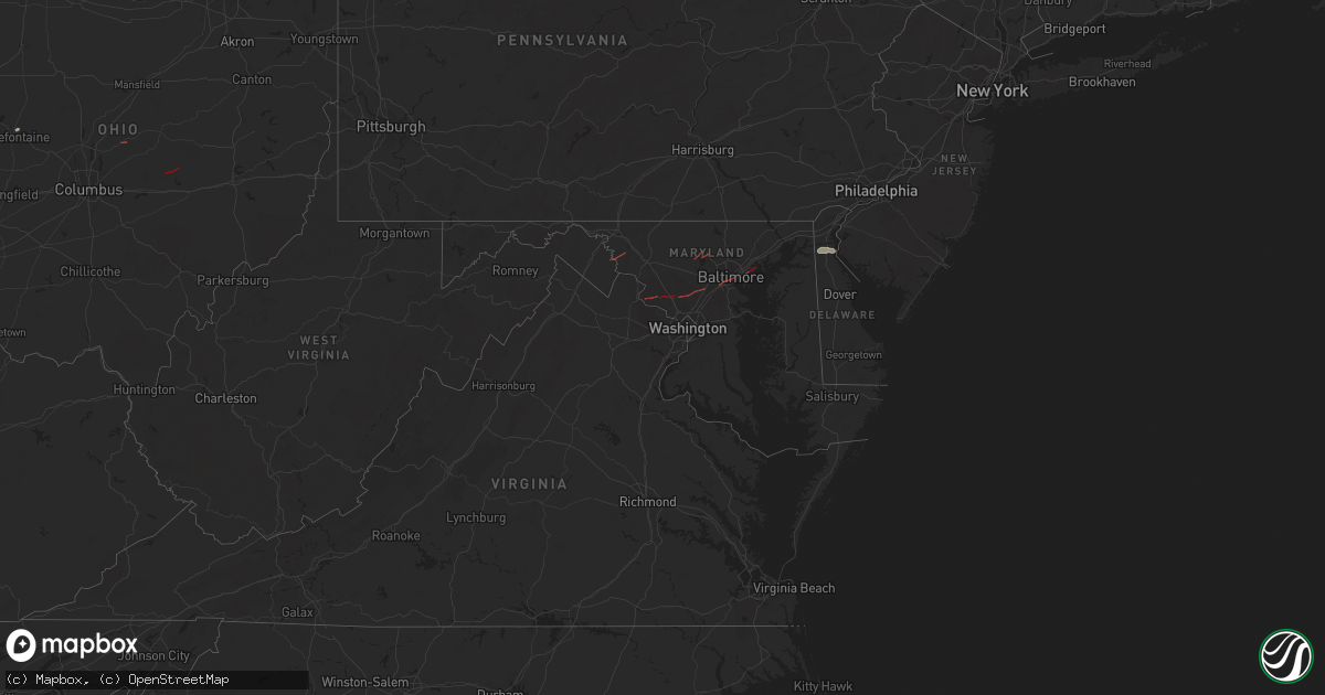
Hail Map in Maryland on June 5, 2024
Get this storm
June 5 map
$229
one time, instant access
Download today. No call, no setup
Keep the $229
Bought the map and want the full workflow? Apply the entire $229 to a subscription within 7 days. None of it is wasted.
Every map, not just this one
This buys you this map. Subscription and you get every map we run, in the markets you choose from a few cities to whole states to nationwide. Plus real-time alerts the moment a storm fires.
Contact data
Name, contact info, occupancy, even credit band for addresses in the footprint. You go from where it hit to who to call.
Become the source they trust
Unlimited branding weather history reports on demand. You already have the documented answer ready for the property owner, and you are the one who showed up with it.
Property data and RoofTrace estimates
Pull up any address you have got, its value and the exact code rules for that jurisdiction, straight from One Click Code. Then RoofTrace estimates the squares, pitch, and roof value, priced the way you price.
Storm reports in Maryland
Maryland
| Date | Description |
|---|---|
| 06/05/20246:42 PM CDT | Numerous reports of homes damaged... Wires and trees down as well as collapsed structures in and around the city of gaithersburg. |
| 06/05/20246:42 PM CDT | Public sent images of brief tornado on the ground just east of the carroll county regional airport. Time estimated from radar. |
| 06/05/20246:39 PM CDT | *** 5 inj *** tree into house on dogwood drive with multiple injuries reported. |
| 06/05/20246:29 PM CDT | Significant damage to the seneca water resource recovery facility as a result of a tornado. |
| 06/05/20246:29 PM CDT | Tree damage was observed just west of the seneca water resource recovery facility as a result of a tornado. |
| 06/05/20246:23 PM CDT | Multiple trees down along the 16000 block of germantown road |
| 06/05/20246:15 PM CDT | Trained spotter located at the junction of rt. 28 and rt. 117 in maryland reported a tornado on the ground about 3 miles west of their location. |
| 06/05/20246:11 PM CDT | Local spotter confirmed tornado lofting debris into the air. |
| 06/05/20244:42 PM CDT | Trained spotter video shows a tornado over an open field between 5:42 and 5:45 pm just south of boonsboro. |
| 06/04/20249:32 PM CDT | Tree down near 800 block of rock run rd |
| 06/04/20249:24 PM CDT | Tree down near rock springs rd and conowingo rd |
| 06/04/20249:24 PM CDT | Tree down near the 200 block of rowlandsville rd |
| 06/04/20248:28 PM CDT | Tree down near hawley rd and principio rd. |
| 06/04/20248:21 PM CDT | Tree down along the curve of sumpter dr. |
| 06/04/20248:19 PM CDT | Numerous homes damaged and trees down in the middle river area. |
| 06/04/20247:57 PM CDT | Tornadic circulation evident on multiple radars. Damage reported to homes on cowhide circle in this enhanced vrot signature |
| 06/04/20247:57 PM CDT | Tornadic circulation evident on multiple radars. Damage reported to homes on cowhide circle i |
| 06/04/20247:56 PM CDT | Tree down near s monroe st and washington blvd. |
| 06/04/20247:45 PM CDT | Spotter report and video of tornado crossing i-95 near i-195 in arbutus. Numerous trees and power lines down in the area. |
| 06/04/20247:26 PM CDT | Several videos of tornado on the ground in columbia. Numerous trees and powerlines down near the intersection of tamar drive and high tor hill in columbia. |
| 06/04/20247:26 PM CDT | Several videos of tornado on the ground in columbia. |
| 06/04/20247:07 PM CDT | Drone video sent of tornado on the ground east of brookesville... Md. |
| 06/04/20247:07 PM CDT | At least two trees on houses in the gamber and eldersburg areas. |
| 06/04/20247:00 PM CDT | Cecil county em reported tornado damage in the gamber area. Approximately 8 structure were damaged. Parts of cherry tree lane and bartholow road remain closed due to do |
All States Impacted by Hail Map on June 5, 2024
Cities Impacted by Hail Map on June 5, 2024
- Arlington, TX
- Grand Prairie, TX
- Mansfield, TX
- Midlothian, TX
- Cedar Hill, TX
- Whitney, TX
- Aquilla, TX
- Valley Mills, TX
- West, TX
- Waco, TX
- Clifton, TX
- Rantoul, IL
- China Spring, TX
- Thomasboro, IL
- Gifford, IL
- Woodway, TX
- Crawford, TX
- Oglesby, TX
- McGregor, TX
- Moody, TX
- Hewitt, TX
- Galveston, TX
- Champaign, IL
- Saint Joseph, IL
- New Durham, NH
- Live Oak, FL
- Bridgton, ME
- Denmark, ME
- Port Lavaca, TX
- Jasper, FL
- Victoria, TX
- Harrison, ME
- Naples, ME
- Jennings, FL
- Ventress, LA
- Wabasha, MN
- Alma, WI
- Kellogg, MN
- Altura, MN
- Cochrane, WI
- Arcadia, WI
- Gorham, ME
- Standish, ME
- Buxton, ME
- Eldorado, TX
- Sonora, TX
- Casco, ME
- Gray, ME
- Oxford, ME
- Portsmouth, NH
- Durham, NH
- Greenland, NH
- Windham, ME
- New Gloucester, ME
- Raymond, ME
- Howland, ME
- Dover, NH
- Madbury, NH
- Exeter, ME
- Corinth, ME
- Charleston, ME
- Garland, ME
- Lagrange, ME
- Minden City, MI
- Dover Foxcroft, ME
- Leesburg, VA
- Paeonian Springs, VA
- Old Town, ME
- Hope, ME
- Springfield, ME
- Orangeburg, SC
- Saint Matthews, SC
- Searsmont, ME
- Lincolnville, ME
- Milford, ME
- Greenbush, ME
- Poolesville, MD
- Boyds, MD
- Newmarket, NH
- Germantown, MD
- Eliot, ME
- Hudson, ME
- Gaithersburg, MD
- Orono, ME
- Wagener, SC
- Derwood, MD
- Tremont, MS
- Hamilton, AL
- Olney, MD
- Stratham, NH
- Hilliard, FL
- Sykesville, MD
- Finksburg, MD
- Reisterstown, MD
- Ozona, TX
- Gainesville, FL
- Sandy Spring, MD
- Ashton, MD
- Highland, MD
- Fulton, MD
- Clarksville, MD
- Columbia, MD
- Hodges, AL
- Spruce Pine, AL
- McCamey, TX
- Brookston, MN
- Centerburg, OH
- Micanopy, FL
- Reddick, FL
- Baltimore, MD
- Halethorpe, MD
- Dickerson, MD
- Cottondale, AL
- Middle River, MD
- Bellefontaine, OH
- Essex, MD
- Summerfield, FL
- Leesville, SC
- Batesburg, SC
- Calumet, MI
- Hancock, MI
- Roscommon, MI
- Mohawk, MI
- Del Rio, TX
- Upperco, MD
- Pikesville, MD
- Owings Mills, MD
- Glyndon, MD
- Stevenson, MD
- Westminster, MD
- Taneytown, MD
- Northport, AL
- Sweet Water, AL
- Bunker Hill, WV
- Inwood, WV
- Newbern, AL
- Faunsdale, AL
- Rocksprings, TX
- Shepherdstown, WV
- Middletown, DE
- Sharpsburg, MD
- Keedysville, MD
- Boonsboro, MD
- Rock, MI
- Ellabell, GA
- Bloomingdale, GA
- Nashport, OH
- Frazeysburg, OH
- Saint Francisville, LA
- Claude, TX
- Amarillo, TX
- Canyon, TX
- Wayside, TX
- Happy, TX
- Winfield, AL
- Eldridge, AL
- Carbon Hill, AL
- Nauvoo, AL
- Madison, AL
- Harvest, AL
- Huntsville, AL


