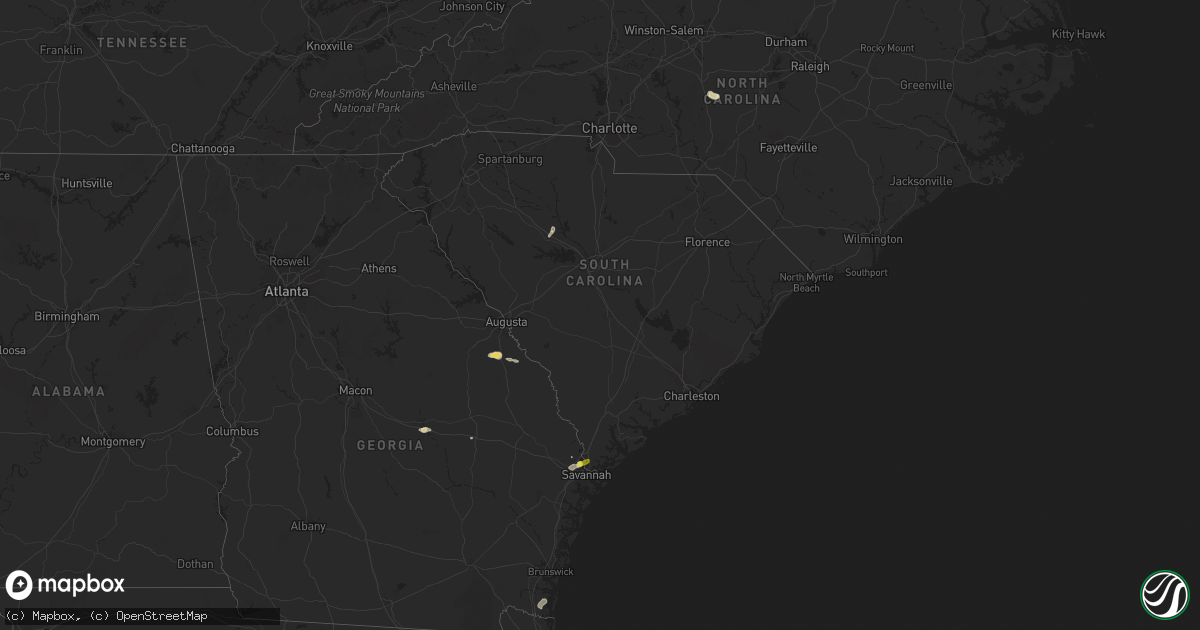
Hail Map in South Carolina on May 22, 2017
Get this storm
May 22 map
$229
one time, instant access
Download today. No call, no setup
Keep the $229
Bought the map and want the full workflow? Apply the entire $229 to a subscription within 7 days. None of it is wasted.
Every map, not just this one
This buys you this map. Subscription and you get every map we run, in the markets you choose from a few cities to whole states to nationwide. Plus real-time alerts the moment a storm fires.
Contact data
Name, contact info, occupancy, even credit band for addresses in the footprint. You go from where it hit to who to call.
Become the source they trust
Unlimited branding weather history reports on demand. You already have the documented answer ready for the property owner, and you are the one who showed up with it.
Property data and RoofTrace estimates
Pull up any address you have got, its value and the exact code rules for that jurisdiction, straight from One Click Code. Then RoofTrace estimates the squares, pitch, and roof value, priced the way you price.
Storm reports in South Carolina
South Carolina
| Date | Description |
|---|---|
| 05/22/20171:50 PM CDT | Report of a tree down on butler road... A power line down on long road... And a tree limb down on a power line on newberry highway near church road. Time estimated base |
| 05/22/20171:40 PM CDT | Few trees and powerlines down off hwy 183 near walhalla. |
| 05/22/20171:40 PM CDT | Newberry county sheriff reported trees down on us 176 correction to previous report. |
| 05/22/20171:40 PM CDT | Several trees down and tin roof blown off on highway 176 between mud creek road and highway 219. |
| 05/22/20171:40 PM CDT | Newberry county sheriff reported trees down on us highway 176. |
| 05/22/20171:32 PM CDT | Trees and power lines down at buff street and sunset in west columbia. |
| 05/22/201712:50 PM CDT | Tree down on cedar springs road in columbia via twitter wistv. |
All States Impacted by Hail Map on May 22, 2017
Cities Impacted by Hail Map on May 22, 2017
- Moberly, MO
- Abilene, TX
- Fort Stockton, TX
- Crane, TX
- Jayton, TX
- Snyder, TX
- Crossroads, NM
- Henrietta, TX
- Ringgold, TX
- Olustee, OK
- Chillicothe, TX
- Odell, TX
- Duke, OK
- Eldorado, OK
- Gould, OK
- Fort Sumner, NM
- Hamlin, TX
- Eastland, TX
- Carbon, TX
- Cisco, TX
- Bowie, TX
- Montague, TX
- Canute, OK
- Elk City, OK
- McCaulley, TX
- Seymour, TX
- Petrolia, TX
- Wichita Falls, TX
- Randlett, OK
- Walters, OK
- Devol, OK
- Asheboro, NC
- Foss, OK
- Jal, NM
- Brunswick, MO
- De Witt, MO
- Memphis, TX
- Childress, TX
- Avoca, TX
- Stacyville, IA
- Little Cedar, IA
- Yeso, NM
- Clyde, TX
- Indiahoma, OK
- Roosevelt, OK
- Snyder, OK
- Granite, OK
- Bellevue, TX
- Frederick, OK
- Decatur, TX
- Loveland, OK
- Nocona, TX
- Chattanooga, OK
- Cache, OK
- Grandfield, OK
- Lone Wolf, OK
- Blair, OK
- Forestburg, TX
- Mountain Park, OK
- Saint Jo, TX
- Byers, TX
- Aspermont, TX
- Ocate, NM
- Watrous, NM
- Kingwood, TX
- Huffman, TX
- Humble, TX
- Merkel, TX
- Nolan, TX
- Sweetwater, TX
- Carlsbad, NM
- Wagon Mound, NM
- Ponder, TX
- Sanger, TX
- Denton, TX
- Alvord, TX
- Krum, TX
- Sunset, TX
- Argyle, TX
- Electra, TX
- Vernon, TX
- Holliday, TX
- Waynesboro, GA
- Keysville, GA
- Hephzibah, GA
- Rotan, TX
- Vinson, OK
- Hollis, OK
- Anson, TX
- Sylvester, TX
- Hawley, TX
- Albany, TX
- Lueders, TX
- Valmora, NM
- Robbins, NC
- Seagrove, NC
- Paducah, TX
- Roswell, NM
- Colesburg, IA
- Baird, TX
- Dublin, GA
- Santa Rosa, NM
- Fluvanna, TX
- Desdemona, TX
- Ranger, TX
- Gorman, TX
- De Leon, TX
- Orlando, FL
- Pooler, GA
- Savannah, GA
- Port Wentworth, GA
- Keytesville, MO
- Salisbury, MO
- Clinton, OK
- Huntsville, MO
- Roby, TX
- Midland, TX
- Wellington, TX
- Clifton Hill, MO
- Houston, TX
- Loving, NM
- Elida, NM
- Marathon, TX
- Fredericksburg, IA
- Calmar, IA
- Fort Atkinson, IA
- Carter, OK
- Sayre, OK
- Guyton, GA
- Rincon, GA
- Stamford, TX
- Nashua, IA
- Greene, IA
- Imperial, TX
- Grandfalls, TX
- Monahans, TX
- Old Glory, TX
- Bloomingdale, GA
- Dublin, TX
- House, NM
- Maynard, IA
- Randalia, IA
- Madison, MO
- Dickens, TX
- Crosbyton, TX
- Mcadoo, TX
- Headrick, OK
- Lake Dallas, TX
- Lewisville, TX
- Moran, TX
- Roscoe, TX
- Rule, TX
- Las Vegas, NM
- Harrold, TX
- Prosperity, SC
- Fort Davis, TX
- Lyons, GA
- Swainsboro, GA
- Trementina, NM
- Cairo, MO
- Saint Ansgar, IA
- Sentinel, OK
- Dill City, OK
- Overbrook, OK
- Burneyville, OK
- Wilson, OK
- East Dublin, GA
- Butler, OK
- Tinnie, NM
- Hermleigh, TX
- Willow, OK
- Post, TX
- Carlsbad, TX
- Afton, TX
- Pomaria, SC
- Woodbine, GA
- Westgate, IA
- Kings Bay, GA
- Kingsland, GA
- Saint Marys, GA
- Girard, TX
- Hardeeville, SC
- Casey, IA
- Menlo, IA
- Ringling, OK
- Marietta, OK


