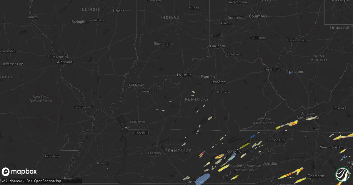
Hail Map in Kentucky on May 6, 2022
Get this storm
May 6 map
$229
one time, instant access
Download today. No call, no setup
Keep the $229
Bought the map and want the full workflow? Apply the entire $229 to a subscription within 7 days. None of it is wasted.
Every map, not just this one
This buys you this map. Subscription and you get every map we run, in the markets you choose from a few cities to whole states to nationwide. Plus real-time alerts the moment a storm fires.
Contact data
Name, contact info, occupancy, even credit band for addresses in the footprint. You go from where it hit to who to call.
Become the source they trust
Unlimited branding weather history reports on demand. You already have the documented answer ready for the property owner, and you are the one who showed up with it.
Property data and RoofTrace estimates
Pull up any address you have got, its value and the exact code rules for that jurisdiction, straight from One Click Code. Then RoofTrace estimates the squares, pitch, and roof value, priced the way you price.
Storm reports in Kentucky
Kentucky
| Date | Description |
|---|---|
| 05/06/20226:04 PM CDT | A large tree blew down on state road 55... Bloomfield road... Near shay lane. Time based on radar. |
| 05/06/20224:42 PM CDT | Corrects previous tstm wnd dmg report from 1 ssw mcclure. Tree reported down on road. Time estimated based on radar. |
| 05/06/20224:41 PM CDT | Corrects previous tstm wnd dmg report from 1 nw calf creek. Trees reported down onto powerline... Nearby power outages reported. |
| 05/06/20224:36 PM CDT | Corrects previous tstm wnd dmg report from 1 nnw tomahawk. Large tree report... Time estimated based on radar. |
| 05/06/20223:50 PM CDT | A large tree was blown down onto ky 1427 and a vfd was called to remove the tree from the roadway. Time of event is radar estimated. |
| 05/06/20223:22 PM CDT | Tree down on reedyville road south of roundhill. Time estimated by radar. |
| 05/06/20223:06 PM CDT | Large tree reported down on ky-421 near the clay/leslie county line. |
| 05/06/20222:50 PM CDT | Large tree reported down on ky-421 near the clay/leslie county line. Time estimated based on radar. |
| 05/06/20222:50 PM CDT | Trees were blown down and a camper was overturned in the turkey community and the turkey creek vicinity. The time of the event is radar estimated. |
| 05/06/20222:40 PM CDT | Tree reported down on the roadway. Time estimated via radar. |
| 05/06/20222:36 PM CDT | Tree reported down at the 5000 block of ky-490. |
| 05/06/20222:15 PM CDT | Tee down on union church rd. Near bumcomb. |
| 05/06/20222:10 PM CDT | Trees were down and an outbuilding was damaged. |
| 05/06/20221:46 PM CDT | Trees down on hwy 490. |
| 05/06/20221:30 PM CDT | Large trees down. Tree fell on mobile home causing structural damage near harris-linville rd. |
| 05/06/20221:15 PM CDT | Corrects previous tstm wnd dmg report from sandgap. Large trees down. Tree fell on mobile home causing structural damage near harris-linville rd. |
| 05/06/202212:58 PM CDT | Corrects previous tstm wnd dmg report from 4 sse ruth. Hardwood tree snapped... Landing along the fencing and porch. |
| 05/06/202212:57 PM CDT | Corrects previous tornado report from tateville. Video report of what appears to be a tornado on the ground. Posted on social media. Tornado 1 mile nnw of tateville. |
| 05/06/202212:52 PM CDT | *** 1 inj *** |
| 05/06/202212:49 PM CDT | *** 2 inj *** corrects previous tornado report from 1 ssw general burnside state park. Nws survey verified an ef-1 tornado that touched down on hardwick road in bronsto |
| 05/06/20221:47 AM CDT | At 646 PM EDT, a severe thunderstorm was located near Bardstown, moving southeast at 30 mph. HAZARD...60 mph wind gusts and quarter size hail. SOURCE...Radar indicated. IMPACT...Hail damage to vehicles is expected. Expect wind damage to roofs, siding, and trees. Locations impacted include... Springfield and Lebanon. |
| 05/06/20221:25 AM CDT | At 625 PM EDT, a severe thunderstorm was located near Bardstown, moving east at 25 mph. HAZARD...60 mph wind gusts and quarter size hail. SOURCE...Radar indicated. IMPACT...Hail damage to vehicles is expected. Expect wind damage to roofs, siding, and trees. This severe thunderstorm will be near... Bardstown around 640 PM EDT. |
| 05/06/20221:23 AM CDT | At 622 PM EDT, a severe thunderstorm was located 10 miles northwest of Lebanon, moving east at 15 mph. HAZARD...60 mph wind gusts and quarter size hail. SOURCE...Radar indicated. IMPACT...Hail damage to vehicles is expected. Expect wind damage to roofs, siding, and trees. This severe thunderstorm will remain over mainly rural areas of southern Nelson, northwestern Marion and southwestern Washington Counties, including the following locations... Loretto, Saint Francis, Burkes Spring, Holy Cross, Dant, Cisselville, Nerinx, Saint Mary, New Hope and Gandertown. |
| 05/06/202212:27 AM CDT | At 526 PM EDT, severe thunderstorms were located along a line extending from 8 miles south of Noetown to near New Tazewell to near Rutledge, moving northeast at 40 mph. HAZARD...60 mph wind gusts. SOURCE...Radar indicated. IMPACT...Expect damage to roofs, siding, and trees. Locations impacted include... New Tazewell, Tazewell, Harrogate, Springdale, Lone Mountain, Cumberland Gap, Ewing, Arthur and Powell River Preserve. |
| 05/05/202211:56 PM CDT | At 455 PM EDT, a severe thunderstorm was located over Riceville, or 8 miles east of Salyersville, moving northeast at 35 mph. HAZARD...70 mph wind gusts. SOURCE...Radar indicated. IMPACT...Expect considerable tree damage. Damage is likely to mobile homes, roofs, and outbuildings. This severe thunderstorm will be near... Dobson around 500 PM EDT. Patrick around 505 PM EDT. Oaklawn Estates around 510 PM EDT. Prestonsburg around 515 PM EDT.Other locations in the path of this severe thunderstorm include WellsChapel and Davisport. |
| 05/05/202211:35 PM CDT | At 432 PM EDT, a severe thunderstorm was located over Guage, or 10 miles southwest of Salyersville, moving northeast at 35 mph. HAZARD...60 mph wind gusts. SOURCE...Radar indicated. IMPACT...Expect damage to roofs, siding, and trees. This severe thunderstorm will be near... Foraker around 435 PM EDT. Carver Station around 440 PM EDT. Conley Station around 445 PM EDT. Marshallville around 450 PM EDT.Other locations in the path of this severe thunderstorm includeBrainard and Swamp Branch. |
| 05/05/202211:07 PM CDT | At 406 PM EDT, a severe thunderstorm was located over Lost Creek, or near Jackson, moving northeast at 35 mph. HAZARD...60 mph wind gusts. SOURCE...Radar indicated. IMPACT...Expect damage to roofs, siding, and trees. This severe thunderstorm will be near... Wilstacy around 410 PM EDT. Sikes around 415 PM EDT. Lunah around 420 PM EDT. Lambric around 425 PM EDT. |
| 05/05/202210:55 PM CDT | At 355 PM EDT, a severe thunderstorm was located over Chenowee, or near Jackson, moving northeast at 30 mph. HAZARD...60 mph wind gusts. SOURCE...Radar indicated. IMPACT...Expect damage to roofs, siding, and trees. This severe thunderstorm will be near... Elkatawa around 400 PM EDT. Fivemile around 405 PM EDT. Jackson around 410 PM EDT. Haginsville around 415 PM EDT.Other locations in the path of this severe thunderstorm includeRousseau. |
| 05/05/202210:46 PM CDT | At 346 PM EDT, severe thunderstorms were located along a line extending from Saul to Essie to Saylor to Callaway, moving east at 35 mph. HAZARD...60 mph wind gusts and quarter size hail. SOURCE...Radar indicated. IMPACT...Hail damage to vehicles is expected. Expect wind damage to roofs, siding, and trees. Severe thunderstorms will be near... Hoskinston around 350 PM EDT. Confluence around 355 PM EDT. Harlan around 400 PM EDT. Rosspoint around 405 PM EDT.Other locations in the path of these severe thunderstorms includeTeetersville and Hazard. |
| 05/05/202210:24 PM CDT | At 323 PM EDT, a severe thunderstorm was located over Old Flat Lick, or near Pineville, moving northeast at 35 mph. HAZARD...60 mph wind gusts and quarter size hail. SOURCE...Radar indicated. IMPACT...Hail damage to vehicles is expected. Expect wind damage to roofs, siding, and trees. This severe thunderstorm will be near... Scalf around 330 PM EDT. Mills around 335 PM EDT. Erose around 340 PM EDT.Other locations in the path of this severe thunderstorm includeBeverly and Skidmore. |
| 05/05/202210:18 PM CDT | At 318 PM EDT, a severe thunderstorm was located over Thomas, or 9 miles south of Booneville, moving northeast at 35 mph. HAZARD...60 mph wind gusts. SOURCE...Radar indicated. IMPACT...Expect damage to roofs, siding, and trees. This severe thunderstorm will be near... Newfound around 325 PM EDT. Gobbard around 330 PM EDT. Arnett around 335 PM EDT.Other locations in the path of this severe thunderstorm includeHouston and Talbert. |
| 05/05/202210:14 PM CDT | At 313 PM CDT, a severe thunderstorm was located 10 miles east of Morgantown, moving east at 15 mph. HAZARD...60 mph wind gusts and quarter size hail. SOURCE...Radar indicated. IMPACT...Hail damage to vehicles is expected. Expect wind damage to roofs, siding, and trees. This severe thunderstorm will remain over mainly rural areas of east central Butler, north central Warren and southwestern Edmonson Counties, including the following locations... Segal, Asphalt, Lindseyville, Nick, Glenmore, Reedyville and Windyville. |
| 05/05/20229:44 PM CDT | At 244 PM EDT, a severe thunderstorm was located over Carmichael, or near London, moving northeast at 35 mph. HAZARD...60 mph wind gusts. SOURCE...Radar indicated. IMPACT...Expect damage to roofs, siding, and trees. This severe thunderstorm will be near... Greenmount around 255 PM EDT. Moores Creek around 300 PM EDT.Other locations in the path of this severe thunderstorm includeDatha, Shepherdtown, Chestnutburg and Sextons Creek. |
| 05/05/20229:28 PM CDT | At 228 PM CDT, severe thunderstorms were located along a line extending from 10 miles south of Celina to near Livingston, moving northeast at 30 mph. HAZARD...60 mph wind gusts and quarter size hail. SOURCE...Radar indicated. IMPACT...Hail damage to vehicles is expected. Expect wind damage to roofs, siding, and trees. Locations impacted include... Livingston, Jamestown, Byrdstown, Pall Mall and Standing Stone State Park. |
| 05/05/20229:03 PM CDT | At 203 PM EDT, a severe thunderstorm was located over Ruth, or near Somerset, moving northeast at 40 mph. HAZARD...60 mph wind gusts and penny size hail. SOURCE...Radar indicated. IMPACT...Expect damage to roofs, siding, and trees. This severe thunderstorm will be near... Bloss around 220 PM EDT.Other locations in the path of this severe thunderstorm includeBillows and Luner. |
All States Impacted by Hail Map on May 6, 2022
Cities Impacted by Hail Map on May 6, 2022
- Monroe, TN
- Greeneville, TN
- Mosheim, TN
- Del Rio, TN
- Liberty, KY
- Clarkson, KY
- Leitchfield, KY
- Pittsboro, NC
- Bear Creek, NC
- Siler City, NC
- Bennett, NC
- Macclesfield, NC
- Wilson, NC
- Fountain, NC
- Stantonsburg, NC
- Walstonburg, NC
- Ahoskie, NC
- Plymouth, NC
- Cadiz, KY
- Pigeon Forge, TN
- Sevierville, TN
- Sylvania, GA
- Allendale, SC
- Blanch, NC
- Madison, NC
- Mayodan, NC
- Providence, NC
- Pelham, NC
- Milton, NC
- Stoneville, NC
- Walnut Cove, NC
- Reidsville, NC
- Yanceyville, NC
- Ruffin, NC
- Pine Hall, NC
- Shannon, NC
- Fayetteville, NC
- Raeford, NC
- Lumber Bridge, NC
- Lafitte, LA
- Barataria, LA
- Scottsburg, VA
- Virgilina, VA
- Red Oak, VA
- Clarksville, VA
- Skipwith, VA
- New Market, TN
- Strawberry Plains, TN
- Birchwood, TN
- Decatur, TN
- Staley, NC
- Liberty, NC
- Prosperity, SC
- Leesville, SC
- Mount Gilead, NC
- Swainsboro, GA
- Alamo, GA
- Mount Vernon, GA
- Vidalia, GA
- Twin City, GA
- Ailey, GA
- Tarrytown, GA
- Portal, GA
- Glenwood, GA
- Lyons, GA
- Metter, GA
- McRae Helena, GA
- Englewood, TN
- Tellico Plains, TN
- Madisonville, TN
- Vonore, TN
- Windsor, NC
- Augusta, GA
- Blythe, GA
- Pitts, GA
- Rochelle, GA
- Pineview, GA
- Abbeville, GA
- Loudon, TN
- Lenoir City, TN
- Kingston, TN
- Philadelphia, TN
- Ten Mile, TN
- Vienna, GA
- Chester, SC
- McConnells, SC
- Rock Hill, SC
- Buffalo, SC
- Union, SC
- Sharon, SC
- Lockhart, SC
- Briceville, TN
- Ward, SC
- Crossville, TN
- Irwinton, GA
- Tennille, GA
- Wrightsville, GA
- Montrose, GA
- Dublin, GA
- Toomsboro, GA
- Dudley, GA
- East Dublin, GA
- Omega, GA
- Doerun, GA
- Sylvester, GA
- Ty Ty, GA
- Tifton, GA
- Sumner, GA
- Robersonville, NC
- Williamston, NC
- Clinton, NC
- Turkey, NC
- Westfield, NC
- Danbury, NC
- Lawsonville, NC
- Abingdon, VA
- Bristol, TN
- Morgantown, KY
- New Hope, KY
- Loretto, KY
- Ayden, NC
- Sardis, GA
- Sweeny, TX
- Garysburg, NC
- Jackson, NC
- Tyler, TX
- Lindale, TX
- Battleboro, NC
- Murfreesboro, NC
- Como, NC
- Rich Square, NC
- Halifax, NC
- Whitakers, NC
- Enfield, NC
- Conway, NC
- Seaboard, NC
- Woodland, NC
- Scotland Neck, NC
- Tarboro, NC
- Marble, NC
- Andrews, NC
- Murphy, NC
- Rockingham, NC
- Bennettsville, SC
- Wallace, SC
- Hamlet, NC
- Laurel Hill, NC
- Laurel Springs, NC
- Wytheville, VA
- Pulaski, VA
- Draper, VA
- Max Meadows, VA
- Corapeake, NC
- Chesapeake, VA
- Suffolk, VA
- Winterville, NC
- Byrdstown, TN
- Pioneer, TN
- Avera, GA
- Louisville, GA
- Trenton, SC
- Sandersville, GA
- Hephzibah, GA
- Matthews, GA
- Gibson, GA
- Stapleton, GA
- Warthen, GA
- Graniteville, SC
- Beech Island, SC
- Aiken, SC
- Davisboro, GA
- Wrens, GA
- North Augusta, SC
- Keysville, GA
- Sweetwater, TN
- Niota, TN
- Parrottsville, TN
- Uvalda, GA
- Smyrna, SC
- Gaffney, SC
- York, SC
- Clover, SC
- Gastonia, NC
- Blacksburg, SC
- Pinetops, NC
- Jonesville, SC
- Enoree, SC
- Maxton, NC
- Red Springs, NC
- Jamesville, NC
- Edgefield, SC
- Clarks Hill, SC
- Johnston, SC
- Saluda, SC
- Batesburg, SC
- Newberry, SC
- Fairhope, AL
- Greenville, NC
- Emporia, VA
- Lancing, TN
- Unadilla, GA
- Pinehurst, GA
- Newsoms, VA
- Franklin, VA
- Youngsville, NC
- Perry, FL
- Lamont, FL
- Lancaster, SC
- Destin, FL
- Miramar Beach, FL
- Franklinville, NC
- Randleman, NC
- Modoc, SC
- Columbia, KY
- South Boston, VA
- Alton, VA
- Ridgeway, SC
- Monticello, KY
- Nancy, KY
- Gainesboro, TN
- Kelford, NC
- Aulander, NC
- Lewiston Woodville, NC
- Knoxville, TN
- Henderson, TN
- Tracy City, TN
- Sewanee, TN
- South Pittsburg, TN
- Whitwell, TN
- Sequatchie, TN
- Jetson, KY
- Roundhill, KY
- Bowling Green, KY
- Merry Hill, NC
- Athens, TN
- Windsor, VA
- Zuni, VA
- Albany, KY
- Hollister, NC
- Warrenton, NC
- Surgoinsville, TN
- Rogersville, TN
- Eidson, TN
- Ellenboro, NC
- Forest City, NC
- Rutherfordton, NC
- Columbus, NC
- Campobello, SC
- Chesnee, SC
- Mooresboro, NC
- Landrum, SC
- Cherryville, NC
- Lincolnton, NC
- Lawndale, NC
- Crouse, NC
- Shelby, NC
- Elko, GA
- Hawkinsville, GA
- Riceville, TN
- Tallassee, TN
- Leesburg, GA
- Chapin, SC
- Society Hill, SC
- Cassatt, SC
- Bethune, SC
- Darlington, SC
- Camden, SC
- Hartsville, SC
- Bishopville, SC
- McBee, SC
- Grimesland, NC
- Bethel, NC
- Greenback, TN
- Maryville, TN
- Greensboro, NC
- Winnsboro, SC
- Jamestown, NC
- High Point, NC
- Pleasant Garden, NC
- Freeman, VA
- Jarratt, VA
- McKenney, VA
- Stokes, NC
- Ambrose, GA
- Alapaha, GA
- Enigma, GA
- Wray, GA
- Ocilla, GA
- Wadesboro, NC
- Springfield, KY
- Bardstown, KY
- Asheboro, NC
- Heppner, OR
- Lyles, TN
- Eagle Springs, NC
- West End, NC
- Carthage, NC
- Spray, OR
- Monument, OR
- Anthony, FL
- Pearland, TX
- Fresno, TX
- Rosharon, TX
- Missouri City, TX
- Manvel, TX
- Glade Spring, VA
- Chilhowie, VA
- Marion, VA
- Watertown, TN
- Milton, TN
- Mount Croghan, SC
- Ellerbe, NC
- Jackson Springs, NC
- Chesterfield, SC
- Morven, NC
- Candor, NC
- Lilesville, NC
- Ruby, SC
- Newport, TN
- Bybee, TN
- Midway, TN
- Mohawk, TN
- Gillett, TX
- Karnes City, TX
- Saltville, VA
- Bristol, VA
- Meadowview, VA
- Adrian, GA
- Eden, NC
- Spring City, TN
- Dayton, TN
- Evensville, TN
- Morrisville, NC
- New Hill, NC
- Apex, NC
- Chapel Hill, NC
- Wake Forest, NC
- Cary, NC
- Durham, NC
- Raleigh, NC
- Heath Springs, SC
- Monroe, NC
- Jefferson, SC
- Great Falls, SC
- Marshville, NC
- Peachland, NC
- Pageland, SC
- Kershaw, SC
- Liberty Hill, SC
- Fort Lawn, SC
- Robertsdale, AL
- Summerdale, AL
- Huntsville, TN
- Perkins, GA
- Midville, GA
- Millen, GA
- Edgewater, FL
- Elizabethtown, NC
- Bristol, FL
- Hosford, FL
- Silverhill, AL
- Carrsville, VA
- Courtland, VA
- Bladenboro, NC
- Clarkton, NC
- Irmo, SC
- Little Mountain, SC
- Marietta, SC
- Travelers Rest, SC
- Rockford, TN
- Blythewood, SC
- Polkton, NC
- Bloomington Springs, TN
- Buffalo Valley, TN
- Baxter, TN
- Granville, TN
- Pilot Rock, OR
- Pendleton, OR
- Lexington, OR
- Weston, OR
- Mendota, VA
- Tryon, NC
- Cheraw, SC
- Mooresburg, TN
- Sneedville, TN
- Thorn Hill, TN
- Fort Oglethorpe, GA
- Cleveland, TN
- Apison, TN
- Chickamauga, GA
- Georgetown, TN
- Chattanooga, TN
- Ringgold, GA
- McDonald, TN
- Rossville, GA
- Lupton City, TN
- Ooltewah, TN
- Charleston, TN
- Hixson, TN
- Harrison, TN
- Alcoa, TN
- Louisville, TN
- Friendsville, TN
- Morristown, TN
- Talbott, TN
- Jefferson City, TN
- Stokesdale, NC
- Efland, NC
- Mebane, NC
- Daphne, AL
- Mobile, AL
- Bronston, KY
- Burnside, KY
- Spokane, WA
- Milton Freewater, OR
- Dudley, NC
- Goldsboro, NC
- Fort Bragg, NC
- Linden, NC
- Sophia, NC
- Garner, NC
- Willow Spring, NC
- Angier, NC
- Coats, NC
- Lillington, NC
- Earlysville, VA
- Charlottesville, VA
- North Garden, VA
- Belle Chasse, LA
- Huntsville, AL
- Harvest, AL
- Tanner, AL
- Gurley, AL
- Athens, AL
- Hollytree, AL
- Brownsboro, AL
- Madison, AL
- New Market, AL
- Grovetown, GA
- Germanton, NC
- Danville, VA
- Ringgold, VA
- Kings Mountain, NC
- Bessemer City, NC
- Harrison, GA
- Sandy Ridge, NC
- Spencer, VA
- Ridgeway, VA
- Afton, TN
- Chuckey, TN


