Hail Map on September 18, 2026
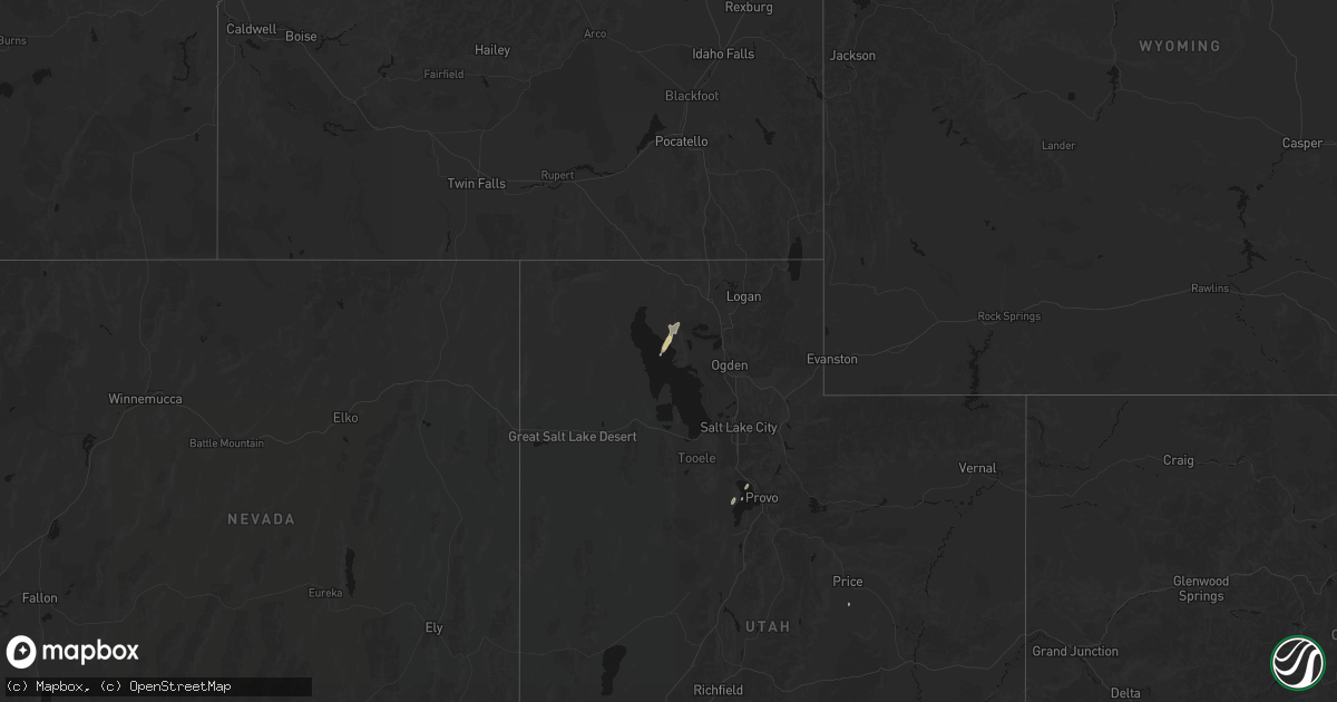
Get this storm
September 18 map
$229
one time, instant access
Download today. No call, no setup
Keep the $229
Bought the map and want the full workflow? Apply the entire $229 to a subscription within 7 days. None of it is wasted.
Every map, not just this one
This buys you this map. Subscription and you get every map we run, in the markets you choose from a few cities to whole states to nationwide. Plus real-time alerts the moment a storm fires.
Contact data
Name, contact info, occupancy, even credit band for addresses in the footprint. You go from where it hit to who to call.
Become the source they trust
Unlimited branding weather history reports on demand. You already have the documented answer ready for the property owner, and you are the one who showed up with it.
Property data and RoofTrace estimates
Pull up any address you have got, its value and the exact code rules for that jurisdiction, straight from One Click Code. Then RoofTrace estimates the squares, pitch, and roof value, priced the way you price.
States Impacted by Hail Map on September 18, 2026
Storm reports
Kentucky
| Date | Description |
|---|---|
| 09/18/20266:50 PM CDT | Multiple trees blew down between at least two properties on ky 22 near northridge drive. A home weather station measured 60 mph. |
| 09/18/20266:42 PM CDT | Downed tree and power lines. |
| 09/18/20262:51 PM CDT | Trees reported down along pilgrims rest rd. |
| 09/18/20262:40 PM CDT | Trees reported down along congleton hollow rd. |
Wyoming
| Date | Description |
|---|---|
| 09/18/20266:53 PM CDT | Asos station kbyg buffalo airport |
| 09/18/20265:42 PM CDT | Mesonet station ktmh i-25 twenty mile hill |
| 09/18/20265:30 PM CDT | Mesonet station pc459 muddy creek |
| 09/18/20265:20 PM CDT | Mesonet station pc377 scenic dr |
| 09/17/20268:47 PM CDT | Asos station ktor torrington airport - tor. |
| 09/17/20267:32 PM CDT | Mesonet station kbrx 1.4 s bordeaux |
Kansas
| Date | Description |
|---|---|
| 09/18/20266:23 PM CDT | Em reports damaged road signs. Time estimated from radar. |
| 09/18/20266:23 PM CDT | Em reports several power poles snapped with lines in the road. Time estimated from radar. |
| 09/18/20266:10 PM CDT | Delayed relayed report of signs down at ks-27 just north of cheyenne/sherman county line. |
| 09/18/20265:58 PM CDT | A local report indicates 63 MPH wind near 12 NNW Ruleton |
| 09/17/20267:15 PM CDT | Spotter report large older trees uprooted with 2 inch branches down. Also reported 1.26 inches of rain within a 25 minute period. |
| 09/17/20267:09 PM CDT | Id: ambient_44b7143c575b2968cdf184967408ca28. |
| 09/17/20267:00 PM CDT | Report of estimated 60 mph gust. |
Indiana
| Date | Description |
|---|---|
| 09/18/20264:45 PM CDT | Tree down on transformer rd. West of sr 159. Time estimated from radar. |
| 09/18/20264:32 PM CDT | Tree down in park on west side of town. |
Georgia
| Date | Description |
|---|---|
| 09/18/20264:15 AM CDT | Tree and powerlines downed off of north sixth street road. |
Colorado
| Date | Description |
|---|---|
| 09/18/20266:45 PM CDT | Maximum hail size 1.00 inch... Average hail size 0.50 inch. |
| 09/18/20265:53 PM CDT | Synoptic_co047. |
| 09/18/20265:43 PM CDT | Synoptic_co047. |
| 09/18/20265:30 PM CDT | Maximum hail size of 1.00 inch... Did cause some damage to car roofs and shredded leaves. Average hail size was 0.375 inches. |
| 09/18/20265:15 PM CDT | Weatherlink_9940b48b-c83f-4282-be3e-a0412107cb11. |
| 09/18/20265:10 PM CDT | Time estimated from radar. Social media post reporting power poles down. |
| 09/18/20265:10 PM CDT | Time estimated from radar. Social media post reporting power poles down. |
South Carolina
| Date | Description |
|---|---|
| 09/18/20265:05 PM CDT | Trees on powerlines on college ave at wilson rd. |
| 09/18/20264:55 PM CDT | Trees down on roadway. |
| 09/18/20264:41 PM CDT | Two trees in roadway on henry knob rd at hwy 55. |
| 09/18/20264:40 PM CDT | Trees down on agony acres rd at hwy 55. |
| 09/17/20269:40 PM CDT | Tree in roadway on highway 28 near intersection of bethia road. Time estimated. |
| 09/17/20269:22 PM CDT | Tree in roadway at old calhoun falls rd at intersection with briarwood rd. |
| 09/17/20269:05 PM CDT | Tree in roadway on milford dairy road at bobo drive. Time estimated from radar. |
| 09/17/20268:45 PM CDT | Social media user reports trees and lines down along hwy 252 around honea path city limit... West of the city. Time estimated from radar. Numerous power outages also re |
| 09/17/20268:45 PM CDT | Several trees and lines down along hwy 252 around honea path city limit... West of the city. Time estimated from radar. Numerous power outages also reported by utility |
| 09/17/20268:40 PM CDT | Trees down at intersection of us-178 and evatt rd. |
| 09/17/20268:20 PM CDT | Power outage due to fallen trees on equipment. |
| 09/17/20268:00 PM CDT | Trees down 1200 block of shackleburg rd. |
| 09/17/20267:38 PM CDT | Power outage due to fallen trees and limbs. |
| 09/17/20267:38 PM CDT | 4 trees in roadway on chapman hill rd near clemson food exchange. |
| 09/17/20267:32 PM CDT | Power outage due to downed trees on powerlines. |
| 09/17/20267:27 PM CDT | Power outage due to downed trees on powerlines. |
| 09/17/20267:11 PM CDT | Power outage due to trees on powerlines. |
| 09/17/20267:08 PM CDT | Power outage due to lightning strike to equipment. |
| 09/17/20267:05 PM CDT | Social media report of multiple trees down at turpin rd and blue ridge st in campobello. |
Tennessee
| Date | Description |
|---|---|
| 09/18/20266:13 PM CDT | Trees reported down in dandridge. Time estimated by radar. |
| 09/18/20266:05 PM CDT | Trees reported down in piedmont. Time estimated by radar. |
| 09/18/20266:04 PM CDT | Trees reported down in white pine. Time estimated by radar. |
| 09/18/20266:03 PM CDT | Trees reported down in jefferson city. Time estimated by radar. |
Nebraska
| Date | Description |
|---|---|
| 09/17/20268:59 PM CDT | Personal weather station. |
| 09/17/20268:36 PM CDT | A local report indicates 64 MPH wind near 2 N Hastings |
| 09/17/20267:32 PM CDT | Ambient_a67b7fc2ca38b35dcbf39194e9c84163. |
New Mexico
| Date | Description |
|---|---|
| 09/18/20262:20 PM CDT | A local report indicates 1.00 inch wind near 3 NE Farmington |
| 09/18/20262:15 PM CDT | Report from mping: quarter |
Florida
| Date | Description |
|---|---|
| 09/18/202612:30 PM CDT | [landspout] broadcast media relayed video of a short duration landspout that lofted palm fronds and other small debris for a brief period before it dissipated. Tpbi ra |
North Carolina
| Date | Description |
|---|---|
| 09/18/20266:06 PM CDT | Tree was blown down on the eastbound lanes of i-40. Time estimated by radar. |
| 09/18/20265:32 PM CDT | Powerline down near hartley dr and flowers st. |
| 09/18/20265:17 PM CDT | Tree down in road at covered bridge rd & n oneil st. |
| 09/18/20265:14 PM CDT | Tree down at auburn church rd & eagle crst wy. |
| 09/18/20265:02 PM CDT | Tree down in road at grasshopper rd & pierce farm rd. |
| 09/18/20264:59 PM CDT | Tree down in roadway at sandy run and amber acres ln. |
| 09/18/20264:56 PM CDT | Tree across road and powerlines in 400 block of n first ave. |
| 09/18/20264:56 PM CDT | Powerline down in shopping center with tree on it in 1000 block of n smithfield rd. |
| 09/18/20264:56 PM CDT | Tree down blocking road on 400 block of hughes rd. |
| 09/18/20264:56 PM CDT | Trees down on powerlines and blocking road at keith st & robertson st. |
| 09/18/20264:50 PM CDT | Tree down on powerlines at buffaloe rd and i 540. |
| 09/18/20264:30 PM CDT | Tree down on autry mill road. |
| 09/18/20264:25 PM CDT | Tree down on godwin falcon road. |
| 09/18/20264:20 PM CDT | Em reports complete road blockage due to numerous trees down on adams creek rd between willie springs and eagles nest. |
| 09/18/20264:09 PM CDT | Powerline down on 100 block of n 11th st. |
| 09/18/20264:06 PM CDT | Tree in roadway on canter ln. |
| 09/18/20264:06 PM CDT | Tree down on powerlines in 10900 block of us 15-501 hwy. |
| 09/18/20263:55 PM CDT | Tree down on the 500 block of unity church road. |
| 09/18/20263:45 PM CDT | Utility company reported equipment damage from trees down due to high winds. |
| 09/18/20263:45 PM CDT | Tree down blocking one lane of cherokee road. |
| 09/18/20263:37 PM CDT | Trees down at cherry grove dr and zion church rd. |
| 09/18/20263:37 PM CDT | Trees down at cherry grove rd and zion church rd. |
| 09/18/20263:35 PM CDT | Tree down on josephine road. |
| 09/18/20263:35 PM CDT | Tree down blocking both lanes on mount carmel road at old carthage road. |
| 09/18/20263:20 PM CDT | Tree down on flint hill church road and wyatt road blocking both lanes. |
| 09/18/20263:15 PM CDT | Tree down on chatham street. |
| 09/18/20263:15 PM CDT | Tree down on plank road near bellview road blocking one lane. |
| 09/18/20263:05 PM CDT | Tree down on cotten road. |
| 09/18/20262:48 PM CDT | Tree on power line. |
| 09/18/20262:45 PM CDT | Trained spotter reported multiple trees down on zion church rd. |
| 09/18/20262:45 PM CDT | Trained spotter reported trees down on john morgan rd south of liberty. |
| 09/18/20262:44 PM CDT | Power company reported power outage caused by downed trees. |
| 09/18/20262:40 PM CDT | Spotter reported shingles blown off roof and damage to siding. |
| 09/18/20262:30 PM CDT | 57 kt |
| 09/18/20262:30 PM CDT | Multiple trees down at charlotte hwy and aztec cir. |
| 09/18/20262:15 PM CDT | Tree down in the 300 block of faith rock road. |
| 09/18/20262:05 PM CDT | Tree down near nc 62. |
| 09/18/20262:00 PM CDT | 911 call center reported trees down on chestnut tr. |
| 09/18/20261:45 PM CDT | Tree in the road blocking coltrane mill road at river mill road. |
| 09/18/20261:33 PM CDT | Branches and large limbs down on i-85 near route 68. |
| 09/18/20261:31 PM CDT | Gso reported a wind gust to 60 kt or 69 mph. |
| 09/18/20261:30 PM CDT | Trees down on roadway. |
Utah
| Date | Description |
|---|---|
| 09/18/20266:05 PM CDT | [landspout] public report shared via social media and television media |
| 09/18/20266:00 PM CDT | A local report indicates a tornado near 15 SE Naples |
| 09/18/20265:10 PM CDT | Report from mping: quarter |
| 09/18/20265:04 PM CDT | Social media video depicting estimated quarter sized hail in west jordan. Time estimated via radar. |
| 09/18/20265:04 PM CDT | Estimated quarter sized hail reported on social media. Time estimated via radar. |
| 09/18/20263:38 PM CDT | Report shared via spotter network. |
| 09/18/20263:30 PM CDT | Multiple social media reports depicting quarter sized hail. Time estimated via radar and other hail reports within the vicinity. |
| 09/18/20263:15 PM CDT | Public report of measured half-dollar sized hail. |
| 09/18/20262:52 PM CDT | Tornado seen in video shared on social media... Showing rotation reaching the ground and debris being lofted into the air. The point that it touched down was near a sum |
| 09/18/20262:45 PM CDT | From a picture shared with our office via social media... Reported as kaysville just west of i-15. |
| 09/18/20262:39 PM CDT | Multiple social media reports depicting quarter sized hail. Time estimated via radar. |
| 09/18/202610:16 AM CDT | Public report of quarter sized hail. |
Cities Impacted by Hail Map on September 18, 2026
- Corinne, UT
- Huntington, UT
- Midway, UT
- Cedar Valley, UT
- Portage, UT
- Plymouth, UT
- Price, UT
- Ely, NV
- East Carbon, UT
- Bliss, ID
- Wendover, UT
- Hanna City, IL
- Elmwood, IL
- Greensboro, NC
- Colfax, NC
- Richmond, KY
- Berea, KY
- Jasper, IN
- Farmington, NM
- Waco, KY
- Palmyra, IN
- Greenville, IN
- Georgetown, IN
- Hanna, UT
- Roosevelt, UT
- Layton, UT
- Kaysville, UT
- Syracuse, UT
- Clearfield, UT
- Hill Afb, UT
- Ogden, UT
- Farmington, UT
- Irvine, KY
- McKee, KY
- Louisville, TN
- Knoxville, TN
- Grantsville, UT
- Lanesville, IN
- Calhan, CO
- Morgan, UT
- Ramah, CO
- Ona, FL
- Lerna, IL
- Charleston, IL
- Elizabeth, IN
- Abingdon, VA
- Bristol, TN
- Arcadia, FL
- New Albany, IN
- Sainte Genevieve, MO
- Centerville, UT
- Stoy, IL
- Robinson, IL
- Corydon, IN
- Huntsville, UT
- Louisville, KY
- Manchester, KY
- Sextons Creek, KY
- Carthage, NC
- Shiprock, NM
- Odon, IN
- Loogootee, IN
- Hickory, NC
- Windsor, IL
- Neoga, IL
- Oblong, IL
- Festus, MO
- Shepherdsville, KY
- Claremont, IL
- Thompson, UT
- Dundas, IL
- Olney, IL
- Jackson Springs, NC
- Washington, IN
- Ellerbe, NC
- Annapolis, IL
- Montgomery, IN
- Dunn, NC
- Switz City, IN
- Worthington, IN
- Shoals, IN
- Sumner, IL
- Erwin, NC
- Jasonville, IN
- Linton, IN
- Bruceville, IN
- Bicknell, IN
- Hutsonville, IL
- Stinnett, KY
- Essie, KY
- Flat Rock, IL
- Barbourville, KY
- Englewood, FL
- Warbranch, KY
- Mozelle, KY
- West Liberty, IL
- Newton, IL
- Stratton, CO
- Traphill, NC
- Roaring River, NC
- Chuckey, TN
- Cannelburg, IN
- Vernal, UT
- Lyons, IN
- Vona, CO
- Magna, UT
- Limestone, TN
- Oaktown, IN
- Elnora, IN
- Plainville, IN
- Bloomfield, IN
- Bethune, CO
- Wade, NC
- Godwin, NC
- West Valley City, UT
- Bountiful, UT
- Roseboro, NC
- Bowling Green, MO
- Albion, IL
- Ragsdale, IN
- Edwardsport, IN
- West Baden Springs, IN
- Crane, IN
- Salt Lake City, UT
- Burlington, CO
- Wheatland, IN
- Paoli, IN
- Newport, TN
- White Pine, TN
- Clarksville, MO
- Eolia, MO
- Westphalia, IN
- Freelandville, IN
- Anton, CO
- French Lick, IN
- Mitchell, IN
- Orleans, IN
- Maynardville, TN
- Sharps Chapel, TN
- Sandborn, IN
- Luttrell, TN
- Kanorado, KS
- Powder Springs, TN
- Blaine, TN
- Washburn, TN
- Kenly, NC
- Lucama, NC
- Taswell, IN
- Idalia, CO
- Goodland, KS
- De Beque, CO
- Wray, CO
- Dinosaur, CO
- Talbott, TN
- Jefferson City, TN
- Rutledge, TN
- Eckerty, IN
- English, IN
- Saint Francis, KS
- New Market, TN
- Wallace, NC
- Norton, KS
- Willard, NC
- Commerce City, CO
- Brighton, CO
- Edson, KS
- Bird City, KS
- Fayetteville, NC
- Dandridge, TN
- Charlestown, IN
- Kaycee, WY
- La Grange, KY
- Goshen, KY
- Buckner, KY
- Crestwood, KY
- Simpsonville, KY
- McDonald, KS
- Maybell, CO
- Douglas, WY
- Gillette, WY
- Shelby, NE
- Ulysses, NE
- Stratton, NE
- Max, NE
- Surprise, NE
- Rising City, NE
- David City, NE
- Dwight, NE
- Brainard, NE
- Wheatland, WY
- Schleswig, IA
- Charter Oak, IA
- Ida Grove, IA
- Wall Lake, IA
- Lusk, WY
- Harrison, NE
- Van Tassell, WY
- Osage, WY
- Herman, NE
- Rockwell City, IA
- Blair, NE
- Tekamah, NE
- Crawford, NE
- Hastings, NE
- Trumbull, NE
- Gresham, NE
- Utica, NE
- Elba, NE
- Wolbach, NE
- Marsland, NE
- Scotia, NE
- Greeley, NE
- Hemingford, NE
- Oliver Springs, TN
- Pleasant Grove, UT
- West Jordan, UT
- Clifton, AZ