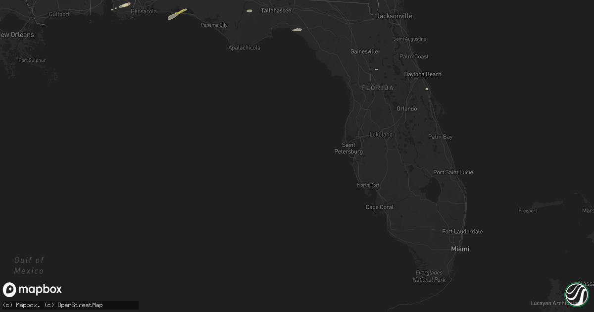
Hail Map in Florida on May 6, 2022
Get this storm
May 6 map
$229
one time, instant access
Download today. No call, no setup
Keep the $229
Bought the map and want the full workflow? Apply the entire $229 to a subscription within 7 days. None of it is wasted.
Every map, not just this one
This buys you this map. Subscription and you get every map we run, in the markets you choose from a few cities to whole states to nationwide. Plus real-time alerts the moment a storm fires.
Contact data
Name, contact info, occupancy, even credit band for addresses in the footprint. You go from where it hit to who to call.
Become the source they trust
Unlimited branding weather history reports on demand. You already have the documented answer ready for the property owner, and you are the one who showed up with it.
Property data and RoofTrace estimates
Pull up any address you have got, its value and the exact code rules for that jurisdiction, straight from One Click Code. Then RoofTrace estimates the squares, pitch, and roof value, priced the way you price.
Storm reports in Florida
Florida
| Date | Description |
|---|---|
| 05/06/20226:10 PM CDT | Survey indicated straight line winds of 80 to 90 mph resulted in snapped trees... A destroyed shed... And roof damage in an area east of perry along san pedro road. |
| 05/06/20226:06 PM CDT | Ef0 tornado confirmed by storm survey in perry. Estimated to be on the ground about 1 minute from 7:06 pm to 7:07 pm. Minor structural and tree damage in town. |
| 05/06/20226:03 PM CDT | Taylor county em reports structural and tree damage in perry near 221 and 27 intersection. |
| 05/06/20225:00 PM CDT | A few trees were blown down in the port st joe area. |
| 05/06/20224:05 PM CDT | Tree reported down on roadway near old bainbridge rd and fred george rd. |
| 05/06/20224:05 PM CDT | Tree reported down on road near homewood rd and old bainbridge rd. |
| 05/06/20223:43 PM CDT | Report of a tree down on bloxham cutoff between fr360 and fr342. |
| 05/06/20222:45 PM CDT | Tree down at 7207 hosford hwy. |
| 05/06/20222:00 PM CDT | Tree down along highway 12 along the liberty-gadsden county border. |
| 05/06/20229:27 AM CDT | Quarter size hail and three trees snapped at the destin fire department. Several reports of dime to quarter size hail reported via social media... Too. |
| 05/06/20229:13 AM CDT | Report of down trees on road caused by thunderstorm winds. |
| 05/06/20228:47 AM CDT | Reported trees down across sw 111th st. And sw 51st trail caused by thunderstorm winds. |
| 05/06/20227:52 AM CDT | Corrects previous tstm wnd dmg report from 2 wsw lake butler. Tree down across sw 92nd street caused by thunderstorm winds. |
| 05/06/20225:56 AM CDT | At 1056 AM CDT, a severe thunderstorm was located 9 miles north of Panama City Beach, moving east at 35 mph. HAZARD...60 mph wind gusts and quarter size hail. SOURCE...Radar indicated. IMPACT...Hail damage to vehicles is expected. Expect wind damage to roofs, siding, and trees. Locations impacted include... Panama City Beach, Ebro, Nixon, Bayhead, West Bay, Southport, Seminole Hills, Recota Beach, Gulf Resort Beach, Greenhead, Camp Flowers, Gainer Spring, Bennett, Pine Log, Sunnyside, Laird, Laguna Beach, Vicksburg, Hollywood Beach and Riverside. |
| 05/06/20225:30 AM CDT | At 1029 PM EDT, severe thunderstorms were located along a line extending from near Durbin to near Picolata to near Bardin, moving east at 50 mph. HAZARD...60 mph wind gusts and penny size hail. SOURCE...Radar indicated. IMPACT...Expect damage to roofs, siding, and trees. Locations impacted include... Saint Augustine, Hastings, East Palatka, Saint Augustine Beach, Marineland, Vilano Beach, Federal Point, South Ponte Vedra, Crescent Beach and Saint Augustine Shores. |
| 05/06/20225:08 AM CDT | At 1008 PM EDT, severe thunderstorms were located along a line extending from near Doctors Inlet to 7 miles north of George's Lake to near Keystone Heights, moving east at 25 mph. HAZARD...60 mph wind gusts and penny size hail. SOURCE...Radar indicated. IMPACT...Expect damage to roofs, siding, and trees. Locations impacted include... Palatka, Green Cove Springs, Keystone Heights, East Palatka, Fruit Cove, Middleburg, World Golf Village, Florahome, Federal Point and Bardin. |
| 05/06/20224:40 AM CDT | At 940 PM EDT, a severe thunderstorm was located near Sampson, or 9 miles southwest of Starke, moving east at 40 mph. HAZARD...60 mph wind gusts and penny size hail. SOURCE...Radar indicated. IMPACT...Expect damage to roofs, siding, and trees. Locations impacted include... Starke, Lake Butler, Middleburg, Beasley, New River, Camp Blanding, Kingsley, Sampson, Penney Farms and Lawtey. |
| 05/06/20224:38 AM CDT | At 937 AM CDT, a severe thunderstorm was located near Santa Rosa Beach, moving northeast at 45 mph. HAZARD...60 mph wind gusts and quarter size hail. SOURCE...Radar indicated. IMPACT...Hail damage to vehicles is expected. Expect wind damage to roofs, siding, and trees. Locations impacted include... Santa Rosa Beach, Eglin Air Force Base, Freeport, Red Bay, Douglass Crossroad, Portland, Villa Tasso, Rock Hill, Miramar Beach, Bruce, Eucheeanna, Gulf Pines, New Home, Knox Hill, Sandestin and Four Mile Village. |
| 05/06/20224:14 AM CDT | At 913 AM CDT, a severe thunderstorm was located 6 miles south of Mary Esther, moving northeast at 40 mph. HAZARD...60 mph wind gusts and quarter size hail. SOURCE...Radar indicated. IMPACT...Hail damage to vehicles is expected. Expect wind damage to roofs, siding, and trees. Locations impacted include... Wright, Fort Walton Beach, Niceville, Destin, Eglin AFB, Valparaiso, Mary Esther, Ocean City, Lake Lorraine, Shalimar and Cinco Bayou. |
| 05/06/20222:56 AM CDT | At 756 PM EDT, a severe thunderstorm was located over Suwannee Valley, or near White Springs, moving east at 25 mph. HAZARD...60 mph wind gusts and penny size hail. SOURCE...Radar indicated. IMPACT...Expect damage to roofs, siding, and trees. Locations impacted include... Suwannee Valley. |
| 05/06/20222:19 AM CDT | At 719 PM EDT, a severe thunderstorm was located near Suwannee Springs, moving east at 45 mph. HAZARD...60 mph wind gusts and penny size hail. SOURCE...Radar indicated. IMPACT...Expect damage to roofs, siding, and trees. Locations impacted include... Live Oak, White Springs, Suwannee Springs, Belmont and Suwannee Valley. |
| 05/06/20221:09 AM CDT | At 608 PM EDT, severe thunderstorms were located along a line extending from 8 miles east of Valdosta to 7 miles southwest of Lake Park, moving east at 50 mph. HAZARD...60 mph wind gusts and penny size hail. SOURCE...Radar indicated. IMPACT...Expect damage to roofs, siding, and trees. Locations impacted include... Homerville, Jennings, Statenville, Du Pont and Mayday. |
| 05/06/20221:05 AM CDT | At 605 PM EDT, severe thunderstorms were located along a line extending from 6 miles southeast of Moody Air Force Base to 7 miles north of Madison, moving east at 35 mph. HAZARD...60 mph wind gusts and penny size hail. SOURCE...Radar indicated. IMPACT...Expect damage to roofs, siding, and trees. Locations impacted include... Lake Park, Valdosta, Dasher, Naylor, I-75 At Exit 5, Greenwood, Twin Lakes, Clyattville, Pinetta, I-75 At Exit 11, Valdosta Regional Airport and Stockton. |
| 05/06/202212:44 AM CDT | At 544 AM CDT, severe thunderstorms were located along a line extending from 11 miles northwest of De Funiak Springs to 4 miles northeast of Niceville to 3 miles southwest of Destin to 15 miles south of Mary Esther, moving east at 50 mph. HAZARD...60 mph wind gusts. SOURCE...Radar indicated. IMPACT...Expect damage to roofs, siding, and trees. Locations impacted include... Niceville, Destin, Eglin AFB, Valparaiso and Lake Lorraine. |
| 05/06/202212:34 AM CDT | At 534 PM EDT, a severe thunderstorm was located 8 miles southwest of Quitman, moving east at 50 mph. HAZARD...60 mph wind gusts and penny size hail. SOURCE...Radar indicated. IMPACT...Expect damage to roofs, siding, and trees. Locations impacted include... Quitman, Valdosta, I-75 At Exit 16, Remerton, Dixie, Grooverville, Kinderlou, Lovett, Nankin, Empress, Clyattville, Brooks Co A/p, Blue Springs, I-75 At Exit 22 and Ashville. |
| 05/06/202212:18 AM CDT | At 518 AM CDT, severe thunderstorms were located along a line extending from 7 miles east of Georgiana to near McKenzie to near Red Level to 10 miles southwest of River Falls to 17 miles west of Lockhart to 7 miles west of Laurel Hill to near Crestview to near Navarre Beach, moving east at 45 mph. HAZARD...70 mph wind gusts. SOURCE...Radar indicated. IMPACT...Expect considerable tree damage. Damage is likely to mobile homes, roofs, and outbuildings. Locations impacted include... Panama City Beach, Elba, Santa Rosa Beach, De Funiak Springs, Geneva, Enterprise, Fort Rucker, Samson, New Brockton, Eglin Air Force Base, Lee, Union, Liberty, Live Oak, Freeport, Paxton, Ponce De Leon, Kinston, Westville and Ebro. |
| 05/05/202211:59 PM CDT | At 457 AM CDT, severe thunderstorms were located along a line extending from 8 miles north of Roeville to 6 miles north of Oriole Beach to 15 miles southwest of Pensacola Beach, moving east at 50 mph. HAZARD...60 mph wind gusts. SOURCE...Radar indicated. IMPACT...Expect damage to roofs, siding, and trees. Locations impacted include... Wright, Fort Walton Beach, Crestview, Niceville, Destin, Eglin AFB, Milton, Valparaiso, Gulf Breeze, Mary Esther, Bagdad, Ocean City, Lake Lorraine, Oriole Beach, Navarre, Shalimar, Cinco Bayou, Pensacola Beach and Navarre Beach. |
| 05/05/202211:50 PM CDT | At 449 AM CDT, severe thunderstorms were located along a line extending from 5 miles east of Jay to 12 miles north of Roeville to Point Baker, moving northeast at 60 mph. THESE ARE DESTRUCTIVE STORMS FOR LOCATIONS IN NORTHERN SANTA ROSA AND NORTHERN OKALOOSA COUNTIES IN FLORIDA AND SOUTHERN ESCAMBIA AND SOUTHERN COVINGTON COUNTIES IN ALABAMA. HAZARD...80 mph wind gusts. SOURCE...Radar indicated. IMPACT...Flying debris will be dangerous to those caught without shelter. Mobile homes will be heavily damaged. Expect considerable damage to roofs, windows, and vehicles. Extensive tree damage and power outages are likely. Locations impacted include... Crestview, Pace, Milton, Brewton, Florala, Baker, East Brewton, Laurel Hill, Lockhart, Riverview, Roeville and Point Baker. |
| 05/05/202211:40 PM CDT | At 440 PM EDT, a severe thunderstorm was located 8 miles southwest of Midway, moving east at 35 mph. HAZARD...60 mph wind gusts and nickel size hail. SOURCE...Radar indicated. IMPACT...Expect damage to roofs, siding, and trees. Locations impacted include... Midway, Tallahassee, Quincy, Woodville, Florida State University, Florida A And M, Tallahassee Comm College, Doak Campbell Stadium, Lake Bradford, Gaither Community Center, Tallahassee Memorial Hosp, Eight Mile Pond, Tallahassee Mall, Bloxham, Tallahassee Regional A/P, Governors Square Mall, Belair, Lake Talquin, Levy Park and Indian Head Acres. |
| 05/05/202211:23 PM CDT | At 423 PM EDT, a severe thunderstorm was located 11 miles south of Greensboro, or 15 miles east of Blountstown, moving east at 55 mph. HAZARD...60 mph wind gusts. SOURCE...Radar indicated. IMPACT...Expect damage to roofs, siding, and trees. Locations impacted include... Midway, Havana, Quincy, Tallahassee, Telogia, Lake Talquin, Hosford, Scotland, Gibson, Fort Braden, Tallahassee Coml Airport, Shady Rest, Lowry, Wetumpka and Bloxham. |
| 05/05/202211:12 PM CDT | At 412 AM CDT, severe thunderstorms were located along a line extending from Atmore to 12 miles west of Molino to 10 miles east of Robertsdale to Bon Secour, moving east at 55 mph. HAZARD...60 mph wind gusts. SOURCE...Radar indicated. IMPACT...Expect damage to roofs, siding, and trees. Locations impacted include... Pensacola, Ferry Pass, Brent, West Pensacola, Ensley, Warrington, Gonzalez, Gulf Shores, Atmore, Foley, Pace, Milton, Gulf Breeze, Brewton, Orange Beach, Goulding, Century, Flomaton, Bagdad and Lillian. |
| 05/05/202210:50 PM CDT | Tree down on road caused by thunderstorm winds. |
| 05/05/202210:38 PM CDT | At 338 PM EDT/238 PM CDT/, a severe thunderstorm was located over Blountstown, moving northeast at 55 mph. HAZARD...60 mph wind gusts. SOURCE...Radar indicated. IMPACT...Expect damage to roofs, siding, and trees. Locations impacted include... Blountstown, Greensboro, Bristol, Rock Bluff, Juniper, Abe Springs, Sharpstown, Kennys Mill, Hardaway, Nettle Ridge, Sycamore, Frink, Lowry, Hugh Creek and Durham. |
| 05/05/20229:50 PM CDT | Down tree blocking road caused by thunderstorm winds. |
All States Impacted by Hail Map on May 6, 2022
Cities Impacted by Hail Map on May 6, 2022
- Monroe, TN
- Greeneville, TN
- Mosheim, TN
- Del Rio, TN
- Liberty, KY
- Clarkson, KY
- Leitchfield, KY
- Pittsboro, NC
- Bear Creek, NC
- Siler City, NC
- Bennett, NC
- Macclesfield, NC
- Wilson, NC
- Fountain, NC
- Stantonsburg, NC
- Walstonburg, NC
- Ahoskie, NC
- Plymouth, NC
- Cadiz, KY
- Pigeon Forge, TN
- Sevierville, TN
- Sylvania, GA
- Allendale, SC
- Blanch, NC
- Madison, NC
- Mayodan, NC
- Providence, NC
- Pelham, NC
- Milton, NC
- Stoneville, NC
- Walnut Cove, NC
- Reidsville, NC
- Yanceyville, NC
- Ruffin, NC
- Pine Hall, NC
- Shannon, NC
- Fayetteville, NC
- Raeford, NC
- Lumber Bridge, NC
- Lafitte, LA
- Barataria, LA
- Scottsburg, VA
- Virgilina, VA
- Red Oak, VA
- Clarksville, VA
- Skipwith, VA
- New Market, TN
- Strawberry Plains, TN
- Birchwood, TN
- Decatur, TN
- Staley, NC
- Liberty, NC
- Prosperity, SC
- Leesville, SC
- Mount Gilead, NC
- Swainsboro, GA
- Alamo, GA
- Mount Vernon, GA
- Vidalia, GA
- Twin City, GA
- Ailey, GA
- Tarrytown, GA
- Portal, GA
- Glenwood, GA
- Lyons, GA
- Metter, GA
- McRae Helena, GA
- Englewood, TN
- Tellico Plains, TN
- Madisonville, TN
- Vonore, TN
- Windsor, NC
- Augusta, GA
- Blythe, GA
- Pitts, GA
- Rochelle, GA
- Pineview, GA
- Abbeville, GA
- Loudon, TN
- Lenoir City, TN
- Kingston, TN
- Philadelphia, TN
- Ten Mile, TN
- Vienna, GA
- Chester, SC
- McConnells, SC
- Rock Hill, SC
- Buffalo, SC
- Union, SC
- Sharon, SC
- Lockhart, SC
- Briceville, TN
- Ward, SC
- Crossville, TN
- Irwinton, GA
- Tennille, GA
- Wrightsville, GA
- Montrose, GA
- Dublin, GA
- Toomsboro, GA
- Dudley, GA
- East Dublin, GA
- Omega, GA
- Doerun, GA
- Sylvester, GA
- Ty Ty, GA
- Tifton, GA
- Sumner, GA
- Robersonville, NC
- Williamston, NC
- Clinton, NC
- Turkey, NC
- Westfield, NC
- Danbury, NC
- Lawsonville, NC
- Abingdon, VA
- Bristol, TN
- Morgantown, KY
- New Hope, KY
- Loretto, KY
- Ayden, NC
- Sardis, GA
- Sweeny, TX
- Garysburg, NC
- Jackson, NC
- Tyler, TX
- Lindale, TX
- Battleboro, NC
- Murfreesboro, NC
- Como, NC
- Rich Square, NC
- Halifax, NC
- Whitakers, NC
- Enfield, NC
- Conway, NC
- Seaboard, NC
- Woodland, NC
- Scotland Neck, NC
- Tarboro, NC
- Marble, NC
- Andrews, NC
- Murphy, NC
- Rockingham, NC
- Bennettsville, SC
- Wallace, SC
- Hamlet, NC
- Laurel Hill, NC
- Laurel Springs, NC
- Wytheville, VA
- Pulaski, VA
- Draper, VA
- Max Meadows, VA
- Corapeake, NC
- Chesapeake, VA
- Suffolk, VA
- Winterville, NC
- Byrdstown, TN
- Pioneer, TN
- Avera, GA
- Louisville, GA
- Trenton, SC
- Sandersville, GA
- Hephzibah, GA
- Matthews, GA
- Gibson, GA
- Stapleton, GA
- Warthen, GA
- Graniteville, SC
- Beech Island, SC
- Aiken, SC
- Davisboro, GA
- Wrens, GA
- North Augusta, SC
- Keysville, GA
- Sweetwater, TN
- Niota, TN
- Parrottsville, TN
- Uvalda, GA
- Smyrna, SC
- Gaffney, SC
- York, SC
- Clover, SC
- Gastonia, NC
- Blacksburg, SC
- Pinetops, NC
- Jonesville, SC
- Enoree, SC
- Maxton, NC
- Red Springs, NC
- Jamesville, NC
- Edgefield, SC
- Clarks Hill, SC
- Johnston, SC
- Saluda, SC
- Batesburg, SC
- Newberry, SC
- Fairhope, AL
- Greenville, NC
- Emporia, VA
- Lancing, TN
- Unadilla, GA
- Pinehurst, GA
- Newsoms, VA
- Franklin, VA
- Youngsville, NC
- Perry, FL
- Lamont, FL
- Lancaster, SC
- Destin, FL
- Miramar Beach, FL
- Franklinville, NC
- Randleman, NC
- Modoc, SC
- Columbia, KY
- South Boston, VA
- Alton, VA
- Ridgeway, SC
- Monticello, KY
- Nancy, KY
- Gainesboro, TN
- Kelford, NC
- Aulander, NC
- Lewiston Woodville, NC
- Knoxville, TN
- Henderson, TN
- Tracy City, TN
- Sewanee, TN
- South Pittsburg, TN
- Whitwell, TN
- Sequatchie, TN
- Jetson, KY
- Roundhill, KY
- Bowling Green, KY
- Merry Hill, NC
- Athens, TN
- Windsor, VA
- Zuni, VA
- Albany, KY
- Hollister, NC
- Warrenton, NC
- Surgoinsville, TN
- Rogersville, TN
- Eidson, TN
- Ellenboro, NC
- Forest City, NC
- Rutherfordton, NC
- Columbus, NC
- Campobello, SC
- Chesnee, SC
- Mooresboro, NC
- Landrum, SC
- Cherryville, NC
- Lincolnton, NC
- Lawndale, NC
- Crouse, NC
- Shelby, NC
- Elko, GA
- Hawkinsville, GA
- Riceville, TN
- Tallassee, TN
- Leesburg, GA
- Chapin, SC
- Society Hill, SC
- Cassatt, SC
- Bethune, SC
- Darlington, SC
- Camden, SC
- Hartsville, SC
- Bishopville, SC
- McBee, SC
- Grimesland, NC
- Bethel, NC
- Greenback, TN
- Maryville, TN
- Greensboro, NC
- Winnsboro, SC
- Jamestown, NC
- High Point, NC
- Pleasant Garden, NC
- Freeman, VA
- Jarratt, VA
- McKenney, VA
- Stokes, NC
- Ambrose, GA
- Alapaha, GA
- Enigma, GA
- Wray, GA
- Ocilla, GA
- Wadesboro, NC
- Springfield, KY
- Bardstown, KY
- Asheboro, NC
- Heppner, OR
- Lyles, TN
- Eagle Springs, NC
- West End, NC
- Carthage, NC
- Spray, OR
- Monument, OR
- Anthony, FL
- Pearland, TX
- Fresno, TX
- Rosharon, TX
- Missouri City, TX
- Manvel, TX
- Glade Spring, VA
- Chilhowie, VA
- Marion, VA
- Watertown, TN
- Milton, TN
- Mount Croghan, SC
- Ellerbe, NC
- Jackson Springs, NC
- Chesterfield, SC
- Morven, NC
- Candor, NC
- Lilesville, NC
- Ruby, SC
- Newport, TN
- Bybee, TN
- Midway, TN
- Mohawk, TN
- Gillett, TX
- Karnes City, TX
- Saltville, VA
- Bristol, VA
- Meadowview, VA
- Adrian, GA
- Eden, NC
- Spring City, TN
- Dayton, TN
- Evensville, TN
- Morrisville, NC
- New Hill, NC
- Apex, NC
- Chapel Hill, NC
- Wake Forest, NC
- Cary, NC
- Durham, NC
- Raleigh, NC
- Heath Springs, SC
- Monroe, NC
- Jefferson, SC
- Great Falls, SC
- Marshville, NC
- Peachland, NC
- Pageland, SC
- Kershaw, SC
- Liberty Hill, SC
- Fort Lawn, SC
- Robertsdale, AL
- Summerdale, AL
- Huntsville, TN
- Perkins, GA
- Midville, GA
- Millen, GA
- Edgewater, FL
- Elizabethtown, NC
- Bristol, FL
- Hosford, FL
- Silverhill, AL
- Carrsville, VA
- Courtland, VA
- Bladenboro, NC
- Clarkton, NC
- Irmo, SC
- Little Mountain, SC
- Marietta, SC
- Travelers Rest, SC
- Rockford, TN
- Blythewood, SC
- Polkton, NC
- Bloomington Springs, TN
- Buffalo Valley, TN
- Baxter, TN
- Granville, TN
- Pilot Rock, OR
- Pendleton, OR
- Lexington, OR
- Weston, OR
- Mendota, VA
- Tryon, NC
- Cheraw, SC
- Mooresburg, TN
- Sneedville, TN
- Thorn Hill, TN
- Fort Oglethorpe, GA
- Cleveland, TN
- Apison, TN
- Chickamauga, GA
- Georgetown, TN
- Chattanooga, TN
- Ringgold, GA
- McDonald, TN
- Rossville, GA
- Lupton City, TN
- Ooltewah, TN
- Charleston, TN
- Hixson, TN
- Harrison, TN
- Alcoa, TN
- Louisville, TN
- Friendsville, TN
- Morristown, TN
- Talbott, TN
- Jefferson City, TN
- Stokesdale, NC
- Efland, NC
- Mebane, NC
- Daphne, AL
- Mobile, AL
- Bronston, KY
- Burnside, KY
- Spokane, WA
- Milton Freewater, OR
- Dudley, NC
- Goldsboro, NC
- Fort Bragg, NC
- Linden, NC
- Sophia, NC
- Garner, NC
- Willow Spring, NC
- Angier, NC
- Coats, NC
- Lillington, NC
- Earlysville, VA
- Charlottesville, VA
- North Garden, VA
- Belle Chasse, LA
- Huntsville, AL
- Harvest, AL
- Tanner, AL
- Gurley, AL
- Athens, AL
- Hollytree, AL
- Brownsboro, AL
- Madison, AL
- New Market, AL
- Grovetown, GA
- Germanton, NC
- Danville, VA
- Ringgold, VA
- Kings Mountain, NC
- Bessemer City, NC
- Harrison, GA
- Sandy Ridge, NC
- Spencer, VA
- Ridgeway, VA
- Afton, TN
- Chuckey, TN


