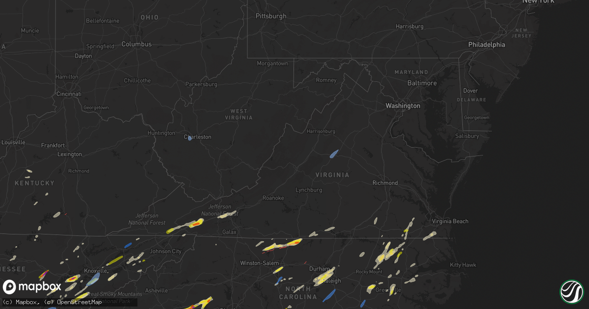
Hail Map in Virginia on May 6, 2022
Get this storm
May 6 map
$229
one time, instant access
Download today. No call, no setup
Keep the $229
Bought the map and want the full workflow? Apply the entire $229 to a subscription within 7 days. None of it is wasted.
Every map, not just this one
This buys you this map. Subscription and you get every map we run, in the markets you choose from a few cities to whole states to nationwide. Plus real-time alerts the moment a storm fires.
Contact data
Name, contact info, occupancy, even credit band for addresses in the footprint. You go from where it hit to who to call.
Become the source they trust
Unlimited branding weather history reports on demand. You already have the documented answer ready for the property owner, and you are the one who showed up with it.
Property data and RoofTrace estimates
Pull up any address you have got, its value and the exact code rules for that jurisdiction, straight from One Click Code. Then RoofTrace estimates the squares, pitch, and roof value, priced the way you price.
Storm reports in Virginia
Virginia
| Date | Description |
|---|---|
| 05/06/20226:45 PM CDT | Patrick county 911 reports multiple trees down throughout the county. |
| 05/06/20226:42 PM CDT | Trees down on power lines. |
| 05/06/20226:33 PM CDT | Trees down near rivermont. |
| 05/06/20226:30 PM CDT | Two trees were reported down in the city of radford. |
| 05/06/20226:30 PM CDT | 911 call center for alleghany county reports multiple trees down throughout the county. |
| 05/06/20226:30 PM CDT | 911 center reports tree down in union hall. |
| 05/06/20226:20 PM CDT | Numerous trees reported down in and around the cana are due to thunderstorm winds. Areas impacted include chantilly drive and wards gap road. |
| 05/06/20226:15 PM CDT | Corrects previous tstm wnd dmg report. Patrick county 911 reports multiple trees down throughout the county. |
| 05/06/20226:12 PM CDT | A few trees down. |
| 05/06/20225:55 PM CDT | A local report indicates 1.00 inch wind near 1 NNE MAX MEADOWS |
| 05/06/20225:47 PM CDT | A local report indicates 1.00 inch wind near 2 SSW MAX MEADOWS |
| 05/06/20225:47 PM CDT | A local report indicates 1.00 inch wind near 2 SSW MAX MEADOWS |
| 05/06/20225:40 PM CDT | Several trees down. |
| 05/06/20224:59 PM CDT | Quarter to half dollar size hail. |
| 05/06/20224:54 PM CDT | Multiple trees reported down due to thunderstorm winds in marion. |
| 05/06/20224:50 PM CDT | Extremely high wind... Rain and hail ranging in sizes of a quarter to as big as a golf ball. Hail accumulated on the ground in some places up to 2inches deep. |
| 05/06/20224:50 PM CDT | A local report indicates 1.75 inch wind near 3 E CHILHOWIE |
| 05/06/20224:47 PM CDT | Multiple trees reported down due to thunderstorm winds along interstate 81 between chilhowie and marion. |
| 05/06/20224:42 PM CDT | A local report indicates 60 MPH wind near 1 S CHILHOWIE |
| 05/06/20224:41 PM CDT | Multiple trees uprooted... Lots of large branches down... In the seven mile ford area... Roofs blown off buildings in chilhowie. |
| 05/06/20224:39 PM CDT | Multiple strutures with damage due to thunderstorms winds along 35 east main street in chilhowie. |
| 05/06/20224:37 PM CDT | Roof blown off one structure along main street in chilhowie due to thunderstorm winds. |
| 05/06/20224:35 PM CDT | Numerous trees down. |
| 05/06/20224:17 PM CDT | Trees down on power lines. Time estimated from radar. |
| 05/06/20224:10 PM CDT | Trees down on power lines. |
| 05/06/20224:02 PM CDT | Report of quarter size hail in franklin. |
| 05/06/20224:00 PM CDT | Report from mping: 3-inch tree limbs broken; power poles broken. |
| 05/06/20223:55 PM CDT | Several trees and power lines down as well. |
| 05/06/20223:54 PM CDT | Power poles down. |
| 05/06/20223:45 PM CDT | Tree down on monroe rd. |
| 05/06/20225:11 AM CDT | At 1011 PM EDT, a severe thunderstorm was located near Kells Corner, or 8 miles east of Chase City, moving northeast at 50 mph. HAZARD...60 mph wind gusts and quarter size hail. SOURCE...Radar indicated. IMPACT...Minor damage to vehicles is possible. Expect wind damage to trees and powerlines. This severe thunderstorm will be near... Lunenburg around 1020 PM EDT. Victoria and Kenbridge around 1025 PM EDT. Dundas around 1030 PM EDT. Fort Pickett around 1040 PM EDT. McKenney and Wilsons around 1050 PM EDT.Other locations impacted by this severe thunderstorm include BaconsFork, North Wellville, Wilburn, Arvins Store, Dolphin, Ammon,Murdocks, Nutbush, Plantersville and Wellville. |
| 05/06/20224:53 AM CDT | At 953 PM EDT, severe thunderstorms were located along a line extending from near Grottoes to 9 miles north of Centenary, moving northeast at 30 mph. HAZARD...60 mph wind gusts. SOURCE...Radar indicated. IMPACT...Damaging winds will cause some trees and large branches to fall. This could injure those outdoors, as well as damage homes and vehicles. Roadways may become blocked by downed trees. Localized power outages are possible. Unsecured light objects may become projectiles. Locations impacted include... Charlottesville, Crozet, Free Union, Campbell, Westmoreland, Hollymead, Gordonsville, Ruckersville, Ivy, Scottsville, Esmont, Quinque, North Garden, Eheart, Barboursville, Stony Point, Flordon, Haneytown, Newtown and Amicus. |
| 05/06/20224:29 AM CDT | At 929 PM EDT, a severe thunderstorm was located over Java, or near Ingram, moving northeast at 45 mph. HAZARD...60 mph wind gusts and quarter size hail. SOURCE...Radar indicated. IMPACT...Hail damage to vehicles is expected. Expect wind damage to roofs, siding, and trees. Locations impacted include... Mt Airy... Ingram... Java... Cody... Leda... Straightstone... and Chalk Level. |
| 05/06/20224:08 AM CDT | At 907 PM EDT, a severe thunderstorm was located over Dry Fork, or near Blairs, moving northeast at 40 mph. HAZARD...60 mph wind gusts and quarter size hail. SOURCE...Radar indicated. IMPACT...Hail damage to vehicles is expected. Expect wind damage to roofs, siding, and trees. Locations impacted include... Chatham... Gretna... Mt Airy... Swansonville... Dry Fork... Chalk Level... and Java. |
| 05/06/20224:06 AM CDT | At 906 PM EDT, severe thunderstorms were located along a line extending from Stuarts Draft to near Wintergreen to New Glasgow, moving east at 45 mph. HAZARD...60 mph wind gusts. SOURCE...Radar indicated. IMPACT...Damaging winds will cause some trees and large branches to fall. This could injure those outdoors, as well as damage homes and vehicles. Roadways may become blocked by downed trees. Localized power outages are possible. Unsecured light objects may become projectiles. Locations impacted include... Charlottesville, Crozet, Shipman, Schuyler, Campbell, Westmoreland, Hollymead, Ivy, Arrington, Scottsville, Esmont, Allens Creek, North Garden, Covesville, Yancey Mills, Stony Point, Buffalo Springs, Flordon, Norwood and Scott Stadium. |
| 05/06/20223:59 AM CDT | At 859 PM EDT, a severe thunderstorm was located over Turbeville, moving northeast at 25 mph. HAZARD...60 mph wind gusts and quarter size hail. SOURCE...Radar indicated. IMPACT...Hail damage to vehicles is expected. Expect wind damage to roofs, siding, and trees. Locations impacted include... South Boston... Halifax... Redoak... Clover... Turbeville... Scottsburg... and Cluster Springs. |
| 05/06/20223:58 AM CDT | At 858 PM EDT, a severe thunderstorm was located over Long Island, or 8 miles west of Brookneal, moving east at 30 mph. HAZARD...60 mph wind gusts and quarter size hail. SOURCE...Radar indicated. IMPACT...Hail damage to vehicles is expected. Expect wind damage to roofs, siding, and trees. Locations impacted include... Appomattox... Brookneal... Charlotte Court House... Phenix... Red House... Rustburg... and Pamplin City. |
| 05/06/20223:42 AM CDT | At 842 PM EDT, severe thunderstorms were located along a line extending from near Goshen to Cornwall to near Naola, moving east at 30 mph. HAZARD...60 mph wind gusts. SOURCE...Radar indicated. IMPACT...Damaging winds will cause some trees and large branches to fall. This could injure those outdoors, as well as damage homes and vehicles. Roadways may become blocked by downed trees. Localized power outages are possible. Unsecured light objects may become projectiles. Locations impacted include... Waynesboro, Stuarts Draft, Sherando, Shipman, Wintergreen, Afton, Fishersville, Lyndhurst, Nellysford, Arrington, Lovingston, Bryant, Tye River, Roseland, Mint Spring, Greenfield, Jonesboro, Afton Mountain and Massies Mill. |
| 05/06/20223:41 AM CDT | At 840 PM EDT, a severe thunderstorm was located near Ferrum, moving northeast at 30 mph. HAZARD...60 mph wind gusts and quarter size hail. SOURCE...Radar indicated. IMPACT...Hail damage to vehicles is expected. Expect wind damage to roofs, siding, and trees. Locations impacted include... Rocky Mount... Sydnorsville... Ferrum... Penhook... Burnt Chimney... Northwest Smith Mountain Lake... and Westlake Corner. |
| 05/06/20223:34 AM CDT | At 833 PM EDT, severe thunderstorms were located along a line extending from near Sedalia to near Bedford to near Moneta, moving east at 25 mph. HAZARD...60 mph wind gusts and quarter size hail. SOURCE...Radar indicated. IMPACT...Hail damage to vehicles is expected. Expect wind damage to roofs, siding, and trees. Locations impacted include... Lynchburg... Bedford... Amherst... Huddleston... Clifford... Forest... and Evington.This includes The following Locations Liberty University, TheNational D-Day Memorial, and Lynchburg Airport. |
| 05/06/20223:30 AM CDT | At 830 PM EDT, a severe thunderstorm was located over Blanch, or near Providence, moving east at 30 mph. HAZARD...60 mph wind gusts and half dollar size hail. SOURCE...Radar indicated. IMPACT...Hail damage to vehicles is expected. Expect wind damage to roofs, siding, and trees. Locations impacted include... Turbeville... Milton... Elmo... Alton... and Ringgold. |
| 05/06/20223:28 AM CDT | At 827 PM EDT, severe thunderstorms were located along a line extending from near Goshen to Lexington to near Glasgow, moving east at 30 mph. HAZARD...60 mph wind gusts and quarter size hail. SOURCE...Radar indicated. IMPACT...Damaging winds will cause some trees and large branches to fall. This could injure those outdoors, as well as damage homes and vehicles. Roadways may become blocked by downed trees. Localized power outages are possible. Unsecured light objects may become projectiles. Locations impacted include... Stuarts Draft, Sherando, Wintergreen, Montebello, Craigsville, Greenville, Middlebrook, Summerdean, Tyro and Spottswood. |
| 05/06/20223:20 AM CDT | At 820 PM EDT, severe thunderstorms were located along a line extending from near Goshen to near Lexington to near Sedalia, moving east at 50 mph. HAZARD...60 mph wind gusts and quarter size hail. SOURCE...Radar indicated. IMPACT...Hail damage to vehicles is expected. Expect wind damage to roofs, siding, and trees. Locations impacted include... Lexington... Buena Vista... Glasgow... Goshen... Forks Of Buffalo... Big Island... and Collierstown.This includes The following Location VMI. |
| 05/06/20223:14 AM CDT | At 814 PM EDT, severe thunderstorms were located along a line extending from near Norfolk International to near Fentress, moving east at 45 mph. HAZARD...60 mph wind gusts and quarter size hail. SOURCE...Radar indicated. IMPACT...Minor damage to vehicles is possible. Expect wind damage to trees and powerlines. These severe thunderstorms will remain over mainly rural areas of , the southeastern City of Norfolk, the northeastern City of Chesapeake and the City of Virginia Beach, including the following locations... Rudee Heights, Mount Pleasant, Princess Anne Plaza, Sigma, Sandbridge Beach, Oceana NAS, Macons Corner, Pungo, Greenbrier and Bayside. |
| 05/06/20223:11 AM CDT | At 810 PM EDT, a severe thunderstorm was located over Ajax, or near Penhook, moving northeast at 25 mph. HAZARD...60 mph wind gusts and quarter size hail. SOURCE...Radar indicated. IMPACT...Hail damage to vehicles is expected. Expect wind damage to roofs, siding, and trees. Locations impacted include... Altavista... Hurt... Gretna... Penhook... Evington... Mt Airy... and Leesville. |
| 05/06/20223:06 AM CDT | At 806 PM EDT, a severe thunderstorm was located near Ayersville, or near Stoneville, moving northeast at 30 mph. HAZARD...60 mph wind gusts and quarter size hail. SOURCE...Radar indicated. IMPACT...Hail damage to vehicles is expected. Expect wind damage to roofs, siding, and trees. Locations impacted include... Eden... Martinsville... Stoneville... Axton... Ridgeway... Price... and Villa Heights.This includes The following Locations The Martinsville Speedway andMartinsville Airport. |
| 05/06/20222:45 AM CDT | At 745 PM EDT, a severe thunderstorm was located near Corapeake, or 9 miles northeast of Sunbury, moving northeast at 40 mph. HAZARD...60 mph wind gusts and quarter size hail. SOURCE...Radar indicated. IMPACT...Minor damage to vehicles is possible. Expect wind damage to trees and powerlines. This severe thunderstorm will be near... Northwest around 805 PM EDT. Great Bridge around 810 PM EDT. Fentress around 815 PM EDT.Other locations impacted by this severe thunderstorm includeHorseshoe, Lynchs Corner, Pierceville, Mount Pleasant, Tar Corner,Herberts Corner, Sharon, Lilly, Hickory and Chesapeake Airport. |
| 05/06/20222:40 AM CDT | At 740 PM EDT, severe thunderstorms were located along a line extending from near New Castle to Salem to near Bent Mountain, moving east at 65 mph. HAZARD...60 mph wind gusts. SOURCE...Radar indicated. IMPACT...Expect damage to roofs, siding, and trees. Locations impacted include... Roanoke... Salem... Vinton... Bedford... Buchanan... Troutville... and New Castle.This includes The following Locations The Salem Fairgrounds andRoanoke Regional Airport. |
| 05/06/20222:36 AM CDT | At 735 PM EDT, a severe thunderstorm was located over Spring Valley, or just west of Fries, moving east at 25 mph. HAZARD...60 mph wind gusts. SOURCE...Radar indicated. IMPACT...Expect damage to roofs, siding, and trees. Locations impacted include... Galax... Hillsville... Fries... Patterson... Fancy Gap... Dugspur... and Ivanhoe. |
| 05/06/20222:22 AM CDT | At 721 PM EDT, a severe thunderstorm was located over Pilot Mountain State Park, or near Pilot Mountain, moving northeast at 25 mph. HAZARD...60 mph wind gusts and quarter size hail. SOURCE...Radar indicated. IMPACT...Hail damage to vehicles is expected. Expect wind damage to roofs, siding, and trees. Locations impacted include... Pilot Mountain... Danbury... Francisco... King... Pilot Mountain State Park... Pinnacle... and Collinstown. |
| 05/06/20222:20 AM CDT | At 720 PM EDT, a severe thunderstorm was located over Rocky Knob Summit, or near Woolwine, moving northeast at 50 mph. HAZARD...60 mph wind gusts and quarter size hail. SOURCE...Radar indicated. IMPACT...Hail damage to vehicles is expected. Expect wind damage to roofs, siding, and trees. Locations impacted include... Rocky Mount... Floyd... Boones Mill... Copper Hill... Ferrum... Woolwine... and Endicott. |
| 05/06/20222:15 AM CDT | At 715 PM EDT, severe thunderstorms were located along a line extending from near Maggie to near Blacksburg to Merrimac to near Draper, moving east at 65 mph. HAZARD...60 mph wind gusts and quarter size hail. SOURCE...Radar indicated. IMPACT...Hail damage to vehicles is expected. Expect wind damage to roofs, siding, and trees. Locations impacted include... Blacksburg... Christiansburg... Radford... Pilot... Shawsville... Sinking Creek... and Paint Bank.This includes The following Location Virginia Tech. |
| 05/06/20222:01 AM CDT | At 701 PM EDT, a severe thunderstorm was located over Providence Forge, or near Roxbury, moving north at 40 mph. HAZARD...60 mph wind gusts and quarter size hail. SOURCE...Radar indicated. IMPACT...Minor damage to vehicles is possible. Expect wind damage to trees and powerlines. This severe thunderstorm will be near... New Kent and Talleysville around 710 PM EDT. King William and King And Queen Court House around 730 PM EDT.Other locations impacted by this severe thunderstorm include Eltham,Chickahominy Shore, Mountcastle, Cohoke, Walkerton, Lanexa, RoseGarden, Mattaponi, Quinton and Colonial Downs. |
| 05/06/20221:56 AM CDT | At 655 PM EDT, severe thunderstorms were located along a line extending from 11 miles southwest of Cleveland Va to near Abingdon to 12 miles east of Bristol Va, moving northeast at 45 mph. This line of storms has a history of producing damaging winds. HAZARD...60 mph wind gusts. SOURCE...Radar indicated. IMPACT...Expect damage to roofs, siding, and trees. Locations impacted include... Abingdon, Lebanon, Cleveland Va, Glade Spring, Honaker, St. Paul, Emory-Meadow View, Rosedale, Dye and Lindell.This includes Interstate 81 in Virginia between mile markers 11 and34. |
| 05/06/20221:55 AM CDT | At 653 PM EDT, a severe thunderstorm was located near Max Meadows and Grahams Forge, moving east at 30 mph. HAZARD...60 mph wind gusts and quarter size hail. SOURCE...Radar indicated. IMPACT...Hail damage to vehicles is expected. Expect wind damage to roofs, siding, and trees. Locations impacted include... Radford... Pulaski... Dublin... Max Meadows... Allisonia... Claytor Dam... and Mc Coy. |
| 05/06/20221:46 AM CDT | At 646 PM EDT, severe thunderstorms were located along a line extending from near Como to near Ahoskie, moving northeast at 45 mph. HAZARD...60 mph wind gusts and quarter size hail. SOURCE...Radar indicated. IMPACT...Minor damage to vehicles is possible. Expect wind damage to trees and powerlines. Locations impacted include... Franklin, Ahoskie, Murfreesboro, Windsor, Gatesville, Sunbury, Holland, Suffolk, Gates, Winton, Cofield, Como, Carrsville, Roduco, Whaleyville, Corapeake, Tunis, Savage, Chowan Beach and Topsy. |
| 05/06/20221:41 AM CDT | At 640 PM EDT, a severe thunderstorm was located near Purdy, moving northeast at 25 mph. HAZARD...60 mph wind gusts and quarter size hail. SOURCE...Radar indicated. IMPACT...Minor damage to vehicles is possible. Expect wind damage to trees and powerlines. This severe thunderstorm will be near... Dewitt around 705 PM EDT. Dinwiddie around 710 PM EDT. Carson around 715 PM EDT.Other locations impacted by this severe thunderstorm includePetersburg Airport, Callaville, Burgess, Templeton, Cherry Hill,Reams, Fields Crossroads, Wharfs Store and Butterworth. |
| 05/06/20221:34 AM CDT | At 634 PM EDT, a severe thunderstorm was located near Seaboard, or 11 miles southwest of Boykins, moving northeast at 40 mph. HAZARD...60 mph wind gusts and half dollar size hail. SOURCE...Radar indicated. IMPACT...Minor damage to vehicles is possible. Expect wind damage to trees and powerlines. This severe thunderstorm will be near... Boykins around 650 PM EDT. Newsoms around 700 PM EDT. Courtland around 710 PM EDT.Other locations impacted by this severe thunderstorm include Worrell,Pleasant Grove, Margarettsville, Sebrell, Branchville, Drewryville,Joyner, Shiloh, Story and Little Texas. |
| 05/06/20221:08 AM CDT | At 606 PM EDT, severe thunderstorms were located along a line extending from Burkes Garden to near Rural Retreat to near Mount Rogers National Recreation Area, moving northeast at 60 mph. HAZARD...60 mph wind gusts and half dollar size hail. SOURCE...Radar indicated. IMPACT...Hail damage to vehicles is expected. Expect wind damage to roofs, siding, and trees. Locations impacted include... Wytheville... Bland... Rural Retreat... Ceres... Max Meadows... Patterson... and Speedwell. |
| 05/06/202212:47 AM CDT | At 546 PM EDT, a severe thunderstorm was located near Broadford, or near Marion, moving northeast at 55 mph. HAZARD...60 mph wind gusts and half dollar size hail. SOURCE...Radar indicated. IMPACT...Hail damage to vehicles is expected. Expect wind damage to roofs, siding, and trees. Locations impacted include... Marion... Chilhowie... Sugar Grove... Mount Rogers National Recreation Area... Nebo... Marion Wytheville... and Adwolf. |
| 05/06/202212:41 AM CDT | At 540 PM EDT, severe thunderstorms were located along a line extending from 8 miles northeast of Tazewell to near Bean Station to 7 miles north of Russellville to near Rogersville to near Greeneville, moving northeast at 40 mph. HAZARD...60 mph wind gusts and quarter size hail. SOURCE...Radar indicated. IMPACT...Hail damage to vehicles is expected. Expect wind damage to roofs, siding, and trees. Locations impacted include... Kingsport, Rogersville, Sneedville, Surgoinsville, Spurgeon, Colonial Heights, Gray, Church Hill, Mount Carmel and Bulls Gap.This includes the following highways... Interstate 26 in Tennessee between mile markers 2 and 11. Interstate 81 in Tennessee between mile markers 26 and 58. |
| 05/06/202212:25 AM CDT | At 524 PM EDT, a severe thunderstorm was located over Zuni, or 8 miles northwest of Windsor, moving northeast at 40 mph. HAZARD...60 mph wind gusts and quarter size hail. SOURCE...Radar indicated. IMPACT...Minor damage to vehicles is possible. Expect wind damage to trees and powerlines. This severe thunderstorm will be near... Isle Of Wight around 530 PM EDT. Smithfield around 540 PM EDT. Surry around 545 PM EDT. Fort Eustis and Scotland around 555 PM EDT. Patrick Henry Field, Kings Point, Denbigh and Jamestown around 600 PM EDT. Newport News, College Of William And Mary, Grove, Lee Hall, Busch Gardens, Carver Gardens and York Terrace around 605 PM EDT. Queens Lake around 610 PM EDT.Other locations impacted by this severe thunderstorm includeRushmere, Pons, Carrollton, Lackey, Chippokes State Park, Longview,Benns Church, Oriana, Bethel Church and Ewell. |
| 05/06/202212:04 AM CDT | At 503 PM EDT, severe thunderstorms were located along a line extending from near Lebanon to 9 miles west of Saltville to Abingdon, moving northeast at 60 mph. HAZARD...60 mph wind gusts and quarter size hail. SOURCE...Radar indicated. IMPACT...Hail damage to vehicles is expected. Expect wind damage to roofs, siding, and trees. Locations impacted include... Marion... Richlands... Saltville... Chilhowie... Cedar Bluff... Mount Rogers National Recreation Area... and Sugar Grove. |
| 05/05/202211:59 PM CDT | At 459 PM EDT, severe thunderstorms were located along a line extending from near Conway to 7 miles south of Halifax, moving northeast at 40 mph. HAZARD...Ping pong ball size hail and 60 mph wind gusts. Half dollar sized hail was reported with these thunderstorms in Northhampton County NC. SOURCE...Trained weather spotters. IMPACT...People and animals outdoors will be injured. Expect hail damage to roofs, siding, windows, and vehicles. Expect wind damage to trees and powerlines. Severe thunderstorms will be near... Boykins around 510 PM EDT. Newsoms around 515 PM EDT. Garysburg around 520 PM EDT. Conway and Seaboard around 530 PM EDT.Other locations impacted by these severe thunderstorms includeMilwaukee, Adams Grove, Grizzard, Booker, Yale, Lumberton, BryantsCorner, Jackson, Worrell and Hilda. |
| 05/05/202211:58 PM CDT | At 458 PM EDT, a severe thunderstorm was located over Gray, or near Kingsport, moving northeast at 45 mph. HAZARD...60 mph wind gusts and quarter size hail. SOURCE...Radar indicated. IMPACT...Hail damage to vehicles is expected. Expect wind damage to roofs, siding, and trees. Locations impacted include... Johnson City, Kingsport, Bristol Tn, Bristol Va, Gray, Oak Grove, Walnut Hill, Spurgeon, Colonial Heights and Bluff City.This includes the following highways... Interstate 26 in Tennessee between mile markers 6 and 18. Interstate 81 in Tennessee between mile markers 56 and 75. Interstate 81 in Virginia between mile markers 1 and 4. |
| 05/05/202211:55 PM CDT | At 455 PM EDT, severe thunderstorms were located along a line extending from near Maynardville to near Dandridge, moving northeast at 45 mph. HAZARD...60 mph wind gusts and quarter size hail. SOURCE...Radar indicated. IMPACT...Hail damage to vehicles is expected. Expect wind damage to roofs, siding, and trees. Locations impacted include... Morristown, Jefferson City, Rogersville, Dandridge, Maynardville, Sneedville, Rutledge, Bean Station, White Pine and Plainview.This includes the following highways... Interstate 40 in Tennessee between mile markers 410 and 424. Interstate 81 in Tennessee between mile markers 1 and 32. |
| 05/05/202211:41 PM CDT | Tree down on north fork church rd... Via 911 center. |
| 05/05/202211:41 PM CDT | At 441 PM EDT, a severe thunderstorm was located over Como, or 8 miles northeast of Murfreesboro, moving north at 40 mph. HAZARD...60 mph wind gusts and penny size hail. SOURCE...Radar indicated. IMPACT...Expect damage to trees and powerlines. This severe thunderstorm will be near... Newsoms around 450 PM EDT. Franklin around 455 PM EDT. Courtland and Hunterdale around 500 PM EDT. Sedley and Carrsville around 505 PM EDT. Zuni around 520 PM EDT. Ivor around 525 PM EDT.Other locations impacted by this severe thunderstorm includeVicksville, Chowan Beach, Topsy, Mapleton, Dort, Dory, Sunbeam, LeesMill, Bartonsville and Riverdale. |
| 05/05/202211:40 PM CDT | At 439 PM EDT, severe thunderstorms were located along a line extending from 8 miles east of Huntsville to La Follette to 8 miles east of Jacksboro to near Clinton, moving east at 45 mph. HAZARD...60 mph wind gusts and quarter size hail. SOURCE...Radar indicated. IMPACT...Hail damage to vehicles is expected. Expect wind damage to roofs, siding, and trees. Locations impacted include... Oak Ridge, Clinton, La Follette, Maynardville, New Tazewell, Tazewell, Jacksboro, Harrogate, Jellico and Caryville.This includes Interstate 75 in Tennessee between mile markers 119 and161. |
| 05/05/202211:13 PM CDT | At 413 PM EDT, a severe thunderstorm was located near Aulander, moving northeast at 45 mph. HAZARD...60 mph wind gusts and quarter size hail. SOURCE...Radar indicated. IMPACT...Minor damage to vehicles is possible. Expect wind damage to trees and powerlines. This severe thunderstorm will be near... Murfreesboro, Chowan University and Cofield around 425 PM EDT. Winton around 430 PM EDT. Como around 435 PM EDT. Roduco around 440 PM EDT. Gates around 445 PM EDT.Other locations impacted by this severe thunderstorm include Tunis,Eure, Earleys, Menola, Chowan Beach, Connaritsa, Topsy, Mapleton,Buckland and Dort. |
| 05/05/202211:12 PM CDT | At 411 PM EDT, severe thunderstorms were located along a line extending from Hardshell to Bulan to near Daley to Leatherwood to Coxton to near Liggett, moving northeast at 30 mph. HAZARD...60 mph wind gusts and quarter size hail. SOURCE...Radar indicated. IMPACT...Hail damage to vehicles is expected. Expect wind damage to roofs, siding, and trees. Severe thunderstorms will be near... Hazard around 415 PM EDT. Slemp around 420 PM EDT. Nolansburg around 425 PM EDT. Vicco around 430 PM EDT.Other locations in the path of these severe thunderstorms include RedStar and Letcher. |
| 05/05/202210:16 PM CDT | At 316 PM EDT, a severe thunderstorm was located 7 miles northwest of Surgoinsville, or 11 miles north of Rogersville, moving northeast at 40 mph. HAZARD...60 mph wind gusts and quarter size hail. SOURCE...Radar indicated. IMPACT...Hail damage to vehicles is expected. Expect wind damage to roofs, siding, and trees. Locations impacted include... Kingsport, Rogersville, Gate City, Big Stone Gap, Surgoinsville, Weber City, Church Hill, Mount Carmel, Duffield and Clinchport. |
| 05/05/20229:29 PM CDT | At 229 PM EDT, a severe thunderstorm was located near Bean Station, or 10 miles northeast of Rutledge, moving northeast at 35 mph. HAZARD...60 mph wind gusts and penny size hail. SOURCE...Radar indicated. IMPACT...Expect damage to roofs, siding, and trees. Locations impacted include... Morristown, Rogersville, Sneedville, Rutledge, Bean Station, Howard Quarter, Thorn Hill, Mooresburg, Evanston and Panther Creek State Park. |
| 05/05/20229:05 PM CDT | Tree down on west river road in fluvanna. Time estimated from radar. |
| 05/05/20228:51 PM CDT | Medium sized trees down. |
| 05/05/20228:50 PM CDT | A tree blew down near the intersection of va-708 red hill road and red hill depot road. |
| 05/05/20228:35 PM CDT | A tree blew down in the 6900 block of va-636 batesville road. |
| 05/05/20228:26 PM CDT | Tree down on 5th street near n delphine ave. |
| 05/05/20228:24 PM CDT | Trees down on grandview drive. |
| 05/05/20228:22 PM CDT | At least 2 trees were blown down along kingwoods road near the community of virgilina. |
| 05/05/20228:18 PM CDT | Corrects previous tstm wnd dmg report from 3 wsw hitesburg. Tree down on north fork church rd... Via 911 center. |
| 05/05/20228:15 PM CDT | Tree fell across dye plant road. |
| 05/05/20228:14 PM CDT | Report of a large uprooted tree... A snapped tree... And generally sporadic wind damage. |
| 05/05/20228:13 PM CDT | Barn roof ripped off by wind. Debris was located in power lines and across a large radius of area.. Some debris found in trees in the surrounding area. |
| 05/05/20228:12 PM CDT | 4 reports of trees down along philpot road. |
| 05/05/20228:11 PM CDT | Corrects previous tstm wnd dmg report from 4 wnw virgilina. Medium sized trees down. |
| 05/05/20228:11 PM CDT | A couple trees down near peaks slaughterhouse. |
| 05/05/20228:10 PM CDT | Roof on barn torn off. Debris in trees... On power wires and across a wide area. Trees broken in several nearby areas. |
| 05/05/20228:09 PM CDT | Multiple trees and powerlines down near howardsville turnpike and china clay road. |
| 05/05/20228:06 PM CDT | Trees and wires down in the 2300 block of indian ridge road. |
| 05/05/20228:04 PM CDT | Hail up to the size of a quarter and tree damage from thunderstorm winds occurred on link puryear road. |
| 05/05/20228:03 PM CDT | Tree and branches down on lake drive near deer trail. |
| 05/05/20228:01 PM CDT | Multiple large trees down |
| 05/05/20227:45 PM CDT | At least two trees were blown down by thunderstorm winds along calvary road. |
| 05/05/20227:40 PM CDT | An ef-0 tornado occurred 0.10 mile northeast of the town of fairfield |
| 05/05/20227:40 PM CDT | A number of large mature trees blown down. Damage to the roof of a house. |
| 05/05/20227:40 PM CDT | Rockbridge county emergency manager reports that numerous trees were down |
| 05/05/20227:35 PM CDT | Cap blown off a chimney and a white pine tree down. A 30 pound ladder blew across our yard. |
| 05/05/20227:34 PM CDT | Trees down on main street. |
| 05/05/20227:31 PM CDT | Straight-line wind damage began approximately 1.25 miles south of the community of fairfield along borden grant trail then continued along a generally northward path to |
| 05/05/20227:30 PM CDT | Thunderstorm winds blew out the supports of a carport... Causing damage to the roof of a home. |
| 05/05/20227:30 PM CDT | A local report indicates 1.75 inch wind near 3 SE DANVILLE AIRPORT |
| 05/05/20227:19 PM CDT | Thunderstorm winds caused an outbuilding to collapse along willis gap road. In addition... Flashing was blown off from a home on the same property. |
| 05/05/20227:12 PM CDT | A local report indicates 1.00 inch wind near 3 WSW RIDGEWAY |
| 05/05/20227:10 PM CDT | Tree down. |
All States Impacted by Hail Map on May 6, 2022
Cities Impacted by Hail Map on May 6, 2022
- Monroe, TN
- Greeneville, TN
- Mosheim, TN
- Del Rio, TN
- Liberty, KY
- Clarkson, KY
- Leitchfield, KY
- Pittsboro, NC
- Bear Creek, NC
- Siler City, NC
- Bennett, NC
- Macclesfield, NC
- Wilson, NC
- Fountain, NC
- Stantonsburg, NC
- Walstonburg, NC
- Ahoskie, NC
- Plymouth, NC
- Cadiz, KY
- Pigeon Forge, TN
- Sevierville, TN
- Sylvania, GA
- Allendale, SC
- Blanch, NC
- Madison, NC
- Mayodan, NC
- Providence, NC
- Pelham, NC
- Milton, NC
- Stoneville, NC
- Walnut Cove, NC
- Reidsville, NC
- Yanceyville, NC
- Ruffin, NC
- Pine Hall, NC
- Shannon, NC
- Fayetteville, NC
- Raeford, NC
- Lumber Bridge, NC
- Lafitte, LA
- Barataria, LA
- Scottsburg, VA
- Virgilina, VA
- Red Oak, VA
- Clarksville, VA
- Skipwith, VA
- New Market, TN
- Strawberry Plains, TN
- Birchwood, TN
- Decatur, TN
- Staley, NC
- Liberty, NC
- Prosperity, SC
- Leesville, SC
- Mount Gilead, NC
- Swainsboro, GA
- Alamo, GA
- Mount Vernon, GA
- Vidalia, GA
- Twin City, GA
- Ailey, GA
- Tarrytown, GA
- Portal, GA
- Glenwood, GA
- Lyons, GA
- Metter, GA
- McRae Helena, GA
- Englewood, TN
- Tellico Plains, TN
- Madisonville, TN
- Vonore, TN
- Windsor, NC
- Augusta, GA
- Blythe, GA
- Pitts, GA
- Rochelle, GA
- Pineview, GA
- Abbeville, GA
- Loudon, TN
- Lenoir City, TN
- Kingston, TN
- Philadelphia, TN
- Ten Mile, TN
- Vienna, GA
- Chester, SC
- McConnells, SC
- Rock Hill, SC
- Buffalo, SC
- Union, SC
- Sharon, SC
- Lockhart, SC
- Briceville, TN
- Ward, SC
- Crossville, TN
- Irwinton, GA
- Tennille, GA
- Wrightsville, GA
- Montrose, GA
- Dublin, GA
- Toomsboro, GA
- Dudley, GA
- East Dublin, GA
- Omega, GA
- Doerun, GA
- Sylvester, GA
- Ty Ty, GA
- Tifton, GA
- Sumner, GA
- Robersonville, NC
- Williamston, NC
- Clinton, NC
- Turkey, NC
- Westfield, NC
- Danbury, NC
- Lawsonville, NC
- Abingdon, VA
- Bristol, TN
- Morgantown, KY
- New Hope, KY
- Loretto, KY
- Ayden, NC
- Sardis, GA
- Sweeny, TX
- Garysburg, NC
- Jackson, NC
- Tyler, TX
- Lindale, TX
- Battleboro, NC
- Murfreesboro, NC
- Como, NC
- Rich Square, NC
- Halifax, NC
- Whitakers, NC
- Enfield, NC
- Conway, NC
- Seaboard, NC
- Woodland, NC
- Scotland Neck, NC
- Tarboro, NC
- Marble, NC
- Andrews, NC
- Murphy, NC
- Rockingham, NC
- Bennettsville, SC
- Wallace, SC
- Hamlet, NC
- Laurel Hill, NC
- Laurel Springs, NC
- Wytheville, VA
- Pulaski, VA
- Draper, VA
- Max Meadows, VA
- Corapeake, NC
- Chesapeake, VA
- Suffolk, VA
- Winterville, NC
- Byrdstown, TN
- Pioneer, TN
- Avera, GA
- Louisville, GA
- Trenton, SC
- Sandersville, GA
- Hephzibah, GA
- Matthews, GA
- Gibson, GA
- Stapleton, GA
- Warthen, GA
- Graniteville, SC
- Beech Island, SC
- Aiken, SC
- Davisboro, GA
- Wrens, GA
- North Augusta, SC
- Keysville, GA
- Sweetwater, TN
- Niota, TN
- Parrottsville, TN
- Uvalda, GA
- Smyrna, SC
- Gaffney, SC
- York, SC
- Clover, SC
- Gastonia, NC
- Blacksburg, SC
- Pinetops, NC
- Jonesville, SC
- Enoree, SC
- Maxton, NC
- Red Springs, NC
- Jamesville, NC
- Edgefield, SC
- Clarks Hill, SC
- Johnston, SC
- Saluda, SC
- Batesburg, SC
- Newberry, SC
- Fairhope, AL
- Greenville, NC
- Emporia, VA
- Lancing, TN
- Unadilla, GA
- Pinehurst, GA
- Newsoms, VA
- Franklin, VA
- Youngsville, NC
- Perry, FL
- Lamont, FL
- Lancaster, SC
- Destin, FL
- Miramar Beach, FL
- Franklinville, NC
- Randleman, NC
- Modoc, SC
- Columbia, KY
- South Boston, VA
- Alton, VA
- Ridgeway, SC
- Monticello, KY
- Nancy, KY
- Gainesboro, TN
- Kelford, NC
- Aulander, NC
- Lewiston Woodville, NC
- Knoxville, TN
- Henderson, TN
- Tracy City, TN
- Sewanee, TN
- South Pittsburg, TN
- Whitwell, TN
- Sequatchie, TN
- Jetson, KY
- Roundhill, KY
- Bowling Green, KY
- Merry Hill, NC
- Athens, TN
- Windsor, VA
- Zuni, VA
- Albany, KY
- Hollister, NC
- Warrenton, NC
- Surgoinsville, TN
- Rogersville, TN
- Eidson, TN
- Ellenboro, NC
- Forest City, NC
- Rutherfordton, NC
- Columbus, NC
- Campobello, SC
- Chesnee, SC
- Mooresboro, NC
- Landrum, SC
- Cherryville, NC
- Lincolnton, NC
- Lawndale, NC
- Crouse, NC
- Shelby, NC
- Elko, GA
- Hawkinsville, GA
- Riceville, TN
- Tallassee, TN
- Leesburg, GA
- Chapin, SC
- Society Hill, SC
- Cassatt, SC
- Bethune, SC
- Darlington, SC
- Camden, SC
- Hartsville, SC
- Bishopville, SC
- McBee, SC
- Grimesland, NC
- Bethel, NC
- Greenback, TN
- Maryville, TN
- Greensboro, NC
- Winnsboro, SC
- Jamestown, NC
- High Point, NC
- Pleasant Garden, NC
- Freeman, VA
- Jarratt, VA
- McKenney, VA
- Stokes, NC
- Ambrose, GA
- Alapaha, GA
- Enigma, GA
- Wray, GA
- Ocilla, GA
- Wadesboro, NC
- Springfield, KY
- Bardstown, KY
- Asheboro, NC
- Heppner, OR
- Lyles, TN
- Eagle Springs, NC
- West End, NC
- Carthage, NC
- Spray, OR
- Monument, OR
- Anthony, FL
- Pearland, TX
- Fresno, TX
- Rosharon, TX
- Missouri City, TX
- Manvel, TX
- Glade Spring, VA
- Chilhowie, VA
- Marion, VA
- Watertown, TN
- Milton, TN
- Mount Croghan, SC
- Ellerbe, NC
- Jackson Springs, NC
- Chesterfield, SC
- Morven, NC
- Candor, NC
- Lilesville, NC
- Ruby, SC
- Newport, TN
- Bybee, TN
- Midway, TN
- Mohawk, TN
- Gillett, TX
- Karnes City, TX
- Saltville, VA
- Bristol, VA
- Meadowview, VA
- Adrian, GA
- Eden, NC
- Spring City, TN
- Dayton, TN
- Evensville, TN
- Morrisville, NC
- New Hill, NC
- Apex, NC
- Chapel Hill, NC
- Wake Forest, NC
- Cary, NC
- Durham, NC
- Raleigh, NC
- Heath Springs, SC
- Monroe, NC
- Jefferson, SC
- Great Falls, SC
- Marshville, NC
- Peachland, NC
- Pageland, SC
- Kershaw, SC
- Liberty Hill, SC
- Fort Lawn, SC
- Robertsdale, AL
- Summerdale, AL
- Huntsville, TN
- Perkins, GA
- Midville, GA
- Millen, GA
- Edgewater, FL
- Elizabethtown, NC
- Bristol, FL
- Hosford, FL
- Silverhill, AL
- Carrsville, VA
- Courtland, VA
- Bladenboro, NC
- Clarkton, NC
- Irmo, SC
- Little Mountain, SC
- Marietta, SC
- Travelers Rest, SC
- Rockford, TN
- Blythewood, SC
- Polkton, NC
- Bloomington Springs, TN
- Buffalo Valley, TN
- Baxter, TN
- Granville, TN
- Pilot Rock, OR
- Pendleton, OR
- Lexington, OR
- Weston, OR
- Mendota, VA
- Tryon, NC
- Cheraw, SC
- Mooresburg, TN
- Sneedville, TN
- Thorn Hill, TN
- Fort Oglethorpe, GA
- Cleveland, TN
- Apison, TN
- Chickamauga, GA
- Georgetown, TN
- Chattanooga, TN
- Ringgold, GA
- McDonald, TN
- Rossville, GA
- Lupton City, TN
- Ooltewah, TN
- Charleston, TN
- Hixson, TN
- Harrison, TN
- Alcoa, TN
- Louisville, TN
- Friendsville, TN
- Morristown, TN
- Talbott, TN
- Jefferson City, TN
- Stokesdale, NC
- Efland, NC
- Mebane, NC
- Daphne, AL
- Mobile, AL
- Bronston, KY
- Burnside, KY
- Spokane, WA
- Milton Freewater, OR
- Dudley, NC
- Goldsboro, NC
- Fort Bragg, NC
- Linden, NC
- Sophia, NC
- Garner, NC
- Willow Spring, NC
- Angier, NC
- Coats, NC
- Lillington, NC
- Earlysville, VA
- Charlottesville, VA
- North Garden, VA
- Belle Chasse, LA
- Huntsville, AL
- Harvest, AL
- Tanner, AL
- Gurley, AL
- Athens, AL
- Hollytree, AL
- Brownsboro, AL
- Madison, AL
- New Market, AL
- Grovetown, GA
- Germanton, NC
- Danville, VA
- Ringgold, VA
- Kings Mountain, NC
- Bessemer City, NC
- Harrison, GA
- Sandy Ridge, NC
- Spencer, VA
- Ridgeway, VA
- Afton, TN
- Chuckey, TN


