Hail Map on September 20, 2026
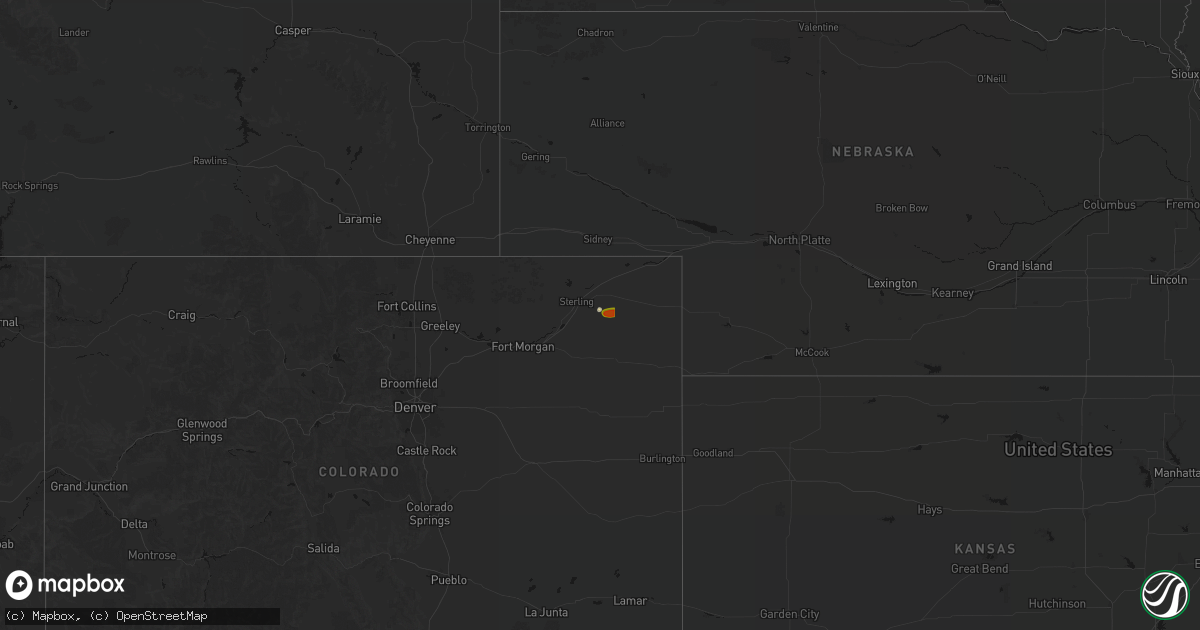
Get this storm
September 20 map
$229
one time, instant access
Download today. No call, no setup
Keep the $229
Bought the map and want the full workflow? Apply the entire $229 to a subscription within 7 days. None of it is wasted.
Every map, not just this one
This buys you this map. Subscription and you get every map we run, in the markets you choose from a few cities to whole states to nationwide. Plus real-time alerts the moment a storm fires.
Contact data
Name, contact info, occupancy, even credit band for addresses in the footprint. You go from where it hit to who to call.
Become the source they trust
Unlimited branding weather history reports on demand. You already have the documented answer ready for the property owner, and you are the one who showed up with it.
Property data and RoofTrace estimates
Pull up any address you have got, its value and the exact code rules for that jurisdiction, straight from One Click Code. Then RoofTrace estimates the squares, pitch, and roof value, priced the way you price.
States Impacted by Hail Map on September 20, 2026
Storm reports
Illinois
| Date | Description |
|---|---|
| 09/20/20266:28 PM CDT | Wind blew some debris into a field. Photo provided. |
| 09/20/20266:15 PM CDT | Power lines reported down in ramsey. Time estimated by radar. |
| 09/20/20265:54 PM CDT | Shed roof ripped off and some trees down at e 2160th ave and n 375th st east of montrose. |
| 09/20/20265:30 PM CDT | Power outages... Tree limbs down on lines and homes. |
| 09/19/20268:10 PM CDT | Awos station koly olney noble ap station elevation: 471 ft. |
| 09/19/20268:08 PM CDT | Some trees and branches blown down along highway 250 northeast of noble. Corn flattened. |
| 09/19/20268:00 PM CDT | Power pole with lines leaning over north passport road about 45 degree angle. Some tree branches blown down. |
| 09/19/20267:30 PM CDT | A few medium size tree branches blown down in bible grove. Reports of power outages from media in bible grove. |
Georgia
| Date | Description |
|---|---|
| 09/20/20266:15 PM CDT | Tree down on parkside drive. |
| 09/20/20266:00 PM CDT | Several trees and powerlines downed in the city of monroe... Including jackson street and olympian way. |
| 09/20/20265:55 PM CDT | Tree down along the 2100 block of wall road. |
| 09/20/20265:55 PM CDT | Tree down along 140 block of powers road. |
| 09/20/20265:45 PM CDT | Tree down near intersection of michael road nw and carl moon road. |
| 09/20/20265:35 PM CDT | Tree down northeast of iron city. |
| 09/20/20265:30 PM CDT | Several trees down near the intersection of westbrook road and ridge drive ne. |
| 09/20/20265:20 PM CDT | A few trees and large branches downed around holland youth sports complex nw to athens. |
| 09/19/20267:40 PM CDT | Several trees downed in and around manning mill park. Closest intersection is manning mill road and manning mill way. |
Alabama
| Date | Description |
|---|---|
| 09/20/20265:45 PM CDT | Tree down near county road 91 and county road 4. |
| 09/20/20265:32 PM CDT | Two trees and a power line down near new hinson baptist church. |
| 09/20/20265:17 PM CDT | A large tree limb fell on a power line and resulted in a power outage along sheppard road and west cook road. |
| 09/20/20265:16 PM CDT | A couple of trees were down in the taylor area. |
| 09/20/20262:15 PM CDT | Trees down in the emerald mountain area... Some across roadways. |
| 09/20/20262:10 PM CDT | Multiple trees downed in the edgewood road and main street area of millbrook... Some onto residences... Vehicles... And power lines. |
Indiana
| Date | Description |
|---|---|
| 09/20/20266:21 PM CDT | Tree downed along a portion of south state line road near talawanda springs. Time estimated by radar. |
| 09/20/20266:10 PM CDT | Multiple trees and tree limbs down. |
| 09/20/20266:10 PM CDT | Photo verified. Time estimated from radar. |
Missouri
| Date | Description |
|---|---|
| 09/20/20266:21 PM CDT | Thunderstorm winds downed a tree on a house and wires were also down in pierce city. |
| 09/20/20265:55 PM CDT | Thunderstorm winds knocked down a tree into a powerline near farm road 249 and farm road 116. |
| 09/20/20265:45 PM CDT | Thunderstorm winds downed a tree blocking glade road. |
| 09/20/20265:30 PM CDT | Thunderstorm winds downed a tree on minnehaha road between nixa and ozark. |
| 09/20/20265:30 PM CDT | Thunderstorm winds downed a tree onto powerlines on south fremont street. |
| 09/20/20265:30 PM CDT | Thunderstorm winds knocked down tree branches and powerlines on brunswick street. |
| 09/20/20265:26 PM CDT | A tree fell on a powerline near grand st and holland. |
| 09/20/20265:25 PM CDT | Thunderstorm winds downed a tree into the northbound lanes of gregg road in nixa. |
| 09/20/20265:25 PM CDT | Thunderstorm winds downed mulitple powerlines and trees in the area of 2nd st and schifferdecker. |
| 09/20/20265:15 PM CDT | Thunderstorm winds downed tree branches and trees into boaz road... Mount sinai road and ficus road near boaz. Several roads were blocked. |
| 09/20/20265:12 PM CDT | Thunderstorm winds downed a tree on davis bridge road. |
| 09/20/20265:00 PM CDT | A large tree was downed near mt carmel road and state highway k south of clever. |
| 09/20/20265:00 PM CDT | A large tree was downned near highway 14 and anemone road. |
Ohio
| Date | Description |
|---|---|
| 09/20/20266:48 PM CDT | Tree downed along east carlton road near west alexandria. Time estimated by radar. |
| 09/20/20266:21 PM CDT | Tree downed along north state route 503 near lewisburg. Time estimated by radar. |
| 09/20/20266:21 PM CDT | Trees downed along a portion of fairhaven college corner road. Time estimated by radar. |
| 09/19/202611:08 PM CDT | Over 1200 customers without power due to tree damage along highway 7. |
| 09/19/202610:17 PM CDT | Tree down at state forest rd and gambill hollow rd. Time estimated from radar. |
| 09/19/20269:22 PM CDT | Several trees downed across the county... Particularly in laurelville. Time estimated by radar. |
| 09/19/20268:20 PM CDT | Tree downed near intersection of boyd road and u.s. 35 se. Time estimated by radar. |
| 09/19/20268:14 PM CDT | Tree downed near intersection of creek road se and miami trace road se. Time estimated by radar. |
| 09/19/20267:45 PM CDT | Tree damage near 3000 block of port william road. Time estimated by radar. |
| 09/19/20267:25 PM CDT | Tree downed near intersection of cook-jones road and u.s. Highway 42. Time estimated by radar. |
| 09/19/20267:24 PM CDT | Tree downed within 1200 block of n. Liberty-keuter road. Time estimated by radar. |
| 09/19/20267:21 PM CDT | Tree downed within 9000 block of old stage road. Time estimated by radar. |
| 09/19/20267:21 PM CDT | Tree downed along 2000 block of cook road. Time estimated by radar. |
| 09/19/20267:20 PM CDT | Tree downed within 4000 block of corwin road. Time estimated by radar. |
| 09/19/20267:19 PM CDT | Multiple large tree limbs downed near intersection of knob hill drive and bellemeade drive. Time estimated by radar. |
| 09/19/20267:19 PM CDT | Part of tree blown down on knob hill drive. Time estimated from radar data. |
| 09/19/20267:19 PM CDT | Tree downed within 3000 block of middle run road. Time estimated by radar. |
| 09/19/20267:17 PM CDT | Several trees were downed in the bellbrook area. Time estimated from radar. |
| 09/19/20267:16 PM CDT | Tree downed within 4000 block of state route 48. Time estimated by radar. |
| 09/19/20267:15 PM CDT | Tree blown down blocking mad river road. Time estimated from radar data. |
| 09/19/20267:08 PM CDT | Tree downed near intersection of west factory road and west lower springboro road. Time estimated by radar. |
| 09/19/20267:06 PM CDT | Two trees downed along 100 block of golfwood drive. Time estimated by radar. |
Colorado
| Date | Description |
|---|---|
| 09/20/20266:11 PM CDT | A local report indicates 2.00 inch wind near 4 SSE Kit Carson |
| 09/20/20266:09 PM CDT | A local report indicates 2.50 inch wind near 6 S Kit Carson |
| 09/20/20266:04 PM CDT | Report from mping: baseball |
| 09/20/20266:02 PM CDT | Corrects previous hail report from 4 sse kit carson. |
| 09/20/20265:46 PM CDT | Report from mping: quarter |
| 09/20/20265:40 PM CDT | Spotter reported baseball size hail near wild horse... Co. |
| 09/20/20265:30 PM CDT | Social media report of tennis ball size hail north of wild horse... Co. |
| 09/20/20265:22 PM CDT | Social media reports of baseball size hail... Some hailstones potentially larger. Damaged windshield of a spotters vehicle. |
| 09/20/20264:33 PM CDT | A local report indicates 2.50 inch wind near 10 N Boyero |
| 09/20/20264:00 PM CDT | Social media report of golf ball size hail near alvin... Co. |
| 09/20/20263:45 PM CDT | Hail rapidly accumulating. |
| 09/20/20263:40 PM CDT | Public reported dime to quarter size hail. |
| 09/20/20263:37 PM CDT | Time estimated from radar. |
| 09/20/20263:28 PM CDT | Corrects previous hail report from 5 n alvin. Social media report of golf ball size hail near alvin... Co. |
| 09/20/20262:56 PM CDT | Time and location estimated from radar. |
| 09/19/20267:33 PM CDT | Report from mping: ping pong ball |
| 09/19/20267:26 PM CDT | Corrects previous hail report from 9 s brandon. Picture of measurement from social media. |
| 09/19/20267:10 PM CDT | Picture of measurement from social media. |
| 09/19/20267:00 PM CDT | Images shared of 4 inch hail that fell south of chivington. |
South Carolina
| Date | Description |
|---|---|
| 09/20/20266:06 PM CDT | Multiple trees down just south of laurens... Sc. |
| 09/20/20265:33 PM CDT | Report of a tree down on winfield dr and norbert ln. Time estimated. |
| 09/20/20264:45 PM CDT | Report of a tree down near intersection of paulan rd and hampton rd. Time estimated. |
Texas
| Date | Description |
|---|---|
| 09/20/20266:00 PM CDT | 15 reports of trees down blocking roads across denison. |
| 09/20/20265:17 PM CDT | Tree blocking hardisty drive. Wind speed estimated to be 50 mph judging by the size and health of the tree. |
| 09/20/20264:50 PM CDT | Facebook report of 50-60 mph winds one mile east of texas lime plant. |
| 09/20/20264:30 PM CDT | Emergency manager reported a wind gust of 61mph as outflow moved through around 4:30pm. |
| 09/20/20264:28 PM CDT | A microburst caused localized wind damage on hyline dr and oakridge rd. A shed had part of its sheet metal roof blown off and some rocks were embedded into its siding. |
| 09/20/20263:36 PM CDT | The hamilton awos site gusted to 60mph at 3:36pm cdt. |
Kansas
| Date | Description |
|---|---|
| 09/20/20262:16 PM CDT | Delayed report. Tree down over trego rd just north of us-59. Also a tree limb down on a nearby power line. Time estimated from radar. |
West Virginia
| Date | Description |
|---|---|
| 09/20/202612:48 AM CDT | Trees and lines down in the 1900 block of gassaway rd roadway is completely blocked. Time estimated from radar. |
| 09/20/202612:44 AM CDT | Tree down on bull fork. Time estimated from radar. |
| 09/20/202612:40 AM CDT | Tree down on cedar creek and spruce run. Time estimated from radar. |
| 09/20/202612:24 AM CDT | Tree down in the 800 block of northside rd. Time estimated from radar. |
| 09/20/202612:22 AM CDT | Multiple trees and power lines down on rt 5 near hog knob road. Time estimated from radar. |
| 09/20/202612:20 AM CDT | Tree down in the roadway on russet rd. Time estimated from radar. |
| 09/20/202612:14 AM CDT | Tree down in the 2600 block of big island run rd. Time estimated from radar. |
| 09/19/202611:56 PM CDT | Tree down in the 2600 block of big island run rd. Time estimated from radar. |
| 09/19/202611:48 PM CDT | Tree down on garfield rd. Time estimated from radar. |
Florida
| Date | Description |
|---|---|
| 09/20/20266:18 PM CDT | Florida highway patrol reports tree across the roadway river rd x timberlane rd. |
| 09/20/20265:48 PM CDT | Trees and power lines down in the esto area. |
| 09/19/20268:10 PM CDT | Tree down on i-10 near mile marker 70. |
| 09/19/20267:41 PM CDT | Tree down on i-10 near the de funiak springs exit. |
| 09/19/20267:40 PM CDT | Power line down near 411 hill street. |
Mississippi
| Date | Description |
|---|---|
| 09/20/20266:45 AM CDT | Report of steeple blown off of main st baptist church roof. |
| 09/20/20261:08 AM CDT | Trees were downed at us 80 and noblin bridge rd and on lake rd... Blocking portions of the roadway. |
Cities Impacted by Hail Map on September 20, 2026
- Palatka, FL
- Fleming, CO
- Haxtun, CO
- Oswego, KS
- Konawa, OK
- San Saba, TX
- Wewoka, OK
- Maud, OK
- Black Mountain, NC
- Ada, OK
- Hamilton, TX
- Spavinaw, OK
- Paoli, CO
- Holyoke, CO
- Yuma, CO
- Wray, CO
- Tupelo, OK
- Allen, OK
- Lometa, TX
- Columbus, KS
- McCune, KS
- Berry, AL
- Northport, AL
- Peebles, OH
- West Union, OH
- Tishomingo, OK
- Champion, NE
- Limon, CO
- Genoa, CO
- Blue Creek, OH
- Cherokee, TX
- Madill, OK
- Morris, GA
- Marietta, OK
- Hugo, CO
- Haigler, NE
- Afton, OK
- Milburn, OK
- Stout, OH
- Old Town, FL
- Parks, NE
- Arriba, CO
- Valley Spring, TX
- Kingston, OK
- Evergreen, AL
- Castleberry, AL
- Mcalester, OK
- Dover, FL
- Benkelman, NE
- Arlington, TX
- Godley, TX
- Brewton, AL
- Cleburne, TX
- Rentz, GA
- Fairland, OK
- Brantley, AL
- Greenville, SC
- Mount Vernon, MO
- Kenefic, OK
- Decherd, TN
- Gainesville, GA
- Llano, TX
- Helton, KY
- Bledsoe, KY
- Mason, TX
- Oronogo, MO
- Webb City, MO
- Nemo, TX
- Kopperl, TX
- Imperial, NE
- Miami, OK
- Williamsburg, KY
- Paint Rock, TX
- Plant City, FL
- Brierfield, AL
- Aurora, MO
- Marionville, MO
- Kit Carson, CO
- Max, NE
- Stratton, NE
- Commerce, OK
- Quapaw, OK
- Picher, OK
- Lithia, FL
- Clearwater, FL
- Calera, OK
- New Castle, IN
- Hull, GA
- Nicholson, GA
- Athens, GA
- Colbert, GA
- Cartwright, OK
- Comer, GA
- Billings, MO
- Menard, TX
- Mead, OK
- Oakwood, GA
- Crandall, GA
- Cisco, GA
- Chatsworth, GA
- Colbert, OK
- Straughn, IN
- Republic, MO
- Knightstown, IN
- Galena, KS
- Baxter Springs, KS
- Flowery Branch, GA
- Carl Junction, MO
- Joplin, MO
- Dunlap, TN
- Union, SC
- Wild Horse, CO
- Everton, MO
- Ash Grove, MO
- Uriah, AL
- Iron City, GA
- Anderson, SC
- Cordele, GA
- Denison, TX
- Lewisville, IN
- Cambridge City, IN
- Carthage, MO
- Sherman, TX
- Dawsonville, GA
- Maiden, NC
- Bridgeport, NE
- Angora, NE
- Mansfield, TX
- Grand Prairie, TX
- Palmer, TN
- Monroe, GA
- Arabi, GA
- Clinton, SC
- Grovespring, MO
- Lebanon, MO
- Connersville, IN
- Milton, IN
- Oaks, OK
- Kansas, OK
- Twin Oaks, OK
- Thomasville, AL
- Marble Hill, GA
- Bogart, GA
- Centerville, IN
- Sweet Water, AL
- Brownsville, IN
- Whitesboro, TX
- Cedar Hill, TX
- Starr, SC
- Strafford, MO
- Rogersville, MO
- Fordland, MO
- Eads, CO
- Pierce City, MO
- Bay Minette, AL
- Colquitt, GA
- Ellijay, GA
- Liberty, IN
- Donalsonville, GA
- Bingham, IL
- Falcon, MO
- Richmond, IN
- Ramsey, IL
- Jackson, AL
- Oshkosh, NE
- Howe, TX
- Van Alstyne, TX
- Gunter, TX
- Seymour, MO
- Marshfield, MO
- Niangua, MO
- Brownstown, IL
- Diamond, MO
- Loxley, AL
- Robertsdale, AL
- Saint Stephens, AL
- Waterloo, SC
- Laurens, SC
- Rocksprings, TX
- Mountville, SC
- Watts, OK
- Colcord, OK
- Plato, MO
- Lynchburg, MO
- Bristol, FL
- College Corner, OH
- Camden, OH
- West College Corner, IN
- Oxford, OH
- Blountstown, FL
- Trion, GA
- Daphne, AL
- Collinsville, TX
- Hartville, MO
- Eaton, OH
- Cottondale, FL
- Beecher City, IL
- Sarcoxie, MO
- Mansfield, MO
- Somerville, OH
- Hamilton, OH
- Gurley, NE
- Neosho, MO
- Sheridan Lake, CO
- Summerville, GA
- Ranger, GA
- Sidney, NE
- Granby, MO
- Mason, IL
- Edgewood, IL
- Talking Rock, GA
- Fairmount, GA
- Trenton, OH
- Middletown, OH
- Louisville, IL
- West Alexandria, OH
- Rydal, GA
- Xenia, OH
- Dayton, OH
- Germantown, OH
- Farmersville, OH
- New Lebanon, OH
- Miamisburg, OH
- Franklin, OH
- Springboro, OH
- Waynesville, OH
- Lebanon, OH
- Oregonia, OH
- Spring Valley, OH
- Bellbrook, OH
- Clarksville, OH
- Harveysburg, OH
- Wilmington, OH
- Jamestown, OH
- White, GA
- Adairsville, GA
- Defuniak Springs, FL
- Morrow, OH
- Holly, CO
- Denton, TX
- Flat Rock, IL
- Mulberry, TN
- Eight Mile, AL
- Lookout Mountain, GA
- Rising Fawn, GA
- Sanger, TX
- Aubrey, TX
- Noble, IL
- Ingraham, IL
- Crossville, AL
- Dawson, AL
- Collinsville, AL
- Clay City, IL
- Kingston, GA
- Chappell, NE
- Dixon, MO
- Vienna, MO
- Lawrenceville, IL
- Geraldine, AL
- Attalla, AL
- Vichy, MO
- Olney, IL
- Vona, CO
- Yoder, CO
- Stratton, CO
- Rush, CO
- Pueblo, CO
- Fountain, CO
- Windsor, IL
- Strasburg, IL
- Parker, CO
- Colorado Springs, CO
- Franktown, CO
- Barksdale, TX
- Barnhart, MO
- Hillsboro, MO
- Elizabeth, CO
- Boone, CO
- Olney Springs, CO
- Flagler, CO
- Johnstown, CO
- Platteville, CO
- Pevely, MO
- Milliken, CO
- Kiowa, CO
- Ordway, CO
- Seibert, CO
- Karval, CO
- Penrose, CO
- Elbert, CO
- Liberty, TN
- Calhan, CO
- Avondale, CO
- Spiceland, IN
- Littleton, CO
- Lone Tree, CO
- Haswell, CO
- Ramah, CO
- Manzanola, CO
- Crowley, CO
- Sugar City, CO
- Simla, CO
- Rocky Ford, CO
- Matheson, CO
- La Junta, CO
- Philadelphia, MS
- Lamar, CO
- Farina, IL
- Paducah, TX
- Granada, CO
- Booneville, AR
- Nokomis, IL
- Fillmore, IL