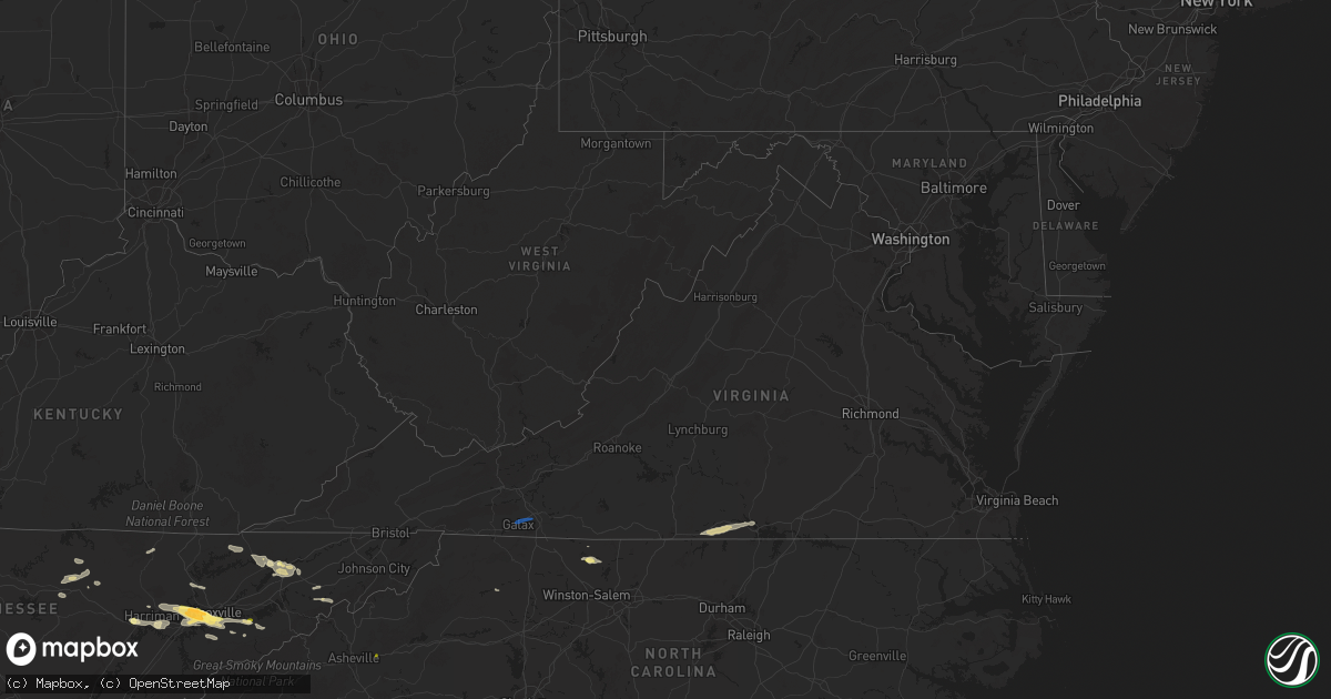
Hail Map in Virginia on September 4, 2025
Get this storm
September 4 map
$229
one time, instant access
Download today. No call, no setup
Keep the $229
Bought the map and want the full workflow? Apply the entire $229 to a subscription within 7 days. None of it is wasted.
Every map, not just this one
This buys you this map. Subscription and you get every map we run, in the markets you choose from a few cities to whole states to nationwide. Plus real-time alerts the moment a storm fires.
Contact data
Name, contact info, occupancy, even credit band for addresses in the footprint. You go from where it hit to who to call.
Become the source they trust
Unlimited branding weather history reports on demand. You already have the documented answer ready for the property owner, and you are the one who showed up with it.
Property data and RoofTrace estimates
Pull up any address you have got, its value and the exact code rules for that jurisdiction, straight from One Click Code. Then RoofTrace estimates the squares, pitch, and roof value, priced the way you price.
Storm reports in Virginia
Virginia
| Date | Description |
|---|---|
| 09/04/20255:57 PM CDT | Report of large tree down off the side of the road on i-95 northbound near mile marker 60. Time estimated via radar. |
| 09/04/20254:27 PM CDT | Trees reported down along us-15 in the town of clarksville. Time is radar estimated. |
| 09/04/20253:55 PM CDT | Tree down blocking road near intersection of east hyco and loftis road. |
| 09/04/20253:53 PM CDT | 20-30 trees blown down... Multiple power lines down... Power pole snapped on newton farm road. |
| 09/04/20253:51 PM CDT | Tree blown down along cherry hill church road. |
| 09/04/20253:51 PM CDT | An intense thunderstorm moved across southern halifax county... Virginia during the afternoon of september 4th. A tornado formed within an area of straight-line damagin |
| 09/04/20253:23 PM CDT | Power line snapped along calvary road. |
| 09/04/20253:07 PM CDT | Tree down near intersection of oxford furnace road and country road. |
| 09/04/20253:06 PM CDT | Power lines down along smoky hollow road. |
| 09/04/20252:11 PM CDT | Tree down blocking iron ridge road near the bridge over little creek. Time estimated from radar. |
| 09/04/20252:00 PM CDT | A few trees were downed near stewartsville. |
| 09/04/20251:57 PM CDT | Power lines down on dell avenue near its intersection with ceylon street ne. Time estimated from radar. |
| 09/04/20251:55 PM CDT | Power line down near the intersection of herberger road nw and peters creek road nw. Time estimated from radar. |
| 09/04/20251:55 PM CDT | Power lines down along stewart avenue. |
| 09/04/20251:54 PM CDT | Power line down along sunrise avenue. |
| 09/04/20251:49 PM CDT | Power lines downed on noble avenue ne near the intersection with courtland road ne. Time estimated from radar. |
| 09/04/20251:44 PM CDT | Tree fell onto a power line on webbs mill road near its intersection with nursery lane. Time estimated from radar. |
| 09/04/20251:22 PM CDT | Tree down on cranberry road near kenwood lane. Time estimated from radar. |
| 09/04/20251:20 PM CDT | Roof blown off of building with people still inside. |
| 09/04/20251:16 PM CDT | Tree down on cliffview road near the ranger station on the new river trail. Time estimated from radar. |
| 09/04/20251:11 PM CDT | *** 1 inj *** tree fell on camper resulting in one injury. |
| 09/04/202510:55 AM CDT | Several trees down. |
All States Impacted by Hail Map on September 4, 2025
Cities Impacted by Hail Map on September 4, 2025
- Butler, MO
- Adrian, MO
- Archie, MO
- Drexel, MO
- Greeneville, TN
- Oak Ridge, TN
- Oliver Springs, TN
- Knoxville, TN
- Clinton, TN
- Harriman, TN
- Speedwell, TN
- Lenoir City, TN
- Monterey, TN
- New Tazewell, TN
- Seymour, TN
- Louisville, TN
- Sevierville, TN
- Clarkrange, TN
- Wilkesboro, NC
- Morristown, TN
- Thorn Hill, TN
- Tazewell, TN
- Cookeville, TN
- Washburn, TN
- Bean Station, TN
- Rockford, TN
- Farragut, TN
- Galax, VA
- Woodlawn, VA
- Mooresburg, TN
- Russellville, TN
- Rutledge, TN
- Maryville, TN
- Rocky Top, TN
- Briceville, TN
- Frankewing, TN
- King, NC
- Westfield, NC
- Walnut Cove, NC
- Whitesburg, TN
- Danbury, NC
- Lawsonville, NC
- Rockwood, TN
- Germanton, NC
- Bulls Gap, TN
- Fayetteville, TN
- Petersburg, TN
- Kingston, TN
- Heiskell, TN
- Amargosa Valley, NV
- Rickman, TN
- Yucca, AZ
- Dolan Springs, AZ
- Santa Ysabel, CA
- Julian, CA
- Alton, VA
- South Boston, VA
- Prescott, AZ
- Livingston, TN
- Franklin, GA
- Roopville, GA
- Crawford, TN
- Virgilina, VA
- Alcoa, TN
- Black Mountain, NC
- Helenwood, TN
- Buffalo Junction, VA
- Clarksville, VA
- Statham, GA
- Bogart, GA
- Carlton, GA
- Maricopa, AZ
- Pine Valley, CA
- Campo, CA
- Watkinsville, GA
- Marshall, MN
- Vesta, MN
- Lucan, MN
- Milroy, MN
- Wabasso, MN
- Lamberton, MN
- Revere, MN
- Walnut Grove, MN
- Tracy, MN
- Oneida, TN
- Balaton, MN
- Garvin, MN
- Slayton, MN
- Lake Wilson, MN
- Currie, MN
- Avoca, MN
- Dovray, MN
- Westbrook, MN
- Redwood Falls, MN
- Wanda, MN
- Springfield, MN
- Clements, MN
- Morgan, MN
- Storden, MN
- Sanborn, MN
- Morton, MN
- Fairfax, MN
- Franklin, MN
- Jeffers, MN
- Sleepy Eye, MN
- Meadview, AZ
- New Ulm, MN
- Lafayette, MN
- Winthrop, MN
- Gibbon, MN
- Courtland, MN
- Gaylord, MN
- Nicollet, MN
- Saint Peter, MN
- Arlington, MN
- Henderson, MN
- Le Sueur, MN
- Mankato, MN
- Hackberry, AZ
- Bullhead City, AZ
- Kasota, MN
- Cleveland, MN
- Hayesville, NC
- Le Center, MN
- Hawthorne, NV
- Caliente, NV
- Roll, AZ
- Wellton, AZ
- Golden Valley, AZ
- Yuma, AZ
- Buffalo, OK
- Minneola, KS
- Mooreland, OK
- Scott City, KS
- Healy, KS
- Dighton, KS
- Waynoka, OK
- Cimarron, KS
- Ringwood, OK
- Enid, OK
- Chandler, OK
- Davenport, OK
- Somerton, AZ
- Mosheim, TN
- Oakdale, TN


